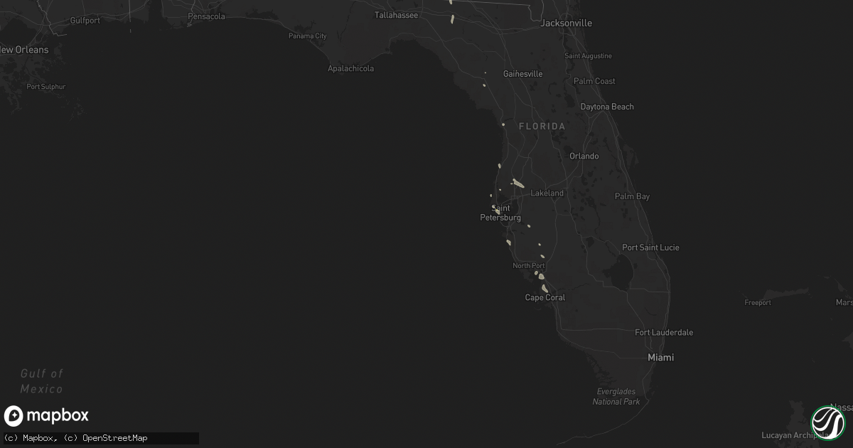
Hail Map in Florida on August 8, 2022
Get this storm
August 8 map
$229
one time, instant access
Download today. No call, no setup
Keep the $229
Bought the map and want the full workflow? Apply the entire $229 to a subscription within 7 days. None of it is wasted.
Every map, not just this one
This buys you this map. Subscription and you get every map we run, in the markets you choose from a few cities to whole states to nationwide. Plus real-time alerts the moment a storm fires.
Contact data
Name, contact info, occupancy, even credit band for addresses in the footprint. You go from where it hit to who to call.
Become the source they trust
Unlimited branding weather history reports on demand. You already have the documented answer ready for the property owner, and you are the one who showed up with it.
Property data and RoofTrace estimates
Pull up any address you have got, its value and the exact code rules for that jurisdiction, straight from One Click Code. Then RoofTrace estimates the squares, pitch, and roof value, priced the way you price.
Storm reports in Florida
Florida
| Date | Description |
|---|---|
| 08/08/20225:10 PM CDT | Tree down on county road 360. |
| 08/08/20224:41 PM CDT | Asos station ksrq sarasota bradent. |
| 08/08/20224:34 PM CDT | Delayed report: broadcast media shared picture of large tree snapped in rotonda area of charlotte co. Several other downed trees reported across the area. Time estimate |
| 08/08/20224:30 PM CDT | Big tree down reported to the 911 call center. |
| 08/08/20224:28 PM CDT | Power line down on jasmine road. |
| 08/08/20224:28 PM CDT | Tree down on holly road. |
| 08/08/20224:10 PM CDT | Quarter sized hail reported in kenneth city by a trained spotter. Time estimated by radar. |
| 08/08/20224:03 PM CDT | Delayed report. Tree down near the intersection of nw 183rd ave and high springs main st. |
| 08/08/20223:21 PM CDT | Delayed report. Tree down on powerline on nw 14th ave. |
| 08/08/20223:13 PM CDT | Delayed report. Tree down on i-75 near mile marker 393. |
| 08/08/20221:09 AM CDT | At 609 PM EDT, severe thunderstorms were located along a line extending from near Luraville to near Steinhatchee, moving northwest at 15 mph. HAZARD...60 mph wind gusts. SOURCE...Radar indicated. IMPACT...Expect damage to roofs, siding, and trees. Locations impacted include... Mayo, Madison, Perry, Steinhatchee, Lee, Pinland, Tennille, Jug Island, Clara, Buckville, Dekle Beach, Jonesboro, Jack Lee Island, Foley, Salem, Perry-Foley Airport, San Pedro Junction, Hampton Springs, Cedar Island and Fish Creek. |
| 08/08/202212:33 AM CDT | At 533 PM EDT, a severe thunderstorm was located near Port Charlotte, moving northwest at 5 mph. HAZARD...60 mph wind gusts and quarter size hail. SOURCE...Radar indicated. IMPACT...Hail damage to vehicles is expected. Expect wind damage to roofs, siding, and trees. Locations impacted include... North Port, Punta Gorda, Murdock, Gulf Cove, South Venice, El Jobean, Palm Island, Harbour Heights, Placida and Rotonda. |
| 08/08/202212:30 AM CDT | At 530 PM EDT, a severe thunderstorm was located over Harbor Bluffs, or over Largo, and is nearly stationary. HAZARD...60 mph wind gusts. SOURCE...Radar indicated. IMPACT...Expect damage to roofs, siding, and trees. Locations impacted include... Clearwater, Largo, Belleair, Redington Shores, Belleair Bluffs, Belleair Beach, Indian Shores, Belleair Shore, Belleair Shores and Harbor Bluffs. |
| 08/08/202212:19 AM CDT | At 519 PM EDT, a severe thunderstorm was located over Sarasota Bradenton Airport, or near Sarasota, moving west at 5 mph. HAZARD...60 mph wind gusts and quarter size hail. SOURCE...Radar indicated. IMPACT...Hail damage to vehicles is expected. Expect wind damage to roofs, siding, and trees. Locations impacted include... Sarasota, Bradenton, Bradenton Beach, Bayshore Gardens, Cortez, Whitney Beach, Samoset, South Bradenton, Desoto Lakes and Palma Sola. |
| 08/08/202212:16 AM CDT | At 516 PM EDT, a severe thunderstorm was located near Manattee Road, or 8 miles southeast of Cross City, moving northwest at 15 mph. HAZARD...60 mph wind gusts. SOURCE...Radar indicated. IMPACT...Expect damage to roofs, siding, and trees. Locations impacted include... Mayo, Cross City, Steinhatchee, Tennille, Cooks Hammock, Shamrock, Clara, Cross City Airport, Old Town, Guaranto Springs, Carbur, Jena, Alton, Hines, Jonesboro, Grady, Hatch Bend, Salem, Eugene and Fletcher. |
| 08/08/202212:03 AM CDT | At 503 PM EDT, severe thunderstorms were located along a line extending from Harbor Bluffs to near Bay Pines to Saint Petersburg, and are nearly stationary. HAZARD...60 mph wind gusts and quarter size hail. SOURCE...Radar indicated. IMPACT...Hail damage to vehicles is expected. Expect wind damage to roofs, siding, and trees. Locations impacted include... St. Petersburg, Clearwater, Largo, Pinellas Park, Seminole, Gulfport, St. Pete Beach, Treasure Island, Kenneth City and South Pasadena. |
| 08/07/202211:44 PM CDT | At 444 PM EDT, a severe thunderstorm was located near Macdill Air Force Base, or 10 miles east of Downtown Saint Petersburg, moving northwest at 10 mph. HAZARD...60 mph wind gusts and quarter size hail. SOURCE...Radar indicated. IMPACT...Hail damage to vehicles is expected. Expect wind damage to roofs, siding, and trees. Locations impacted include... Tampa, St. Petersburg, South Tampa, Weedon Island State Preserve, Venetian Isles, Macdill Air Force Base and Gandy. |
| 08/07/202211:07 PM CDT | At 406 PM EDT, a severe thunderstorm was located near Gainesville, moving west at 10 mph. HAZARD...60 mph wind gusts and penny size hail. SOURCE...Radar indicated. IMPACT...Expect damage to roofs, siding, and trees. Locations impacted include... Alachua. |
| 08/07/202210:19 PM CDT | At 319 PM EDT, a severe thunderstorm was located over Tallahassee Comm College, or near Tallahassee, moving northeast at 5 mph. HAZARD...60 mph wind gusts. SOURCE...Radar indicated. IMPACT...Expect damage to roofs, siding, and trees. Locations impacted include... Tallahassee, Florida A And M, Tallahassee Comm College, Florida State University, Doak Campbell Stadium, Lake Bradford, Macon Community Park, Gaither Community Center, Lake Munson, Tallahassee Memorial Hosp, Lake Ella, Tallahassee Mall, Tallahassee Regional A/P, State Capital Complex, Governors Square Mall, Springsax Park, Belair, Levy Park, Indian Head Acres and Andrew. |
| 08/07/20229:53 PM CDT | At 253 PM EDT, a severe thunderstorm was located near Orange Springs, or 8 miles northeast of Fort McCoy, moving west at 10 mph. HAZARD...60 mph wind gusts and quarter size hail. SOURCE...Radar indicated. IMPACT...Hail damage to vehicles is expected. Expect wind damage to roofs, siding, and trees. Locations impacted include... Orange Springs, Hog Valley and Johnson. |
| 08/07/20229:13 PM CDT | At 212 PM CDT, a severe thunderstorm was located over Hiland Park, or over Lynn Haven, moving west at 15 mph. HAZARD...60 mph wind gusts. SOURCE...Radar indicated. IMPACT...Expect damage to roofs, siding, and trees. Locations impacted include... Panama City, Lynn Haven, Panama City Beach, Callaway, Springfield, Hiland Park, Tyndall Air Force Base, Parker, St Andrews State Park, Southport, Cedar Grove, Dirego Park, College Station, Gulf Resort Beach, Bayou George, West Panama City, Bahama Beach, Biltmore Beach, Brannonville and Millville. |
All States Impacted by Hail Map on August 8, 2022
Cities Impacted by Hail Map on August 8, 2022
- Calico Rock, AR
- Van Buren, AR
- Alma, AR
- Noble, IL
- Ironton, MO
- Fredericktown, MO
- Villa Ridge, IL
- Pulaski, IL
- Olmsted, IL
- Oblong, IL
- Robinson, IL
- Walnut Grove, MO
- Morrisville, MO
- Des Arc, MO
- Yellville, AR
- Centerville, MO
- Golden City, MO
- Bunch, OK
- Hornbeak, TN
- Marshfield, MO
- South West City, MO
- Mountain View, AR
- Parma, MO
- Malden, MO
- Gideon, MO
- Dover, AR
- Pelsor, AR
- Bolivar, MO
- Brownsville, TN
- Cecil, AR
- Charleston, AR
- Lavaca, AR
- Fort Smith, AR
- Hereford, TX
- Martin, TN
- Diamond, MO
- Sarcoxie, MO
- Carthage, MO
- Miami, TX
- Joplin, MO
- Neosho, MO
- Stockton, MO
- Subiaco, AR
- Desha, AR
- Batesville, AR
- Witts Springs, AR
- Jerusalem, AR
- Hector, AR
- Deer, AR
- Parthenon, AR
- Sulphur Rock, AR
- Cord, AR
- Cave City, AR
- Fulton, KY
- South Fulton, TN
- Scheller, IL
- Waltonville, IL
- Sesser, IL
- Bauxite, AR
- Sheridan, AR
- Prattsville, AR
- Jackson, TN
- Beech Bluff, TN
- Pinson, TN
- Mountain Grove, MO
- Norwood, MO
- New Athens, IL
- Altamont, IL
- Effingham, IL
- Beecher City, IL
- Saint Elmo, IL
- Greenfield, MO
- Lockwood, MO
- Van Buren, MO
- El Dorado Springs, MO
- New Raymer, CO
- Grover, CO
- Weldona, CO
- Briggsdale, CO
- Gainesville, MO
- Amarillo, TX
- Mound City, IL
- Barlow, KY
- Aurora, MO
- Branson, MO
- Pampa, TX
- Hartville, MO
- Niangua, MO
- Grovespring, MO
- Campbell, MO
- Stilwell, OK
- Salem, MO
- Little Rock, AR
- Hensley, AR
- Clarksville, AR
- Ozone, AR
- Kosciusko, MS
- Kingman, AZ
- Galena, MO
- Highlandville, MO
- Ponce De Leon, MO
- Spokane, MO
- Sweetwater, OK
- Westcliffe, CO
- Gainesville, FL
- Congress, AZ
- Fairburn, GA
- Palmetto, GA
- Des Arc, AR
- Cape Coral, FL
- West Liberty, IL
- Watson, IL
- Ellington, MO
- Caseyville, IL
- East Saint Louis, IL
- Oran, MO
- Oklahoma City, OK
- Willard, MO
- Ash Grove, MO
- Bois D Arc, MO
- Springfield, MO
- Chestnut Mound, TN
- Elmwood, TN
- Strafford, MO
- Jerico Springs, MO
- Sheldon, MO
- Annapolis, MO
- Vulcan, MO
- Piedmont, MO
- Oakwood, OK
- Williamsville, MO
- Ozark, AR
- Elkins, AR
- Combs, AR
- Saint Paul, AR
- Chandler, OK
- Waynesville, MO
- Evening Shade, AR
- Half Way, MO
- Mount Airy, NC
- Du Bois, IL
- Lutz, FL
- Minden, LA
- Ada, OK
- Evergreen, AL
- Seligman, AZ
- Walnut Ridge, AR
- Realitos, TX
- Hot Springs National Park, AR
- Miller City, IL
- Charleston, MO
- Sidney, AR
- Watonga, OK
- Cherry Valley, AR
- Kingfisher, OK
- Clarkridge, AR
- Mountain Home, AR
- Fort Morgan, CO
- Farmington, MO
- Floral, AR
- Locust Grove, AR
- Rosie, AR
- Stotts City, MO
- Pierce City, MO
- La Russell, MO
- Miller, MO
- Avilla, MO
- Wentworth, MO
- Reeds, MO
- Mansfield, AR
- Grand Chain, IL
- Alton, MO
- Doniphan, MO
- Thornfield, MO
- Girard, KS
- Pittsburg, KS
- Seymour, MO
- Dadeville, MO
- Fair Play, MO
- Aldrich, MO
- Fifty Six, AR
- Briscoe, TX
- Cairo, IL
- Newport, AR
- Ellsinore, MO
- Grandin, MO
- Savannah, TN
- Tecumseh, OK
- Shawnee, OK
- Oakland, TN
- Somerville, TN
- Hollister, MO
- Timbo, AR
- Fox, AR
- Edgemont, AR
- Traskwood, AR
- Humansville, MO
- Dunnegan, MO
- Guffey, CO
- Ullin, IL
- Reeds Spring, MO
- Pocahontas, AR
- Mathiston, MS
- Ackerman, MS
- Saint Petersburg, FL
- Nashville, AR
- Mineral Springs, AR
- Gilbertsville, KY
- Perry, OK
- Bloomfield, MO
- Essex, MO
- Hardin, KY
- Benton, KY
- Clinton, AR
- Dennard, AR
- Seneca, MO
- Wyandotte, OK
- Rockville, IN
- Eufaula, OK
- Mcalester, OK
- Canadian, OK
- Vega, TX
- Konawa, OK
- Dumas, TX
- Starkville, MS
- Faunsdale, AL
- Gallion, AL
- Hodgen, OK
- Walnut Shade, MO
- Chestnutridge, MO
- Cutler, IL
- Hoxie, AR
- Nashville, IL
- Hoyleton, IL
- Newark, AR
- Folsom, NM
- Rogersville, MO
- Steele, MO
- Clever, MO
- Marionville, MO
- Billings, MO
- Republic, MO
- Brookline, MO
- Crane, MO
- Nixa, MO
- Bokoshe, OK
- Keota, OK
- Taloga, OK
- Putnam, OK
- Vian, OK
- Lamar, MO
- Ozark, MO
- Muldrow, OK
- Hattieville, AR
- Collins, MO
- Lenzburg, IL
- Deerfield, MO
- Fort Scott, KS
- Fayetteville, AR
- Hindsville, AR
- Mosquero, NM
- Oil Trough, AR
- Amity, AR
- Magnolia, AR
- Conchas Dam, NM
- Hornsby, TN
- Okolona, AR
- Arkadelphia, AR
- Meeker, OK
- Gurdon, AR
- Cherokee Village, AR
- Ash Flat, AR
- Christiana, TN
- Rockvale, TN
- Murfreesboro, TN
- Ina, IL
- Whittington, IL
- Julian, CA
- Boulevard, CA
- Arcadia, FL
- Sherrill, AR
- Antlers, OK
- Morgan, GA
- Crowder, OK
- Cleveland, AR
- Scotland, AR
- Norman, AR
- Mena, AR
- Thomasville, AL
- Waldron, AR
- Austin, AR
- Cabot, AR
- Lonoke, AR
- Jacksonville, AR
- Dragoon, AZ
- New Albany, MS
- San Manuel, AZ
- Broken Bow, OK
- Little Rock Air Force Base, AR
- Sherwood, AR
- Holcomb, MS
- El Dorado, AR
- Utica, MS
- Wheatley, AR
- Redfield, AR
- Punta Gorda, FL
- Clayton, NM
- Chino Valley, AZ
- Prescott, AZ
- Butler, AL
- Lisman, AL
- Mabelvale, AR
- Morton, MS
- Lena, MS
- Hot Springs Village, AR
- Malvern, AR
- Emerson, AR
- Roff, OK
- Fitzhugh, OK
- Cement, OK
- Chickasha, OK
- Perryville, AR
- Pearcy, AR
- Trenton, FL
- Bell, FL
- Port Charlotte, FL
- Hermanville, MS
- Payson, AZ
- Quitman, MS
- Meridian, MS
- Brinkley, AR
- Sells, AZ
- Bismarck, AR
- Langley, AR
- Umpire, AR
- Caddo Gap, AR
- Braxton, MS
- Brandon, MS
- Greenville, FL
- Madison, FL
- Valdosta, GA
- Quitman, GA
- Alexander, AR
- Hazlehurst, GA
- Denton, GA
- Mooringsport, LA
- Oil City, LA
- Glenwood, AR
- Kirby, AR
- Newhope, AR
- Lonsdale, AR
- Benton, AR
- Canyon, TX
- Maben, MS
- Palm Harbor, FL
- Oldsmar, FL
- Clearwater Beach, FL
- Jachin, AL
- Paducah, KY
- Brookport, IL
- Smithland, KY
- Ledbetter, KY
- Calvert City, KY
- Fulton, MS
- Golden, MS
- Crystal River, FL
- Corrigan, TX
- Stuart, OK
- Carthage, TX
- Baconton, GA
- Doerun, GA
- Flippin, AR
- Booneville, AR
- Sallis, MS
- Birch Tree, MO
- Cashion, OK
- Hennessey, OK
- Prescott, AR
- Valliant, OK
- Leola, AR
- Newnan, GA
- Myakka City, FL
- Wickes, AR
- Macomb, OK
- Florence, MS
- Selma, AL
- Marion Junction, AL
- Whiteville, TN
- Campo, CO
- Walsh, CO
- Monett, MO
- Benson, AZ
- Hudson, FL
- Sarasota, FL
- Watson, OK
- England, AR
- Tucker, AR
- Jefferson, AR
- Murfreesboro, AR
- San Jon, NM
- Grady, NM
- Happy, TX
- Animas, NM
- Wesley Chapel, FL
- Tampa, FL
- Land O'Lakes, FL
- Clayton, OK
- Snyder, TX
- Bonnerdale, AR
- Clayton, AL
- Seminole, FL
- Parrish, FL
- Alamo, TN
- Halls, TN
- Stillwater, OK
- Duncan, OK
- Chiefland, FL
- Stoneham, CO
- Lorain, OH
- Sheffield Lake, OH
- Amherst, OH
- Elyria, OH


