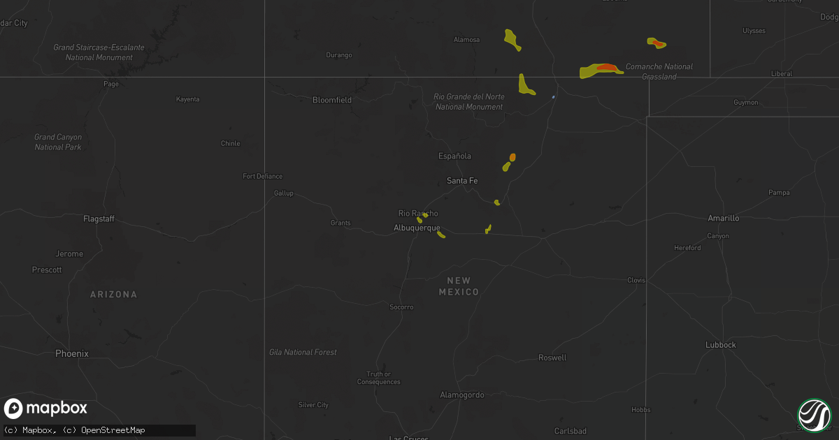
Hail Map on August 3, 2020
Get this storm
August 3 map
$229
one time, instant access
Download today. No call, no setup
Keep the $229
Bought the map and want the full workflow? Apply the entire $229 to a subscription within 7 days. None of it is wasted.
Every map, not just this one
This buys you this map. Subscription and you get every map we run, in the markets you choose from a few cities to whole states to nationwide. Plus real-time alerts the moment a storm fires.
Contact data
Name, contact info, occupancy, even credit band for addresses in the footprint. You go from where it hit to who to call.
Become the source they trust
Unlimited branding weather history reports on demand. You already have the documented answer ready for the property owner, and you are the one who showed up with it.
Property data and RoofTrace estimates
Pull up any address you have got, its value and the exact code rules for that jurisdiction, straight from One Click Code. Then RoofTrace estimates the squares, pitch, and roof value, priced the way you price.
States Impacted by Hail Map on August 3, 2020
Storm reports
Wyoming
| Date | Description |
|---|---|
| 08/03/20206:36 PM CDT | A local report indicates 62 MPH wind near 13 NNE WRIGHT |
| 08/03/202012:55 AM CDT | At 554 PM MDT, a severe thunderstorm was located near Bosler, or 21 miles north of Laramie, moving southeast at 30 mph. HAZARD...60 mph wind gusts and quarter size hail. SOURCE...Radar indicated. IMPACT...Hail damage to vehicles is expected. Expect wind damage to roofs, siding, and trees. This severe thunderstorm will be near... Baldy Peak around 610 PM MDT. |
| 08/02/202010:51 PM CDT | At 350 PM MDT, a severe thunderstorm was located 10 miles northwest of Fort Reno Historical Site, which is 17 miles northeast of Kaycee, moving east at 30 mph. HAZARD...60 mph wind gusts and quarter size hail. SOURCE...Radar indicated. IMPACT...Hail damage to vehicles is expected. Expect wind damage to roofs, siding, and trees. This severe thunderstorm will be near... Fort Reno Historical Site around 410 PM MDT.This includes Interstate 25 between mile markers 263 and 265. |
New Jersey
| Date | Description |
|---|---|
| 08/03/20206:59 PM CDT | Spotter reports 58 mph winds... Penny size hail... And power outages. Time estimated from radar. |
| 08/03/20206:55 PM CDT | Njwxnet station. |
| 08/03/20206:54 PM CDT | Downed trees and wires near ward avenue in crosswicks. Time estimated from radar. |
| 08/03/20206:51 PM CDT | Corrects previous tstm wnd gst report from berkeley twp. Kmjx asos. |
| 08/03/20206:50 PM CDT | Downed trees and wires near morningside street and 10th avenue near pine lake. Time estimated from radar. |
| 08/03/20206:37 PM CDT | Downed power lines near lacey road in roosevelt city. Time estimated from radar. |
| 08/03/20206:35 PM CDT | Siding blown off building in mount laurel. |
| 08/03/20206:33 PM CDT | Nws employee estimated 60 mph winds along with some minor tree damage. |
| 08/03/20206:20 PM CDT | Trees down on burnt mills rd. And walt whitman blvd. |
| 08/03/20206:18 PM CDT | Downed trees and wires near cotswold lane in cherry hill. Time estimated from radar. |
| 08/03/20206:10 PM CDT | Wires down. |
| 08/03/20206:01 PM CDT | Downed power lines near mantua boulevard in sewell. Time estimated from radar. |
| 08/03/20203:26 AM CDT | At 826 PM EDT, a severe thunderstorm was located over Bridgewater, or near Somerville, moving northeast at 30 mph. HAZARD...60 mph wind gusts. SOURCE...Radar indicated. IMPACT...Damage to roofs, siding, trees, and power lines is possible. Locations impacted include... Morristown, Somerville, Somerset, Bridgewater, Dover, Madison, Middlesex, Florham Park, East Hanover, Bound Brook, Manville, Chatham, Boonton, Wharton, Rockaway, Morris Plains, Mount Arlington, Mendham, Mountain Lakes and High Bridge.This includes the following highways... Interstate 78 in New Jersey between mile markers 15 and 42. Interstate 80 in New Jersey between mile markers 27 and 48. Interstate 287 in New Jersey between mile markers 7 and 45. |
| 08/03/20202:43 AM CDT | At 742 PM EDT, a severe thunderstorm was located over Lakehurst, or 7 miles west of Toms River, moving northeast at 35 mph. HAZARD...70 mph wind gusts and quarter size hail. SOURCE...Radar indicated. IMPACT...Minor damage to vehicles is possible. Expect considerable tree damage. Wind damage is also likely to mobile homes, roofs, and outbuildings. Locations impacted include... Toms River, Long Branch, Asbury Park, Lakewood, Jackson, Howell, Tinton Falls, Red Bank, Beachwood, Manasquan, Point Pleasant Beach, Seaside Heights, Lakehurst, Farmingdale, Mantoloking, Allenwood, Six Flags Theme Park, West Freehold, Cassville and Adelphia.This includes the following highways... Interstate 195 in New Jersey between mile markers 15 and 34. Garden State Parkway between mile markers 73 and 109. |
| 08/03/20202:12 AM CDT | At 709 PM EDT, a severe thunderstorm was located over Tabernacle, or 24 miles east of Gloucester City, moving northeast at 35 mph. HAZARD...60 mph wind gusts. SOURCE...Radar indicated. IMPACT...Damage to roofs, siding, trees, and power lines is possible. Locations impacted include... Toms River, Medford, Hammonton, Beachwood, Berlin, Tabernacle, Shamong, Presidential Lakes Estates, Lakehurst, Chesilhurst, Pemberton, Wrightstown, Atsion, Holiday City South, Leisuretowne, Chatsworth, Georgetown, Atco, Wharton State Forest and Presidential Lakes.This includes Garden State Parkway between mile markers 79 and 83. |
| 08/03/20202:02 AM CDT | At 702 PM EDT, a severe thunderstorm was located over Elmer, or 13 miles northwest of Vineland, moving northeast at 30 mph. HAZARD...60 mph wind gusts. SOURCE...Radar indicated. IMPACT...Damage to roofs, siding, trees, and power lines is possible. Locations impacted include... Glassboro, Pitman, Clayton, Chesilhurst, Elmer, Franklinville, Sicklerville, Williamstown, Olivet, Turnersville, Monroe Township, Wenonah, Centerton and Blackwood.This includes Atlantic City Expressway between mile markers 35 and44. |
| 08/03/20201:48 AM CDT | At 648 PM EDT, a severe thunderstorm was located over Victory Lakes, or 10 miles north of Vineland, moving northeast at 30 mph. HAZARD...60 mph wind gusts. SOURCE...Radar indicated. IMPACT...Damage to roofs, siding, trees, and power lines is possible. Locations impacted include... Evesham, Glassboro, Lindenwold, Hammonton, Clayton, Berlin, Shamong, Buena, Chesilhurst, Newfield, Franklinville, Sicklerville, Atsion, Atco, Victory Lakes, Wharton State Forest, Williamstown, Malaga, Batsto and Marlton Lakes.This includes Atlantic City Expressway between mile markers 23 and41. |
| 08/03/20201:05 AM CDT | At 605 PM EDT, a severe thunderstorm was located over Fortesque, or 12 miles south of Bridgeton, moving northeast at 20 mph. HAZARD...60 mph wind gusts. SOURCE...Radar indicated. IMPACT...Damage to roofs, siding, trees, and power lines is possible. Locations impacted include... Millville, Laurel Lake, Newport, Fairton, Bricksboro, Cedarville, Port Elizabeth, Fortesque, Dividing Creek, Rosenhayn and Port Norris. |
| 08/02/20208:11 PM CDT | Downed trees and wires near minnehaha boulevard in lake hiawatha. Time estimated from radar. |
| 08/02/20207:47 PM CDT | Downed tree on cooper lane near tiger brook park in chester. Time estimated from radar. |
| 08/02/20207:45 PM CDT | Downed trees and wires near hill road and lincoln avenue in iselin. Time estimated from radar. |
| 08/02/20207:32 PM CDT | Downed trees and wires near hartshorne lane in rumson. Time estimated from radar. |
| 08/02/20207:31 PM CDT | Downed trees and wires near heathcliff road in rumson. Time estimated from radar. |
| 08/02/20207:30 PM CDT | Trees down in bedminster. |
| 08/02/20207:19 PM CDT | Downed trees and wires near corlies avenue in neptune city. Time estimated from radar. |
| 08/02/20207:18 PM CDT | A local report indicates 59 MPH wind near MANTOLOKING |
| 08/02/20207:17 PM CDT | A local report indicates 59 MPH wind near NESHANIC STATION |
| 08/02/20207:16 PM CDT | Downed tree on nj route 33 westbound ramp to nj route 18 in neptune township... Nj. |
| 08/02/20207:15 PM CDT | Trees down in branchburg. |
| 08/02/20207:15 PM CDT | Tree down in monroe. |
| 08/02/20207:11 PM CDT | Downed tree and wires on nj route 37 both directions at cr 39 |
| 08/02/20207:10 PM CDT | Downed trees and wires near hendrickson drive in west windsor. Time estimated from radar. |
Maryland
| Date | Description |
|---|---|
| 08/03/20203:15 PM CDT | Tree down on us-301 crain hgwy at dyson rd |
| 08/03/20203:14 PM CDT | Trees down in the area of md-382 croom road and molly berry road. |
| 08/03/20202:55 PM CDT | Tree down near the intersection of hampshire circle and gray wolf court |
| 08/03/20202:47 PM CDT | Tree down in the 8000 block of kentucky avenue |
| 08/03/20202:43 PM CDT | Powerlines down near the intersection of bayside road and bailey drive |
| 08/03/20202:40 PM CDT | Tree down in the 8000 block of kentucky avenue |
| 08/03/20202:32 PM CDT | Tree down in the 1300 block of saunders marina place |
| 08/03/20202:22 PM CDT | Tree down in the 1300 block of saunders marina place |
| 08/03/20206:47 AM CDT | Trees down and sheared off. Possible tornado. |
| 08/03/20206:39 AM CDT | Nws storm survey confirmed an ef0 tornado with a peak wind speed of 70 mph occurred in worcester county... Md near the town of berlin. The tornado occurred from about 7 |
| 08/03/20206:35 AM CDT | Multiple trees reported down in the willow beach colony area. |
| 08/03/20206:23 AM CDT | Downed trees... Gutter... And fence damage consistent with a brief ef0 tornado at country club south and the green hill country club near quantico in wicomico county... |
| 08/03/20206:17 AM CDT | Tree and home damage. Possible tornado. |
| 08/03/20206:15 AM CDT | Nws storm survey confirmed an ef2 tornado with a peak wind speed of 115 mph occurred near stockton in worcester county... Md. The tornado occurred from about 7:14 am to |
| 08/03/20206:11 AM CDT | Law enforcement reports trees and power lines down... Along with some structural damage. |
| 08/03/20205:46 AM CDT | Multiple trees reported down along with damage to house. |
| 08/03/20205:46 AM CDT | Multiple trees reported down... With several falling onto trees and cars in the same area. |
| 08/03/20205:30 AM CDT | Prelim info from nws storm survey... Will be revised in report issued wed. Ef-1 tornado confirmed. Peak wind 100mph. Path length 7.3 mi. Path width 100yds. Time on grou |
| 08/03/20205:27 AM CDT | Prelim info from nws storm survey... Will be revised in report issued wed. Ef-0 tornado confirmed. Peak wind 80 mph. Path length 0.9 mi. Path width 75 yards. Time on gr |
| 08/03/20204:59 AM CDT | Nws storm survey confirmed an ef2 tornado with a peak wind speed of 125 mph occurred at mardela springs in wicomico county... Md. The tornado occurred from about 5:55 a |
| 08/03/20204:50 AM CDT | Trained spotter reported tornado on the ground near route 50. |
| 08/02/202010:39 PM CDT | At 337 PM EDT, severe thunderstorms were located along a line extending from near Spotsylvania to near Aquia Creek to near Popes Creek, moving north at 25 mph. HAZARD...Scattered damagin wind gusts up to 60 mph. SOURCE...Radar indicated. IMPACT...Damaging winds will cause some trees and large branches to fall. This could injure those outdoors, as well as damage homes and vehicles. Roadways may become blocked by downed trees. Localized power outages are possible. Unsecured light objects may become projectiles. Locations impacted include... Stafford, Waldorf, Dale City, Clinton, Springfield, Fort Washington, Fort Hunt, Groveton, La Plata, Fort Belvoir, Woodbridge, National Harbor, Upper Marlboro, Quantico, Andrews Air Force Base, Lake Ridge, Montclair, Camp Springs, Lorton and Franconia. |
| 08/02/20209:55 PM CDT | At 255 PM EDT, severe thunderstorms were located along a line extending from 6 miles northeast of Gum Spring to Bowling Green to near White Point Beach, moving northwest at 25 mph. HAZARD...60 mph wind gusts. SOURCE...Radar indicated. IMPACT...Damaging winds will cause some trees and large branches to fall. This could injure those outdoors, as well as damage homes and vehicles. Roadways may become blocked by downed trees. Localized power outages are possible. Unsecured light objects may become projectiles. Locations impacted include... Stafford, Waldorf, Fredericksburg, La Plata, King George, Leonardtown, Dahlgren, Fairview Beach, Popes Creek, Hallowing Point, Aquia Creek, Potomac Creek, Sheridan Point, Saint Clements Bay, Nanjemoy Creek, Wicomico River, White Point Beach, Port Tobacco River, Golden Beach and Massaponax. |
| 08/02/20209:55 PM CDT | At 255 AM EDT, a severe thunderstorm was located near Sheridan Point, moving northeast at 45 mph. HAZARD...60 mph wind gusts. SOURCE...Radar indicated. IMPACT...Damaging winds will cause some trees and large branches to fall. This could injure those outdoors, as well as damage homes and vehicles. Roadways may become blocked by downed trees. Localized power outages are possible. Unsecured light objects may become projectiles. Locations impacted include... Prince Frederick, Hallowing Point, Sheridan Point, Flag Harbor, Golden Beach, Saint Leonard, Long Beach, Mechanicsville, Calvert Beach, Barstow, Port Republic, Sandgates and Dares Beach. |
| 08/02/20209:38 PM CDT | At 238 PM EDT, a severe thunderstorm was located over Aquia Creek, moving east at 15 mph. HAZARD...60 mph wind gusts. SOURCE...Radar indicated. IMPACT...Damaging winds will cause some trees and large branches to fall. This could injure those outdoors, as well as damage homes and vehicles. Roadways may become blocked by downed trees. Localized power outages are possible. Unsecured light objects may become projectiles. Locations impacted include... Stafford, Potomac Creek, Aquia Creek, Brooke, Marbury, Nanjemoy, Widewater, Pisgah, Ironsides, Arkendale and Rison. |
| 08/02/20209:13 PM CDT | At 213 AM EDT, a severe thunderstorm was located over Golden Beach, or near Sheridan Point, moving northeast at 30 mph. HAZARD...60 mph wind gusts. SOURCE...Radar indicated. IMPACT...Damaging winds will cause some trees and large branches to fall. This could injure those outdoors, as well as damage homes and vehicles. Roadways may become blocked by downed trees. Localized power outages are possible. Unsecured light objects may become projectiles. Locations impacted include... Chesapeake Beach, Prince Frederick, Hallowing Point, Breezy Point, Sheridan Point, Flag Harbor, Golden Beach, Saint Leonard, Huntingtown, Hughesville, Long Beach, Mechanicsville, Charlotte Hall, Aquasco, Calvert Beach, Benedict, Eagle Harbor, Barstow, Port Republic and Morganza. |
Pennsylvania
| Date | Description |
|---|---|
| 08/03/20202:20 AM CDT | At 718 PM EDT, a severe thunderstorm was located over Greentree, or 7 miles east of Gloucester City, moving northeast at 30 mph. HAZARD...60 mph wind gusts. SOURCE...Radar indicated. IMPACT...Damage to roofs, siding, trees, and power lines is possible. Locations impacted include... Trenton, Camden, Gloucester City, Cherry Hill, Evesham, Mount Laurel, Willingboro, Voorhees, Medford, Lindenwold, Lumberton, Florence, Bellmawr, Burlington, Bristol, Mount Holly, Riverside, Berlin, Palmyra and Magnolia.This includes the following highways... New Jersey Turnpike between exits 3 and 7A. Pennsylvania Turnpike between mile markers 358 and 359. Interstate 76 in New Jersey between mile markers 0 and 2. Interstate 195 in New Jersey between mile markers 0 and 2. Interstate 295 in New Jersey between mile markers 27 and 62. Interstate 676 in New Jersey between mile markers 0 and 3. Atlantic City Expressway mile marker 42 and near mile marker 44. |
| 08/03/20201:59 AM CDT | At 659 PM EDT, a severe thunderstorm was located over Woodbury Heights, or 7 miles south of Gloucester City, moving northeast at 25 mph. HAZARD...60 mph wind gusts. SOURCE...Radar indicated. IMPACT...Damage to roofs, siding, trees, and power lines is possible. Locations impacted include... Philadelphia, Camden, Gloucester City, Cherry Hill, Evesham, Mount Laurel, Deptford, Voorhees, West Deptford, Glassboro, Lindenwold, Bellmawr, Woodbury, Pitman, Berlin, Palmyra, Paulsboro, Magnolia, Westville and Woodbury Heights.This includes the following highways... New Jersey Turnpike between exits 3 and 4. Interstate 95 in Pennsylvania between mile markers 17 and 18. Interstate 76 in Pennsylvania near mile marker 351. Interstate 76 in New Jersey between mile markers 0 and 3. Interstate 295 in New Jersey between mile markers 17 and 40. Interstate 676 in New Jersey between mile markers 0 and 3. Atlantic City Expressway between mile markers 42 and 44. |
Missouri
| Date | Description |
|---|---|
| 08/02/202011:36 PM CDT | At 435 PM CDT, a severe thunderstorm was located 7 miles northeast of Scott City, moving southeast at 15 mph. HAZARD...60 mph wind gusts and quarter size hail. SOURCE...Radar indicated. IMPACT...Hail damage to vehicles is expected. Expect wind damage to roofs, siding, and trees. Locations impacted include... Olive Branch and East Cape Girardeau. |
Kentucky
| Date | Description |
|---|---|
| 08/03/20205:52 PM CDT | Tree uprooted and covering us 68. |
| 08/03/20205:45 PM CDT | Mercer county dispatch reported a tree down on us 127 at 2118 danville road. |
| 08/03/20205:31 PM CDT | Tree down on mitchellsburg knob road. |
| 08/03/20205:29 PM CDT | Tree down covering the road. |
| 08/03/20201:38 AM CDT | At 637 PM EDT, a severe thunderstorm was located 8 miles southwest of Harrodsburg, moving east at 35 mph. HAZARD...60 mph wind gusts and penny size hail. SOURCE...Radar indicated. IMPACT...Expect damage to roofs, siding, and trees. Locations impacted include... Danville, Harrodsburg, Burgin, Marcellus, Caldwell Manor, Hedgeville, Marksbury, Faulconer, Bushtown and Dixville. |
| 08/02/20207:30 PM CDT | 2 trees knocked down on route 8. |
South Carolina
| Date | Description |
|---|---|
| 08/03/20207:36 AM CDT | At 1236 AM EDT, a severe thunderstorm was located 4 miles south of Shelby, or near Patterson Springs, moving northeast at 20 mph. HAZARD...60 mph wind gusts and penny size hail. SOURCE...Radar indicated. IMPACT...Expect damage to trees and power lines. Locations impacted include... Shelby, Kings Mountain, Cherryville, Bessemer City, Boiling Springs NC, Dallas, Grover, Patterson Springs, Waco and Earl. |
| 08/03/20207:21 AM CDT | At 1220 AM EDT, a severe thunderstorm was located 7 miles west of Shelby, or near Mooresboro, moving northeast at 50 mph. HAZARD...60 mph wind gusts and penny size hail. SOURCE...Radar indicated. IMPACT...Expect damage to trees and power lines. Locations impacted include... Shelby, Boiling Springs NC, Belwood, Lawndale, Fallston, Polkville, Ellenboro, Lattimore, Mooresboro and Waco. |
| 08/02/20207:20 PM CDT | *** 1 inj *** waterspout moved onshore on south waccamaw dr in garden city. It caused damage to a few homes as it quickly moved across the island. It dissipated over th |
Virginia
| Date | Description |
|---|---|
| 08/03/20203:49 PM CDT | Tree down in the 11300 block of homeland road. |
| 08/03/20203:43 PM CDT | Trees and wires down near annandale and merrifield... Including near the intersection of whispering lane and watkins trail... And on va-699 prosperity avenue near us-50 |
| 08/03/20203:27 PM CDT | Tree down at the intersection of massaponax church rd and smith station rd. |
| 08/03/20203:12 PM CDT | A tree fell onto a car in the 4000 block of us-522 zachary taylor highway. |
| 08/03/20202:34 PM CDT | Tree down near 729 walnut dr. |
| 08/03/20202:31 PM CDT | Tree down near 120 river rd. |
| 08/03/20202:27 PM CDT | Tree down at the intersection of caledon rd and garcia ct |
| 08/03/20202:25 PM CDT | Tree down at the intersection of muscoe place and comorn road |
| 08/03/20202:22 PM CDT | Tree down at the intersection of massaponax church rd and smith station rd. |
| 08/03/20202:22 PM CDT | Tree down at 5979 partlow rd. |
| 08/03/20202:20 PM CDT | Tree down on us-17 tidewater trail near the spotsylvania/caroline county line. |
| 08/03/20202:13 PM CDT | Tree down at the intersection of muscoe place and comorn road |
| 08/03/20201:18 PM CDT | Tree down at the intersection of hope rd and somerset ln. |
| 08/03/202012:55 PM CDT | Tree on power line in the 500 block of dillons fork road. |
| 08/03/202012:52 PM CDT | Multiple reports of trees down at the intersection of trustlow rd and poplar rd. |
| 08/03/202012:48 PM CDT | Tree down at 92 east river bend dr. |
| 08/03/202012:40 PM CDT | Tree down at the intersection of soapstone road and chestnut knob road. |
| 08/03/202012:31 PM CDT | Tree down across plantation drive. |
| 08/03/202012:14 PM CDT | Tree down at the intersection of swain and chatham rd.. |
| 08/03/20205:08 AM CDT | Nws storm survey confirmed an ef1 tornado with a peak wind speed of 105 mph occurred near the town of fleeton in northumberland county... Va. The tornado occurred from |
| 08/03/20205:07 AM CDT | Damage in the fleeton and buzzard point area. |
| 08/03/20204:57 AM CDT | Tornado damage in the browns store area. |
| 08/03/20204:47 AM CDT | Serious damage on waverly avenue and rt. 200 in kilmarnock. |
| 08/03/20204:45 AM CDT | *** 5 inj *** nws storm survey confirmed an ef2 tornado with a peak wind speed of 135 mph occurred from lancaster county... Va into northumberland county... Va. The tor |
| 08/03/20204:42 AM CDT | *** 2 inj *** significant structural damage along tornado path in eastern lancaster county. |
| 08/03/20203:57 AM CDT | Nws storm survey confirmed an ef1 tornado with a peak wind speed of 90 to 95 mph tracked across gloucester county near middle peninsula state park. The tornado likely t |
| 08/03/20203:55 AM CDT | Trees down and damaged houses in the abingdon area of gloucester county. |
| 08/03/20203:14 AM CDT | Numerous trees down near two rivers country club. |
| 08/03/20203:13 AM CDT | Nws storm survey confirmed an ef1 tornado with a peak wind speed of 90 mph occurred at governors land at two rivers in james city county... Va. The tornado occurred aro |
| 08/03/20202:17 AM CDT | Nws storm survey confirmed an ef1 tornado with a peak wind speed of 100 mph tracked from northern pasquotank county... Nc through the city of suffolk... Va... Including |
| 08/03/20202:15 AM CDT | Numerous trees and power lines down... Along with roof damage to many houses in downtown suffolk. Time estimated. |
| 08/03/20202:13 AM CDT | Nws storm survey confirmed an ef0 tornado with a peak wind speed of 80 mph occurred in the city of suffolk just west of downtown suffolk. The tornado touched down just |
| 08/03/20201:56 AM CDT | Major damage to structures and trees down along along business route 58 in courtland. |
| 08/03/20201:55 AM CDT | Nws storm survey confirmed an ef2 tornado with peak wind speed of 120 to 125 mph tracked across southampton county... Va near the town of courtland. The tornado touched |
| 08/02/202010:55 PM CDT | At 355 PM EDT, severe thunderstorms were located along a line extending from 6 miles northwest of Boswells Tavern to near Orange to 9 miles northeast of Mineral, moving north at 35 mph. HAZARD...60 mph wind gusts. SOURCE...Radar indicated. IMPACT...Damaging winds will cause some trees and large branches to fall. This could injure those outdoors, as well as damage homes and vehicles. Roadways may become blocked by downed trees. Localized power outages are possible. Unsecured light objects may become projectiles. Locations impacted include... Culpeper, Orange, Madison, Gordonsville, Brightwood, Catalpa, Stevensburg, Eheart, Brandy Station, Oakpark, Barboursville, Everona, Verdiersville, Haywood, Montpelier Station, Syria, Thornhill, Nasons, Winston and Banco. |
| 08/02/202010:32 PM CDT | At 331 AM EDT, a severe thunderstorm was located just southeast of Cana near the North Carolina/Virginia border, moving northeast at 25 mph. HAZARD...60 mph wind gusts and quarter size hail. SOURCE...Radar indicated. IMPACT...Hail damage to vehicles is expected. Expect wind damage to roofs, siding, and trees. Locations impacted include... Mount Airy... Fancy Gap... Ararat... Cana... Dugspur... Laurel Fork... and Lambsburg. |
| 08/02/20209:31 PM CDT | At 230 PM EDT, a severe thunderstorm was located over Western Smith Mountain Lake, or 7 miles northwest of Penhook, moving northeast at 30 mph. HAZARD...60 mph wind gusts. SOURCE...Radar indicated. IMPACT...Expect damage to roofs, siding, and trees. Locations impacted include... Bedford... Huddleston... Montvale... Moneta... Penhook... Forest... and Burnt Chimney.This includes The following Location The National D-Day Memorial. |
| 08/02/20209:22 PM CDT | At 222 PM EDT, a severe thunderstorm was located 10 miles east of Orange, moving northeast at 15 mph. HAZARD...60 mph wind gusts and quarter size hail. SOURCE...Radar indicated. IMPACT...Damaging winds will cause some trees and large branches to fall. This could injure those outdoors, as well as damage homes and vehicles. Roadways may become blocked by downed trees. Localized power outages are possible. Unsecured light objects may become projectiles. Locations impacted include... Raccoon Ford, Mine Run, Stevensburg, Rhoadesville, Everona, Verdiersville, Burr Hill, Locust Grove, Flat Run, Lignum, Lahore, Lake Of The Woods and Unionville. |
| 08/02/20208:47 PM CDT | At 146 PM EDT, a severe thunderstorm was located near Fredericksburg, moving northeast at 10 mph. HAZARD...60 mph wind gusts and quarter size hail. SOURCE...Radar indicated. IMPACT...Damaging winds will cause some trees and large branches to fall. This could injure those outdoors, as well as damage homes and vehicles. Roadways may become blocked by downed trees. Localized power outages are possible. Unsecured light objects may become projectiles. Locations impacted include... Stafford, Fredericksburg, Falmouth, Leeland, Roseville, Brooke, Ramoth, Storck, Holly Corner, Dunavant, Glendie, Hartwood, Ruby and Spring Valley. |
Alabama
| Date | Description |
|---|---|
| 08/03/202011:50 AM CDT | Quarter-size hail reported in white plains along choccolocco road. |
| 08/03/202011:50 AM CDT | Tree and metal shed blown down. |
| 08/03/202010:42 AM CDT | A few trees were blown down. |
| 08/03/202010:32 AM CDT | Quarter-sized hail gaylesville to broomtown. |
| 08/03/202010:28 AM CDT | Quarter-sized hail reported in the cedar bluff area. |
| 08/03/20207:15 AM CDT | At 1214 PM EDT, a severe thunderstorm was located over Cloudland, or 10 miles west of Summerville, moving north at 25 mph. HAZARD...60 mph wind gusts and half dollar size hail. SOURCE...Radar indicated. IMPACT...Hail damage to vehicles is expected. Expect wind damage to roofs, siding, and trees. Locations impacted include... Menlo, Rising Fawn, Cloudland and Linwood. |
| 08/03/20207:01 AM CDT | At 1201 PM CDT, a severe thunderstorm was located near Heflin, moving east at 10 mph. HAZARD...60 mph wind gusts and quarter size hail. SOURCE...Radar indicated. IMPACT...Hail damage to vehicles is expected. Expect wind damage to roofs, siding, and trees. Locations impacted include... Heflin, Edwardsville, Sweetwater Lake and Coleman Lake And Campground. |
| 08/03/20206:44 AM CDT | At 1144 AM CDT, a severe thunderstorm was located near Fort McClellan, moving east at 10 mph. HAZARD...60 mph wind gusts and quarter size hail. SOURCE...Radar indicated. IMPACT...Hail damage to vehicles is expected. Expect wind damage to roofs, siding, and trees. Locations impacted include... Anniston and Jacksonville. |
| 08/03/20205:58 AM CDT | At 1058 AM CDT, a severe thunderstorm was located near Little River Falls, or near Little River Canyon National Preserve, moving north at 20 mph. HAZARD...60 mph wind gusts and half dollar size hail. SOURCE...Radar indicated. IMPACT...Hail damage to vehicles is expected. Expect wind damage to roofs, siding, and trees. Locations impacted include... Little River Falls, New Moon, Broomtown, Chesterfield and Little River Canyon NP. |
Connecticut
| Date | Description |
|---|---|
| 08/03/20204:45 AM CDT | At 945 PM EDT, severe thunderstorms were located along a line extending from Tappan to near Stony Brook, moving northeast at 30 mph. HAZARD...60 mph wind gusts. SOURCE...Radar indicated. IMPACT...Expect damage to trees and power lines. Severe thunderstorms will be near... White Plains around 955 PM EDT. Mount Kisco around 1020 PM EDT. Milford and Bedford around 1030 PM EDT. Brewster and Lake Carmel around 1045 PM EDT. |
| 08/02/20208:53 PM CDT | Large tree limb down and blocking the road on highland place in greenwich with time estimated by radar |
| 08/02/20208:45 PM CDT | A large branch reported down in greenwich in back yard at elm street and mason street. |
| 08/02/20208:45 PM CDT | Large branch reported down at hubbard avenue near west north steet |
| 08/02/20208:43 PM CDT | Downed street light and power cables from a fallen branch on barret avenue with road closure at turner road and barrett avenue |
Georgia
| Date | Description |
|---|---|
| 08/03/20205:34 PM CDT | Trees down on highway 43 at amity woodlawn rd. |
| 08/03/20205:17 PM CDT | Tree down in the city of dublin near intersection of vine st and hudson st. |
| 08/03/20205:07 PM CDT | Tree down along bailey road. |
| 08/03/20205:05 PM CDT | Tree down along ware mclendon road. |
| 08/03/20205:02 PM CDT | Tree down near the intersection of newton road and pecan grove road. |
| 08/03/20205:01 PM CDT | Tree down along jones chapel road. |
| 08/03/20205:00 PM CDT | Tree down along hill street in the city of washington. |
| 08/03/20203:28 PM CDT | Several trees down along the 2300 block of high shoals road. |
| 08/03/20203:28 PM CDT | Several trees down along high shoals road. |
| 08/03/20203:15 PM CDT | Large tree down along grant road. |
| 08/03/20203:15 PM CDT | Large tree down on house along yates drive. |
| 08/03/20203:15 PM CDT | Tree down on powerline along yancy street. |
| 08/03/20203:05 PM CDT | Numerous trees were snapped or uprooted in the 2000 block of rays church road. |
| 08/03/20203:05 PM CDT | Two trees were downed in the 2100 block of rays church road. |
| 08/03/20202:50 PM CDT | Trees reported down on powerlines along hwy 36... North of barnesville. Time estimated from radar. |
| 08/03/20202:47 PM CDT | Tree down near the intersection of michael rd and ike stone rd. |
| 08/03/20202:34 PM CDT | Tree down near intersection of mt. Parin church rd and hwy 11. |
| 08/03/20202:31 PM CDT | Tree down near intersection of monroe jersey rd and criswell rd. |
| 08/03/20202:30 PM CDT | 60+ trees reported down across mainly the western... Central... And northern portions of walton county per emergency management officials. |
| 08/03/20202:27 PM CDT | Tree reported down along fannie thompson road. |
| 08/03/20202:21 PM CDT | Tree down along stock gap rd. |
| 08/03/20202:07 PM CDT | Trees downed on s hicks circle in conyers and along honey creek road. |
| 08/03/20202:05 PM CDT | Metal roofing ripped from the strip mall at the intersection of hwy 53 east and hwy 400. Metal was blown into large power lines behind the building and severed the line |
| 08/03/20202:01 PM CDT | Tree down in the 2000 block of gum creek church rd. |
| 08/03/20202:01 PM CDT | Tree down on power lines. |
| 08/03/20201:58 PM CDT | Several trees reported down near the intersection of center hill church road and south sharon church rd. |
| 08/03/20201:52 PM CDT | Tree downed onto the road at spalding drive and old dominion drive |
| 08/03/20201:50 PM CDT | Tree blocking all lanes at cannady court and treadwick drive. |
| 08/03/20201:45 PM CDT | Tree down on powerlines along kayron drive and reed lane causing road closure. |
| 08/03/20201:42 PM CDT | Tree downed onto a bath house off of vanns tavern rd near vanns tavern park. |
| 08/03/20201:42 PM CDT | Tree downed over the road on donaldson drive near blairsville circle |
| 08/03/20201:40 PM CDT | Quarter-sized hail reported in oscarville on hwy 369... 1.25 miles from the lake lanier bridge. |
| 08/03/20201:40 PM CDT | Boat dock turned loose... Boat dock forced on top of another boat dock... Numerous trees down... And quarter-sized hail reported on/near the 9000 block of ponderosa tra |
| 08/03/20201:39 PM CDT | Numerous trees down along mcswain dr... Old mill dr... And bailey mill road near lake lanier. |
| 08/03/20201:30 PM CDT | Metal awning above boats sustained damage at the aqualand marina. |
| 08/03/20201:15 PM CDT | Trees and power lines down along wolf fork road. |
| 08/03/20201:15 PM CDT | A few trees and power lines downed on antioch church rd. |
| 08/03/20201:10 PM CDT | A few trees and power lines downed on tilley rd. |
| 08/03/20201:10 PM CDT | Trees were downed in the deerwood academy area on fairburn rd sw. |
| 08/03/20201:10 PM CDT | 7-10 trees taken down near intersection of hwy 136 and old post trail. |
| 08/03/20201:10 PM CDT | Several trees downed in south fulton. Old fairburn road and lakeside blvd. |
| 08/03/20201:09 PM CDT | Upwards of 25 trees reported down across the northwestern portion of pickens county. |
| 08/03/202012:40 PM CDT | Tennis ball-sized hail reported on fairmount highway near cash road. |
| 08/03/202012:38 PM CDT | Tennis ball-sized hail reported at sonora drive se... Leaving dents in cars. |
| 08/03/202012:30 PM CDT | Multiple trees down along charmin circle road. |
| 08/03/202012:30 PM CDT | Trees reported snapped/uprooted between hwy 124 and hog mountain rd. |
| 08/03/202012:27 PM CDT | A couple trees downed and roof damage to a structure on hensley rd se |
| 08/03/202012:22 PM CDT | Roof damage to several homes along bowdoin lane... Including shingles and insulation pulled off |
| 08/03/202012:16 PM CDT | Quarter- to half dollar-sized hail reported near the intersection of plainville rd and old calhoun rd. |
| 08/03/202011:12 AM CDT | Quarter-sized hail reported along the al/ga line. |
| 08/03/20207:20 AM CDT | At 1220 PM EDT, a severe thunderstorm was located near Tidings, or 8 miles southeast of Summerville, moving northeast at 25 mph. HAZARD...60 mph wind gusts and quarter size hail. SOURCE...Radar indicated. IMPACT...Hail damage to vehicles is expected. Expect wind damage to roofs, siding, and trees. Locations impacted include... Rome, Calhoun, Plainville, Shannon, Lyerly, Pinson, Oostanaula, Tidings, Armuchee, Lake Marvin, Coosa, Sugar Valley, Everett Springs, James H. Floyd State Park and Holland. |
| 08/03/20206:13 AM CDT | At 1113 AM CDT, a severe thunderstorm was located 8 miles northeast of Little River Falls, or 10 miles northeast of Little River Canyon National Preserve, moving north at 20 mph. HAZARD...Quarter size hail. SOURCE...Radar indicated. IMPACT...Damage to vehicles is expected. This severe thunderstorm will remain over mainly rural areas of east central DeKalb County. |
| 08/02/202010:39 PM CDT | At 339 PM EDT, a severe thunderstorm was located over Monroe, moving east at 15 mph. HAZARD...60 mph wind gusts and quarter size hail. SOURCE...Radar indicated. IMPACT...Hail damage to vehicles is expected. Expect wind damage to roofs, siding, and trees. Locations impacted include... Monroe, Social Circle, Bostwick, Between, Good Hope, Jersey, Herndonville, Ebenezer, Gratis, Nicholasville, Pannell and Campton. |
| 08/02/20209:48 PM CDT | At 248 PM EDT, a severe thunderstorm was located over Big Haynes Creek Park, or near Conyers, moving east at 10 mph. HAZARD...60 mph wind gusts and half dollar size hail. SOURCE...Radar indicated. IMPACT...Hail damage to vehicles is expected. Expect wind damage to roofs, siding, and trees. Locations impacted include... Conyers, Monroe, Snellville, Loganville, Dacula, Grayson, Walnut Grove, Between, Jersey, Lakeview Estates, Bold Springs, Windsor, Harbin, Nicholasville, Milstead, Youth, Big Haynes Creek Park, Pannell and Rosebud. |
| 08/02/20209:41 PM CDT | At 241 PM EDT, a severe thunderstorm was located over Oscarville, or 7 miles west of Gainesville, moving north at 15 mph. HAZARD...60 mph wind gusts and quarter size hail. SOURCE...Radar indicated. IMPACT...Hail damage to vehicles is expected. Expect wind damage to roofs, siding, and trees. Locations impacted include... Gainesville, Dawsonville, Oakwood, Dougherty, Silver City, Chestatee, Murrayville, Oscarville, Coal Mountain and War Hill Park. |
| 08/02/20209:10 PM CDT | At 209 PM EDT, a severe thunderstorm was located over Rest Haven, or 10 miles southeast of Cumming, moving northwest at 10 mph. HAZARD...60 mph wind gusts and half dollar size hail. SOURCE...Radar indicated. IMPACT...Hail damage to vehicles is expected. Expect wind damage to roofs, siding, and trees. Locations impacted include... Gainesville, Sugar Hill, Suwanee, Buford, Flowery Branch, Oakwood, Rest Haven, Buford Dam-Lake Lanier Parks, Aqualand Park, Chestatee, Chestnut Mountain, Oscarville, Lake Lanier Islands and Hog Mountain. |
| 08/02/20209:01 PM CDT | At 201 PM EDT, a severe thunderstorm was located near Campbellton, or 12 miles southeast of Douglasville, moving northeast at 15 mph. HAZARD...60 mph wind gusts and quarter size hail. SOURCE...Radar indicated. IMPACT...Hail damage to vehicles is expected. Expect wind damage to roofs, siding, and trees. Locations impacted include... Atlanta, Douglasville, East Point, Union City, Fairburn, Austell, Palmetto, Lithia Springs, Chattahoochee Hills, Sweetwater Creek State Park, Chapel Hill, Six Flags Over Georgia, Cascade Heights, Campbellton, Sandtown and Mableton. |
| 08/02/20208:54 PM CDT | At 152 PM EDT, a severe thunderstorm was located over Ranger, or 12 miles east of Calhoun, moving northeast at 25 mph. HAZARD...Golf ball size hail and 60 mph wind gusts. SOURCE...Radar indicated. At 145 PM EDT, public reported tennis ball-sized hail on Fairmount Highway in Gordon County. IMPACT...People and animals outdoors will be injured. Expect hail damage to roofs, siding, windows, and vehicles. Expect wind damage to roofs, siding, and trees. Locations impacted include... Ellijay, East Ellijay, Talking Rock, Fairmount, Ranger, Talona, Blaine, Oakman, Hinton and Roundtop. |
| 08/02/20208:20 PM CDT | At 120 PM EDT, a severe thunderstorm was located near Plainville, or near Calhoun, moving east at 25 mph. HAZARD...60 mph wind gusts and quarter size hail. SOURCE...Radar indicated. IMPACT...Hail damage to vehicles is expected. Expect wind damage to roofs, siding, and trees. Locations impacted include... Calhoun, Adairsville, Resaca, Plainville, Fairmount, Ranger, Sonoraville, Oostanaula, Redbud, Folsom, Nickelsville and Audubon. |
Montana
| Date | Description |
|---|---|
| 08/03/20204:30 PM CDT | Via social media. Time and exact location estimated by radar and social media report. |
| 08/03/20207:19 AM CDT | At 1217 PM MDT, a severe thunderstorm was located 15 miles southwest of Stanford, moving northeast at 30 mph. HAZARD...60 mph wind gusts and quarter size hail. SOURCE...Radar indicated. IMPACT...Hail damage to vehicles is expected. Expect wind damage to roofs, siding, and trees. Locations impacted include... Stanford, Utica, Windham, Moccasin and Benchland. |
| 08/03/20204:19 AM CDT | At 918 PM MDT, a severe thunderstorm was located over Billings Heights, or near Billings, moving east at 35 mph. HAZARD...70 mph wind gusts and pea size hail. SOURCE...Radar indicated. Wind gusts of 67 mph were reported at Billings airport at 915 PM. IMPACT...Expect considerable tree damage. Damage is likely to mobile homes, roofs, and outbuildings. Locations impacted include... Billings, Lockwood, Shepherd, Huntley, Billings Heights, Worden, Billings West End, Ballantine, Pompeys Pillar and Acton. |
| 08/03/20201:54 AM CDT | At 652 PM MDT, a severe thunderstorm was located near Livingston, moving east at 35 mph. HAZARD...70 mph wind gusts. SOURCE...Trained weather spotters. AT 644 PM MDT, a 72 mph wind gust was reported at the Livingston Airport. IMPACT...Expect considerable tree damage. Damage is likely to mobile homes, roofs, and outbuildings. Locations impacted include... Livingston and Springdale. |
| 08/03/20201:02 AM CDT | At 602 PM MDT, a severe thunderstorm was located near Lewistown, moving east at 30 mph. HAZARD...60 mph wind gusts and quarter size hail. SOURCE...Radar indicated. IMPACT...Hail damage to vehicles is expected. Expect wind damage to roofs, siding, and trees. Locations impacted include... Lewistown, Heath and Forestgrove. |
| 08/03/202012:49 AM CDT | At 548 PM MDT, a severe thunderstorm was located 17 miles southwest of Bozeman, moving north at 30 mph. HAZARD...60 mph wind gusts and quarter size hail. SOURCE...Radar indicated. IMPACT...Hail damage to vehicles is expected. Expect wind damage to roofs, siding, and trees. Locations impacted include... Gallatin Gateway and Bozeman Hot Springs. |
| 08/02/202010:45 PM CDT | Power lines down both at this location and on the west end of town. |
| 08/02/202010:20 PM CDT | Cottonwood tree downed on parked car in billings heights. |
| 08/02/202010:15 PM CDT | A local report indicates 67 MPH wind near 3 NW BILLINGS |
| 08/02/20209:35 PM CDT | A local report indicates 60 MPH wind near 6 E COLUMBUS |
| 08/02/20209:28 PM CDT | A local report indicates 60 MPH wind near 7 E COLUMBUS |
| 08/02/20208:15 PM CDT | A local report indicates 1.00 inch wind near 2 NE BOZEMAN HOT SPRING |
| 08/02/20207:55 PM CDT | A local report indicates 75 MPH wind near 6 ENE LIVINGSTON |
| 08/02/20207:44 PM CDT | A local report indicates 72 MPH wind near 6 ENE LIVINGSTON |
Michigan
| Date | Description |
|---|---|
| 08/03/20204:39 AM CDT | At 939 AM EDT, a severe thunderstorm was located near Ubly, moving east at 25 mph. HAZARD...60 mph wind gusts and quarter size hail. SOURCE...Radar indicated. IMPACT...Hail damage to vehicles is expected. Expect wind damage to roofs, siding, and trees. This severe thunderstorm will be near... Ubly around 945 AM EDT. Forestville around 1030 AM EDT.Other locations impacted by this severe thunderstorm include Redman,Parisville, White Rock, Rapson, New Greenleaf, Tyre, Ruth, Palms,Helena and Verona. |
North Carolina
| Date | Description |
|---|---|
| 08/03/20206:55 PM CDT | Ef2 115 mph... Hundreds of large tres snapped or uprooted... Cleared a path through the trees... Several homes damaged with roof loss and blown in windows. |
| 08/03/20206:55 PM CDT | Report relayed by county emergency manager. No other details at this time. |
| 08/03/20207:35 AM CDT | At 1235 AM EDT, a severe thunderstorm was located over Ringgold, or just east of Danville, moving northeast at 30 mph. HAZARD...60 mph wind gusts. SOURCE...Radar indicated. IMPACT...Expect damage to roofs, siding, and trees. Locations impacted include... Danville... South Boston... Yanceyville... Providence... Turbeville... Ingram... and Milton.This includes The following Location Danville Airport. |
| 08/03/20201:39 AM CDT | Nws storm survey confirmed an ef0 tornado with a peak wind speed of 65 mph just ne of como... Nc. The tornado occurred from about 2:37 am to 2:41 am and tracked 3.1 mil |
| 08/03/20201:13 AM CDT | Numerous trees down and structural damage along william vinson road. |
| 08/03/202012:17 AM CDT | *** 2 fatal... 14 inj *** nws storm survey confirmed an ef3 tornado with a peak wind speed of 145 mph tracked across bertie county... Nc touching down near the intersec |
| 08/03/202012:15 AM CDT | 911 call center confirmed a tornado in the windsor area. Some damage has been reported. Time estimated by radar. |
| 08/03/202012:15 AM CDT | Significant damage at trailer park on morning road. |
| 08/03/202012:12 AM CDT | Nws storm survey confirmed an ef0 tornado with a peak wind speed of 75 mph occurred south of murfreesboro... Nc. The tornado occurred from about 1:11-1:16 am and tracke |
| 08/03/202012:02 AM CDT | Nws storm survey found an ef-1 tornado associated with hurricane isaias formed in rural southeastern martin county... Uprooting a large oak tree that fell on a mobile h |
| 08/02/202011:50 PM CDT | Storm survey confirms an ef-1 tornado in bayview... Nc with estimated maximum wind speeds of 105mph... Path width of 180 yards... And path length of 0.80 miles. |
| 08/02/202011:48 PM CDT | Nws storm survey found an ef-1 tornado impacted rural beaufort county northeast of pinetown associated with hurricane isaias. Several large hardwood trees were uprooted |
| 08/02/202011:18 PM CDT | Nws storm survey found an ef-1 tornado associated with hurricane isaias formed on the southeast side of goose creek state park that tracked northeast towards the park |
| 08/02/202010:23 PM CDT | Nws storm survey found tornado damage from hurricane isaias in western pamlico county. Trees were snapped along pine ln in kennels beach that fell on a home... And addi |
| 08/02/20209:00 PM CDT | Ef1... Maximum winds estimated at 104 mph... Approximately 100 trees snapped... Roof damage to numerous homes in area... Several fences blown down corrected time of eve |
| 08/02/20208:42 PM CDT | Emergency manager report of a downed tree on power lines at the intersection of deer hill drive and myrtle grove road. |
| 08/02/20208:18 PM CDT | At 117 PM EDT, severe thunderstorms were located along a line extending from near Mayfield to near Prestonville, moving north at 30 mph. HAZARD...60 mph wind gusts. SOURCE...Radar indicated. IMPACT...Expect damage to roofs, siding, and trees. Locations impacted include... Eden... Martinsville... Rocky Mount... Mayodan... Madison... Stuart... and Stoneville.This includes The following Locations The Martinsville Speedway andMartinsville Airport. |
| 08/02/20207:43 PM CDT | A few snapped pine trees near the intersection of hwy 17 and hwy 74. Spotty tree damage continued to the nw for approximately 2.5 miles. Estimated wind speed 90 mph |
| 08/02/20207:42 PM CDT | Ef1... Maximum winds estimated at 104 mph... Approximately 100 trees snapped... Roof damage to numerous homes in area... Several fences blown down |
| 08/02/20207:15 PM CDT | Approximately 20 large pine trees snapped along green swamp road. Estimated wind speed 100 mph |
| 08/02/20207:10 PM CDT | Brief ef0 tornado touchdown near bollivia with estimated winds of 75 mph. |
| 08/02/20207:05 PM CDT | Tornado moved on shore over bald head island and then continued inland over southport as an ef1 with estimated wind speed of 105 mph. Planning on surveying bald head is |
New Mexico
| Date | Description |
|---|---|
| 08/03/20204:56 PM CDT | A local report indicates 2.00 inch wind near BUENA VISTA |
| 08/03/20202:08 AM CDT | At 708 PM MDT, a severe thunderstorm was located near Sedillo, or 14 miles west of Moriarty, moving southeast at 10 mph. HAZARD...60 mph wind gusts and quarter size hail. SOURCE...Radar indicated. IMPACT...Hail damage to vehicles is expected. Expect wind damage to roofs, siding, and trees. Locations impacted include... Edgewood, Moriarty, Tijeras, Escabosa, Sedillo, Chilili, Cedro, Ponderosa Pines and Miera.This includes Interstate 40 between Mile Markers 176 and 195. |
| 08/03/20201:58 AM CDT | At 658 PM MDT, a severe thunderstorm was located near Sandia Pueblo, or near Bernalillo, moving southeast at 5 mph. HAZARD...60 mph wind gusts and quarter size hail. SOURCE...Radar indicated. IMPACT...Hail damage to vehicles is expected. Expect wind damage to roofs, siding, and trees. Locations impacted include... Sandia Heights. |
| 08/03/20201:14 AM CDT | At 614 PM MDT, a severe thunderstorm was located near Branson, or 21 miles north of Des Moines, moving east southeast at 25 mph. HAZARD...60 mph wind gusts and half dollar size hail. SOURCE...Radar indicated. IMPACT...Hail damage to vehicles is expected. Expect wind damage to roofs, siding, and trees. Locations impacted include... Branson. |
| 08/03/20201:12 AM CDT | At 612 PM MDT, a severe thunderstorm was located over northern Albuquerque, moving southeast at 20 mph. HAZARD...60 mph wind gusts and quarter size hail. SOURCE...Radar indicated. IMPACT...Hail damage to vehicles is expected. Expect wind damage to roofs, siding, and trees. Locations impacted include... Albuquerque, southwestern Rio Rancho, Corrales, Los Ranchos De Albuquerque, Cabezon, Paradise Hills, Sandia Heights, North Valley, Rio Rancho Intel Area and Sandia Park.This includes the following highways... Interstate 40 between Mile Markers 153 and 170. Interstate 25 between Mile Markers 220 and 236. |
| 08/03/20201:06 AM CDT | At 606 PM MDT, a severe thunderstorm was located near Ribera, or 17 miles southwest of Las Vegas, moving southeast at 20 mph. HAZARD...60 mph wind gusts and quarter size hail. SOURCE...Radar indicated. IMPACT...Hail damage to vehicles is expected. Expect wind damage to roofs, siding, and trees. Locations impacted include... Villanueva, Villanueva State Park, Anton Chico, Ribera, Chapelle, Sena, Los Montoyas and Tecolotito.This includes Interstate 25 between Mile Markers 323 and 335. |
| 08/02/202011:57 PM CDT | At 457 PM MDT, a severe thunderstorm was located near Clines Corners, or 27 miles east of Moriarty, moving southwest at 15 mph. HAZARD...60 mph wind gusts and quarter size hail. SOURCE...Radar indicated. IMPACT...Hail damage to vehicles is expected. Expect wind damage to roofs, siding, and trees. Locations impacted include... Clines Corners.This includes the following highways... Interstate 40 between Mile Markers 213 and 231. Highway 285 between Mile Markers 234 and 252. |
| 08/02/202011:21 PM CDT | At 420 PM MDT, a severe thunderstorm was located 10 miles northeast of Clines Corners, or 31 miles east of Moriarty, moving south at 15 mph. HAZARD...60 mph wind gusts and quarter size hail. SOURCE...Radar indicated. IMPACT...Hail damage to vehicles is expected. Expect wind damage to roofs, siding, and trees. This severe thunderstorm will remain over mainly rural areas of southwestern San Miguel, west central Guadalupe and northeastern Torrance Counties.This includes the following highways... Interstate 40 between Mile Markers 222 and 239. Highway 285 near Mile Marker 241. |
| 08/02/202010:59 PM CDT | At 359 PM MDT, a severe thunderstorm was located near Sapello, or 11 miles south of Mora, moving south at 15 mph. HAZARD...Ping pong ball size hail and 60 mph wind gusts. SOURCE...Radar indicated. IMPACT...People and animals outdoors will be injured. Expect hail damage to roofs, siding, windows, and vehicles. Expect wind damage to roofs, siding, and trees. Locations impacted include... Montezuma, Tierra Monte, El Porvenir, Storrie Lake State Park, Sapello, South Carmen, Manuelitas, Gallinas and Rociada. |
| 08/02/202010:00 PM CDT | At 300 PM MDT, a severe thunderstorm was located 7 miles northeast of La Cueva, or 11 miles east of Mora, moving south at 20 mph. HAZARD...60 mph wind gusts and quarter size hail. SOURCE...Radar indicated. IMPACT...Hail damage to vehicles is expected. Expect wind damage to roofs, siding, and trees. Locations impacted include... Sapello, La Cueva, Golondrinas, Ojo Feliz, Rainsville and Manuelitas.This includes Interstate 25 between Mile Markers 356 and 363. |
| 08/02/20209:06 PM CDT | At 206 PM MDT, a severe thunderstorm was located over Ocate, or 21 miles northwest of Wagon Mound, moving south at 15 mph. HAZARD...60 mph wind gusts and quarter size hail. SOURCE...Radar indicated. IMPACT...Hail damage to vehicles is expected. Expect wind damage to roofs, siding, and trees. Locations impacted include... Ocate and Ojo Feliz. |
| 08/02/20207:36 PM CDT | Krtn asos. |
District of Columbia
| Date | Description |
|---|---|
| 08/03/20203:36 PM CDT | A few trees and large branches were blown down in dc... Including in the 3300 block of alabama avenue southeast... Near the intersection of 12th street northwest and ka |
Ohio
| Date | Description |
|---|---|
| 08/03/20205:28 AM CDT | At 1027 PM EDT, a severe thunderstorm was located near Load, or 11 miles south of Portsmouth, moving east at 20 mph. HAZARD...60 mph wind gusts and penny size hail. SOURCE...Radar indicated. IMPACT...Expect damage to roofs, siding, and trees. Locations impacted include... Ironton, Greenup, Load, Flatwoods, Russell, Raceland, Worthington, Wurtland, Bellefonte and Hanging Rock. |
| 08/02/20208:02 PM CDT | Tree downed on to car on state route 73. No injuries. Time est by radar. |
Colorado
| Date | Description |
|---|---|
| 08/03/20203:27 AM CDT | At 827 PM MDT, a severe thunderstorm was located 7 miles northwest of Pritchett, or 19 miles west of Springfield, moving east at 25 mph. HAZARD...60 mph wind gusts and half dollar size hail. SOURCE...Radar indicated. IMPACT...Hail damage to vehicles is expected. Expect wind damage to roofs, siding, and trees. Locations impacted include... Pritchett. |
| 08/03/20201:58 AM CDT | At 657 PM MDT, a severe thunderstorm was located 16 miles southwest of Kim, or 27 miles northeast of Des Moines, moving east at 20 mph. HAZARD...Ping pong ball size hail and 60 mph wind gusts. SOURCE...Radar indicated. IMPACT...People and animals outdoors will be injured. Expect hail damage to roofs, siding, windows, and vehicles. Expect wind damage to roofs, siding, and trees. This severe thunderstorm will remain over mainly rural areas of southeastern Las Animas County. |
| 08/03/202012:52 AM CDT | At 551 PM MDT, a severe thunderstorm was located over Trinchera, or 24 miles northwest of Des Moines, moving southeast at 15 mph. HAZARD...60 mph wind gusts and quarter size hail. SOURCE...Radar indicated. IMPACT...Hail damage to vehicles is expected. Expect wind damage to roofs, siding, and trees. Locations impacted include... Branson and Trinchera. |
| 08/03/202012:15 AM CDT | At 514 PM MDT, a severe thunderstorm was located 10 miles northeast of Ponderosa Park, or 24 miles southeast of Denver, moving southeast at 15 mph. HAZARD...Ping pong ball size hail and 60 mph wind gusts. SOURCE...Radar indicated. IMPACT...Expect damage to roofs, siding, and trees. People and animals outdoors will be injured. Expect hail damage to roofs, siding, windows, and vehicles. Locations impacted include... Kiowa. |
| 08/03/202012:09 AM CDT | At 509 PM MDT, a severe thunderstorm was located 4 miles north of Kiowa, or 33 miles southeast of Denver, moving southeast at 15 mph. HAZARD...60 mph wind gusts and half dollar size hail. SOURCE...Radar indicated. IMPACT...Expect damage to roofs, siding, and trees. Hail damage to vehicles is expected. Locations impacted include... Kiowa and Ponderosa Park. |
| 08/03/202012:00 AM CDT | At 459 PM MDT, a severe thunderstorm was located 17 miles south of Stonewall, or 28 miles west of Raton, moving southeast at 20 mph. HAZARD...60 mph wind gusts and half dollar size hail. SOURCE...Radar indicated. IMPACT...Hail damage to vehicles is expected. Expect wind damage to roofs, siding, and trees. Locations impacted include... Vermejo Park. |
| 08/02/202011:00 PM CDT | At 400 PM MDT, a severe thunderstorm was located over northeastern Spring Burn Scar south of Highway 160 in Costilla county, moving south at 30 mph. HAZARD...60 mph wind gusts and half dollar size hail. SOURCE...Radar indicated. IMPACT...Hail damage to vehicles is expected. Expect wind damage to roofs, siding, and trees. Locations impacted include... Spring Burn Scar south of Highway 160 in Costilla county, Spring Burn Scar north of Highway 160, Indian Creek on the southeastern Spring Burn Scar, Spring Burn Scar south of Highway 160 in Huerfano county, La Veta Pass, Cuchara and Cuchara Pass. |
| 08/02/202010:41 PM CDT | At 341 PM MDT, a severe thunderstorm was located over Wellington Lake, or 35 miles southwest of Denver, moving southeast at 30 mph. HAZARD...60 mph wind gusts and quarter size hail. SOURCE...Radar indicated. IMPACT...Expect damage to roofs, siding, and trees. Hail damage to vehicles is expected. Locations impacted include... Westcreek, Cheesman Reservoir, Deckers and Wellington Lake. |
| 08/02/202010:15 PM CDT | At 314 PM MDT, a severe thunderstorm was located near Saguache, or 19 miles southwest of Hayden Pass Burn Scar, moving south at 10 mph. HAZARD...60 mph wind gusts and quarter size hail. SOURCE...Radar indicated. IMPACT...Hail damage to vehicles is expected. Expect wind damage to roofs, siding, and trees. Locations impacted include... Moffat. |
| 08/02/202010:11 PM CDT | At 311 PM MDT, a severe thunderstorm was located 7 miles north of Red Wing, or 17 miles northwest of Spring Burn Scar north of Highway 160, moving southeast at 30 mph. HAZARD...60 mph wind gusts and half dollar size hail. SOURCE...Radar indicated. IMPACT...Hail damage to vehicles is expected. Expect wind damage to roofs, siding, and trees. Locations impacted include... Spring Burn Scar north of Highway 160, Farisita, Gardner and La Veta Pass. |
| 08/02/20209:56 PM CDT | At 256 PM MDT, a severe thunderstorm was located 12 miles southwest of Junkins Burn Scar, moving southeast at 10 mph. HAZARD...60 mph wind gusts and quarter size hail. SOURCE...Radar indicated. IMPACT...Hail damage to vehicles is expected. Expect wind damage to roofs, siding, and trees. Locations impacted include... Rosita. |
| 08/02/20209:31 PM CDT | At 231 PM MDT, a severe thunderstorm was located near Rustic, or 31 miles west of Fort Collins, moving southeast at 30 mph. HAZARD...60 mph wind gusts and quarter size hail. SOURCE...Radar indicated. IMPACT...Expect damage to roofs, siding, and trees. Hail damage to vehicles is expected. Locations impacted include... Rustic, Glen Haven, Buckhorn Mountain and Pingree Park. |
| 08/02/20208:43 PM CDT | At 142 PM MDT, a severe thunderstorm was located near Texas Creek, or 13 miles northeast of Hayden Pass Burn Scar, moving southeast at 25 mph. HAZARD...60 mph wind gusts and half dollar size hail. SOURCE...Radar indicated. IMPACT...Hail damage to vehicles is expected. Expect wind damage to roofs, siding, and trees. Locations impacted include... Cotopaxi, Texas Creek and Hillside. |
Arizona
| Date | Description |
|---|---|
| 08/02/202010:37 PM CDT | At 336 PM MST, a severe thunderstorm was located near Patagonia, or 16 miles northeast of Nogales, moving southwest at 10 mph. HAZARD...60 mph wind gusts and nickel size hail. SOURCE...Radar indicated. IMPACT...Expect damage to roofs, siding, and trees. Locations impacted include... Patagonia, Nogales International Airport, Patagonia Lake State Park and Kino Springs.This includes Route 82 between mile markers 7 and 26. |
| 08/02/20209:59 PM CDT | At 259 PM MST, a severe thunderstorm was located over Tucson, moving southeast at 15 mph. HAZARD...60 mph wind gusts and quarter size hail. SOURCE...Radar indicated. IMPACT...Hail damage to vehicles is expected. Expect wind damage to roofs, siding, and trees. Locations impacted include... Tucson, Davis-Monthan Air Force Base, Drexel Heights, South Tucson, East Sahuarita, Catalina Foothills, Tucson International Airport, Summit, Saguaro National Park East, Tucson Estates, Rita Ranch and San Xavier Mission.This includes the following highways... Interstate 10 between mile markers 257 and 277. Interstate 19 between mile markers 52 and 63. Route 86 between mile markers 166 and 171. |
| 08/02/20208:50 PM CDT | At 150 PM MST, a severe thunderstorm was located near Green Valley, moving southeast at 15 mph. HAZARD...60 mph wind gusts and quarter size hail. SOURCE...Radar indicated. IMPACT...Hail damage to vehicles is expected. Expect wind damage to roofs, siding, and trees. Locations impacted include... Green Valley, Tubac, Amado, Madera Canyon and Arivaca Junction. This includes Interstate 19 between mile markers 22 and 38. |
| 08/02/20208:04 PM CDT | At 104 PM MST, a severe thunderstorm was located 7 miles southwest of Parker Canyon Lake, or 20 miles southwest of Sierra Vista, and is nearly stationary. HAZARD...60 mph wind gusts and quarter size hail. SOURCE...Radar indicated. IMPACT...Hail damage to vehicles is expected. Expect wind damage to roofs, siding, and trees. Locations impacted include... Parker Canyon Lake and Lochiel. This includes Route 83 between mile markers 3 and 4. |
Tennessee
| Date | Description |
|---|---|
| 08/03/20206:00 PM CDT | Photo showed a tree blown down onto a house on central pike east of tulip grove road in hermitage |
New York
| Date | Description |
|---|---|
| 08/03/20206:39 PM CDT | Tree on house on chelsea way |
| 08/03/20206:30 PM CDT | Tree down in yard on south lincoln road |
| 08/03/20206:25 PM CDT | Tree down in backyard |
| 08/03/20206:15 PM CDT | Tree down across mendon center road near carolina dr. |
| 08/03/20203:56 AM CDT | At 856 PM EDT, severe thunderstorms were located along a line extending from Arturo Toscanini Ps to near Long Beach, moving northeast at 45 mph. HAZARD...60 mph wind gusts. SOURCE...Radar indicated. IMPACT...Expect damage to trees and power lines. Severe thunderstorms will be near... Long Beach and Woodmere around 900 PM EDT. Freeport and Valley Stream around 905 PM EDT. Garden City and Jamaica around 910 PM EDT. Westbury and Levittown around 915 PM EDT. Great Neck and Farmingdale around 920 PM EDT. Syosset and Woodbury around 925 PM EDT. Huntington and Glen Cove around 930 PM EDT. Oyster Bay and Northport around 935 PM EDT. |
| 08/03/20202:56 AM CDT | At 755 PM EDT, a severe thunderstorm was located over Crosswicks, or 9 miles southeast of Trenton, moving northeast at 45 mph. HAZARD...60 mph wind gusts. SOURCE...Radar indicated. IMPACT...Damage to roofs, siding, trees, and power lines is possible. Locations impacted include... Trenton, New Brunswick, Perth Amboy, Sandy Hook, Somerset, Edison, Middletown, Old Bridge, East Brunswick, South Brunswick, Sayreville, North Brunswick, Marlboro, Manalapan, Carteret, Tinton Falls, Holmdel, Princeton, Red Bank and Keansburg.This includes the following highways... New Jersey Turnpike between exits 7 and 13. Interstate 195 in New Jersey between mile markers 0 and 19. Interstate 295 in New Jersey between mile markers 56 and 67. Interstate 287 in New Jersey between mile markers 0 and 8. Garden State Parkway between mile markers 109 and 134. |
| 08/03/20202:05 AM CDT | At 704 PM EDT, a severe thunderstorm was located over Henrietta, or near Brighton, moving northeast at 25 mph. HAZARD...60 mph wind gusts. SOURCE...Radar indicated. IMPACT...Expect damage to roofs, siding, and trees. Locations impacted include... Rochester, Irondequoit, East Rochester, Webster, Fairport, Brighton, Ontario, Henrietta, Penfield and Newark. This includes the following highways... Interstate 390 between exits 11 and 12. Interstate 90 between exits 46 and 45. |
| 08/02/20208:40 PM CDT | A marine thunderstorm wind gust of 51 knots was reported at bayville mesonet station |
| 08/02/20208:14 PM CDT | A 40 foot white birch was bent over to just above the ground with debris everywhere with police on scene |
| 08/02/20208:13 PM CDT | A thunderstorm wind gust of 58 mph was reported at great south bay mesonet station |
Cities Impacted by Hail Map on August 3, 2020
- Fredericksburg, VA
- La Veta, CO
- Weston, CO
- Fort Garland, CO
- Elizabeth, CO
- Kiowa, CO
- Parker, CO
- Raton, NM
- Branson, CO
- Trinchera, CO
- Springfield, CO
- Pritchett, CO
- Gaylesville, AL
- Mentone, AL
- Centre, AL
- Cedar Bluff, AL
- Rome, GA
- Anniston, AL
- Fairmount, GA
- Plainville, GA
- Armuchee, GA
- Adairsville, GA
- Calhoun, GA
- Rydal, GA
- Gainesville, GA
- Flowery Branch, GA
- Kaycee, WY
- Bosler, WY
- Wheatland, WY
- Belle Haven, VA
- Salisbury, MD
- Rose Hill, NC
- Powells Point, NC
- Ahoskie, NC
- Hallieford, VA
- Point Harbor, NC
- Grandy, NC
- Elizabeth City, NC
- Solomons, MD
- Kure Beach, NC
- Maple Hill, NC
- Rich Square, NC
- Horntown, VA
- Cobbs Creek, VA
- Bolton, NC
- Fayetteville, NC
- Avenue, MD
- Oak City, NC
- Wallops Island, VA
- Willards, MD
- Onemo, VA
- Federalsburg, MD
- Abell, MD
- Trappe, MD
- Linkwood, MD
- Columbia, NC
- Kilmarnock, VA
- New Church, VA
- Edward, NC
- Carrollton, VA
- Hubert, NC
- Seven Springs, NC
- Nags Head, NC
- King And Queen Court House, VA
- Wake, VA
- Bethel, DE
- Gibson Island, MD
- Albertson, NC
- Melfa, VA
- Grantsboro, NC
- Kinsale, VA
- Fremont, NC
- Eden, MD
- Council, NC
- Plymouth, NC
- Gatesville, NC
- Hebron, MD
- North Beach, MD
- Wilmington, NC
- Callao, VA
- Teachey, NC
- Moyock, NC
- Easton, MD
- Claiborne, MD
- Fruitland, MD
- Creswell, NC
- Salemburg, NC
- Virginia Beach, VA
- Montross, VA
- Scotland, MD
- Great Mills, MD
- Winnabow, NC
- Chester, MD
- Marshallberg, NC
- Windsor, NC
- North, VA
- Bladenboro, NC
- Deep Run, NC
- Chinquapin, NC
- Pollocksville, NC
- Tall Timbers, MD
- Stedman, NC
- Surry, VA
- Bolivia, NC
- Moon, VA
- Atlantic, NC
- Mattaponi, VA
- Deale, MD
- Pawleys Island, SC
- Broomes Island, MD
- Wittman, MD
- Ocean Isle Beach, NC
- Burgess, VA
- Lusby, MD
- Bethel, NC
- Deltaville, VA
- Laurel, DE
- Frisco, NC
- Dudley, NC
- Harkers Island, NC
- Manteo, NC
- Avon, NC
- Hollywood, MD
- Oriental, NC
- Delmar, MD
- Churchton, MD
- Owings, MD
- Center Cross, VA
- Deal Island, MD
- Seaford, DE
- Lake Waccamaw, NC
- Delmar, DE
- Galesville, MD
- Royal Oak, MD
- Aylett, VA
- Garland, NC
- Maple, NC
- Painter, VA
- Longwood, NC
- Warwick, MD
- Hurlock, MD
- Ayden, NC
- Arapahoe, NC
- Hallwood, VA
- West Point, VA
- Nanticoke, MD
- Willard, NC
- Saint Michaels, MD
- Hartfield, VA
- New Kent, VA
- Hamilton, NC
- Oxford, MD
- Shacklefords, VA
- Foster, VA
- Farmville, NC
- Kitty Hawk, NC
- Jacksonville, NC
- Gloucester Point, VA
- Murfreesboro, NC
- Gunpowder, MD
- Ernul, NC
- Grimesland, NC
- Tracys Landing, MD
- Williamsburg, VA
- Poplar Branch, NC
- Valley Lee, MD
- Snow Hill, NC
- Riegelwood, NC
- Drayden, MD
- South Mills, NC
- Colerain, NC
- Merry Hill, NC
- Gates, NC
- Hatteras, NC
- Queenstown, MD
- Kenansville, NC
- Lanexa, VA
- Dameron, MD
- Lexington Park, MD
- Bloxom, VA
- Hayes, VA
- Dunnsville, VA
- Merritt, NC
- Belhaven, NC
- Hampstead, NC
- Prince Frederick, MD
- Harrellsville, NC
- La Grange, NC
- Onley, VA
- Jamesville, NC
- Salvo, NC
- Georgetown, SC
- Dover, NC
- Conway, SC
- Atlantic, VA
- Atlantic Beach, NC
- Tyner, NC
- Hookerton, NC
- Barco, NC
- Whiteville, NC
- Aberdeen Proving Ground, MD
- Hobbsville, NC
- Rhodesdale, MD
- Roper, NC
- Girdletree, MD
- Hacksneck, VA
- Murrells Inlet, SC
- Still Pond, MD
- King William, VA
- Delco, NC
- Selbyville, DE
- Quantico, MD
- Stokes, NC
- Bath, NC
- Colonial Beach, VA
- Laneview, VA
- Vanceboro, NC
- Wingate, MD
- Frankford, DE
- Carolina Beach, NC
- Newton Grove, NC
- Princess Anne, MD
- Southport, NC
- Beaufort, NC
- Oak Island, NC
- Gloucester, VA
- Cambridge, MD
- Davis, NC
- Farnham, VA
- Champlain, VA
- Smithfield, VA
- Carrsville, VA
- Engelhard, NC
- Shady Side, MD
- Corolla, NC
- Tangier, VA
- Pinetops, NC
- Mcdaniel, MD
- Preston, MD
- Stacy, NC
- Lewiston Woodville, NC
- Stantonsburg, NC
- Bayboro, NC
- Withams, VA
- Suffolk, VA
- Scranton, NC
- North East, MD
- Turkey, NC
- Chestertown, MD
- Betterton, MD
- Mears, VA
- Tilghman, MD
- Burgaw, NC
- Chesapeake City, MD
- Saint Inigoes, MD
- Lancaster, VA
- Yorktown, VA
- Washington, NC
- Midway Park, NC
- Cardinal, VA
- Dutton, VA
- Parksley, VA
- Port Haywood, VA
- Windsor, VA
- Winton, NC
- Wanchese, NC
- Norfolk, VA
- Fairfield, NC
- Roxobel, NC
- Emerald Isle, NC
- Gwynn, VA
- Wallace, NC
- Saluda, VA
- Chesapeake, VA
- Fort Monroe, VA
- Mardela Springs, MD
- Tappahannock, VA
- Crisfield, MD
- Stella, NC
- Greenbush, VA
- North Myrtle Beach, SC
- Mount Olive, NC
- Stevensville, MD
- Callaway, MD
- Warsaw, NC
- Showell, MD
- Clements, MD
- Toddville, MD
- Pinetown, NC
- Rock Hall, MD
- Benson, NC
- East New Market, MD
- Sanford, VA
- Cedar Island, NC
- Mascot, VA
- Macclesfield, NC
- Eure, NC
- Four Oaks, NC
- California, MD
- Centreville, MD
- Shiloh, NC
- Neavitt, MD
- Stockton, MD
- Fishing Creek, MD
- Water View, VA
- Newsoms, VA
- Weems, VA
- Smyrna, NC
- Bivalve, MD
- Nakina, NC
- Urbanna, VA
- Waves, NC
- Princeton, NC
- Sherwood, MD
- Rodanthe, NC
- Woodland, NC
- Ridge, MD
- Ewell, MD
- Worton, MD
- Walkerton, VA
- Temperanceville, VA
- Bozman, MD
- Maysville, NC
- Franklin, VA
- Assawoman, VA
- Coltons Point, MD
- Park Hall, MD
- Millsboro, DE
- Edgewater, MD
- Sealevel, NC
- Goldsboro, NC
- Stumpy Point, NC
- Swanquarter, NC
- Pasadena, MD
- Hertford, NC
- Vienna, MD
- Reedville, VA
- Little River, SC
- Autryville, NC
- Topping, VA
- Greenbackville, VA
- Faison, NC
- Barhamsville, VA
- Salter Path, NC
- Magnolia, NC
- Camden, NC
- White Stone, VA
- Church Creek, MD
- Clarendon, NC
- Hobucken, NC
- Loris, SC
- Sneads Ferry, NC
- Quinby, VA
- Edenton, NC
- Parsonsburg, MD
- Accomac, VA
- Taylors Island, MD
- Robersonville, NC
- Holly Ridge, NC
- Sunset Beach, NC
- Clinton, NC
- Bruington, VA
- Ash, NC
- Stevensville, VA
- Sunderland, MD
- Secretary, MD
- Harrells, NC
- Church View, VA
- Sparrows Point, MD
- Marion Station, MD
- Buxton, NC
- Ocean City, MD
- Elberon, VA
- Atkinson, NC
- Elkton, MD
- Corapeake, NC
- Mechanicsville, MD
- Piney Point, MD
- Lowland, NC
- Vandemere, NC
- Harbinger, NC
- Nassawadox, VA
- Wilson, NC
- Lottsburg, VA
- Mathews, VA
- Beulaville, NC
- McClellanville, SC
- Saint Stephens Church, VA
- Dowell, MD
- West River, MD
- Kelly, NC
- Cove City, NC
- Swansboro, NC
- Grifton, NC
- Little Plymouth, VA
- Warsaw, VA
- Currituck, NC
- Conway, NC
- Franktown, VA
- Chincoteague Island, VA
- Chocowinity, NC
- Irvington, VA
- Newport News, VA
- Whaleyville, MD
- Castle Hayne, NC
- Annapolis, MD
- Kennedyville, MD
- Coinjock, NC
- Longs, SC
- Leland, NC
- Myrtle Beach, SC
- Greenville, NC
- Como, NC
- Westover, MD
- Supply, NC
- Hardyville, VA
- Ocracoke, NC
- Chadbourn, NC
- Hobgood, NC
- Camp Lejeune, NC
- Birdsnest, VA
- Shawboro, NC
- Madison, MD
- Pink Hill, NC
- Winterville, NC
- Earleville, MD
- Fountain, NC
- Tyaskin, MD
- New Bern, NC
- Walstonburg, NC
- Pittsville, MD
- Manns Harbor, NC
- Currie, NC
- Cape Charles, VA
- Belvidere, NC
- Kill Devil Hills, NC
- Tarawa Terrace, NC
- Perryville, MD
- Aulander, NC
- Woolford, MD
- Kelford, NC
- Pikeville, NC
- Crapo, MD
- Hemingway, SC
- Cofield, NC
- Jarvisburg, NC
- Saint Leonard, MD
- Toano, VA
- Newport, NC
- Sharptown, MD
- Sunbury, NC
- Portsmouth, VA
- Exmore, VA
- Loveville, MD
- Tabor City, NC
- Calypso, NC
- Chesapeake Beach, MD
- Tarboro, NC
- Arnold, MD
- Morehead City, NC
- Knotts Island, NC
- Aydlett, NC
- Williamston, NC
- Seaford, VA
- Diggs, VA
- Blounts Creek, NC
- Grasonville, MD
- Wrightsville Beach, NC
- Port Republic, MD
- Calabash, NC
- Trenton, NC
- Aurora, NC
- Crocheron, MD
- Bohannon, VA
- Clarkton, NC
- Elizabethtown, NC
- Fort Eustis, VA
- Patuxent River, MD
- Hague, VA
- Pantego, NC
- Oak Hall, VA
- Richlands, NC
- Leonardtown, MD
- Shallotte, NC
- Dunn, NC
- Berlin, MD
- Scotland Neck, NC
- Snow Hill, MD
- Jamaica, VA
- Ivanhoe, NC
- Heathsville, VA
- Havelock, NC
- Machipongo, VA
- Locust Hill, VA
- Kinston, NC
- Newark, MD
- Hallsboro, NC
- Elm City, NC
- Huntingtown, MD
- Onancock, VA
- Susan, VA
- Friendship, MD
- Roseboro, NC
- Harwood, MD
- Rocky Point, NC
- Bishopville, MD
- Godwin, NC
- Gloucester, NC
- Poquoson, VA
- Hudgins, VA
- Hampton, VA
- Pocomoke City, MD
- Greenwich, NJ
- Bridgeton, NJ
- Millville, NJ
- Cedarville, NJ
- Newport, NJ
- Port Norris, NJ
- Woodbury, NY
- Hazlet, NJ
- Lawrence, NY
- New Haven, CT
- Irvington, NJ
- Roosevelt, NY
- Nutley, NJ
- Huntington Station, NY
- Teterboro, NJ
- Carteret, NJ
- Sewaren, NJ
- Red Bank, NJ
- Merrick, NY
- Richmond Hill, NY
- Hastings On Hudson, NY
- Maywood, NJ
- Queens Village, NY
- Port Washington, NY
- South Ozone Park, NY
- Pelham, NY
- Bogota, NJ
- South Amboy, NJ
- Fairfield, CT
- Closter, NJ
- Bronx, NY
- Bayonne, NJ
- Inwood, NY
- Greenvale, NY
- Newark, NJ
- College Point, NY
- Holmdel, NJ
- Hewlett, NY
- Port Chester, NY
- Lynbrook, NY
- Mill Neck, NY
- Middle Village, NY
- Manhasset, NY
- Union, NJ
- Ridgewood, NY
- Leonia, NJ
- Roselle, NJ
- Elmont, NY
- North Bergen, NJ
- Jersey City, NJ
- Saint Albans, NY
- White Plains, NY
- Ridgefield Park, NJ
- Carlstadt, NJ
- Woodmere, NY
- New Milford, NJ
- Cambria Heights, NY
- Bayville, NY
- East Rutherford, NJ
- Rockville Centre, NY
- Weehawken, NJ
- Staten Island, NY
- Roselle Park, NJ
- Hasbrouck Heights, NJ
- Purchase, NY
- Wood Ridge, NJ
- Kew Gardens, NY
- Glen Head, NY
- East Rockaway, NY
- Oceanside, NY
- Rutherford, NJ
- Bayside, NY
- Hackensack, NJ
- Hoboken, NJ
- Hillside, NJ
- Westport, CT
- Rumson, NJ
- Bellmore, NY
- Edgewater, NJ
- Breezy Point, NY
- Clifton, NJ
- Rahway, NJ
- Sea Cliff, NY
- Fort Lee, NJ
- Atlantic Highlands, NJ
- Perth Amboy, NJ
- Harrison, NJ
- Westbury, NY
- Malverne, NY
- Maspeth, NY
- Massapequa, NY
- Port Monmouth, NJ
- Haworth, NJ
- Parlin, NJ
- Melville, NY
- Fairview, NJ
- Point Lookout, NY
- Cresskill, NJ
- Demarest, NJ
- Trumbull, CT
- East Norwich, NY
- Hicksville, NY
- Lyndhurst, NJ
- East Haven, CT
- River Edge, NJ
- Elmhurst, NY
- Whitestone, NY
- East Elmhurst, NY
- Hollis, NY
- Eastchester, NY
- Long Beach, NY
- Port Reading, NJ
- Norwalk, CT
- Far Rockaway, NY
- Garden City, NY
- Oyster Bay, NY
- Jamaica, NY
- Glen Cove, NY
- East Meadow, NY
- Tuckahoe, NY
- Middletown, NJ
- Harrison, NY
- Cedarhurst, NY
- Greenwich, CT
- Larchmont, NY
- Sunnyside, NY
- Belford, NJ
- Wantagh, NY
- Williston Park, NY
- Teaneck, NJ
- Floral Park, NY
- New Hyde Park, NY
- Babylon, NY
- Moonachie, NJ
- Elizabeth, NJ
- Albertson, NY
- Bellerose, NY
- Elizabethport, NJ
- Woodside, NY
- Scarsdale, NY
- Arverne, NY
- Carle Place, NY
- Alpine, NJ
- Cos Cob, CT
- South Richmond Hill, NY
- Franklin Square, NY
- Matawan, NJ
- Highlands, NJ
- Rockaway Park, NY
- Sayreville, NJ
- Long Island City, NY
- Tenafly, NJ
- Rosedale, NY
- Springfield Gardens, NY
- Glen Oaks, NY
- Edison, NJ
- Cold Spring Harbor, NY
- Brooklyn, NY
- Massapequa Park, NY
- Amityville, NY
- Mineola, NY
- Southport, CT
- Milford, CT
- Mount Vernon, NY
- New York, NY
- Stratford, CT
- Keyport, NJ
- Oakland Gardens, NY
- Ridgefield, NJ
- Bridgeport, CT
- Roslyn, NY
- Forest Hills, NY
- Old Westbury, NY
- Huntington, NY
- Rye, NY
- Palisades Park, NJ
- Darien, CT
- Ozone Park, NY
- Island Park, NY
- Jericho, NY
- South Hackensack, NJ
- Howard Beach, NY
- Avenel, NJ
- Astoria, NY
- Fresh Meadows, NY
- West Hempstead, NY
- Roslyn Heights, NY
- Jackson Heights, NY
- Woodhaven, NY
- Lodi, NJ
- New Rochelle, NY
- Colonia, NJ
- Freeport, NY
- Flushing, NY
- Metuchen, NJ
- Uniondale, NY
- Mamaroneck, NY
- Little Ferry, NJ
- Secaucus, NJ
- Iselin, NJ
- Englewood, NJ
- Little Neck, NY
- Great Neck, NY
- Seaford, NY
- Wallington, NJ
- Bergenfield, NJ
- Norwood, NJ
- Baldwin, NY
- Plainview, NY
- Dumont, NJ
- Englewood Cliffs, NJ
- East Orange, NJ
- Orange, CT
- Yonkers, NY
- West Harrison, NY
- Locust Valley, NY
- Bronxville, NY
- Old Bethpage, NY
- Atlantic Beach, NY
- Kearny, NJ
- Glenwood Landing, NY
- Cliffside Park, NJ
- Syosset, NY
- Corona, NY
- Stamford, CT
- Union City, NJ
- New Canaan, CT
- North Arlington, NJ
- Valley Stream, NY
- Belleville, NJ
- Bloomfield, NJ
- Farmingdale, NY
- Keasbey, NJ
- Linden, NJ
- Keansburg, NJ
- Cliffwood, NJ
- Fords, NJ
- Rego Park, NY
- Clark, NJ
- Levittown, NY
- Leonardo, NJ
- Old Greenwich, CT
- Hempstead, NY
- West New York, NJ
- West Haven, CT
- Bethpage, NY
- Riverside, CT
- Woodbridge, NJ
- West Hartford, CT
- Portland, CT
- Hartford, CT
- Wethersfield, CT
- Rocky Hill, CT
- Higganum, CT
- Newington, CT
- Cromwell, CT
- Bloomfield, CT
- Windsor, CT
- Middletown, CT
- Princeton Junction, NJ
- Monroe Township, NJ
- Hightstown, NJ
- Bridgewater, NJ
- Hillsborough, NJ
- Neshanic Station, NJ
- Somerville, NJ
- Peapack, NJ
- Bedminster, NJ
- Far Hills, NJ
- Basking Ridge, NJ
- Chester, NJ
- Boonton, NJ
- Pine Brook, NJ
- Lake Hiawatha, NJ
- Montville, NJ
- Parsippany, NJ
- East Hanover, NJ
- Towaco, NJ
- Centerport, NY
- Greenlawn, NY
- East Northport, NY
- Northport, NY
- Commack, NY
- Hopewell Junction, NY
- Lagrangeville, NY
- Poughquag, NY
- Holmes, NY
- Stormville, NY
- Patterson, NY
- Brewster, NY
- Carmel, NY
- Middlebury, CT
- Oxford, CT
- Woodbury, CT
- Southbury, CT
- Naugatuck, CT
- Watertown, CT
- Waterbury, CT
- Oakville, CT
- Bristol, CT
- Harwinton, CT
- New Hartford, CT
- Burlington, CT
- Winsted, CT
- Torrington, CT
- East Hartford, CT
- South Windsor, CT
- East Windsor, CT
- West Suffield, CT
- Southwick, MA
- Enfield, CT
- Windsor Locks, CT
- East Granby, CT
- Manchester, CT
- Feeding Hills, MA
- Suffield, CT
- Broad Brook, CT
- Westfield, MA
- Huntington, MA
- Russell, MA
- Chester, MA
- Worthington, MA
- Granby, MA
- South Hadley, MA
- Amherst, MA
- Belchertown, MA
- Hadley, MA
- Marlborough, CT
- Glastonbury, CT
- Hebron, CT
- Andover, CT
- Lebanon, CT
- Columbia, CT
- Bolton, CT
- Colchester, CT
- Amston, CT
- Coventry, CT
- Blandford, MA
- Holyoke, MA
- Chicopee, MA
- Agawam, MA
- Springfield, MA
- West Springfield, MA
- Courtland, VA
- Bear, DE
- Odessa, DE
- Middletown, DE
- Townsend, DE
- Dover, DE
- Smyrna, DE
- Gravel Switch, KY
- Harrodsburg, KY
- Perryville, KY
- Danville, KY
- Junction City, KY
- Parksville, KY
- Livingston, MT
- Columbus, MT
- Molt, MT
- Park City, MT
- Laurel, MT
- Billings, MT
- Rainsville, NM
- Buena Vista, NM
- Ocate, NM
- Sapello, NM
- Moriarty, NM
- Ribera, NM
- Cimarron, NM
- Las Vegas, NM
- Serafina, NM
- San Jose, NM
- Albuquerque, NM
- Tijeras, NM
- Edgewood, NM
- Corrales, NM
- Gallatin Gateway, MT
- Lewistown, MT
- Manhattan, MT
- Bozeman, MT
- Ranger, GA
- Atlanta, GA
- Fairburn, GA
- Dacula, GA
- Hoschton, GA
- Buford, GA
- Auburn, GA
- Conyers, GA
- Lincolnton, GA
- Chatsworth, NJ
- Vincentown, NJ
- Toms River, NJ
- Point Pleasant Beach, NJ
- Bayville, NJ
- Manasquan, NJ
- Deal, NJ
- Ocean Grove, NJ
- Manchester Township, NJ
- Avon By The Sea, NJ
- Asbury Park, NJ
- Allenhurst, NJ
- Lavallette, NJ
- Sea Girt, NJ
- Allenwood, NJ
- Long Branch, NJ
- Lakewood, NJ
- Belmar, NJ
- Brick, NJ
- Neptune, NJ
- Monmouth Beach, NJ
- Bradley Beach, NJ
- Oceanport, NJ
- Spring Lake, NJ
- Mantoloking, NJ
- Forked River, NJ
- Farmingdale, NJ
- Beachwood, NJ
- West Long Branch, NJ
- Oakhurst, NJ
- Howell, NJ
- Brielle, NJ
- Big Timber, MT
- Floweree, MT
- Great Falls, MT
- Buffalo, WY
- Aguilar, CO
- Moscow, KS
- Lance Creek, WY
- Lead, SD
- Spearfish, SD
- Kim, CO
- Custer, SD
- Belle Fourche, SD
- Bad Axe, MI
- Fort Benton, MT
- Embudo, NM
- Hernandez, NM
- Dawsonville, GA
- Mora, NM
- White, GA
- Cumming, GA
- Cleveland, NM
- Resaca, GA
- Chatsworth, GA