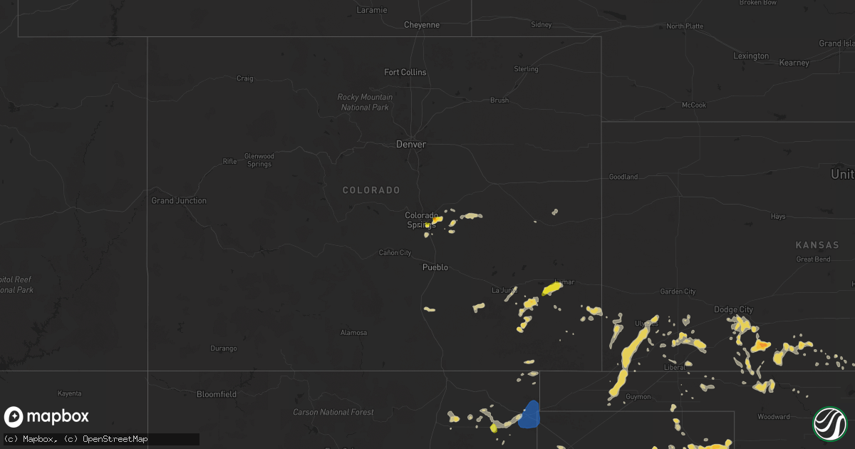
Hail Map on August 1, 2024
Get this storm
August 1 map
$229
one time, instant access
Download today. No call, no setup
Keep the $229
Bought the map and want the full workflow? Apply the entire $229 to a subscription within 7 days. None of it is wasted.
Every map, not just this one
This buys you this map. Subscription and you get every map we run, in the markets you choose from a few cities to whole states to nationwide. Plus real-time alerts the moment a storm fires.
Contact data
Name, contact info, occupancy, even credit band for addresses in the footprint. You go from where it hit to who to call.
Become the source they trust
Unlimited branding weather history reports on demand. You already have the documented answer ready for the property owner, and you are the one who showed up with it.
Property data and RoofTrace estimates
Pull up any address you have got, its value and the exact code rules for that jurisdiction, straight from One Click Code. Then RoofTrace estimates the squares, pitch, and roof value, priced the way you price.
States Impacted by Hail Map on August 1, 2024
Storm reports
Oklahoma
| Date | Description |
|---|---|
| 08/01/202412:59 AM CDT | A personal weather station recorded a 59 mph gust in outflow winds from storms farther north. |
Colorado
| Date | Description |
|---|---|
| 07/31/20248:58 PM CDT | A local report indicates 1.50 inch wind near 5 E Peterson AFB |
| 07/31/20248:24 PM CDT | Corrects previous hail report timing from 5 e peterson afb. |
West Virginia
| Date | Description |
|---|---|
| 07/31/20248:36 PM CDT | Tree down at intersection of mill creek rd and route 52... Blocking most of the roadway. |
Pennsylvania
| Date | Description |
|---|---|
| 08/01/20244:15 PM CDT | Multiple downed trees brought down power lines across sr 911 |
Texas
| Date | Description |
|---|---|
| 08/01/20246:32 PM CDT | A local report indicates 71 MPH wind near 2 N Texline |
| 07/31/20249:20 PM CDT | A local report indicates 68 MPH wind near 7 E Borger |
| 07/31/20248:44 PM CDT | A local report indicates 59 MPH wind near 2 N Borger |
| 07/31/20248:35 PM CDT | A local report indicates 63 MPH wind near 5 NNW Pampa |
| 07/31/20248:35 PM CDT | A local report indicates 60 MPH wind near 3 SE Dumas |
| 07/31/20248:24 PM CDT | A local report indicates 66 MPH wind near 7 E Borger |
| 07/31/20248:15 PM CDT | A local report indicates 60 MPH wind near 5 NNW Pampa |
Illinois
| Date | Description |
|---|---|
| 08/01/20241:31 PM CDT | Delayed report. Several trees down in norris city... Including one that fell onto a house causing considerable damage to the structure. Time estimated from radar. |
| 08/01/20241:18 PM CDT | Trees down in enfield. |
| 08/01/20241:15 PM CDT | A local report indicates 60 MPH wind near Mount Carmel |
| 08/01/20241:10 PM CDT | Public report of tree limbs down. |
| 08/01/20241:06 PM CDT | Several power poles on the east side of the county line road fell or snapped. Other power poles are leaning. |
| 08/01/20241:06 PM CDT | The top of an elevator grain bin was peeled back. A camper awning was damaged. A large tree was blown down onto a house. Minor tree damage throughout town. |
| 08/01/20241:06 PM CDT | Large section of roofing removed from a farm building... A side wall fell over. |
| 08/01/20241:05 PM CDT | Irrigation system damaged. |
| 08/01/20241:05 PM CDT | Several large trees and many large branches downed... Some of the trees fell in a diverging pattern. |
| 08/01/20241:03 PM CDT | Large sections of metal roofing from a long farm building blown off. |
| 08/01/202412:58 PM CDT | Row of 10 power lines snapped. Several buildings in northeast hamilton county lost roofs. Several locations had trees fall over roads. |
| 08/01/202412:50 PM CDT | Two large barns destroyed... One in mayberry area and one south of i-64 east of gammon curve. Several locations with large trees broken off. |
| 08/01/202412:48 PM CDT | Several trees limb down around olney. Time estimated by radar. |
| 08/01/202412:47 PM CDT | Public report of large tree limbs down. |
| 08/01/202412:42 PM CDT | Trees down... Large limbs broken due to outflow winds. |
| 08/01/202412:18 PM CDT | Several power poles down near marigold lane and us 45. |
| 08/01/202412:15 PM CDT | Power pole blown down on the south side of flora. |
| 08/01/202412:13 PM CDT | Power lines and power pole down in rinard. Time estimated from radar. |
| 08/01/202412:10 PM CDT | A local report indicates 61 MPH wind near Flora Municipal Airport |
Kentucky
| Date | Description |
|---|---|
| 08/01/20246:54 PM CDT | County dispatch reported a tree down with electrical wire fire at skyline view. Event time estimated from radar. |
| 08/01/20246:54 PM CDT | County dispatch reported a tree down with electrical wires causing a fire about the midway along sasser school road. Event time estimated from radar. |
| 08/01/20246:54 PM CDT | County dispatch reports a tree blown down in the 3200 block of ky-1569. Event time estimated from radar. |
| 08/01/20246:52 PM CDT | County dispatch reported a tree blown down on raymond ridge road. Even time estimated from radar. |
| 08/01/20246:52 PM CDT | County dispatch reported a tree blown down and blocking grand avenue between the minter & moore veterinary clinic and the beattyville & lee county fire department. Even |
| 08/01/20246:52 PM CDT | County dispatch reported tree down with electrical wires causing electrical fire at matt baker road. Event time estimated from radar. |
| 08/01/20246:52 PM CDT | County dispatch reported multiple trees blown down along ky-229 at different points between london and the laurel/knox county line. Event time estimated from radar. |
| 08/01/20246:49 PM CDT | County dispatch reported tree blown down along johnson fork road. Reported at 755 pm. Event time estimated from radar. |
| 08/01/20246:49 PM CDT | County dispatch reports 2 power lines blown down near the intersection of 1209 and ky-587. Time estimated from radar. |
| 08/01/20246:46 PM CDT | County dispatch reported a tree blown down on ky-1193 out toward the noes dock area. Event time estimated from radar. |
| 08/01/20246:46 PM CDT | County dispatch reports a tree blown down about 2 miles up ky-715 n. Event time estimated from radar. |
| 08/01/20246:43 PM CDT | County dispatch reports a tree blown down in the 900 block of leighton road. Event time estimated from radar. |
| 08/01/20246:43 PM CDT | County dispatch reported multiple trees blown down in salt lick but did not give specific locations. Event time estimated from radar. |
| 08/01/20246:42 PM CDT | County dispatch reported a tree blown down on nada tunnel road in the 1000 to 2000 block. Event time estimated from radar. |
| 08/01/20246:40 PM CDT | County dispatch reported multiple trees blown down in owingsville but did not give specific locations. Event time estimated from radar. |
| 08/01/20246:37 PM CDT | County dispatch reported a tree blown down in the 600 block of buchanan road. Event time estimated from radar. |
| 08/01/20246:37 PM CDT | County dispatch reported that a vehicle hit a tree blown down into the road near the intersection of ky-1568 and bradley road. Event time estimated from radar. |
| 08/01/20246:35 PM CDT | County dispatch reported a tree blown down onto kendall springs road around the 4800 block. Event time estimated from radar. |
| 08/01/20246:34 PM CDT | County dispatch reported tree blown down onto oakley-pebble road. Specific location was not given. Event time estimated from radar. |
| 08/01/20246:32 PM CDT | County dispatch reports tree blown down in tipton ridge road on the cobhill side. Exact location not given. Event time estimated from radar. |
| 08/01/20246:32 PM CDT | County dispatch reports tree blown down near intersection of halls branch road and campton road with power line involved. Also a tree was blown down at the adjacent mar |
| 08/01/20246:31 PM CDT | County dispatch reports electric lines down at the intersection of ky-52 and ky-213. Event time estimated from radar. |
| 08/01/20246:29 PM CDT | County dispatch reported a tree blown down and blocking ky-90 in the 2300 block -- not far from parkers lake. Called in to dispatch at 1933 lt. Event time estimated fro |
| 08/01/20246:29 PM CDT | County dispatch reported a tree blown down on twyford point road near the lakeshore. Event time estimated from radar. |
| 08/01/20246:28 PM CDT | County dispatch reported a tree blown down onto coral avenue. Event time estimated from radar. |
| 08/01/20246:27 PM CDT | County dispatch reports tree blown down on old sigmon loop road. Event time estimated from radar. |
| 08/01/20246:25 PM CDT | County dispatch reports a tree blown down near the intersection of white rock road and ky-150. Event time estimated from radar. |
| 08/01/20246:22 PM CDT | County dispatch reported tree blown down onto ky-790 at a sharp curve in bronston. Event time estimated from radar. |
| 08/01/20246:21 PM CDT | County dispatch reported trees blown down near intersection of eddie ridge and happy top roads. |
| 08/01/20246:20 PM CDT | County dispatch reports tree blown down on wells lane. Event time estimated from radar. |
| 08/01/20246:20 PM CDT | Dispatch reports trees down across madison county. Krga measured a peak wind gust of 46 mph. |
| 08/01/20246:19 PM CDT | Dispatch reported tree blown down in the 8200 block of north wilderness road. Event time estimated from radar. |
| 08/01/20246:18 PM CDT | County dispatch reported tree blown down onto cooperas creek road. Event time estimated from radar. |
| 08/01/20246:18 PM CDT | County dispatch reported a tree blown down in the 7700 block of winchester road and impacted an electric line causing a small fire. Event time estimated from radar. |
| 08/01/20246:15 PM CDT | County dispatch reported a tree blown onto power lines near the intersection of ky-836 and cindy lane. Event time estimated from radar. |
| 08/01/20246:14 PM CDT | Tree down along kentucky route 39 south of crab orchard. |
| 08/01/20246:13 PM CDT | Multiple trees reportedly blown down on road to jonesville boat ramp. Event time estimated from radar. |
| 08/01/20246:10 PM CDT | County dispatch reported a tree blown down around 1000 red river road. Event time estimated from radar. |
| 08/01/20246:08 PM CDT | Tree downed on mccalls mill road near athens. |
| 08/01/20246:06 PM CDT | County dispatch reports tree blown down in the along ky-2993 in the vicinity of mclin lane. Even time estimated from radar. |
| 08/01/20246:04 PM CDT | County dispatch reports multiple trees blown down in the vicinity of white lily along ky-192. Event time estimated from radar. |
| 08/01/20245:50 PM CDT | Trees down along kentucky route 698. |
| 08/01/20245:42 PM CDT | Trees down along kentucky route 2141. |
| 08/01/20245:40 PM CDT | Measured at spin fayette county ky mesonet site. |
| 08/01/20245:36 PM CDT | Large tree limbs down across warwick road near mccroskey pike. |
| 08/01/20245:26 PM CDT | Trees down along gilberts creek road in eastern anderson county. |
| 08/01/20245:18 PM CDT | Trees and power lines down on spurlington road in northeastern taylor county. |
| 08/01/20245:14 PM CDT | A tree fell onto an apartment building on ridgewood lane in frankfort. |
| 08/01/20245:12 PM CDT | Tree down at the intersection of cardwell lane and c michael davenport boulevard in frankfort. |
| 08/01/20244:41 PM CDT | Delayed report. Facebook user sent several pictures of a large tree that snapped onto a truck and a house. Report said it was about 545 pm when it occurred. Radar shows |
| 08/01/20244:20 PM CDT | Tree down on bircham road. |
| 08/01/20244:15 PM CDT | A large tree fell onto a garage in jeffersontown and was tangled in power lines. |
| 08/01/20244:13 PM CDT | A tree fell through the roof of a house on lynnwood way in jeffersontown. |
| 08/01/20244:13 PM CDT | Trees down onto power lines near the intersection of sherburn lane and mallard creek road. |
| 08/01/20244:08 PM CDT | Trees down near the intersection of breckenridge lane and grandview avenue in saint matthews. |
| 08/01/20243:05 PM CDT | Damage to a few trees in the city of owensboro. |
| 08/01/20242:55 PM CDT | A local report indicates 60 MPH wind near 6 SSE Hebbardsville |
| 08/01/20242:44 PM CDT | Power lines down. |
| 08/01/20242:40 PM CDT | Several trees down in the city. |
| 08/01/20242:14 AM CDT | Delayed report. Two large tree limbs down near the intersection of lakeview drive and albany ave. Time estimated from radar. |
| 08/01/20242:00 AM CDT | Delayed report. Trees and powerlines down near and along noble road... Bobo road... And carneal road. Time estimated from radar. |
| 08/01/20242:00 AM CDT | Delayed report. Trees and powerlines down near and along noble road... Bobo road... And carneal ro |
| 07/31/20248:44 PM CDT | State police reports tree blocking us-460 near intersection with blair-adkins road. Event time estimated from radar. |
| 07/31/20248:37 PM CDT | State police reports several trees blown down onto collins highway near the intersection with buckfield road. Event time estimated from radar. |
| 07/31/20248:33 PM CDT | State police reports tree down in the 6700 block of robinson creek road blocking both lanes. Event time estimated from radar. |
| 07/31/20247:57 PM CDT | County dispatch reports a tree blown down at the intersection of ky-7 and ky-2029. Event time estimated from radar. |
| 07/31/20247:38 PM CDT | County dispatch reports a tree blown down on walker branch road blocking the highway and trapping power lines. Event time estimated from radar. |
| 07/31/20247:34 PM CDT | County dispatch reported 1 tree blown down at the intersection of osborne fork and upper bull creek roads. Event time estimated from radar. |
| 07/31/20247:27 PM CDT | County dispatch reports 2 trees blown down around mm 3 along us-421. Event time estimated from radar. |
| 07/31/20247:20 PM CDT | County dispatch reports tree blown down onto us-460 at the morgan/magoffin county line. Event time estimate from radar. |
| 07/31/20247:20 PM CDT | County dispatch reported a tree blown down in the 5900 block of canoe road. Event time estimated from radar. |
| 07/31/20247:19 PM CDT | County dispatch reported a tree blown down on us-421 s approximately 11 miles out of manchester. Event time estimated from radar. |
| 07/31/20247:18 PM CDT | County dispatch reported a tree blown down on road about 6 miles up ky-11 north. Event time estimated from radar. |
| 07/31/20247:14 PM CDT | Dispatch reports tree blown down on ky-134 approximately 2 miles from the intersection with ky-191 at adele. Event time estimate from radar. |
| 07/31/20247:12 PM CDT | Dispatch reported a tree blown down on collins fork road. Event time estimated from radar. |
| 07/31/20247:06 PM CDT | Social media report of trees down along hwy 11 from clay county to knox county. Exact location estimated. Time estimated via radar. |
| 07/31/20247:04 PM CDT | County dispatch reported a tree blown down on ky-472 about 2.5 miles from us-421. Event time estimated from radar. |
| 07/31/20247:04 PM CDT | County dispatch reports a tree blown down on keith lane. Event time estimated from radar. |
| 07/31/20247:00 PM CDT | Nws employee reported that a tree had blown down across ky-3356 near mm 1. Event time estimated from radar. |
| 07/31/20247:00 PM CDT | County dispatch reported trees blown down on ky-225 near the intersection with warren camp road. Event time estimated from radar. |
Wisconsin
| Date | Description |
|---|---|
| 08/01/20244:50 PM CDT | Multiple tree branches down between wautoma and wild rose. Highway department called out. Time estimated from radar. |
| 08/01/20243:30 PM CDT | Branches down. One tree down. |
Indiana
| Date | Description |
|---|---|
| 08/01/20245:41 PM CDT | Report of a tree down in portland. |
| 08/01/20243:47 PM CDT | Power lines down on old indiana route 135 in corydon. |
| 08/01/20242:55 PM CDT | Trees were downed on deer creek road near cannelton. |
| 08/01/20242:45 PM CDT | Several trees downed... With some snapped and uprooted trees along troy ridge road and brushy fork road. |
| 08/01/20242:12 PM CDT | Late report of thunderstorm winds that downed a tree at the intersection of county roads 125 east and 400 south. |
| 08/01/20242:09 PM CDT | Large tree down near home. |
| 08/01/20241:34 PM CDT | Tree downed. Time estimated from radar. |
| 08/01/20241:33 PM CDT | Public report of large tree limbs down. |
Ohio
| Date | Description |
|---|---|
| 08/01/20246:03 PM CDT | Tree down on a power line. |
| 08/01/20245:44 PM CDT | Large tree limb down on house. |
| 07/31/20248:29 PM CDT | Powerlines down. |
| 07/31/20248:24 PM CDT | Trees down. |
| 07/31/20247:32 PM CDT | Two trees down. |
Virginia
| Date | Description |
|---|---|
| 08/01/20241:57 PM CDT | A couple trees and large branches down on hampstead drive and dandridge boulevard. |
New Mexico
| Date | Description |
|---|---|
| 08/01/20244:58 PM CDT | Lots of blowing dust and lawn furniture is getting thrashed about. |
| 08/01/20244:55 PM CDT | Reported at clayton muni airpark airport. |
| 08/01/20244:55 PM CDT | Large live tree snapped and damaged utility powerlines at 2nd and main st in clayton. |
| 08/01/20243:55 PM CDT | A local report indicates 1.00 inch wind near 13 E Gladstone |
Tennessee
| Date | Description |
|---|---|
| 07/31/20249:59 PM CDT | Facebook report of tree down in madison. |
| 07/31/20249:56 PM CDT | Facebook report of tree down in the goodlettsville-union hill area. |
| 07/31/20249:30 PM CDT | Tree down at short street and mcadams avenue. Time estimated from radar. |
| 07/31/20249:10 PM CDT | Multiple trees down... Including one on a powerline. |
| 07/31/20249:00 PM CDT | Multiple trees down in the area. |
| 07/31/20248:52 PM CDT | Facebook video showed boat dock destroyed in foxland harbor area. |
| 07/31/20248:50 PM CDT | Tspotter report and photo of large tree snapped on saint blaise rd. |
| 07/31/20248:50 PM CDT | Tree and powerlines down on hammer road. Road comes off john sevier highway just south of interstate 40. |
| 07/31/20248:46 PM CDT | Trees down east of buffalo springs. Time estimated from radar. |
| 07/31/20248:30 PM CDT | Large tree down blocking both lanes of north campbell station road. Cross street is yarnell road. |
| 07/31/20248:25 PM CDT | Tree down on couch mill road. Time estimated by radar. |
| 07/31/20248:15 PM CDT | A few trees down in maynardville. Time estimated by radar. |
| 07/31/20247:55 PM CDT | Tree down on norris freeway. Time estimated from radar. |
South Carolina
| Date | Description |
|---|---|
| 08/01/20244:00 PM CDT | Trees blown down on powerlines. |
| 08/01/20243:30 PM CDT | Report of a brief period of up to quarter size hail in the palmetto point/market common area. |
Cities Impacted by Hail Map on August 1, 2024
- Iuka, IL
- Johnsonville, IL
- Salem, IL
- Xenia, IL
- Flora, IL
- Louisville, IL
- Bluford, IL
- Texico, IL
- Keenes, IL
- Kell, IL
- Sims, IL
- Wayne City, IL
- Rinard, IL
- Mount Vernon, IL
- Clay City, IL
- Cisne, IL
- Belle Rive, IL
- Opdyke, IL
- Geff, IL
- Noble, IL
- Ingraham, IL
- Olney, IL
- Springerton, IL
- Dahlgren, IL
- McLeansboro, IL
- Barnhill, IL
- Fairfield, IL
- West Salem, IL
- Calhoun, IL
- Golden Gate, IL
- Mount Erie, IL
- Bone Gap, IL
- Ellery, IL
- Parkersburg, IL
- Albion, IL
- Wrightsville, PA
- Windsor, PA
- Red Lion, PA
- Mount Carmel, IL
- Browns, IL
- Conestoga, PA
- Macedonia, IL
- Sailor Springs, IL
- Mill Shoals, IL
- Owensville, IN
- Princeton, IN
- Burnt Prairie, IL
- Grayville, IL
- Bellmont, IL
- Griffin, IN
- Crossville, IL
- Enfield, IL
- Carmi, IL
- Broughton, IL
- Lawrenceville, IL
- Flat Rock, IL
- Bridgeport, IL
- Saint Francisville, IL
- Sumner, IL
- Allendale, IL
- Claremont, IL
- Vincennes, IN
- Patoka, IN
- Decker, IN
- Francisco, IN
- Cynthiana, IN
- New Harmony, IN
- Poseyville, IN
- Hazleton, IN
- Fort Branch, IN
- Norris City, IL
- Omaha, IL
- Withee, WI
- Elizabethtown, PA
- Manheim, PA
- Palmyra, PA
- Oaktown, IN
- Edwardsport, IN
- Wheatland, IN
- Monroe City, IN
- Sandborn, IN
- Bruceville, IN
- Petersburg, IN
- Elnora, IN
- Plainville, IN
- Westphalia, IN
- Ragsdale, IN
- Bicknell, IN
- Washington, IN
- Winslow, IN
- Evansville, IN
- Wadesville, IN
- Oakland City, IN
- Lynnville, IN
- Elberfeld, IN
- Haubstadt, IN
- Mount Vernon, IN
- Rockport, IN
- Grandview, IN
- Brooksville, FL
- Baldwin, GA
- Ridgway, IL
- New Haven, IL
- Odon, IN
- Otwell, IN
- Montgomery, IN
- Stendal, IN
- Spurgeon, IN
- Cannelburg, IN
- Velpen, IN
- Loogootee, IN
- Jasper, IN
- Greenwood, WI
- Webster, FL
- Morganfield, KY
- Lewisport, KY
- Maysville, GA
- Lula, GA
- Gillsville, GA
- Mount Airy, GA
- Medford, WI
- Homer, GA
- Carnesville, GA
- Evanston, IN
- Lamar, IN
- Shoals, IN
- Crane, IN
- Williams, IN
- Mitchell, IN
- Rhinelander, WI
- Corydon, KY
- Commerce, GA
- Henderson, KY
- Myakka City, FL
- Springer, NM
- Cannelton, IN
- Tell City, IN
- Hawesville, KY
- Willard, WI
- Nekoosa, WI
- Hancock, WI
- Waverly, KY
- Uniontown, KY
- Robards, KY
- Reed, KY
- Owensboro, KY
- Richland, IN
- Spottsville, KY
- Calhoun, KY
- Utica, KY
- Philpot, KY
- Maceo, KY
- Reynolds Station, KY
- Hartford, KY
- Whitesville, KY
- Cloverport, KY
- Harshaw, WI
- Polk City, FL
- Rome, IN
- Myrtle Beach, SC
- Orlando, FL
- Lake Alfred, FL
- Earlington, KY
- Madisonville, KY
- Hardinsburg, KY
- Westview, KY
- Derby, IN
- Salem, IN
- Scottsburg, IN
- Manitou, KY
- Nebo, KY
- Hazelhurst, WI
- Lake Tomahawk, WI
- Union Star, KY
- Pierson, FL
- Beaver Dam, KY
- Stephensport, KY
- Fordsville, KY
- Falls Of Rough, KY
- Brandenburg, KY
- Central, IN
- Leavenworth, IN
- Mauckport, IN
- Corydon, IN
- Battletown, KY
- Guston, KY
- Irvington, KY
- Payneville, KY
- Rhodelia, KY
- Webster, KY
- Horse Branch, KY
- Borden, IN
- Minocqua, WI
- Livermore, KY
- Fort Meade, FL
- Wisconsin Dells, WI
- Neillsville, WI
- Hudson, KY
- McDaniels, KY
- Leitchfield, KY
- Winter Garden, FL
- Grenville, NM
- Gladstone, NM
- Junction City, WI
- Stevens Point, WI
- Rosine, KY
- Big Clifty, KY
- New Columbia, PA
- Cambria, WI
- Rio, WI
- Greenville, KY
- Graham, KY
- Bartow, FL
- Noblesville, IN
- Cromwell, KY
- Olaton, KY
- Eastview, KY
- Custer, KY
- Garfield, KY
- Cecilia, KY
- McHenry, KY
- Des Moines, NM
- Clermont, FL
- Adams, WI
- White Plains, KY
- Elizabethtown, KY
- Rineyville, KY
- Caneyville, KY
- Louisville, KY
- Deerbrook, WI
- Coloma, WI
- Central City, KY
- Mosinee, WI
- Friendship, WI
- Radcliff, KY
- New Lisbon, WI
- Drakesboro, KY
- Pewee Valley, KY
- Clayton, NM
- Bowling Green, FL
- Mulberry, FL
- Bradley, FL
- Pittsville, WI
- Canadian, TX
- Necedah, WI
- Crestwood, KY
- La Grange, KY
- Arkdale, WI
- Islandton, SC
- Bloomfield, KY
- Taylorsville, KY
- Coxs Creek, KY
- Lawrenceburg, KY
- Chaplin, KY
- Mount Eden, KY
- New Haven, KY
- Hodgenville, KY
- Pelican Lake, WI
- Elcho, WI
- Shepherdsville, KY
- Mount Washington, KY
- Russellville, KY
- Elkton, KY
- Allensville, KY
- Olmstead, KY
- Lewisburg, KY
- Belton, KY
- Dunmor, KY
- Waddy, KY
- Sedan, NM
- Fall River, WI
- Randolph, WI
- Beaver Dam, WI
- Columbus, WI
- Kim, CO
- New Hope, KY
- Frostproof, FL
- Bowling Green, KY
- Higgins, TX
- Dawson Springs, KY
- Sebring, FL
- Las Animas, CO
- Avon Park, FL
- Nortonville, KY
- Fort Myers Beach, FL
- Bonita Springs, FL
- Merrill, WI
- Walsenburg, CO
- Adairville, KY
- Alpena, AR
- Channing, TX
- Crofton, KY
- Harrison, AR
- Chrisney, IN
- Hopkinsville, KY
- Miami, TX
- Model, CO
- Hasty, CO
- Texline, TX
- Watertown, WI
- Perryton, TX
- Juneau, WI
- Vega, TX
- Big Rock, TN
- Trenton, KY
- Eddyville, KY
- Lamar, CO
- Dalhart, TX
- Hartley, TX
- Neosho, WI
- Lebanon, WI
- Punta Gorda, FL
- Arcadia, FL
- Venus, FL
- Oconomowoc, WI
- Guthrie, KY
- Kuttawa, KY
- Rubicon, WI
- Ixonia, WI
- Thompsonville, IL
- Pampa, TX
- Manchester, KY
- Colorado Springs, CO
- Cadiz, KY
- Westerville, OH
- Galena, OH
- Johnstown, OH
- Hartford, WI
- Hubertus, WI
- Spearman, TX
- Ewing, IL
- Boulevard, CA
- Winkelman, AZ
- Stinnett, TX
- Fountain, CO
- Menomonee Falls, WI
- Sussex, WI
- Springfield, CO
- Eldorado, IL
- Andersonville, TN
- Clinton, TN
- Norris, TN
- Goodwell, OK
- Franklin, KY
- New Albany, OH
- Sunbury, OH
- Springfield, TN
- Cross Plains, TN
- Orlinda, TN
- Balko, OK
- Yoder, CO
- Rush, CO
- Peyton, CO
- Hardesty, OK
- Hatley, WI
- Jackson, KY
- Junction, IL
- Amarillo, TX
- Heiskell, TN
- Fritch, TX
- Calhan, CO
- Kit Carson, CO
- Belen, NM
- Holly, CO
- Granada, CO
- Veguita, NM
- Shawneetown, IL
- Rolla, KS
- Panhandle, TX
- Barbourville, KY
- Ramah, CO
- Hanson, KY
- Richfield, KS
- Brookfield, WI
- Elkhart, KS
- Gleason, WI
- Ashippun, WI
- Manter, KS
- Dixon, KY
- Johnson, KS
- Sturgis, KY
- Ulysses, KS
- Saint Charles, KY
- Hugoton, KS
- Moscow, KS
- Satanta, KS
- Liberal, KS
- Kismet, KS
- Sublette, KS
- Wilmore, KS
- Ford, KS
- Protection, KS
- Plains, KS
- Beaver, OK
- Forgan, OK
- Bucklin, KS
- Coldwater, KS
- Minneola, KS
- Turpin, OK
- Dodge City, KS
- Gate, OK
- Meade, KS
- Copeland, KS
- Laverne, OK
- Lake City, KS
- Medford, OK
- Rosston, OK
- Buffalo, OK
- Ashland, KS
- Sun City, KS
- Englewood, KS
- Lamont, OK
- Deer Creek, OK
- Nardin, OK
- Blackwell, OK
- Hazelton, KS
- Sharon, KS
- Medicine Lodge, KS
- Waldron, KS
- Anthony, KS
- Hardtner, KS
- Ponca City, OK
- Manchester, OK
- Kiowa, KS
- Waynoka, OK
- Vienna, IL
- Freedom, OK
- Wakita, OK
- Hunter, OK
- Tonkawa, OK
- Burlington, OK
- Simpson, IL
- Perry, OK
- Fairfax, OK
- Ralston, OK
- Jennings, OK
- Stillwater, OK
- Cleveland, OK
- Perkins, OK
- Hominy, OK
- Morgantown, KY
- Osage, OK
- Wingo, KY
- Mayfield, KY
- Sedalia, KY
- Farmington, KY
- Pawnee, OK
- Troy, IN
- Mcalester, OK
- Hartshorne, OK
- Wilburton, OK
- Harned, KY
- Boston, KY