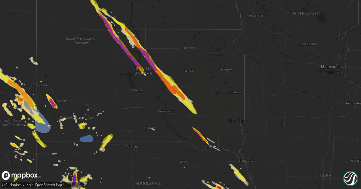
Hail Map on July 30, 2023
Get this storm
July 30 map
$229
one time, instant access
Download today. No call, no setup
Keep the $229
Bought the map and want the full workflow? Apply the entire $229 to a subscription within 7 days. None of it is wasted.
Every map, not just this one
This buys you this map. Subscription and you get every map we run, in the markets you choose from a few cities to whole states to nationwide. Plus real-time alerts the moment a storm fires.
Contact data
Name, contact info, occupancy, even credit band for addresses in the footprint. You go from where it hit to who to call.
Become the source they trust
Unlimited branding weather history reports on demand. You already have the documented answer ready for the property owner, and you are the one who showed up with it.
Property data and RoofTrace estimates
Pull up any address you have got, its value and the exact code rules for that jurisdiction, straight from One Click Code. Then RoofTrace estimates the squares, pitch, and roof value, priced the way you price.
States Impacted by Hail Map on July 30, 2023
Storm reports
Alabama
| Date | Description |
|---|---|
| 07/30/20235:32 PM CDT | Several trees down south of geneva. Reported by social media... And time estimated by radar. |
| 07/30/20233:47 PM CDT | Powerlines down on otho rd. Time estimated by radar. |
| 07/30/20232:10 PM CDT | A tree down on cty rd 19 near hwy 69. |
| 07/30/20231:18 PM CDT | Trees and powerlines down in the coosada area. |
| 07/30/202312:25 PM CDT | 3 large tree branches down. |
| 07/30/202311:22 AM CDT | Trees and powerlines down. |
| 07/30/202311:07 AM CDT | Tree down on power lines on liles lane. |
| 07/30/202310:45 AM CDT | Several trees down in the bagley area. |
Colorado
| Date | Description |
|---|---|
| 07/30/20236:08 PM CDT | Picture on social media. |
| 07/30/20236:07 PM CDT | Golfball to tennis ball size hail. |
| 07/29/20237:24 PM CDT | Report from mping: quarter |
Missouri
| Date | Description |
|---|---|
| 07/30/20236:47 PM CDT | Pea to quarter size hail fell for about 5 minutes. |
| 07/30/20236:44 PM CDT | Report from mping: half dollar |
| 07/30/20236:40 PM CDT | Report from mping: quarter |
| 07/30/20235:45 PM CDT | Delayed report of half dollar hail reported at roaring river state park. Hail fell for about 15 minutes. |
| 07/30/202312:20 AM CDT | Trees down in the bradleyville area. |
| 07/30/202312:13 AM CDT | Hwy 97 and hwy b trees blocking road. |
| 07/30/202312:08 AM CDT | Large tree down on skyline drive. |
| 07/30/202312:05 AM CDT | Powerlines down and trees over hwy 39. |
| 07/30/202312:04 AM CDT | Large tree down on home. |
| 07/30/202312:04 AM CDT | Tree limbs from 1 to 2 inches broken and shingles blown off a home. |
| 07/30/202312:03 AM CDT | Limbs down... Wall on barn is damaged. Limbs on house. |
| 07/30/202312:03 AM CDT | Severe damage. 60 foot oak tree down on west plain drive and northview... North of tracker rd. |
| 07/29/202311:59 PM CDT | On 60 and 65 there was damage to roofing and multiple limbs down. Power outages. Estimate 70 mph. |
| 07/29/202311:57 PM CDT | Large tree limbs 4 inches or greater in diameter broken all over the place. Large tree down. |
| 07/29/202311:56 PM CDT | Delayed report. Two trees down. Largest was at least a foot in diameter... Large maple. |
| 07/29/202311:56 PM CDT | Delayed report. Two trees down. Largest was at least a foot in diameter... Large maple. |
| 07/29/202311:55 PM CDT | Mesonet station fw9611 branson. |
| 07/29/202311:55 PM CDT | 6 inch and larger tree limbs with 2 to 3 large trees down blocking the 1700 block of lakewood. |
| 07/29/202311:53 PM CDT | Multiple big trees uprooted. Branches up to 10 inches broken. Shingles blown off. Power and cable lines damaged. Delayed report. |
| 07/29/202311:51 PM CDT | A local report indicates 65 MPH wind near Branson |
| 07/29/202311:50 PM CDT | Numerous trees down in the ozark heights area. |
| 07/29/202311:48 PM CDT | Severe tree damage and high winds on 65 & cc. No power. |
| 07/29/202311:46 PM CDT | Report from mping of trees uprooted or snapped and shingles blown off a roof. Delayed report. |
| 07/29/202311:45 PM CDT | Power outages. Moving outdoor furniture. |
| 07/29/202311:43 PM CDT | Multiple trees down and blocking roads. |
| 07/29/202311:42 PM CDT | A local report indicates 70 MPH wind near West Branson |
| 07/29/202311:36 PM CDT | A local report indicates 74 MPH wind near Kimberling City |
| 07/29/202311:33 PM CDT | Several limbs and power lines down. Power outages throughout the city. |
| 07/29/202311:33 PM CDT | High winds downed 3-inch and larger tree limbs and broke several power poles. Delayed report and time estimated by radar. |
| 07/29/202311:32 PM CDT | Central crossing fd is reporting a tree down across yy hwy near barry/stone line. |
| 07/29/202311:30 PM CDT | Mobile home with part of the roof ripped off and water flooding into residence east side of highlandville on ee road. |
| 07/29/202311:30 PM CDT | Large tree branches down. |
| 07/29/202311:30 PM CDT | Northern part of stone county had several trees and powerlines down. |
| 07/29/202311:30 PM CDT | 3 separate fires in anderson due to trees into electric lines. |
| 07/29/202311:30 PM CDT | Delayed report. Several large tree branches and tree reported downed in southeastern springfield. |
| 07/29/202311:30 PM CDT | Glenstone and independence there are reports of roof damage and small limbs down. |
| 07/29/202311:30 PM CDT | National and grand there are several trees down. |
| 07/29/202311:28 PM CDT | Several trees uprooted or snapped and shingles blow off a roof. Delayed report. |
| 07/29/202311:22 PM CDT | Several trees down in verona. |
| 07/29/202311:20 PM CDT | East on highway 14 there is a tree blocking the road. |
| 07/29/202311:20 PM CDT | Multiple trees and large limbs reported down in and around town. Shingles blown off several homes and some large limbs down on roofs. Delayed report. |
| 07/29/202311:20 PM CDT | Multiple 2 to 4 inch tree branches from a healthy oak tree broken off. Several large trees uprooted or snapped. |
| 07/29/202311:19 PM CDT | Power outages. |
| 07/29/202311:13 PM CDT | Nearly half the roof decking was removed from a home by high winds estimated at least 60 mph. |
| 07/29/202311:12 PM CDT | Several trees uprooted or snapped and shingles blown of a roof. Delayed report. |
| 07/29/202311:10 PM CDT | Delayed report. Large metal out building had large portion of roof blown off. |
| 07/29/202311:05 PM CDT | Tree down... 1 foot in diameter. |
| 07/29/202311:01 PM CDT | Delayed report from mping: trees uprooted or snapped; roof blown off. |
| 07/29/202311:00 PM CDT | Trees down. |
| 07/29/202310:57 PM CDT | Reports of numerous tree limbs down. Winds estimated at least 70 mph. |
| 07/29/202310:57 PM CDT | A local report indicates 70 MPH wind near Bolivar |
| 07/29/202310:54 PM CDT | Multiple 3-inch tree limbs broken and several power poles broken. Delayed report. |
| 07/29/202310:52 PM CDT | Large tree down on olive street. |
| 07/29/202310:52 PM CDT | Mesonet station mvvm7 mt vernon raws. |
| 07/29/202310:50 PM CDT | Delayed report from sunday evening. Several large tree branches down long with a few large trees knocked over. |
| 07/29/202310:40 PM CDT | Delayed report. Gutters blown off home. Corn crop heavily damaged. Tree limbs down on power lines. |
| 07/29/202310:38 PM CDT | Joplin asos measured 64 mph gust. |
| 07/29/202310:36 PM CDT | Spotternetwork.org report... Large tree limb 3 in or larger down... Unknown damage to building... Possibly garage. |
| 07/29/202310:35 PM CDT | Several trees uprooted or snapped and shingles blown off a roof. Delayed report. |
| 07/29/202310:33 PM CDT | Numerous tree and large limbs were reported down with some on power lines. Some trees were down on homes... Little or no damage reported. The city of lockwood was witho |
| 07/29/202310:32 PM CDT | Barton county em reporting the cities of lamar and golden city out of power. (s |
| 07/29/202310:32 PM CDT | Barton county em reporting the cities of lamar and golden city out of power. |
| 07/29/202310:32 PM CDT | Barton county em reporting cities of lamar and golden city out of power. |
| 07/29/202310:25 PM CDT | Estimated from ham. |
| 07/29/202310:25 PM CDT | Delayed report. 8 inch tree branches broken and 12-14 inch tree snapped over. Time based on radar estimate. |
| 07/29/202310:20 PM CDT | Numerous reports of tree damage in the lamar area. Some structural damage due to trees falling on homes. |
| 07/29/202310:19 PM CDT | Measured 65 mph. |
| 07/29/202310:18 PM CDT | 60 mph winds measured by jasper fire north of town. |
| 07/29/202310:15 PM CDT | House significantly damaged... 1 injury. |
| 07/29/202310:14 PM CDT | Measured 70 mph north of lamar. |
| 07/29/202310:08 PM CDT | Corrects previous tstm wnd dmg report from irwin. Widespread power outages. |
| 07/29/202310:06 PM CDT | Measured 68 mph north of lamar. |
| 07/29/202310:05 PM CDT | Tress down over road on c hwy near milford. |
| 07/29/20239:59 PM CDT | 63 mph measured at nevada awos. |
| 07/29/20239:55 PM CDT | Numerous trees and large limbs were reported down from walker to nevada to sheldon. Several outbuildings and machine sheds suffered roof damage with roof sheeting remov |
| 07/29/20239:52 PM CDT | Report from mping. 3 inch tree limbs broken. Power poles broken. |
| 07/29/20239:51 PM CDT | 74 mph gust measured at nevada city hall. |
| 07/29/20239:50 PM CDT | A local report indicates 60 MPH wind near Nevada |
| 07/29/20239:47 PM CDT | Estimated 60 mph wind ongoing and power outage. |
| 07/29/20239:45 PM CDT | Delayed report. Large trees down and large branches broken. Time based on radar. |
| 07/29/20239:45 PM CDT | Trees and power lines down in nevada. Most of nevada out of power. |
| 07/29/20239:41 PM CDT | Public weather station measured 63 mph wind. |
| 07/29/20239:18 PM CDT | Recorded on personal weather station. Reported via social media. |
| 07/29/20238:50 PM CDT | A local report indicates 60 MPH wind near 1 NW Lake Winnebago |
| 07/29/20238:40 PM CDT | Estimated 65 mph wind gusts. Several tree limbs were blown down. |
| 07/29/20238:35 PM CDT | Truck driver measured 70 mph wind on handheld anemometer. |
| 07/29/20238:30 PM CDT | Numerous large trees down between nw 64th st and nw 79th terrace on prairie view rd. Trees blocking multiple side streets. |
| 07/29/20238:25 PM CDT | Asos station kmkc kansas city dntn. |
| 07/29/20238:23 PM CDT | A local report indicates 64 MPH wind near Kansas City Downtown |
| 07/29/20238:20 PM CDT | Trees reported down and power is out. |
| 07/29/20238:11 PM CDT | A local report indicates 66 MPH wind near 1 W Kansas City Intl Ar |
| 07/29/20237:30 PM CDT | Severe tree limbs down in st joe. |
| 07/29/20237:21 PM CDT | A local report indicates 67 MPH wind near Saint Joseph Airport |
| 07/29/20237:01 PM CDT | Several trees were blown down over roads in the city of oregon. |
California
| Date | Description |
|---|---|
| 07/30/20236:29 AM CDT | Report from mping: 1-inch tree limbs broken and shingles blown off near anza. Nearby obs showed wind gusts of 25-30 mph at the time. |
| 07/30/20236:27 AM CDT | Corrects previous tstm wnd dmg report from 2 sw coachella. Report of palm tree in the road near the intersection of calhoun st and 54th ave in thermal. Following report |
| 07/30/20234:25 AM CDT | Measured wind gust of 57 kts at kipl |
| 07/30/20234:03 AM CDT | Measured wind gust of 51 kts at knjk from thunderstorm outflow winds. |
Florida
| Date | Description |
|---|---|
| 07/30/20236:33 PM CDT | Between country roads 125 & 127 near the town of cuyler dispatch reported numerous trees and power poles down... A tree fell on a vehicle... Tree fell down on a house n |
| 07/30/20236:31 PM CDT | Trees down in choctaw beach. Photo from social media and time estimated by radar. |
| 07/30/20236:15 PM CDT | Corrects previous tstm wnd dmg report from 2 e richter crossroads. A couple of trees down on lovewood road. Time estimated by radar. |
| 07/30/20236:00 PM CDT | Reported multiple trees down along small branch trail off of cr-125...time estimated off radar. |
| 07/30/20236:00 PM CDT | Trees down blocking lane of traffic at n cr 125 and crews road...time estimated off radar. |
| 07/30/20235:58 PM CDT | Tree and powerlines down on boat ramp road. Time estimated by radar. |
| 07/30/20235:48 PM CDT | Powerlines down on county highway 179. Time estimated by radar. |
| 07/30/20235:15 PM CDT | A couple of trees down on lovewood road. Time estimated by radar. |
| 07/30/20235:04 PM CDT | Mesonet station xjak jacksonville. |
| 07/30/20234:50 PM CDT | Tree down at paces ferry and moores mill road. Time estimated by radar. |
| 07/30/20234:42 PM CDT | Tree down at ocala rd and rumba way. Time estimated by radar. |
| 07/30/20234:41 PM CDT | Tree down at east 6th ave and beard street. Time estimated by radar. |
| 07/30/20234:34 PM CDT | Tree down at old st augustine road and hendrix road. Time estimated by radar. |
| 07/30/20234:22 PM CDT | Tree down on st augustine at paul russell road. Time estimated by radar. |
| 07/30/20234:03 PM CDT | Tree down on bloxham cutoff at national forest road 307. Time estimated by radar. |
| 07/30/20233:53 PM CDT | Trees down on bloxham cutoff road. Time estimated by radar. |
| 07/29/20238:40 PM CDT | Power poles and trees down. |
Iowa
| Date | Description |
|---|---|
| 07/30/20234:55 PM CDT | Relay of a public report through broadcast media. Time estimated based on radar. |
South Carolina
| Date | Description |
|---|---|
| 07/30/20233:41 PM CDT | Farm owner reported one medium size tree down in red top farm. Time estimated. |
| 07/30/20233:29 PM CDT | Nws cooperative observer located 4 miles southwest of johnston recorded a wind gust of 59 mph. |
| 07/29/20238:00 PM CDT | Tree down blocking both lanes around the 5000 block of cottageville highway. Time estimated by radar. |
| 07/29/20237:58 PM CDT | Tree down blocking lane at the 10000 block of jacksonboro road. Tree down blocking lane near the intersection of jacksonboro and bodison memorial roads. Time estimated |
| 07/29/20237:55 PM CDT | Colleton county emergency management reported a tree down blocking the roadway near the 5000 block of cottageville highway. A vehicle collided with the tree at this loc |
| 07/29/20237:55 PM CDT | 911 call center reported a tree down along the 200 block of pocotaligo rd. Time was estimated via radar data. |
| 07/29/20237:52 PM CDT | Tree down blocking both lanes near the intersection of fennell drive and round o road. Time estimated by radar. |
| 07/29/20237:50 PM CDT | Tree down blocking lane at the 10000 block of jacksonboro road. Tree down blocking lane near the intersection of jacksonboro and bodison memorial roads. Time estimated |
| 07/29/20237:48 PM CDT | Tree down blocking both lanes arond the 2000 block of merrick drive. Tree down blocking one lane around the 2700 block of coolers dairy road. Time estimated by radar. |
| 07/29/20237:46 PM CDT | Colleton county emergency management reported a tree down and in the roadway near 1035 welch creek road. A vehicle collided with the tree at this location but there wer |
| 07/29/20237:46 PM CDT | Emergency manager reported a tree down along the 6400 block of jefferies hwy... Blocking both lanes. Time was estimated via radar data. |
| 07/29/20237:46 PM CDT | Colleton county emergency management reported a tree down and in the roadway near the intersection of hendersonville highway and lowcountry highway. A vehicle collided |
| 07/29/20237:45 PM CDT | Tree down blocking both lanes on sidneys road... Near the intersection of cottageville highway. Time estimated by radar. |
| 07/29/20237:45 PM CDT | Tree down blocking one lane on featherbed road... Near cottageville highway. Time estimated by radar. |
| 07/29/20237:43 PM CDT | 911 call center reported a tree down along the 200 block of pocotaligo rd. Time was estimated via radar data. |
| 07/29/20237:40 PM CDT | Multiple trees down. One tree blocking lanes around the 700 block of chestnut road. One tree down blocking lanes around the 400 block of keegan drive. One tree down at |
| 07/29/20237:40 PM CDT | Tree and lines down blocking road around the 3100 block of sidneys road. Tree down blocking lane around the 1300 block of industrial road. Tree down blocking both lanes |
| 07/29/20237:40 PM CDT | Tree down and powerlines down at 9900 round o road. Radar indicates the cause to be the outflow boundary of a thunderstorm. Time estimated by radar. |
| 07/29/20237:36 PM CDT | 911 call center reported a tree down along the 7400 block of bamberg hwy. Time was estimated via radar data. |
| 07/29/20237:36 PM CDT | 911 call center reported a tree down along grays hwy and pine level church rd. Time was estimated via radar data. |
| 07/29/20237:35 PM CDT | 911 call center reported a tree blocking roadway at the corner of gray's highway and pinelevel church road. |
| 07/29/20237:35 PM CDT | 911 call center reported a tree blocking roadway at the corner of gray's hiway and linelevel church road. |
| 07/29/20237:34 PM CDT | 911 call center reported a tree down along the 700 block of anna laurel rd. Time was estimated via radar data. |
| 07/29/20237:34 PM CDT | Tree down around the 6400 block of jefferies highway blocking both lanes. Time estimated by radar. |
| 07/29/20237:27 PM CDT | 911 call center reported several trees down near harper rd and orangeburg rd... Nixville rd... Matthews bluff... West of estill. Time was estimated via radar data. |
| 07/29/20237:24 PM CDT | 911 call center reported a tree down along the 900 block of furman nixville rd due to thunderstorm outflow. Time was estimated via radar data. |
| 07/29/20237:21 PM CDT | 911 call center reported a few trees down and power lines down near and around cecilia rd at grass hill rd. Time was estimated via radar data. |
| 07/29/20237:15 PM CDT | Emergency manager reported a tree down near the intersection of garris ave and williams rd... Blocking both lanes. Time was estimated via radar data. |
| 07/29/20237:15 PM CDT | Colleton county emergency management reported a tree down and in the roadway near 800 smyly road. A vehicle collided with the tree at this location but there were no re |
| 07/29/20237:15 PM CDT | Tree down blocking both lanes around the 1500 block of lowcountry highway. Time estimated by radar. |
| 07/29/20237:07 PM CDT | Emergency manager reported a tree down along the 2600 block of williams rd blocking both lanes. Time was estimated via radar data. |
| 07/29/20237:03 PM CDT | 911 call center reported two large limbs down along augusta hwy near the allendale/hampton county border. Limbs were large enough that cars needed to drive around them. |
| 07/29/20237:03 PM CDT | Tree down at the intersection of garris ave and williams road blocking both lanes. Another tree down around the 2600 block of williams road blocking both lanes. Time es |
| 07/29/20237:03 PM CDT | 911 call center reported power lines down along williamson st. Time was estimated via radar data. |
North Carolina
| Date | Description |
|---|---|
| 07/30/20234:06 PM CDT | A large tree was blocking the road near the 1400 block of tarpin town rd in polkton. Time estimated by radar. |
| 07/30/20234:02 PM CDT | A tree fell on the roadway near the 800 block of savannah rd in peachland. Time estimated by radar. |
| 07/30/20234:00 PM CDT | Multiple trees down and power outages. |
| 07/30/20234:00 PM CDT | A tree fell on a house near the 100 block of baxter st in peachland. Time estimated by radar. |
Arkansas
| Date | Description |
|---|---|
| 07/30/20233:47 AM CDT | Tall pine tree snapped at the top. |
| 07/30/20231:31 AM CDT | Shed was destroyed. |
| 07/30/202312:55 AM CDT | Twenty two hundred power outages reported in northwest marion county... With most location completely without power from peel south towards summit. |
| 07/30/202312:37 AM CDT | 3500 power outages reported within the entergy network in boone county... With the highest density power outages between bergman and harrison. |
| 07/29/202311:40 PM CDT | Report of fallen tree from thunderstorms at intersection of highways 62 and 127 in garfield. |
Kansas
| Date | Description |
|---|---|
| 07/29/20239:35 PM CDT | Poles and lines down in the fort scott area. |
| 07/29/20239:25 PM CDT | 60-70 est. |
| 07/29/20239:08 PM CDT | A local report indicates 1.75 inch wind near Lebo |
| 07/29/20238:58 PM CDT | Personal weather station measured 68 mph gust. |
| 07/29/20238:51 PM CDT | Personal weather station recorded 62 mph. |
| 07/29/20238:45 PM CDT | A local report indicates 1.00 inch wind near 5 NW Reading |
| 07/29/20238:39 PM CDT | A local report indicates 60 MPH wind near Greeley |
| 07/29/20238:39 PM CDT | Asos station kixd olathe industria. |
| 07/29/20238:38 PM CDT | Asos station kojc olathe executive. |
| 07/29/20238:38 PM CDT | Large tree blown down. Reported via social media. |
| 07/29/20238:35 PM CDT | A local report indicates 70 MPH wind near 4 W Stanley |
| 07/29/20238:30 PM CDT | Multiple large branches down. Via social media. Time estimated from radar. |
| 07/29/20238:25 PM CDT | A local report indicates 70 MPH wind near 1 S Lyndon |
| 07/29/20238:25 PM CDT | Personal weather station. |
| 07/29/20238:20 PM CDT | Heavy rain... Pea sized hail... Estimated 60-70 mph winds with some tree damage. |
| 07/29/20238:19 PM CDT | A local report indicates 70 MPH wind near 1 S Baldwin City |
| 07/29/20238:19 PM CDT | 6-8 inch tree limb down. |
| 07/29/20238:18 PM CDT | Tree down at 70th and washington road. |
| 07/29/20238:17 PM CDT | A local report indicates 64 MPH wind near 4 NNE Princeton |
| 07/29/20238:17 PM CDT | Many trees being reported down in the county. Winds of at least 60 mph reported. |
| 07/29/20238:17 PM CDT | Measured near 99th and leavenworth rd. |
| 07/29/20238:16 PM CDT | A local report indicates 65 MPH wind near 4 SSW Quenemo |
| 07/29/20238:15 PM CDT | Steeple blown off church. Relayed via social media through broadcast media. |
| 07/29/20238:13 PM CDT | From kofo: tree downed through roof of house. Power is out all through town. |
| 07/29/20238:12 PM CDT | Est. 60-70 mph winds. |
| 07/29/20238:10 PM CDT | From kofo: 18 wheeler blown off of interstate 35. |
| 07/29/20237:59 PM CDT | Spotter reports 50-60 mph winds. |
| 07/29/20237:55 PM CDT | Kansas mesonet. |
| 07/29/20237:50 PM CDT | Strom spotter reported wind gusts of 60-70 mph. |
| 07/29/20237:45 PM CDT | A local report indicates 1.50 inch wind near 2 S Cuba |
| 07/29/20237:43 PM CDT | Personal weather station. |
| 07/29/20237:43 PM CDT | A local report indicates 63 MPH wind near 3 N Pleasant Grove |
| 07/29/20237:35 PM CDT | Reports of trees and limbs down and across roadway. |
| 07/29/20237:32 PM CDT | Personal weather station. |
| 07/29/20237:21 PM CDT | 50-60 mph wind gusts. |
| 07/29/20237:20 PM CDT | Lots of nickel and quarter sized hail. |
| 07/29/20237:04 PM CDT | Report from mping: half dollar |
Nebraska
| Date | Description |
|---|---|
| 07/30/20234:46 PM CDT | Up to quarter sized hail. |
| 07/30/20233:50 PM CDT | Wind gust relayed via emergency management from trained spotter. |
| 07/30/20233:40 PM CDT | Delayed report from social media. |
| 07/30/20233:38 PM CDT | Report relayed via emergency management. |
| 07/30/20233:32 PM CDT | Delayed report of quarter-sized hail. |
| 07/30/20238:08 AM CDT | Dimes to nickel with a few quarters mixed in. |
| 07/30/202312:26 AM CDT | Picture of a tree on a house via facebook. |
| 07/29/20239:55 PM CDT | Hailstones were sparse. |
| 07/29/20239:24 PM CDT | Quarter size hail reported. |
| 07/29/20238:20 PM CDT | Pictures on social media showing approximately 2 inch diameter tree branches broken. Estimated wind speeds of 60 mph. |
| 07/29/20237:45 PM CDT | Storm chaser reports 4 inch hail west of antioch on highway 2... Time estimated based on radar. |
| 07/29/20237:40 PM CDT | Spotter reports 3 inch hail near antioch via spotternetwork... Time estimate based on radar and location given. |
| 07/29/20237:35 PM CDT | Public reports 30+ mins of hail... Pea to quarter sized with a few stones measured at half dollar sized. |
| 07/29/20237:06 PM CDT | Dime to quarter size hail falling. |
Mississippi
| Date | Description |
|---|---|
| 07/30/20236:08 PM CDT | Tree and powerlines downed at the intersection of mclemore road and monroe road. Time estimated based upon radar. |
| 07/30/20236:00 PM CDT | Tree and powerline downed along the 400 block of north eastabuchie road. Time estimated based upon radar. |
| 07/30/20235:48 PM CDT | Tree downed along the 2100 block of ovett-petal road. Time estimated based upon radar. |
| 07/30/20235:40 PM CDT | Tree downed on old highway 15 south at highway 15 south. Time estimated based upon radar. |
| 07/30/20235:36 PM CDT | Powerline downed on wilson avenue. Time estimated based upon radar. |
| 07/30/20235:36 PM CDT | Powerline downed on leroy hill road. Time estimated based upon radar. |
| 07/30/20235:32 PM CDT | Tree downed at the intersection of lower myrick road and line road. Time estimated based upon radar. |
| 07/30/20235:29 PM CDT | Tree down on reeves road near bush dairy road. Time estimated based upon radar. |
| 07/30/20235:29 PM CDT | Utility pole downed and transformer on fire at 24th street and 1st avenue. Traffic signal damaged at highway 15 north at old amy road. |
| 07/30/20235:26 PM CDT | Tree downed at the intersection of keahey-gore road and pierce arrington road. Time estimated based upon radar. |
| 07/30/20235:26 PM CDT | Two trees downed in this area... One on pavillion road and another on g morgan road. Powerline and transformer downed and woods on fire along blackledge circle near mil |
| 07/30/20235:17 PM CDT | Tree down along bonner road near sandersville. Time estimated based upon radar. |
| 07/30/20235:05 PM CDT | Tree downed at 1200 block of hwy 528 northwest of heidelberg. |
| 07/30/20234:56 PM CDT | Large tree down on county road 280. |
| 07/30/20234:03 PM CDT | Numerous trees and powerlines downed across the city... With some downed powerlines catching fire. Time estimated based upon radar. |
| 07/30/20234:02 PM CDT | Tree downed across grandview avenue at 42nd street. Report and picture relayed via social media. Time estimated based upon radar. |
| 07/30/20233:34 PM CDT | Em reported a tree down on a house near union. |
| 07/29/20238:06 PM CDT | Corrects previous tstm wnd gst report from 11 sse pascagoula. Mesonet station ptbm6 petit bois is |
Georgia
| Date | Description |
|---|---|
| 07/30/20236:54 PM CDT | 911 call center reported a tree down along s old river rd. Time was estimated via radar data. |
| 07/30/20236:30 PM CDT | 911 call center reported a tree down near hwy 80 and burkhalter rd. Time was estimated via radar data. |
| 07/30/20236:30 PM CDT | 911 call center reported a tree down along millhaven rd. Time was estimated via radar data. |
| 07/30/20236:22 PM CDT | 911 call center reported a tree down near lakeview rd and middle ground rd. Time was estimated via radar data. |
| 07/30/20236:13 PM CDT | 911 call center reported a tree down near rocky ford rd and moore rd. Time was estimated via radar data. |
| 07/30/20236:10 PM CDT | 911 call center reported a tree down on power lines which caught fire near the intersection of hwy 25 and rocky ford rd. Time was estimated via radar data. |
| 07/30/20236:04 PM CDT | 911 call center reported a tree down along thomasboro rd. Time was estimated via radar data. |
| 07/30/20236:04 PM CDT | Tree knocked down reported by 911 dispatch center. |
| 07/30/20235:55 PM CDT | Reported widespread trees down along southside of county...time estimated off radar. |
| 07/30/20235:45 PM CDT | Numerous trees and powerlines down countywide. |
| 07/30/20235:45 PM CDT | Numerous trees and powerlines down countywide. |
| 07/30/20235:40 PM CDT | Trees reported down across danny kirkman road. |
| 07/30/20235:30 PM CDT | Reported widespread trees down along eastside of county...time estimated off radar. |
| 07/30/20235:20 PM CDT | Widespread trees blown down along the douglas highway from denton to hazelhurst. The time of damage was based on radar. |
| 07/30/20235:20 PM CDT | Several trees and powerlines down in pavo. Time estimated by radar. |
| 07/30/20235:10 PM CDT | Emer. Mngr relayed report of a tree down on house off of broxton hwy 1 mile nne of snipesville... Ga. Also reported power lines and trees down along bell telephone road |
| 07/30/20235:10 PM CDT | Extensive tree damage occurred in snipesville. The time of damage was based on radar. |
| 07/30/20234:57 PM CDT | The emergency manager reported a few trees down near greenway road in the eastern portion of the county. |
| 07/30/20234:50 PM CDT | Reported widespread trees down along northside of county...time estimated off radar. |
| 07/30/20234:42 PM CDT | Trees knocked down along hwy 441 north end of the county. |
| 07/30/20234:41 PM CDT | The emergency manager reported a few trees down in the north end of the county. |
| 07/30/20234:24 PM CDT | Tree down on friendship church rd near hwy 117. |
| 07/30/20234:24 PM CDT | Tree down on edison ray rd off of hwy 117. |
| 07/30/20234:20 PM CDT | Sheet metal roofing was blown off of a home on hopewell church rd. |
| 07/30/20234:04 PM CDT | Trees down along with roof damage on hwy 115 between rhine and telfair county line. |
| 07/30/20234:00 PM CDT | Tree down with damage to fence in the 1000 block of adams park rd. |
| 07/30/20233:50 PM CDT | Tree down at bullard rd and savage rd. |
| 07/30/20233:47 PM CDT | Trees down on powerlines in the 200 block of south cedar creek. |
| 07/30/20233:40 PM CDT | Tree down on glover rd and bullard rd. |
| 07/30/20233:40 PM CDT | Tree down on hwy 96 and prospect rd. |
| 07/30/20233:33 PM CDT | 2 trees down on the 4200 block of vanderbilt drive. Time estimated by radar. |
| 07/30/20233:33 PM CDT | 2 trees down on the 4200 block of vanderbilt drive. Time |
| 07/30/20233:12 PM CDT | Tree down on ga highway 27 just south of stewart/quitman county line. Time estimated by radar. |
| 07/30/20233:07 PM CDT | Corrects previous tstm wnd dmg report from 1 e ellaville. Powerlines down at intersection of east oglethorpe street and hayes avenue. |
| 07/30/20233:05 PM CDT | Tree uprooted in the 900 block of scenic route. |
| 07/30/20232:53 PM CDT | The emergency manager reported three trees down in the county. |
| 07/30/20232:37 PM CDT | Powerlines down at intersection of east oglethorpe street and hayes avenue. |
| 07/30/20232:28 PM CDT | Powerlines down in ne portion of marion county. |
| 07/30/20231:57 PM CDT | Tree reported down at gentian blvd and cougar ct. |
| 07/30/20231:41 PM CDT | The emergency manager reported two trees down. |
| 07/30/20231:17 PM CDT | Tree down across i-85 in troup county. |
South Dakota
| Date | Description |
|---|---|
| 07/30/20233:24 PM CDT | Mping report |
| 07/30/20233:16 PM CDT | A local report indicates 3.25 inch wind near 2 E Sheridan Lake |
| 07/30/20233:14 PM CDT | A local report indicates 3.00 inch wind near 1 SSE Sheridan Lake |
| 07/30/20233:13 PM CDT | Hail size ranged from peas to golf balls. Time estimated from radar. |
| 07/30/20233:10 PM CDT | A local report indicates 2.50 inch wind near 1 NNW Sheridan Lake |
| 07/30/20233:02 PM CDT | A local report indicates 2.50 inch wind near 2 S Pactola Resv |
| 07/30/20233:01 PM CDT | Mping report |
| 07/30/20233:00 PM CDT | A local report indicates 3.00 inch wind near 1 SSE Pactola Resv |
| 07/30/20232:55 PM CDT | A local report indicates 1.50 inch wind near Johnson Siding |
| 07/30/20232:54 PM CDT | A local report indicates 2.00 inch wind near 1 ENE Pactola Resv |
| 07/30/20232:48 PM CDT | A local report indicates 1.75 inch wind near 2 NE Silver City |
| 07/30/20232:39 PM CDT | A local report indicates 1.00 inch wind near 4 N Silver City |
| 07/30/20232:36 PM CDT | Time estimated from radar. |
| 07/30/20231:35 PM CDT | Golf ball to tennis ball sized hail fell straight down from storm... And cracked the windshield on spotters parked pickup truck at home. |
| 07/30/202312:15 PM CDT | A local report indicates 1.50 inch wind near 7 E Sutton Bay Rec Area |
| 07/30/202312:06 PM CDT | Time estimated from radar. |
| 07/30/202312:05 PM CDT | A local report indicates 1.25 inch wind near 14 SSW Seneca |
| 07/30/202312:00 PM CDT | A local report indicates 1.00 inch wind near 7 NE Sutton Bay Rec Are |
| 07/30/202311:56 AM CDT | Report from mping: half dollar |
| 07/30/202311:35 AM CDT | A local report indicates 1.00 inch wind near 9 E Sunshine Bible Acad |
| 07/30/202311:26 AM CDT | A local report indicates 1.25 inch wind near 6 NW Lebanon |
| 07/30/202311:00 AM CDT | Ping pong to golfball sized hail via facebook. |
| 07/30/202310:52 AM CDT | Video via facebook. |
| 07/30/202310:28 AM CDT | A local report indicates 1.00 inch wind near Mobridge Municipal Airp |
| 07/30/20239:52 AM CDT | Public report of quarter to half dollar via facebook. Estimated time based on radar. |
| 07/30/20239:48 AM CDT | A local report indicates 1.00 inch wind near 7 SSE Mcintosh |
| 07/29/202311:19 PM CDT | A local report indicates 62 MPH wind near 4 E Cactus Flat |
| 07/29/202311:14 PM CDT | A local report indicates 61 MPH wind near 4 E Cactus Flat |
| 07/29/202310:49 PM CDT | A local report indicates 72 MPH wind near 11 W Hot Springs |
| 07/29/202310:44 PM CDT | A local report indicates 61 MPH wind near 11 W Hot Springs |
| 07/29/202310:42 PM CDT | A local report indicates 60 MPH wind near 10 W Edgemont |
| 07/29/202310:32 PM CDT | A local report indicates 60 MPH wind near 10 W Edgemont |
| 07/29/20239:54 PM CDT | A local report indicates 58 MPH wind near 8 W Jewel Cave |
| 07/29/20239:46 PM CDT | A local report indicates 65 MPH wind near 9 SW Batesland |
| 07/29/20239:45 PM CDT | 50-60 mph wind gusts. Wind changed direction multiple times. |
| 07/29/20239:45 PM CDT | 50-60 mph wind gusts. Wind changed direction multiple times. |
| 07/29/20239:35 PM CDT | A local report indicates 59 MPH wind near 3 NW Wasta |
| 07/29/20239:27 PM CDT | Marble size with a few quarters |
| 07/29/20239:21 PM CDT | A local report indicates 1.25 inch wind near 1 NNW Sharps Corner |
| 07/29/20237:43 PM CDT | A local report indicates 1.00 inch wind near 14 SSW Provo |
Montana
| Date | Description |
|---|---|
| 07/30/20236:20 PM CDT | 6 to 10 inch russian olive tree snapped at the base of the trunk. |
| 07/30/20236:20 PM CDT | Several large trees |
| 07/30/20236:19 PM CDT | Corrects previous tstm wnd gst report from 3 e wolf point. This was the latest observation before instrument failed. |
| 07/30/20236:16 PM CDT | Facebook report. |
| 07/30/20236:15 PM CDT | Power poles and trees reported to be knocked down... Cross walk light near northside elementary school has been blown over. Facebook report. Time estimated from radar. |
| 07/30/20236:15 PM CDT | Power poles... Trees reported to be knocked down. A crosswalk light near the northside elementary school has been blown over. Facebook report with time estimated from r |
| 07/30/20236:10 PM CDT | Corrects previous tstm wnd dmg report from 1 w wolf point. Hardcover of pickup bed lifted into back window causing damage... Estimated gust 90 mph. |
| 07/30/20236:10 PM CDT | Hardcover of pickup bed lifted into back window causing damage... Estimated gust 80 mph. |
| 07/30/20235:40 PM CDT | Facebook report. |
| 07/30/20235:35 PM CDT | House siding blown off. Tree wind break blown away. |
| 07/30/20235:34 PM CDT | Davis weather station recorded a 63 mph wind gust. Spotter also reported dime size hail. |
| 07/30/20235:19 PM CDT | This was the latest observation before instrument failed. |
| 07/30/20235:10 PM CDT | Mesonet observation. |
| 07/30/20231:01 AM CDT | Some of the damage that the spotter observed: a lid on a grain bin was blown away. Some trees down. At a nearby school... The flat top roof was lifted off the building. |
| 07/30/202312:33 AM CDT | Asos station kggw glasgow airport |
| 07/30/202312:30 AM CDT | A local report indicates 62 MPH wind near Saint Marie |
| 07/29/202310:19 PM CDT | Started hailing around 905 pm and just ended. Hail is covering the ground. It started as pea to dime size after 5 minutes... But it became larger after then. Most stone |
| 07/29/202310:09 PM CDT | Photos submitted of hail in harlem. |
| 07/29/20239:36 PM CDT | Public submitted of hail being measured with ruler and also compared to coins. |
| 07/29/20239:28 PM CDT | Photos submitted of large hail in chinook. |
| 07/29/20239:25 PM CDT | Spotter just arrived in town and estimates that the hail ended approximately 10 minutes ago... But there were still a few quarter size hailstones on the ground. |
| 07/29/20239:20 PM CDT | Blaine county deputy em reported golf ball size hail at their property. |
| 07/29/20239:08 PM CDT | Corrected report to reflect time of actual hail occurrence. Spotter just arrived in town and estimates that the hail ended approximately 10 minutes ago... But there wer |
| 07/29/20238:48 PM CDT | Report from mping: quarter |
| 07/29/20238:20 PM CDT | Recorded by automated weather observing system on southeast end of fresno reservoir. |
| 07/29/20238:15 PM CDT | 1.85-2 inches of rain... Quarter to ping pong size hail... Wind speeds of 60+ mph. |
| 07/29/20238:15 PM CDT | 1.85-2 rain... Quarter to ping pong size hail... Wind speeds of 60+ mph. |
| 07/29/20238:00 PM CDT | Estimated wind gusts of 50 to 60 mph. |
| 07/29/20237:15 PM CDT | Also... Neighbors horse trailer was blown over. |
Wyoming
| Date | Description |
|---|---|
| 07/30/20236:44 PM CDT | Several powerpoles snapped. |
| 07/30/20236:44 PM CDT | Camper and horse trailer blown over. |
| 07/30/20236:44 PM CDT | A local report indicates 1.75 inch wind near 2 WNW Oshoto |
| 07/30/20236:11 PM CDT | Side by side atv and playground equipment blown over. Wind equipment showed 60 plus mph. |
| 07/30/20236:11 PM CDT | Side by side atv and playground equipment blown over. Wind equipment showed 60 plus mph. |
| 07/30/20236:08 PM CDT | Gusts estimated 70-80 mph. Several powerpoles in the area snapped. 30 inch diameter tree snapped. |
| 07/30/20235:00 PM CDT | Few quarters. Mostly nickels. |
| 07/29/20239:45 PM CDT | A local report indicates 60 MPH wind near 11 NE Morrisey |
| 07/29/20239:42 PM CDT | Mesonet station wy50 mills 2 ne |
| 07/29/20239:36 PM CDT | Asos station kcpr casper airport. |
| 07/29/20238:17 PM CDT | A local report indicates 1.75 inch wind near 2 NE Upton |
| 07/29/20237:49 PM CDT | A local report indicates 1.50 inch wind near 15 S Sundance |
| 07/29/20237:26 PM CDT | A local report indicates 1.75 inch wind near 10 WSW Sundance |
| 07/29/20237:21 PM CDT | Mping report |
| 07/29/20237:14 PM CDT | Fence line down. Few tree branches down. 175 gallon feed tubs blown 20 feet. |
| 07/29/20237:14 PM CDT | Fence line down. Few tree branches down. 175 gallon feed tubs blown 20 feet. |
| 07/29/20237:02 PM CDT | Mostly nickels and dimes. 60-70 mph wind gust with initial hail and torrential rain. |
| 07/29/20237:02 PM CDT | Mostly nickels and dimes. 60-70 mph wind gust with initial hail and torrential rain. |
Virginia
| Date | Description |
|---|---|
| 07/29/20238:00 PM CDT | Tree down blocking ferrum school rd. |
Arizona
| Date | Description |
|---|---|
| 07/30/20235:10 PM CDT | Estimated 60 mph winds... Along with frequently lightning and heavy rainfall. |
North Dakota
| Date | Description |
|---|---|
| 07/30/20239:32 AM CDT | Relayed via social media. Hail lasted approximately 9 minutes. |
| 07/30/20239:27 AM CDT | Mostly smaller... But some golf balls. Power is out in the area. Garden was severely damaged. |
| 07/30/20239:24 AM CDT | A local report indicates 1.00 inch wind near 14 SSW Saint Gertrude |
| 07/30/20239:00 AM CDT | A local report indicates 1.25 inch wind near 1 N Selfridge |
| 07/30/20238:00 AM CDT | A local report indicates 1.00 inch wind near Selfridge |
| 07/30/20237:33 AM CDT | A local report indicates 1.00 inch wind near Richardton |
| 07/30/20237:12 AM CDT | A local report indicates 1.00 inch wind near Carson |
Cities Impacted by Hail Map on July 30, 2023
- Pueblo, CO
- Penrose, CO
- Beulah, CO
- Rye, CO
- Avondale, CO
- Colorado City, CO
- Wetmore, CO
- Carson, ND
- Elgin, ND
- Flasher, ND
- Selfridge, ND
- Fort Yates, ND
- New Leipzig, ND
- Hebron, ND
- Glen Ullin, ND
- Richardton, ND
- Shields, ND
- McLaughlin, SD
- Wakpala, SD
- Fairfield, NE
- Glenvil, NE
- Deweese, NE
- McIntosh, SD
- Glenham, SD
- Mobridge, SD
- Mound City, SD
- Selby, SD
- Akaska, SD
- Trail City, SD
- Glencross, SD
- Timber Lake, SD
- Eagle Butte, SD
- Gettysburg, SD
- Hoven, SD
- Lebanon, SD
- Miller, SD
- Ree Heights, SD
- Highmore, SD
- Saint Lawrence, SD
- Wessington, SD
- Wessington Springs, SD
- Onida, SD
- Seneca, SD
- Alpena, SD
- Plankinton, SD
- Woonsocket, SD
- Letcher, SD
- Mount Vernon, SD
- Mitchell, SD
- Holabird, SD
- Agar, SD
- Inland, NE
- Winner, SD
- Colome, SD
- Hayden, AL
- Hastings, NE
- Clay Center, NE
- Taylor, ND
- Alabaster, AL
- Helena, AL
- Adamsville, AL
- Mulga, AL
- Bessemer, AL
- Quinton, AL
- Pelham, AL
- Raleigh, ND
- Bullhead, SD
- Brookwood, AL
- Dora, AL
- Bremen, AL
- Empire, AL
- Jasper, AL
- Rockford, AL
- Armour, SD
- Delmont, SD
- Tripp, SD
- Deadwood, SD
- Nemo, SD
- Rapid City, SD
- Hill City, SD
- Parkman, WY
- Dayton, WY
- Wisner, NE
- Pender, NE
- Wakefield, NE
- Emerson, NE
- Thurston, NE
- Madison, NE
- Creston, NE
- Tyndall, SD
- Avon, SD
- Keystone, SD
- Ranchester, WY
- Wolf, WY
- Granite Canon, WY
- Bancroft, NE
- Rosalie, NE
- Lyons, NE
- Stanton, NE
- Leigh, NE
- Prague, NE
- Malmo, NE
- Larslan, MT
- Cheyenne, WY
- Lindsay, NE
- Humphrey, NE
- Missouri Valley, IA
- Honey Creek, IA
- Nashua, MT
- Frazer, MT
- Wolf Point, MT
- Jacksonville, FL
- Jacksonville Beach, FL
- Wheatland, WY
- Manville, WY
- Broadus, MT
- Weston, WY
- Recluse, WY
- Gillette, WY
- Sterling, CO
- Atwood, CO
- Bailey, MS
- Meridian, MS
- Enterprise, MS
- Eclectic, AL
- Tallassee, AL
- Berryville, AR
- Eureka Springs, AR
- Clarkson, NE
- Wellington, CO
- Omaha, NE
- Lance Creek, WY
- Buford, WY
- Moorcroft, WY
- Amity, AR
- Akron, AL
- Roanoke, AL
- Marion, AL
- Greensboro, AL
- Forest, MS
- Lena, MS
- Wray, GA
- Broxton, GA
- Fitzgerald, GA
- Lumpkin, GA
- Wyola, MT
- Jeffersonville, GA
- Dry Branch, GA
- Eufaula, AL
- Adrian, GA
- Kite, GA
- Faunsdale, AL
- Newbern, AL
- Vance, AL
- Philadelphia, MS
- Union, MS
- Walnut Grove, MS
- Oakland, NE
- Craig, NE
- Blair, NE
- Marion, MS
- Livermore, CO
- Tie Siding, WY
- Lauderdale, MS
- Daleville, MS
- Toomsuba, MS
- Porterville, MS
- De Kalb, MS
- Scotland, SD
- Tabor, SD
- Conehatta, MS
- Decatur, MS
- Notasulga, AL
- Platte Center, NE
- Papillion, NE
- Glasgow, MT
- Edgefield, SC
- Hawkinsville, GA
- Petersburg, NE
- Schuyler, NE
- Newman Grove, NE
- Tilden, NE
- Arabi, GA
- Cordele, GA
- Council Bluffs, IA
- Underwood, IA
- Modale, IA
- Crescent, IA
- Ormond Beach, FL
- Yankton, SD
- Brent, AL
- Forsyth, MT
- Lead, SD
- Otoe, NE
- Avoca, NE
- Valdosta, GA
- Quitman, GA
- Monticello, AR
- Little Rock, MS
- Sparta, GA
- Willacoochee, GA
- Preston, GA
- Plains, GA
- Sawyerville, AL
- Morse Bluff, NE
- Abbeville, AL
- Tallahassee, FL
- Thomaston, AL
- Murdock, NE
- Rochelle, GA
- Pitts, GA
- Baxley, GA
- Alamo, GA
- Glenwood, GA
- Coolidge, GA
- Pavo, GA
- Centreville, AL
- Weston, NE
- Eagle Rock, MO
- Seligman, MO
- Cassville, MO
- Yutan, NE
- Ashland, NE
- Forkland, AL
- Dublin, GA
- Duncanville, AL
- Cottondale, AL
- Cobb, GA
- Dunbar, NE
- Nebraska City, NE
- Altoona, FL
- Soperton, GA
- Pinetta, FL
- Mauk, GA
- Junction City, GA
- Tekamah, NE
- Allen, NE
- Concord, NE
- Decatur, NE
- Dodge, NE
- Milledgeville, GA
- Eatonton, GA
- Union, NE
- Americus, GA
- Buena Vista, GA
- Ellaville, GA
- Ash Fork, AZ
- Bluffton, GA
- Arlington, GA
- Glen Saint Mary, FL
- Macclenny, FL
- Crawfordville, FL
- Adger, AL
- Mead, NE
- Colon, NE
- Wahoo, NE
- Cuba, AL
- Ward, AL
- Lisman, AL
- Rhine, GA
- Gainesville, AL
- Epes, AL
- Fairview, MO
- Stark City, MO
- Chunky, MS
- Collinsville, MS
- Denton, GA
- Mobile, AL
- Springfield, NE
- Gretna, NE
- Damascus, GA
- Ithaca, NE
- Ocala, FL
- East Dublin, GA
- Winnebago, NE
- Ames, NE
- Oakfield, GA
- Monroe, NE
- Moundville, AL
- Cochran, GA
- McCalla, AL
- Granby, MO
- Neosho, MO
- Neptune Beach, FL
- Columbus, GA
- Johnston, SC
- Trenton, SC
- Waycross, GA
- Leslie, GA
- Bruno, NE
- Sopchoppy, FL
- Hosford, FL
- Folkston, GA
- South Bend, NE
- Weeping Water, NE
- Greenwood, NE
- Louisville, NE
- Waterloo, NE
- Cedar Bluffs, NE
- Morgan, GA
- Warwick, GA
- Abie, NE
- Manley, NE
- Elkhorn, NE
- David City, NE
- Nehawka, NE
- Columbus, NE
- Linwood, NE
- Fremont, NE
- Bellwood, NE
- Elmwood, NE
- Alvo, NE
- Howells, NE
- Fordyce, NE
- Crofton, NE
- Rock Port, MO
- Gann Valley, SD
- Utica, SD
- Lesterville, SD
- Milan, GA
- Jacksonville, GA
- Carthage, MS
- Golden, MO
- Vida, MT
- Richey, MT
- Poplar, MT
- Hulett, WY
- Hebron, NE
- Deshler, NE
- Chester, NE
- Hubbell, NE
- Belleville, KS
- Munden, KS
- Byron, NE
- Ellsworth, NE
- Lakeside, NE
- Oshkosh, NE
- Alliance, NE
- Snyder, CO
- Sundance, WY
- Upton, WY
- Newcastle, WY
- Osage, WY
- Berryton, KS
- Lecompton, KS
- Tecumseh, KS
- Lawrence, KS
- Eudora, KS
- Overbrook, KS
- Baldwin City, KS
- Ottawa, KS
- Pomona, KS
- Topeka, KS
- Lyndon, KS
- Quenemo, KS
- Scranton, KS
- Carbondale, KS
- Wakarusa, KS
- Vassar, KS
- Agenda, KS
- Narka, KS
- Cuba, KS
- Aurora, KS
- Concordia, KS
- Bridgeport, NE
- Platte City, MO
- Farley, MO
- Leavenworth, KS
- Liberty, MO
- Fort Leavenworth, KS
- Smithville, MO
- Kansas City, KS
- Lansing, KS
- Tonganoxie, KS
- Kansas City, MO
- Easton, KS
- Waldron, MO
- Basehor, KS
- Weston, MO
- Odessa, MO
- Orrick, MO
- Camden Point, MO
- Kearney, MO
- Sibley, MO
- Grain Valley, MO
- Blue Springs, MO
- Wellington, MO
- Missouri City, MO
- Independence, MO
- Levasy, MO
- Bates City, MO
- Oak Grove, MO
- Buckner, MO
- Napoleon, MO
- Riverside, MO
- Excelsior Springs, MO
- Bonner Springs, KS
- Leawood, KS
- Overland Park, KS
- Lees Summit, MO
- Prairie Village, KS
- Lenexa, KS
- Shawnee, KS
- Mission, KS
- Edgerton, MO
- Grandview, MO
- Atchison, KS
- Edgerton, KS
- Gardner, KS
- Garnett, KS
- Williamsburg, KS
- Wellsville, KS
- Richmond, KS
- Rantoul, KS
- Greeley, KS
- Melvern, KS
- Princeton, KS
- Spring Hill, KS
- Westphalia, KS
- Osawatomie, KS
- Lane, KS
- Paola, KS
- Waverly, KS
- Edgemont, SD
- Harrison, NE
- Lambert, MT
- Savage, MT
- Bloomfield, MT
- Great Falls, MT
- Stockett, MT
- Belt, MT
- Sand Coulee, MT
- Gildford, MT
- Kremlin, MT
- Havre, MT
- Chinook, MT
- Lisco, NE
- Kyle, SD
- Merriman, NE
- Tuthill, SD
- Martin, SD
- Reading, KS
- Admire, KS
- Emporia, KS
- Neosho Rapids, KS
- Lebo, KS
- Hartford, KS
- Burlington, KS
- Osage City, KS
- Lone Jack, MO
- Centerview, MO
- Pleasant Hill, MO
- Greenwood, MO
- Warrensburg, MO
- Holden, MO
- Kingsville, MO
- Leeton, MO
- Strasburg, MO
- Raymore, MO
- Chilhowee, MO
- Cleveland, MO
- Garden City, MO
- Harrisonville, MO
- Adrian, MO
- Urich, MO
- Archie, MO
- Belton, MO
- East Lynne, MO
- Clinton, MO
- Blairstown, MO
- Butler, MO
- Freeman, MO
- Peculiar, MO
- Drexel, MO
- Creighton, MO
- Stilwell, KS
- Olathe, KS
- De Soto, KS
- Linwood, KS
- Bucyrus, KS
- Louisburg, KS
- La Cygne, KS
- Amoret, MO
- Amsterdam, MO
- Mound City, KS
- Welda, KS
- Parker, KS
- Centerville, KS
- Fontana, KS
- Pleasanton, KS
- Mapleton, KS
- Uniontown, KS
- Fulton, KS
- Prescott, KS
- Hume, MO
- Bronson, KS
- Foster, MO
- Colony, KS
- Blue Mound, KS
- Kincaid, KS
- La Harpe, KS
- Moran, KS
- Montrose, MO
- Appleton City, MO
- Quincy, MO
- Warsaw, MO
- Osceola, MO
- Deepwater, MO
- Calhoun, MO
- Lowry City, MO
- Schell City, MO
- Rockville, MO
- El Dorado Springs, MO
- Walker, MO
- Richards, MO
- Fort Scott, KS
- Rich Hill, MO
- Nevada, MO
- Harwood, MO
- Redfield, KS
- Farlington, KS
- Arcadia, KS
- Moundville, MO
- Arma, KS
- Hepler, KS
- Bronaugh, MO
- Deerfield, MO
- Girard, KS
- Garland, KS
- Milo, MO
- Liberal, MO
- Gridley, KS
- Le Roy, KS
- Neosho Falls, KS
- Custer, SD
- Owanka, SD
- Wall, SD
- Wasta, SD
- Pine Ridge, SD
- Batesland, SD
- Wounded Knee, SD
- Gordon, NE
- Porcupine, SD
- Geyser, MT
- Raynesford, MT
- Highwood, MT
- Zurich, MT
- Harlem, MT
- Hays, MT
- Lamar, MO
- Wheatland, MO
- Sheldon, MO
- Flemington, MO
- Humansville, MO
- Weaubleau, MO
- Stockton, MO
- Mulberry, KS
- Hermitage, MO
- Pittsburg, MO
- Jerico Springs, MO
- Collins, MO
- Polk, MO
- Louisburg, MO
- Buffalo, MO
- Half Way, MO
- Long Lane, MO
- Bolivar, MO
- Dunnegan, MO
- Phillipsburg, MO
- Fair Play, MO
- Dadeville, MO
- Lockwood, MO
- Arcola, MO
- Aldrich, MO
- Mindenmines, MO
- Franklin, KS
- Elkland, MO
- Greenfield, MO
- Conway, MO
- Pittsburg, KS
- Joplin, MO
- Clever, MO
- Reeds, MO
- Walnut Grove, MO
- Opolis, KS
- Billings, MO
- Butterfield, MO
- Sarcoxie, MO
- Willard, MO
- La Russell, MO
- Marionville, MO
- Diamond, MO
- Bois D Arc, MO
- Crane, MO
- Asbury, MO
- Stotts City, MO
- Purdy, MO
- Ash Grove, MO
- Carthage, MO
- Wheaton, MO
- Pleasant Hope, MO
- Verona, MO
- Monett, MO
- Jasper, MO
- Miller, MO
- Webb City, MO
- Wentworth, MO
- Aurora, MO
- Mount Vernon, MO
- Freistatt, MO
- Carterville, MO
- Springfield, MO
- Avilla, MO
- Republic, MO
- Oronogo, MO
- South Greenfield, MO
- Purcell, MO
- Neck City, MO
- Brighton, MO
- Fair Grove, MO
- Golden City, MO
- Carl Junction, MO
- Alba, MO
- Halltown, MO
- Exeter, MO
- Morrisville, MO
- Everton, MO
- Brookline, MO
- Pierce City, MO
- Frontenac, KS
- Marshfield, MO
- Strafford, MO
- Duenweg, MO
- Rocky Comfort, MO
- Stella, MO
- Weir, KS
- Galena, KS
- Scammon, KS
- Urbana, MO
- Hot Springs, SD
- Crete, NE
- Hallam, NE
- Rudyard, MT
- Burlingame, KS
- Cortland, NE
- Adams, NE
- Volborg, MT
- Scandia, KS
- Lusk, WY
- Jamestown, KS
- Supai, AZ
- Williams, AZ
- Louin, MS
- Bay Springs, MS
- Saint George, GA
- Bonifay, FL
- Green Forest, AR
- Alpena, AR
- Joplin, MT
- Chester, MT
- Crystal River, FL
- Maitland, MO
- Mound City, MO
- Fort Calhoun, NE
- Alford, FL
- Cottondale, FL
- Harrison, AR
- Wrightsville, GA
- Rockledge, GA
- Girard, GA
- Silver Lake, KS
- Rossville, KS
- Maple Hill, KS
- Saint Marys, KS
- Vendor, AR
- Birney, MT
- Beloit, KS
- Glen Elder, KS
- Barnard, KS
- Cleveland, AR
- Hattieville, AR
- Clinton, AR
- Center Ridge, AR
- Jerusalem, AR
- Fairburn, SD
- Bamberg, SC
- Denmark, SC
- Allen, KS
- Merino, CO
- Devils Tower, WY
- Brewton, AL
- Geraldine, MT
- Robertsdale, AL
- Thomasville, GA
- Lost Springs, WY
- Shawnee, WY
- Clarkdale, AZ
- Jerome, AZ
- Avon Park, FL
- Patterson, GA
- Blackshear, GA
- Easton, MO
- Sells, AZ
- Oregon, MO
- Marana, AZ
- Bogalusa, LA
- Carriere, MS
- Emelle, AL
- Portal, GA
- Ambrose, GA
- Marianna, FL
- Milford, NE
- Green Cove Springs, FL
- Rushville, NE
- Peru, NE
- Julian, NE
- Auburn, NE
- Talmage, NE
- Brock, NE
- Glendo, WY
- Belle Fourche, SD
- Natoma, KS
- Plainville, KS
- Buckatunna, MS
- Moselle, MS
- Seminary, MS
- Garrett, WY
- Pleasant Dale, NE
- Denton, NE
- Oral, SD
- Poplarville, MS
- Buffalo Gap, SD
- Crawford, NE
- Walterboro, SC
- Chalmette, LA
- Violet, LA
- New Orleans, LA
- Meraux, LA
- Sanderson, FL
- Hector, AR
- Pelsor, AR
- Witts Springs, AR
- Mount Judea, AR
- Defuniak Springs, FL
- Surrency, GA
- Odum, GA
- Bristol, GA
- Shell Knob, MO
- Loranger, LA
- Rose Hill, MS
- Quitman, MS
- Pachuta, MS
- Vossburg, MS
- Paulding, MS
- Clifton, KS
- Clyde, KS
- Lame Deer, MT
- Fargo, GA
- Fort McCoy, FL
- Torrington, WY
- Alzada, MT
- Theodore, AL
- Clermont, FL
- Lawrence, MS
- Raleigh, MS
- Huntsville, AR
- Bartow, GA
- Delia, KS
- Picayune, MS
- Bishopville, SC
- Brownville, NE
- Nemaha, NE
- Hickory, MS
- Allen, SD
- Soso, MS
- Ellisville, MS
- Big Sandy, MT
- Hemingford, NE
- Otter, MT
- Stonewall, MS
- Inverness, MT
- Millen, GA
- Garfield, GA
- Atlantic Beach, FL
- Ponte Vedra Beach, FL
- Perkinston, MS
- Saucier, MS
- Kiln, MS
- Pass Christian, MS
- Spearfish, SD
- Grand Bay, AL
- Irvington, AL
- Moss Point, MS
- Statesboro, GA
- Grover, CO
- Watson, MO
- Bingham, NE
- Aliceville, AL
- Kissimmee, FL
- Starke, FL
- Keystone Heights, FL
- Lawtey, FL
- Webb, AL
- Dothan, AL
- Cowarts, AL
- Verdon, NE
- Hamburg, IA
- Lorton, NE
- Falls City, NE
- Shubert, NE
- Stella, NE
- Johnson, NE
- Frostproof, FL
- Savannah, GA
- Heidelberg, MS
- Fairfax, MO
- Skidmore, MO
- Sebring, FL
- Marsland, NE
- Nalcrest, FL
- Lake Wales, FL
- Conrad, MT
- Brady, MT
- Riceboro, GA
- Sylvania, GA
- Morton, MS
- Pelahatchie, MS
- Saint Johns, FL
- Mershon, GA
- Hoboken, GA
- Savannah, MO
- Saint Joseph, MO
- Boys Town, NE
- Beverly Hills, FL
- Lecanto, FL
- Whigham, GA
- Waynesboro, MS
- Lake, MS
- Scenic, SD
- Fishtail, MT
- Emmett, KS
- Taylorsville, MS
- Shubuta, MS
- Livingston, AL
- Bayard, NE
- Hingham, MT
- Jachin, AL
- Martin, SC
- Jasper, AR
- Marble Falls, AR
- Newton, MS
- Clarksdale, MO
- Stewartsville, MO
- Hammond, LA
- Alma, GA
- Hazlehurst, GA
- Fairfax, SC
- Lodge, SC
- Smoaks, SC
- Compton, AR
- Collins, MS
- Kaycee, WY
- Pickrell, NE
- Hinsdale, MT
- Vandalia, MT
- Saint Marie, MT
- Fort Peck, MT
- Galena, MO
- Nixa, MO
- Rogersville, MO
- Fordland, MO
- Ozark, MO
- Sparta, MO
- Bruner, MO
- Niangua, MO
- Seymour, MO
- Highlandville, MO
- Spokane, MO
- Chestnutridge, MO
- Walnut Shade, MO
- Chadwick, MO
- Forsyth, MO
- Oldfield, MO
- Ponce De Leon, MO
- Ava, MO
- Reeds Spring, MO
- Cape Fair, MO
- Garrison, MO
- Kissee Mills, MO
- Lakeview, AR
- Powersite, MO
- Hollister, MO
- Thornfield, MO
- Wasola, MO
- Gainesville, MO
- Lampe, MO
- Theodosia, MO
- Protem, MO
- Peel, AR
- Gassville, AR
- Lead Hill, AR
- Yellville, AR
- Omaha, AR
- Blue Eye, MO
- Ridgedale, MO
- Branson, MO
- Midway, AR
- Kirbyville, MO
- Rockaway Beach, MO
- Rueter, MO
- Mountain Home, AR
- Bradleyville, MO
- Oakland, AR
- Cedarcreek, MO
- Bull Shoals, AR
- Squires, MO
- Noble, MO
- Isabella, MO
- Kimberling City, MO
- Pontiac, MO
- Taneyville, MO
- Cotter, AR
- Norfork, AR
- Flippin, AR
- Oak Grove, AR
- Summit, AR
- Everton, AR
- Saint Joe, AR
- Onia, AR
- Marshall, AR
- Pyatt, AR
- Valley Springs, AR
- Harriet, AR
- Leslie, AR
- Timbo, AR
- Big Flat, AR
- Gilbert, AR
- Pindall, AR
- Western Grove, AR
- Hasty, AR
- Washburn, MO
- Kingston, AR
- Deer, AR
- Parthenon, AR
- Ponca, AR
- Garfield, AR
- Rogers, AR
- Callaway, NE
- Calico Rock, AR
- Ashby, NE
- Everest, KS
- Interior, SD
- Humboldt, KS
- Erie, KS
- Savonburg, KS
- Chanute, KS
- Hartington, NE
- Lloyd, MT
- Guion, AR
- Angora, NE
- Hartman, AR
- Clarksville, AR
- Custer, MT
- Soldier, KS
- Havensville, KS
- Lewellen, NE
- Melbourne, AR
- Clatonia, NE
- Wilber, NE
- Wood River, NE
- Five Points, AL
- Loup City, NE
- Laurel, NE
- Brewster, NE
- Grand Island, NE
- Cairo, NE
- Shelton, NE
- Arthur, NE
- Virginia, NE
- Crab Orchard, NE
- Lewiston, NE
- Filley, NE
- Dorchester, NE
- Burchard, NE
- Steinauer, NE
- Elk Creek, NE
- Firth, NE
- Tecumseh, NE
- Ansley, NE
- Mountain View, AR
- Springfield, SD
- Ashton, NE
- Ravenna, NE
- Rockville, NE
- Tucson, AZ
- Sahuarita, AZ
- Hyannis, NE
- Saco, MT
- Batesville, AR
- Horton, KS
- Hiawatha, KS
- Stapleton, NE
- Brady, NE
- Arnold, NE
- Maxwell, NE
- Scotland, AR
- Martell, NE
- De Witt, NE
- Hay Springs, NE
- Broadwater, NE
- Virgil, SD
- Malta, MT
- Wellton, AZ
- Dover, AR
- Hogeland, MT
- Saint Edward, NE
- Holton, KS
- Mayetta, KS
- Camden, AL
- Merna, NE
- Brockton, MT
- Flaxville, MT
- Meadow Grove, NE
- Twin City, GA
- Memphis, NE
- Elgin, NE
- Oakdale, NE
- Battle Creek, NE
- Sumiton, AL
- Leary, GA
- North Bend, NE
- Wadley, GA
- Bastrop, LA