Hail Map in Wisconsin on July 30, 2012
Get this storm
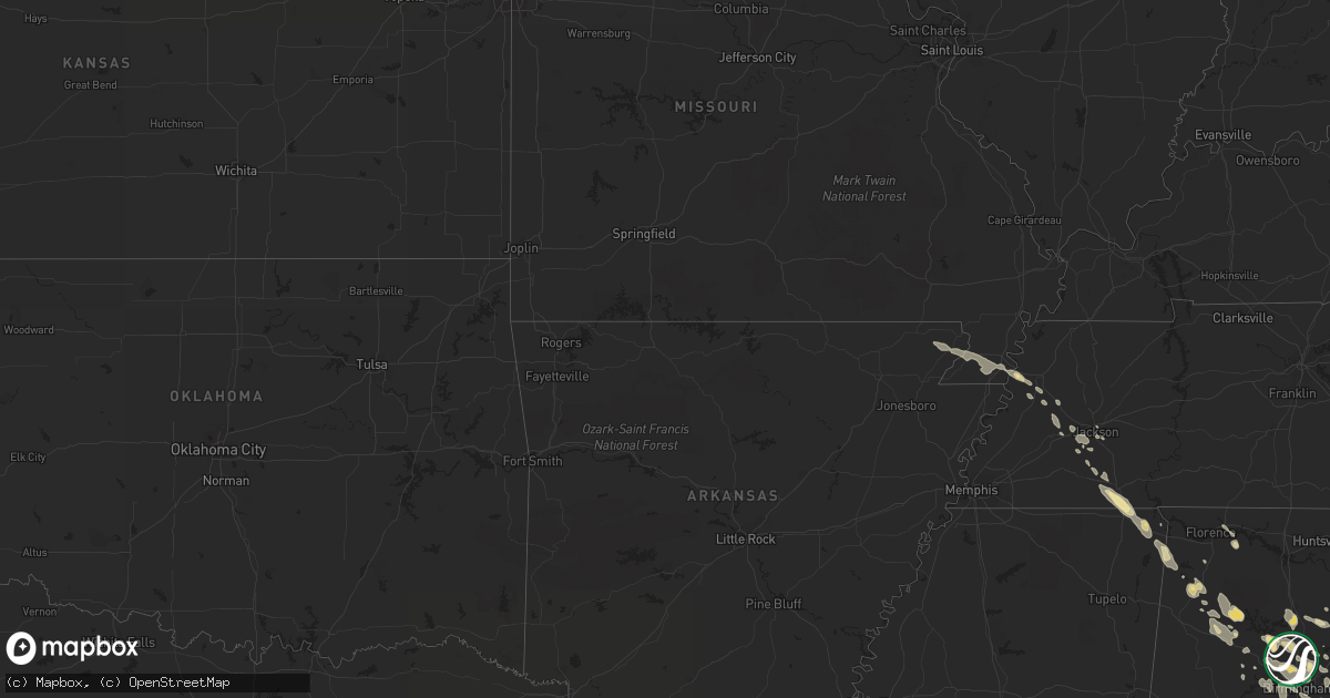
July 30 map
$229
one time, instant access
Download today. No call, no setup
Keep the $229
Bought the map and want the full workflow? Apply the entire $229 to a subscription within 7 days. None of it is wasted.
Every map, not just this one
This buys you this map. Subscription and you get every map we run, in the markets you choose from a few cities to whole states to nationwide. Plus real-time alerts the moment a storm fires.
Contact data
Name, contact info, occupancy, even credit band for addresses in the footprint. You go from where it hit to who to call.
Become the source they trust
Unlimited branding weather history reports on demand. You already have the documented answer ready for the property owner, and you are the one who showed up with it.
Property data and RoofTrace estimates
Pull up any address you have got, its value and the exact code rules for that jurisdiction, straight from One Click Code. Then RoofTrace estimates the squares, pitch, and roof value, priced the way you price.
Storm reports in Wisconsin
Wisconsin
| Date | Description |
|---|---|
| 07/30/20125:57 PM CDT | A local report indicates 1.00 inch wind near 1 S SUAMICO |
| 07/30/20125:57 PM CDT | A local report indicates 2.50 inch wind near HOWARD |
| 07/30/20125:54 PM CDT | A local report indicates 1.00 inch wind near HOWARD |
| 07/30/20125:52 PM CDT | A local report indicates 1.50 inch wind near GREEN BAY |
| 07/30/20125:42 PM CDT | A local report indicates 1.00 inch wind near LITTLE SUAMICO |
| 07/30/20125:42 PM CDT | A local report indicates 1.00 inch wind near 3 WSW HOWARD |
| 07/30/20125:30 PM CDT | A local report indicates 2.00 inch wind near 4 W SOBIESKI |
| 07/30/20124:20 PM CDT | Mostly 1/4 to 1/2 inch hail. A few hail stones reached the size of quarters. |
| 07/30/20121:05 AM CDT | A couple large trees down in the caldwell area and in the tichigan area west and north of tichigan lake. Time is estimated based on radar. |
| 07/30/201212:57 AM CDT | Tree down at big bend road and n lake drive. Time estimated. |
| 07/30/201212:50 AM CDT | A local report indicates 1.00 inch wind near 2 E NORTH PRAIRIE |
| 07/30/201212:47 AM CDT | A couple trees down in the area from 3 ene la grange to 5 ene of la grange. One of the trees blocked a road. Time is estimated based on radar. |
| 07/29/201211:40 PM CDT | A local report indicates 1.00 inch wind near 1 NW SUN PRAIRIE |
| 07/29/201211:39 PM CDT | A local report indicates 1.00 inch wind near SUN PRAIRIE |
| 07/29/20128:15 PM CDT | A local report indicates 1.00 inch wind near EGG HARBOR |
| 07/29/20128:03 PM CDT | Hail a little larger than quarters. |
| 07/29/20128:00 PM CDT | Hail at least 2 inches in diameter. |
| 07/29/20127:28 PM CDT | Windshield cracked |
| 07/29/20127:28 PM CDT | Windshield cracked |
| 07/29/20127:12 PM CDT | Hail began at 710 pm and ended at 712 pm. |
All States Impacted by Hail Map on July 30, 2012
Cities Impacted by Hail Map on July 30, 2012
- Divide, CO
- Woodland Park, CO
- Cascade, CO
- Green Mountain Falls, CO
- Fairhope, AL
- Andalusia, AL
- Fort Stewart, GA
- Bloomingdale, GA
- Ellabell, GA
- Hartford, AL
- Black, AL
- Ponce De Leon, FL
- Two Rivers, WI
- Denmark, WI
- Whitelaw, WI
- Mishicot, WI
- Maribel, WI
- Simla, CO
- Bailey, CO
- Pine, CO
- Morrison, TN
- Manchester, TN
- Rochelle, IL
- Chana, IL
- Holcomb, IL
- Dakota, IL
- Davis Junction, IL
- Lindenwood, IL
- Oregon, IL
- Byron, IL
- Winnebago, IL
- Pecatonica, IL
- Ridott, IL
- Rock City, IL
- Durand, IL
- Stillman Valley, IL
- Davis, IL
- Freeport, IL
- Rockford, IL
- German Valley, IL
- Sylvania, GA
- Estill, SC
- Niles, MI
- South Bend, IN
- Buchanan, MI
- Beaufort, SC
- Port Royal, SC
- Berrien Springs, MI
- Saint Joseph, MI
- Benton Harbor, MI
- Baroda, MI
- Stevensville, MI
- Flagler, CO
- North Augusta, SC
- Saco, MT
- Elbert, CO
- Calhan, CO
- Kiowa, CO
- Ramah, CO
- Iuka, MS
- Gulf Breeze, FL
- Racine, WI
- Oak Creek, WI
- Lebanon, TN
- Castalian Springs, TN
- Gallatin, TN
- Bethpage, TN
- Hartsville, TN
- Watertown, TN
- Auburntown, TN
- Lake City, MI
- Reedsville, WI
- Town Creek, AL
- Brownsville, TN
- New Berlin, WI
- Chesterfield, SC
- Morven, NC
- Thornton, IL
- Harvey, IL
- South Holland, IL
- Dekalb, IL
- Kiel, WI
- Elkhart Lake, WI
- Chilton, WI
- New Holstein, WI
- Myrtle Beach, SC
- Crown Point, IN
- Orland Park, IL
- Mokena, IL
- Peyton, CO
- Blountsville, AL
- Halls, TN
- Vernon Hill, VA
- South Boston, VA
- Java, VA
- Keeling, VA
- Chatham, VA
- Halifax, VA
- Quinton, AL
- Bessemer, AL
- Mulga, AL
- Byers, CO
- Bay Minette, AL
- Stockton, AL
- Pinson, AL
- Trussville, AL
- Cullman, AL
- Hanceville, AL
- Hartford, WI
- Kewaskum, WI
- Allenton, WI
- Slinger, WI
- West Bend, WI
- Akron, CO
- Limon, CO
- Matheson, CO
- Van Dyne, WI
- Richfield, WI
- Lomira, WI
- Jackson, WI
- Mount Calvary, WI
- Saint Cloud, WI
- Theresa, WI
- Brownsville, WI
- Iron Ridge, WI
- Eden, WI
- Mayville, WI
- Fond Du Lac, WI
- Hilbert, WI
- Adell, WI
- Campbellsport, WI
- Rubicon, WI
- Malone, WI
- Cope, CO
- Clanton, AL
- Nauvoo, AL
- Blountstown, FL
- Manistique, MI
- Birmingham, AL
- Cedar Lake, IN
- University Park, IL
- Frankfort, IL
- Beecher, IL
- Monee, IL
- Crete, IL
- Remus, MI
- Mount Pleasant, MI
- Weidman, MI
- Hotevilla, AZ
- Summerdale, AL
- Silverhill, AL
- Magnolia Springs, AL
- Foley, AL
- Weldona, CO
- Wiggins, CO
- Kaibeto, AZ
- New Brockton, AL
- Westminster, SC
- Long Creek, SC
- Sedalia, CO
- Castle Rock, CO
- Bremen, AL
- Empire, AL
- Jasper, AL
- Second Mesa, AZ
- Charleston, WV
- Belle, WV
- Bonifay, FL
- Daleville, AL
- Green Bay, WI
- Loxley, AL
- Seney, MI
- Guyton, GA
- Ludowici, GA
- Hinesville, GA
- Glennville, GA
- Gobler, MO
- Steele, MO
- Kennett, MO
- Bragg City, MO
- South Beloit, IL
- Clinton, WI
- Poplar Grove, IL
- Larkspur, CO
- Olney Springs, CO
- Muskegon, MI
- Twin Lake, MI
- Fort Morgan, CO
- Polacca, AZ
- Kykotsmovi Village, AZ
- Miramar Beach, FL
- Cassopolis, MI
- Verona, WI
- South Pittsburg, TN
- Jasper, TN
- Sequatchie, TN
- Machesney Park, IL
- Gillett, WI
- Finley, TN
- Cedar Grove, WI
- Belgium, WI
- Canton, NC
- Waynesville, NC
- Piggott, AR
- Mobile, AL
- Green Lake, WI
- Markesan, WI
- Fort Rucker, AL
- Seibert, CO
- Marshall, WI
- Geraldine, MT
- Holt, FL
- Sterrett, AL
- Helena, AL
- Pelham, AL
- Wilsonville, AL
- Alabaster, AL
- Chelsea, AL
- Columbiana, AL
- Harpersville, AL
- Kewaunee, WI
- Wrightstown, WI
- Kaukauna, WI
- Greenleaf, WI
- De Pere, WI
- Luxemburg, WI
- Woodbury, TN
- Bradyville, TN
- Abrams, WI
- Little Suamico, WI
- Pulaski, WI
- Krakow, WI
- Sobieski, WI
- Jackson, TN
- Ridgeland, SC
- Walkerville, MI
- Custer, MI
- Branch, MI
- Colorado Springs, CO
- Double Springs, AL
- Grafton, WI
- Mequon, WI
- Cedarburg, WI
- Clyde, NC
- Seymour, WI
- Oneida, WI
- Dyersburg, TN
- Panama City, FL
- Lynn, AL
- Eldridge, AL
- Rector, AR
- Lowndesboro, AL
- Leighton, AL
- Gladstone, MI
- Fort Benton, MT
- Loma, MT
- Arriba, CO
- Panama City Beach, FL
- Ebro, FL
- Morris, IL
- Grand Marais, MI
- Fountain, CO
- Arcadia, IN
- Cicero, IN
- Strasburg, CO
- Brillion, WI
- Whitewater, WI
- Fort Atkinson, WI
- Helenville, WI
- Waterloo, WI
- Deerfield, WI
- Lake Mills, WI
- Jefferson, WI
- Eagle, WI
- Palmyra, WI
- Madison, WI
- Sun Prairie, WI
- Watertown, WI
- East Troy, WI
- Deforest, WI
- Cottage Grove, WI
- Windsor, WI
- Johnson Creek, WI
- Waunakee, WI
- Vulcan, MI
- Monteagle, TN
- Sewanee, TN
- Tracy City, TN
- Rosebush, MI
- Kalkaska, MI
- Williamsville, VA
- Lawrenceville, VA
- Gulf Shores, AL
- Williams, AZ
- Perry, FL
- Milton, FL
- Pensacola, FL
- Cantonment, FL
- Remlap, AL
- Cleveland, AL
- West Olive, MI
- Spring Lake, MI
- Grand Haven, MI
- Brantley, AL
- Rye, CO
- Bennett, CO
- Fremont, MI
- Grant, MI
- Chase City, VA
- Boydton, VA
- Lewistown, MT
- Haleyville, AL
- Bear Creek, AL
- Fultondale, AL
- Gardendale, AL
- Nicholls, GA
- Douglas, GA
- West Green, GA
- La Porte, IN
- Westville, IN
- Chesterton, IN
- Michigan City, IN
- Hinckley, IL
- Rapid River, MI
- Escanaba, MI
- Cornell, MI
- Winnett, MT
- Stephenson, MI
- Early Branch, SC
- Beloit, WI
- Brodhead, WI
- Newton, AL
- Slocomb, AL
- Tonalea, AZ
- Eglin Afb, FL
- Graysville, AL
- Mount Olive, AL
- Midway, GA
- Dozier, AL
- Opp, AL
- Seneca, IL
- Mazon, IL
- Menominee, MI
- Wallace, MI
- Sturgeon Bay, WI
- Usaf Academy, CO
- Sheboygan Falls, WI
- Plymouth, WI
- Westville, FL
- Kirkland, IL
- Kingston, IL
- Titusville, FL
- Clairton, PA
- Elizabeth, PA
- Summersville, WV
- Baker, FL
- Ruby, SC
- Mount Croghan, SC
- Highwood, MT
- Folkston, GA
- Ashville, AL
- Loxahatchee, FL
- Hart, MI
- Brush, CO
- Noblesville, IN
- Niagara, WI
- Altamont, TN
- Pelham, TN
- Ashton, IL
- Cropwell, AL
- Robertsdale, AL
- Manton, MI
- Fair Oaks, IN
- Lake Village, IN
- Crystal Lake, IL
- Island Lake, IL
- Mchenry, IL
- McMillan, MI
- Newberry, MI
- Cherokee, AL
- Belmont, MS
- Tishomingo, MS
- Red Bay, AL
- Burnsville, MS
- Coleman, MI
- Avondale, CO
- Ozark, AL
- Ariton, AL
- Brundidge, AL
- Glenwood, AL
- Florala, AL
- Troy, AL
- Wing, AL
- Luverne, AL
- Gantt, AL
- Evergreen, AL
- Brewton, AL
- Elba, AL
- Jack, AL
- Enterprise, AL
- Milwaukee, WI
- Greendale, WI
- Warrior, AL
- Hayden, AL
- Beaverton, MI
- Clare, MI
- Phil Campbell, AL
- Hackleburg, AL
- Spruce Pine, AL
- Hodges, AL
- Sodus, MI
- Anton, CO
- Genoa, CO
- Hesperia, MI
- Shelby, MI
- Monroe, WI
- Juda, WI
- Munster, IN
- Gary, IN
- Hammond, IN
- Chicago, IL
- Chicago Heights, IL
- Lowell, IN
- East Chicago, IN
- Griffith, IN
- Highland, IN
- Lansing, IL
- Merrillville, IN
- Saint John, IN
- Whiting, IN
- Dyer, IN
- Hebron, IN
- Schererville, IN
- Cleveland, WI
- Monticello, FL
- Mount Vernon, AL
- Killen, AL
- Covert, MI
- Pell City, AL
- Janesville, WI
- Pinetop, AZ
- Belvidere, IL
- Marengo, IL
- Caledonia, IL
- Harvard, IL
- Capron, IL
- Roscoe, IL
- Loves Park, IL
- Garden Prairie, IL
- Callahan, FL
- Hilliard, FL
- Grant Park, IL
- Rincon, GA
- Springfield, GA
- Leland, IL
- Somonauk, IL
- North Versailles, PA
- Mckeesport, PA
- Oshkosh, WI
- Russellville, AL
- Dennis, MS
- Leaf River, IL
- Franktown, CO
- Wetmore, MI
- Daphne, AL
- Spring Grove, IL
- Antioch, IL
- Fox Lake, IL
- Tallahassee, FL
- Monongahela, PA
- Charleroi, PA
- Guys, TN
- Corinth, MS
- Ramer, TN
- Michie, TN
- Vernon, FL
- Dalton, WI
- Clarksville, FL
- Greensboro, AL
- Sheridan, IL
- Germfask, MI
- Henderson, TN
- Hornsby, TN
- Baxley, GA
- Alma, GA
- Hardeeville, SC
- Leeds, AL
- Moody, AL
- Coalmont, TN
- Hillsboro, TN
- Manitowoc, WI
- Lillian, AL
- Perronville, MI
- Bark River, MI
- Carney, MI
- Fowler, CO
- Shelby, AL
- Sylacauga, AL
- Mears, MI
- Hilger, MT
- Ochopee, FL
- Union, IL
- Empire, MI
- Waverly, GA
- Eau Claire, MI
- Blairsville, GA
- Grayling, MI
- New Lenox, IL
- Manhattan, IL
- Joliet, IL
- Elwood, IL
- Glen, MS
- Pentwater, MI
- Scottville, MI
- Baileys Harbor, WI
- Egg Harbor, WI
- Fish Creek, WI
- Ludington, MI
- Little Lake, MI
- Eight Mile, AL
- Theodore, AL
- Semmes, AL
- Caruthersville, MO
- Suamico, WI
- Toone, TN
- Medon, TN
- Petoskey, MI
- Evanston, IL
- Wilmington, IL
- Winslow, AZ
- Hosford, FL
- Fredonia, WI
- Daggett, MI
- Hilton Head Island, SC
- Bailey, MI
- Ravenna, MI
- Graniteville, SC
- Aiken, SC
- Berrien Center, MI
- Dowagiac, MI
- Albany, WI
- Evansville, WI
- Palatine, IL
- Arlington Heights, IL
- Sheboygan, WI
- Waukesha, WI
- Mukwonago, WI
- North Prairie, WI
- Toccoa, GA
- Jemison, AL
- Oakman, AL
- Roy, MT
- Burlington, WI
- Waynesboro, GA
- Elberta, AL
- Canvas, WV
- Nettie, WV
- Foster City, MI
- Otis, CO
- Beech Island, SC
- Warrenville, SC
- Saint Ignace, MI
- Grass Range, MT
- Mercer, TN
- Pocahontas, TN
- Selmer, TN
- Cross Plains, WI
- Middleton, WI
- Muscle Shoals, AL
- Thomasville, GA
- Yorkville, IL
- Newark, IL
- Dora, AL
- Sumiton, AL
- Morris, AL
- Docena, AL
- Brookside, AL
- Adamsville, AL
- Pleasant Grove, AL
- Dolomite, AL
- Cordova, AL
- Kimberly, AL
- Fairfield, AL
- Denmark, TN
- Grant, CO
- Christmas, FL
- Moore, MT
- Freeman, VA
- Dolphin, VA
- Skipwith, VA
- Clarksville, VA
- Elkhorn, WI
- Lake Geneva, WI
- Defuniak Springs, FL
- Brilliant, AL
- Winfield, AL
- Carbon Hill, AL
- Concho, AZ
- Littleton, CO
- Yoder, CO
- Section, AL
- Pueblo, CO
- Red Oak, VA
- Baskerville, VA
- Monument, CO
- Falmouth, MI
- Moore Haven, FL
- Plantersville, AL
- Stanton, AL
- Maplesville, AL
- Orfordville, WI
- Holton, MI
- White Cloud, MI
- Satsuma, AL
- Saraland, AL
- Ponte Vedra Beach, FL
- Ponte Vedra, FL
- Rio, WI
- New Raymer, CO
- Destin, FL
- Orchard, CO
- Peachland, NC
- Freeport, FL
- Deer Park, AL
- McIntosh, AL
- Newaygo, MI
- Okatie, SC
- Shingleton, MI
- Munising, MI
- Glen Arbor, MI
- New Franken, WI
- Bitely, MI
- Rock, MI
- Jacksonville Beach, FL
- Brent, AL
- Fall River, WI
- Randolph, WI
- Moundville, AL
- Cambria, WI
- Friesland, WI
- Florissant, CO
- Oconomowoc, WI
- Big Bend, WI
- Wales, WI
- Delafield, WI
- Sullivan, WI
- Dousman, WI
- Mount Prospect, IL
- Des Plaines, IL
- Elk Grove Village, IL
- Fennville, MI
- Pembine, WI
- Alamo, GA
- Lake Station, IN
- Steger, IL
- Park Forest, IL
- Friendship, TN
- Jarratt, VA
- Allegan, MI
- Whitehall, MI
- Lena, IL
- Belleville, WI
- Starke, FL
- Saint Johns, FL
- Kingsley, MI
- Vona, CO
- Steward, IL
- Saint Augustine, FL
- Port Washington, WI
- Mount Horeb, WI
- Oregon, WI
- New Glarus, WI
- Brooklyn, WI
- Monticello, WI
- Springville, AL
- Steele, AL
- Ellison Bay, WI
- Marinette, WI
- Washington Island, WI
- Bowman, SC
- Saint George, SC
- Miami, FL
- Newton, WI
- Potter, WI
- Saint Nazianz, WI
- Valders, WI
- Summit Argo, IL
- Burbank, IL
- Hometown, IL
- Evergreen Park, IL
- La Junta, CO
- Sandwich, IL
- Thorsby, AL
- Monroe Center, IL
- Beverly, WV
- Randolph, AL
- Wray, CO
- Rockton, IL
- Bridgman, MI
- Coloma, MI
- Sawyer, MI
- Walsenburg, CO
- Creola, AL
- Axis, AL
- Calera, AL
- Montevallo, AL
- Saint Johns, AZ
- Bells, TN
- Shabbona, IL
- Malta, IL
- Plano, IL
- Big Rock, IL
- Tinley Park, IL
- Homer Glen, IL
- Bristol, FL
- Granger, IN
- Mishawaka, IN
- Barrington, IL
- Scottsboro, AL
- Watkins, CO
- Wauconda, IL
- Mazomanie, WI
- Dane, WI
- Sauk City, WI
- Townley, AL
- Laurel Hill, FL
- Saint Marys, GA
- Yulee, FL
- Kings Bay, GA
- Kingsland, GA
- Kinston, AL
- Samson, AL
- Cocoa, FL
- Louisville, GA
- Rocky Ford, CO
- South Haven, MI
- Black Earth, WI
- Elizabeth, CO
- Clare, IL
- Sycamore, IL
- Pooler, GA
- Chipley, FL
- Wells, MI
- Delavan, WI
- Parrish, AL
- Newington, GA
- Mcminnville, TN
- Liberty, TN
- Grand Junction, MI
- Thayer, IN
- Demotte, IN
- Oneonta, AL
- Como, CO
- Hornersville, MO
- Valdosta, GA
- Ray City, GA
- Traverse City, MI
- Jay, FL
- Bethel Springs, TN
- Pellston, MI
- Momence, IL
- Ordway, CO
- Kit Carson, CO
- Brookfield, WI
- Pewaukee, WI
- Idaho Springs, CO
- Peotone, IL
- Duquesne, PA
- Brierfield, AL
- Mackinac Island, MI
- Waterman, IL
- Millbrook, IL
- Columbus, WI
- Bonduel, WI
- Pinon, AZ
- Alamo, TN
- Wewahitchka, FL
- Fruitport, MI
- Coden, AL


