Hail Map in Alabama on July 30, 2012
Get this storm
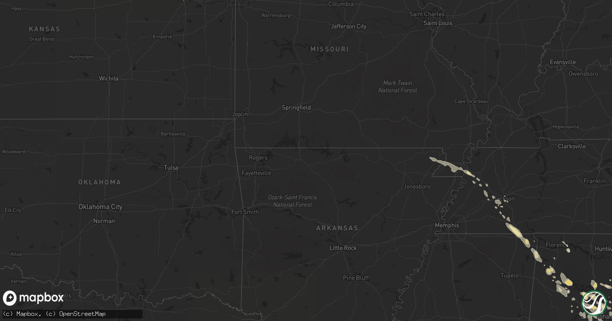
July 30 map
$229
one time, instant access
Download today. No call, no setup
Keep the $229
Bought the map and want the full workflow? Apply the entire $229 to a subscription within 7 days. None of it is wasted.
Every map, not just this one
This buys you this map. Subscription and you get every map we run, in the markets you choose from a few cities to whole states to nationwide. Plus real-time alerts the moment a storm fires.
Contact data
Name, contact info, occupancy, even credit band for addresses in the footprint. You go from where it hit to who to call.
Become the source they trust
Unlimited branding weather history reports on demand. You already have the documented answer ready for the property owner, and you are the one who showed up with it.
Property data and RoofTrace estimates
Pull up any address you have got, its value and the exact code rules for that jurisdiction, straight from One Click Code. Then RoofTrace estimates the squares, pitch, and roof value, priced the way you price.
Storm reports in Alabama
Alabama
| Date | Description |
|---|---|
| 07/30/20126:49 PM CDT | Quarter to golf ball size hail reported covering ground. |
| 07/30/20126:45 PM CDT | At least two trees down in level plains and no power in the area. |
| 07/30/20126:35 PM CDT | Several trees down between county road 305 and county road 315. |
| 07/30/20126:15 AM CDT | Isolated trees down in the northern portion of the county. |
| 07/30/20125:42 AM CDT | There were numerous reports of wind damage including trees and tree limbs down throughout the town. Winds estimated at 50 mph. |
| 07/30/20125:07 AM CDT | Numerous large trees down and power lines down along hwy 25...cty rd 8...and on reeder street. Streets closed due to trees in the road. Winds gust estimated at 60 mph. |
| 07/30/20124:34 AM CDT | Trees and powerlines down in the tutwiler community along cr 6 |
| 07/30/20124:30 AM CDT | A partially rotted tree snapped and split a single-wide manufactured home. A large healthy tree snapped and fell across highway 269 at near the same location. |
| 07/30/20124:18 AM CDT | Multiple trees and powerlines down in and around good springs. Worst damage is along hwy 269 |
| 07/30/20124:05 AM CDT | Trees and powerlines down along hwy 124 in the townley community |
| 07/30/20123:18 AM CDT | Large tree blocking the roadway near the intersection of county roads 57 and 20. |
| 07/30/20123:15 AM CDT | Tree was down blocking the roadway near the intersection of county roads 24 and 19. Tree has been cleared by the vfd. Time estimated from radar. |
| 07/30/20123:15 AM CDT | Tree down blocking the roadway on county road 20 west at the interstate 65 overpass. Time estimated from radar. |
| 07/30/20123:10 AM CDT | Large tree blocking the roadway near the intersection of county roads 59 and 24. Time estimated from radar. |
| 07/30/20122:43 AM CDT | Jones road and hwy 247 tree down and power lines down. Time based on radar. |
| 07/30/20122:30 AM CDT | Tree down and power lines down |
| 07/30/20122:30 AM CDT | Eighth st. Tree down. Time estimated by radar. |
| 07/30/20122:21 AM CDT | Robertson hill rd. Tree down. Time estimated by radar. |
| 07/30/20122:21 AM CDT | Tree down. Time estimated by radar. |
| 07/30/20122:17 AM CDT | Tree down. Time estimated by radar. |
| 07/30/20122:15 AM CDT | Large tree limbs and tree tops snapped along cr 339 between cr 340 and cr 26. Tree down on car. Time estimated by radar. |
| 07/30/20121:50 AM CDT | Large gas canopy partially collapsed at the jet pep in pelham. Time estimated from radar. Corrected. |
| 07/30/20121:50 AM CDT | Trees down blocking tutwiler road. Time estimated from radar. |
| 07/30/20121:42 AM CDT | Tree debris and powerlines down blocking main street in sumiton. Time estimated from radar. |
| 07/30/20121:35 AM CDT | Numerous trees and power lines down along al hwy 269 near parrish. Time estimated from radar. |
| 07/30/20121:35 AM CDT | Trees down blocking kings mill road. Time estimated from radar. |
| 07/30/20121:15 AM CDT | Large tree limbs and tree tops snapped along cr 339 between cr 340 and cr 26. Tree down on car. Time estimated by radar. |
| 07/30/20121:08 AM CDT | Reported at stoney brooke apartments in fultondale. |
| 07/30/20121:00 AM CDT | Several trees down in lynn. |
| 07/30/20121:00 AM CDT | Several trees down. |
| 07/30/201212:45 AM CDT | Several trees down in haleyville and the surrounding area. Numerous power outages around the county. |
| 07/30/201212:40 AM CDT | Multiple trees down across the county. |
| 07/30/201212:33 AM CDT | Two small tree limbs were knocked down in red bay. |
| 07/30/201212:30 AM CDT | Several trees down. |
| 07/30/201212:30 AM CDT | Trees down in bear creek. Time estimated from radar. |
| 07/30/201212:29 AM CDT | Several trees snapped or uprooted. Power line down. Estimated wind 70 mph. |
| 07/30/201212:25 AM CDT | Trees down blocking the roadway on hwy 43 just north of the wrangler plant. Time estimated from radar. |
| 07/30/201212:22 AM CDT | A tree was knocked down on highway 43. Time estimated by radar. |
| 07/30/201212:14 AM CDT | Hail up to quarter sized fell from approx. 1214-1224 am in hanceville. |
| 07/30/201212:09 AM CDT | A tree was blown down on county farm road. Time estimated by radar. |
| 07/29/201211:58 PM CDT | A tree was knocked down along highway 24 near county road 21. Time estimated by radar. |
| 07/29/201211:57 PM CDT | Tree down on blue rd. Time estimated by radar |
| 07/29/201211:57 PM CDT | Power outage. Damage to roof of library. Time estimated by radar. |
| 07/29/20127:59 PM CDT | Numerous reports of quarter size hail in the area. |
| 07/29/20127:30 PM CDT | Public estimated golf ball size hail in slocomb. Reported via facebook. |
| 07/29/20127:29 PM CDT | Quarter size hail at donnas grocery along county rd 2290. |
| 07/29/20127:19 PM CDT | Hail larger than coins reported in wicksburg. |
| 07/29/20127:18 PM CDT | Quarter size hail estimated by public in hartford. |
| 07/29/20127:17 PM CDT | Quarter size hail near intersection of highway 84w and cumbi road. |
| 07/29/20127:16 PM CDT | Picture of hail estimated at quarter size from the dundee area on facebook. |
All States Impacted by Hail Map on July 30, 2012
Cities Impacted by Hail Map on July 30, 2012
- Divide, CO
- Woodland Park, CO
- Cascade, CO
- Green Mountain Falls, CO
- Fairhope, AL
- Andalusia, AL
- Fort Stewart, GA
- Bloomingdale, GA
- Ellabell, GA
- Hartford, AL
- Black, AL
- Ponce De Leon, FL
- Two Rivers, WI
- Denmark, WI
- Whitelaw, WI
- Mishicot, WI
- Maribel, WI
- Simla, CO
- Bailey, CO
- Pine, CO
- Morrison, TN
- Manchester, TN
- Rochelle, IL
- Chana, IL
- Holcomb, IL
- Dakota, IL
- Davis Junction, IL
- Lindenwood, IL
- Oregon, IL
- Byron, IL
- Winnebago, IL
- Pecatonica, IL
- Ridott, IL
- Rock City, IL
- Durand, IL
- Stillman Valley, IL
- Davis, IL
- Freeport, IL
- Rockford, IL
- German Valley, IL
- Sylvania, GA
- Estill, SC
- Niles, MI
- South Bend, IN
- Buchanan, MI
- Beaufort, SC
- Port Royal, SC
- Berrien Springs, MI
- Saint Joseph, MI
- Benton Harbor, MI
- Baroda, MI
- Stevensville, MI
- Flagler, CO
- North Augusta, SC
- Saco, MT
- Elbert, CO
- Calhan, CO
- Kiowa, CO
- Ramah, CO
- Iuka, MS
- Gulf Breeze, FL
- Racine, WI
- Oak Creek, WI
- Lebanon, TN
- Castalian Springs, TN
- Gallatin, TN
- Bethpage, TN
- Hartsville, TN
- Watertown, TN
- Auburntown, TN
- Lake City, MI
- Reedsville, WI
- Town Creek, AL
- Brownsville, TN
- New Berlin, WI
- Chesterfield, SC
- Morven, NC
- Thornton, IL
- Harvey, IL
- South Holland, IL
- Dekalb, IL
- Kiel, WI
- Elkhart Lake, WI
- Chilton, WI
- New Holstein, WI
- Myrtle Beach, SC
- Crown Point, IN
- Orland Park, IL
- Mokena, IL
- Peyton, CO
- Blountsville, AL
- Halls, TN
- Vernon Hill, VA
- South Boston, VA
- Java, VA
- Keeling, VA
- Chatham, VA
- Halifax, VA
- Quinton, AL
- Bessemer, AL
- Mulga, AL
- Byers, CO
- Bay Minette, AL
- Stockton, AL
- Pinson, AL
- Trussville, AL
- Cullman, AL
- Hanceville, AL
- Hartford, WI
- Kewaskum, WI
- Allenton, WI
- Slinger, WI
- West Bend, WI
- Akron, CO
- Limon, CO
- Matheson, CO
- Van Dyne, WI
- Richfield, WI
- Lomira, WI
- Jackson, WI
- Mount Calvary, WI
- Saint Cloud, WI
- Theresa, WI
- Brownsville, WI
- Iron Ridge, WI
- Eden, WI
- Mayville, WI
- Fond Du Lac, WI
- Hilbert, WI
- Adell, WI
- Campbellsport, WI
- Rubicon, WI
- Malone, WI
- Cope, CO
- Clanton, AL
- Nauvoo, AL
- Blountstown, FL
- Manistique, MI
- Birmingham, AL
- Cedar Lake, IN
- University Park, IL
- Frankfort, IL
- Beecher, IL
- Monee, IL
- Crete, IL
- Remus, MI
- Mount Pleasant, MI
- Weidman, MI
- Hotevilla, AZ
- Summerdale, AL
- Silverhill, AL
- Magnolia Springs, AL
- Foley, AL
- Weldona, CO
- Wiggins, CO
- Kaibeto, AZ
- New Brockton, AL
- Westminster, SC
- Long Creek, SC
- Sedalia, CO
- Castle Rock, CO
- Bremen, AL
- Empire, AL
- Jasper, AL
- Second Mesa, AZ
- Charleston, WV
- Belle, WV
- Bonifay, FL
- Daleville, AL
- Green Bay, WI
- Loxley, AL
- Seney, MI
- Guyton, GA
- Ludowici, GA
- Hinesville, GA
- Glennville, GA
- Gobler, MO
- Steele, MO
- Kennett, MO
- Bragg City, MO
- South Beloit, IL
- Clinton, WI
- Poplar Grove, IL
- Larkspur, CO
- Olney Springs, CO
- Muskegon, MI
- Twin Lake, MI
- Fort Morgan, CO
- Polacca, AZ
- Kykotsmovi Village, AZ
- Miramar Beach, FL
- Cassopolis, MI
- Verona, WI
- South Pittsburg, TN
- Jasper, TN
- Sequatchie, TN
- Machesney Park, IL
- Gillett, WI
- Finley, TN
- Cedar Grove, WI
- Belgium, WI
- Canton, NC
- Waynesville, NC
- Piggott, AR
- Mobile, AL
- Green Lake, WI
- Markesan, WI
- Fort Rucker, AL
- Seibert, CO
- Marshall, WI
- Geraldine, MT
- Holt, FL
- Sterrett, AL
- Helena, AL
- Pelham, AL
- Wilsonville, AL
- Alabaster, AL
- Chelsea, AL
- Columbiana, AL
- Harpersville, AL
- Kewaunee, WI
- Wrightstown, WI
- Kaukauna, WI
- Greenleaf, WI
- De Pere, WI
- Luxemburg, WI
- Woodbury, TN
- Bradyville, TN
- Abrams, WI
- Little Suamico, WI
- Pulaski, WI
- Krakow, WI
- Sobieski, WI
- Jackson, TN
- Ridgeland, SC
- Walkerville, MI
- Custer, MI
- Branch, MI
- Colorado Springs, CO
- Double Springs, AL
- Grafton, WI
- Mequon, WI
- Cedarburg, WI
- Clyde, NC
- Seymour, WI
- Oneida, WI
- Dyersburg, TN
- Panama City, FL
- Lynn, AL
- Eldridge, AL
- Rector, AR
- Lowndesboro, AL
- Leighton, AL
- Gladstone, MI
- Fort Benton, MT
- Loma, MT
- Arriba, CO
- Panama City Beach, FL
- Ebro, FL
- Morris, IL
- Grand Marais, MI
- Fountain, CO
- Arcadia, IN
- Cicero, IN
- Strasburg, CO
- Brillion, WI
- Whitewater, WI
- Fort Atkinson, WI
- Helenville, WI
- Waterloo, WI
- Deerfield, WI
- Lake Mills, WI
- Jefferson, WI
- Eagle, WI
- Palmyra, WI
- Madison, WI
- Sun Prairie, WI
- Watertown, WI
- East Troy, WI
- Deforest, WI
- Cottage Grove, WI
- Windsor, WI
- Johnson Creek, WI
- Waunakee, WI
- Vulcan, MI
- Monteagle, TN
- Sewanee, TN
- Tracy City, TN
- Rosebush, MI
- Kalkaska, MI
- Williamsville, VA
- Lawrenceville, VA
- Gulf Shores, AL
- Williams, AZ
- Perry, FL
- Milton, FL
- Pensacola, FL
- Cantonment, FL
- Remlap, AL
- Cleveland, AL
- West Olive, MI
- Spring Lake, MI
- Grand Haven, MI
- Brantley, AL
- Rye, CO
- Bennett, CO
- Fremont, MI
- Grant, MI
- Chase City, VA
- Boydton, VA
- Lewistown, MT
- Haleyville, AL
- Bear Creek, AL
- Fultondale, AL
- Gardendale, AL
- Nicholls, GA
- Douglas, GA
- West Green, GA
- La Porte, IN
- Westville, IN
- Chesterton, IN
- Michigan City, IN
- Hinckley, IL
- Rapid River, MI
- Escanaba, MI
- Cornell, MI
- Winnett, MT
- Stephenson, MI
- Early Branch, SC
- Beloit, WI
- Brodhead, WI
- Newton, AL
- Slocomb, AL
- Tonalea, AZ
- Eglin Afb, FL
- Graysville, AL
- Mount Olive, AL
- Midway, GA
- Dozier, AL
- Opp, AL
- Seneca, IL
- Mazon, IL
- Menominee, MI
- Wallace, MI
- Sturgeon Bay, WI
- Usaf Academy, CO
- Sheboygan Falls, WI
- Plymouth, WI
- Westville, FL
- Kirkland, IL
- Kingston, IL
- Titusville, FL
- Clairton, PA
- Elizabeth, PA
- Summersville, WV
- Baker, FL
- Ruby, SC
- Mount Croghan, SC
- Highwood, MT
- Folkston, GA
- Ashville, AL
- Loxahatchee, FL
- Hart, MI
- Brush, CO
- Noblesville, IN
- Niagara, WI
- Altamont, TN
- Pelham, TN
- Ashton, IL
- Cropwell, AL
- Robertsdale, AL
- Manton, MI
- Fair Oaks, IN
- Lake Village, IN
- Crystal Lake, IL
- Island Lake, IL
- Mchenry, IL
- McMillan, MI
- Newberry, MI
- Cherokee, AL
- Belmont, MS
- Tishomingo, MS
- Red Bay, AL
- Burnsville, MS
- Coleman, MI
- Avondale, CO
- Ozark, AL
- Ariton, AL
- Brundidge, AL
- Glenwood, AL
- Florala, AL
- Troy, AL
- Wing, AL
- Luverne, AL
- Gantt, AL
- Evergreen, AL
- Brewton, AL
- Elba, AL
- Jack, AL
- Enterprise, AL
- Milwaukee, WI
- Greendale, WI
- Warrior, AL
- Hayden, AL
- Beaverton, MI
- Clare, MI
- Phil Campbell, AL
- Hackleburg, AL
- Spruce Pine, AL
- Hodges, AL
- Sodus, MI
- Anton, CO
- Genoa, CO
- Hesperia, MI
- Shelby, MI
- Monroe, WI
- Juda, WI
- Munster, IN
- Gary, IN
- Hammond, IN
- Chicago, IL
- Chicago Heights, IL
- Lowell, IN
- East Chicago, IN
- Griffith, IN
- Highland, IN
- Lansing, IL
- Merrillville, IN
- Saint John, IN
- Whiting, IN
- Dyer, IN
- Hebron, IN
- Schererville, IN
- Cleveland, WI
- Monticello, FL
- Mount Vernon, AL
- Killen, AL
- Covert, MI
- Pell City, AL
- Janesville, WI
- Pinetop, AZ
- Belvidere, IL
- Marengo, IL
- Caledonia, IL
- Harvard, IL
- Capron, IL
- Roscoe, IL
- Loves Park, IL
- Garden Prairie, IL
- Callahan, FL
- Hilliard, FL
- Grant Park, IL
- Rincon, GA
- Springfield, GA
- Leland, IL
- Somonauk, IL
- North Versailles, PA
- Mckeesport, PA
- Oshkosh, WI
- Russellville, AL
- Dennis, MS
- Leaf River, IL
- Franktown, CO
- Wetmore, MI
- Daphne, AL
- Spring Grove, IL
- Antioch, IL
- Fox Lake, IL
- Tallahassee, FL
- Monongahela, PA
- Charleroi, PA
- Guys, TN
- Corinth, MS
- Ramer, TN
- Michie, TN
- Vernon, FL
- Dalton, WI
- Clarksville, FL
- Greensboro, AL
- Sheridan, IL
- Germfask, MI
- Henderson, TN
- Hornsby, TN
- Baxley, GA
- Alma, GA
- Hardeeville, SC
- Leeds, AL
- Moody, AL
- Coalmont, TN
- Hillsboro, TN
- Manitowoc, WI
- Lillian, AL
- Perronville, MI
- Bark River, MI
- Carney, MI
- Fowler, CO
- Shelby, AL
- Sylacauga, AL
- Mears, MI
- Hilger, MT
- Ochopee, FL
- Union, IL
- Empire, MI
- Waverly, GA
- Eau Claire, MI
- Blairsville, GA
- Grayling, MI
- New Lenox, IL
- Manhattan, IL
- Joliet, IL
- Elwood, IL
- Glen, MS
- Pentwater, MI
- Scottville, MI
- Baileys Harbor, WI
- Egg Harbor, WI
- Fish Creek, WI
- Ludington, MI
- Little Lake, MI
- Eight Mile, AL
- Theodore, AL
- Semmes, AL
- Caruthersville, MO
- Suamico, WI
- Toone, TN
- Medon, TN
- Petoskey, MI
- Evanston, IL
- Wilmington, IL
- Winslow, AZ
- Hosford, FL
- Fredonia, WI
- Daggett, MI
- Hilton Head Island, SC
- Bailey, MI
- Ravenna, MI
- Graniteville, SC
- Aiken, SC
- Berrien Center, MI
- Dowagiac, MI
- Albany, WI
- Evansville, WI
- Palatine, IL
- Arlington Heights, IL
- Sheboygan, WI
- Waukesha, WI
- Mukwonago, WI
- North Prairie, WI
- Toccoa, GA
- Jemison, AL
- Oakman, AL
- Roy, MT
- Burlington, WI
- Waynesboro, GA
- Elberta, AL
- Canvas, WV
- Nettie, WV
- Foster City, MI
- Otis, CO
- Beech Island, SC
- Warrenville, SC
- Saint Ignace, MI
- Grass Range, MT
- Mercer, TN
- Pocahontas, TN
- Selmer, TN
- Cross Plains, WI
- Middleton, WI
- Muscle Shoals, AL
- Thomasville, GA
- Yorkville, IL
- Newark, IL
- Dora, AL
- Sumiton, AL
- Morris, AL
- Docena, AL
- Brookside, AL
- Adamsville, AL
- Pleasant Grove, AL
- Dolomite, AL
- Cordova, AL
- Kimberly, AL
- Fairfield, AL
- Denmark, TN
- Grant, CO
- Christmas, FL
- Moore, MT
- Freeman, VA
- Dolphin, VA
- Skipwith, VA
- Clarksville, VA
- Elkhorn, WI
- Lake Geneva, WI
- Defuniak Springs, FL
- Brilliant, AL
- Winfield, AL
- Carbon Hill, AL
- Concho, AZ
- Littleton, CO
- Yoder, CO
- Section, AL
- Pueblo, CO
- Red Oak, VA
- Baskerville, VA
- Monument, CO
- Falmouth, MI
- Moore Haven, FL
- Plantersville, AL
- Stanton, AL
- Maplesville, AL
- Orfordville, WI
- Holton, MI
- White Cloud, MI
- Satsuma, AL
- Saraland, AL
- Ponte Vedra Beach, FL
- Ponte Vedra, FL
- Rio, WI
- New Raymer, CO
- Destin, FL
- Orchard, CO
- Peachland, NC
- Freeport, FL
- Deer Park, AL
- McIntosh, AL
- Newaygo, MI
- Okatie, SC
- Shingleton, MI
- Munising, MI
- Glen Arbor, MI
- New Franken, WI
- Bitely, MI
- Rock, MI
- Jacksonville Beach, FL
- Brent, AL
- Fall River, WI
- Randolph, WI
- Moundville, AL
- Cambria, WI
- Friesland, WI
- Florissant, CO
- Oconomowoc, WI
- Big Bend, WI
- Wales, WI
- Delafield, WI
- Sullivan, WI
- Dousman, WI
- Mount Prospect, IL
- Des Plaines, IL
- Elk Grove Village, IL
- Fennville, MI
- Pembine, WI
- Alamo, GA
- Lake Station, IN
- Steger, IL
- Park Forest, IL
- Friendship, TN
- Jarratt, VA
- Allegan, MI
- Whitehall, MI
- Lena, IL
- Belleville, WI
- Starke, FL
- Saint Johns, FL
- Kingsley, MI
- Vona, CO
- Steward, IL
- Saint Augustine, FL
- Port Washington, WI
- Mount Horeb, WI
- Oregon, WI
- New Glarus, WI
- Brooklyn, WI
- Monticello, WI
- Springville, AL
- Steele, AL
- Ellison Bay, WI
- Marinette, WI
- Washington Island, WI
- Bowman, SC
- Saint George, SC
- Miami, FL
- Newton, WI
- Potter, WI
- Saint Nazianz, WI
- Valders, WI
- Summit Argo, IL
- Burbank, IL
- Hometown, IL
- Evergreen Park, IL
- La Junta, CO
- Sandwich, IL
- Thorsby, AL
- Monroe Center, IL
- Beverly, WV
- Randolph, AL
- Wray, CO
- Rockton, IL
- Bridgman, MI
- Coloma, MI
- Sawyer, MI
- Walsenburg, CO
- Creola, AL
- Axis, AL
- Calera, AL
- Montevallo, AL
- Saint Johns, AZ
- Bells, TN
- Shabbona, IL
- Malta, IL
- Plano, IL
- Big Rock, IL
- Tinley Park, IL
- Homer Glen, IL
- Bristol, FL
- Granger, IN
- Mishawaka, IN
- Barrington, IL
- Scottsboro, AL
- Watkins, CO
- Wauconda, IL
- Mazomanie, WI
- Dane, WI
- Sauk City, WI
- Townley, AL
- Laurel Hill, FL
- Saint Marys, GA
- Yulee, FL
- Kings Bay, GA
- Kingsland, GA
- Kinston, AL
- Samson, AL
- Cocoa, FL
- Louisville, GA
- Rocky Ford, CO
- South Haven, MI
- Black Earth, WI
- Elizabeth, CO
- Clare, IL
- Sycamore, IL
- Pooler, GA
- Chipley, FL
- Wells, MI
- Delavan, WI
- Parrish, AL
- Newington, GA
- Mcminnville, TN
- Liberty, TN
- Grand Junction, MI
- Thayer, IN
- Demotte, IN
- Oneonta, AL
- Como, CO
- Hornersville, MO
- Valdosta, GA
- Ray City, GA
- Traverse City, MI
- Jay, FL
- Bethel Springs, TN
- Pellston, MI
- Momence, IL
- Ordway, CO
- Kit Carson, CO
- Brookfield, WI
- Pewaukee, WI
- Idaho Springs, CO
- Peotone, IL
- Duquesne, PA
- Brierfield, AL
- Mackinac Island, MI
- Waterman, IL
- Millbrook, IL
- Columbus, WI
- Bonduel, WI
- Pinon, AZ
- Alamo, TN
- Wewahitchka, FL
- Fruitport, MI
- Coden, AL


