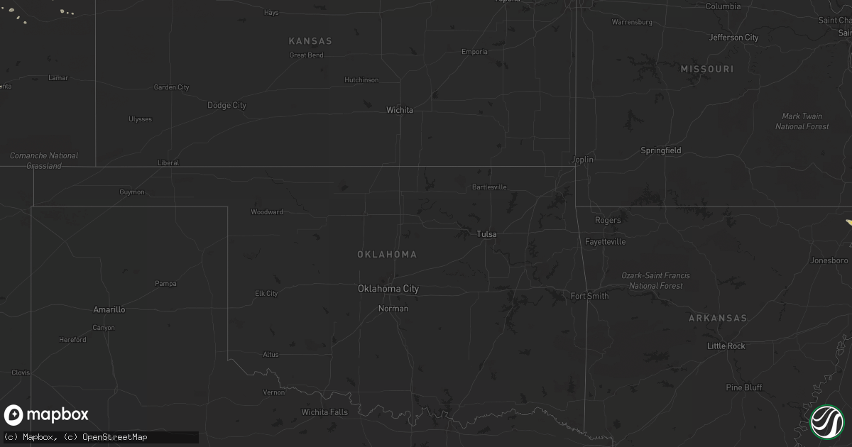
Hail Map on July 30, 2012
Get this storm
July 30 map
$229
one time, instant access
Download today. No call, no setup
Keep the $229
Bought the map and want the full workflow? Apply the entire $229 to a subscription within 7 days. None of it is wasted.
Every map, not just this one
This buys you this map. Subscription and you get every map we run, in the markets you choose from a few cities to whole states to nationwide. Plus real-time alerts the moment a storm fires.
Contact data
Name, contact info, occupancy, even credit band for addresses in the footprint. You go from where it hit to who to call.
Become the source they trust
Unlimited branding weather history reports on demand. You already have the documented answer ready for the property owner, and you are the one who showed up with it.
Property data and RoofTrace estimates
Pull up any address you have got, its value and the exact code rules for that jurisdiction, straight from One Click Code. Then RoofTrace estimates the squares, pitch, and roof value, priced the way you price.
States Impacted by Hail Map on July 30, 2012
Storm reports
Florida
| Date | Description |
|---|---|
| 07/30/20125:20 PM CDT | Reported by glades county emergency management on wayman road near u.s. Highway 27 west of moore haven. |
| 07/30/20123:00 PM CDT | Power line down in overstreet. |
| 07/30/20123:00 PM CDT | The department of public works reported tree limbs down on pwerlines which caused power outages. The time given was based on radar. |
| 07/30/20122:56 PM CDT | Trees reported down near on interstate 10 near mile marker 40. |
| 07/30/20122:45 PM CDT | Trees reported down in destin |
| 07/30/20122:40 PM CDT | *** 1 inj *** large tree fell on house with one person injured. Time estimated by radar. |
| 07/30/20122:35 PM CDT | Power lines down along harris dr. |
| 07/30/20122:30 PM CDT | Tree down in front yard of residence |
| 07/30/20122:26 PM CDT | Power lines down at the intersection of w. 13th street and grace avenue. |
| 07/30/20122:25 PM CDT | Tree on a house on keldave rd. |
| 07/30/20122:20 PM CDT | Tree down on scotts ferry rd at the intersection of clements rd. |
| 07/30/20122:10 PM CDT | Trees reported down near the intersection of state route 4 and us 90. |
| 07/30/20122:10 PM CDT | Trees reported down along interstate 10 near mile marker 40. |
| 07/30/20121:20 PM CDT | Tree down along county rd 181 just north of hickory mill rd. |
| 07/30/20121:16 PM CDT | Tree blocking sr-81 approx 5 miles south of holmes county border. |
| 07/30/20121:07 PM CDT | An auto dealership in fort walton beach on north beal parkway reported their roof was blown off. |
Missouri
| Date | Description |
|---|---|
| 07/29/20127:38 PM CDT | Report of roof damage to an apartment building in the city. |
Alabama
| Date | Description |
|---|---|
| 07/30/20126:49 PM CDT | Quarter to golf ball size hail reported covering ground. |
| 07/30/20126:45 PM CDT | At least two trees down in level plains and no power in the area. |
| 07/30/20126:35 PM CDT | Several trees down between county road 305 and county road 315. |
| 07/30/20126:15 AM CDT | Isolated trees down in the northern portion of the county. |
| 07/30/20125:42 AM CDT | There were numerous reports of wind damage including trees and tree limbs down throughout the town. Winds estimated at 50 mph. |
| 07/30/20125:07 AM CDT | Numerous large trees down and power lines down along hwy 25...cty rd 8...and on reeder street. Streets closed due to trees in the road. Winds gust estimated at 60 mph. |
| 07/30/20124:34 AM CDT | Trees and powerlines down in the tutwiler community along cr 6 |
| 07/30/20124:30 AM CDT | A partially rotted tree snapped and split a single-wide manufactured home. A large healthy tree snapped and fell across highway 269 at near the same location. |
| 07/30/20124:18 AM CDT | Multiple trees and powerlines down in and around good springs. Worst damage is along hwy 269 |
| 07/30/20124:05 AM CDT | Trees and powerlines down along hwy 124 in the townley community |
| 07/30/20123:18 AM CDT | Large tree blocking the roadway near the intersection of county roads 57 and 20. |
| 07/30/20123:15 AM CDT | Tree down blocking the roadway on county road 20 west at the interstate 65 overpass. Time estimated from radar. |
| 07/30/20123:15 AM CDT | Tree was down blocking the roadway near the intersection of county roads 24 and 19. Tree has been cleared by the vfd. Time estimated from radar. |
| 07/30/20123:10 AM CDT | Large tree blocking the roadway near the intersection of county roads 59 and 24. Time estimated from radar. |
| 07/30/20122:43 AM CDT | Jones road and hwy 247 tree down and power lines down. Time based on radar. |
| 07/30/20122:30 AM CDT | Tree down and power lines down |
| 07/30/20122:30 AM CDT | Eighth st. Tree down. Time estimated by radar. |
| 07/30/20122:21 AM CDT | Tree down. Time estimated by radar. |
| 07/30/20122:21 AM CDT | Robertson hill rd. Tree down. Time estimated by radar. |
| 07/30/20122:17 AM CDT | Tree down. Time estimated by radar. |
| 07/30/20122:15 AM CDT | Large tree limbs and tree tops snapped along cr 339 between cr 340 and cr 26. Tree down on car. Time estimated by radar. |
| 07/30/20121:50 AM CDT | Large gas canopy partially collapsed at the jet pep in pelham. Time estimated from radar. Corrected. |
| 07/30/20121:50 AM CDT | Trees down blocking tutwiler road. Time estimated from radar. |
| 07/30/20121:42 AM CDT | Tree debris and powerlines down blocking main street in sumiton. Time estimated from radar. |
| 07/30/20121:35 AM CDT | Trees down blocking kings mill road. Time estimated from radar. |
| 07/30/20121:35 AM CDT | Numerous trees and power lines down along al hwy 269 near parrish. Time estimated from radar. |
| 07/30/20121:15 AM CDT | Large tree limbs and tree tops snapped along cr 339 between cr 340 and cr 26. Tree down on car. Time estimated by radar. |
| 07/30/20121:08 AM CDT | Reported at stoney brooke apartments in fultondale. |
| 07/30/20121:00 AM CDT | Several trees down. |
| 07/30/20121:00 AM CDT | Several trees down in lynn. |
| 07/30/201212:45 AM CDT | Several trees down in haleyville and the surrounding area. Numerous power outages around the county. |
| 07/30/201212:40 AM CDT | Multiple trees down across the county. |
| 07/30/201212:33 AM CDT | Two small tree limbs were knocked down in red bay. |
| 07/30/201212:30 AM CDT | Trees down in bear creek. Time estimated from radar. |
| 07/30/201212:30 AM CDT | Several trees down. |
| 07/30/201212:29 AM CDT | Several trees snapped or uprooted. Power line down. Estimated wind 70 mph. |
| 07/30/201212:25 AM CDT | Trees down blocking the roadway on hwy 43 just north of the wrangler plant. Time estimated from radar. |
| 07/30/201212:22 AM CDT | A tree was knocked down on highway 43. Time estimated by radar. |
| 07/30/201212:14 AM CDT | Hail up to quarter sized fell from approx. 1214-1224 am in hanceville. |
| 07/30/201212:09 AM CDT | A tree was blown down on county farm road. Time estimated by radar. |
| 07/29/201211:58 PM CDT | A tree was knocked down along highway 24 near county road 21. Time estimated by radar. |
| 07/29/201211:57 PM CDT | Tree down on blue rd. Time estimated by radar |
| 07/29/201211:57 PM CDT | Power outage. Damage to roof of library. Time estimated by radar. |
| 07/29/20127:59 PM CDT | Numerous reports of quarter size hail in the area. |
| 07/29/20127:30 PM CDT | Public estimated golf ball size hail in slocomb. Reported via facebook. |
| 07/29/20127:29 PM CDT | Quarter size hail at donnas grocery along county rd 2290. |
| 07/29/20127:19 PM CDT | Hail larger than coins reported in wicksburg. |
| 07/29/20127:18 PM CDT | Quarter size hail estimated by public in hartford. |
| 07/29/20127:17 PM CDT | Quarter size hail near intersection of highway 84w and cumbi road. |
| 07/29/20127:16 PM CDT | Picture of hail estimated at quarter size from the dundee area on facebook. |
Wisconsin
| Date | Description |
|---|---|
| 07/30/20125:57 PM CDT | A local report indicates 2.50 inch wind near HOWARD |
| 07/30/20125:57 PM CDT | A local report indicates 1.00 inch wind near 1 S SUAMICO |
| 07/30/20125:54 PM CDT | A local report indicates 1.00 inch wind near HOWARD |
| 07/30/20125:52 PM CDT | A local report indicates 1.50 inch wind near GREEN BAY |
| 07/30/20125:42 PM CDT | A local report indicates 1.00 inch wind near 3 WSW HOWARD |
| 07/30/20125:42 PM CDT | A local report indicates 1.00 inch wind near LITTLE SUAMICO |
| 07/30/20125:30 PM CDT | A local report indicates 2.00 inch wind near 4 W SOBIESKI |
| 07/30/20124:20 PM CDT | Mostly 1/4 to 1/2 inch hail. A few hail stones reached the size of quarters. |
| 07/30/20121:05 AM CDT | A couple large trees down in the caldwell area and in the tichigan area west and north of tichigan lake. Time is estimated based on radar. |
| 07/30/201212:57 AM CDT | Tree down at big bend road and n lake drive. Time estimated. |
| 07/30/201212:50 AM CDT | A local report indicates 1.00 inch wind near 2 E NORTH PRAIRIE |
| 07/30/201212:47 AM CDT | A couple trees down in the area from 3 ene la grange to 5 ene of la grange. One of the trees blocked a road. Time is estimated based on radar. |
| 07/29/201211:40 PM CDT | A local report indicates 1.00 inch wind near 1 NW SUN PRAIRIE |
| 07/29/201211:39 PM CDT | A local report indicates 1.00 inch wind near SUN PRAIRIE |
| 07/29/20128:15 PM CDT | A local report indicates 1.00 inch wind near EGG HARBOR |
| 07/29/20128:03 PM CDT | Hail a little larger than quarters. |
| 07/29/20128:00 PM CDT | Hail at least 2 inches in diameter. |
| 07/29/20127:28 PM CDT | Windshield cracked |
| 07/29/20127:28 PM CDT | Windshield cracked |
| 07/29/20127:12 PM CDT | Hail began at 710 pm and ended at 712 pm. |
Kansas
| Date | Description |
|---|---|
| 07/29/20129:00 PM CDT | Time estimate |
Illinois
| Date | Description |
|---|---|
| 07/30/20124:21 AM CDT | At the intersection of nelson and laraway. |
Pennsylvania
| Date | Description |
|---|---|
| 07/29/20129:00 PM CDT | A local report indicates 1.25 inch wind near MONROEVILLE |
| 07/29/20128:57 PM CDT | A local report indicates 1.00 inch wind near NORTH VERSAILLES |
Colorado
| Date | Description |
|---|---|
| 07/29/20128:40 PM CDT | Trees and power lines blown down. |
| 07/29/20128:34 PM CDT | A local report indicates 63 MPH wind near 4 S BURLINGTON |
| 07/29/20128:30 PM CDT | Time estimated |
| 07/29/20128:26 PM CDT | A local report indicates 60 MPH wind near 6 E KIRK |
| 07/29/20127:21 PM CDT | No damage was reported |
| 07/29/20127:00 PM CDT | A local report indicates 66 MPH wind near AKRON |
Arizona
| Date | Description |
|---|---|
| 07/29/20127:42 PM CDT | A cinder block flew through a wall in a house and poked a hole through the sheet rock inside. Another cinder block fell into the metal roof. |
South Carolina
| Date | Description |
|---|---|
| 07/30/20126:45 PM CDT | Trees downed on mcneary st at arbor knoll |
| 07/30/20126:19 PM CDT | One tree was reported down near the intersection of state highway 174 and cedar hall road. |
| 07/30/20125:27 PM CDT | Sc highway patrol reports a tree down and in the roadway on haven road near horseford road. |
| 07/30/20125:15 PM CDT | Sc highway patrol reports a tree in the roadway on hw-61 near hw-27. |
| 07/30/20124:52 PM CDT | One tree down near the intersection of gum branch road and mt. Moriah road. |
| 07/30/20124:46 PM CDT | Sc highway patrol reported trees down on hwy 453 between holly hill and i-26 |
| 07/30/20124:39 PM CDT | Sc highway patrol reported trees down on hwy 453 near hwy 176 in holly hill |
| 07/30/20124:35 PM CDT | Sc highway patrol reports a tree on i-26 at mile marker 175. |
| 07/30/20124:35 PM CDT | Sc highway patrol reports a tree in the roadway near the intersection of boat landing way and ranger drive. |
| 07/30/20124:00 PM CDT | Spotter reported numerous trees and powerlines down along hwy 265 between jefferson and cheraw |
| 07/30/20123:58 PM CDT | Law enforcement reported a power line down near the intersection of highway 278 and highway 17. |
| 07/30/20123:46 PM CDT | Sc highway patrol reported trees down on hwy 453 between holly hill and i-26 |
| 07/30/20123:39 PM CDT | Sc highway patrol reported trees down on hwy 453 near hwy 176 in holly hill |
| 07/30/20123:35 PM CDT | Trees down at the intersection of sc265 and sc9. Time estimated from radar. |
| 07/30/20123:29 PM CDT | Sc highway patrol reports a tree down and blocking the roadway at mile marker 37 on i-95. |
| 07/30/20123:29 PM CDT | Public reported several trees and power lines down on ridgecut rd near yemassee. |
| 07/30/20123:26 PM CDT | Sc highway patrol reports a tree down and in the roadway on davidson tower road near the intersection with yemassee highway. |
| 07/29/20127:02 PM CDT | Sc highway patrol reporting trees down on sudlow lake rd at addie rd. Time estimated by radar. |
West Virginia
| Date | Description |
|---|---|
| 07/30/20126:40 PM CDT | Caller reported high water on us 250 and hail .75 to 1 inch. |
| 07/30/20126:10 PM CDT | Trees down on house on chesterfield ave in kanawha city. |
| 07/30/20126:09 PM CDT | Trees down in kanawha city |
| 07/30/20124:48 PM CDT | Trees and lines down along webster road |
Georgia
| Date | Description |
|---|---|
| 07/30/20124:35 PM CDT | One tree down on old river road near stonegate drive. |
| 07/30/20123:52 PM CDT | Tree down on griffin lake rd at george hurst rd. |
| 07/30/20122:10 PM CDT | The post office reported a large tree blocking the roadway near winokur road. The time given was given was based on radar. |
| 07/30/20122:06 PM CDT | Trained spotter e-mailed report of several large limbs snapped off. |
| 07/30/20121:36 PM CDT | 911 call center reported a few trees down along the off-ramp from i-95 to woodbine near satilla bluff road. |
| 07/29/20129:35 PM CDT | 911 call center reported trees down on a house and a vehicle at a residence at 2379 highway 221 on the northeast side of douglas. No injuries were reported. |
| 07/29/20129:30 PM CDT | Emergency manager reported a few trees down along sand hill church road and new forrest highway. |
| 07/29/20129:05 PM CDT | County dispatch reported trees were blown down along sand hill church road. The time of the event was based on radar imagery. |
| 07/29/20128:30 PM CDT | Trees were blown down along highway 23. The time of event was estimated based on radar. |
| 07/29/20128:30 PM CDT | Trees were blown down along big creek church road. The time of the event was estimated based on radar. |
| 07/29/20127:42 PM CDT | Richmond county dispatch reported a tree and large limbs down at a residence on cairo dr. |
Mississippi
| Date | Description |
|---|---|
| 07/30/20122:13 AM CDT | 100 year old trees down in burnsville. Numerous power outtages in burnsville and iuka |
| 07/29/201211:28 PM CDT | Trees and power lines down as far south as the paden area. |
| 07/29/201211:28 PM CDT | Numerous trees and power lines down across the northern and central part of tishomingo county. |
| 07/29/201211:00 PM CDT | Numerous trees and road signs down... Power out in corinth and in farmington |
| 07/29/201210:07 PM CDT | Several trees down in the olive branch area. Likely resulted from a small...brief microbust over northeastern desoto county. Time estimated based on radar. |
Virginia
| Date | Description |
|---|---|
| 07/30/20125:12 PM CDT | Branches down |
| 07/29/20128:10 PM CDT | Hail ranging from nickel to quarter size fell on hawkins road. |
| 07/29/20127:51 PM CDT | Tree down near the intersection of north main street and white street. |
| 07/29/20127:47 PM CDT | Tree down on abbott place near spring garden road. |
| 07/29/20127:00 PM CDT | Trees down on indian draft road. |
North Carolina
| Date | Description |
|---|---|
| 07/30/20122:56 PM CDT | Up to 1 inch hail at the canton fire dept. |
| 07/30/201210:01 AM CDT | Dare county 911 reported waterspout again came onshore in wanchese. |
| 07/30/20129:41 AM CDT | Dare county 911 relayed report of a waterspout that moved onshore north of the bodie island lighthouse heading west. |
Tennessee
| Date | Description |
|---|---|
| 07/30/20125:18 AM CDT | Two trees down. |
| 07/30/20121:47 AM CDT | Report of roof damage to the paper mill bldg on the lebanon city square. |
| 07/30/20121:46 AM CDT | Multiple large trees down in the kontiki subdivision |
| 07/30/20121:45 AM CDT | A local report indicates 60 MPH wind near 2 N LEBANON |
| 07/29/20129:22 PM CDT | Multiple large trees down across the county. |
Montana
| Date | Description |
|---|---|
| 07/30/20125:50 PM CDT | Damaged roof |
| 07/30/20125:41 PM CDT | Badly damaged a billboard along the interstate |
| 07/30/20125:00 PM CDT | Up to 20 power poles blown down just north of townsend. Time of event is estimated. |
| 07/30/20123:40 AM CDT | Trained spotter with a wind anemometer measured a 74 mph gust. Sustained winds were 56 mph. |
| 07/30/201212:55 AM CDT | A local report indicates 58 MPH wind near 1 WNW THE PINES RECREAT |
| 07/30/201212:40 AM CDT | King coulee raws |
| 07/30/201212:00 AM CDT | South sawmill creek raws |
| 07/29/20129:40 PM CDT | 67 mph wind gust at the millegan weather underground station. |
| 07/29/20129:20 PM CDT | 72 mph wind gust measured near cascade. |
Michigan
| Date | Description |
|---|---|
| 07/30/20125:55 PM CDT | 6-7 inch tree limb downed from storm. Also reported leaves all over the road but they were not home to confirm whether it was wind or hail. |
| 07/30/20125:30 PM CDT | A local report indicates 1.00 inch wind near 1 S GLADSTONE |
| 07/30/20124:40 PM CDT | A local report indicates 59 MPH wind near GRAND MARAIS |
| 07/30/20123:37 AM CDT | Hail average between one and one half inch in diameter. Smaller limbs as well as leaves down from the hail. |
| 07/30/20123:37 AM CDT | Hail average between one and one half inch in diameter. Smaller limbs as well as leaves down from the hail. |
| 07/30/20123:30 AM CDT | From wsbt facebook page |
| 07/30/20123:20 AM CDT | A local report indicates 1.00 inch wind near SAINT JOSEPH |
| 07/30/20122:37 AM CDT | Live power line down relayed by amateur radio operator. |
| 07/30/20122:35 AM CDT | Tree blocking part of m60 at 30 mile road. |
| 07/30/20122:15 AM CDT | Tree blocking part of m60 at 30 mile road. |
| 07/30/20122:15 AM CDT | Trees and wires down. Some trees blocking roads. |
| 07/30/20121:40 AM CDT | Two foot diameter tree down near central ave and 32nd st. Numerous limbs and branches have also come down. Time is estimated from radar. |
| 07/30/20121:40 AM CDT | 12 inch diameter limb down at the intersection of weiss and mackinaw. |
| 07/30/20121:30 AM CDT | Numerous trees and branches...some rotten...were uprooted or snapped off near james st and lakeshore drive. Some portions of the road are blocked by debris. Time of str |
| 07/30/20121:30 AM CDT | Two thirty inch diameter trees in fair health snapped off at 10 feet and 30 feet above ground on the west edge of lake macatawa. Time is radar estimated. |
| 07/30/20121:30 AM CDT | Estimated wind gust at the western edge of lake macatawa. Time is estimated from radar. |
| 07/30/201212:07 AM CDT | Tree reported down at 22 mile rd and trenton on the kent and newaygo county line. This tree down report was the first of many across kent county as reported by the kent |
| 07/30/201212:00 AM CDT | Central dispatch reports scattered to numerous trees down across the northern portion of montcalm county...mainly around the howard city area. Time is estimated from ra |
| 07/29/201211:58 PM CDT | Reports of trees and power lines down in white cloud and areas north...and also in the city of newaygo. |
| 07/29/201211:58 PM CDT | Trees and power lines down in cedar creek twp. |
| 07/29/201211:37 PM CDT | Wzzm tv viewer reports a large tree branch down. Lost power. |
| 07/29/201211:37 PM CDT | Hanger door blown off at white cloud airport. Many trees and branches down across the area. Most trees were rotted with the largest trees up to one and a half feet in d |
| 07/29/201211:34 PM CDT | Fox 17 viewer reports trees down in hesperia. |
| 07/29/201211:33 PM CDT | *** 2 fatal *** tree fell on a house in long lake. |
| 07/29/201211:30 PM CDT | Trees blocking road east of white cloud on m20. Time estimated from radar. |
| 07/29/201211:25 PM CDT | Scattered trees down mainly across western portions of the county according to the road commission. Numerous poplar trees came down near hesperia. |
| 07/29/201211:15 PM CDT | About a hundred trees down across newaygo county north and east of a line from hesperia to newaygo. |
| 07/29/201211:12 PM CDT | Report of one tree down. |
| 07/29/20129:20 PM CDT | Trees down in road. |
| 07/29/20128:56 PM CDT | Significant number of large trees down in the northern section of burt lake. Trees down on houses and power out around the burt lake area. Most of the damage reported n |
| 07/29/20128:45 PM CDT | A local report indicates 62 MPH wind near PELLSTON |
Arkansas
| Date | Description |
|---|---|
| 07/29/20127:13 PM CDT | A local report indicates 1.00 inch wind near 2 N RECTOR |
Indiana
| Date | Description |
|---|---|
| 07/30/201211:18 AM CDT | A local report indicates 1.75 inch wind near MARTINSVILLE |
| 07/30/201211:18 AM CDT | Trees and power lines down. |
| 07/30/201210:50 AM CDT | Damage reported to several cars and buildings. |
| 07/30/20125:22 AM CDT | A local report indicates 1.00 inch wind near LEITERS FORD |
| 07/30/20124:05 AM CDT | Vehicle hit a tree limb on the roadway at us 331 and kern rd. Power lines also reported down. |
Cities Impacted by Hail Map on July 30, 2012
- Divide, CO
- Woodland Park, CO
- Cascade, CO
- Green Mountain Falls, CO
- Fairhope, AL
- Andalusia, AL
- Fort Stewart, GA
- Bloomingdale, GA
- Ellabell, GA
- Hartford, AL
- Black, AL
- Ponce De Leon, FL
- Two Rivers, WI
- Denmark, WI
- Whitelaw, WI
- Mishicot, WI
- Maribel, WI
- Simla, CO
- Bailey, CO
- Pine, CO
- Morrison, TN
- Manchester, TN
- Rochelle, IL
- Chana, IL
- Holcomb, IL
- Dakota, IL
- Davis Junction, IL
- Lindenwood, IL
- Oregon, IL
- Byron, IL
- Winnebago, IL
- Pecatonica, IL
- Ridott, IL
- Rock City, IL
- Durand, IL
- Stillman Valley, IL
- Davis, IL
- Freeport, IL
- Rockford, IL
- German Valley, IL
- Sylvania, GA
- Estill, SC
- Niles, MI
- South Bend, IN
- Buchanan, MI
- Beaufort, SC
- Port Royal, SC
- Berrien Springs, MI
- Saint Joseph, MI
- Benton Harbor, MI
- Baroda, MI
- Stevensville, MI
- Flagler, CO
- North Augusta, SC
- Saco, MT
- Elbert, CO
- Calhan, CO
- Kiowa, CO
- Ramah, CO
- Iuka, MS
- Gulf Breeze, FL
- Racine, WI
- Oak Creek, WI
- Lebanon, TN
- Castalian Springs, TN
- Gallatin, TN
- Bethpage, TN
- Hartsville, TN
- Watertown, TN
- Auburntown, TN
- Lake City, MI
- Reedsville, WI
- Town Creek, AL
- Brownsville, TN
- New Berlin, WI
- Chesterfield, SC
- Morven, NC
- Thornton, IL
- Harvey, IL
- South Holland, IL
- Dekalb, IL
- Kiel, WI
- Elkhart Lake, WI
- Chilton, WI
- New Holstein, WI
- Myrtle Beach, SC
- Crown Point, IN
- Orland Park, IL
- Mokena, IL
- Peyton, CO
- Blountsville, AL
- Halls, TN
- Vernon Hill, VA
- South Boston, VA
- Java, VA
- Keeling, VA
- Chatham, VA
- Halifax, VA
- Quinton, AL
- Bessemer, AL
- Mulga, AL
- Byers, CO
- Bay Minette, AL
- Stockton, AL
- Pinson, AL
- Trussville, AL
- Cullman, AL
- Hanceville, AL
- Hartford, WI
- Kewaskum, WI
- Allenton, WI
- Slinger, WI
- West Bend, WI
- Akron, CO
- Limon, CO
- Matheson, CO
- Van Dyne, WI
- Richfield, WI
- Lomira, WI
- Jackson, WI
- Mount Calvary, WI
- Saint Cloud, WI
- Theresa, WI
- Brownsville, WI
- Iron Ridge, WI
- Eden, WI
- Mayville, WI
- Fond Du Lac, WI
- Hilbert, WI
- Adell, WI
- Campbellsport, WI
- Rubicon, WI
- Malone, WI
- Cope, CO
- Clanton, AL
- Nauvoo, AL
- Blountstown, FL
- Manistique, MI
- Birmingham, AL
- Cedar Lake, IN
- University Park, IL
- Frankfort, IL
- Beecher, IL
- Monee, IL
- Crete, IL
- Remus, MI
- Mount Pleasant, MI
- Weidman, MI
- Hotevilla, AZ
- Summerdale, AL
- Silverhill, AL
- Magnolia Springs, AL
- Foley, AL
- Weldona, CO
- Wiggins, CO
- Kaibeto, AZ
- New Brockton, AL
- Westminster, SC
- Long Creek, SC
- Sedalia, CO
- Castle Rock, CO
- Bremen, AL
- Empire, AL
- Jasper, AL
- Second Mesa, AZ
- Charleston, WV
- Belle, WV
- Bonifay, FL
- Daleville, AL
- Green Bay, WI
- Loxley, AL
- Seney, MI
- Guyton, GA
- Ludowici, GA
- Hinesville, GA
- Glennville, GA
- Gobler, MO
- Steele, MO
- Kennett, MO
- Bragg City, MO
- South Beloit, IL
- Clinton, WI
- Poplar Grove, IL
- Larkspur, CO
- Olney Springs, CO
- Muskegon, MI
- Twin Lake, MI
- Fort Morgan, CO
- Polacca, AZ
- Kykotsmovi Village, AZ
- Miramar Beach, FL
- Cassopolis, MI
- Verona, WI
- South Pittsburg, TN
- Jasper, TN
- Sequatchie, TN
- Machesney Park, IL
- Gillett, WI
- Finley, TN
- Cedar Grove, WI
- Belgium, WI
- Canton, NC
- Waynesville, NC
- Piggott, AR
- Mobile, AL
- Green Lake, WI
- Markesan, WI
- Fort Rucker, AL
- Seibert, CO
- Marshall, WI
- Geraldine, MT
- Holt, FL
- Sterrett, AL
- Helena, AL
- Pelham, AL
- Wilsonville, AL
- Alabaster, AL
- Chelsea, AL
- Columbiana, AL
- Harpersville, AL
- Kewaunee, WI
- Wrightstown, WI
- Kaukauna, WI
- Greenleaf, WI
- De Pere, WI
- Luxemburg, WI
- Woodbury, TN
- Bradyville, TN
- Abrams, WI
- Little Suamico, WI
- Pulaski, WI
- Krakow, WI
- Sobieski, WI
- Jackson, TN
- Ridgeland, SC
- Walkerville, MI
- Custer, MI
- Branch, MI
- Colorado Springs, CO
- Double Springs, AL
- Grafton, WI
- Mequon, WI
- Cedarburg, WI
- Clyde, NC
- Seymour, WI
- Oneida, WI
- Dyersburg, TN
- Panama City, FL
- Lynn, AL
- Eldridge, AL
- Rector, AR
- Lowndesboro, AL
- Leighton, AL
- Gladstone, MI
- Fort Benton, MT
- Loma, MT
- Arriba, CO
- Panama City Beach, FL
- Ebro, FL
- Morris, IL
- Grand Marais, MI
- Fountain, CO
- Arcadia, IN
- Cicero, IN
- Strasburg, CO
- Brillion, WI
- Whitewater, WI
- Fort Atkinson, WI
- Helenville, WI
- Waterloo, WI
- Deerfield, WI
- Lake Mills, WI
- Jefferson, WI
- Eagle, WI
- Palmyra, WI
- Madison, WI
- Sun Prairie, WI
- Watertown, WI
- East Troy, WI
- Deforest, WI
- Cottage Grove, WI
- Windsor, WI
- Johnson Creek, WI
- Waunakee, WI
- Vulcan, MI
- Monteagle, TN
- Sewanee, TN
- Tracy City, TN
- Rosebush, MI
- Kalkaska, MI
- Williamsville, VA
- Lawrenceville, VA
- Gulf Shores, AL
- Williams, AZ
- Perry, FL
- Milton, FL
- Pensacola, FL
- Cantonment, FL
- Remlap, AL
- Cleveland, AL
- West Olive, MI
- Spring Lake, MI
- Grand Haven, MI
- Brantley, AL
- Rye, CO
- Bennett, CO
- Fremont, MI
- Grant, MI
- Chase City, VA
- Boydton, VA
- Lewistown, MT
- Haleyville, AL
- Bear Creek, AL
- Fultondale, AL
- Gardendale, AL
- Nicholls, GA
- Douglas, GA
- West Green, GA
- La Porte, IN
- Westville, IN
- Chesterton, IN
- Michigan City, IN
- Hinckley, IL
- Rapid River, MI
- Escanaba, MI
- Cornell, MI
- Winnett, MT
- Stephenson, MI
- Early Branch, SC
- Beloit, WI
- Brodhead, WI
- Newton, AL
- Slocomb, AL
- Tonalea, AZ
- Eglin Afb, FL
- Graysville, AL
- Mount Olive, AL
- Midway, GA
- Dozier, AL
- Opp, AL
- Seneca, IL
- Mazon, IL
- Menominee, MI
- Wallace, MI
- Sturgeon Bay, WI
- Usaf Academy, CO
- Sheboygan Falls, WI
- Plymouth, WI
- Westville, FL
- Kirkland, IL
- Kingston, IL
- Titusville, FL
- Clairton, PA
- Elizabeth, PA
- Summersville, WV
- Baker, FL
- Ruby, SC
- Mount Croghan, SC
- Highwood, MT
- Folkston, GA
- Ashville, AL
- Loxahatchee, FL
- Hart, MI
- Brush, CO
- Noblesville, IN
- Niagara, WI
- Altamont, TN
- Pelham, TN
- Ashton, IL
- Cropwell, AL
- Robertsdale, AL
- Manton, MI
- Fair Oaks, IN
- Lake Village, IN
- Crystal Lake, IL
- Island Lake, IL
- Mchenry, IL
- McMillan, MI
- Newberry, MI
- Cherokee, AL
- Belmont, MS
- Tishomingo, MS
- Red Bay, AL
- Burnsville, MS
- Coleman, MI
- Avondale, CO
- Ozark, AL
- Ariton, AL
- Brundidge, AL
- Glenwood, AL
- Florala, AL
- Troy, AL
- Wing, AL
- Luverne, AL
- Gantt, AL
- Evergreen, AL
- Brewton, AL
- Elba, AL
- Jack, AL
- Enterprise, AL
- Milwaukee, WI
- Greendale, WI
- Warrior, AL
- Hayden, AL
- Beaverton, MI
- Clare, MI
- Phil Campbell, AL
- Hackleburg, AL
- Spruce Pine, AL
- Hodges, AL
- Sodus, MI
- Anton, CO
- Genoa, CO
- Hesperia, MI
- Shelby, MI
- Monroe, WI
- Juda, WI
- Munster, IN
- Gary, IN
- Hammond, IN
- Chicago, IL
- Chicago Heights, IL
- Lowell, IN
- East Chicago, IN
- Griffith, IN
- Highland, IN
- Lansing, IL
- Merrillville, IN
- Saint John, IN
- Whiting, IN
- Dyer, IN
- Hebron, IN
- Schererville, IN
- Cleveland, WI
- Monticello, FL
- Mount Vernon, AL
- Killen, AL
- Covert, MI
- Pell City, AL
- Janesville, WI
- Pinetop, AZ
- Belvidere, IL
- Marengo, IL
- Caledonia, IL
- Harvard, IL
- Capron, IL
- Roscoe, IL
- Loves Park, IL
- Garden Prairie, IL
- Callahan, FL
- Hilliard, FL
- Grant Park, IL
- Rincon, GA
- Springfield, GA
- Leland, IL
- Somonauk, IL
- North Versailles, PA
- Mckeesport, PA
- Oshkosh, WI
- Russellville, AL
- Dennis, MS
- Leaf River, IL
- Franktown, CO
- Wetmore, MI
- Daphne, AL
- Spring Grove, IL
- Antioch, IL
- Fox Lake, IL
- Tallahassee, FL
- Monongahela, PA
- Charleroi, PA
- Guys, TN
- Corinth, MS
- Ramer, TN
- Michie, TN
- Vernon, FL
- Dalton, WI
- Clarksville, FL
- Greensboro, AL
- Sheridan, IL
- Germfask, MI
- Henderson, TN
- Hornsby, TN
- Baxley, GA
- Alma, GA
- Hardeeville, SC
- Leeds, AL
- Moody, AL
- Coalmont, TN
- Hillsboro, TN
- Manitowoc, WI
- Lillian, AL
- Perronville, MI
- Bark River, MI
- Carney, MI
- Fowler, CO
- Shelby, AL
- Sylacauga, AL
- Mears, MI
- Hilger, MT
- Ochopee, FL
- Union, IL
- Empire, MI
- Waverly, GA
- Eau Claire, MI
- Blairsville, GA
- Grayling, MI
- New Lenox, IL
- Manhattan, IL
- Joliet, IL
- Elwood, IL
- Glen, MS
- Pentwater, MI
- Scottville, MI
- Baileys Harbor, WI
- Egg Harbor, WI
- Fish Creek, WI
- Ludington, MI
- Little Lake, MI
- Eight Mile, AL
- Theodore, AL
- Semmes, AL
- Caruthersville, MO
- Suamico, WI
- Toone, TN
- Medon, TN
- Petoskey, MI
- Evanston, IL
- Wilmington, IL
- Winslow, AZ
- Hosford, FL
- Fredonia, WI
- Daggett, MI
- Hilton Head Island, SC
- Bailey, MI
- Ravenna, MI
- Graniteville, SC
- Aiken, SC
- Berrien Center, MI
- Dowagiac, MI
- Albany, WI
- Evansville, WI
- Palatine, IL
- Arlington Heights, IL
- Sheboygan, WI
- Waukesha, WI
- Mukwonago, WI
- North Prairie, WI
- Toccoa, GA
- Jemison, AL
- Oakman, AL
- Roy, MT
- Burlington, WI
- Waynesboro, GA
- Elberta, AL
- Canvas, WV
- Nettie, WV
- Foster City, MI
- Otis, CO
- Beech Island, SC
- Warrenville, SC
- Saint Ignace, MI
- Grass Range, MT
- Mercer, TN
- Pocahontas, TN
- Selmer, TN
- Cross Plains, WI
- Middleton, WI
- Muscle Shoals, AL
- Thomasville, GA
- Yorkville, IL
- Newark, IL
- Dora, AL
- Sumiton, AL
- Morris, AL
- Docena, AL
- Brookside, AL
- Adamsville, AL
- Pleasant Grove, AL
- Dolomite, AL
- Cordova, AL
- Kimberly, AL
- Fairfield, AL
- Denmark, TN
- Grant, CO
- Christmas, FL
- Moore, MT
- Freeman, VA
- Dolphin, VA
- Skipwith, VA
- Clarksville, VA
- Elkhorn, WI
- Lake Geneva, WI
- Defuniak Springs, FL
- Brilliant, AL
- Winfield, AL
- Carbon Hill, AL
- Concho, AZ
- Littleton, CO
- Yoder, CO
- Section, AL
- Pueblo, CO
- Red Oak, VA
- Baskerville, VA
- Monument, CO
- Falmouth, MI
- Moore Haven, FL
- Plantersville, AL
- Stanton, AL
- Maplesville, AL
- Orfordville, WI
- Holton, MI
- White Cloud, MI
- Satsuma, AL
- Saraland, AL
- Ponte Vedra Beach, FL
- Ponte Vedra, FL
- Rio, WI
- New Raymer, CO
- Destin, FL
- Orchard, CO
- Peachland, NC
- Freeport, FL
- Deer Park, AL
- McIntosh, AL
- Newaygo, MI
- Okatie, SC
- Shingleton, MI
- Munising, MI
- Glen Arbor, MI
- New Franken, WI
- Bitely, MI
- Rock, MI
- Jacksonville Beach, FL
- Brent, AL
- Fall River, WI
- Randolph, WI
- Moundville, AL
- Cambria, WI
- Friesland, WI
- Florissant, CO
- Oconomowoc, WI
- Big Bend, WI
- Wales, WI
- Delafield, WI
- Sullivan, WI
- Dousman, WI
- Mount Prospect, IL
- Des Plaines, IL
- Elk Grove Village, IL
- Fennville, MI
- Pembine, WI
- Alamo, GA
- Lake Station, IN
- Steger, IL
- Park Forest, IL
- Friendship, TN
- Jarratt, VA
- Allegan, MI
- Whitehall, MI
- Lena, IL
- Belleville, WI
- Starke, FL
- Saint Johns, FL
- Kingsley, MI
- Vona, CO
- Steward, IL
- Saint Augustine, FL
- Port Washington, WI
- Mount Horeb, WI
- Oregon, WI
- New Glarus, WI
- Brooklyn, WI
- Monticello, WI
- Springville, AL
- Steele, AL
- Ellison Bay, WI
- Marinette, WI
- Washington Island, WI
- Bowman, SC
- Saint George, SC
- Miami, FL
- Newton, WI
- Potter, WI
- Saint Nazianz, WI
- Valders, WI
- Summit Argo, IL
- Burbank, IL
- Hometown, IL
- Evergreen Park, IL
- La Junta, CO
- Sandwich, IL
- Thorsby, AL
- Monroe Center, IL
- Beverly, WV
- Randolph, AL
- Wray, CO
- Rockton, IL
- Bridgman, MI
- Coloma, MI
- Sawyer, MI
- Walsenburg, CO
- Creola, AL
- Axis, AL
- Calera, AL
- Montevallo, AL
- Saint Johns, AZ
- Bells, TN
- Shabbona, IL
- Malta, IL
- Plano, IL
- Big Rock, IL
- Tinley Park, IL
- Homer Glen, IL
- Bristol, FL
- Granger, IN
- Mishawaka, IN
- Barrington, IL
- Scottsboro, AL
- Watkins, CO
- Wauconda, IL
- Mazomanie, WI
- Dane, WI
- Sauk City, WI
- Townley, AL
- Laurel Hill, FL
- Saint Marys, GA
- Yulee, FL
- Kings Bay, GA
- Kingsland, GA
- Kinston, AL
- Samson, AL
- Cocoa, FL
- Louisville, GA
- Rocky Ford, CO
- South Haven, MI
- Black Earth, WI
- Elizabeth, CO
- Clare, IL
- Sycamore, IL
- Pooler, GA
- Chipley, FL
- Wells, MI
- Delavan, WI
- Parrish, AL
- Newington, GA
- Mcminnville, TN
- Liberty, TN
- Grand Junction, MI
- Thayer, IN
- Demotte, IN
- Oneonta, AL
- Como, CO
- Hornersville, MO
- Valdosta, GA
- Ray City, GA
- Traverse City, MI
- Jay, FL
- Bethel Springs, TN
- Pellston, MI
- Momence, IL
- Ordway, CO
- Kit Carson, CO
- Brookfield, WI
- Pewaukee, WI
- Idaho Springs, CO
- Peotone, IL
- Duquesne, PA
- Brierfield, AL
- Mackinac Island, MI
- Waterman, IL
- Millbrook, IL
- Columbus, WI
- Bonduel, WI
- Pinon, AZ
- Alamo, TN
- Wewahitchka, FL
- Fruitport, MI
- Coden, AL