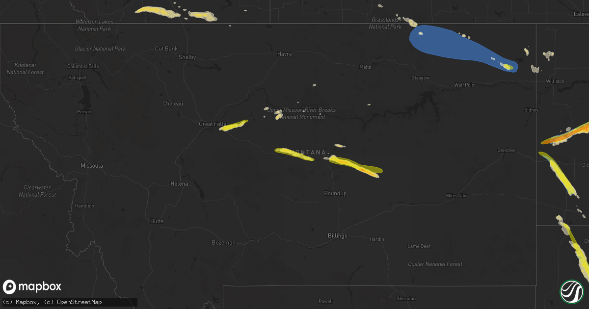
Hail Map on July 29, 2023
Get this storm
July 29 map
$229
one time, instant access
Download today. No call, no setup
Keep the $229
Bought the map and want the full workflow? Apply the entire $229 to a subscription within 7 days. None of it is wasted.
Every map, not just this one
This buys you this map. Subscription and you get every map we run, in the markets you choose from a few cities to whole states to nationwide. Plus real-time alerts the moment a storm fires.
Contact data
Name, contact info, occupancy, even credit band for addresses in the footprint. You go from where it hit to who to call.
Become the source they trust
Unlimited branding weather history reports on demand. You already have the documented answer ready for the property owner, and you are the one who showed up with it.
Property data and RoofTrace estimates
Pull up any address you have got, its value and the exact code rules for that jurisdiction, straight from One Click Code. Then RoofTrace estimates the squares, pitch, and roof value, priced the way you price.
States Impacted by Hail Map on July 29, 2023
Storm reports
Nebraska
| Date | Description |
|---|---|
| 07/29/202311:02 AM CDT | A local report indicates 64 MPH wind near 1 N Falls City |
| 07/29/202310:10 AM CDT | A local report indicates 62 MPH wind near 3 WSW Nemaha |
| 07/29/20239:30 AM CDT | A local report indicates 60 MPH wind near Talmage |
| 07/29/20239:30 AM CDT | Asos report. Fnb gust to 52 knots. |
| 07/29/20239:30 AM CDT | Corrects previous tstm wnd gst report from falls city. Asos report. Fnb gust to 52 knots. |
| 07/29/20238:48 AM CDT | Measured from a personal weather station. |
| 07/29/20238:39 AM CDT | A local report indicates 67 MPH wind near 4 E Lewiston |
| 07/29/20238:30 AM CDT | 3 to 4 inch diameter tree branches down. |
| 07/29/20238:21 AM CDT | Gust measured by the kbie awos. |
| 07/29/20238:19 AM CDT | Measured gust from private weather station. |
| 07/29/20238:17 AM CDT | Multiple large trees down in beatrice. |
| 07/29/20238:11 AM CDT | Measured from private weather station. |
| 07/29/20238:10 AM CDT | Measured from a personal weather station. |
| 07/29/20238:07 AM CDT | Multiple large trees down. |
| 07/29/20238:06 AM CDT | Measurement from private weather station. |
| 07/29/20238:05 AM CDT | Measured from private weather station. |
| 07/29/20238:05 AM CDT | Measured gust from private weather station. |
| 07/29/20238:05 AM CDT | Measured gust from private weather station. |
| 07/29/20238:00 AM CDT | Measured gust from private weather station. |
| 07/29/20238:00 AM CDT | Measured via a weather station. |
| 07/29/20237:56 AM CDT | Measured from private weather station. |
| 07/29/20237:54 AM CDT | Wind gust to 78 mph on hwy 4 west of plymouth. Trees... Pivots and power lines down and minor building damage from 2 miles north of tobias to 3 miles north of plymouth |
| 07/29/20237:48 AM CDT | Roof off a hog barn. |
| 07/29/20237:46 AM CDT | A local report indicates 60 MPH wind near 1 NW Western |
| 07/29/20237:45 AM CDT | Moderate tree damage and power lines down. Time estimated from radar. Minor building damage. |
| 07/29/20237:45 AM CDT | Wl-geneva1.98nnw. |
| 07/29/20237:36 AM CDT | A local report indicates 70 MPH wind near Milligan |
| 07/29/20237:35 AM CDT | Moderate tree damage and power lines down. Time estimated from radar. |
| 07/29/20237:30 AM CDT | A local report indicates 66 MPH wind near 4 NNW Ohiowa |
| 07/29/20237:30 AM CDT | Mesonet: pws-knemilli4. |
| 07/29/20237:19 AM CDT | Corrects time of the previous tstm wnd gst report from 2 nnw geneva. Wl-geneva1.98nnw. |
| 07/29/20237:15 AM CDT | Power pole down near yrtc in nw geneva. Time estimated from radar. |
| 07/29/20237:15 AM CDT | Numerous large tree branches down across town blocking streets. Time is estimated from radar. |
| 07/29/20237:12 AM CDT | Wl-geneva4.94w. |
| 07/29/20237:05 AM CDT | Corrects previous tstm wnd dmg report from 6 ese clay center. 3 to 4 inch diameter tree branches down. Time estimated from radar. |
| 07/29/20237:00 AM CDT | Reports of a shed on a car on main street and multiple power poles down. Additionally a building roof is blocking main street. |
New Hampshire
| Date | Description |
|---|---|
| 07/29/20231:23 PM CDT | Delayed report: photos of quarter-size hail reported on social media. Time estimated by radar. |
| 07/29/20231:16 PM CDT | Reported by weather spotter. 1.25 inch hail reported near st anselm college. Time estimated by radar. |
| 07/29/202312:40 PM CDT | Reported by amateur radio. 1.25 inch hail reported near the foss mountain trail head. Time estimated by radar. |
Georgia
| Date | Description |
|---|---|
| 07/29/20236:44 PM CDT | 8 trees down hwy 280 west of preston. |
| 07/29/202312:53 PM CDT | Tree down at boydville road and us-84. Time estimated by radar. |
| 07/29/202312:43 PM CDT | Tree down on us-84 just outside the city limits of cairo. Time estimated by radar. |
| 07/28/202310:45 PM CDT | A tree fell onto power lines on fayetteville rd se. |
| 07/28/202310:45 PM CDT | A large tree fell onto a home on the 600 block of daniel ave se. |
| 07/28/202310:45 PM CDT | Tree down on a car at intersection of parker ave se and glenwood ave se. |
| 07/28/20238:57 PM CDT | Tree down on 7000 block of county line rd. |
| 07/28/20238:57 PM CDT | Tree down at intersection of williams st and harrison st. |
| 07/28/20238:35 PM CDT | Tree down on bowersville highway. |
| 07/28/20238:35 PM CDT | Tree down at intersection of mount vernon rd and ben parks rd. |
| 07/28/20238:32 PM CDT | Tree down on lavonia highway. |
| 07/28/20238:32 PM CDT | Tree down on junction 77 road. Time estimated from radar. |
| 07/28/20238:31 PM CDT | Tree down on 5000 block of hopewell church rd. |
Connecticut
| Date | Description |
|---|---|
| 07/29/20236:57 PM CDT | Tree downed on old boston post road. Time estimated by radar. |
| 07/29/20236:55 PM CDT | In brooklyn... A tree was down on the 200 block of pomfret road. Time approximate. Report relayed by amateur radio. |
| 07/29/20236:42 PM CDT | In hampton... Near the pomfret line... Several trees and wires were down with the fire dept. Responding. Report per ct demhs. Time approximate based on radar. |
| 07/29/20236:35 PM CDT | In chaplin... There were three reports |
| 07/29/20236:30 PM CDT | Several trees down and roads closed across riverside in greenwich ct. |
| 07/29/20236:27 PM CDT | A couple of trees reported down around town. |
| 07/29/20236:26 PM CDT | Trees down near lake quassapaug. |
| 07/28/20237:14 PM CDT | Large tree downed blocking texa heights road. Time estimated from radar. |
| 07/28/20237:12 PM CDT | Corrects previous tstm wnd dmg report from 1 e danielson. In south killingly... Trees and wires downed near the intersection of westcott and korpita road. Report relaye |
| 07/28/20237:00 PM CDT | In south killingly... Trees and wires were down. Report relayed by amateur radio. |
South Dakota
| Date | Description |
|---|---|
| 07/29/202312:44 AM CDT | A local report indicates 71 MPH wind near 4 E Cactus Flat |
| 07/28/202311:38 PM CDT | Wind driven hail damaged buildings... Cars... And crops. |
| 07/28/202311:38 PM CDT | Wind driven hail damaged buildings... Cars... And crops. |
| 07/28/202311:15 PM CDT | Hailed for about 20 minutes |
| 07/28/202310:11 PM CDT | A local report indicates 1.25 inch wind near 6 WSW Opal |
| 07/28/202310:10 PM CDT | Relayed report from spotter. Large hay bales blown across road. Roof blown off of structure. Leaning utility poles. |
| 07/28/20239:49 PM CDT | Lots of hail. Mostly marble sized. 35 mph wind gusts. |
| 07/28/20239:22 PM CDT | A local report indicates 1.25 inch wind near Zeona |
| 07/28/20239:22 PM CDT | A local report indicates 60 MPH wind near Zeona |
Delaware
| Date | Description |
|---|---|
| 07/29/20235:47 PM CDT | A few reports of trees and power lines down across millsboro. Time estimated from radar. |
| 07/29/20235:21 PM CDT | Several reports of trees and power lines down in the seaford area. A few other similar reports from western sussex county |
| 07/29/20235:21 PM CDT | Several reports of trees and power lines down in the seaford area. A few other similar reports from western sussex county |
| 07/29/20235:20 PM CDT | Large tree limb down along smyrna-leipsic road near sunnyside road. Report via social media. |
| 07/29/20234:50 PM CDT | Black diamond rd is closed between tina marie rd and rt 13 due to power lines down in roadway. Time estimated from radar. |
| 07/29/20234:50 PM CDT | Black diamond rd is closed between tina marie rd and rt 13 due to power lines down in roadway. Time estimated from radar. |
| 07/29/20234:50 PM CDT | Report of a tree blown down into a structure in smryna. Time estimated from radar. |
| 07/29/20234:46 PM CDT | Several reports of trees and power lines down in clayton. Time estimated from radar. |
| 07/29/20234:34 PM CDT | Middleneck rd just before the maryland line is closed for a tree across the roadway. Time estimated from radar. |
| 07/29/20234:34 PM CDT | Middleneck rd just before the maryland line is closed for a tree across the roadway. Time estimated from radar. |
Colorado
| Date | Description |
|---|---|
| 07/29/20236:31 PM CDT | Multiple videos of a tornado on twitter and multiple phone calls reporting a tornado. |
| 07/28/20238:45 PM CDT | A local report indicates 60 MPH wind near 1 SSW Pueblo West |
North Carolina
| Date | Description |
|---|---|
| 07/29/20236:45 PM CDT | Large tree blocking roadway at jerry crump rd and saddletree rd. Time estimated from radar. |
| 07/29/20236:42 PM CDT | Trees down in roadway along turnersburg highway. |
| 07/29/20236:40 PM CDT | Large tree on roadway west of vale. Time estimated from radar. |
| 07/29/20236:38 PM CDT | Tree down on beauchamp rd. Time estimated from radar. |
| 07/29/20236:36 PM CDT | Tree down on danner rd. Time estimated from radar. |
| 07/29/20236:35 PM CDT | Several trees down across caldwell county. |
| 07/29/20236:35 PM CDT | Tree blocking roadway on robinson rd. Time estimated from radar. |
| 07/29/20236:35 PM CDT | Several large trees down. |
| 07/29/20236:32 PM CDT | Tree down on intersection of witty road and scalesville road. |
| 07/29/20236:32 PM CDT | Reports of trees down across the hickory area. |
| 07/29/20236:30 PM CDT | Large trees blocking roadways around conover. Time estimated from radar. |
| 07/29/20236:24 PM CDT | Tree reported down on clemmons road. |
| 07/29/20236:18 PM CDT | Tree down on yadkinville road. |
| 07/29/20236:18 PM CDT | Corrects previous non-tstm wnd dmg report from 1 ene madison. Several large trees down. |
| 07/29/20236:18 PM CDT | Trees down on sugar loaf rd. |
| 07/29/20236:05 PM CDT | Corrects previous tstm wnd dmg report from 3 nnw drexel. Trees and power lines down on antioch rd. |
| 07/29/20236:00 PM CDT | Tree reported down on grindstone drive. |
| 07/29/20235:58 PM CDT | Trees and power lines down on antioch rd. |
| 07/29/20235:54 PM CDT | Trees down. |
| 07/29/20235:53 PM CDT | Powerlines and numerous trees downed by thunderstorm winds around east bend. |
| 07/29/20235:51 PM CDT | Several trees downed by thunderstorm winds in the forbush area. |
| 07/29/20235:50 PM CDT | Trees down on mud cut rd. |
| 07/29/20235:48 PM CDT | Tree down on sparta road near mulberry. Time estimated from radar. |
| 07/29/20235:48 PM CDT | Tree down on sparta road near mulberry. Time estimated from radar. |
| 07/29/20235:47 PM CDT | Tree down on donnaha road and martin ferry road. |
| 07/29/20235:46 PM CDT | Tree down blocking the roadway on lackey town rd. |
| 07/29/20235:40 PM CDT | Tree down blocking roadway on watson rd. |
| 07/29/20235:35 PM CDT | Trees down blocking the roadway on settlemyre rd. |
| 07/29/20235:30 PM CDT | Trees down on nc 80 near lake tahoma. |
| 07/29/20235:27 PM CDT | Tree down on pleasant ridge road near us 21. Time estimated from radar. |
| 07/29/20235:24 PM CDT | Large tree down in a backyard. |
| 07/29/20235:24 PM CDT | Corrects previous tstm wnd dmg report from 2 se thurmond. Tree down on west tate drive. Time estimated from radar. |
| 07/29/20235:22 PM CDT | Tree down on moxley ridge road. |
| 07/29/20235:20 PM CDT | A tree down in minneapolis... And one along the linville falls hwy. |
| 07/29/20235:20 PM CDT | Metal basketball goal pole snapped by strong winds along castleton ln in hendersonville. The goal fell onto a car and shattered the back window. |
| 07/29/20235:17 PM CDT | Tree down on russ ave. |
| 07/29/20235:17 PM CDT | A local report indicates 1.00 inch wind near 1 NNE Waynesville |
| 07/29/20235:11 PM CDT | Downed trees and power lines in the worley road area. |
| 07/29/20235:08 PM CDT | Tree blown down on power lines in area of thorncliff drive. |
| 07/29/20235:08 PM CDT | Trees down across haywood county. |
| 07/29/20235:08 PM CDT | Thunderstorm winds blew down numerous trees between mount airy and dobson. |
| 07/29/20235:05 PM CDT | Corrects previous tstm wnd dmg report from 4 s canton. Trees and limbs down on power lines. |
| 07/29/20235:05 PM CDT | Corrects previous tstm wnd dmg report from 3 nnw drexel. Corrects previous tstm wnd dmg report from 3 nnw drexel. Trees and power lines down on antioch rd. |
| 07/29/20235:05 PM CDT | Tress down blocking roadway at the intersection of north drexel rd and butler hill rd. |
| 07/29/20235:02 PM CDT | Three trees downed blocking road in area of kellersviile and andy hicks road. |
| 07/29/20234:49 PM CDT | Thunderstorm winds blew down about ten trees down along west pine street between the intersections with maple hollow road and with greyhound road. |
| 07/29/20234:49 PM CDT | Thunderstorm winds blew down about ten trees along west pine street between the intersections with maple hollow road and with greyhound road. |
| 07/28/20238:12 PM CDT | Tree down on us hwy 15 n and stovall road. |
| 07/28/20238:06 PM CDT | Tree down on dalton mill road. |
| 07/28/20237:35 PM CDT | Report of power lines down on eaton cir. |
| 07/28/20237:20 PM CDT | Report of power lines on rock island rd. Time estimated from radar. |
| 07/28/20237:12 PM CDT | Tree down on dicks mill road. |
| 07/28/20237:10 PM CDT | Reports of trees on powerlines and one on roadway on north and east side of china grove. |
| 07/28/20237:06 PM CDT | Tree down on rankinmill road. |
| 07/28/20237:00 PM CDT | Tree down on east cone blvd. |
Maryland
| Date | Description |
|---|---|
| 07/29/20236:54 PM CDT | Three reports of downed trees in the california area |
| 07/29/20236:44 PM CDT | Tree across cedar lane rd. Near blacksmith shop rd. |
| 07/29/20236:35 PM CDT | Large tree fell on a camper. Numerous trees down in the vicinity of crumpton and chesterville... And scattered across northern part of the county. Corrected time from p |
| 07/29/20236:32 PM CDT | Trees in power lines on deal island. |
| 07/29/20236:20 PM CDT | Trees and wires down... Scattered throughout kent county. |
| 07/29/20236:20 PM CDT | Trees down between westover and princess anne. |
| 07/29/20236:20 PM CDT | Large tree fell on a camper. Numerous trees down in the vicinity of crumpton and chesterville... And scattered across northern part of the county. |
| 07/29/20236:20 PM CDT | Six reports of trees and power poles down around chaptico to morganza |
| 07/29/20236:20 PM CDT | Delayed report. St. Mary's county em relayed reports of numerous trees down along thompson corner road... Mechanicsville road... And baptist church road between mechani |
| 07/29/20236:04 PM CDT | A local report indicates 80 MPH wind near 2 WSW Andrews |
| 07/29/20235:38 PM CDT | Delayed report. St. Mary's county em reported numerous trees and power lines downed along many roads south of mechanicsville. Time estimated from radar. |
| 07/29/20235:33 PM CDT | At least seven reports of downed trees in the area around mechanicsville and several miles north and east |
| 07/29/20235:30 PM CDT | St. Mary's county em reported a large tree downed near new market turner road and lockes hill road. Time estimated from radar. |
| 07/29/20235:26 PM CDT | Multiple trees down onto homes and cars in golden beach. |
| 07/29/20235:24 PM CDT | A local report indicates 61 MPH wind near 2 WSW Andrews |
| 07/29/20235:24 PM CDT | Tree down on maryland route 6 between four seasons court and flora corner road. |
| 07/29/20235:18 PM CDT | Numerous trees blew down along golden beach road and on northbound md-5 leonardtown road. |
| 07/29/20235:17 PM CDT | Tree on a house in cambridge. Trees on power lines and blocking roads across portions of the area. |
| 07/29/20235:03 PM CDT | Several large branches blown down on nobel and breeding road. Time estimated from radar. |
| 07/29/20234:58 PM CDT | Ripley road is impassable due to numerous trees reported down. |
| 07/29/20234:55 PM CDT | Multiple reports of trees down across hughesville. |
| 07/29/20234:50 PM CDT | Wxflow gauge at millington. |
| 07/29/20234:49 PM CDT | Wunderground station kmdtilgh14. |
| 07/29/20234:45 PM CDT | A wind gust of 54 knots |
| 07/29/20234:44 PM CDT | Wunderground station kmdmasse2. |
| 07/29/20234:40 PM CDT | Tree down on jefferys way in easton. Time estimated from radar. |
| 07/29/20234:38 PM CDT | Power lines and wires down on elm avenue and wayside avenue in easton. Time estimated from radar. |
| 07/29/20234:38 PM CDT | Numerous large trees fell down onto houses on walleye court... Mark drive... And cottoneaster court. |
| 07/29/20234:38 PM CDT | Trees down on baileys neck road southwest of easton. Time estimated from radar. |
| 07/29/20234:36 PM CDT | Numerous large trees blew down in the pomfret area... Including along billingsley road... Bennsville road... And cattle place. |
| 07/29/20234:35 PM CDT | Corrects previous tstm wnd dmg report from crumpton. Large tree fell on a camper. Numerous trees down in the vicinity of crumpton and chesterville... And scattered acro |
| 07/29/20234:35 PM CDT | Corrects previous tstm wnd dmg report from crumpton. Large tree fell on a camper. Numerous trees down in the vicinity of crumpton and chesterville... And scattered acro |
| 07/29/20234:34 PM CDT | Mesonet station md073 md-33 at knapps narrows drawbrid. |
| 07/29/20234:33 PM CDT | Wind gusts of up to 50 knots |
| 07/29/20234:33 PM CDT | Tree down on todds corner road. Time estimated from radar. |
| 07/29/20234:30 PM CDT | Cecil county 911 center reported a tree down along buds landing road. Time estimated from radar. |
| 07/29/20234:29 PM CDT | Wind gusts of up to 50 knots |
| 07/29/20234:26 PM CDT | Wind gust to 60 mph recorded by a weatherflow sensor in worton. |
| 07/29/20234:25 PM CDT | Corrects time of previous tstm wnd dmg report from worton. Trees and wires down... Scattered throughout kent county. |
| 07/29/20234:24 PM CDT | Wunderground station kmdwittm5. |
| 07/29/20234:24 PM CDT | Wunderground station kmdmaryl25. |
| 07/29/20234:24 PM CDT | Wind gusts of up to 51 knots |
| 07/29/20234:24 PM CDT | Wunderground station kmdsteve76. |
| 07/29/20234:24 PM CDT | Wunderground station kmdsteve76. |
| 07/29/20234:23 PM CDT | Trees and limbs down in kennedyville. Time estimated from radar. |
| 07/29/20234:21 PM CDT | Wxflow gauge at worton. |
| 07/29/20234:19 PM CDT | Tree down at kent island high school. Time estimated from radar. |
| 07/29/20234:19 PM CDT | Tree down at kent island high school. Time estimated from radar. |
| 07/29/20234:19 PM CDT | Tree down at kent island high school. Time estimated from radar. |
| 07/29/20234:18 PM CDT | Trees blew down on southbound md-210 indian head highway at md-228 berry road. |
| 07/29/20234:17 PM CDT | Trees and limbs down in still pond. Time estimated from radar. |
| 07/29/20234:06 PM CDT | Trees blew down on southbound i-95/i-495 capital beltway inner loop at exit 4b/md-414 saint barnabas road. |
| 07/29/20234:03 PM CDT | Trees blew down on southbound md-794 at md-408 mount zion marlboro road. |
| 07/29/20234:01 PM CDT | Trees blew down on eastbound md-4 pennsylvania avenue/stephanie roper highway at md-717 water street. |
| 07/29/20233:54 PM CDT | Trees blew down on eastbound md-178 generals highway prior to herald harbor road. |
| 07/29/20233:53 PM CDT | Trees blew down on northbound md-424 davidsonville road at us-50 john hanson highway. |
| 07/29/20233:52 PM CDT | Trees blew down on md-450 defense highway at pebblebrook court. |
| 07/29/20233:50 PM CDT | Trees blew down on us-40 pulaski highway at abingdon road. |
| 07/29/20233:45 PM CDT | Large trees blew down near the intersection of md-197 laurel-bowie road and old chapel road. |
| 07/29/20233:45 PM CDT | Public reports numerous downed trees in the takoma park and silver spring areas. Time estimated from radar. |
| 07/29/20233:45 PM CDT | Harford county 911 center reported numerous trees and power lines downed in the edgewood area. |
| 07/29/20233:43 PM CDT | A wind gust of 50 knots |
| 07/29/20233:39 PM CDT | Trees blew down onto southbound md-295 baltimore-washington parkway prior to md-193 greenbelt road. |
| 07/29/20233:39 PM CDT | Tree down on us route 1 at new cut road. |
| 07/29/20233:38 PM CDT | Large tree limbs snapped |
| 07/29/20233:33 PM CDT | Tree down on us route 1 at whiskey bottom road. |
| 07/29/20233:31 PM CDT | Numerous large trees and branches blew down near savage... Including on vollmerhausen road between the little patuxent river and savage guilford road... And along found |
| 07/29/20233:30 PM CDT | Tree down onto a home in the 500 block of albany ave. In tacoma park... Md. |
| 07/29/20233:30 PM CDT | Delayed report. Montgomery county em relayed report of numerous trees down in the forest glen area. Time estimated from radar. |
| 07/29/20233:30 PM CDT | Montgomery county fire reported numerous people were displaced after trees fell onto multiple residences in the bethesda park condominiums in rockville. |
| 07/29/20233:30 PM CDT | A wind gust of 53 knots |
| 07/29/20233:28 PM CDT | Trees blew down on us-1 washington boulevard north at corridor road. |
| 07/29/20233:28 PM CDT | Trees blew down on southbound us-29 columbia pike at exit 21a/southbound md-108 clarksville pike. |
| 07/29/20233:28 PM CDT | Multiple large trees down onto structures near the 1220 block of charles road. |
| 07/29/20233:28 PM CDT | Montgomery county fire reported significant roof damage to a business along rockville pike and bou ave. |
| 07/29/20233:28 PM CDT | Tree down on maryland route 175 at us route 29. |
| 07/29/20233:27 PM CDT | Trees blew down on eastbound md-614 goldsboro road at wedgewood road. |
| 07/29/20233:26 PM CDT | Trees blew down on eastbound md-190 river road at whittier boulevard. |
| 07/29/20233:25 PM CDT | Delayed report. Trained spotter relayed report of numerous trees down in the columbia area along haprers farm rd... Cedar lane... And homewood rd. |
| 07/29/20233:25 PM CDT | Montgomery county fire reported a large tree downed onto two residences. Several people were trapped and had to be rescued. No injuries reported. |
| 07/29/20233:24 PM CDT | Trees blew down on clara barton parkway at cabin john parkway. |
| 07/29/20233:24 PM CDT | Numerous trees down on clara barton pkwy. |
| 07/29/20233:23 PM CDT | Tree down onto a home in the 6000 block of cronwell dr. In bethesda... Md. |
| 07/29/20233:23 PM CDT | Multiple trees down onto powerlines near glen echo. |
| 07/29/20233:22 PM CDT | Trees blew down on md-355 rockville pike at i-495 capital beltway. |
| 07/29/20233:21 PM CDT | Trees blew down on southbound md-185 connecticut avenue at veirs mill road. |
| 07/29/20233:20 PM CDT | Montgomery county fire reported numerous downed trees along tilden laand in north bethesda. |
| 07/29/20233:19 PM CDT | Multiple large trees and power lines down on the north side of bethesda. One community had several trees down onto vehicles and onto porches of homes. |
| 07/29/20233:19 PM CDT | Roof blown off of a commercial building with significant strucutural damage to the building. |
| 07/29/20233:19 PM CDT | Delayed report. Mdot reported md-138 was closed between monkton road and wesley chapel road due to downed power lines on roadway. |
| 07/29/20233:17 PM CDT | Trees blew down on eastbound md-108 olney sandy spring road past prince philip drive. |
| 07/29/20233:15 PM CDT | Delayed report. Montgomery county em relayed report of numerous downed trees in the potomac area. Time estimated from radar. |
| 07/29/20233:10 PM CDT | Multiple trees... Powerlines... And transformers down along layhill rd. Between chester mill rd. And norbeck rd. |
| 07/29/20233:05 PM CDT | A wind gust of 60 knots |
| 07/29/20233:02 PM CDT | Trees blew down on md-355 frederick road at md-118 germantown road. |
| 07/29/20233:02 PM CDT | Delayed report. Montgomery county em relayed report of a tree downed onto a power pole along 22600 blk of wildcat road. |
| 07/29/20233:01 PM CDT | Large tree split in half on the 15200 block of montevideo road. |
| 07/29/20233:01 PM CDT | Multiple trees down near montgomery village. |
| 07/29/20233:01 PM CDT | Mutliple trees down on gainford court. |
| 07/28/20238:25 PM CDT | Tempest station at trinity church rd measured a peak wind gust of 60kt/69mph. |
| 07/28/20237:41 PM CDT | Tree down across point lookout rd. Near bauer rd. |
| 07/28/20237:22 PM CDT | Tree down blocking both lanes of happyland rd. |
| 07/28/20237:15 PM CDT | A wind gust of 52 knots |
| 07/28/20237:13 PM CDT | Wind gusts of up to 52 knots |
Tennessee
| Date | Description |
|---|---|
| 07/29/20236:25 PM CDT | Multiple tree and power line reports across the county. Tree partially blocking roadway near harmony rd and tillery rd. Time estimated from radar. |
| 07/29/20236:15 PM CDT | Multiple reports of trees down across the county. Report of tree down blocking the road near turkey cove lane and parkside drive. |
| 07/29/20235:50 PM CDT | Dispatch reported multiple trees and powerlines down across the county... And trees and lines across some roadways. Time estimated from radar. |
| 07/29/20235:45 PM CDT | Dispatch reported multiple trees down in the jacksboro area. Time estimated from radar. |
| 07/29/20235:31 PM CDT | Twitter report of a tree down off cut off road in walterhill. Time estimated by radar. |
| 07/29/20235:20 PM CDT | Dispatch reported multiple trees and a few powerlines down across the county. Time estimated from radar. |
| 07/29/20235:18 PM CDT | Twitter pictures of tree/limbs down near the nashville zoo. Time estimated via radar. |
| 07/29/20235:00 PM CDT | Several trees down near south fentress park with highway 127 blocked and closed. Roof damage to clarkrange baptist church. |
| 07/29/20234:57 PM CDT | Several trees down throughout the county with multiple trees down in the edgar evans state park / center hill dam area. Minor metal roof damage to the marina as well. T |
| 07/29/20234:54 PM CDT | Report of of numerous trees and limbs down. Time estimated via radar. |
| 07/29/20234:51 PM CDT | A few trees were uprooted with 3 to 4 damaged power poles along saundersville road... Resulting in power outages. Time estimated by radar. |
| 07/29/20234:50 PM CDT | Corrects previous tstm wnd dmg report from 3 ne green hill. A small but intense microburst struck far north mount juliet. Dozens of trees were snapped and uprooted in a |
| 07/29/20234:45 PM CDT | Dispatch reported several trees and powerlines down county wide. Time estimated from radar. |
| 07/29/20234:40 PM CDT | Dispatch reported numerous trees and powerlines down across the county. Time estimated from radar. |
| 07/29/20234:20 PM CDT | Dispatch reported numerous trees down across the county. Time estimated from radar. |
| 07/29/20234:15 PM CDT | Dispatch reported numerous trees and lines down across the county. Time estimated from radar. |
| 07/29/20234:15 PM CDT | Report of multiple stoplights/lines down in kingsport near wilcox dr and east center street. Time estimated from radar. |
| 07/29/20233:45 PM CDT | Report of tree down blocking road near ellistown rd and shipe rd. Time estimated from radar. |
| 07/29/20233:30 PM CDT | Tspotter report of a downed tree at a residence in the new deal area. Pictures shared also show that the tree destroyed a fence. Time estimated based on radar. |
| 07/29/20233:28 PM CDT | Facebook report of flagpole snapped and several tree tops blown off in the oak grove area. |
| 07/29/20233:20 PM CDT | Multiple trees down across the county. Time estimated from radar. |
| 07/29/20233:20 PM CDT | Dispatch reported tree down and some power outages. Time estimated from radar. |
| 07/29/20232:40 PM CDT | Dispatch reported multiple trees down across the county. Time estimated from radar. |
| 07/29/20232:15 PM CDT | Dispatch reported multiple trees and powerlines down in kingston and harriman. Time estimated from radar. |
| 07/28/202311:10 PM CDT | Tspotter photos of roof blown off barn on old smithville highway north. |
Pennsylvania
| Date | Description |
|---|---|
| 07/29/20236:15 PM CDT | Large tree fell onto vehicle. No injuries reported. Photo via social media. |
| 07/29/20236:08 PM CDT | Trees down in ridgley twp. Time estimated from radar. |
| 07/29/20236:05 PM CDT | A few trees down reported around aston and ridley township. |
| 07/29/20236:00 PM CDT | Corrects time on previous tstm wnd dmg report from aston twp.. A few trees down reported around aston and ridley township. |
| 07/29/20235:55 PM CDT | Corrects time on previous tstm wnd dmg report from lima. Large tree fell onto vehicle. No injuries reported. Photo via social media. |
| 07/29/20235:45 PM CDT | Several large limbs and power lines blown down. |
| 07/29/20235:42 PM CDT | Trees and power lines down near exton. Time estimated from radar. |
| 07/29/20235:30 PM CDT | Trees and wires down near plumstead and richmond townships in bucks county. |
| 07/29/20235:15 PM CDT | Two trees down across the train tracks off bower st. |
| 07/29/20235:00 PM CDT | Large tree down across the power lines and took the lines to the ground. It pulled the power line feeds down from five houses 32 people without power on the street. |
| 07/29/20234:38 PM CDT | Several large limbs blown down. |
| 07/29/20232:42 PM CDT | Several trees down along lake road on the east side of lake mokoma... Stretching from the intersections with gate road and east shore drive. One home was damaged from f |
West Virginia
| Date | Description |
|---|---|
| 07/29/20232:55 PM CDT | Tree down blocking both lanes of rocket boys drive below high rocks. |
Arkansas
| Date | Description |
|---|---|
| 07/28/20239:30 PM CDT | A few trees were blown down. |
| 07/28/20239:00 PM CDT | A few trees were blown down. |
| 07/28/20238:25 PM CDT | A large tree fell down... Damaging a house and a vehicle. |
| 07/28/20238:15 PM CDT | Trees and powerlines were blown down. |
Rhode Island
| Date | Description |
|---|---|
| 07/28/20237:10 PM CDT | In foster... A tree and wires were down on north road. |
Indiana
| Date | Description |
|---|---|
| 07/28/20239:25 PM CDT | Trees down along german ridge road. Time estimated by radar. |
| 07/28/20237:39 PM CDT | This report was for 6 miles north of princeton ky... Not indiana. There was no report for 3 nne patoka... In. |
| 07/28/20237:39 PM CDT | A local report indicates 60 MPH wind near 3 NNE Patoka |
Montana
| Date | Description |
|---|---|
| 07/29/20233:45 AM CDT | 0.9 e saint marie marco site - 07mt. |
| 07/29/20233:45 AM CDT | 0.9 e saint marie marco site - 07mt. ( |
| 07/29/202312:44 AM CDT | Mesonet station kigm8 king coulee. |
| 07/28/202310:15 PM CDT | Delayed report of hail up to 1 inch in diameter. Time estimated by radar. |
| 07/28/20239:16 PM CDT | 62 mph wind gust reported at sweet grass port of entry montana department of transportation automated site. |
Arizona
| Date | Description |
|---|---|
| 07/28/202310:20 PM CDT | Delayed report: many homes in the area had roof/awning/carport/shed damage with numerous large limbs and smaller trees downed. |
District of Columbia
| Date | Description |
|---|---|
| 07/29/20234:28 PM CDT | *** 2 inj *** tree down onto a vehicle. |
| 07/29/20234:28 PM CDT | *** 2 inj *** tree down onto a vehicle. |
| 07/29/20234:00 PM CDT | A wind gust of 73 knots |
| 07/29/20233:58 PM CDT | A wind gust of 52 knots |
| 07/29/20233:50 PM CDT | The smithsonian national zoo reports numerous downed trees throughout the property. |
| 07/29/20233:50 PM CDT | Public reports numerous downed tress along massachussetts ave nw that are blocking the road for about two block. |
| 07/29/20233:50 PM CDT | Dc fire rescue reports the roof of a residential building was torn off. No injuries... Many residents displaced. |
| 07/29/20233:49 PM CDT | Numerous large trees... Branches and wires blew down in adams morgan and dupont... Including around sheridan circle northwest and on massachusetts avenue northwest near |
| 07/29/20233:47 PM CDT | Multiple trees reported down on foxhall road in nw dc. |
| 07/29/20233:46 PM CDT | Right lane of whitehurst freeway at i-66 blocked due to a downed utility pole. |
| 07/29/20233:45 PM CDT | Numerous trees down... Rendering multiple roadways impassable. |
| 07/29/20233:44 PM CDT | Tree down on foxhall road nw at canal road. |
| 07/29/20233:44 PM CDT | Wind gusts of up to 52 knots |
| 07/29/20233:37 PM CDT | Large tree down onto a residence. |
| 07/29/20233:33 PM CDT | Numerous trees and branches blew down around dupont circle... Including several onto people. |
| 07/29/20233:28 PM CDT | Roof blown off of apartment complex in the 3000 block of wisconsin ave. |
| 07/29/20233:28 PM CDT | Large branch down blocking roadway at the intersection of 41st st. Nw and ellicott st. Nw. |
Kansas
| Date | Description |
|---|---|
| 07/29/20231:59 PM CDT | A local report indicates 90 MPH wind near 2 E Webster State Park |
| 07/29/202310:33 AM CDT | A local report indicates 65 MPH wind near 2 ESE Wathena |
| 07/29/20238:40 AM CDT | 50 to 60 mph winds. |
Illinois
| Date | Description |
|---|---|
| 07/29/20236:42 PM CDT | Large tree down on road. Also minor wind damage to canopy near ridgway. |
| 07/29/20236:42 PM CDT | Trees and power lines down. Power outages widespread. |
| 07/29/20236:32 PM CDT | Large tree down. Also limbs down elsewhere in county. Measured gust 54 mph at round knob. |
| 07/29/20236:26 PM CDT | Large tree branch broken off. |
| 07/29/20236:10 PM CDT | Large tree down on barn. |
| 07/29/20236:00 PM CDT | Tree down on power line. |
| 07/29/20235:50 PM CDT | Large tree fell on a power line. |
| 07/29/20235:50 PM CDT | Trees... Limbs... And power lines down. |
| 07/29/20235:45 PM CDT | Trees down countywide... Including west frankfort... Buckner... And benton. Tree down on van and camper in thompsonville. |
| 07/29/20235:45 PM CDT | Tree down on a home. Also tree limbs down throughout the county. |
| 07/29/20235:45 PM CDT | Trees... Limbs... And power lines down. |
| 07/29/20235:45 PM CDT | Trees... Limbs... And power lines down. |
| 07/29/20235:40 PM CDT | Trees... Limbs... And power lines down. |
| 07/29/20235:40 PM CDT | Trees down and unknown damage to home near state route 37 and england rd. |
| 07/29/20235:39 PM CDT | Large trees down... Wind estimated 70 to 80 mph. |
| 07/29/20235:35 PM CDT | Trees... Limbs... And power lines down. |
| 07/29/20235:32 PM CDT | Multiple trees and large tree limbs down across town... Some on cars and several structures. |
| 07/29/20235:31 PM CDT | Large tree limbs down crab orchard campground. |
| 07/29/20235:29 PM CDT | Road sign blown across road. |
| 07/29/20235:28 PM CDT | Late report. Several trees down along with up to 6 inch limbs. |
| 07/29/20235:25 PM CDT | Photo powerlines downed by a large tree limb with several limbs littering the ground. Time estimated by radar. |
| 07/29/20235:25 PM CDT | Tree down on a road in a park near gorham. |
| 07/29/20235:20 PM CDT | Tree down on a house. |
| 07/29/20235:09 PM CDT | Multiple trees... Power lines... And power poles down across county. Much of county is without power. |
| 07/29/20235:09 PM CDT | Trees and power lines down. |
| 07/29/20235:00 PM CDT | Reports of trees and limbs down scattered about the town. |
| 07/29/20234:55 PM CDT | Report of four broken power poles within the city. |
| 07/29/20234:52 PM CDT | Corrects previous non-tstm wnd dmg report from 2 wnw steeleville. Several power poles down. |
| 07/29/20234:50 PM CDT | Ham radio relayed report of 4 inch diameter tulip tree being blown down. |
| 07/29/20234:50 PM CDT | Time estimate from radar. |
| 07/29/20234:47 PM CDT | Large tree branches down. |
| 07/29/20234:41 PM CDT | A local report indicates 73 MPH wind near 2 SE Swansea |
| 07/29/20234:40 PM CDT | Cwop report. |
| 07/29/20234:37 PM CDT | A local report indicates 63 MPH wind near Scott Afb |
| 07/29/20234:32 PM CDT | Observation relayed by st. Clair county skywarn. |
| 07/29/20234:30 PM CDT | Tree limbs down and roof damage. |
| 07/29/20234:28 PM CDT | 6 ft diameter tree snapped. Time estimated by radar. |
| 07/29/20234:27 PM CDT | Trees down. |
| 07/29/20234:26 PM CDT | Large tree snapped. Photos from social media. Time estimate from radar. |
| 07/29/20234:25 PM CDT | Trees down... Power poles snapped... And power lines down in fairview heights and ofallon il. A partial roof collapse in ofallon. |
| 07/29/20234:25 PM CDT | Trees and limbs down. |
| 07/29/20234:25 PM CDT | Large tree branches down. |
| 07/29/20234:24 PM CDT | 12 inch diameter tree limb blown down. Time estimated by radar. |
| 07/29/20234:22 PM CDT | Tree limbs down in the east alton area. Lost power in the area. Time estimated by radar. |
| 07/29/20234:22 PM CDT | A few 2 inch tree limbs down in the area. Spotter also noted a powerline was down a block away from their residence. Time estimated by radar. |
| 07/29/20234:21 PM CDT | Partial roof collapse... Potentially related to a downed tree branch. Time estimated from radar. |
| 07/29/20234:21 PM CDT | Partial roof collapse from wind. Time estimated from radar. |
| 07/29/20234:21 PM CDT | 6 inch tree limb down at wood river ave and first street. 4 inch tree limbs down along washington ave. Time estimated from radar. |
| 07/29/20234:20 PM CDT | Line down. |
| 07/29/20234:18 PM CDT | Trees and limbs down. |
| 07/29/20234:17 PM CDT | Cwop report. |
| 07/29/20234:17 PM CDT | Observation from the monroe county fairground near waterloo il. |
| 07/29/20234:15 PM CDT | Estimated 50-60 mph gusts. |
| 07/29/20234:13 PM CDT | A local report indicates 62 MPH wind near 2 W New Handover |
| 07/29/20234:10 PM CDT | 5 to 8 inch tree limbs down near bethel road. Time estimated by radar. |
| 07/29/20234:10 PM CDT | Trees and limbs down. |
| 07/29/20234:10 PM CDT | Trees down. |
| 07/29/20234:10 PM CDT | Road signs down. |
| 07/29/20234:10 PM CDT | Wind gusts estimated near 60 mph. Time estimated by radar. |
| 07/29/20234:07 PM CDT | Large tree down. Photo sent in via social media. Time estimated by radar. |
| 07/29/20234:07 PM CDT | 3-inch tree limbs broken; power poles broken. Time estimated by radar. |
| 07/29/20234:05 PM CDT | Trees and limbs down. |
| 07/29/20233:57 PM CDT | 6 in tree limb down. |
| 07/29/20233:53 PM CDT | Trees down on route 16 west of fieldon. |
New York
| Date | Description |
|---|---|
| 07/29/20236:58 PM CDT | Corrects time from previous tstm wnd dmg report from 1 wnw stony brook. Video of a large tree down across lotowana lane in stony brook ny. |
| 07/29/20236:32 PM CDT | Mesonet station xbay bayville. 45 ft elevation. |
| 07/29/20236:32 PM CDT | Marine thunderstorm wind gust of 56 kt. Mesonet station xbay bayville. 45 ft elevation. |
| 07/29/20235:37 PM CDT | Tree down on home on cromwell road. |
| 07/29/20231:40 PM CDT | Trees down. Time estimated from radar. |
| 07/29/20231:11 PM CDT | Tree down on clizbe avenue |
| 07/29/20231:09 PM CDT | Trees down. Time estimated from radar. |
| 07/29/20231:05 PM CDT | Trees down. Time estimated from radar. |
| 07/29/20231:05 PM CDT | Tree down on rt 67 between sacandaga road and mcdonald drive. |
| 07/29/202312:41 PM CDT | Large trees downed from winds associated with thunderstorm. Winds estimated at 60-70mph. |
| 07/29/202312:41 PM CDT | Tree down on lower prospect street that hit two houses. |
| 07/29/202312:41 PM CDT | Tree down on keller drive. |
| 07/29/202312:24 PM CDT | Large tree across stone arabia road. |
| 07/29/202311:35 AM CDT | Tree down. Time estimated from radar. |
| 07/29/202311:06 AM CDT | Herkimer county officials report trees down in the town of herkimer due to winds associated with thunderstorm. |
| 07/29/202311:06 AM CDT | Herkimer county officials report trees down in mohawk due to winds associated with thunderstorm. |
| 07/29/202311:06 AM CDT | Herkimer county officials report trees down in ilion due to winds associated with thunderstorm. |
| 07/29/202310:50 AM CDT | Tree down blocking both lanes of bouck road just south of widrick road in the town of frankfort. Time estimated by radar. |
| 07/29/202310:17 AM CDT | Tree down on wires near kimball road in augusta... Ny. |
| 07/29/202310:16 AM CDT | Trees and wires down across knoxboro rd in knoxboro... Ny. |
| 07/28/20238:13 PM CDT | Multiple trees down around town. |
| 07/28/20238:04 PM CDT | Multiple trees down around town. |
| 07/28/20237:50 PM CDT | Multiple trees down around town. |
| 07/28/20237:34 PM CDT | Marine thunderstorm wind gust of 56 kt measured nearby on horseshoe road. |
| 07/28/20237:33 PM CDT | Tree down on north side road. |
| 07/28/20237:21 PM CDT | Multiple trees down around town. |
| 07/28/20237:10 PM CDT | Multiple trees down around town. |
| 07/28/20237:09 PM CDT | Mesonet station ew5678 stony brook station elevation: 159 ft. |
| 07/28/20237:03 PM CDT | Corrects previous tstm wnd dmg report from setauket-east seta. Large limb and wires down on the intersection of old field road and conscience bay road. |
| 07/28/20237:03 PM CDT | Large limb and wires down on the intersection of old field road and conscience road. |
New Jersey
| Date | Description |
|---|---|
| 07/29/20236:28 PM CDT | Tree limbs down. Picture provided via social media. Time estimated via radar. |
| 07/29/20236:12 PM CDT | Widespread tree debris with a few large limbs down on roads. |
| 07/29/20236:09 PM CDT | Tree limbs down on power lines. Power outages in the area. Time estimated from radar. |
| 07/29/20236:05 PM CDT | Tree down blocking columbia avenue. Several other large limbs down in the area. Pictures via social media. |
| 07/29/20236:02 PM CDT | Report of 1 tree down that emergency responders had to reroute around. |
| 07/29/20235:57 PM CDT | Trees and wires down on east katherine avenue in upper township. Time estimated from radar. |
| 07/29/20235:46 PM CDT | Tree down on catskill court in montgomery township. Time estimated from radar. |
| 07/29/20235:45 PM CDT | Reports of trees and wires down in lambertville. Time estimated from radar. |
| 07/29/20235:39 PM CDT | Tree down on zion road in hillsborough twp. Time estimated from radar. |
| 07/29/20235:34 PM CDT | Tree down on rock mill run in montgomery township. Time estimated from radar. |
| 07/29/20235:26 PM CDT | 911 call center received numerous reports of trees down... Power lines down... And large limbs down... Especially along route 202 in east and west amwell townships betw |
| 07/29/20235:24 PM CDT | 911 call center received numerous reports of trees down... Power lines down... And large limbs down... Especially along route 523 in raritan twp southwest of flemington |
| 07/29/20235:19 PM CDT | Report of multiple 3-5 inch tree limbs broken with power lines down at intersection of libertyville road and county route 519 in wantage. |
| 07/29/20235:18 PM CDT | Report of 12 inch diameter branch snapped off a tree. |
| 07/29/20235:18 PM CDT | 911 call center received numerous reports of trees down... Power lines down... And large limbs down... Especially along route 523 in delaware twp northeast of stockton. |
| 07/29/20235:17 PM CDT | Downed tree on wires. Time estimated from radar. |
| 07/29/20235:13 PM CDT | Trees and power lines down in kingwood... Especially along route 29. Time estimate from radar. |
| 07/29/20235:09 PM CDT | Corrects time on previous tstm wnd dmg report from 3 sw monroe twp. Tree limbs down on power lines. Power outages in the area. Time estimated from radar. |
| 07/29/20234:40 PM CDT | Multiple reports of trees and wires blown down across salem county. Time and location estimated from radar. |
| 07/29/20234:38 PM CDT | Several trees and power lines down along bailey street and south main street in woodstown. Time estimated from radar. |
| 07/29/20234:38 PM CDT | Social media photo of several snapped power poles along south main street in woodstown. Time estimated from radar. |
South Carolina
| Date | Description |
|---|---|
| 07/29/20236:40 PM CDT | Numerous trees and large limbs down here and within 5 miles of the location. Flag pole bent to the ground also. |
| 07/29/20236:20 PM CDT | Tree down blocking hwy 288. Time estimated from radar. |
| 07/29/20236:06 PM CDT | Tree and powerline down near goodjoin and babb rd intersection. Time estimated from radar. |
| 07/29/20236:05 PM CDT | Large tree on on roddy rd just west of asheville hwy. Time estimated from radar. |
| 07/28/20238:16 PM CDT | Report of two trees down and a large limb blocking entrance to dog park in the city of greenwood. Time estimated from radar. |
| 07/28/20237:00 PM CDT | Tree on powerlines along e hayne st in woodruff. Time estimated from radar. |
North Dakota
| Date | Description |
|---|---|
| 07/29/20236:14 AM CDT | Mostly dimes to nickels but a few as big as a quarter. Time estimated from radar. |
| 07/28/20239:14 PM CDT | A local report indicates 1.50 inch wind near 8 NW Twin Buttes |
| 07/28/20239:14 PM CDT | Delayed report. Relayed via social media. |
| 07/28/20239:14 PM CDT | Delayed report. Relayed via social media. |
| 07/28/20239:02 PM CDT | Measured thunderstorm wind gust at the amidon ndawn |
| 07/28/20238:16 PM CDT | Delayed report. Picture of hail stone next to golf ball relayed via broadcast media. Time estimated by radar. |
| 07/28/20237:48 PM CDT | Weather camera estimated hail size at the grassy butte ndawn |
| 07/28/20237:48 PM CDT | Measured peak wind gust at the grassy butte ndawn |
| 07/28/20237:30 PM CDT | Hail lasted for 10 minutes. 730 - 740 pm. Lots of smaller hail and 1.29 inches of rain. |
Kentucky
| Date | Description |
|---|---|
| 07/29/20236:58 PM CDT | Tree through roof of apartment. Also tree limb on power line near hendron. |
| 07/29/20236:50 PM CDT | Trees down on roads. |
| 07/29/20236:40 PM CDT | Large limbs down. |
| 07/29/20235:38 PM CDT | Tree down on the 400 block of fox lane. |
| 07/29/20235:38 PM CDT | A tree blew down which brought a light pole down on the 200 block of stephens ridge road. |
| 07/29/20235:38 PM CDT | A tree fell on half acre road near the sewer plant. |
| 07/29/20233:27 PM CDT | County dispatch reported a tree downed into power lines along ky-1643. Time estimated from radar. |
| 07/29/20233:26 PM CDT | Corrects previous tstm wnd dmg report from 1 n varilla. Wril reported a snapped power pole on ky-987 near the intersection of baker hill rd |
| 07/29/20233:26 PM CDT | Wril reported a snapped power pole on ky-987 near the intersection of baker hill rd |
| 07/29/20233:16 PM CDT | County dispatch reported trees blown down into power lines along ky-3001 in front of the harlan country club. Time estimated from radar. |
| 07/29/20233:12 PM CDT | Picture on social media shows several large limbs down in yard along baker street. Time estimated from radar. |
| 07/29/20233:09 PM CDT | County dispatch reported several trees blown down into power lines in the holiday acres trailer park. Time estimated from radar. |
| 07/29/20233:06 PM CDT | Corrects previous tstm wnd dmg report from rosspoint. Pictures on social media shows half a large deciduous tree blown down into power lines along engle drive. Time est |
| 07/29/20233:04 PM CDT | Amateur radio operator reports downed tree on ky-413 leading to a power outage in the rosspoint area of baxter. Event time estimated from radar. |
| 07/29/20233:03 PM CDT | A member of the public shared a picture of a large tree snapped and fallen across ky-588 about halfway between roxana and blackey. The tree trunk was still suspended in |
| 07/29/20233:02 PM CDT | Trees were down on multiple county roads. |
| 07/29/20232:49 PM CDT | Wxkq relayed a social media report showing a large tree down on the camp branch side of thornton in the vicinity of tim hall timber trucking. Time estimated from radar. |
| 07/29/20232:48 PM CDT | Scattered trees and power lines down including on walker street. Some city vehicles were damaged from the falling trees. |
| 07/29/20232:45 PM CDT | County dispatch reported a tree blown down and blocking 1 lane of us-421 around mm 11. Time estimated from radar. |
| 07/29/20232:36 PM CDT | Knott county dispatch relayed a report of a down tree into the powerlines near the intersection of hwy 160 and hwy 899. Time estimated from radar. |
| 07/29/20232:35 PM CDT | Kytc district 12 reported that ky-160 near the ky-899 intersection was closed due to a tree fall. Power and telephone lines were involved. Event time estimated from rad |
| 07/29/20232:31 PM CDT | County dispatch reported tree blown down blocking one lane of davidson fork rd. |
| 07/29/20232:27 PM CDT | Magoffin county dispatch relayed a report of a down tree near mile marker 4 on south river road. Time estimated from radar. |
| 07/29/20232:26 PM CDT | County dispatch reported a beech tree blown down onto a powerline blocking both lanes of traffic on dryhill rd. Time estimate from radar. |
| 07/29/20232:22 PM CDT | County dispatch reported a power pole split by fallen tree along us-421 near mm 26. Time estimated by radar. |
| 07/29/20232:18 PM CDT | Social media report of metal awning damage near the 300 block of main street in hazard. Time estimated from radar. |
| 07/29/20232:18 PM CDT | Off-duty nws estimated winds of 60 mph in hazard. |
| 07/29/20232:15 PM CDT | County dispatch reported powerlines blown down along whitaker fork rd. Time estimated from radar. |
| 07/29/20232:14 PM CDT | County dispatch reported powerlines blown down near the intersection of oakhurst avenue and brown street. Time estimate from radar. |
| 07/29/20232:13 PM CDT | County dispatch reported a tree blown down in the 4300 block of ky-15 n in the vicinity of bonnyman. Time estimated from radar. |
| 07/29/20232:13 PM CDT | County dispatch reported power lines blown down along browns fork rd. Time estimated from radar. |
| 07/29/20232:10 PM CDT | County dispatch reported a tree blown down on coal harbor lane. Time estimated from radar. |
| 07/29/20232:10 PM CDT | County dispatch reported powerlines blown down in the 2300 block of big willard rd. Near busy. Time estimated from radar. |
| 07/29/20232:04 PM CDT | County dispatch received multiple reports of a tree blown down on big cave road |
| 07/29/20231:51 PM CDT | County dispatch reported 2 trees blown down on renfro creek rd. One tree was large and laid across the entire highway near the intersection with hurricane school rd. Th |
| 07/29/20231:42 PM CDT | Breathitt county dispatch reported a tree down at the intersection of knack branch and stray branch rd. Time estimated via radar. |
| 07/29/20231:24 PM CDT | Estill county dispatch relayed a report of tree down on millers creek rd near the railroad crossing. Time estimated from radar. |
| 07/29/20231:19 PM CDT | Individual on social media shared picture of large limb broken off a tree in the 3100 block of tipton ridge rd. Time estimated. |
| 07/29/20237:01 AM CDT | Magoffin county dispatch relayed a report of a down tree near mile marker 2 on litteral fork rd. Time estimated from radar. |
| 07/28/20239:30 PM CDT | Trees down along highway 376 |
| 07/28/20239:30 PM CDT | Trees down along highway 376. Time estimated by radar. |
| 07/28/20239:10 PM CDT | Tree down blocking west main street in auburn... Ky. |
| 07/28/20238:55 PM CDT | Trees down on homes on radio station road and saint rose road. There is damage to a barn and roof off of a house on saint rose road in lebanon. Timing is best guess fro |
| 07/28/20238:15 PM CDT | At least a few trees down... Including one on a house. Power outages. |
| 07/28/20238:10 PM CDT | Measured at kentucky mesonet site. |
| 07/28/20237:45 PM CDT | Kentucky mesonet site. |
| 07/28/20237:39 PM CDT | A local report indicates 60 MPH wind near 6 SW Fryer |
Missouri
| Date | Description |
|---|---|
| 07/29/20236:06 PM CDT | Tree down in town. |
| 07/29/20236:00 PM CDT | Healthy tree limbs down just north of aurora. |
| 07/29/20235:40 PM CDT | Large tree limbs down. Weather station just north of town measured 50mph. |
| 07/29/20234:55 PM CDT | Awos station kpcd perryville mo. |
| 07/29/20234:15 PM CDT | Lost power. Location is approximate. |
| 07/29/20234:12 PM CDT | A local report indicates 60 MPH wind near 2 E Shrewsbury |
| 07/29/20234:03 PM CDT | Area around kirkwood continued to gust around 60 mph. The area has lost power. |
| 07/29/20234:00 PM CDT | 12 inch diameter tree down near hwy 94. 4 inch diameter branch down near hwy 94. Report from social media. Time is estimated. |
| 07/29/20234:00 PM CDT | Trees and powerlines down in the cedar hill area. |
| 07/29/20233:55 PM CDT | Multiple tree limbs down. One landed on a powerline. Photos submitted via social media. Time estimated by radar. |
| 07/29/20233:55 PM CDT | 6 inch tree limbs down. |
| 07/29/20233:53 PM CDT | Roof soffit and a few shingle removed from residence. Report submitted via social media. Time estimated by radar. |
| 07/29/20233:50 PM CDT | Report submitted via social media. |
| 07/29/20233:50 PM CDT | Large branches down. |
| 07/29/20233:46 PM CDT | Large maple tree blown over at the corner of sutton and richmond in maplewood. Report accompanied by photo courtesy of kmov-tv. Time estimated by radar. |
| 07/29/20233:46 PM CDT | Large tree branch down just southwest of george winter park. Photo submitted via social media. Time estimated by radar. |
| 07/29/20233:45 PM CDT | 4-6 inch tree limbs down. Location is approximate. Estimated 50 mph wind gusts. |
| 07/29/20233:41 PM CDT | Multiple photos of tree damage at a residence near highway 270 west of kirkwood. Photos submitted on social media. Time estimated by radar. |
| 07/29/20233:40 PM CDT | Large tree branches down. |
| 07/29/20233:39 PM CDT | Multiple trees down near st. Matthews and manor hill in ofallon. Time estimated by radar. |
| 07/29/20233:37 PM CDT | Multiple tree branches down. Largest limb was about 10 inches in diameter which knocked down a residential fence. Time estimated by radar. |
| 07/29/20233:33 PM CDT | Spotter measured the gust with an anemometer installed at their residence. |
| 07/29/20233:30 PM CDT | Small tree down... Flashing torn from roof. |
| 07/29/20233:29 PM CDT | 40 ft tree down at clintonview court in st charles city. |
| 07/29/20233:29 PM CDT | St. Charles county emergency operations center reporting multiple trees and wires down across the county. Transformer fire reported near sawyer and w clay. |
| 07/29/20233:28 PM CDT | Large limb down partially covering highway hh. Photos submitted via social media. Time estimated by radar. |
| 07/29/20233:28 PM CDT | 10 inch diameter tree down on hwy p/bryan road near mexico road. Time estimated from radar. |
| 07/29/20233:25 PM CDT | 6 inch tree limbs down. A limb fell on house and caused gutter damage. |
| 07/29/20233:23 PM CDT | A local report indicates 60 MPH wind near 4 NNW Saint Peters |
| 07/29/20233:23 PM CDT | Large tree snapped at the base. Photo submitted via social media. Time estimated by radar. |
| 07/29/20233:21 PM CDT | Modot will be closing the roadway near the junction of highway b and highway c in northern st. Charles county due to multiple powerlines down in the area. Time of event |
| 07/29/20233:20 PM CDT | Several tree limbs down. Wind gusts estimated to be 60-70 mph. |
| 07/29/20233:20 PM CDT | Several tree limbs down. Wind gusts estimated to be 60-70 mph. |
| 07/29/20233:17 PM CDT | Several trees down in the area of feise road and highway k. Pictures accompanied report via social media. Time of occurrence estimated by radar. |
| 07/29/20233:16 PM CDT | Tree reported down around st. Clair. Time estimated by radar. |
| 07/29/20233:16 PM CDT | Mature tree fallen on house. 1 foot diameter tree fallen on house. Time estimate from radar. |
| 07/29/20233:15 PM CDT | 6-8 inch tree snapped and crossroads elementary. Time estimate from radar. |
| 07/29/20233:15 PM CDT | Trees approx. 50 ft. Tall and 8-10 in. Diameter. Several houses lost siding in riverdale neighborhood |
| 07/29/20233:14 PM CDT | Trees down in gasconade county. Time estimate from radar. |
| 07/29/20233:14 PM CDT | Corrects previous tstm wnd dmg report from owensville. Trees down on power lines in gasconade county. Time estimate from radar. |
| 07/29/20233:12 PM CDT | Large limb down over a residential driveway. Photos submitted via social media. Time estimated by radar. |
| 07/29/20233:12 PM CDT | Multiple limbs down off magnolia drive. Report submitted via social media with photos. Time estimated by radar. |
| 07/29/20233:07 PM CDT | Trees reported down in the union area. Time estimated by radar. |
| 07/29/20233:00 PM CDT | Power lines down. Time estimate from radar. |
| 07/29/20232:55 PM CDT | Shingles peeled off of roof. Picture from social media. Time estimate from radar. |
| 07/29/20232:55 PM CDT | Multiple trees down south of troy. Largest limbs were 6-10 inches in diameter. Spotter recorded 53 mph gust at his personal weather station their residence in troy. |
| 07/29/20232:53 PM CDT | 4-5 ft diameter tree fell on residence near west cherry and 4th street. Em stated that multiple areas around the county suffered tree damage. Repeater to the monroe fir |
| 07/29/20232:53 PM CDT | Caller estimated winds of 65-70 mph ahead of the main line of thunderstorms. |
| 07/29/20232:51 PM CDT | Local affiliate estimated gusts to be 60 mph or higher. Courtesy of ktvi-tv. |
| 07/29/20232:42 PM CDT | Tree down on bear creek bridge. Time estimate from radar. |
| 07/29/20232:41 PM CDT | Multiple areas suffered tree and powerline damage. Most extensive was along the stretch of highway 47 between warrenton and hawk point. Time estimated by radar. |
| 07/29/20232:40 PM CDT | Multiple tree damage. Time estimated from radar. |
| 07/29/20232:40 PM CDT | Corrects previous tstm wnd dmg report from bay. Trees down on power lines in gasconade county. Time estimate from radar. |
| 07/29/20232:34 PM CDT | Trees down. Time estimate from radar. |
| 07/29/20232:30 PM CDT | Two powerlines down and bounced off a car... Condition of car unknown. Time estimate from radar. |
| 07/29/20232:30 PM CDT | *** 1 inj *** emergency management reported a large tree down on an occupied vehicle. Occupant suffered injuries with emergency personnel responding to the scene. Time |
| 07/29/20232:29 PM CDT | Transformer blew. Time estimate from radar. |
| 07/29/20232:25 PM CDT | Trees down along hwy j. Time estimate from radar. |
| 07/29/20232:20 PM CDT | Observation taken with handheld kestrel anemometer just west of middletown. Gusts of 50-60 mph continues after the initial outflow for approximately 20 minutes. |
| 07/29/20232:20 PM CDT | Trees down. Time estimate from radar. |
| 07/29/20232:18 PM CDT | Time estimate from radar. 70 mph winds were persistent for 10/15 minutes. |
| 07/29/20232:08 PM CDT | Fallen trees on powerlines. Time estimate from radar. |
| 07/29/20232:08 PM CDT | Tree down across hwy 19. Time estimated by radar. |
| 07/29/20232:08 PM CDT | Fallen tree on power line. Time estimate from radar. |
| 07/29/20232:04 PM CDT | Large limbs down near santa fe. Time estimate from radar. |
| 07/29/20231:55 PM CDT | Utility line down. Time estimate from radar. |
| 07/29/20231:51 PM CDT | Multiple power outages from trees on power lines in fulton city limits. Multiple trees down in fulton city limits. Time estimate from radar. |
| 07/29/20231:51 PM CDT | Electric line down at 100 block of west street. Time estimated from radar. |
| 07/29/20231:46 PM CDT | Large tree limb down 2 miles northeast of mexico mo. Time estimated by radar. |
| 07/29/20231:44 PM CDT | Estimated gust along outflow running ahead of the main line of thunderstorms. Em relayed the report from ham radio operator. Time estimated by radar. |
| 07/29/20231:44 PM CDT | Tree limb down on powerline near south morris and west breckenridge. Time estimated by radar. |
| 07/29/20231:41 PM CDT | A local report indicates 59 MPH wind near 3 NE Ashland |
| 07/29/20231:30 PM CDT | Tree down on home. |
| 07/29/20231:30 PM CDT | Trees down on a car and home. |
| 07/29/20231:30 PM CDT | Large trees down. |
| 07/29/20231:27 PM CDT | Power pole snapped. |
| 07/29/20231:25 PM CDT | Streetlight in roadway at 600 block of heidman road. Time estimated from radar. |
| 07/29/20231:25 PM CDT | Small limbs down in the area. Multiple power outages reported. Time estimated by radar. |
| 07/29/20231:25 PM CDT | Trees down. |
| 07/29/20231:25 PM CDT | Large tree down on deck and part of house. |
| 07/29/20231:24 PM CDT | Rescue of person blown from patio hanging off the ledge at high rise apartment building. Time estimated from radar. |
| 07/29/20231:23 PM CDT | Steel roof peeled off of home. |
| 07/29/20231:20 PM CDT | A local report indicates 60 MPH wind near Green City |
| 07/29/20231:18 PM CDT | 8 inch tree limb broken. |
| 07/29/20231:17 PM CDT | Several small limbs down in the area. Spotter estimated winds to be near 60 mph. |
| 07/29/20231:17 PM CDT | Emergency management has relayed several reports of tree and power line damage. Downed trees have blocked some roadway within the columbia city limits. |
| 07/29/20231:17 PM CDT | Nws employee stated that winds were solidly at 60 mph. Large tree limbs down in the area. One limb down near elm street that is about 18 inches in diameter. |
| 07/29/20231:16 PM CDT | Power lines down near worley and providence inside city limits. Power outages and traffic lights out in town. |
| 07/29/20231:15 PM CDT | Em reporting thousands without power across boone county between 1:15 and 1:45pm. |
| 07/29/20231:10 PM CDT | Estimated wind of 60-70 mph from caseys gas station employee. |
| 07/29/202312:55 PM CDT | 60-70 mph. |
| 07/29/202312:52 PM CDT | A local report indicates 60 MPH wind near 1 N Marceline |
| 07/29/202312:52 PM CDT | Gust of 65 and multiple 8-10 inch limbs broken. |
| 07/29/202312:32 PM CDT | Tree and powerline down. |
| 07/29/202312:29 PM CDT | Sheriff office reports 60 mph winds. |
| 07/29/202312:23 PM CDT | Several reports of 60 mph. |
| 07/29/202312:20 PM CDT | 6 inch tree limb broken. |
| 07/29/202312:14 PM CDT | 60 mph wind and a few small tree limbs broken. |
| 07/29/202311:50 AM CDT | Several 1-2 inch tree limbs broken. |
| 07/29/202311:45 AM CDT | Sign blown down and 8-10 inch tree limbs broken in town. |
| 07/29/202311:39 AM CDT | A local report indicates 60 MPH wind near Breckenridge |
| 07/29/202311:36 AM CDT | 60-70 mph wind reported. |
| 07/29/202311:25 AM CDT | A local report indicates 60 MPH wind near 3 NE Pattonsburg |
| 07/29/202311:22 AM CDT | Report of trees and powerlines down in cowgill. |
| 07/29/202311:12 AM CDT | A local report indicates 60 MPH wind near Mcfall |
| 07/29/202311:01 AM CDT | Estimate of 60-70 mph wind. |
| 07/29/202311:01 AM CDT | A local report indicates 71 MPH wind near 1 NW Cameron |
| 07/29/202311:00 AM CDT | 50 to 60 mph winds. |
| 07/29/202310:55 AM CDT | A local report indicates 60 MPH wind near Osborn |
| 07/29/202310:49 AM CDT | Tree blocked road. |
| 07/29/202310:40 AM CDT | A local report indicates 72 MPH wind near 6 ENE Iatan |
| 07/29/202310:33 AM CDT | Trees blocking multiple roads in st. Joseph. |
| 07/29/202310:33 AM CDT | A local report indicates 65 MPH wind near 3 ESE Saint Joseph |
| 07/29/20239:58 AM CDT | Estimated wind gust at the dollar general in mound city. |
| 07/29/20239:57 AM CDT | Estimate of 50 to 60 mph with 1 inch limbs broken. |
| 07/28/20238:52 PM CDT | Several limbs down in thayer... Power outages throughout town. |
| 07/28/20238:27 PM CDT | Trees down on 142 east of yy in howell county. |
| 07/28/20238:27 PM CDT | A local report indicates 60 MPH wind near 2 SSW Moody |
| 07/28/20238:15 PM CDT | Report of tree across road at cloud 9 ranch on 160. |
| 07/28/20238:15 PM CDT | Per bakersfield fire department. Several trees down on o hwy... Highway 101 and smokey road. |
| 07/28/20238:05 PM CDT | Delayed report. Several trees down near highway 5 and highway w south of gainesville. |
| 07/28/20238:00 PM CDT | Eastern douglas county fire department reporting numerous trees down in the county. Tree down on highway 14 one mile east of highway ac. |
| 07/28/20237:50 PM CDT | Limbs down. Also had a 60mph estimated report with the storms. |
| 07/28/20237:38 PM CDT | Tree in the road on highway p southeast of ava. |
| 07/28/20237:30 PM CDT | Report of tree down on a highway 4-5 miles south of ava. Also several reports of estimated 60mph in the area. |
| 07/28/20237:23 PM CDT | Tree down on y-521 blocking the dirt road this is just west of ava. |
| 07/28/20237:22 PM CDT | Tree down on west highway 76 near goodhope. Also reports of limbs down in this area. |
Massachusetts
| Date | Description |
|---|---|
| 07/29/20231:35 PM CDT | In cohasset... A large tree limb and wires were down on beechwood street. Report relayed by amateur radio. |
| 07/29/20231:35 PM CDT | In scituate... Large branches were down on route 3a in front of the dpw. Report relayed by amateur radio. |
| 07/28/20237:55 PM CDT | In duxbury... A tree was down on birch street... One-half mile from route 53. Report relayed by amateur radio. |
| 07/28/20237:45 PM CDT | In norwell... A tree was down on hillcrest circle at tiffany road. A tree was down on heritage lane and river street. A tree was down on common street at river street. |
| 07/28/20237:45 PM CDT | In west bridgewater... Trees and wires were down on matfield street. A tree was down on brewster blvd. Reports relayed by amateur radio. |
| 07/28/20237:45 PM CDT | In west bridgewater... Trees and wires were down on matfield street. A tree was down on brewster blvd. A large tree was down on power lines on west street... Near the e |
| 07/28/20237:35 PM CDT | In brockton... A tree was down on the route 24 northbound exit 33 onramp. Wires were down on west chestnut street. Reports relayed by amateur radio. |
| 07/28/20237:35 PM CDT | In brockton... A tree was down on the route 24 northbound exit 33 onramp. Wires were down on west chestnut street. A tree and utility pole were down on east street at n |
| 07/28/20237:30 PM CDT | In easton... Trees were down on poquanticut avenue... With one onto a house. A tree and wires were down on heath road at prospect street. A tree was down on wires on sc |
| 07/28/20237:29 PM CDT | Wires and tree branches downed near the intersection of coral and south leyden street. Time estimated by radar. |
| 07/28/20237:15 PM CDT | In foxboro... Two trees were down on windsor drive. Report relayed by amateur radio. |
| 07/28/20237:10 PM CDT | In franklin... On the 300 block of union street... A 20-person tent was lofted into the air and wrapped around some power lines. Report relayed by amateur radio. |
Virginia
| Date | Description |
|---|---|
| 07/29/20236:57 PM CDT | Trees down near hopkins rd and medowdale blvd. |
| 07/29/20236:56 PM CDT | Tree down on hopkins rd heading toward beulah rd. Time estimated. |
| 07/29/20236:51 PM CDT | Tree down on lynchester drive. Time estimated. |
| 07/29/20236:42 PM CDT | Tree knocked down and damage to a roof. Time estimated from radar. |
| 07/29/20236:41 PM CDT | Multiple trees down near the intersection of robious and huguenot road. Time estimated. |
| 07/29/20236:40 PM CDT | Numerous trees down across western chesterfield from swift creek to moseley. |
| 07/29/20236:40 PM CDT | Multiple trees down in and near brandermill. Time estimated. |
| 07/29/20236:39 PM CDT | A couple trees down blocking leda road. |
| 07/29/20236:36 PM CDT | Thunderstorm winds blew trees down in the 400 block of berkshire drive. |
| 07/29/20236:33 PM CDT | A large tree was uprooted and damaged a house on radstock road. Time estimated from radar. |
| 07/29/20236:25 PM CDT | A couple trees down in randolph. |
| 07/29/20236:22 PM CDT | Trees down south of amelia court house. |
| 07/29/20236:20 PM CDT | Tree down near intersection of river ridge road and pine lake road. |
| 07/29/20236:17 PM CDT | Tree down on monroe church road in rice. Time estimated. |
| 07/29/20236:15 PM CDT | Couple of trees down in altavista. |
| 07/29/20236:15 PM CDT | Two trees down near charlotte court house. |
| 07/29/20236:12 PM CDT | Trees down near jetersville. |
| 07/29/20236:10 PM CDT | Tree down on route 1137 in the vicinity of cul-de-sac. Time estimated. |
| 07/29/20236:10 PM CDT | Tree knocked down near public library. Time estimated from radar. |
| 07/29/20236:09 PM CDT | Corrects previous tstm wnd dmg report from gretna. Tree and power lines down along vaden drive. |
| 07/29/20236:09 PM CDT | Tree and power lines down along vaden dri. |
| 07/29/20236:03 PM CDT | Corrects previous tstm wnd dmg report from farmville. Tree knocked down. Time estimated from radar. |
| 07/29/20236:00 PM CDT | Wind damage... Multiple trees down. Time estimated from radar. |
| 07/29/20235:55 PM CDT | Reports of trees or large limbs down along anderson hwy and ballsville rd. Report from the waze app. |
| 07/29/20235:48 PM CDT | Tree down on 9000 block of straightstone road. |
| 07/29/20235:46 PM CDT | Tree down near 10000 block of w. Gretna road. |
| 07/29/20235:45 PM CDT | Tree down near intersection of dr. Mease drive and w gretna road. |
| 07/29/20235:43 PM CDT | Thunderstorm winds blew down one tree along the 1900 block of bowler creek road. |
| 07/29/20235:42 PM CDT | Numerous trees and powerlines down across cumberland county... Especially in the area just south of cartersville. Time estimated from radar. |
| 07/29/20235:40 PM CDT | Thunderstorm winds blew down one tree along the 1100 block of hixburg road. |
| 07/29/20235:38 PM CDT | Thunderstorm winds blew down one tree along the 7400 block of virginia avenue. |
| 07/29/20235:35 PM CDT | Tree down on pine valley drive near bassett heights road. Time estimated from radar. |
| 07/29/20235:35 PM CDT | Various large limbs and trees knocked down along us-17. Reports from waze app. |
| 07/29/20235:34 PM CDT | Tree downed and blocking one lane of long island road near gladys road. Time estimated from radar. |
| 07/29/20235:30 PM CDT | Numerous trees down along newland rd. Newland road completely closed due to down trees. |
| 07/29/20235:29 PM CDT | Tree down along 1600 fairfield road. |
| 07/29/20235:25 PM CDT | Trees down near carter town rd. |
| 07/29/20235:25 PM CDT | One tree down. |
| 07/29/20235:24 PM CDT | Several large trees snapped in half near suanee creek road. |
| 07/29/20235:22 PM CDT | Thunderstorm winds blew down one tree along the 1400 block of chilton road. |
| 07/29/20235:22 PM CDT | Tree down along new chapel road. |
| 07/29/20235:16 PM CDT | Tree down on memorial park drive. |
| 07/29/20235:14 PM CDT | Tree down on powerlines at lynch road near intersection with west road. Time estimated from radar. |
| 07/29/20235:11 PM CDT | Tree down blocking ingramville road. |
| 07/29/20235:08 PM CDT | One tree down. |
| 07/29/20235:06 PM CDT | One tree down. |
| 07/29/20235:03 PM CDT | Tree knocked down. Time estimated from radar. |
| 07/29/20235:03 PM CDT | One tree down. |
| 07/29/20235:03 PM CDT | Tree knocked down. Time estimated from radar. |
| 07/29/20235:00 PM CDT | Trees down at highway 301 and highway 17. |
| 07/29/20235:00 PM CDT | Thunderstorm winds blew down one tree near the intersection of arrington drive and colonial highway. |
| 07/29/20234:50 PM CDT | Thunderstorm winds blew down multiple trees near the 3100 block of evington road that knocked over power lines... A power pole... And a transformer. |
| 07/29/20234:49 PM CDT | Over a dozen trees down in the area of bethel church road... With a few being very large. Two sheds were destroyed by falling trees... And minor damage to a roof was ca |
| 07/29/20234:45 PM CDT | Tree down in patrick springs. |
| 07/29/20234:40 PM CDT | About 10 trees down near floyd. |
| 07/29/20234:40 PM CDT | Multiple trees down in between galax and dugspur... Va. |
| 07/29/20234:40 PM CDT | Five trees down in stuart. |
| 07/29/20234:30 PM CDT | A tree was reported down on eastbound va-602 chapel green road in the vicinity of bully hill drive. |
| 07/29/20234:30 PM CDT | Tree downed by thunderstorm winds near the intersection of black hollow road and montague road. |
| 07/29/20234:28 PM CDT | A couple of trees downed... In addition to large branches thrown long distances along big easy place. |
| 07/29/20234:28 PM CDT | Tree downed by thunderstorm winds on scratch gravel road. |
| 07/29/20234:28 PM CDT | Tree down on thomas bridge road. |
| 07/29/20234:17 PM CDT | Several trees and limbs down along thaxton school road. Time estimated by radar. |
| 07/29/20234:16 PM CDT | Trees blew down on southbound interstate 95 at mile marker 154.0. |
| 07/29/20234:15 PM CDT | Numerous reports of trees and powerlines down across washington county. Time estimated from radar. |
| 07/29/20234:15 PM CDT | Numerous trees downed by thunderstorm winds in wytheville. |
| 07/29/20234:15 PM CDT | Trees blew down on george washington memorial parkway at morningside lane. |
| 07/29/20234:15 PM CDT | Multiple trees reported down in the area of brock road and gordon road. |
| 07/29/20234:13 PM CDT | *** 1 fatal *** tree down onto a residence in the 15000 block of holly hill dr. |
| 07/29/20234:13 PM CDT | *** 1 fatal *** tree down onto a residence in the 15000 block of holly hill dr. |
| 07/29/20234:12 PM CDT | Tree down on minnieville road at dale boulevard. |
| 07/29/20234:12 PM CDT | Numerous trees blew down on northbound va-613 brock road in the vicinity of va-624 piney branch road. |
| 07/29/20234:11 PM CDT | Trees blew down on northbound va-612 catharpin road in the vicinity of cinnamon teal drive. |
| 07/29/20234:10 PM CDT | Trees blew down on northbound va-234 dumfries road in the vicinity of va-695 sinclair mill road. |
| 07/29/20234:10 PM CDT | Tree down blocking one lane on jefferson manor drive. Time estimated from radar. |
| 07/29/20234:10 PM CDT | Tree down on kentford drive at sydenstricker road. |
| 07/29/20234:09 PM CDT | Multiple trees reported down in the del ray neighborhood of alexandria. |
| 07/29/20234:09 PM CDT | Tree reported down on the 8900 block of mountain ash drive. |
| 07/29/20234:09 PM CDT | Tree reported down on catharpin road near brock road |
| 07/29/20234:09 PM CDT | Delayed report. Prince william county em relayed reports of numerous downed and snapped trees in the doves landing park area south of brentsville road. Time estimated f |
| 07/29/20234:07 PM CDT | A wind gust of 50 knots |
| 07/29/20234:07 PM CDT | Tree down on izaak walton drive at bristow road. |
| 07/29/20234:07 PM CDT | Numerous trees blew down along va-629 fort hunt road. |
| 07/29/20234:05 PM CDT | Multiple trees reported down along with a street lamp pole knocked down near the 3900 block of fairfax drive. |
| 07/29/20234:05 PM CDT | Tree down on fort hunt road at hunting cove place. |
| 07/29/20234:05 PM CDT | Public reports large tree down onto a residence along langport drive in springfield. |
| 07/29/20234:03 PM CDT | Numerous reports of trees down in woodbine... Canova... And riverview estates |
| 07/29/20234:00 PM CDT | Large tree down onto a home near the 6800 block of duke st. |
| 07/29/20233:57 PM CDT | Trees blew down on northbound i-495 capital beltway inner loop at mile marker 54.0. |
| 07/29/20233:56 PM CDT | Trees blew down on whispering lane in the vicinity of lakeview drive. |
| 07/29/20233:56 PM CDT | Thunderstorm winds blew down one tree along the 600 block of riverland road. |
| 07/29/20233:55 PM CDT | One tree down on main street. |
| 07/29/20233:55 PM CDT | Public reports many large trees down in the lyon village area... With several trees downed onto cars. |
| 07/29/20233:52 PM CDT | Large trees blew down on eastbound carolyn drive in the vicinity of valley lane. |
| 07/29/20233:51 PM CDT | Tree down on military drive at diamond drive. |
| 07/29/20233:51 PM CDT | Trees blew down on northbound brush drive in the vicinity of strathmore street. |
| 07/29/20233:50 PM CDT | Multiple trees down across the road near east carters valley rd and wadlow gap hwy reported via social media. Time estimated from radar. |
| 07/29/20233:50 PM CDT | Public reports several downed trees onto vehicles and residences in the court house area of arlington. |
| 07/29/20233:49 PM CDT | Tree down on zion drive at colton street. |
| 07/29/20233:41 PM CDT | Numerous trees and large tree limbs blew down in the 7500 block of allegheny road. |
| 07/29/20233:38 PM CDT | Numerous large tree limbs blew down and shingles blew off a house in the 12000 block of ridge knoll drive. |
| 07/29/20233:35 PM CDT | Dickenson county 911 center reported a tree down on dickenson highway between squirrel camp rd and dante mountain rd. Time estimated via radar. |
| 07/29/20233:32 PM CDT | Numerous trees and large branches blew down blocking eastbound interstate 66 custis memorial parkway. |
| 07/29/20233:30 PM CDT | Dispatch reported tree down. Time estimated from radar. |
| 07/29/20233:29 PM CDT | Numerous trees down in and around the city of falls church. |
| 07/29/20233:29 PM CDT | Trees blew down on eastbound tilton valley drive in the vicinity of hickory knoll place. |
| 07/29/20233:26 PM CDT | Trees blew down on the george washington memorial parkway at va-123 dolley madison boulevard/chain bridge road. |
| 07/29/20233:23 PM CDT | Multiple trees down on the george washington memorial pkwy. |
| 07/29/20233:22 PM CDT | At least 3 trees down blocking both lanes of dickenson highway in clinchco. |
| 07/29/20233:22 PM CDT | Numerous trees down in northeastern fairfax county. |
| 07/29/20233:21 PM CDT | Trees blew down on eastbound va-193 georgetown pike in the vicinity of dead run drive. |
| 07/29/20233:14 PM CDT | Tree down on virginia route 7 at baron cameron avenue. |
| 07/29/20233:11 PM CDT | Numerous trees down across western fairfax county. |
| 07/29/20233:10 PM CDT | Trees blew down on eastbound minburn street in the vicinity of golden arrow street. |
| 07/29/20233:09 PM CDT | Trees blew down on eastbound shesue street in the vicinity of challedon road. |
| 07/29/20232:45 PM CDT | Trees blew down on eastbound va-663 taylorstown road in the vicinity of va-673 bald hill road. |
| 07/29/20232:39 PM CDT | Multiple trees and power lines down around creek ln. And clover hill rd. In waterford. |
| 07/28/20237:30 PM CDT | Multiple trees down in clarksville. Time estimated. |
| 07/28/20237:11 PM CDT | A few couple trees down in roadway near the intersection of virgie cole and wallace cole road. |
| 07/28/20237:00 PM CDT | Tree down on robertson street in chester. Time estimated. |
| 07/28/20237:00 PM CDT | Tree down on creek meadow circle. Time estimated. |
| 07/28/20237:00 PM CDT | A couple trees and power lines down on moore street. |
Alabama
| Date | Description |
|---|---|
| 07/29/20233:02 PM CDT | An oak tree was blown onto a home east of jemison. Nest camera video shows wind gusts blowing branches out of nearby trees. |
Cities Impacted by Hail Map on July 29, 2023
- Waterloo, IA
- Winthrop, IA
- Independence, IA
- Jesup, IA
- Dunkerton, IA
- Rowley, IA
- Fairbank, IA
- Brandon, IA
- Mount Auburn, IA
- Walker, IA
- Vinton, IA
- La Porte City, IA
- Atkins, IA
- Cedar Rapids, IA
- Center Point, IA
- Shellsburg, IA
- Quasqueton, IA
- Fairfax, IA
- Palo, IA
- Urbana, IA
- Durango, IA
- Bernard, IA
- Hopkinton, IA
- Coggon, IA
- Worthington, IA
- Central City, IA
- Robins, IA
- Delhi, IA
- Manchester, IA
- Marion, IA
- Ryan, IA
- Langworthy, IA
- Springville, IA
- Monticello, IA
- Alburnett, IA
- Farley, IA
- Dubuque, IA
- Earlville, IA
- Epworth, IA
- Peosta, IA
- Toddville, IA
- Dyersville, IA
- Anamosa, IA
- Cascade, IA
- Masonville, IA
- Prairieburg, IA
- Delaware, IA
- Hiawatha, IA
- Akron, CO
- Yuma, CO
- Joes, CO
- Cope, CO
- Tucson, AZ
- Cleveland, GA
- Clermont, GA
- Dahlonega, GA
- Murrayville, GA
- Dawsonville, GA
- Cartersville, GA
- Sutton, NE
- McCool Junction, NE
- York, NE
- Henderson, NE
- Grafton, NE
- Guide Rock, NE
- Edgar, NE
- Nelson, NE
- Superior, NE
- Bradshaw, NE
- Clay Center, NE
- Saronville, NE
- Oak, NE
- Geneva, NE
- Ong, NE
- Fairmont, NE
- Stromsburg, NE
- Benedict, NE
- Waco, NE
- Davenport, NE
- Shickley, NE
- Deshler, NE
- Ruskin, NE
- Hardy, NE
- Ohiowa, NE
- Strang, NE
- Carleton, NE
- Exeter, NE
- Bruning, NE
- Milligan, NE
- Tobias, NE
- Western, NE
- Gresham, NE
- Milford, NE
- Seward, NE
- Utica, NE
- Dorchester, NE
- Beaver Crossing, NE
- Crete, NE
- Friend, NE
- Cordova, NE
- Hebron, NE
- Belvidere, NE
- Daykin, NE
- Fairbury, NE
- Wilber, NE
- Alexandria, NE
- Swanton, NE
- Plymouth, NE
- De Witt, NE
- Jansen, NE
- Goehner, NE
- Pleasant Dale, NE
- Denton, NE
- Martell, NE
- Hallam, NE
- Cortland, NE
- Clatonia, NE
- Beatrice, NE
- Pickrell, NE
- Gilead, NE
- Steele City, NE
- Odell, NE
- Diller, NE
- Endicott, NE
- Blue Springs, NE
- Wymore, NE
- Sprague, NE
- Roca, NE
- Firth, NE
- Filley, NE
- Adams, NE
- Hickman, NE
- Bennet, NE
- Liberty, NE
- Virginia, NE
- Panama, NE
- Lincoln, NE
- Crab Orchard, NE
- Tecumseh, NE
- Douglas, NE
- Sterling, NE
- Palmyra, NE
- Burr, NE
- Unadilla, NE
- Syracuse, NE
- Cook, NE
- Elk Creek, NE
- Lewiston, NE
- Steinauer, NE
- Burchard, NE
- Talmage, NE
- Johnson, NE
- Auburn, NE
- Table Rock, NE
- Humboldt, NE
- Brock, NE
- Pawnee City, NE
- Brownville, NE
- Julian, NE
- Du Bois, NE
- Peru, NE
- Nebraska City, NE
- Dawson, NE
- Stella, NE
- Nemaha, NE
- Salem, NE
- Verdon, NE
- Shubert, NE
- Falls City, NE
- Rock Port, MO
- Fairfax, MO
- Craig, MO
- Rulo, NE
- Mound City, MO
- Forest City, MO
- Hiawatha, KS
- Sabetha, KS
- Morrill, KS
- White Cloud, KS
- Maitland, MO
- Oregon, MO
- Fillmore, MO
- Saint Joseph, MO
- Robinson, KS
- Wathena, KS
- Highland, KS
- Amazonia, MO
- Savannah, MO
- Troy, KS
- Cosby, MO
- Elwood, KS
- Barneston, NE
- Easton, MO
- Stewartsville, MO
- Agency, MO
- Clarksdale, MO
- Helena, MO
- Rosendale, MO
- Union Star, MO
- Maysville, MO
- Amity, MO
- Gower, MO
- Faucett, MO
- Denton, KS
- Bendena, KS
- Rushville, MO
- Dearborn, MO
- De Kalb, MO
- Atchison, KS
- Weston, MO
- Leavenworth, KS
- Platte City, MO
- Camden Point, MO
- Osborn, MO
- Edgerton, MO
- Winston, MO
- Smithville, MO
- Weatherby, MO
- Cameron, MO
- Trimble, MO
- Plattsburg, MO
- Lathrop, MO
- Turney, MO
- Excelsior Springs, MO
- Kearney, MO
- Holt, MO
- Liberty, MO
- Kingston, MO
- Gallatin, MO
- Hamilton, MO
- Altamont, MO
- Kidder, MO
- Polo, MO
- Lawson, MO
- Rayville, MO
- Cowgill, MO
- Richmond, MO
- Hardin, MO
- Braymer, MO
- Norborne, MO
- Breckenridge, MO
- Ludlow, MO
- Jamesport, MO
- Carrollton, MO
- Dawn, MO
- Bogard, MO
- Lock Springs, MO
- Chillicothe, MO
- Mooresville, MO
- Utica, MO
- Tina, MO
- Hale, MO
- Brunswick, MO
- Triplett, MO
- De Witt, MO
- Bosworth, MO
- Sumner, MO
- Slater, MO
- Dalton, MO
- Miami, MO
- Meadville, MO
- Wheeling, MO
- Mendon, MO
- Salisbury, MO
- Keytesville, MO
- Glasgow, MO
- Chula, MO
- Brookfield, MO
- Rothville, MO
- Laclede, MO
- Marceline, MO
- Linneus, MO
- New Cambria, MO
- Bucklin, MO
- Armstrong, MO
- Fayette, MO
- Clifton Hill, MO
- Callao, MO
- Huntsville, MO
- Bevier, MO
- Excello, MO
- Higbee, MO
- Rocheport, MO
- Columbia, MO
- Harrisburg, MO
- Macon, MO
- Sturgeon, MO
- Moberly, MO
- Cairo, MO
- Clark, MO
- Ashland, MO
- Hallsville, MO
- Centralia, MO
- Jacksonville, MO
- Madison, MO
- Holliday, MO
- Freedom, NH
- Madison, NH
- Brownfield, ME
- Porter, ME
- Ashley, IL
- Mount Vernon, IL
- Dix, IL
- Marissa, IL
- Saint Libory, IL
- Mascoutah, IL
- Ewing, IL
- Belle Rive, IL
- Ina, IL
- Carmi, IL
- Enfield, IL
- Nashville, IL
- Hoyleton, IL
- Waltonville, IL
- Woodlawn, IL
- Whigham, GA
- Cairo, GA
- McLeansboro, IL
- Pelham, GA
- Bonnie, IL
- Du Bois, IL
- Dahlgren, IL
- Springerton, IL
- New Harmony, IN
- Hartville, MO
- Bradfordsville, KY
- Gravel Switch, KY
- Macedonia, IL
- Opdyke, IL
- Carrier Mills, IL
- Marion, IL
- Lenzburg, IL
- Addieville, IL
- Keenes, IL
- Polk, NE
- Centralia, IL
- Scheller, IL
- Walnut Hill, IL
- Okawville, IL
- Oakdale, IL
- Whittington, IL
- Wayne City, IL
- Fulton, MO
- Thompson, MO
- Paris, MO
- Rush Hill, MO
- Mexico, MO
- Kingdom City, MO
- Auxvasse, MO
- Perry, MO
- Santa Fe, MO
- Laddonia, MO
- Benton City, MO
- Goffstown, NH
- Manchester, NH
- Farber, MO
- Vandalia, MO
- Martinsburg, MO
- Williamsburg, MO
- Montgomery City, MO
- Steedman, MO
- Wellsville, MO
- Portland, MO
- Rhineland, MO
- New Florence, MO
- Middletown, MO
- Warrenton, MO
- Truxton, MO
- Jonesburg, MO
- Bellflower, MO
- High Hill, MO
- Hermann, MO
- Hawk Point, MO
- Troy, MO
- Wright City, MO
- Silex, MO
- Moscow Mills, MO
- Truesdale, MO
- Foristell, MO
- Busy, KY
- Bulan, KY
- Hyden, KY
- Hazard, KY
- Bonnyman, KY
- Wooton, KY
- Krypton, KY
- Hindman, KY
- Combs, KY
- Carrie, KY
- Delphia, KY
- Smilax, KY
- Linefork, KY
- Viper, KY
- Partridge, KY
- Cornettsville, KY
- Slemp, KY
- Happy, KY
- Neon, KY
- Deane, KY
- Seco, KY
- Vicco, KY
- Sassafras, KY
- Whitesburg, KY
- Letcher, KY
- Jenkins, KY
- Jeff, KY
- Millstone, KY
- Thornton, KY
- Yeaddiss, KY
- Eolia, KY
- Ermine, KY
- Jeremiah, KY
- Mayking, KY
- Benham, KY
- Premium, KY
- Pine Top, KY
- Mallie, KY
- Redfox, KY
- Scuddy, KY
- Cumberland, KY
- Lynch, KY
- Hallie, KY
- Blackey, KY
- Gordon, KY
- Roxana, KY
- Littcarr, KY
- Isom, KY
- Helton, KY
- Wendover, KY
- Evarts, KY
- Stinnett, KY
- Putney, KY
- Chappell, KY
- Baxter, KY
- Mozelle, KY
- Bledsoe, KY
- Big Laurel, KY
- Essie, KY
- Warbranch, KY
- Totz, KY
- Dwarf, KY
- Emmalena, KY
- Morrison, MO
- Bland, MO
- Mount Sterling, MO
- Owensville, MO
- Gerald, MO
- Washington, MO
- Leslie, MO
- Rosebud, MO
- Berger, MO
- New Haven, MO
- Union, MO
- Beaufort, MO
- Clarence, MO
- Boyds, MD
- Clarksburg, MD
- Damascus, MD
- Gaithersburg, MD
- Germantown, MD
- Mount Airy, MD
- Dickerson, MD
- Barnesville, MD
- Sullivan, MO
- Villa Ridge, MO
- Saint Clair, MO
- Saint Peters, MO
- Saint Charles, MO
- O'Fallon, MO
- Wentzville, MO
- Lake Saint Louis, MO
- Old Monroe, MO
- Maryland Heights, MO
- Saint Louis, MO
- Glen Echo, MD
- Potomac, MD
- Cabin John, MD
- Bethesda, MD
- Washington, DC
- Chevy Chase, MD
- Earth City, MO
- Hazelwood, MO
- Bridgeton, MO
- Florissant, MO
- Chesterfield, MO
- Saint Ann, MO
- Alexandria, VA
- Falls Church, VA
- Arlington, VA
- Annandale, VA
- McLean, VA
- Capitol Heights, MD
- Oxon Hill, MD
- Clinton, MD
- Suitland, MD
- Andrews Air Force Base, MD
- Upper Marlboro, MD
- Fort Washington, MD
- Temple Hills, MD
- District Heights, MD
- Naval Anacost Annex, DC
- Bowie, MD
- Annapolis, MD
- Edgewater, MD
- Gambrills, MD
- Odenton, MD
- Crownsville, MD
- Crofton, MD
- Davidsonville, MD
- Riva, MD
- Shady Side, MD
- Galesville, MD
- West River, MD
- Harwood, MD
- Fort Myer, VA
- Ballwin, MO
- East Saint Louis, IL
- Lovejoy, IL
- Madison, IL
- East Carondelet, IL
- Granite City, IL
- Venice, IL
- Fairview Heights, IL
- Lebanon, IL
- Belleville, IL
- O'Fallon, IL
- Troy, IL
- Dupo, IL
- Collinsville, IL
- Caseyville, IL
- Millstadt, IL
- Freeburg, IL
- Scott Air Force Base, IL
- Waterloo, IL
- Valmeyer, IL
- Columbia, IL
- Smithton, IL
- New Athens, IL
- Red Bud, IL
- Hecker, IL
- Flora, IL
- Clay City, IL
- Chestertown, MD
- Worton, MD
- Millington, MD
- Still Pond, MD
- Kennedyville, MD
- Stevensville, MD
- Claiborne, MD
- Mcdaniel, MD
- Wittman, MD
- Saint Michaels, MD
- Bozman, MD
- Sherwood, MD
- Royal Oak, MD
- Neavitt, MD
- New Baden, IL
- Trenton, IL
- Albers, IL
- Bartelso, IL
- Waynesville, NC
- Model, CO
- Aurora, MO
- Marionville, MO
- Galena, MD
- Massey, MD
- Clayton, DE
- Townsend, DE
- Crumpton, MD
- Chester, IL
- Walsh, IL
- Coulterville, IL
- Pinckneyville, IL
- Ellis Grove, IL
- Evansville, IL
- Steeleville, IL
- Du Quoin, IL
- Percy, IL
- Sparta, IL
- Tilden, IL
- Tamaroa, IL
- Cutler, IL
- Baldwin, IL
- Rehoboth Beach, DE
- Brooklyn, CT
- Marine, IL
- Edwardsville, IL
- Saint Jacob, IL
- Brussels, IL
- Golden Eagle, IL
- Sainte Genevieve, MO
- Fairfield, IL
- Girdler, KY
- Hinkle, KY
- Cannon, KY
- Barbourville, KY
- Rogersville, MO
- Albany, KY
- Byrdstown, TN
- Clanton, AL
- Jemison, AL
- Nokesville, VA
- Gainesville, VA
- Bristow, VA
- Bedford, NH
- New Bloomfield, MO
- Ashburn, VA
- Leesburg, VA
- Farmington, MO
- Forest, MS
- Allensville, KY
- Ceres, VA
- Glen Arm, MD
- Abingdon, MD
- Hydes, MD
- Phoenix, MD
- Kingsville, MD
- Gunpowder, MD
- Edgewood, MD
- Joppa, MD
- Nottingham, MD
- White Marsh, MD
- Upper Falls, MD
- Fallston, MD
- Fork, MD
- Baldwin, MD
- Perry Hall, MD
- Eidson, TN
- Rogersville, TN
- Sneedville, TN
- Pelahatchie, MS
- Pall Mall, TN
- Ten Mile, TN
- Kingston, TN
- Rockwood, TN
- Booneville, KY
- Ricetown, KY
- McKee, KY
- Port Tobacco, MD
- La Plata, MD
- Jackson, KY
- Carterville, IL
- Bluford, IL
- Iuka, IL
- Salem, IL
- Dante, VA
- Bee, VA
- Cleveland, VA
- Monticello, KY
- Springfield, TN
- Greenbrier, TN
- Vest, KY
- Rocky Top, TN
- Jacksboro, TN
- Caryville, TN
- Morton, MS
- Brandon, MS
- Cottontown, TN
- Cross Plains, TN
- New Tazewell, TN
- Sharps Chapel, TN
- Speedwell, TN
- Tebbetts, MO
- Bonnots Mill, MO
- Jefferson City, MO
- Hartsburg, MO
- Holts Summit, MO
- La Vergne, TN
- Mount Juliet, TN
- Lebanon, TN
- Hermitage, TN
- Crawford, TN
- Allred, TN
- Rickman, TN
- Grand Tower, IL
- Wolf Lake, IL
- Carlyle, IL
- Jackson, MO
- Portland, TN
- Westmoreland, TN
- Bethpage, TN
- Mulkeytown, IL
- Spickard, MO
- Kingman, AZ
- Hackberry, AZ
- La Follette, TN
- Scottsville, KY
- Adolphus, KY
- Duffield, VA
- Goodlettsville, TN
- Joelton, TN
- Whites Creek, TN
- Cape Girardeau, MO
- Mokane, MO
- Winfield, MO
- Castlewood, VA
- Lebanon, VA
- Somerset, KY
- Burnside, KY
- Millersville, MO
- Marble Hill, MO
- Thorsby, AL
- Saint Paul, VA
- Kyles Ford, TN
- Springfield, KY
- Lebanon, KY
- Johnston City, IL
- West Frankfort, IL
- Thompsonville, IL
- Pittsburg, IL
- Magee, MS
- Mendenhall, MS
- Alto Pass, IL
- Jakin, GA
- Donalsonville, GA
- Annville, KY
- Tyner, KY
- Knoxville, TN
- Heiskell, TN
- Arnold, MO
- Gray, KY
- Lake, MS
- Andersonville, TN
- Maynardville, TN
- Liberty, KY
- Pinola, MS
- Stanford, KY
- Crab Orchard, KY
- Birchleaf, VA
- Clinchco, VA
- Haysi, VA
- Glen Carbon, IL
- Verona, MO
- Christopher, IL
- Sesser, IL
- Benton, IL
- Royalton, IL
- Jamestown, TN
- Altenburg, MO
- Pulaski, MS
- Nashville, TN
- Bowman, ND
- Irvine, KY
- Alma, IL
- Laurel, MD
- Richmond, KY
- Atkins, VA
- Auburn, KY
- Jamestown, MO
- Centertown, MO
- Raton, NM
- Woodburn, KY
- Bowling Green, KY
- Johnsonville, IL
- Carbondale, IL
- Newark, DE
- Woodstown, NJ
- Bear, DE
- New Castle, DE
- Pennsville, NJ
- Salem, NJ
- Xenia, IL
- Hendersonville, TN
- White House, TN
- Lily, KY
- London, KY
- Corbin, KY
- Burkesville, KY
- Tompkinsville, KY
- Columbiana, AL
- Shelby, AL
- Versailles, MO
- Walsenburg, CO
- Lorton, VA
- Fort Belvoir, VA
- Crane, MO
- Springfield, VA
- Elkville, IL
- Parksville, KY
- White Plains, MD
- Waldorf, MD
- Max Meadows, VA
- Draper, VA
- Harriman, TN
- Nicholasville, KY
- Russellville, TN
- Whitesburg, TN
- Accokeek, MD
- Batchtown, IL
- Foley, MO
- Harrogate, TN
- Tazewell, TN
- Breese, IL
- Aviston, IL
- Germantown, IL
- Livingston, TN
- Mooresburg, TN
- Maryville, IL
- West Blocton, AL
- Alvaton, KY
- Fountain Run, KY
- Franklin, KY
- Billings, MO
- Manchester, KY
- Hiram, ME
- Sedalia, CO
- Ashford, AL
- Thaxton, VA
- Geff, IL
- Rinard, IL
- Cisne, IL
- Sims, IL
- Hilham, TN
- Allons, TN
- Ava, IL
- Campbell Hill, IL
- Burfordville, MO
- Fairfax, VA
- Bryans Road, MD
- Vienna, VA
- Clifton, VA
- Great Falls, VA
- Burke, VA
- Dunn Loring, VA
- Woodbridge, VA
- Fairfax Station, VA
- Indian Head, MD
- Weogufka, AL
- Phenix City, AL
- Mountain Grove, MO
- Stuart, VA
- Galatia, IL
- Carthage, MO
- Jasper, MO
- Golden City, MO
- Surgoinsville, TN
- Gate City, VA
- Church Hill, TN
- Abingdon, VA
- Junction City, KY
- Kite, KY
- Topmost, KY
- Greenback, TN
- Maryville, TN
- Herrin, IL
- Energy, IL
- Windsor, KY
- Philadelphia, TN
- Wallins Creek, KY
- Harlan, KY
- Gordon, AL
- Jamestown, KY
- Russell Springs, KY
- Barnhill, IL
- Bristol, VA
- Sextons Creek, KY
- Clarksville, TN
- Mount Airy, NC
- West Alton, MO
- Monroe, TN
- Buckhorn, KY
- Sizerock, KY
- Thousandsticks, KY
- Bear Branch, KY
- Oneida, KY
- Glade Valley, NC
- Gamaliel, KY
- Freistatt, MO
- Mill Shoals, IL
- Crossville, IL
- Burnt Prairie, IL
- Norwood, MO
- Ava, MO
- Anna, IL
- Lake George, CO
- Festus, MO
- Mount Vernon, KY
- Berea, KY
- Sentinel Butte, ND
- Beach, ND
- Fairfield, ND
- Ludlow, SD
- East Bridgewater, MA
- Brockton, MA
- South Easton, MA
- West Bridgewater, MA
- Sand Coulee, MT
- Belt, MT
- Great Falls, MT
- Mount Carmel, IL
- Patoka, IN
- Owensville, IN
- Hazleton, IN
- Princeton, IN
- Francisco, IN
- Decker, IN
- Fort Branch, IN
- Fredonia, KY
- Princeton, KY
- Dawson Springs, KY
- Gainesville, MO
- Brixey, MO
- Squires, MO
- Noble, MO
- Zanoni, MO
- Wasola, MO
- Thornfield, MO
- Hardenville, MO
- Crofton, KY
- Saint Charles, KY
- White Plains, KY
- Cerulean, KY
- Hopkinsville, KY
- Rockvale, CO
- Canon City, CO
- Wetmore, CO
- Florence, CO
- Orchard, CO
- Grassy Butte, ND
- Killdeer, ND
- Dunn Center, ND
- Medora, ND
- Belfield, ND
- New England, ND
- Amidon, ND
- Rhame, ND
- Geyser, MT
- Geraldine, MT
- Highwood, MT
- Elkton, KY
- Pembroke, KY
- Eddyville, KY
- Herndon, KY
- Trenton, KY
- Cadiz, KY
- Oak Grove, KY
- Gracey, KY
- Solomons, MD
- Lexington Park, MD
- Great Mills, MD
- Callaway, MD
- California, MD
- Patuxent River, MD
- Saint Inigoes, MD
- Drayden, MD
- Ridge, MD
- Dameron, MD
- Valley Lee, MD
- Scotland, MD
- Park Hall, MD
- Lusby, MD
- Bennett, CO
- Halliday, ND
- Scranton, ND
- Reva, SD
- Prairie City, SD
- Mud Butte, SD
- Faith, SD
- Buffalo, SD
- Newell, SD
- Enning, SD
- Union Center, SD
- White Owl, SD
- Moccasin, MT
- Moore, MT
- Lewistown, MT
- Hobson, MT
- Grass Range, MT
- Wall, SD
- Howes, SD
- Wasta, SD
- Forest Grove, MT
- Winnett, MT
- Quinn, SD
- Philip, SD
- Colorado City, CO
- Penrose, CO
- Pueblo, CO
- Beulah, CO
- Rye, CO
- Avondale, CO
- Walnut Ridge, AR
- Beech Grove, AR
- Bono, AR
- Ararat, NC
- Dobson, NC
- Oak Ridge, TN
- Union Star, KY
- Lynch Station, VA
- Irvington, KY
- Pamplin, VA
- Appomattox, VA
- Marion, NC
- Denton, MT
- Statesville, NC
- Marietta, SC
- Cleveland, SC
- Cumberland Furnace, TN
- Cumberland City, TN
- Vanleer, TN
- Boston, KY
- Lebanon Junction, KY
- Shepherdsville, KY
- Dillwyn, VA
- Fordland, MO
- Bruner, MO
- Lucedale, MS
- Thayer, MO
- Mammoth Spring, AR
- Koshkonong, MO
- Sonoita, AZ
- Vail, AZ
- Rousseau, KY
- Springfield, MO
- West Plains, MO
- Hurt, VA
- Penhook, VA
- Union Hall, VA
- Sandy Level, VA
- Caret, VA
- Guffey, CO
- Buena Vista, GA
- Americus, GA
- Plains, GA
- Shellman, GA
- Ellaville, GA
- Chestnut Mound, TN
- Elmwood, TN
- Georgetown, DE
- Elberfeld, IN
- Lynnville, IN
- Oakland City, IN
- Chatham, VA
- Keeling, VA
- Sparta, MO
- Ozark, MO
- Chadwick, MO
- Oldfield, MO
- Sturgis, KY
- Norris, TN
- Gretna, VA
- Elkin, NC
- Columbia, AL
- Headland, AL
- Webb, AL
- East Bend, NC
- Higden, AR
- Bridgeville, DE
- Seaford, DE
- Edgemont, AR
- Shirley, AR
- Hustle, VA
- Port Royal, VA
- Dale, IN
- Lancaster, KY
- Batesville, AR
- Marcella, AR
- Locust Grove, AR
- Kinmundy, IL
- Ferrum, VA
- Mountain Home, AR
- Lynchburg, MO
- Monett, MO
- Mount Vernon, MO
- Camden, MS
- Williamsburg, KY
- Doniphan, MO
- Gatewood, MO
- Preston, GA
- Richland, GA
- Weston, GA
- Graff, MO
- Boonville, NC
- Dewey, AZ
- Prescott Valley, AZ
- Reliance, TN
- Aurora, NE
- Tiptonville, TN
- Ridgely, TN
- Bryantown, MD
- Equality, IL
- Harrisburg, IL
- Kell, IL
- Junction, IL
- Louisville, IL
- Noble, IL
- Honaker, VA
- Chandler, IN
- Evansville, IN
- Calvert City, KY
- Mistletoe, KY
- Buckingham, VA
- Scottsville, VA
- Howardsville, VA
- Salem, KY
- Siloam, NC
- Irvington, IL
- Richview, IL
- Harned, KY
- Garfield, KY
- Vernon Hill, VA
- Java, VA
- Pocahontas, AR
- Golden Gate, IL
- Occoquan, VA
- Pomfret, MD
- Philpot, KY
- Grandview, IN
- Lewisport, KY
- Maceo, KY
- Opelika, AL
- Salem, AL
- Pippa Passes, KY
- Bone Gap, IL
- Albion, IL
- Texico, IL
- Seale, AL
- Warsaw, VA
- Hardinsburg, KY
- Webster, KY
- Thurmond, NC
- Roaring Gap, NC
- Haubstadt, IN
- Oakman, AL
- Sparta, TN
- Mayfield, KY
- Stearns, KY
- Pinnacle, NC
- Millsboro, DE
- Showell, MD
- Frankford, DE
- Delmar, DE
- Whaleyville, MD
- Willards, MD
- Laurel, DE
- Bishopville, MD
- Berlin, MD
- Loretto, KY
- Altha, FL
- Fountain, FL
- Canton, MS
- Dawson, GA
- State Road, NC
- Cynthiana, IN
- Stephensport, KY
- Marbury, MD
- Bunnell, FL
- Antioch, TN
- Mauckport, IN
- Central, IN
- Battletown, KY
- Columbus, NC
- Mill Spring, NC
- Cartersville, VA
- Cumberland, VA
- Powhatan, VA
- Buncombe, IL
- Gladstone, VA
- Bradleyville, MO
- Garrison, MO
- Sandgap, KY
- Nixa, MO
- Denton, MD
- Lake City, AR
- Woodford, VA
- Spotsylvania, VA
- Fredericksburg, VA
- Ellery, IL
- Henry, VA
- East Flat Rock, NC
- Flat Rock, NC
- Hendersonville, NC
- Bowersville, GA
- Hartwell, GA
- Mountain View, AR
- Benton, KY
- Symsonia, KY
- Huddleston, VA
- Kadoka, SD
- Ingomar, MT
- Carthage, TN
- Winifred, MT
- Berthold, ND
- Des Lacs, ND
- Matheson, CO
- Reeder, ND
- Cunningham, TN
- Stanley, ND
- Calhan, CO
- Tecumseh, MO
- Zahl, ND
- Seymour, MO
- Plaza, ND
- Grenora, ND
- Long Valley, SD
- Fairburn, GA
- White River, SD
- Palermo, ND
- Cobden, IL
- Makanda, IL
- Clarkridge, AR
- Corydon, IN
- Decatur, GA
- Ellenwood, GA
- Mansfield, MO
- Browns, IL
- Ross, ND
- Wilder, TN
- Macon, GA
- Wanblee, SD
- Oak Ridge, MO
- Atlanta, GA
- Smyrna, GA
- Marietta, GA
- Parshall, ND
- Garrison, ND
- Roseglen, ND
- Clinton, TN
- Marshfield, MO
- Strafford, MO
- Naylor, MO
- Hinsdale, MT
- Richland, MT
- Opheim, MT
- Peerless, MT
- Larslan, MT
- Glentana, MT
- Scobey, MT
- Wolf Point, MT
- Frazer, MT
- Poplar, MT
- Brockton, MT
- Flaxville, MT
- Homestead, MT
- Medicine Lake, MT
- Froid, MT
- Richardton, ND
- Hebron, ND
- New Leipzig, ND
- Glen Ullin, ND
- Elgin, ND
- Carson, ND
- Dagmar, MT
- Antelope, MT
- Reserve, MT
- Musselshell, MT
- Wood River, NE
- Williston, ND
- Bainville, MT
- Westby, MT
- Benton, TN
- Vonore, TN
- Savannah, TN
- Prim, AR
- Almont, ND
- New Salem, ND
- Taylor, ND
- Flasher, ND