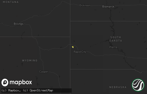
Hail Map in South Dakota on July 28, 2020
The weather event in South Dakota on July 28, 2020 includes Hail and Wind maps. 15 states and 208 cities were impacted and suffered possible damage. The total estimated number of properties impacted is 16.

Hail
Wind
16
Estimated number of impacted properties by a 1.00" hail or larger0
Estimated number of impacted properties by a 1.75" hail or larger0
Estimated number of impacted properties by a 2.50" hail or largerStorm reports in South Dakota
South Dakota
| Date | Description |
|---|---|
| 07/28/20203:06 AM CDT | At 806 PM CDT, a severe thunderstorm was located near Meckling, or 11 miles east of Yankton, moving east at 10 mph. HAZARD...60 mph wind gusts and quarter size hail. SOURCE...Radar indicated. IMPACT...Hail damage to vehicles is expected. Expect wind damage to roofs, siding, and trees. This severe thunderstorm will be near... Meckling around 845 PM CDT.Other locations impacted by this severe thunderstorm includeGayville. |
| 07/27/20208:06 PM CDT | Report via social media. Large tree limbs down on east side of town. |
| 07/27/20208:03 PM CDT | Report via social media. One tree toppled and several large branches down. |
| 07/27/20207:20 PM CDT | Report of trees down north of elk point. Report from social media... Time estimated by radar. |
All States Impacted by Hail Map on July 28, 2020
Cities Impacted by Hail Map on July 28, 2020
- Chemult, OR
- Idleyld Park, OR
- Rocky Mount, NC
- Vermillion, SD
- Appomattox, VA
- Spout Spring, VA
- Sheboygan, WI
- Glenbeulah, WI
- Sheboygan Falls, WI
- Plymouth, WI
- Oostburg, WI
- Waldo, WI
- Kohler, WI
- Rosendale, WI
- Oshkosh, WI
- Van Dyne, WI
- Eden, WI
- Eldorado, WI
- Pickett, WI
- Fond Du Lac, WI
- Berlin, WI
- Ripon, WI
- Redgranite, WI
- Omro, WI
- Elkhart Lake, WI
- Mount Calvary, WI
- Malone, WI
- Saint Cloud, WI
- Jarales, NM
- Hayes, SD
- Elm City, NC
- Pinetops, NC
- Wilson, NC
- Macclesfield, NC
- Burbank, SD
- Lewiston Woodville, NC
- Windsor, NC
- New Underwood, SD
- Hayden, CO
- Clayton, NM
- Adams Run, SC
- Floydada, TX
- Plainview, TX
- Lockney, TX
- Forsyth, MT
- Owanka, SD
- Wasta, SD
- Pierre, SD
- Virginia Beach, VA
- Rapid City, SD
- Tarboro, NC
- Ridgeville, SC
- Roseboro, NC
- Salemburg, NC
- Clinton, NC
- Hart, TX
- Fort Pierre, SD
- Montrose, CO
- Olathe, CO
- Louisa, VA
- Kents Store, VA
- Bosque, NM
- Adrian, TX
- Godwin, NC
- Hill City, SD
- Blunt, SD
- New Bern, NC
- Chocowinity, NC
- Grimesland, NC
- Grantsboro, NC
- Round O, SC
- Saint George, SC
- Johnsonville, SC
- Waverly, VA
- Vanceboro, NC
- Trinidad, CO
- Ahoskie, NC
- Laguna, NM
- Nazareth, TX
- Dimmitt, TX
- Nara Visa, NM
- Cottageville, SC
- Elk Point, SD
- Black Hawk, SD
- Pampa, TX
- Magdalena, NM
- Supply, NC
- Wendell, NC
- Hermosa, SD
- Kenly, NC
- Lucama, NC
- Belgium, WI
- Zebulon, NC
- Smithfield, UT
- Holly Springs, NC
- New Hill, NC
- Wallace, NC
- Port Washington, WI
- Wall, SD
- Harrold, SD
- Bumpass, VA
- Mineral, VA
- Saint Leonard, MD
- Edward, NC
- Vass, NC
- Newton Grove, NC
- Autryville, NC
- Wade, NC
- Tabor City, NC
- Piedmont, SD
- Hobgood, NC
- Ernul, NC
- Sunray, TX
- Harmony, NC
- Olin, NC
- Laketown, UT
- Cascade, WI
- Adell, WI
- Campbellsport, WI
- Arapahoe, NC
- Oriental, NC
- Merritt, NC
- Wilmington, NC
- Branchville, SC
- Fort Bragg, NC
- Whiteville, NC
- Charleston Afb, SC
- Charleston, SC
- North Charleston, SC
- Scenic, SD
- Logan, UT
- Vernon Hill, VA
- Keeling, VA
- Spring Grove, VA
- Fountain, NC
- Stantonsburg, NC
- Skipwith, VA
- Reevesville, SC
- Highmore, SD
- Maurice, IA
- Ruther Glen, VA
- Apex, NC
- Hollywood, MD
- Bethel, NC
- Bowman, SC
- Selma, NC
- Walterboro, SC
- Otter, MT
- Chilton, WI
- New Holstein, WI
- Lebanon, CT
- Bonesteel, SD
- Dameron, MD
- Java, VA
- Raleigh, NC
- Wake Forest, NC
- Rolesville, NC
- Knightdale, NC
- Troy, VA
- Grifton, NC
- Windsor, VA
- Zuni, VA
- Castalia, NC
- Pinewood, SC
- Cleveland, WI
- Caputa, SD
- Rincon, GA
- Leland, NC
- Lake Waccamaw, NC
- Bolton, NC
- Sparta, GA
- Newell, SD
- Dalhart, TX
- Church Creek, MD
- North Wilkesboro, NC
- Richlands, NC
- Chinquapin, NC
- Manning, SC
- Willard, NC
- Ruffin, SC
- Chatsworth, IA
- Akron, IA
- Hawarden, IA
- Alcester, SD
- Gloucester, VA
- Fayetteville, NC
- Fuquay Varina, NC
- Denmark, SC
- Saint Matthews, SC
- Goose Creek, SC
- Hanahan, SC
- Snowville, UT
- Wessington Springs, SD
- Suffolk, VA
- Stuart, VA
- Westfield, NC
- Concord, VA
- Smoaks, SC
- Beulaville, NC
- Rose Hill, NC
- Garfield, GA
- Falfurrias, TX
- Fowler, CO
- Mount Airy, NC
- Burgaw, NC
- Asheboro, NC
- Broadus, MT
- Linden, NC


