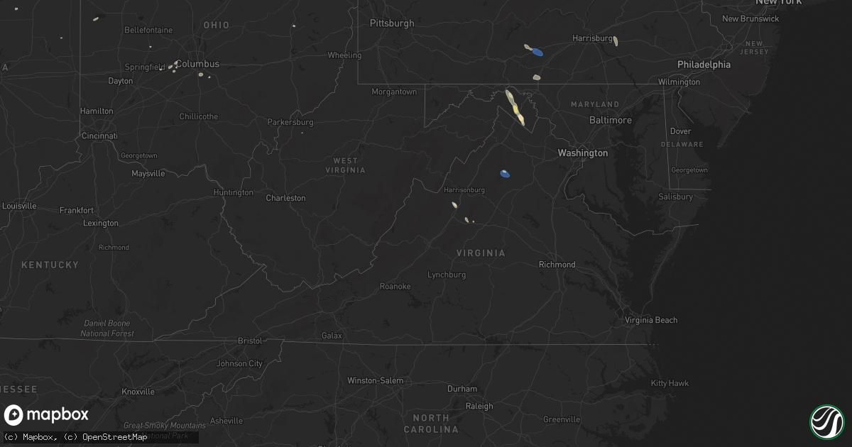
Hail Map in Virginia on July 26, 2025
Get this storm
July 26 map
$229
one time, instant access
Download today. No call, no setup
Keep the $229
Bought the map and want the full workflow? Apply the entire $229 to a subscription within 7 days. None of it is wasted.
Every map, not just this one
This buys you this map. Subscription and you get every map we run, in the markets you choose from a few cities to whole states to nationwide. Plus real-time alerts the moment a storm fires.
Contact data
Name, contact info, occupancy, even credit band for addresses in the footprint. You go from where it hit to who to call.
Become the source they trust
Unlimited branding weather history reports on demand. You already have the documented answer ready for the property owner, and you are the one who showed up with it.
Property data and RoofTrace estimates
Pull up any address you have got, its value and the exact code rules for that jurisdiction, straight from One Click Code. Then RoofTrace estimates the squares, pitch, and roof value, priced the way you price.
Storm reports in Virginia
Virginia
| Date | Description |
|---|---|
| 07/26/20256:59 PM CDT | Two trees down in rockfish gap. |
| 07/26/20256:43 PM CDT | Trees and wires blew down in the 700 block of dooms crossing road. |
| 07/26/20255:30 PM CDT | Trees blew down on va-731 natural chimney road. |
| 07/26/20254:24 PM CDT | Tree down onto roadway on reva rd. |
| 07/26/20253:44 PM CDT | Several trees down in sperryville |
| 07/26/20253:44 PM CDT | Several trees down in sperryville |
| 07/26/20253:44 PM CDT | Tree down near the intersection of sperryville pike and f.t valley road. |
All States Impacted by Hail Map on July 26, 2025
Cities Impacted by Hail Map on July 26, 2025
- Epping, ND
- Ray, ND
- White Earth, ND
- Tioga, ND
- Stanley, ND
- New Town, ND
- Ross, ND
- Watford City, ND
- Middletown, IL
- Elkhart, IL
- New Holland, IL
- Lincoln, IL
- Stanford, IL
- Atlanta, IL
- Delavan, IL
- Minier, IL
- Hartsburg, IL
- Emden, IL
- Armington, IL
- McLean, IL
- Bloomington, IL
- Danvers, IL
- Clinton, IL
- Beason, IL
- Shirley, IL
- Kenney, IL
- Mount Pulaski, IL
- Waynesville, IL
- Chestnut, IL
- Lawndale, IL
- Heyworth, IL
- Wapella, IL
- Lexington, IL
- Towanda, IL
- Normal, IL
- Hudson, IL
- Ellsworth, IL
- Downs, IL
- Le Roy, IL
- Cooksville, IL
- Clitherall, MN
- Vining, MN
- Battle Lake, MN
- Henning, MN
- Herman, MN
- Donnelly, MN
- Brandon, MN
- Evansville, MN
- Garfield, MN
- Alexandria, MN
- Shade Gap, PA
- Neelyton, PA
- Orbisonia, PA
- Three Springs, PA
- Berkeley Springs, WV
- Bowling Green, MO
- Willow Hill, PA
- Spring Run, PA
- Orrstown, PA
- Fannettsburg, PA
- Upperstrasburg, PA
- Pleasant Hall, PA
- Louisiana, MO
- Burnt Cabins, PA
- Knox, IN
- North Judson, IN
- Monterey, IN
- Ora, IN
- Hedgesville, WV
- Rensselaer, IN
- Harrisonville, MO
- Peculiar, MO
- Bennington, OK
- Martinsburg, WV
- Gerrardstown, WV
- Inwood, WV
- Walker, WV
- Elizabeth, WV
- Rochester, IN
- Kewanna, IN
- Lockney, TX
- Bunker Hill, WV
- Kearneysville, WV
- Fort Wayne, IN
- Summit Point, WV
- Maple Hill, NC
- Charles Town, WV
- South Vienna, OH
- South Charleston, OH
- Coldwater, OH
- Matador, TX
- Montezuma, OH
- Celina, OH
- Vega, TX
- Huntington, IN
- Columbia City, IN
- Sperryville, VA
- Silas, AL
- Saint Henry, OH
- Roanoke, IN
- Woodville, VA
- Childress, TX
- Lyman, NE
- Grand Marais, MN
- Paola, KS
- Saint Francis, SD
- Walsh, CO
- Silverton, TX
- Floydada, TX
- Converse, IN
- Marion, IN
- Faunsdale, AL
- Port Hope, MI
- Hay Springs, NE
- Clarence, MO
- Kinde, MI
- Hereford, TX
- Linden, AL
- Rushville, NE
- Mcadoo, TX
- Campo, CO
- Hemingford, NE
- Martinsville, IN
- Monrovia, IN
- Quincy, IN
- Stilesville, IN
- Clayton, IN
- Mooresville, IN
- Corn, OK
- Divernon, IL
- Glenarm, IL
- Auburn, IL
- Urbana, OH
- Two Dot, MT
- Carter, MT
- Brady, MT
- Mount Solon, VA
- Butler, PA
- Valencia, PA
- Gravois Mills, MO
- Millry, AL
- Mount Sidney, VA
- Staunton, VA
- Bridgeport, NE
- Bayard, NE
- Eutaw, AL
- Cloverdale, IN
- Mars, PA
- Angora, NE
- Verona, VA
- Weatherford, OK
- Stover, MO
- Edwards, MO
- Versailles, MO
- Fort Pierre, SD
- Hayes, SD
- Eagle Butte, SD
- Richfield, KS
- Hobson, MT
- Geyser, MT
- Ryegate, MT
- Haxtun, CO
- Owingsville, KY
- Gordon, NE
- Merriman, NE
- Saco, MT
- Hinsdale, MT
- Nelson, MO
- Colony, OK
- Alliance, NE
- Martin, SD
- Rolla, KS
- Shawmut, MT
- Fort Defiance, VA
- Crowell, TX
- Lavina, MT
- Santo, TX
- West Jefferson, OH
- Palo Pinto, TX
- Murphy, ID
- London, OH
- Waynesboro, VA
- Paducah, TX
- Palmyra, PA
- Norris, SD
- Lewistown, MT
- Buffalo, MT
- New Philadelphia, OH
- Ovid, CO
- Glasgow, MT
- Crozet, VA
- Lithopolis, OH
- Canal Winchester, OH
- Groveport, OH
- Roundup, MT
- Columbus, OH
- Lockbourne, OH
- Timber Lake, SD
- Trail City, SD
- Marsing, ID
- Homedale, ID
- Tuthill, SD
- Larslan, MT
- Long Valley, SD
- Hays, MT
- Dodson, MT
- Malta, MT
- Nashua, MT
- Fleming, CO
- Midland, SD
- Quanah, TX
- Turner, MT
- Hogeland, MT
- Hulett, WY
- Broadwater, NE
- Marshall, MO
- El Dorado Springs, MO
- Moore, MT
- Annville, PA
- Lebanon, PA
- Manheim, PA
- Elizabethtown, PA
- White River, SD
- Wood, SD
- Elkhart, KS
- Hilger, MT
- Gettysburg, SD
- Agar, SD
- Selby, SD
- Lebanon, SD
- Hoven, SD
- Bowdle, SD
- Java, SD
- Tolstoy, SD
- Onaka, SD
- Roscoe, SD
- Loring, MT
- Winifred, MT
- Chinook, MT
- Nyssa, OR
- Roy, MT
- Ridgeville, IN
- Ellsworth, NE
- Cascade, MT
- Lloyd, MT
- Ontario, OR
- Sedgwick, CO
- Onida, SD
- Farwell, MN
- Starbuck, MN
- Winnett, MT
- Brusett, MT
- Mosby, MT
- Vale, OR
- Whitewater, MT
- Zortman, MT
- Jordan, MT
- Fort Peck, MT
- Draper, SD
- Okaton, SD
- Murdo, SD
- Kadoka, SD
- Belvidere, SD
- Fort Yates, ND
- Harlem, MT
- Oshkosh, NE
- Selfridge, ND
- Mullen, NE
- Greencastle, PA
- Midland, TX
- Gardendale, TX
- Odessa, TX
- Goldsmith, TX
- Highmore, SD
- Seneca, SD
- Holabird, SD
- Solen, ND
- Wishek, ND
- Linton, ND
- Stanton, TX
- Ashley, ND
- Waynesboro, PA
- Cannon Ball, ND
- Sand Springs, MT
- Orient, SD
- Hyannis, NE
- Springfield, OH
- Farmersville, IL
- Ree Heights, SD
- Lehr, ND
- Hazelton, ND
- Mandan, ND
- Sabillasville, MD
- Cascade, MD
- Smithsburg, MD
- Hagerstown, MD
- Napoleon, ND
- Cohagen, MT
- Tulare, SD
- Redfield, SD
- Faulkton, SD
- Miller, SD
- Rockham, SD
- Saint Lawrence, SD
- Wessington, SD
- Harrold, SD
- Blunt, SD
- Pierre, SD
- Northville, SD
- Cresbard, SD
- Mansfield, SD
- Ipswich, SD
- Ashton, SD
- Hosmer, SD
- Whitman, NE
- Elsberry, MO
- Silex, MO
- Hammond, MT
- Boyes, MT
- Sturgis, SD
- Moffit, ND
- Braddock, ND
- Howes, SD
- Piedmont, SD
- Enning, SD
- New Underwood, SD
- Tappen, ND
- Streeter, ND
- Gackle, ND
- Saint Anthony, ND
- Menoken, ND
- Bismarck, ND
- Driscoll, ND
- Sterling, ND
- Union Center, SD
- Faith, SD
- Julesburg, CO
- Steele, ND
- Circle, MT
- Brockway, MT
- Frazer, MT
- Wolf Point, MT
- White Owl, SD
- Aberdeen, SD
- Mellette, SD
- Warner, SD
- Stratford, SD
- Turton, SD
- Brentford, SD
- Hitchcock, SD
- Medina, ND
- Dawson, ND
- Wing, ND
- Tuttle, ND
- Robinson, ND
- Newell, SD
- Vale, SD
- Cleveland, ND
- Woodworth, ND
- Buchanan, ND
- Venango, NE
- Pingree, ND
- Dupree, SD
- Meadow, SD
- Richey, MT
- Poplar, MT
- Vida, MT
- Bloomfield, MT
- Lambert, MT
- Lindsay, MT
- Bowdon, ND
- Wimbledon, ND
- Spiritwood, ND
- Courtenay, ND
- Pettibone, ND
- Jamestown, ND
- Kensal, ND
- Carrington, ND
- Sykeston, ND
- Valley City, ND
- Shields, ND
- Flasher, ND
- Seneca, NE
- Thedford, NE
- Anselmo, NE
- Oriska, ND
- Rogers, ND
- Dazey, ND
- Stapleton, NE
- Brockton, MT
- Sidney, MT
- Fairview, MT
- Froid, MT
- Culbertson, MT
- Bainville, MT
- Cathay, ND
- New Rockford, ND
- Sheyenne, ND
- Glenfield, ND
- Cooperstown, ND
- Mchenry, ND
- Grace City, ND
- Binford, ND
- Sutton, ND
- Hannaford, ND
- Luverne, ND
- Halsey, NE
- Merna, NE
- Arnold, NE
- Ludlow, SD
- Willow City, ND
- Towner, ND
- Bantry, ND
- Jessie, ND
- Aneta, ND
- Crary, ND
- Warwick, ND
- Mcville, ND
- Michigan, ND
- Lakota, ND
- Tolna, ND
- Oberon, ND
- Saint Michael, ND
- Pekin, ND
- Northwood, ND
- Finley, ND
- Petersburg, ND
- Clifford, ND
- Galesburg, ND
- Portland, ND
- Blanchard, ND
- Hope, ND
- Sharon, ND
- Hatton, ND
- Homestead, MT
- Medicine Lake, MT
- Dagmar, MT
- Williston, ND
- Cartwright, ND
- Bowman, ND
- Annada, MO
- Winchester, IN
- Scranton, ND
- Broken Bow, NE
- Bottineau, ND
- Fairfield, ND
- Amidon, ND
- New England, ND
- Donnybrook, ND
- Powers Lake, ND
- Kenmare, ND
- Alexander, ND
- Grassy Butte, ND
- Medora, ND
- Grenora, ND
- Belfield, ND
- Mohall, ND
- Lefor, ND
- Gladstone, ND
- Dickinson, ND
- Regent, ND
- Crookston, MN
- Richardton, ND
- Taylor, ND
- Maxbass, ND
- Manning, ND
- South Heart, ND
- Eolia, MO
- Mott, ND
- Zahl, ND
- Alamo, ND
- Ambrose, ND
- Trenton, ND
- Crosby, ND
- Mandaree, ND
- Arnegard, ND
- Keene, ND
- Wildrose, ND
- Killdeer, ND
- Sargent, NE
- Red Lake Falls, MN
- Mentor, MN
- Dunn Center, ND
- Halliday, ND
- Hettinger, ND
- Reeder, ND
- Hebron, ND
- Glen Ullin, ND
- New Leipzig, ND
- Niagara, ND
- Larimore, ND
- Emerado, ND
- Mayville, ND
- Arvilla, ND
- Gilby, ND
- Mekinock, ND
- Thompson, ND
- Grand Forks Afb, ND
- Manvel, ND
- Reynolds, ND
- East Grand Forks, MN
- Oslo, MN
- Grand Forks, ND
- Buxton, ND
- Warren, MN
- Fisher, MN
- Euclid, MN
- Nielsville, MN
- Beltrami, MN
- Shelly, MN
- Cummings, ND
- Caledonia, ND
- Climax, MN
- Ada, MN
- Hillsboro, ND
- Fertile, MN
- Thief River Falls, MN
- Saint Hilaire, MN
- Plummer, MN
- Brooks, MN
- Mcintosh, MN
- Fosston, MN
- Bejou, MN
- Winger, MN
- Gary, MN
- Erskine, MN
- Oklee, MN
- McIntosh, SD
- Isabel, SD
- McLaughlin, SD
- Little Eagle, SD
- Glencross, SD
- Wakpala, SD
- Vivian, SD
- Presho, SD
- Philip, SD
- Milesville, SD
- Cherry Creek, SD
- Trail, MN
- Clearbrook, MN
- Gully, MN
- Gonvick, MN
- Mahnomen, MN
- Bagley, MN
- Lengby, MN
- Palermo, ND
- Beulah, ND
- New Salem, ND
- Almont, ND
- Zap, ND
- Roseglen, ND
- Dodge, ND
- Golden Valley, ND
- Columbus, ND
- Noonan, ND
- Mcgregor, ND
- Lignite, ND
- Bowbells, ND
- Parshall, ND
- Berthold, ND
- Plaza, ND
- Garrison, ND
- Ryder, ND
- Hazen, ND
- Ogema, MN
- Leonard, MN
- Des Lacs, ND
- Burlington, ND
- Makoti, ND
- Surrey, ND
- Shevlin, MN
- Minot, ND
- Norwich, ND
- Laporte, MN
- Solway, MN
- Park Rapids, MN
- Granville, ND
- Deering, ND
- Glenburn, ND
- Bemidji, MN
- Lake George, MN
- Cass Lake, MN
- Ponsford, MN
- Akeley, MN
- Longville, MN
- Nevis, MN
- Walker, MN
- Pennington, MN
- Bena, MN
- Deer River, MN
- Minot Afb, ND
- Carpio, ND
- Douglas, ND
- Tolley, ND
- Lansford, ND
- Mercer, ND
- Benedict, ND
- Wolford, ND
- Westhope, ND
- Rugby, ND
- Turtle Lake, ND
- Martin, ND
- Underwood, ND
- Butte, ND
- Goodrich, ND
- York, ND
- Denhoff, ND
- Balta, ND
- Rolette, ND
- Velva, ND
- Coleharbor, ND
- Souris, ND
- Stanton, ND
- Newburg, ND
- Knox, ND
- Anamoose, ND
- Upham, ND
- Ruso, ND
- Fessenden, ND
- Mcclusky, ND
- Voltaire, ND
- Kramer, ND
- Riverdale, ND
- Balfour, ND
- Sawyer, ND
- Esmond, ND
- Max, ND
- Karlsruhe, ND
- Maddock, ND
- Harvey, ND
- Hurdsfield, ND
- Chaseley, ND
- Drake, ND
- Blackduck, MN
- Federal Dam, MN
- Max, MN
- Talmoon, MN
- Remer, MN
- Cohasset, MN
- Grand Rapids, MN
- Marcell, MN
- Bigfork, MN
- Minnewaukan, ND
- Cando, ND
- Mylo, ND
- Bisbee, ND
- Agate, ND
- Leeds, ND
- Motley, MN
- Staples, MN
- Nashwauk, MN
- Goodland, MN
- Calumet, MN
- Coleraine, MN
- Hibbing, MN
- Pengilly, MN
- Bovey, MN
- Marble, MN
- Taconite, MN
- Keewatin, MN
- Cook, MN
- Side Lake, MN
- Chisholm, MN
- Pequot Lakes, MN
- Nisswa, MN
- Pine River, MN


