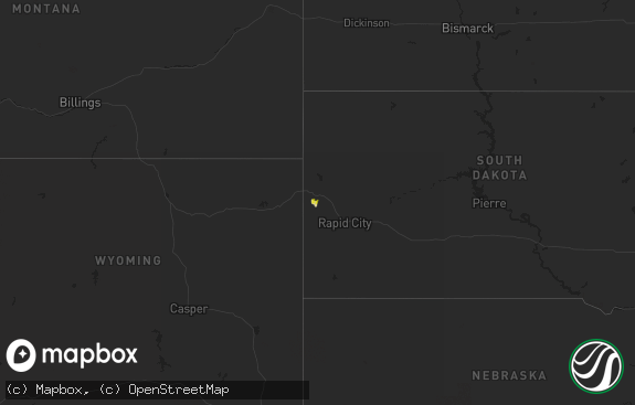
Hail Map in South Dakota on July 26, 2019
The weather event in South Dakota on July 26, 2019 includes Hail and Wind maps. 11 states and 196 cities were impacted and suffered possible damage. The total estimated number of properties impacted is 212.

Hail
Wind
212
Estimated number of impacted properties by a 1.00" hail or larger0
Estimated number of impacted properties by a 1.75" hail or larger0
Estimated number of impacted properties by a 2.50" hail or largerStorm reports in South Dakota
South Dakota
| Date | Description |
|---|---|
| 07/26/20197:54 AM CDT | A local report indicates 1.00 inch wind near 2 WSW SWETT |
| 07/26/20194:07 AM CDT | At 906 PM CDT, a severe thunderstorm was located 7 miles northeast of Verdigre, or 23 miles southwest of Lewis And Clark State Recreation Area, moving east at 25 mph. HAZARD...60 mph wind gusts and quarter size hail. SOURCE...Radar indicated. IMPACT...Hail damage to vehicles is expected. Expect wind damage to roofs, siding, and trees. Locations impacted include... Bloomfield, Crofton, Center, Lewis And Clark State Recreation Area and Lindy. |
| 07/26/20193:54 AM CDT | At 853 AM CDT, a severe thunderstorm was located 8 miles southeast of Cedar Butte, or 10 miles southwest of White River, moving east at 30 mph. HAZARD...Half dollar size hail. SOURCE...Radar indicated. IMPACT...Damage to vehicles is expected. Locations impacted include... White River. |
| 07/26/20193:15 AM CDT | At 815 AM CDT, a severe thunderstorm was located over Parmelee, or 19 miles west of Mission, moving southeast at 25 mph. HAZARD...Quarter size hail. SOURCE...Radar indicated. IMPACT...Damage to vehicles is expected. Locations impacted include... Mission, Rosebud, Saint Francis, Parmelee and Spring Creek. |
| 07/26/20192:47 AM CDT | At 747 AM CDT, a severe thunderstorm was located 3 miles northwest of Parmelee, or 20 miles west of Mission, moving southeast at 15 mph. HAZARD...Quarter size hail. SOURCE...Radar indicated. IMPACT...Damage to vehicles is expected. Locations impacted include... Rosebud, Saint Francis and Parmelee. |
All States Impacted by Hail Map on July 26, 2019
Cities Impacted by Hail Map on July 26, 2019
- Duluth, MN
- Spencer, NE
- Allen, SD
- Martin, SD
- Ashland, WI
- Bayfield, WI
- Washburn, WI
- Chisholm, MN
- Emmons, MN
- Northwood, IA
- Long Prairie, MN
- Swanville, MN
- Parmelee, SD
- Torrington, WY
- Oneill, NE
- Cedar, MI
- Traverse City, MI
- Cook, MN
- Tower, MN
- Valentine, NE
- Aurora, MN
- Gilbert, MN
- Makinen, MN
- Waterville, MN
- Le Center, MN
- Kilkenny, MN
- Montgomery, MN
- Saint Paul, MN
- Minneapolis, MN
- Circle Pines, MN
- Lakeland, MN
- Big Lake, MN
- Zimmerman, MN
- Hugo, MN
- Andover, MN
- Stillwater, MN
- Clear Lake, MN
- Sartell, MN
- Clearwater, MN
- Avon, MN
- Saint Joseph, MN
- Lake Elmo, MN
- Elk River, MN
- Willernie, MN
- Dayton, MN
- Becker, MN
- Anoka, MN
- Sauk Rapids, MN
- Waite Park, MN
- Saint Cloud, MN
- Rogers, MN
- Hudson, WI
- Oak Park, MN
- Princeton, MN
- Foreston, MN
- Milaca, MN
- Sandstone, MN
- Atkinson, NE
- Chappell, NE
- Sedgwick, CO
- Lodgepole, NE
- Two Harbors, MN
- Mondovi, WI
- Durand, WI
- Tuthill, SD
- Garrett, WY
- Waseca, MN
- Medicine Bow, WY
- Verdigre, NE
- Angora, MN
- West Concord, MN
- La Pointe, WI
- Merriman, NE
- Whitman, NE
- Foley, MN
- Johnstown, NE
- Long Valley, SD
- Norris, SD
- Mountain Iron, MN
- Wood Lake, NE
- Orr, MN
- Morristown, MN
- Faribault, MN
- Le Sueur, MN
- Menomonie, WI
- Spring Valley, WI
- Woodville, WI
- Elmwood, WI
- Owatonna, MN
- Hope, MN
- Ellendale, MN
- Janesville, MN
- Burtrum, MN
- Darfur, MN
- Saint James, MN
- Wheatland, WY
- Bosler, WY
- Ellsworth, NE
- Crookston, NE
- Kilgore, NE
- Saint Francis, SD
- Nenzel, NE
- Cody, NE
- Ashby, NE
- Bingham, NE
- Cornucopia, WI
- Lewellen, NE
- Pease, MN
- Brimson, MN
- Isabella, MN
- Marine On Saint Croix, MN
- New Richland, MN
- Porcupine, SD
- White River, SD
- Lake Leelanau, MI
- Ledyard, IA
- Douglas, AZ
- Isanti, MN
- Cambridge, MN
- Winnetoon, NE
- Center, NE
- Bloomfield, NE
- Page, NE
- Hartville, WY
- Champlin, MN
- Cold Spring, MN
- Albany, MN
- Afton, MN
- Bayport, MN
- Chugwater, WY
- Cheyenne, WY
- Bristow, NE
- Cushing, MN
- Browerville, MN
- Somerset, WI
- Morrill, NE
- Oshkosh, NE
- Big Falls, MN
- Winner, SD
- Mission, SD
- Yoder, WY
- Fort Laramie, WY
- Little Falls, MN
- Royalton, MN
- Iron, MN
- Eveleth, MN
- Herbster, WI
- Eleva, WI
- Kinney, MN
- Virginia, MN
- Guernsey, WY
- Boca Raton, FL
- Wanblee, SD
- Roberts, WI
- Fellsmere, FL
- Dennison, MN
- Baldwin, WI
- Wilson, WI
- Eau Galle, WI
- Forest Lake, MN
- Glenville, MN
- Kenyon, MN
- Magdalena, NM
- Rice, MN
- New Richmond, WI
- Babbitt, MN
- Albert Lea, MN
- Hibbing, MN
- Leupp, AZ
- Dundas, MN
- Northfield, MN
- Silver Bay, MN
- Effie, MN
- Springerville, AZ
- Maiden Rock, WI
- Ely, MN
- Houlton, WI
- Pompano Beach, FL
- Butterfield, MN
- Arkansaw, WI
- Hammond, WI
- Strum, WI
- Eau Claire, WI
- River Falls, WI
- Glendo, WY
- Biwabik, MN
- Buffalo Center, IA
- Alden, MN
- Jay Em, WY
- Holdingford, MN
- Plum City, WI
- Mims, FL
- Lonsdale, MN
- Arthur, NE
- Niobrara, NE
- Orchard, NE


