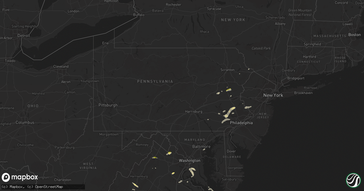
Hail Map in Pennsylvania on July 25, 2023
Get this storm
July 25 map
$229
one time, instant access
Download today. No call, no setup
Keep the $229
Bought the map and want the full workflow? Apply the entire $229 to a subscription within 7 days. None of it is wasted.
Every map, not just this one
This buys you this map. Subscription and you get every map we run, in the markets you choose from a few cities to whole states to nationwide. Plus real-time alerts the moment a storm fires.
Contact data
Name, contact info, occupancy, even credit band for addresses in the footprint. You go from where it hit to who to call.
Become the source they trust
Unlimited branding weather history reports on demand. You already have the documented answer ready for the property owner, and you are the one who showed up with it.
Property data and RoofTrace estimates
Pull up any address you have got, its value and the exact code rules for that jurisdiction, straight from One Click Code. Then RoofTrace estimates the squares, pitch, and roof value, priced the way you price.
Storm reports in Pennsylvania
Pennsylvania
| Date | Description |
|---|---|
| 07/25/20232:22 PM CDT | Reports of several trees down on taylor road between downingtown and exton. |
| 07/25/202312:48 PM CDT | Trees down at quaker alley and n 6th street in stroudsburg. Time estimated from radar. |
| 07/25/202312:35 PM CDT | Trees down at hamilton elementary school in hamilton township. Time estimated from radar. |
| 07/25/202312:35 PM CDT | Trees down at twin pine and running valley roads in jackson township. Time estimated from radar. |
| 07/25/202312:35 PM CDT | Trees down along route 209 in hamilton township. Time estimated from radar. |
| 07/25/202312:27 PM CDT | Trees down at kennel and mcilhaney roads in chestnuthill township. Time estimated from radar. |
| 07/25/202312:27 PM CDT | Report from mping: trees uprooted or snapped; roof blown off. Time estimated from radar. |
| 07/25/202312:00 PM CDT | Driver observed 1 inch hail at mile marker 77 on i-476/pa turnpike northeast extension. |
| 07/25/202311:58 AM CDT | Tree down on wires in franklin township. Time estimated from radar. |
| 07/25/202311:40 AM CDT | Wires down with brush on fire near the intersection of bethlehem pike/rte 309 and rich hill road. Time estimated from radar. |
| 07/25/202311:18 AM CDT | Quarter size hail report near green lane. Power in the area is also out. |
All States Impacted by Hail Map on July 25, 2023
Cities Impacted by Hail Map on July 25, 2023
- Pennsburg, PA
- Green Lane, PA
- Lehighton, PA
- Kunkletown, PA
- Tamaqua, PA
- Shohola, PA
- Narvon, PA
- Mohnton, PA
- Perkiomenville, PA
- Sellersville, PA
- Harleysville, PA
- Telford, PA
- Douglassville, PA
- Birdsboro, PA
- Frederick, PA
- Gilbertsville, PA
- Quakertown, PA
- Palmerton, PA
- Curtis Bay, MD
- Sparrows Point, MD
- Pottstown, PA
- Royersford, PA
- Spring City, PA
- Phoenixville, PA
- Schwenksville, PA
- Chester Springs, PA
- Tuscarora, PA
- Mary D, PA
- Brockton, PA
- Coplay, PA
- Whitehall, PA
- Northampton, PA
- Broadview Heights, OH
- Brecksville, OH
- Richfield, OH
- Ramah, CO
- Calhan, CO
- Pueblo, CO
- Brant Lake, NY
- Philadelphia, TN
- Sweetwater, TN
- Corryton, TN
- Osnabrock, ND
- Nekoma, ND
- Milton, ND
- Fairdale, ND
- Owensboro, KY
- Utica, KY
- Stockton, NJ
- Frenchtown, NJ
- Eagle River, WI
- Marion, NC
- Dameron, MD
- Smyrna, DE
- Andersonville, TN
- Kerhonkson, NY
- New Hope, PA
- Lambertville, NJ
- Cleveland, GA
- Lancaster, PA
- Harriman, TN
- Kingston, TN
- Ooltewah, TN
- McDonald, TN
- Alcove, NY
- Hannacroix, NY
- Rhinebeck, NY
- Ulster Park, NY
- Staatsburg, NY
- North Royalton, OH
- Scotland, MD
- Bassett, VA
- Collinsville, VA
- Stanleytown, VA
- Cleveland, TN
- Georgetown, TN
- Glenmoore, PA
- Jim Thorpe, PA
- Loxahatchee, FL
- Cornelia, GA
- Zieglerville, PA
- Freehold, NY
- Greenville, NY
- East Durham, NY
- Greene, ME
- Lewiston, ME
- Lebanon, VA
- Gardiner, NY
- Independence, OH
- Elverson, PA
- Downingtown, PA
- Red Hill, PA
- Hilliard, FL
- Bryceville, FL
- Summit Hill, PA
- Clarkesville, GA
- Demorest, GA
- Greentown, PA
- Rochester, NY
- Sturgis, KY
- Morganfield, KY
- Crivitz, WI
- Athelstane, WI
- Oliver Springs, TN
- Vonore, TN
- Madisonville, TN
- Simla, CO
- Auburn, ME
- Castlewood, VA
- Morgantown, PA
- Edinburg, ND
- Alsen, ND
- Maynardville, TN
- Chagrin Falls, OH
- Solon, OH
- Merritt Island, FL
- South Wales, NY
- Strykersville, NY
- Thorndale, PA
- Malvern, PA
- Coatesville, PA
- Exton, PA
- Skillman, NJ
- Hopewell, NJ
- Lankin, ND
- Collegeville, PA
- Oak Ridge, TN
- Knoxville, TN
- Ringoes, NJ
- Doylestown, PA
- Englewood, TN
- Etowah, TN
- Athens, TN
- Erwinna, PA
- New Paltz, NY
- Port Ewen, NY
- Kingston, NY
- Indiantown, FL
- Stuart, FL
- Midland, VA
- Catlett, VA
- Round Hill, VA
- Purcellville, VA
- Burkesville, KY
- Middletown, VA
- Strasburg, VA
- Ree Heights, SD
- Miller, SD
- Hankinson, ND
- Ainsworth, NE
- Wessington, SD
- Saint Lawrence, SD
- Wessington Springs, SD
- Taylor, NE
- Shelbyville, IL
- Tower Hill, IL
- Plankinton, SD
- Woonsocket, SD
- Lovington, IL
- Arthur, IL
- Arcola, IL
- Findlay, IL
- Letcher, SD
- Mount Vernon, SD
- Tuscola, IL
- Hindsboro, IL
- Camargo, IL
- Mitchell, SD
- Wheaton, MN
- Morris, MN
- Dumont, MN
- Donnelly, MN
- Chokio, MN
- Graceville, MN
- Alberta, MN
- Clontarf, MN
- Hancock, MN
- Glenwood, MN
- Benson, MN
- Starbuck, MN
- Murdock, MN
- Kerkhoven, MN
- Sunburg, MN
- Danvers, MN
- Cyrus, MN
- Spicer, MN
- Willmar, MN
- Pennock, MN
- Brooten, MN
- Belgrade, MN
- New London, MN
- Ethan, SD
- Dimock, SD
- Stickney, SD
- Alexandria, SD
- Parkston, SD
- Atwater, MN
- Grove City, MN
- Paynesville, MN
- Eden Valley, MN
- Roscoe, MN
- Newman, IL
- Oakland, IL
- Brocton, IL
- Freeman, SD
- Bridgewater, SD
- Emery, SD
- Litchfield, MN
- Dalton City, IL
- Bethany, IL
- Moweaqua, IL
- Adams, ND
- Pisek, ND
- Grafton, ND
- Park River, ND
- Warren, MN
- Sperryville, VA
- Assumption, IL
- Avondale, CO
- Coleman, WI
- Pound, WI
- Highmore, SD
- La Plata, MD
- Pomfret, MD
- White Plains, MD
- Rosholt, SD
- Luray, VA
- Hatton, ND
- Reynolds, ND
- Thompson, ND
- Northwood, ND
- Front Royal, VA
- Sells, AZ
- Milnor, ND
- Finland, MN
- Waynesboro, VA
- Staunton, VA
- Stuarts Draft, VA
- Argyle, MN
- Goldvein, VA
- Karval, CO
- Long Pine, NE
- Exmore, VA
- Belle Haven, VA
- Sabattus, ME
- Charleston, IL
- Ashmore, IL
- Alvarado, MN
- Sullivan, IL
- King George, VA
- Austin, KY
- Etoile, KY
- Glasgow, KY
- Fountain Run, KY
- Verona, VA
- Minto, ND
- Wray, CO
- Gillett, WI
- Suring, WI
- Oconto Falls, WI
- Lena, WI
- Larkspur, CO
- Colorado Springs, CO
- Lidgerwood, ND
- Porcupine, SD
- Hamilton, VA
- Upperville, VA
- Bluemont, VA
- Bealeton, VA
- Carthage, IL
- Pana, IL
- Hugo, CO
- Hughesville, MD
- Waldorf, MD
- Accokeek, MD
- Brandywine, MD
- Rush, CO
- Lowry, MN
- Metcalf, IL
- Charlotte Hall, MD
- Bryantown, MD
- Faulkner, MD
- Fredericksburg, VA
- Naples, FL
- Grand Canyon, AZ
- Claire City, SD
- Akron, CO
- Miami, AZ
- Sheridan Lake, CO
- Fordville, ND
- Kandiyohi, MN
- Dassel, MN
- Watkins, MN
- Darwin, MN
- Cokato, MN
- Kimball, MN
- South Haven, MN
- Cold Spring, MN
- Richmond, MN
- Annandale, MN
- Silver Lake, MN
- Hutchinson, MN
- Howard Lake, MN
- Viborg, SD
- Clark, SD
- Vienna, SD
- Bryant, SD
- Hazel, SD
- Willow Lake, SD
- Barrett, MN
- Herman, MN
- Hoffman, MN
- Kensington, MN
- Farwell, MN
- Paullina, IA
- Primghar, IA
- Sutherland, IA
- Peterson, IA
- Linn Grove, IA
- Rembrandt, IA
- Sioux Rapids, IA
- Albert City, IA
- Storm Lake, IA
- Newell, IA
- Seymour, IN
- Wentworth, SD
- Quincy, IN
- Martinsville, IN
- Paragon, IN
- Lake Lillian, MN
- Alexandria, MN
- Clewiston, FL
- Hurley, SD
- Hinckley, OH
- Cayuga, ND
- Villard, MN
- Cottage Grove, MN
- Prescott, WI
- Hastings, MN
- Lutsen, MN
- Buffalo, MN
- Mattoon, IL
- Swanton, VT
- Saint Albans, VT
- Inver Grove Heights, MN
- South Saint Paul, MN
- Alcester, SD
- Beresford, SD
- Humboldt, IL
- Redmon, IL
- Kansas, IL
- Paris, IL
- Winona, KS
- Hager City, WI
- Ellsworth, WI
- Carbon, IN
- Reelsville, IN
- Greencastle, IN
- Rosedale, IN
- Brazil, IN
- Parkers Prairie, MN
- Vining, MN
- Freetown, IN
- Centerville, SD
- Colman, SD
- Montrose, MN
- Brownsburg, IN
- Lebanon, IN
- Zionsville, IN
- Indianapolis, IN
- Pittsboro, IN
- Clinton, IN
- Flandreau, SD
- Thief River Falls, MN
- Fairmount, ND
- New Effington, SD
- Magnolia, MN
- Adrian, MN
- Raymond, MN
- Marion, SD
- Euclid, MN
- Red Lake Falls, MN
- Luverne, MN
- Martinsville, IL
- Garretson, SD
- Kenneth, MN
- Jasper, MN
- Terre Haute, IN
- Norcross, MN
- Madison, SD
- Saint Hilaire, MN
- Cloverdale, IN
- Woodland Park, CO
- Dell Rapids, SD
- Blomkest, MN
- Poland, IN
- Bedford, IN
- Norman, IN
- Heltonville, IN
- Tofte, MN
- Hume, IL
- Immokalee, FL
- Sauk Centre, MN
- Grand Portage, MN
- Hovland, MN
- Franktown, VA
- Trent, SD
- Charlestown, IN
- Colby, KS
- Whitestown, IN
- Divide, CO
- Palmer Lake, CO
- New Ross, IN
- Crawfordsville, IN
- Brownton, MN
- Saint Paul, MN
- Livingston, WI
- Maple Lake, MN
- George, IA
- Oxford, WI
- Grand Marsh, WI
- Berlin, WI
- Grand Marais, MN
- Maiden Rock, WI
- Bay City, WI
- Wisconsin Dells, WI
- Neshkoro, WI
- Rosendale, WI
- Green Lake, WI
- Ripon, WI
- Erwin, SD
- Lake Norden, SD
- Gibbon, MN
- Wautoma, WI
- Sheldon, IA
- Friendship, WI
- Larchwood, IA
- Rock Rapids, IA
- Hills, MN
- Egan, SD
- Oakfield, WI
- Waupun, WI
- Mankato, MN
- Fonda, IA
- Pomeroy, IA
- Camp Douglas, WI
- Tomah, WI
- Marathon, IA
- Hartley, IA
- Nicollet, MN
- Courtland, MN
- Garfield, MN
- New Ulm, MN
- Wilton, WI
- Kendall, WI
- Sparta, WI
- Bernard, IA
- Mauston, WI
- Elkton, SD
- Westfield, WI
- Montello, WI
- Buffalo Lake, MN
- Cosmos, MN
- Stewart, MN
- Scales Mound, IL
- East Dubuque, IL
- Hazel Green, WI
- Galena, IL
- Beltrami, MN
- Matheson, CO
- Ashton, IA
- Redgranite, WI
- Sanborn, IA
- Arcadia, WI
- Adams, WI
- Ettrick, WI
- Royal, IA
- Archer, IA
- Laurens, IA
- Battle Lake, MN
- Clitherall, MN
- Henning, MN
- Lyndon Station, WI
- Newport, MN
- Saint Paul Park, MN
- Markesan, WI
- Dalton, WI
- Coeymans Hollow, NY
- Cairo, NY
- Surprise, NY
- Norwalk, WI
- Warrens, WI
- Hayti, SD
- Lancaster, WI
- Fennimore, WI
- Mount Hope, WI
- Fairfax, MN
- Randolph, WI
- Cambria, WI
- Friesland, WI
- Marshall, IL
- Dodge Center, MN
- New Lisbon, WI
- Elroy, WI
- Pickett, WI
- Eldorado, WI
- Brandon, WI
- Sioux Center, IA
- Orange City, IA
- Prinsburg, MN
- Cochrane, WI
- Plum City, WI
- Cascade, IA
- Galesville, WI
- Hustler, WI
- Coloma, WI
- Pemberton, MN
- Saint Clair, MN
- Janesville, MN
- Minnetonka, MN
- Wayzata, MN
- Hopkins, MN
- Rushmore, MN
- Gosport, IN


