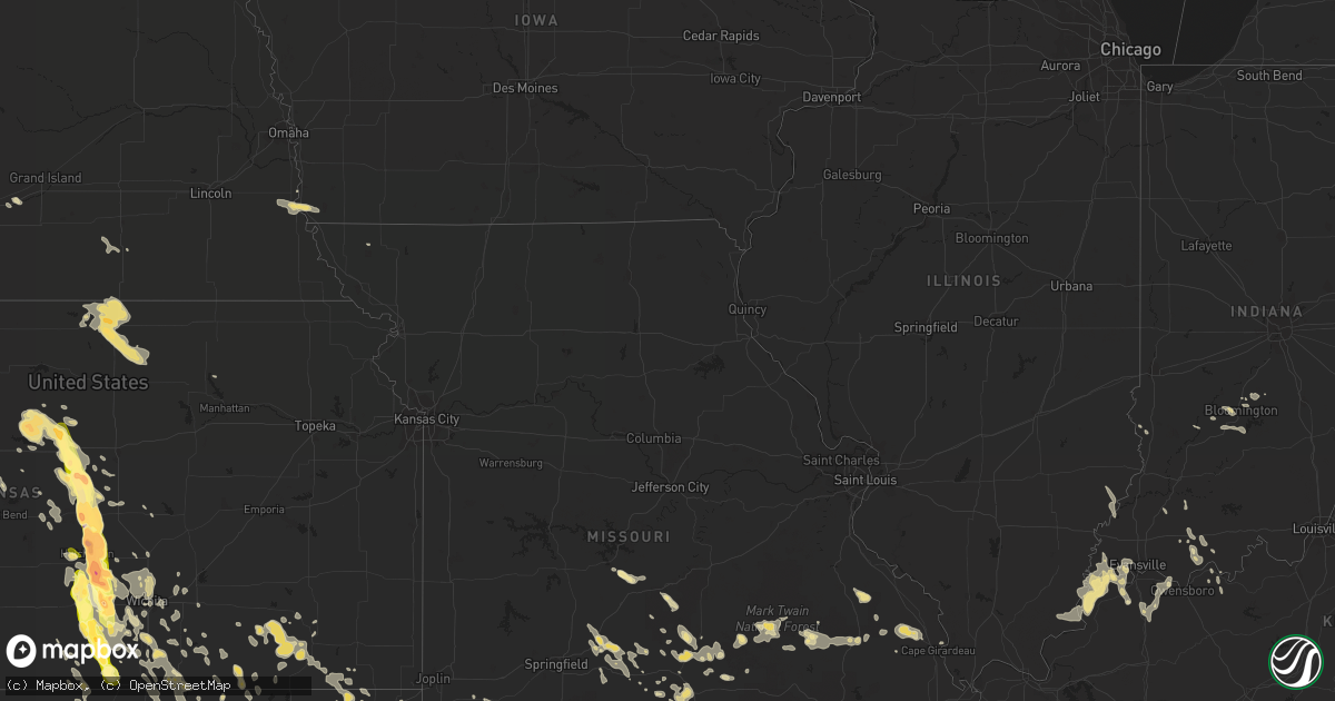
Hail Map in Oklahoma on July 23, 2013
Get this storm
July 23 map
$229
one time, instant access
Download today. No call, no setup
Keep the $229
Bought the map and want the full workflow? Apply the entire $229 to a subscription within 7 days. None of it is wasted.
Every map, not just this one
This buys you this map. Subscription and you get every map we run, in the markets you choose from a few cities to whole states to nationwide. Plus real-time alerts the moment a storm fires.
Contact data
Name, contact info, occupancy, even credit band for addresses in the footprint. You go from where it hit to who to call.
Become the source they trust
Unlimited branding weather history reports on demand. You already have the documented answer ready for the property owner, and you are the one who showed up with it.
Property data and RoofTrace estimates
Pull up any address you have got, its value and the exact code rules for that jurisdiction, straight from One Click Code. Then RoofTrace estimates the squares, pitch, and roof value, priced the way you price.
Storm reports in Oklahoma
Oklahoma
| Date | Description |
|---|---|
| 07/23/20135:20 PM CDT | A local report indicates 60 MPH wind near 2 W CENTRAILIA |
| 07/23/20135:05 PM CDT | A local report indicates 1.00 inch wind near 4 E HUGO |
| 07/23/20134:15 PM CDT | A local report indicates 1.50 inch wind near 2 SE BOSWELL |
| 07/23/20134:10 AM CDT | Delayed report of downed trees and power lines in ardmore. Time estimated from radar. |
| 07/23/20132:55 AM CDT | Scattered wind damage in and around hugo. Some trees down completely...numerous broken limbs. Over 300 customers were without power. A few structures had roof damage. |
| 07/23/20132:25 AM CDT | Several trees down. |
| 07/23/20131:50 AM CDT | Large tree down. |
| 07/23/20131:40 AM CDT | Large tree down. Numerous large limbs down. |
| 07/23/20131:00 AM CDT | Roof blown off porch in longtown. |
| 07/23/201312:56 AM CDT | Numerous trees down. Small outbuildings severely damaged. |
| 07/23/201312:55 AM CDT | Many trees blown down. All around 12 inches in diameter. |
| 07/23/201312:54 AM CDT | Sustained wind of 54 mph with gust to 77 mph at the courthouse in eufaula. |
| 07/23/201312:52 AM CDT | Large tree limbs down in and near pawnee. |
| 07/23/201312:52 AM CDT | Estimated wind gust to 76 mph at courthouse in eufaula. City without power. |
| 07/23/201312:24 AM CDT | Several trees and power lines down |
| 07/23/201312:15 AM CDT | Trees down onto mobile homes near whitehorn cove marina. |
| 07/23/201312:11 AM CDT | Outbuilding overtunred. Section of roof blown off metal shop building. Metal storage building severely damaged. |
| 07/23/201312:06 AM CDT | A tornado tore the roof off of a large metal building...destroyed portions of two wood-framed storage units...damaged numerous homes and businesses...destroyed a travel |
| 07/23/201312:04 AM CDT | Measured thunderstorm wind of 66 mph at the hectorville mesonet. |
| 07/23/201312:00 AM CDT | Large tree limbs down at 11th and memorial. |
| 07/22/201311:59 PM CDT | 9 power poles down on 141 s. And 225 east ave...numerous trees down...some roof damage |
| 07/22/201311:50 PM CDT | Several limbs down at heritage hills golf course. |
| 07/22/201311:45 PM CDT | Numerous large tree limbs down in the cornerstone west addition. |
| 07/22/201311:45 PM CDT | Gust measured by a home weather station near 37th and nogales. |
| 07/22/201311:45 PM CDT | Public estimated 60 to 70 mph thunderstorm winds and torrential rainfall at 37th and jackson in west tulsa. |
| 07/22/201311:45 PM CDT | Large tree limbs down. |
| 07/22/201311:43 PM CDT | Measured wind gust of 60 mph at 121st and peoria. |
| 07/22/201311:42 PM CDT | Measured 76 mph winds at the tulsa international airport. |
| 07/22/201311:40 PM CDT | Several tres uprooted in round mountain area near lake keystone. |
| 07/22/201311:40 PM CDT | Measured thunderstorm wind gust at the tulsa mesonet. |
| 07/22/201311:40 PM CDT | From media at lookout mountain |
| 07/22/201311:40 PM CDT | Numerous large tree limbs and powerlines down along 86th street north around 177th street east. |
| 07/22/201311:34 PM CDT | Thunderstorm winds estimated to 60 mph. 3 inch diameter tree limbs downed. |
| 07/22/201311:30 PM CDT | A couple of trees blown down. Many large limbs broken in other trees around the area. |
| 07/22/201311:25 PM CDT | Awning and roof damage at restaurant. |
| 07/22/201311:04 PM CDT | Measured wind gust of 66 mph at wynona mesonet. |
| 07/22/201310:54 PM CDT | Measured wind gust of 73 mph at the burbank mesonet. |
| 07/22/201310:50 PM CDT | Measured wind gust of 66 mph at the foraker mesonet. |
| 07/22/201310:50 PM CDT | Large tree limbs down. |
| 07/22/201310:50 PM CDT | Measured gust of 58 mph at the burbank mesonet. |
| 07/22/201310:46 PM CDT | A local report indicates 60 MPH wind near PONCA CITY |
| 07/22/201310:34 PM CDT | A local report indicates 62 MPH wind near PONCA CITY |
| 07/22/201310:23 PM CDT | A local report indicates 75 MPH wind near 2 W BLACKWELL |
| 07/22/20139:50 PM CDT | A local report indicates 61 MPH wind near 7 SSW ALVA |
| 07/22/20139:15 PM CDT | One tree blown down and many large limbs near adair and cherokee county line along hwy 62. |
| 07/22/20139:05 PM CDT | A local report indicates 64 MPH wind near 1 SW BUFFALO |
All States Impacted by Hail Map on July 23, 2013
Cities Impacted by Hail Map on July 23, 2013
- Hookstown, PA
- Georgetown, PA
- Meridian, OK
- Guthrie, OK
- Bloomington, IN
- Ola, AR
- Casa, AR
- Dorrance, KS
- Lucas, KS
- Sylvan Grove, KS
- Hay Springs, NE
- Annapolis, MO
- Vienna, GA
- Ravenna, OH
- Rootstown, OH
- Melbourne, AR
- Mountain View, AR
- Buhler, KS
- Hutchinson, KS
- Mount Hope, KS
- Inman, KS
- Haven, KS
- Dongola, IL
- Anna, IL
- Munden, KS
- Belleville, KS
- Wood River, NE
- Hope, AR
- Seymour, MO
- Norwich, KS
- Kingman, KS
- Argonia, KS
- Conway Springs, KS
- Milton, KS
- Danville, KS
- Harper, KS
- Freeport, KS
- Caldwell, KS
- Spivey, KS
- Wellston, OK
- Crescent, OK
- Cleveland, OH
- Lakewood, OH
- Liberty, IN
- Spencer, IN
- Broken Bow, OK
- Lambert, MS
- Clinton, AR
- Spearville, KS
- Hanston, KS
- Jetmore, KS
- Republic, KS
- Webber, KS
- Chadron, NE
- Ashland, KS
- Buffalo, OK
- Claremore, OK
- Chelsea, OK
- West Plains, MO
- Caulfield, MO
- Salineville, OH
- Summitville, OH
- Kensington, OH
- Lansing, MI
- East Lansing, MI
- Fairburn, SD
- Chrisney, IN
- Louisville, OH
- Alliance, OH
- Homeworth, OH
- Paris, OH
- Waynesboro, MS
- Fredericktown, MO
- Marquand, MO
- Bluffton, AR
- Hot Springs National Park, AR
- Scandia, KS
- Hamilton, OH
- Lewellen, NE
- Buffalo Gap, SD
- Shuqualak, MS
- Macon, MS
- Shirley, AR
- Fox, AR
- Dupree, SD
- Henderson, KY
- Corydon, KY
- Isabel, SD
- McLaughlin, SD
- Timber Lake, SD
- McIntosh, SD
- Lakeside, NE
- Ellsworth, NE
- Goshen, OH
- Pleasant Plain, OH
- Fayetteville, OH
- Loveland, OH
- Blanchester, OH
- Maineville, OH
- Morrow, OH
- Hartville, MO
- Marshfield, MO
- Niangua, MO
- Benton, AR
- Alexander, AR
- Traskwood, AR
- Malvern, AR
- Lonsdale, AR
- Paron, AR
- Howard, KS
- Longton, KS
- Fall River, KS
- Elk City, KS
- White River, SD
- Fort Leonard Wood, MO
- Waynesville, MO
- Adair, OK
- Tuthill, SD
- Martin, SD
- Kimbolton, OH
- Newcomerstown, OH
- Caddo Gap, AR
- Cuba, AL
- Alto Pass, IL
- Cobden, IL
- Anthony, KS
- Aliceville, AL
- Pottsville, AR
- Littlefield, AZ
- Independence, KS
- Hattieville, AR
- Solgohachia, AR
- Scotland, AR
- Morrilton, AR
- Jerusalem, AR
- Atkins, AR
- Cleveland, AR
- Black, MO
- Laquey, MO
- Garvin, OK
- Idabel, OK
- Barnsdall, OK
- Pawhuska, OK
- Lyons, KS
- Little River, KS
- Hunter, KS
- Braman, OK
- Newkirk, OK
- Blackwell, OK
- South Haven, KS
- Kenesaw, NE
- Protection, KS
- Ford, KS
- Minneola, KS
- Bucklin, KS
- Aurora, MO
- Monett, MO
- Verona, MO
- Purdy, MO
- Leupp, AZ
- Patton, MO
- Cheney, KS
- Garden Plain, KS
- Lewisville, AR
- Buckner, AR
- Stamps, AR
- Waldo, AR
- West Lafayette, OH
- Coshocton, OH
- Minco, OK
- Partridge, KS
- Abbyville, KS
- Nickerson, KS
- Ponca City, OK
- Rapid City, SD
- Keystone, SD
- Santa Claus, IN
- Lamar, IN
- Coyle, OK
- Saint Francis, SD
- Mount Vernon, IN
- Dennard, AR
- Bushnell, NE
- Harrisburg, NE
- Lesterville, MO
- Haworth, OK
- Foreman, AR
- Saint Joe, AR
- New Leipzig, ND
- Glen Ullin, ND
- Elgin, ND
- Water Valley, MS
- Okaton, SD
- Midland, SD
- Belvidere, SD
- Ivanhoe, TX
- Bonham, TX
- Ravenna, TX
- Pretty Prairie, KS
- Murdock, KS
- Milesville, SD
- Cherry Creek, SD
- Fairview, MO
- Rocky Comfort, MO
- Stella, MO
- Stark City, MO
- Wheaton, MO
- Fresno, OH
- Atlanta, KS
- Lake City, KS
- Oklahoma City, OK
- Edmond, OK
- Willow Springs, MO
- Vanzant, MO
- El Dorado, AR
- Nash, OK
- Kremlin, OK
- Medford, OK
- Pond Creek, OK
- Winfield, KS
- Geuda Springs, KS
- Arkansas City, KS
- Hammondsville, OH
- Avella, PA
- Richmond, OH
- New Cumberland, WV
- Wellsburg, WV
- Weirton, WV
- Bethany, WV
- Toronto, OH
- Irondale, OH
- Steubenville, OH
- Colliers, WV
- Follansbee, WV
- Burgettstown, PA
- Hennessey, OK
- Hoisington, KS
- Hamburg, IA
- Nebraska City, NE
- Percival, IA
- Elk Falls, KS
- Liberty, KS
- Fredonia, KS
- Neodesha, KS
- Sedan, KS
- Wright, KS
- Americus, GA
- Prattville, AL
- Autaugaville, AL
- Selma, AL
- College Corner, OH
- Strang, NE
- Bruning, NE
- Hettinger, ND
- Lemmon, SD
- Marquette, KS
- Boswell, OK
- Jessieville, AR
- Stoutland, MO
- Lebanon, MO
- Camdenton, MO
- Marshall, OK
- Newton, IL
- Cabool, MO
- Houston, MO
- Solo, MO
- Fouke, AR
- Sumner, IL
- Mansfield, MO
- Conway, MO
- Elkland, MO
- Aurora, OH
- Meadow, SD
- Meridian, MS
- Calhoun, KY
- Windom, KS
- Plato, MO
- Milan, KS
- Hermosa, SD
- Parmelee, SD
- Shidler, OK
- Defuniak Springs, FL
- Calico Rock, AR
- Sainte Genevieve, MO
- Farmington, MO
- Summersville, MO
- Hartshorn, MO
- Eminence, MO
- Newalla, OK
- Tecumseh, OK
- Mcloud, OK
- Valley Center, KS
- Belle Plaine, KS
- Wellington, KS
- Peck, KS
- Norman, AR
- Vardaman, MS
- Calhoun City, MS
- Burbank, OK
- Venango, NE
- Huntsville, AR
- Greenwood, MS
- Carrollton, MS
- Hector, AR
- Witts Springs, AR
- Pelsor, AR
- Mount Ida, AR
- Bonnerdale, AR
- Pine Ridge, SD
- Prairie Grove, AR
- West Fork, AR
- Bakersfield, MO
- Gepp, AR
- Fordyce, AR
- Ivan, AR
- Clearwater, KS
- Bunch, OK
- Stilwell, OK
- Wilmore, KS
- Lisman, AL
- Grandin, MO
- Fairfax, OK
- Ralston, OK
- Norfork, AR
- Mountain Home, AR
- Pineville, AR
- Salem, MO
- Hodgen, OK
- Heavener, OK
- Howe, OK
- Winslow, AR
- Altamont, KS
- Yukon, MO
- Wallingford, KY
- Wichita, KS
- Goddard, KS
- Camden, AL
- Bryant, AR
- Bauxite, AR
- Little Rock, AR
- Hill City, SD
- Oglala, SD
- Ozark, AR
- Montreal, MO
- Deatsville, AL
- Lead Hill, AR
- Bluff City, KS
- Manchester, OK
- Wakita, OK
- Marion, AL
- Shady Point, OK
- Poteau, OK
- Yukon, OK
- Oxford, OH
- Chickasha, OK
- Verden, OK
- Checotah, OK
- Dixons Mills, AL
- Thomasville, AL
- Oxford, MS
- Medina, OH
- Waterford, PA
- El Reno, OK
- Huntingdon, TN
- Zanesville, OH
- Roseville, OH
- Philo, OH
- Blue Rock, OH
- Mcconnelsville, OH
- Oxford, KS
- Evening Shade, AR
- Udall, KS
- Marion Junction, AL
- Welch, OK
- Catherine, AL
- Perry, AR
- Holly Pond, AL
- Pottersville, MO
- Pomona, MO
- Hughes, AR
- Amity, AR
- Lawley, AL
- Alva, OK
- Payson, AZ
- East Rochester, OH
- Brookville, KS
- Geneseo, KS
- Lincoln, KS
- Mcpherson, KS
- Kanopolis, KS
- Ellsworth, KS
- Keldron, SD
- Morristown, SD
- McKenzie, TN
- Wanette, OK
- Evansville, IN
- Cedar Vale, KS
- Kechi, KS
- Sedgwick, KS
- Maize, KS
- Bentley, KS
- Colwich, KS
- Newton, KS
- Cement, OK
- Buena Vista, TN
- Lawrenceburg, KY
- Grafton, OH
- El Dorado, KS
- Towanda, KS
- Camden, OH
- Eaton, OH
- Fort Pierre, SD
- East Liverpool, OH
- Des Arc, MO
- Ellington, MO
- Uniontown, AL
- Quitman, MS
- Nashport, OH
- Barberton, OH
- Akron, OH
- Wadsworth, OH
- Valley City, OH
- Owensboro, KY
- Reynolds Station, KY
- Hawesville, KY
- Ackerman, MS
- Derby, KS
- Cameron, OK
- Epes, AL
- Inola, OK
- Stamping Ground, KY
- Maple Heights, OH
- Arab, AL
- Wright City, OK
- Akron, AL
- Louann, AR
- Camden, AR
- Eighty Four, PA
- Bentleyville, PA
- Springdale, AR
- Fayetteville, AR
- Gamaliel, AR
- Danville, AR
- Clio, MI
- Millington, MI
- Bucyrus, MO
- Falcon, MO
- Fitzgerald, GA
- Chaparral, NM
- Georgiana, AL
- McKenzie, AL
- Dryden, MI
- Leonard, MI
- Romeo, MI
- Almont, MI
- Leon, KS
- Augusta, KS
- Alexander City, AL
- Omaha, AR
- Asher, OK
- Pittsboro, MS
- Rushville, NE
- Ratcliff, AR
- Charleston, AR
- Branch, AR
- Cecil, AR
- Mount Holly, AR
- Smackover, AR
- Burrton, KS
- South Hutchinson, KS
- Uniontown, KY
- Morganfield, KY
- Sturgis, KY
- Vinita, OK
- Moline, KS
- Otwell, IN
- Jasper, IN
- Velpen, IN
- Mabelvale, AR
- Oak Ridge, MO
- Jackson, MO
- Millersville, MO
- Marble Hill, MO
- Clifton, KS
- Clyde, KS
- Wellsville, OH
- Lisbon, OH
- Mountain Grove, MO
- Bedford, OH
- Solon, OH
- Delight, AR
- Murfreesboro, AR
- Okeana, OH
- Colquitt, GA
- Donalsonville, GA
- Faunsdale, AL
- Wilson, KS
- Poplar Bluff, MO
- Oshkosh, NE
- Brookville, IN
- Morenci, AZ
- Safford, AZ
- Concordia, KS
- Winslow, IN
- Petersburg, IN
- Minerva, OH
- Moody, MO
- Carlisle, IN
- Sullivan, IN
- Delaware, OK
- Lagrange, OH
- Frankfort, KY
- Lantry, SD
- Selfridge, ND
- Windham, OH
- Tahlequah, OK
- Hulbert, OK
- Drury, MO
- Chase, KS
- Sterling, KS
- Alden, KS
- Herod, IL
- Equality, IL
- Gainesville, MO
- Clarkridge, AR
- Miami, OK
- Newbern, AL
- Eddyville, IL
- Golconda, IL
- Hillsboro, KS
- Lehigh, KS
- Clio, AL
- Clopton, AL
- Pine Apple, AL
- Clinton, PA
- Aliquippa, PA
- Tuttle, OK
- Amber, OK
- Chagrin Falls, OH
- Carson, ND
- Honobia, OK
- Smithville, OK
- Proctor, OK
- Courtland, KS
- New Haven, KY
- Westville, OK
- Bartlett, KS
- Edna, KS
- Dora, MO
- Willisville, AR
- Rosston, AR
- Buhl, AL
- Gordo, AL
- Bardstown, KY
- Boligee, AL
- Eutaw, AL
- Sterling Heights, MI
- Warren, MI
- Greensboro, AL
- Bayard, NM
- Troy, MI
- Madison Heights, MI
- Clawson, MI
- De Kalb, MS
- Daleville, MS
- Bagdad, KY
- Shelbyville, KY
- Mountainburg, AR
- Paris, AR
- Subiaco, AR
- Heath, OH
- Mount Perry, OH
- Glenford, OH
- Thornville, OH
- Glenwood, AR
- Story, AR
- Luther, OK
- Berry, AL
- Northport, AL
- Sadieville, KY
- Greenwood, FL
- Sneads, FL
- Grand Ridge, FL
- Lenapah, OK
- Riverton, IA
- Harrisburg, IL
- Blissfield, OH
- Conesville, OH
- Warsaw, OH
- Plainfield, OH
- Dresden, OH
- Cambridge, OH
- Shenandoah, IA
- Carmen, OK
- Cherokee, OK
- Dacoma, OK
- Grove Hill, AL
- Bloomfield, IN
- Ganado, AZ
- Sebree, KY
- Slaughters, KY
- Rockport, IN
- Robards, KY
- Richland, IN
- Attica, KS
- Campbell, AL
- Dunbar, NE
- Sidney, IA
- Otoe, NE
- Batesville, MS
- Sardis, MS
- Heiskell, TN
- Clinton, TN
- Bethel, OK
- Gentry, AR
- Siloam Springs, AR
- Colcord, OK
- Batavia, OH
- Witter, AR
- Combs, AR
- Saint Paul, AR
- Scooba, MS
- Big Springs, NE
- Brule, NE
- Aline, OK
- East Canton, OH
- Red Oak, OK
- Kingsland, AR
- Merom, IN
- Tilly, AR
- Morgantown, IN
- Big Flat, AR
- Sidney, NE
- Tutwiler, MS
- Bison, OK
- De Queen, AR
- Horatio, AR
- Shawnee, OK
- Elizabethtown, IL
- Cave In Rock, IL
- Hugo, OK
- Lexington, KY
- Potwin, KS
- Cordele, GA
- Blakely, GA
- Bunker, MO
- New Haven, IL
- Junction, IL
- New Harmony, IN
- Shawneetown, IL
- Waverly, KY
- Harrodsburg, KY
- Pierce City, MO
- Viola, AR
- Brent, AL
- Forkland, AL
- Covington, OK
- Garber, OK
- Waukomis, OK
- Kingfisher, OK
- Andover, KS
- Benton, KS
- Peru, KS
- McNeil, AR
- Sallisaw, OK
- Cuyahoga Falls, OH
- Magazine, AR
- Booneville, AR
- Jakin, GA
- Cleveland, OK
- Garland City, AR
- Holcomb, MS
- Earlsboro, OK
- Maud, OK
- Alberta, AL
- Birch Tree, MO
- Cliff, NM
- Salvisa, KY
- Oral, SD
- Richland, GA
- Udall, MO
- Tecumseh, MO
- Henderson, AR
- Elizabeth, AR
- Pontiac, MO
- Jackson, AL
- Bellville, OH
- Taylor, MS
- Andale, KS
- Broxton, GA
- Denton, GA
- Rayland, OH
- Mingo Junction, OH
- Waddy, KY
- Louisville, MS
- Winona, MS
- Cincinnati, OH
- Utica, MI
- Plumerville, AR
- Pawnee, OK
- Falun, KS
- Lindsborg, KS
- Toomsuba, MS
- Gladstone, ND
- Broseley, MO
- Fisk, MO
- Afton, OK
- Tulsa, OK
- Pocahontas, AR
- Russellville, AL
- Pearcy, AR
- Bernie, MO
- Dexter, MO
- Flippin, AR
- Columbia, AL
- Buckhorn, NM
- Norman, OK
- Broken Arrow, OK
- Magnolia, AR
- Killbuck, OH
- Fredericktown, OH
- Orrville, AL
- Safford, AL
- Eunice, MO
- Crestview, FL
- Sedgewickville, MO
- Norwood, MO
- Emmet, AR
- Yellville, AR
- Valley Springs, AR
- Viola, KS
- Anadarko, OK
- Mission, SD
- Centreville, AL
- Kingston, AR
- Williams, AZ
- Vulcan, MO
- Centerville, MO
- Brookwood, AL
- Richmond, IN
- Buncombe, IL
- Vienna, IL
- Warner Robins, GA
- Arcadia, OK
- Jones, OK
- Salem, OH
- Williamsburg, OH
- Harrison, AR
- Rocky River, OH
- Bankston, AL
- Bath, IN
- West Harrison, IN
- Twin Oaks, OK
- Oglethorpe, GA
- Linden, TN
- Dolph, AR
- Guion, AR
- Hazlehurst, GA
- Coffeeville, AL
- Bartlesville, OK
- Wynona, OK
- Skiatook, OK
- Mantua, OH
- Lewisport, KY
- Elkins, AR
- Bluejacket, OK
- Burden, KS
- Rattan, OK
- Nashoba, OK
- Kirby, AR
- North Branch, MI
- Fostoria, MI
- Midway, KY
- Washington, MI
- Rochester, MI
- Cloudcroft, NM
- Unionville, IN
- Cascilla, MS
- Wister, OK
- Beverly, KS
- Haysville, KS
- Arlington, KS
- Mayfield, KS
- Mccurtain, OK
- Spavinaw, OK
- Salina, OK
- Grenola, KS
- Mount Judea, AR
- Baxley, GA
- Wesley, AR
- Hindsville, AR
- Oakland, MS
- Charleston, MS
- Robinson, IL
- Lexington, OK
- Mullinville, KS
- Bascom, FL
- Raymondville, MO
- Richland, MO
- Milton, FL
- Cannelton, IN
- Graff, MO
- Barnard, KS
- Versailles, KY
- Crooksville, OH
- Malta, OH
- Atwater, OH
- Beloit, OH
- North Benton, OH
- Berlin Center, OH
- Lower Peach Tree, AL
- Licking, MO
- Union, NE
- Vance, MS
- Rosiclare, IL
- Watauga, SD
- Merriman, NE
- New Boston, TX
- De Kalb, TX
- Lynchburg, OH
- Houston, AR
- Hadley, MI
- Lapeer, MI
- Goodrich, MI
- Metamora, MI
- Ideal, GA
- Bloomfield, NM
- Inkster, MI
- Westland, MI
- Wayne, MI
- West Chester, OH
- Fairfield, OH
- Rose Hill, KS
- Mulvane, KS
- Douglass, KS
- Union, MS
- Little Rock, MS
- Rock, KS
- Gentryville, IN
- Tennyson, IN
- Georgetown, OH
- Hamersville, OH
- Mulhall, OK
- Columbia Station, OH
- Bunker Hill, KS
- North Newton, KS
- Farragut, IA
- Dale, IN
- Ferdinand, IN
- Big Cabin, OK
- Hampton, AR
- Titus, AL
- Ellaville, GA
- Brookpark, OH
- Clinton Township, MI
- Fraser, MI
- Neosho, MO
- Blevins, AR
- Prescott, AR
- Somerville, OH
- Okarche, OK
- Watts, OK
- Kansas, OK
- Geneva, NE
- Shickley, NE
- Gallup, NM
- S Coffeyville, OK
- Coffeyville, KS
- Salina, KS
- Stigler, OK
- Morehead, KY
- Dardanelle, AR
- Shubuta, MS
- Coolidge, GA
- Rose, OK
- Abbeville, AL
- Mustang, OK
- Cashion, OK
- Piedmont, OK
- Grandview, IN
- Evanston, IN
- Lincoln City, IN
- Owensville, IN
- Allendale, IL
- Mount Carmel, IL
- Chunky, MS
- Newburg, MO
- Spurlockville, WV
- Alkol, WV
- Peterman, AL
- Monroeville, AL
- Summers, AR
- Lincoln, AR
- Belleville, AR
- Noble, OK
- Stanford, KY
- Lancaster, KY
- Danville, KY
- Everton, AR
- Hurley, NM
- Silver City, NM
- North Ridgeville, OH
- North Olmsted, OH
- Avon, OH
- Westlake, OH
- Leslie, GA
- Independence, OH
- Pettigrew, AR
- Holladay, TN
- Kennedy, AL
- Halstead, KS
- Cassville, MO
- Sidney, AR
- Formoso, KS
- Byron, NE
- Agenda, KS
- Chester, NE
- Solsberry, IN
- Pope, MS
- Courtland, MS
- Holland, IN
- Burlington Junction, MO
- Simpson, IL
- Olsburg, KS
- Cape Girardeau, MO
- Brownsville, PA
- Fredericktown, PA
- Sage, AR
- Horseshoe Bend, AR
- Franklin, AR
- Dover, OK
- Pie Town, NM
- Sardinia, OH
- Hillsboro, OH
- Ironton, MO
- Springfield, OH
- Fosters, AL
- Ralph, AL
- Glennville, GA
- Dexter, KS
- Bedford, IN
- Springville, IN
- Heltonville, IN
- Offerle, KS
- Springfield, AR
- Center Ridge, AR
- Adona, AR
- Gainestown, AL
- Raymond, KS
- Julesburg, CO
- Hanoverton, OH
- Hartville, OH
- Canton, OH
- Shell Knob, MO
- Macomb, OK
- Enterprise, MS
- Perry, OK
- Lucien, OK
- Success, MO
- Roby, MO
- Santa Teresa, NM
- Sunland Park, NM
- Boston, KY
- Midway, AR
- Lakeview, AR
- Bay Village, OH
- Beachwood, OH
- Sawyerville, AL
- Streetsboro, OH
- Kent, OH
- Lebanon, OH
- Fairland, OK
- Altoona, KS
- Parsons, TN
- Bushton, KS
- Reform, AL
- Millport, AL
- Collinsville, MS
- Bailey, MS
- Edinboro, PA
- Cambridge Springs, PA
- Imboden, AR
- Dix, NE
- Kimball, NE
- Potter, NE
- Dalton, NE
- Gurley, NE
- Midland, PA
- Ashby, NE
- Bingham, NE
- Oelrichs, SD


