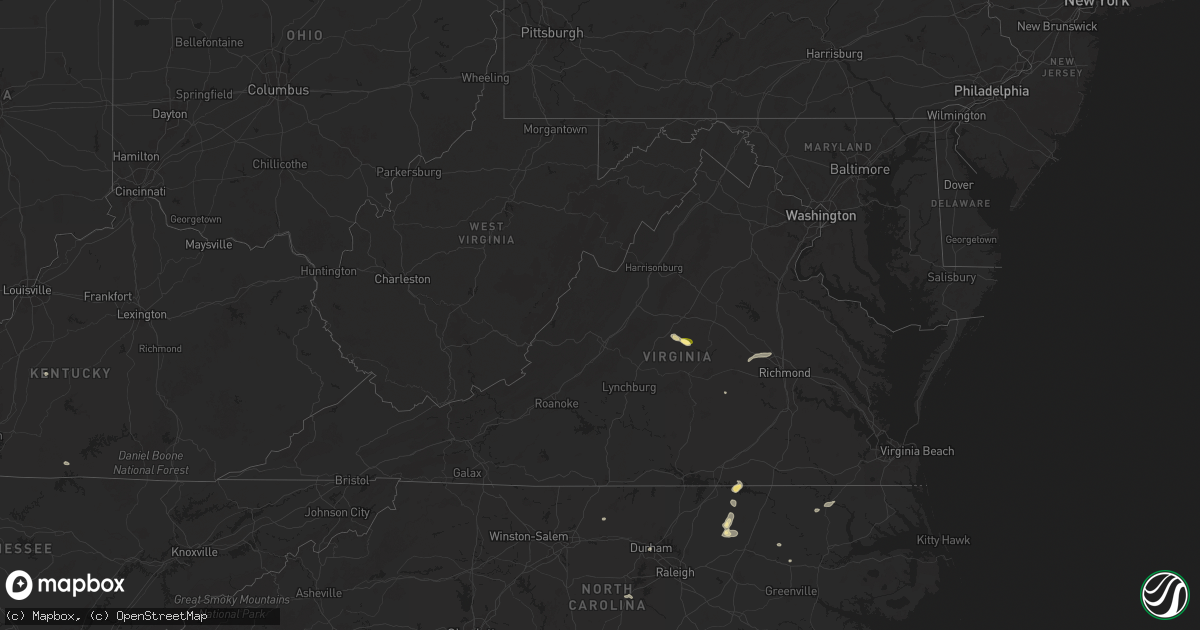
Hail Map in Virginia on July 19, 2025
Get this storm
July 19 map
$229
one time, instant access
Download today. No call, no setup
Keep the $229
Bought the map and want the full workflow? Apply the entire $229 to a subscription within 7 days. None of it is wasted.
Every map, not just this one
This buys you this map. Subscription and you get every map we run, in the markets you choose from a few cities to whole states to nationwide. Plus real-time alerts the moment a storm fires.
Contact data
Name, contact info, occupancy, even credit band for addresses in the footprint. You go from where it hit to who to call.
Become the source they trust
Unlimited branding weather history reports on demand. You already have the documented answer ready for the property owner, and you are the one who showed up with it.
Property data and RoofTrace estimates
Pull up any address you have got, its value and the exact code rules for that jurisdiction, straight from One Click Code. Then RoofTrace estimates the squares, pitch, and roof value, priced the way you price.
Storm reports in Virginia
Virginia
| Date | Description |
|---|---|
| 07/19/20256:59 PM CDT | A powerline fell due to thunderstorm wind. |
| 07/19/20256:59 PM CDT | 3 trees have fallen across the eastern portion of the county. |
| 07/19/20256:53 PM CDT | Tree down on va-155 in the county of charles city... In the vicinity of kenthill ln; county/city/town line: new kent county line/charles city county line. |
| 07/19/20256:43 PM CDT | Numerous trees down across king william county. |
| 07/19/20256:14 PM CDT | Tree down on i-95 via waze and traffic camera. |
| 07/19/20256:11 PM CDT | Tree reported down on mountain rd. Tim estimated by radar. |
| 07/19/20256:10 PM CDT | Numerous trees down along staples mill rd. |
| 07/19/20256:10 PM CDT | Numerous trees down across broad street. |
| 07/19/20256:09 PM CDT | Numerous trees reported down along ashland rd. Time estimated by radar. |
| 07/19/20256:09 PM CDT | Tree down on howards mill road. Time estimated by radar. |
| 07/19/20256:08 PM CDT | Tree fell on car on cauthorne rd. No injuries were reported. Time estimated by radar. |
| 07/19/20256:05 PM CDT | Numerous trees down along twin hickory lake dr. |
| 07/19/20256:01 PM CDT | Power line wires down along broad street rd. |
| 07/19/20256:00 PM CDT | Tree down along st matthews ln. |
| 07/19/20256:00 PM CDT | Tree knocked down blocking ashland rd. Near three chopt rd. Time estimated from radar. |
| 07/19/20255:58 PM CDT | A large tree down along hermitage rd. |
| 07/19/20255:58 PM CDT | Power line wires down along millers ln. |
| 07/19/20255:58 PM CDT | 2 reports of trees blocking portions of i-64 in eastern goochland county. Time estimated from radar. |
| 07/19/20255:58 PM CDT | Tree down along millers ln. |
| 07/19/20255:56 PM CDT | Tree down along manakin rd. |
| 07/19/20255:56 PM CDT | Tree down along 656 rockford rd. |
| 07/19/20255:52 PM CDT | Tree down along river rd w. |
| 07/19/20255:40 PM CDT | Tree down along nash rd. |
| 07/19/20255:34 PM CDT | Tree down along old white oak rd. |
| 07/19/20255:23 PM CDT | Corrects previous tstm wnd dmg report from 1 n meredithville. Tree reported down across brunswick dr. Time estimated by radar. |
| 07/19/20255:21 PM CDT | Corrects previous tstm wnd dmg report from 2 nw meredithville. Tree reported down across shining creek rd. Time estimated by radar. |
| 07/19/20254:32 PM CDT | Tree reported down across brunswick dr. Time estimated by radar. |
| 07/19/20254:31 PM CDT | Tree reported down across shining creek rd. Time estimated by radar. |
| 07/19/20254:30 PM CDT | Tree reported down at the intersection of huckstep rd. And robinson ferry rd. Time estimated by radar. |
| 07/19/20254:30 PM CDT | Tree reported down across tillman rd. Time estimated by radar. |
| 07/19/20254:29 PM CDT | Tree reported down across alvis rd. Time estimated by radar. |
| 07/19/20254:21 PM CDT | Tree down across the road blocking all lanes. Time estimated by radar. |
| 07/19/20254:21 PM CDT | Updates previous tstm wnd dmg report from 3 w gasburg. Several trees down across the road blocking all lanes. Time estimated by radar. |
| 07/19/20254:15 PM CDT | Tree down across the road blocking traffic. Time estimated by radar. |
| 07/19/20253:08 PM CDT | Tree downed by thunderstorm winds on irisburg road... And blocked one lane. |
| 07/19/20252:21 PM CDT | Trees down on proffit road and proffit station road. |
| 07/19/20252:20 PM CDT | Multiple trees knocked down along w river rd. Time estimated from radar. |
| 07/19/20252:19 PM CDT | 3 trees down across the town of scottsville. Relayed from albemarle county. Time estimated from radar. |
| 07/19/20252:16 PM CDT | Three trees down near scottsville on james river road. |
| 07/18/20259:20 PM CDT | Tree downed by thunderstorm winds near the intersection of meadowood trail and preston road... And blocked the entire roadway. |
| 07/18/20258:38 PM CDT | Tree downed by thunderstorm winds and blocking both lanes of iron bridge road... About a mile and a half from route 57. |
| 07/18/20257:45 PM CDT | Tree down along lottsburg rd. |
| 07/18/20257:44 PM CDT | Tree down along sydnors millpond rd. |
| 07/18/20257:44 PM CDT | Trees down at the intersection of dodlyt rd and northumberland hwy. |
| 07/18/20257:34 PM CDT | Numerous trees down across lancaster county. |
| 07/18/20257:30 PM CDT | Report of a tree down on tucker hill road. Time estimated via radar. |
| 07/18/20257:19 PM CDT | Tree down at the intersection of town bridge rd and old virginia street. |
| 07/18/20257:19 PM CDT | Tree down at the intersection of old virginia street and warner rd. |
| 07/18/20257:01 PM CDT | A large tree down on on rt. 632 in the county of king william... In the vicinity of smith ferry rd; rt. 630n/s |
All States Impacted by Hail Map on July 19, 2025
Cities Impacted by Hail Map on July 19, 2025
- Scottsville, VA
- Esmont, VA
- Tryon, NE
- Stapleton, NE
- Hyannis, NE
- Mullen, NE
- Seneca, NE
- Inman, NE
- Oneill, NE
- Page, NE
- Ewing, NE
- Arthur, NE
- Orchard, NE
- Winnetoon, NE
- Brady, NE
- Arnold, NE
- North Platte, NE
- Verdigre, NE
- Creighton, NE
- Burlington, CO
- Sheridan Lake, CO
- Johnstown, NE
- Ainsworth, NE
- Sutherland, NE
- Gothenburg, NE
- Callaway, NE
- McDonald, KS
- Bird City, KS
- Weskan, KS
- Sharon Springs, KS
- Long Pine, NE
- Bassett, NE
- Brockway, MT
- Biddle, MT
- Boyes, MT
- Atwood, KS
- Maxwell, NE
- Newport, NE
- Atkinson, NE
- Stuart, NE
- Circle, MT
- Cozad, NE
- Oconto, NE
- Lexington, NE
- Eddyville, NE
- Farnam, NE
- Eustis, NE
- Elwood, NE
- Terry, MT
- Lindsay, MT
- Fallon, MT
- Ismay, MT
- Hayes Center, NE
- Maywood, NE
- Curtis, NE
- Stockville, NE
- Sumner, NE
- Glendive, MT
- Burwell, NE
- Palisade, NE
- Moorefield, NE
- Lead, SD
- Plevna, MT
- Arapahoe, NE
- Holbrook, NE
- Edison, NE
- Loomis, NE
- Bertrand, NE
- Oxford, NE
- Holdrege, NE
- Orleans, NE
- Atlanta, NE
- Wilcox, NE
- Alma, NE
- Republican City, NE
- Indianola, NE
- McCook, NE
- Culbertson, NE
- Black Hawk, SD
- Rapid City, SD
- Piedmont, SD
- Naponee, NE
- Hildreth, NE
- Bloomington, NE
- Ellsworth Afb, SD
- Box Elder, SD
- Red Cloud, NE
- Riverton, NE
- Upland, NE
- Franklin, NE
- Inavale, NE
- Campbell, NE
- New Underwood, SD
- Bladen, NE
- Blue Hill, NE
- Plainville, KS
- Bogue, KS
- Damar, KS
- Palco, KS
- Stockton, KS
- Volborg, MT
- Natoma, KS
- Woodston, KS
- Ekalaka, MT
- Hermosa, SD
- Scenic, SD
- Baker, MT
- Camp Crook, SD
- Buffalo, SD
- Winona, KS
- Wallace, KS
- Tribune, KS
- Colby, KS
- Edson, KS
- Monument, KS
- Levant, KS
- Pine Ridge, SD
- Kyle, SD
- Oakley, KS
- Wanblee, SD
- Allen, SD
- Bartlett, NE
- Chambers, NE
- Whitman, NE
- Rexford, KS
- Marengo, IA
- Blairstown, IA
- Watkins, IA
- Petersburg, IL
- Loraine, IL
- Greenview, IL
- Athens, IL
- Oakland City, IN
- Golden, IL
- Mount Vernon, IN
- Augusta, IL
- Huntsville, IL
- La Prairie, IL
- Plymouth, IL
- Luzerne, IA
- Schuyler, VA
- Blandinsville, IL
- Campbellsville, KY
- New Haven, KY
- Tarboro, NC
- Winslow, IN
- Ahoskie, NC
- Ocala, FL
- Whitakers, NC
- New Harmony, IN
- Wadesville, IN
- White Plains, VA
- Gasburg, VA
- Littleton, NC
- Louisburg, NC
- Warrenton, NC
- North Garden, VA
- Horse Branch, KY
- Sumterville, FL
- Wildwood, FL
- Coleman, FL
- Macon, NC
- Henrico, NC
- Durham, NC
- Cheyenne Wells, CO
- Kit Carson, CO
- Pierson, FL
- De Leon Springs, FL
- Castalia, NC
- Nashville, NC
- Bainville, MT
- Bowen, IL
- Carthage, IL
- Cofield, NC
- Winton, NC
- Benton, IL
- Bethune, CO
- Keene, VA
- Beaver Dam, KY
- Ebony, VA
- Bunnell, FL
- Brodnax, VA
- Hollister, NC
- Philpot, KY
- Whitesville, KY
- San Mateo, FL
- Cohagen, MT
- Palatka, FL
- Deland, FL
- Hulett, WY
- Wellfleet, NE
- Karval, CO
- Fordsville, KY
- Hartford, KY
- Olaton, KY
- Gem, KS
- Grayson, LA
- Bushnell, FL
- Catharine, KS
- Osborne, KS
- Williston, ND
- Simpson, IL
- Columbia, LA
- Hammond, MT
- Tekamah, NE
- Ozark, IL
- Overton, NE
- Upton, WY
- Sundance, WY
- Moorcroft, WY
- Benkelman, NE
- Max, NE
- Amelia, NE
- Hinsdale, MT
- State Farm, VA
- Maidens, VA
- Glen Allen, VA
- Oilville, VA
- Rockville, VA
- Henrico, VA
- Manakin Sabot, VA
- Crozier, VA
- Arapahoe, CO
- Alton, KS
- Portis, KS
- Branchland, WV
- Burlington, NC
- Elon, NC
- Forsyth, MT
- Cambridge, NE
- Bartley, NE
- Hill City, KS
- Hays, KS
- Morgantown, KY
- Nemo, SD
- Onawa, IA
- Castana, IA
- Moorhead, IA
- Soldier, IA
- Sanford, NC
- Mankato, KS
- Jetersville, VA
- Smithfield, NE
- Burkesville, KY
- Russellville, KY
- Auburn, KY
- Osage, WY
- Newcastle, WY
- Pisgah, IA
- Little Sioux, IA
- Smith Center, KS
- Lebanon, KS
- Deadwood, SD
- Stratton, CO
- Peerless, MT
- Broomes Island, MD
- Saint Leonard, MD
- Imperial, NE
- Champion, NE
- Saint Francis, KS
- Scribner, NE
- Jewell, KS
- Racine, OH
- Stratton, NE
- Saronville, NE
- Clay Center, NE
- Fairfield, NE
- Richland, MT
- Opheim, MT
- Caputa, SD
- Larslan, MT
- Gaylord, KS
- Osceola, IA
- West Columbia, WV
- Syracuse, OH
- Middleport, OH
- Pomeroy, OH
- Mason, WV
- Hartford, WV
- Holyoke, CO
- Haxtun, CO
- Dickens, NE
- Guide Rock, NE
- Columbus, NE
- Schuyler, NE
- Bellwood, NE
- Glasgow, MT
- Nashua, MT
- Edgar, NE
- Haigler, NE
- Weldon, IA
- Chariton, IA
- Corydon, IA
- Derby, IA
- Humeston, IA
- Woodburn, IA
- Cedar Rapids, NE
- Belgrade, NE
- Shelby, NE
- Hoxie, KS
- Esbon, KS
- Seymour, IA
- Park, KS
- Republic, KS
- Leigh, NE
- Cedar Bluffs, NE
- Wakeeney, KS
- Rising City, NE
- Clarks, NE
- Central City, NE
- Unionville, MO
- Merrill, IA
- Hooper, NE
- Thayer, IA
- Fort Calhoun, NE
- Omaha, NE
- Colon, NE
- Russell, IA
- Malmo, NE
- Morland, KS
- Hinton, IA
- Mondamin, IA
- Modale, IA
- Logan, IA
- Missouri Valley, IA
- Lucerne, MO
- Saint Edward, NE
- Allerton, IA
- Howells, NE
- Clarkson, NE
- Kennard, NE
- Bennington, NE
- Cincinnati, IA
- Centerville, IA
- Woodbine, IA
- Dunlap, IA
- West Point, NE
- Oakland, NE
- Randall, KS
- Blencoe, IA
- Guthrie Center, IA
- Bayard, IA
- Vail, IA
- Dow City, IA
- Manilla, IA
- Denison, IA
- Defiance, IA
- Carroll, IA
- Millerton, IA
- Glidden, IA
- Lake City, IA
- Lyons, NE
- Coon Rapids, IA
- Rhame, ND
- Lemmon, SD
- Hettinger, ND
- Gladbrook, IA
- East Lynn, WV
- Mechanicsville, MD
- The Villages, FL
- Fairfield, IA
- Hodgenville, KY
- Van Horne, IA
- Letart, WV
- Ellis, KS
- Wray, CO
- Charlottesville, VA
- Snyder, NE
- Beaman, IA
- Lacon, IL
- Grenora, ND
- Broadus, MT
- Long Valley, SD
- Penokee, KS
- Grinnell, KS


