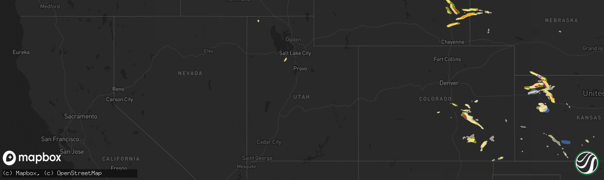
Hail Map in Utah on July 19, 2023
The weather event in Utah on July 19, 2023 includes Wind, Tornado, and Hail maps. 27 states and 569 cities were impacted and suffered possible damage. The total estimated number of properties impacted is 4,900.
Want more than just the map?
Turn this storm into a full workflow.
- Owner + property data so you know who to knock
- OnDemand branded weather history reports to win the "did we even have hail?" argument
- RoofTrace estimate so reps stop guessing numbers at the door
Bought this map? Upgrade within 7 days and we'll credit the $230. (10-15 min setup call)
Wind
Tornado
Hail
4,900
Estimated number of impacted properties by a 1.00" hail or larger0
Estimated number of impacted properties by a 1.75" hail or larger0
Estimated number of impacted properties by a 2.50" hail or largerStorm reports in Utah
Utah
| Date | Description |
|---|---|
| 07/19/20236:56 PM CDT | Corrects previous non-tstm wnd gst report from 5 ne lake pt. Mesonet station as768 great salt lake marina. |
| 07/19/20236:44 PM CDT | A local report indicates 1.25 inch wind near Tooele |
| 07/19/20236:32 PM CDT | Broadcast media shared photo of large hail stones. Largest estimated is the size of a ping pong ball. Time estimated from radar. |
| 07/19/20236:26 PM CDT | A local report indicates 1.00 inch wind near Tooele |
| 07/19/20236:20 PM CDT | Mesonet station dpg06 camel back mtn. |
| 07/19/20236:10 PM CDT | Mesonet station utsto sr-36 at mp 49 stockton bar. |
| 07/19/20236:00 PM CDT | Mesonet station dpg21 simpson spring. |
| 07/18/20238:33 PM CDT | Asos station kogd ogden-hinckley airport. |
| 07/18/20238:33 PM CDT | Corrects previous non-tstm wnd gst report from hill afb. Awos station khif hill air force base. |
| 07/18/20238:20 PM CDT | Corrects previous non-tstm wnd gst report from 3 ne sundance. Mesonet station utdcd us-189 at deer creek dam. |
| 07/18/20238:18 PM CDT | *** 1 fatal *** a 40-50 ft tall tree along the denver and rio grande western rail trail fell on a bicyclist. |
| 07/18/20238:16 PM CDT | Mesonet station uupya uofu playa research site. |
| 07/18/20238:10 PM CDT | Mesonet station snd arrowhead summit. |
| 07/18/20238:00 PM CDT | Mesonet station pc034 provo canyon. |
| 07/18/20238:00 PM CDT | Mesonet station snd arrowhead summit. |
| 07/18/20237:50 PM CDT | Mesonet station ut201 sr-201 at i-80. |
| 07/18/20237:45 PM CDT | Mesonet station kcc02 marina. |
| 07/18/20237:20 PM CDT | Mesonet station pc104 grantsville south. |
All States Impacted by Hail Map on July 19, 2023
Cities Impacted by Hail Map on July 19, 2023
- Kiahsville, WV
- Harts, WV
- Dunlow, WV
- Ranger, WV
- Midkiff, WV
- Spurlockville, WV
- Alkol, WV
- Branchland, WV
- Griffithsville, WV
- Yawkey, WV
- Sumerco, WV
- Wilsondale, WV
- Fort Gay, WV
- Crum, WV
- Rocky Mount, NC
- Battleboro, NC
- Whitakers, NC
- Nashville, NC
- Wood, SD
- Presho, SD
- Draper, SD
- Fulton, KY
- Clinton, KY
- Arlington, KY
- Bardwell, KY
- Wickliffe, KY
- Cunningham, KY
- Sullivan, MO
- Cairo, IL
- Miller City, IL
- Federalsburg, MD
- Bridgeville, DE
- Thebes, IL
- Olive Branch, IL
- Scott City, MO
- Lonedell, MO
- McClure, IL
- Arlington, SD
- Bruce, SD
- Cohasset, MN
- Grand Rapids, MN
- Mcgregor, MN
- Tamarack, MN
- Crosby, MN
- Emily, MN
- Aitkin, MN
- White, SD
- Toronto, SD
- Astoria, SD
- Hendricks, MN
- Ivanhoe, MN
- Floodwood, MN
- Kelliher, MN
- Ponemah, MN
- Blackduck, MN
- Northome, MN
- Colorado Springs, CO
- Usaf Academy, CO
- Peyton, CO
- Max, MN
- Deer River, MN
- Talmoon, MN
- Spring Lake, MN
- Marcell, MN
- Bigfork, MN
- Calhan, CO
- Yoder, CO
- Rush, CO
- Minneota, MN
- Marshall, MN
- Sturgeon Lake, MN
- Bovey, MN
- Kettle River, MN
- Moose Lake, MN
- Grantsburg, WI
- Hinckley, MN
- Danbury, WI
- Webster, WI
- Chugwater, WY
- Siren, WI
- Hawk Springs, WY
- Kerrick, MN
- Bruno, MN
- Yoder, WY
- Veteran, WY
- Torrington, WY
- Starbuck, MN
- Glenwood, MN
- Paynesville, MN
- Freeport, MN
- Albany, MN
- Avon, MN
- Glendo, WY
- Cheyenne, WY
- Shell Lake, WI
- Frederic, WI
- Nashwauk, MN
- Melrose, MN
- Spooner, WI
- Hertel, WI
- Saint Martin, MN
- Richmond, MN
- Montevideo, MN
- Kerkhoven, MN
- Clara City, MN
- Maynard, MN
- Raymond, MN
- Murdock, MN
- Sandstone, MN
- Barronett, WI
- Bowlus, MN
- Holdingford, MN
- Royalton, MN
- Rice, MN
- Sartell, MN
- Sauk Rapids, MN
- Foley, MN
- Clear Lake, MN
- Princeton, MN
- Oak Park, MN
- Boone, CO
- Olney Springs, CO
- Ordway, CO
- Sugar City, CO
- Sarona, WI
- Cumberland, WI
- Ramah, CO
- Rice Lake, WI
- Brooten, MN
- Belgrade, MN
- Cold Spring, MN
- Watkins, MN
- Kimball, MN
- South Haven, MN
- Clearwater, MN
- Annandale, MN
- Hartville, WY
- Model, CO
- Roy, NM
- Gladstone, NM
- Grenville, NM
- Haugen, WI
- Buffalo, MN
- Montrose, MN
- Delano, MN
- Waverly, MN
- Howard Lake, MN
- Maple Lake, MN
- Eden Valley, MN
- Pengilly, MN
- Conchas Dam, NM
- Barron, WI
- Cameron, WI
- Morrill, NE
- Harrison, NE
- Hibbing, MN
- Lingle, WY
- Jay Em, WY
- Wheatland, WY
- Guernsey, WY
- Goodland, MN
- Chadron, NE
- Nashua, MN
- Kadoka, SD
- Midland, SD
- Fort Pierre, SD
- Okaton, SD
- Warner, SD
- Bluffton, MN
- Sebeka, MN
- Pine River, MN
- Pierpont, SD
- Wadena, MN
- Highmore, SD
- New Effington, SD
- New York Mills, MN
- Sisseton, SD
- Blunt, SD
- Holabird, SD
- Staples, MN
- Wanblee, SD
- Stratford, SD
- Andover, SD
- Fairmount, ND
- Dalton, MN
- Rosholt, SD
- Pierre, SD
- Underwood, MN
- Remer, MN
- Northville, SD
- Rockham, SD
- Porcupine, SD
- Roslyn, SD
- Mellette, SD
- Cresbard, SD
- Longville, MN
- Orient, SD
- Backus, MN
- Harrold, SD
- Crawford, NE
- Manderson, SD
- Kyle, SD
- Belvidere, SD
- Campbell, MN
- Conde, SD
- Groton, SD
- Eden, SD
- Tintah, MN
- Pine Ridge, SD
- Ottertail, MN
- Fergus Falls, MN
- Faulkton, SD
- Lake City, SD
- Henning, MN
- Battle Lake, MN
- Saint Michael, MN
- Hanover, MN
- Rogers, MN
- Minneapolis, MN
- Osseo, MN
- Maple Grove, MN
- Stratton, NE
- Trenton, NE
- Atwood, KS
- Brewster, KS
- Levant, KS
- Colby, KS
- Cyrus, MN
- Hancock, MN
- Morris, MN
- Carlton, MN
- Jacobson, MN
- Milaca, MN
- Herndon, KS
- Trementina, NM
- Montello, NV
- Ideal, GA
- Oglethorpe, GA
- Palisade, MN
- Mitchell, SD
- Fulton, SD
- Lake Benton, MN
- Elkton, SD
- Fremont, NC
- De Smet, SD
- Long Prairie, MN
- Swanville, MN
- Burtrum, MN
- Grey Eagle, MN
- Isle, MN
- McGrath, MN
- Milledgeville, GA
- Eatonton, GA
- Lagrange, GA
- Lanett, AL
- Squaw Lake, MN
- Echo, MN
- Wood Lake, MN
- Barnum, MN
- Hamill, SD
- Kennebec, SD
- Ideal, SD
- Winner, SD
- Ghent, MN
- Porter, MN
- Taunton, MN
- Cottonwood, MN
- Limon, CO
- Bonaire, GA
- Dry Branch, GA
- Kathleen, GA
- Warner Robins, GA
- Jeffersonville, GA
- Wessington Springs, SD
- Roscoe, MN
- Ocala, FL
- Cromwell, MN
- Ellaville, GA
- Raton, NM
- Des Moines, NM
- East Prairie, MO
- Americus, GA
- Lowry, MN
- Danville, GA
- Irwinton, GA
- Virgil, SD
- Wessington, SD
- Cusseta, AL
- Valley, AL
- Windsor, NC
- Sauk Centre, MN
- Elrosa, MN
- Belview, MN
- Brookings, SD
- Alpena, SD
- Winter Park, FL
- Stedman, NC
- Fayetteville, NC
- Folsom, NM
- Five Points, AL
- Garrison, UT
- New London, MN
- Plains, GA
- Woonsocket, SD
- Winter Springs, FL
- Casselberry, FL
- Hawkinsville, GA
- Orlando, FL
- Farwell, MN
- Saint Joseph, MN
- Tampa, FL
- Matheson, CO
- Mitchell, NE
- Fort Laramie, WY
- Chetek, WI
- Kim, CO
- Ludell, KS
- Edson, KS
- Bird City, KS
- McDonald, KS
- Mosquero, NM
- Weyerhaeuser, WI
- Tooele, UT
- New Auburn, WI
- Bruce, WI
- Oberlin, KS
- Duluth, MN
- Holcombe, WI
- Hammond, WI
- Baldwin, WI
- Wilson, WI
- Woodville, WI
- Roberts, WI
- Glenwood City, WI
- Menomonie, WI
- Knapp, WI
- Spring Valley, WI
- Inver Grove Heights, MN
- Saint Paul Park, MN
- South Saint Paul, MN
- Lamberton, MN
- Sanborn, MN
- Springfield, MN
- Ellsworth, WI
- Hager City, WI
- Saint Stephen, MN
- Alliance, NE
- Richlands, NC
- Campo, CO
- Grinnell, KS
- Stuart, NE
- Oneill, NE
- Prescott, WI
- Crofton, NE
- Fordyce, NE
- Park, KS
- Hoxie, KS
- Quinter, KS
- Oakley, KS
- Dalbo, MN
- Stanchfield, MN
- Welch, MN
- Revere, MN
- Hines, MN
- Pine City, MN
- Scotland, SD
- Selden, KS
- Watertown, MN
- Spencer, NE
- Lynch, NE
- Hastings, MN
- Cannon Falls, MN
- Gem, KS
- La Junta, CO
- Bloomer, WI
- Cornell, WI
- Park Valley, UT
- Garita, NM
- Rush City, MN
- Willow River, MN
- Birchwood, WI
- New Richmond, WI
- Clayton, NM
- Hawthorne, NV
- Cloquet, MN
- Kite, GA
- Swainsboro, GA
- Askov, MN
- Sheridan Lake, CO
- Mikana, WI
- Kenton, OK
- Pritchett, CO
- Fowler, CO
- Niobrara, NE
- Bloomfield, NE
- New Prague, MN
- Las Animas, CO
- Foxboro, WI
- Garfield, GA
- Twin City, GA
- Midville, GA
- Dresden, KS
- Merna, NE
- Anselmo, NE
- Millen, GA
- Dana, IA
- Yankton, SD
- Tabor, SD
- Saint Helena, NE
- Tyndall, SD
- Cottage Grove, MN
- Finlayson, MN
- Walsenburg, CO
- Hampton, MN
- Winsted, MN
- Rockford, MN
- Center, NE
- Verdigre, NE
- Sahuarita, AZ
- Green Valley, AZ
- Emigsville, PA
- Dover, PA
- York, PA
- Red Lion, PA
- Silver Lake, MN
- Lester Prairie, MN
- Glencoe, MN
- Mayer, MN
- New Germany, MN
- Sylvania, GA
- Bay City, WI
- Hamel, MN
- Loretto, MN
- Lesterville, SD
- Gabbs, NV
- Saint Cloud, MN
- Rexford, KS
- Jennings, KS
- Kensington, MN
- Litchfield, MN
- Portal, GA
- Grove City, MN
- Dalton, NE
- Bayard, NE
- Cokato, MN
- Dallas, WI
- Saint Peter, MN
- Le Sueur, MN
- Pittsville, WI
- Dodge City, KS
- Wright, KS
- Ford, KS
- Bucklin, KS
- Greensburg, KS
- Mullinville, KS
- Gove, KS
- Baudette, MN
- Littlefork, MN
- Mountain Iron, MN
- Chisholm, MN
- Kinney, MN
- Buhl, MN
- Jim Falls, WI
- Canon City, CO
- Guffey, CO
- Calumet, MN
- Ingalls, KS
- Freedom, OK
- Fall Creek, WI
- Downing, WI
- Montezuma, KS
- Copeland, KS
- Maiden Rock, WI
- Neillsville, WI
- Fairchild, WI
- Humbird, WI
- Black River Falls, WI
- Merrillan, WI
- Virginia, MN
- Loman, MN
- Red Wing, MN
- Garden City, KS
- Pratt, KS
- Cimarron, KS
- Haviland, KS
- Solon Springs, WI
- Ellis, KS
- Le Center, MN
- Iuka, KS
- Follett, TX
- Syracuse, KS
- Augusta, WI
- Ogallah, KS
- Turon, KS
- Stafford, KS
- Elk Mound, WI
- Kendall, KS
- Altoona, WI
- Eau Claire, WI
- Chippewa Falls, WI
- Cadott, WI
- Long Lake, MN
- Boyceville, WI
- Winona, KS
- Minneola, KS
- Ensign, KS
- Richfield, KS
- Eden Prairie, MN
- Maple Plain, MN
- Kincaid, KS
- Colony, KS
- Canadian, TX
- Burlington, KS
- Westphalia, KS
- Bronson, KS
- Wellington, KS
- Oxford, KS
- Belle Plaine, KS
- Winfield, KS
- Pleasanton, KS
- Phillipsburg, MO
- Long Lane, MO
- Babcock, WI
- Bolivar, MO
- Half Way, MO
- Polk, MO
- Iola, KS
- Blue Mound, KS
- Welda, KS
- Garnett, KS
- La Harpe, KS
- Moran, KS
- Camdenton, MO
- Buffalo, MO
- Carthage, TN
- Gainesboro, TN
- Pleasant Shade, TN
- Centerville, KS
- Parker, KS
- Mound City, KS
- El Dorado Springs, MO
- Walker, MO
- Collins, MO
- Mapleton, KS
- Humansville, MO
- Ashland, KS
- Westmoreland, TN
- Morrisville, MO
- Aldrich, MO
- Nevada, MO
- Englewood, KS
- Fargo, OK
- Neosho Falls, KS
- Le Roy, KS
- Shattuck, OK
- Flemington, MO
- Dunnegan, MO
- Quincy, MO
- Osceola, MO
- Rockville, MO
- Appleton City, MO
- Elkland, MO
- Amoret, MO
- Amsterdam, MO
- Roach, MO
- Weaubleau, MO
- Butler, MO
- Lebanon, MO
- Macks Creek, MO


