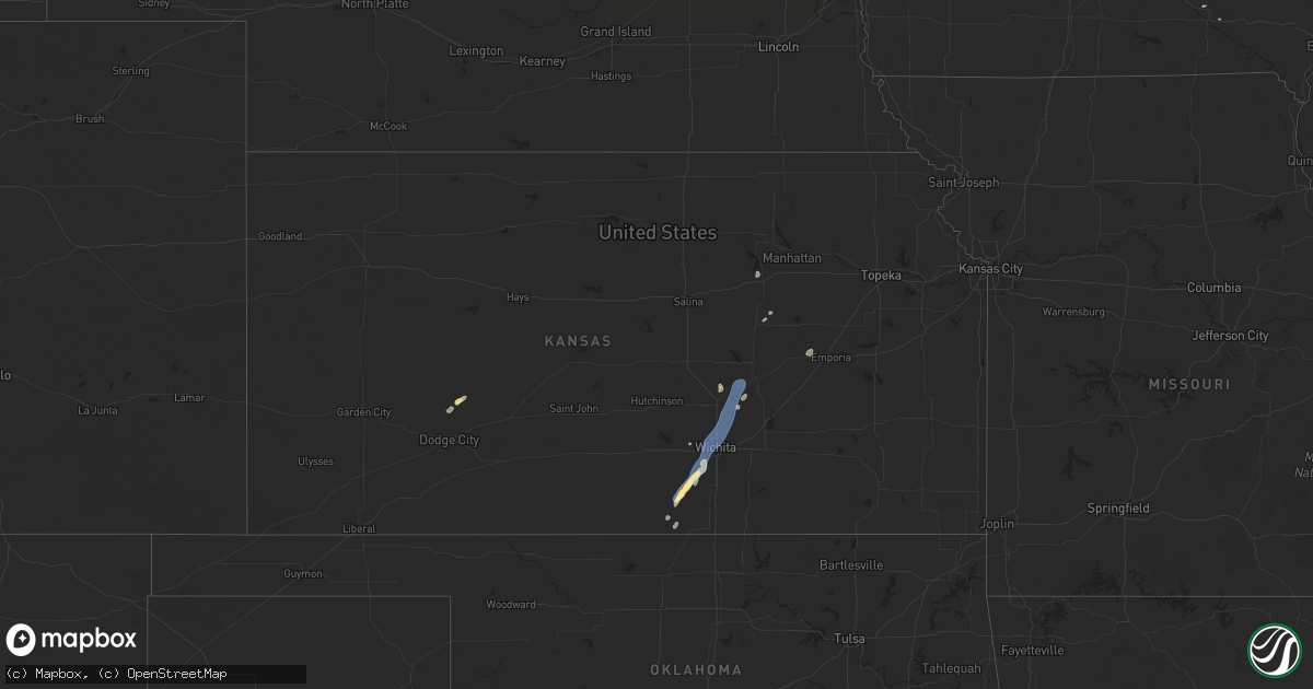
Hail Map in Kansas on July 18, 2025
Get this storm
July 18 map
$229
one time, instant access
Download today. No call, no setup
Keep the $229
Bought the map and want the full workflow? Apply the entire $229 to a subscription within 7 days. None of it is wasted.
Every map, not just this one
This buys you this map. Subscription and you get every map we run, in the markets you choose from a few cities to whole states to nationwide. Plus real-time alerts the moment a storm fires.
Contact data
Name, contact info, occupancy, even credit band for addresses in the footprint. You go from where it hit to who to call.
Become the source they trust
Unlimited branding weather history reports on demand. You already have the documented answer ready for the property owner, and you are the one who showed up with it.
Property data and RoofTrace estimates
Pull up any address you have got, its value and the exact code rules for that jurisdiction, straight from One Click Code. Then RoofTrace estimates the squares, pitch, and roof value, priced the way you price.
Storm reports in Kansas
Kansas
| Date | Description |
|---|---|
| 07/18/20256:16 PM CDT | A local report indicates 60 MPH wind near Peabody |
| 07/18/20255:48 PM CDT | Delayed report... Large tree limb was knocked down by thunderstorm wind gusts. |
| 07/18/20255:30 PM CDT | Nws employee reported tree damage on zoo blvd just east of i-235... Part of the lane was being blocked by the downed tree. |
| 07/18/20255:29 PM CDT | Emergency management reported a tree limb blown down on a car near irma & 45th n in maize. |
| 07/18/20255:26 PM CDT | Nws employee reported 70mph winds at 9th and zoo blvd. |
| 07/18/20255:26 PM CDT | Reported wind gust of 65mph came from a trained spotter at central and oliver. |
| 07/18/20255:16 PM CDT | Delayed report. Yingling aviation at eisenhower airport reported a small fedex cessna 208 caravan plane was tipped over with wing damage by thunderstorm wind gusts. |
| 07/18/20255:15 PM CDT | A local report indicates 71 MPH wind near Wichita NWS Office |
| 07/18/20255:03 PM CDT | A local report indicates 60 MPH wind near 4 NW Clearwater |
| 07/18/20254:57 PM CDT | A local report indicates 60 MPH wind near Clearwater |
| 07/18/20254:39 PM CDT | A local report indicates 1.75 inch wind near Conway Springs |
| 07/18/20254:35 PM CDT | A local report indicates 70 MPH wind near Conway Springs |
| 07/18/20254:29 PM CDT | A local report indicates 60 MPH wind near Conway Springs |
All States Impacted by Hail Map on July 18, 2025
Cities Impacted by Hail Map on July 18, 2025
- Axton, VA
- Ridgeway, VA
- Vinton, VA
- Goodview, VA
- Moneta, VA
- Mineral, VA
- Bumpass, VA
- Montpelier, VA
- Milan, KS
- Argonia, KS
- Conway Springs, KS
- Clearwater, KS
- Viola, KS
- Midwest, WY
- Casper, WY
- Thermopolis, WY
- Worland, WY
- Wichita, KS
- Haysville, KS
- Valley Center, KS
- Kechi, KS
- Wheatland, WY
- Guernsey, WY
- Fort Laramie, WY
- Sedgwick, KS
- Newton, KS
- Whitewater, KS
- Yoder, WY
- Manville, WY
- Shawnee, WY
- Glendo, WY
- Torrington, WY
- Lingle, WY
- Kim, CO
- Pritchett, CO
- Granite Falls, MN
- Sacred Heart, MN
- Maynard, MN
- Clarkfield, MN
- Montevideo, MN
- Wood Lake, MN
- Echo, MN
- Clara City, MN
- Belview, MN
- Renville, MN
- Lusk, WY
- Lance Creek, WY
- Ainsworth, NE
- Johnstown, NE
- Morrill, NE
- Lyman, NE
- Hampton, VA
- Poquoson, VA
- Mitchell, NE
- Gering, NE
- Scottsbluff, NE
- Richmond, MN
- Grove City, MN
- New London, MN
- Paynesville, MN
- Atwater, MN
- Spicer, MN
- Eden Valley, MN
- Watkins, MN
- Cold Spring, MN
- Kimball, MN
- Minatare, NE
- Melbeta, NE
- South Haven, MN
- Saint Cloud, MN
- Clearwater, MN
- Bayard, NE
- Burwell, NE
- Harrisburg, NE
- Sibley, IA
- Melvin, IA
- Ashton, IA
- Sheldon, IA
- Sanborn, IA
- Ocheyedan, IA
- Hartley, IA
- George, IA
- Everly, IA
- Spencer, IA
- Harris, IA
- Milford, IA
- Lake Park, IA
- Primghar, IA
- Rockville, MN
- Walton, KS
- Peabody, KS
- Elbing, KS
- Merrill, WI
- Athens, WI
- Rib Lake, WI
- Medford, WI
- Wausau, WI
- Boone, IA
- Stratford, IA
- Ames, IA
- Aniwa, WI
- Birnamwood, WI
- Antigo, WI
- Bowler, WI
- Clear Lake, MN
- Kennebec, SD
- Lower Brule, SD
- Byrdstown, TN
- Martinsville, VA
- Riner, VA
- Christiansburg, VA
- Ravenel, SC
- Conway, SC
- Radford, VA
- Trinidad, CO
- Monte Vista, CO
- Latta, SC
- Rowland, NC
- Meeteetse, WY
- Magnolia, KY
- Jetersville, VA
- Amelia Court House, VA
- Moncks Corner, SC
- Capitan, NM
- Paducah, KY
- Monroe, LA
- Alton, VA
- Whiteville, NC
- Princeton, KY
- Fairfield, NC
- Trementina, NM
- Appomattox, VA
- Pamplin, VA
- Monroe, TN
- Las Vegas, NV
- Chadbourn, NC
- Clarendon, NC
- Dublin, VA
- Hurricane, UT
- Okatie, SC
- Kaycee, WY
- Waverly, VA
- Spring Grove, VA
- Hanley Falls, MN
- West Monroe, LA
- Stony Creek, VA
- Disputanta, VA
- Fairmont, NC
- Del Norte, CO
- Pilot, VA
- Metropolis, IL
- Brookport, IL
- Bolton, NC
- Roanoke, VA
- Cloverdale, VA
- Rice, VA
- Watertown, SD
- Tamms, IL
- Mounds, IL
- Amorita, OK
- Burlington, OK
- Canby, MN
- Porter, MN
- Taunton, MN
- Gary, SD
- Clear Lake, SD
- Loris, SC
- Farmville, VA
- Grenville, NM
- Folkston, GA
- Hermitage, AR
- Cumberland, VA
- Dillwyn, VA
- Georgetown, SC
- Cherokee, OK
- Shawneetown, IL
- Munfordville, KY
- Callahan, FL
- Bluff City, KS
- Richmond, VA
- Henrico, VA
- Raton, NM
- Strandburg, SD
- Caldwell, KS
- Freeport, KS
- Maxwell, NM
- Morrilton, AR
- Benson, NC
- Dunn, NC
- Powell, WY
- White City, KS
- Herington, KS
- Burlington, NC
- Yanceyville, NC
- Mebane, NC
- Hardy, VA
- Goodwin, SD
- Douglas, WY
- Newton Grove, NC
- Revillo, SD
- Marietta, MN
- Tabor City, NC
- Wakefield, VA
- Glasgow, KY
- Milroy, MN
- Vesta, MN
- Goddard, KS
- Strong City, KS
- Emporia, KS
- Darlington, SC
- Ghent, MN
- Roper, NC
- Winona, MO
- North Wilkesboro, NC
- Roaring River, NC
- Junction City, KS
- Cottonwood, MN
- Marshall, MN
- Minneota, MN
- Bluffton, SC
- Hartville, WY
- Newport News, VA
- Yorktown, VA
- Cave City, KY
- Horse Cave, KY
- Dendron, VA
- Burns, KS
- Amelia, NE
- Jarratt, VA
- Lynd, MN
- Litchfield, MN
- Darwin, MN
- Florence, SD
- Mount Airy, NC
- Brewster, NE
- Tracy, MN
- Plymouth, NC
- Gurdon, AR
- Arkadelphia, AR
- Colwich, KS
- Fairfax, SD
- Walnut Grove, MN
- Windsor, NC
- Prescott, AR
- Golconda, IL
- Herod, IL
- Andale, KS
- Jonesville, NC
- Ronda, NC
- Creswell, NC
- West Plains, MO
- Revere, MN
- Rogers, MN
- Turtle Lake, WI
- Saint Croix Falls, WI
- Dresser, WI
- Ericson, NE
- Greeley, NE
- Scotia, NE
- Ord, NE
- Bartlett, NE
- Spalding, NE
- Taylor, NE
- Butterfield, MN
- Saint James, MN
- Bassett, NE
- Lamberton, MN
- Arvonia, VA
- Comfrey, MN
- Mountain Lake, MN
- Purdum, NE
- Lakefield, MN
- Round Lake, MN
- Bridgeport, NE
- Jeffers, MN
- Bingham Lake, MN
- Springfield, MN
- Sanborn, MN
- Spirit Lake, IA
- Jackson, MN
- Long Pine, NE
- Granada, MN
- Fairmont, MN
- Truman, MN
- Jetmore, KS
- Butte, NE
- Naper, NE
- Beresford, SD
- Corsica, SD
- Geddes, SD
- Okabena, MN
- Thompson, IA
- Buffalo Center, IA
- Elmore, MN
- Rake, IA
- Frost, MN
- Newport, NE
- Ormsby, MN
- Odin, MN
- Blue Earth, MN
- Winnebago, MN
- Swea City, IA
- Ledyard, IA
- Stuart, NE
- Atkinson, NE
- Angora, NE
- Mallard, IA
- Havelock, IA
- West Bend, IA
- Ottosen, IA
- Algona, IA
- Centerville, SD
- Lennox, SD
- Burke, SD
- Rock Rapids, IA
- Rolfe, IA
- Bode, IA
- Belmond, IA
- Kanawha, IA
- Clarion, IA
- Goldfield, IA
- Renwick, IA
- Leland, IA
- Lu Verne, IA
- Livermore, IA
- Chambers, NE
- Armour, SD
- Glen Allen, VA
- Alden, IA
- Eagle Grove, IA
- Badger, IA
- Clare, IA
- Fort Dodge, IA
- Humboldt, IA
- Dows, IA
- Alexander, IA
- Rowan, IA
- Latimer, IA
- Galt, IA
- Hardy, IA
- Blairsburg, IA
- Williams, IA
- Lake Andes, SD
- Emmetsburg, IA
- Bonesteel, SD
- Saint Charles, SD
- Thor, IA
- Woolstock, IA
- Vincent, IA
- Thornton, IA
- Swaledale, IA
- Ethan, SD
- Traer, IA
- Brusett, MT
- Cylinder, IA
- Whittemore, IA
- Canistota, SD
- Sheffield, IA
- New Sharon, IA
- Ogden, IA
- Paton, IA
- Iowa Falls, IA
- Popejoy, IA
- Salem, SD
- Jefferson, IA
- Churdan, IA
- Bradgate, IA
- Bouton, IA
- Doon, IA
- Polk City, IA
- Woodward, IA
- Madrid, IA
- Perry, IA
- Alexandria, SD
- Grand Junction, IA
- Dana, IA
- Dumont, IA
- Ottumwa, IA
- Dimock, SD
- Parkston, SD
- Hampton, IA
- Kamrar, IA
- Webster City, IA
- Ackley, IA
- Geneva, IA
- Meservey, IA
- Klemme, IA
- Goodell, IA
- Curlew, IA
- Dysart, IA
- Clear Lake, IA
- Gladbrook, IA
- Austinville, IA
- Parkersburg, IA
- New Hartford, IA
- Stout, IA
- Aplington, IA
- Garner, IA
- Scarville, IA
- Gilmore City, IA
- Boxholm, IA
- Rippey, IA
- Bridgewater, SD
- Jordan, MT
- Agency, IA
- Archer, IA
- Delmont, SD
- Garwin, IA
- Toledo, IA
- Luther, IA
- Jamaica, IA
- Dawson, IA
- Sheldahl, IA
- Slater, IA
- Dayton, IA
- Pilot Mound, IA
- Lehigh, IA
- Belle Plaine, IA
- Chelsea, IA
- Blairstown, IA
- Elberon, IA
- Van Horne, IA
- Luzerne, IA
- Keystone, IA
- Shell Rock, IA
- Woden, IA
- Titonka, IA
- Radcliffe, IA
- Cedar Falls, IA
- Dike, IA
- Milton, NC
- La Porte City, IA
- Flint Hill, VA
- Huntly, VA
- Cairo, IL
- Las Vegas, NM
- Pulaski, IL
- Platte, SD
- Garrison, IA
- Columbia, NC
- Jesup, GA
- Coulter, IA
- Malta, MT
- Summerfield, IL
- Trenton, IL
- Ringle, WI
- Kelley, IA
- Marathon, WI


