Hail Map in Wisconsin on July 17, 2011
Get this storm
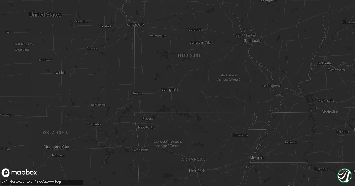
July 17 map
$229
one time, instant access
Download today. No call, no setup
Keep the $229
Bought the map and want the full workflow? Apply the entire $229 to a subscription within 7 days. None of it is wasted.
Every map, not just this one
This buys you this map. Subscription and you get every map we run, in the markets you choose from a few cities to whole states to nationwide. Plus real-time alerts the moment a storm fires.
Contact data
Name, contact info, occupancy, even credit band for addresses in the footprint. You go from where it hit to who to call.
Become the source they trust
Unlimited branding weather history reports on demand. You already have the documented answer ready for the property owner, and you are the one who showed up with it.
Property data and RoofTrace estimates
Pull up any address you have got, its value and the exact code rules for that jurisdiction, straight from One Click Code. Then RoofTrace estimates the squares, pitch, and roof value, priced the way you price.
Storm reports in Wisconsin
Wisconsin
| Date | Description |
|---|---|
| 07/17/20116:55 PM CDT | Trees down - time estimated by radar. |
| 07/17/20116:05 PM CDT | Trees blown down around drummond. |
| 07/17/20116:03 PM CDT | Trees blown down near highway 63 around grand view. Several other reports received by bayfield county dispatch of trees blown down. |
| 07/17/20116:45 AM CDT | A few large trees down that blocked road. |
| 07/16/201111:15 PM CDT | Trees and power lines down |
| 07/16/201111:05 PM CDT | Power line down just east of u.s. Highway 41 near fond du lac county/winnebago county line. Time estimated from radar. |
| 07/16/201111:00 PM CDT | A local report indicates 61 MPH wind near 4 N MISHICOT |
| 07/16/201110:55 PM CDT | Trees and power lines down |
| 07/16/201110:50 PM CDT | Trees down |
| 07/16/201110:35 PM CDT | Tree down on power lines - tree on fire |
| 07/16/201110:20 PM CDT | Power line down on highway 22 |
| 07/16/201110:05 PM CDT | 14 inch tree limb down |
| 07/16/20119:50 PM CDT | Trees down. Power out. |
| 07/16/20119:50 PM CDT | Trees and power lines down across whole county...worst damage in peshtigo area. |
| 07/16/20119:50 PM CDT | Large tree down at intersection of hwy 187 and 156 |
| 07/16/20119:45 PM CDT | Trees down |
| 07/16/20119:18 PM CDT | Trees down |
| 07/16/20119:15 PM CDT | Trees down on highway 47 and highway m |
| 07/16/20119:09 PM CDT | Large tree down at 11th avenue and stewart avenue |
| 07/16/20118:52 PM CDT | Tree down on county hwy f |
| 07/16/20118:42 PM CDT | Tree down on county hwy b near aurora |
| 07/16/20118:30 PM CDT | Trees and power lines down |
| 07/16/20118:10 PM CDT | Power pole down - report relayed by law enforcement |
| 07/16/20118:00 PM CDT | Trees and power lines down |
| 07/16/20118:00 PM CDT | Trees and power lines down |
| 07/16/20117:55 PM CDT | Trees and power lines down |
| 07/16/20117:52 PM CDT | Tree down on a wire along hwy 55 |
| 07/16/20117:45 PM CDT | Trees and power lines |
| 07/16/20117:45 PM CDT | Tree limbs and power lines down in township of emery. |
| 07/16/20117:42 PM CDT | Multiple reports of trees being blown down...and tree limbs bringing down power lines in and around hayward. |
| 07/16/20117:35 PM CDT | A local report indicates 65 MPH wind near 6 NW RHINELANDER |
| 07/16/20117:15 PM CDT | Some campers stranded on the flowage as their canoes or watercraft were blown away from the campsite. |
| 07/16/20117:10 PM CDT | Trees blown down near fishermans landing. Dispatch also reports trees blown down in several other parts of the county. |
| 07/16/20117:00 PM CDT | Power poles blown down in addition to tree damage. |
All States Impacted by Hail Map on July 17, 2011
Cities Impacted by Hail Map on July 17, 2011
- Wheatland, ND
- Pickford, MI
- Rudyard, MI
- Nederland, CO
- Montevideo, MN
- Immokalee, FL
- Naples, FL
- Jamestown, ND
- Ypsilanti, ND
- Montpelier, ND
- Strandquist, MN
- Newfolden, MN
- Butternut, WI
- Finland, MN
- Maynard, MN
- Granite Falls, MN
- Balfour, ND
- Drake, ND
- Velva, ND
- Voltaire, ND
- Sawyer, ND
- Minot, ND
- Boulder, CO
- Ward, CO
- Jamestown, CO
- Berlin, ND
- Harvey, ND
- Maddock, ND
- Sheyenne, ND
- Indian River, MI
- Cando, ND
- Blackduck, MN
- Cayuga, ND
- Lidgerwood, ND
- Milnor, ND
- Wabasha, MN
- Kellogg, MN
- Lyons, CO
- Lake City, MN
- Hayward, WI
- Stanley, ND
- Ringle, WI
- Boulder Junction, WI
- Cheboygan, MI
- Moran, MI
- Trout Lake, MI
- Newberry, MI
- Saint Ignace, MI
- Wittenberg, WI
- Eland, WI
- New Rockford, ND
- Glenfield, ND
- Bonita Springs, FL
- Estero, FL
- Goetzville, MI
- Homestead, FL
- Ayr, ND
- Hialeah, FL
- Jud, ND
- Dickey, ND
- Edgeley, ND
- Lamoure, ND
- Sault Sainte Marie, MI
- McMillan, MI
- Merrill, WI
- Tomahawk, WI
- Gleason, WI
- Irma, WI
- Greenwood, WI
- Neillsville, WI
- Tripoli, WI
- Phillips, WI
- Berthold, ND
- Schofield, WI
- Ryder, ND
- Douglas, ND
- Manton, MI
- Pepin, WI
- Morris, MN
- Donnelly, MN
- Kennan, WI
- Rollinsville, CO
- Golden, CO
- Allenspark, CO
- Fessenden, ND
- Alexander, ND
- Palermo, ND
- Luverne, ND
- Hope, ND
- Rugby, ND
- Williston, ND
- Grace City, ND
- Plaza, ND
- Hannaford, ND
- Karlsruhe, ND
- Watford City, ND
- Max, ND
- Pillsbury, ND
- Parshall, ND
- Keene, ND
- Cooperstown, ND
- Mchenry, ND
- Anamoose, ND
- Sutton, ND
- Epping, ND
- Page, ND
- Makoti, ND
- Martin, ND
- Binford, ND
- New Town, ND
- Burlington, ND
- Des Lacs, ND
- Amenia, ND
- Champion, MI
- Ishpeming, MI
- Willmar, MN
- Kandiyohi, MN
- Atwater, MN
- Lake Lillian, MN
- Wolverine, MI
- Erie, ND
- Medina, ND
- Woodworth, ND
- Lac Du Flambeau, WI
- Minocqua, WI
- Park Falls, WI
- Manitowish Waters, WI
- Mercer, WI
- Danvers, MN
- Tintah, MN
- Herman, MN
- Norcross, MN
- Wheaton, MN
- Pennock, MN
- Gould City, MI
- Gulliver, MI
- Germfask, MI
- Willard, WI
- Fairchild, WI
- Augusta, WI
- Stanley, WI
- Traverse City, MI
- Silver Bay, MN
- Middle River, MN
- Hancock, MN
- Cleveland, ND
- Tappen, ND
- Verona, ND
- Pettibone, ND
- Glidden, WI
- Lake Tomahawk, WI
- Rhinelander, WI
- Fort Ransom, ND
- York, ND
- Glen Arbor, MI
- Empire, MI
- Elk Mound, WI
- Hamlet, IN
- Westboro, WI
- Medford, WI
- Paradise, MI
- Marion, ND
- Afton, MI
- Hazelhurst, WI
- Harshaw, WI
- Drummond, WI
- Ellendale, ND
- Rosholt, SD
- Fairmount, ND
- Hankinson, ND
- Raymond, MN
- Wolford, ND
- Merrillan, WI
- Kulm, ND
- Mellen, WI
- Saxon, WI
- Ashland, WI
- Kerkhoven, MN
- Eagle River, WI
- Strathcona, MN
- Springbrook, WI
- Ross, ND
- Wausau, WI
- Aniwa, WI
- Antigo, WI
- Kinross, MI
- Woodruff, WI
- Clintonville, WI
- Crary, ND
- Murdock, MN
- Sterling, MI
- Brantwood, WI
- Wyndmere, ND
- Elcho, WI
- Idaho Springs, CO
- Norwich, ND
- Osseo, WI
- Reedsville, WI
- Humbird, WI
- Holloway, MN
- Benson, MN
- Clontarf, MN
- Greenbush, MN
- Clara City, MN
- Appleton, MN
- Sunburg, MN
- Lisbon, ND
- Bemidji, MN
- Manistique, MI
- Seney, MI
- Miami, FL
- Forest Junction, WI
- Brillion, WI
- Hilbert, WI
- Bonduel, WI
- Shiocton, WI
- Knox, IN
- Shawano, WI
- Presque Isle, WI
- Towner, ND
- Litchfield, MN
- Cosmos, MN
- Fort Myers, FL
- Republic, MI
- Ochopee, FL
- Sarasota, FL
- Fife Lake, MI
- Kingsley, MI
- Birnamwood, WI
- Lake Ann, MI
- Cedar, MI
- Au Gres, MI
- Standish, MI
- Omer, MI
- Mason, WI
- Cadillac, MI
- Hutchinson, MN
- Gwinner, ND
- Central City, CO
- Sayner, WI
- Saint Germain, WI
- Marquette, MI
- Eckerman, MI
- Solon Springs, WI
- Minong, WI
- Fall Creek, WI
- Eleva, WI
- Strum, WI
- Eau Claire, WI
- Northome, MN
- Laramie, WY
- Pelican Lake, WI
- Marion, WI
- Menasha, WI
- Cathay, ND
- Tioga, ND
- Casselton, ND
- Kaukauna, WI
- Combined Locks, WI
- Appleton, WI
- Alma, WI
- Elbow Lake, MN
- Menomonie, WI
- Nevada, IA
- Maxwell, IA
- Michigamme, MI
- Goodhue, MN
- Mazeppa, MN
- Summit Lake, WI
- Rose City, MI
- Bryant, WI
- Alberta, MN
- Chokio, MN
- Michigan, ND
- Bear Creek, WI
- Covington, MI
- Absaraka, ND
- Oberon, ND
- De Pere, WI
- Wrightstown, WI
- Puposky, MN
- Clarkfield, MN
- Boyd, MN
- Dawson, MN
- Cook, MN
- New Port Richey, FL
- Hines, MN
- Hatley, WI
- Buffalo, ND
- Lakota, ND
- Devils Lake, ND
- Gordon, WI
- Trout Creek, MI
- Mizpah, MN
- Deerbrook, WI
- Red Wing, MN
- Brimson, MN
- Stockholm, WI
- Campbell, MN
- Reads Landing, MN
- Dafter, MI
- Mantador, ND
- Kimberly, WI
- Twining, MI
- Mackinac Island, MI
- Davenport, ND
- Kewadin, MI
- Rapid City, MI
- Pulaski, WI
- Whitehall, WI


