Hail Map in North Dakota on July 17, 2011
Get this storm
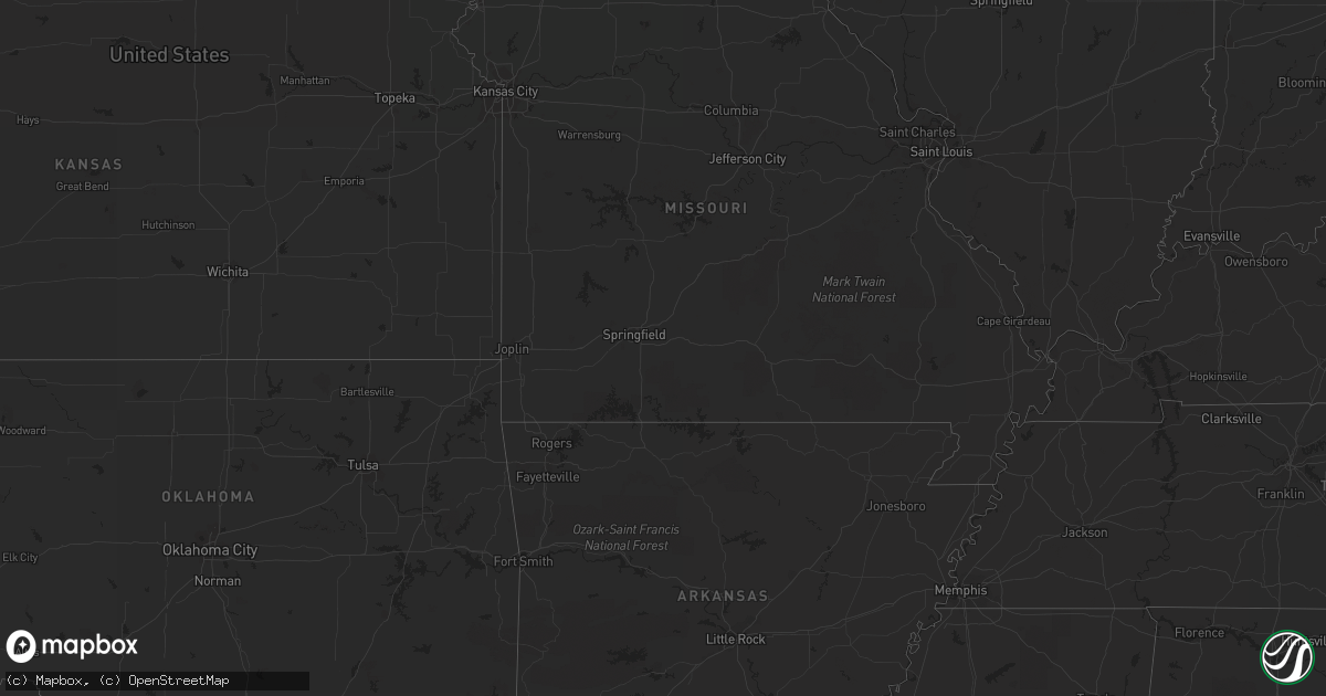
July 17 map
$229
one time, instant access
Download today. No call, no setup
Keep the $229
Bought the map and want the full workflow? Apply the entire $229 to a subscription within 7 days. None of it is wasted.
Every map, not just this one
This buys you this map. Subscription and you get every map we run, in the markets you choose from a few cities to whole states to nationwide. Plus real-time alerts the moment a storm fires.
Contact data
Name, contact info, occupancy, even credit band for addresses in the footprint. You go from where it hit to who to call.
Become the source they trust
Unlimited branding weather history reports on demand. You already have the documented answer ready for the property owner, and you are the one who showed up with it.
Property data and RoofTrace estimates
Pull up any address you have got, its value and the exact code rules for that jurisdiction, straight from One Click Code. Then RoofTrace estimates the squares, pitch, and roof value, priced the way you price.
Storm reports in North Dakota
North Dakota
| Date | Description |
|---|---|
| 07/17/20116:35 PM CDT | Significant damage to house from tornado. |
| 07/17/20116:29 PM CDT | Hail lasted 5 minutes. |
| 07/17/20116:24 PM CDT | Golfball to baseball size hail |
| 07/17/20116:18 PM CDT | Golfball to 2 inch hail |
| 07/17/20116:05 PM CDT | Relayed by law enforcement. Farmstead hit by tornado. House damaged. No injuries. |
| 07/17/20116:05 PM CDT | *** 1 inj *** upper bound ef3 tornado. Wind speeds 165 mph. Moved southeast and lifted 6 miles south southeast of berlin around 645 pm cdt. Times are estimated. This wa |
| 07/17/20115:25 PM CDT | Public report and photo received via media facebook page. Hail occurred between 525 and 530 pm cdt. |
| 07/17/20115:22 PM CDT | Corrected time of event from 422 pm cdt to 522 pm cdt and size of hail from 0.25 inch to 2.00 inch diameter. Error was that of the nws in typing the report. Relayed by |
| 07/17/20115:11 PM CDT | A local report indicates 1.75 inch wind near 5 SE PAGE |
| 07/17/20115:10 PM CDT | A local report indicates 1.75 inch wind near 8 S ELDRIDGE |
| 07/17/20115:10 PM CDT | A local report indicates 1.50 inch wind near 4 S ERIE |
| 07/17/20114:36 PM CDT | Public report relayed via media |
| 07/17/20114:34 PM CDT | Ndhp reports 100 feet visibility along interstate 94 in very heavy rain and very high wind. Pea size hail. |
| 07/17/20114:22 PM CDT | Relayed by media. |
| 07/17/20114:15 PM CDT | A local report indicates 2.75 inch wind near 5 S PILLSBURY |
| 07/17/20114:07 PM CDT | Rotation in the storm. No hail. Funnel clouds have dissipated. |
| 07/17/20113:16 PM CDT | Brief touchdown for approximately 2 minutes. Trees and tree limbs blown down. Tornado tracked for less than a mile from 4 wnw hannaford to around 3.5 west of hannaford |
| 07/17/20112:35 PM CDT | This tornado tracked intermittently for about 5 miles to around 2 wsw of revere by 250 pm cdt. Several trees were knocked down in shelter belts along the route. Maximum |
| 07/17/20112:28 PM CDT | Brief touchdown. |
| 07/17/20111:42 PM CDT | Tornado on the ground for 3 to 4 minutes. |
| 07/17/20111:09 PM CDT | Tornado tracked for at least a mile to around 5 miles sse of new rockford by 112 pm cdt. Tornado broke down two power poles along the west side of hwy 281 and severely |
| 07/17/20111:08 PM CDT | Clear damage path from highway 281 4s new rockford through shelter-belt east of 281 |
| 07/17/20111:07 PM CDT | High winds in town blew down trees with some street flooding due to the heavy rain. |
| 07/17/20111:07 PM CDT | 2 power poles snapped along us highway 281 |
| 07/17/20111:06 PM CDT | A local report indicates 1.75 inch wind near NEW ROCKFORD |
| 07/17/201112:55 PM CDT | A local report indicates 1.00 inch wind near 1 W NEW ROCKFORD |
| 07/17/201112:45 PM CDT | Report relayed by the media. |
| 07/17/201112:28 PM CDT | A local report indicates 1.75 inch wind near HEIMDAL |
| 07/17/201112:22 PM CDT | Report relayed by the media. |
| 07/17/201112:15 PM CDT | Dime to quarter sized hail driven by very strong winds produced widespread crop damage near the wells county line. |
| 07/17/201111:48 AM CDT | Brief touchdown 3 n of harvey by goose lake. Report relayed by the media. |
| 07/17/201111:06 AM CDT | Report relayed by the media. |
| 07/17/201110:56 AM CDT | Also reports heavy rain. Large hail ended at 1110 am cdt. Estimated winds at 50-60 mph with no visible damage from his home. |
| 07/17/201110:50 AM CDT | Report relayed by the media. |
| 07/17/201110:40 AM CDT | Report relayed by the media. |
| 07/17/201110:38 AM CDT | Report relayed by the media. |
| 07/17/201110:25 AM CDT | Report relayed by media. |
| 07/17/201110:10 AM CDT | 8 miles east of the old radar base. Report relayed by media. |
| 07/17/20119:48 AM CDT | Report relayed by the media. |
| 07/16/20118:55 PM CDT | Report of wahpeton apt awos |
| 07/16/20118:55 PM CDT | Report of wahpeton apt kbwp awos. |
| 07/16/20118:46 PM CDT | Peak winds measured by the nddot rwis site along nd hwy 13 near mile post 384.5. |
| 07/16/20118:30 PM CDT | Thunderstorm wind caused tree to crash into house. |
| 07/16/20118:16 PM CDT | Several two inch to three inch diameter branches down in lidgerwood...mostly from cottonwood trees |
| 07/16/20118:15 PM CDT | Thunderstorm wind caused tree to crash into house. Some trees uprooted. |
| 07/16/20118:12 PM CDT | Winds approaching 60 mph brought down 3 to 4 inch tree branches. |
| 07/16/20118:12 PM CDT | Winds approaching 60 mph brought down 3 to 4 inch tree branches. |
| 07/16/20118:10 PM CDT | A four to six inch diameter birch tree...roughly 40 feet tall...came down with high winds ... Spotter received 0.59 inches of rain |
| 07/16/20117:47 PM CDT | Very high winds east of gwinner...near zero visibility with wind and rain...and the highway has several tree branches across it |
| 07/16/20117:32 PM CDT | A local report indicates 60 MPH wind near 6 W GWINNER |
| 07/16/20117:20 PM CDT | Time is estimated based on radar. Many trees snapped around merricourt...mainly evergreen. All lying in a similar direction. |
| 07/16/20117:06 PM CDT | Reports from emergency manager of funnel with debris 3 n of fullerton but was becoming rain wrapped. |
All States Impacted by Hail Map on July 17, 2011
Cities Impacted by Hail Map on July 17, 2011
- Wheatland, ND
- Pickford, MI
- Rudyard, MI
- Nederland, CO
- Montevideo, MN
- Immokalee, FL
- Naples, FL
- Jamestown, ND
- Ypsilanti, ND
- Montpelier, ND
- Strandquist, MN
- Newfolden, MN
- Butternut, WI
- Finland, MN
- Maynard, MN
- Granite Falls, MN
- Balfour, ND
- Drake, ND
- Velva, ND
- Voltaire, ND
- Sawyer, ND
- Minot, ND
- Boulder, CO
- Ward, CO
- Jamestown, CO
- Berlin, ND
- Harvey, ND
- Maddock, ND
- Sheyenne, ND
- Indian River, MI
- Cando, ND
- Blackduck, MN
- Cayuga, ND
- Lidgerwood, ND
- Milnor, ND
- Wabasha, MN
- Kellogg, MN
- Lyons, CO
- Lake City, MN
- Hayward, WI
- Stanley, ND
- Ringle, WI
- Boulder Junction, WI
- Cheboygan, MI
- Moran, MI
- Trout Lake, MI
- Newberry, MI
- Saint Ignace, MI
- Wittenberg, WI
- Eland, WI
- New Rockford, ND
- Glenfield, ND
- Bonita Springs, FL
- Estero, FL
- Goetzville, MI
- Homestead, FL
- Ayr, ND
- Hialeah, FL
- Jud, ND
- Dickey, ND
- Edgeley, ND
- Lamoure, ND
- Sault Sainte Marie, MI
- McMillan, MI
- Merrill, WI
- Tomahawk, WI
- Gleason, WI
- Irma, WI
- Greenwood, WI
- Neillsville, WI
- Tripoli, WI
- Phillips, WI
- Berthold, ND
- Schofield, WI
- Ryder, ND
- Douglas, ND
- Manton, MI
- Pepin, WI
- Morris, MN
- Donnelly, MN
- Kennan, WI
- Rollinsville, CO
- Golden, CO
- Allenspark, CO
- Fessenden, ND
- Alexander, ND
- Palermo, ND
- Luverne, ND
- Hope, ND
- Rugby, ND
- Williston, ND
- Grace City, ND
- Plaza, ND
- Hannaford, ND
- Karlsruhe, ND
- Watford City, ND
- Max, ND
- Pillsbury, ND
- Parshall, ND
- Keene, ND
- Cooperstown, ND
- Mchenry, ND
- Anamoose, ND
- Sutton, ND
- Epping, ND
- Page, ND
- Makoti, ND
- Martin, ND
- Binford, ND
- New Town, ND
- Burlington, ND
- Des Lacs, ND
- Amenia, ND
- Champion, MI
- Ishpeming, MI
- Willmar, MN
- Kandiyohi, MN
- Atwater, MN
- Lake Lillian, MN
- Wolverine, MI
- Erie, ND
- Medina, ND
- Woodworth, ND
- Lac Du Flambeau, WI
- Minocqua, WI
- Park Falls, WI
- Manitowish Waters, WI
- Mercer, WI
- Danvers, MN
- Tintah, MN
- Herman, MN
- Norcross, MN
- Wheaton, MN
- Pennock, MN
- Gould City, MI
- Gulliver, MI
- Germfask, MI
- Willard, WI
- Fairchild, WI
- Augusta, WI
- Stanley, WI
- Traverse City, MI
- Silver Bay, MN
- Middle River, MN
- Hancock, MN
- Cleveland, ND
- Tappen, ND
- Verona, ND
- Pettibone, ND
- Glidden, WI
- Lake Tomahawk, WI
- Rhinelander, WI
- Fort Ransom, ND
- York, ND
- Glen Arbor, MI
- Empire, MI
- Elk Mound, WI
- Hamlet, IN
- Westboro, WI
- Medford, WI
- Paradise, MI
- Marion, ND
- Afton, MI
- Hazelhurst, WI
- Harshaw, WI
- Drummond, WI
- Ellendale, ND
- Rosholt, SD
- Fairmount, ND
- Hankinson, ND
- Raymond, MN
- Wolford, ND
- Merrillan, WI
- Kulm, ND
- Mellen, WI
- Saxon, WI
- Ashland, WI
- Kerkhoven, MN
- Eagle River, WI
- Strathcona, MN
- Springbrook, WI
- Ross, ND
- Wausau, WI
- Aniwa, WI
- Antigo, WI
- Kinross, MI
- Woodruff, WI
- Clintonville, WI
- Crary, ND
- Murdock, MN
- Sterling, MI
- Brantwood, WI
- Wyndmere, ND
- Elcho, WI
- Idaho Springs, CO
- Norwich, ND
- Osseo, WI
- Reedsville, WI
- Humbird, WI
- Holloway, MN
- Benson, MN
- Clontarf, MN
- Greenbush, MN
- Clara City, MN
- Appleton, MN
- Sunburg, MN
- Lisbon, ND
- Bemidji, MN
- Manistique, MI
- Seney, MI
- Miami, FL
- Forest Junction, WI
- Brillion, WI
- Hilbert, WI
- Bonduel, WI
- Shiocton, WI
- Knox, IN
- Shawano, WI
- Presque Isle, WI
- Towner, ND
- Litchfield, MN
- Cosmos, MN
- Fort Myers, FL
- Republic, MI
- Ochopee, FL
- Sarasota, FL
- Fife Lake, MI
- Kingsley, MI
- Birnamwood, WI
- Lake Ann, MI
- Cedar, MI
- Au Gres, MI
- Standish, MI
- Omer, MI
- Mason, WI
- Cadillac, MI
- Hutchinson, MN
- Gwinner, ND
- Central City, CO
- Sayner, WI
- Saint Germain, WI
- Marquette, MI
- Eckerman, MI
- Solon Springs, WI
- Minong, WI
- Fall Creek, WI
- Eleva, WI
- Strum, WI
- Eau Claire, WI
- Northome, MN
- Laramie, WY
- Pelican Lake, WI
- Marion, WI
- Menasha, WI
- Cathay, ND
- Tioga, ND
- Casselton, ND
- Kaukauna, WI
- Combined Locks, WI
- Appleton, WI
- Alma, WI
- Elbow Lake, MN
- Menomonie, WI
- Nevada, IA
- Maxwell, IA
- Michigamme, MI
- Goodhue, MN
- Mazeppa, MN
- Summit Lake, WI
- Rose City, MI
- Bryant, WI
- Alberta, MN
- Chokio, MN
- Michigan, ND
- Bear Creek, WI
- Covington, MI
- Absaraka, ND
- Oberon, ND
- De Pere, WI
- Wrightstown, WI
- Puposky, MN
- Clarkfield, MN
- Boyd, MN
- Dawson, MN
- Cook, MN
- New Port Richey, FL
- Hines, MN
- Hatley, WI
- Buffalo, ND
- Lakota, ND
- Devils Lake, ND
- Gordon, WI
- Trout Creek, MI
- Mizpah, MN
- Deerbrook, WI
- Red Wing, MN
- Brimson, MN
- Stockholm, WI
- Campbell, MN
- Reads Landing, MN
- Dafter, MI
- Mantador, ND
- Kimberly, WI
- Twining, MI
- Mackinac Island, MI
- Davenport, ND
- Kewadin, MI
- Rapid City, MI
- Pulaski, WI
- Whitehall, WI


