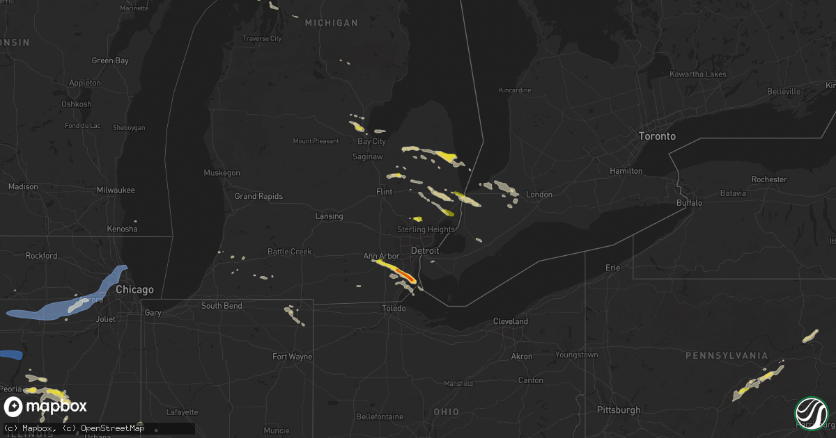
Hail Map on July 14, 2023
Get this storm
July 14 map
$229
one time, instant access
Download today. No call, no setup
Keep the $229
Bought the map and want the full workflow? Apply the entire $229 to a subscription within 7 days. None of it is wasted.
Every map, not just this one
This buys you this map. Subscription and you get every map we run, in the markets you choose from a few cities to whole states to nationwide. Plus real-time alerts the moment a storm fires.
Contact data
Name, contact info, occupancy, even credit band for addresses in the footprint. You go from where it hit to who to call.
Become the source they trust
Unlimited branding weather history reports on demand. You already have the documented answer ready for the property owner, and you are the one who showed up with it.
Property data and RoofTrace estimates
Pull up any address you have got, its value and the exact code rules for that jurisdiction, straight from One Click Code. Then RoofTrace estimates the squares, pitch, and roof value, priced the way you price.
States Impacted by Hail Map on July 14, 2023
Storm reports
Virginia
| Date | Description |
|---|---|
| 07/14/20236:05 PM CDT | Tree down in cornwall. |
| 07/14/20235:50 PM CDT | Multiple trees down on telegraph road near wickford drive. |
| 07/14/20235:30 PM CDT | Tree down on reedy creek road nw of bristol va. Time estimated from radar. |
| 07/14/20235:30 PM CDT | A couple trees down along north lee highway. |
| 07/14/20235:28 PM CDT | Two trees down in town. |
| 07/14/20235:20 PM CDT | A couple trees down. |
| 07/14/20234:35 PM CDT | A local report indicates 59 MPH wind near Dulles Intl Airport |
| 07/14/20234:34 PM CDT | A local report indicates 66 MPH wind near Reston |
| 07/14/20234:31 PM CDT | Multiple trees down on georgetown pike. Trees also down in great falls park. |
| 07/14/20234:31 PM CDT | Tree down onto a vehicle and powerlines near the intersection of georgetown pike and spring hill road. |
| 07/14/20234:25 PM CDT | Tree damage and large garbage dumpster displaced. |
| 07/14/20234:20 PM CDT | A local report indicates 1.50 inch wind near Herndon |
| 07/14/20234:03 PM CDT | Treee down on downey mill road near quarter branch road. |
| 07/14/20234:00 PM CDT | One large tree limb was broken off. |
| 07/14/20233:59 PM CDT | Tree down on roadway near the intersection of hirst road and berlin turnpike. |
| 07/14/20233:59 PM CDT | Multiple trees down along berlin turnpike between wheatland and lovettsville. |
| 07/14/20233:54 PM CDT | Tree down on north fork road near telegraph springs road. |
| 07/14/20233:40 PM CDT | Tree down on mountain road near route 690. |
| 07/14/20233:32 PM CDT | Tree down on route 714 near route 716. |
| 07/14/20232:59 PM CDT | Quarter sized hail near the w&od trail in herndon. |
| 07/14/20232:27 PM CDT | Half dollar sized hail near the intersection of 522 north and hunting ridge road. |
| 07/14/20232:18 PM CDT | Quarter sized hail in cross junction virginia. |
| 07/14/20232:09 PM CDT | Half dollar sized hail in cross junction virginia. |
| 07/14/20231:57 PM CDT | A local report indicates 1.00 inch wind near 2 WSW Cross Junction |
| 07/14/20231:17 PM CDT | Multiple trees and wires down in the clover hill area toward the north side of bridgewater. |
| 07/14/20231:08 PM CDT | Several trees and powerlines down near the 8500 block of union springs road. |
Kansas
| Date | Description |
|---|---|
| 07/14/20236:39 PM CDT | The line has just worked in... We have winds right at 60 mph in central cherokee county. |
| 07/14/20236:36 PM CDT | Report from mping: 1-inch tree limbs broken; shingles blown off. Time based on radar. |
| 07/14/20236:32 PM CDT | Winds estimated 70 mph with damage and power outages. Time based on radar. |
| 07/14/20236:32 PM CDT | Several roadways are blocked by trees with many powerlines down. Time based on radar. |
| 07/14/20236:24 PM CDT | Reports of street flooding in town along with several trees and power lines down. |
| 07/14/20236:21 PM CDT | Report from mping: 1-inch tree limbs broken; shingles blown off. |
| 07/14/20236:20 PM CDT | Several large tree limbs down and transformers blown in girard. Unknown size other than large. Time based on radar. |
| 07/14/20236:13 PM CDT | A local report indicates 62 MPH wind near 1 N Maple City |
| 07/14/20236:10 PM CDT | Round bales moved in the wind and power lines down. Picture sent in email. Time based on radar. |
| 07/14/20236:05 PM CDT | Tree reported down in town. |
| 07/14/20236:05 PM CDT | Trees and powerlines down. Time estimated from radar. |
| 07/14/20236:05 PM CDT | Trees and powerlines down. Time estimated from radar. |
| 07/14/20235:57 PM CDT | Report of power lines down in erie. |
| 07/14/20235:55 PM CDT | Trees and powerlines down. Time estimated from radar. |
| 07/14/20235:52 PM CDT | Report from mping: trees uprooted or snapped; roof blown off. |
| 07/14/20235:45 PM CDT | Delayed report of trees down and the power out in the city. Time based on radar. |
| 07/14/20235:43 PM CDT | A local report indicates 70 MPH wind near Allen County Airport |
| 07/14/20235:39 PM CDT | A local report indicates 63 MPH wind near 7 N Arkansas City |
| 07/14/20235:36 PM CDT | Ks mesonet site reported an 85 mph wind gust. |
| 07/14/20235:32 PM CDT | A local report indicates 69 MPH wind near Chanute Airport |
| 07/14/20235:30 PM CDT | County dispatch reports... 60 to 70 mph winds. |
| 07/14/20235:27 PM CDT | A local report indicates 58 MPH wind near Chanute Airport |
| 07/14/20235:25 PM CDT | A local report indicates 70 MPH wind near Humboldt |
| 07/14/20235:08 PM CDT | Report of a semi trailer blown over on highway 54. Multiple power lines are reported down through the county. |
| 07/14/20234:57 PM CDT | 4 to 6 inch tree limbs and power lines down. |
| 07/14/20234:57 PM CDT | Widespread 4 to 6 inch tree limbs down. Some limbs were 12 inches in diameter. |
| 07/14/20234:57 PM CDT | Widespread 4 to 6 inch diameter tree limbs down in hamilton. Some limbs were 12 inches in diameter. |
| 07/14/20234:41 PM CDT | A local report indicates 65 MPH wind near 3 E Thrall |
| 07/14/20234:40 PM CDT | A local report indicates 60 MPH wind near 4 N Clearwater |
| 07/14/20234:20 PM CDT | Multiple reports of power lines and tree limbs down. |
| 07/14/20234:20 PM CDT | Report from mping: 3-inch tree limbs broken; power poles broken. |
| 07/14/20234:20 PM CDT | Report from mping: 1-inch tree limbs broken. |
| 07/14/20234:17 PM CDT | Delayed report of 4 inch diameter tree limbs down. Time estimated by radar. |
| 07/14/20234:15 PM CDT | Report from mping: 3-inch tree limbs broken; power poles broken. |
| 07/14/20234:14 PM CDT | Large tree snapped. |
| 07/14/20234:14 PM CDT | Report from mping: 3-inch tree limbs broken; power poles broken. |
| 07/14/20234:11 PM CDT | Report from mping: 3-inch tree limbs broken; power poles broken. |
| 07/14/20234:09 PM CDT | Report from mping: 1-inch tree limbs broken. |
| 07/14/20234:09 PM CDT | Trained spotter reported 60 mph gusts as well as localized street flooding. |
| 07/14/20234:07 PM CDT | Report from mping: 3-inch tree limbs broken; power poles broken. |
| 07/14/20234:05 PM CDT | Delayed report... Broadcast media tweet showing very large tree on house with significant roof damage. Time estimated from radar. |
| 07/14/20234:04 PM CDT | 21 inch diameter tree down at vine and maple. |
| 07/14/20234:03 PM CDT | Trained spotter estimated 75-80 mph winds. |
| 07/14/20234:00 PM CDT | A local report indicates 65 MPH wind near 1 S Merriam |
| 07/14/20234:00 PM CDT | A local report indicates 60 MPH wind near Potwin |
| 07/14/20234:00 PM CDT | A local report indicates 60 MPH wind near Burns |
| 07/14/20233:58 PM CDT | A local report indicates 60 MPH wind near 2 SSE Lenexa |
| 07/14/20233:57 PM CDT | Report from mping: 3-inch tree limbs broken; power poles broken. |
| 07/14/20233:56 PM CDT | Report from mping: 1-inch tree limbs broken. |
| 07/14/20233:55 PM CDT | Report from mping: 1-inch tree limbs broken. |
| 07/14/20233:55 PM CDT | Spotter reports 70 mph wind gusts for 20 minutes with a peak gust of 89 mph. Large tree limbs down and shingles blown off roof. |
| 07/14/20233:55 PM CDT | 6 inch tree branches downed. Time estimated from radar. |
| 07/14/20233:54 PM CDT | Large tree limbs downed on maplewood lane in lenexa. |
| 07/14/20233:53 PM CDT | Delayed report... Twitter picture of a personal weather station indicating 69.7 mph wind at 3:53 pm. |
| 07/14/20233:50 PM CDT | Report from mping: 1-inch tree limbs broken. |
| 07/14/20233:47 PM CDT | *** 1 inj *** numerous trees and powerlines down. A car was blown off us 59 into a creek and an injury resulted. |
| 07/14/20233:47 PM CDT | A local report indicates 68 MPH wind near 1 NNW Maywood |
| 07/14/20233:45 PM CDT | Report from mping: 1-inch tree limbs broken. |
| 07/14/20233:43 PM CDT | Delayed report... Tree down at 51st and quivira. |
| 07/14/20233:40 PM CDT | Delayed report of partial roof blown off at the municipal airport in marion. |
| 07/14/20233:40 PM CDT | Estimated 6 inch tree branches down at the marion county courthouse. |
| 07/14/20233:39 PM CDT | A local report indicates 70 MPH wind near 2 SW Lake Quivira |
| 07/14/20233:39 PM CDT | A local report indicates 1.00 inch wind near 1 SSE Wellsville |
| 07/14/20233:35 PM CDT | A local report indicates 67 MPH wind near Newton Airport |
| 07/14/20233:34 PM CDT | Delayed report... Several tree branches down in the area of 168th and evans road. |
| 07/14/20233:29 PM CDT | Heavy rain... Low visibility. |
| 07/14/20233:25 PM CDT | Tree downed into power lines in tonganoxie. |
| 07/14/20233:21 PM CDT | Corrects previous non-tstm wnd gst report from 5 nne lawrence. Asos station klwc lawrence. |
| 07/14/20233:20 PM CDT | Klwc asos. |
| 07/14/20233:20 PM CDT | Report from mping: 1-inch tree limbs broken; shingles blown off. |
| 07/14/20233:17 PM CDT | Delayed report... |
| 07/14/20233:16 PM CDT | Report from mping: 1-inch tree limbs broken; shingles blown off. |
| 07/14/20233:14 PM CDT | A local report indicates 60 MPH wind near 3 W Jarbalo |
| 07/14/20233:12 PM CDT | A local report indicates 1.75 inch wind near Eskridge |
| 07/14/20233:09 PM CDT | A local report indicates 70 MPH wind near Oskaloosa |
| 07/14/20233:08 PM CDT | Personal weather station. |
| 07/14/20233:08 PM CDT | Spotter estimated 50-60 mph wind gusts. |
| 07/14/20233:07 PM CDT | A local report indicates 1.00 inch wind near 4 WNW Lawrence |
| 07/14/20233:07 PM CDT | A local report indicates 70 MPH wind near 3 WNW Lawrence |
| 07/14/20233:01 PM CDT | Personal weather station. |
| 07/14/20233:00 PM CDT | Personal weather station. |
| 07/14/20233:00 PM CDT | Also one foot diameter tree limbs down and quarter size hail. |
| 07/14/20233:00 PM CDT | Report from mping: 3-inch tree limbs broken; power poles broken. Time estimated from radar. |
| 07/14/20232:59 PM CDT | A local report indicates 58 MPH wind near Hutchinson Airport |
| 07/14/20232:57 PM CDT | Up station. |
| 07/14/20232:57 PM CDT | Report from mping: 3-inch tree limbs broken; power poles broken. Delayed report. |
| 07/14/20232:57 PM CDT | A local report indicates 75 MPH wind near 1 W Oskaloosa |
| 07/14/20232:56 PM CDT | Kansas state mesonet. |
| 07/14/20232:54 PM CDT | Delayed report... By off duty nws employee of 6 inch diameter tree limbs down. |
| 07/14/20232:53 PM CDT | Kfoe asos. |
| 07/14/20232:52 PM CDT | Large tree looks like its been snapped in half. Report from social media. |
| 07/14/20232:52 PM CDT | Fire chief estimating 70 mph wind gust. |
| 07/14/20232:50 PM CDT | A local report indicates 65 MPH wind near 4 N Carbondale |
| 07/14/20232:45 PM CDT | Fire chief estimates 85 mph wind gust. Signs blown of posts and 0 visibility. |
| 07/14/20232:45 PM CDT | Kansas state mesonet. |
| 07/14/20232:41 PM CDT | Report from mping: 1-inch tree limbs broken; shingles blown off. |
| 07/14/20232:41 PM CDT | Power lines down... Significant damages to trees... Homes... Vehicles with many power lines down across perry. Time estimated from radar. |
| 07/14/20232:41 PM CDT | Multiple trees snapped in perry... One as large as 36 inches in diameter. |
| 07/14/20232:40 PM CDT | A local report indicates 60 MPH wind near 2 NE Lawrence |
| 07/14/20232:39 PM CDT | Personal weather station... Delayed report. |
| 07/14/20232:35 PM CDT | Personal weather station. |
| 07/14/20232:34 PM CDT | A local report indicates 60 MPH wind near Salina Municipal Airpor |
| 07/14/20232:31 PM CDT | Report from mping: 1-inch tree limbs broken; shingles blown off. |
| 07/14/20232:30 PM CDT | Many tree limbs around 3 inches in diameter down on road. |
| 07/14/20232:30 PM CDT | Personal station. |
| 07/14/20232:30 PM CDT | Union and pacific station. |
| 07/14/20232:30 PM CDT | Estimated 8 inch tree limbs down. Time estimated from radar data. |
| 07/14/20232:29 PM CDT | Ktop asos. |
| 07/14/20232:28 PM CDT | Kansas state mesonet. |
| 07/14/20232:28 PM CDT | Asos station ktop topeka. |
| 07/14/20232:25 PM CDT | 60-70 estimated. |
| 07/14/20232:24 PM CDT | Kansas state mesonet. |
| 07/14/20232:20 PM CDT | Estimated wind gusts to 60. |
| 07/14/20232:20 PM CDT | Estimated gusts 70-75 mph. |
| 07/14/20232:16 PM CDT | Four inch diameter tree limbs broken along with a couple larger weaker trees. There are powerlines down as well leaving parts of the city with out power. Time is based |
| 07/14/20232:16 PM CDT | Spotter reports widespread tree damage in lyons. |
| 07/14/20232:14 PM CDT | Estimated wind gusts of 70-80 mph... With large branches broken. |
| 07/14/20232:14 PM CDT | A local report indicates 1.00 inch wind near 4 W Ellinwood |
| 07/14/20232:14 PM CDT | 60 to 70 mph winds. |
| 07/14/20232:10 PM CDT | 55-65 estimated. |
| 07/14/20232:07 PM CDT | Personal weather station. |
| 07/14/20232:02 PM CDT | A local report indicates 60 MPH wind near Great Bend Airport |
| 07/14/20231:59 PM CDT | A local report indicates 60 MPH wind near Ellsworth |
| 07/14/20231:50 PM CDT | Observer reported 65 to 70 mph winds and tree damage in town. Time is based on radar. |
| 07/14/20231:50 PM CDT | Significant tree damage as well as power outages in town. |
| 07/14/20231:46 PM CDT | Wind estimated at 60 to 70 mph. Visibility was reduced to 200 yards. Report received through social media. |
| 07/14/20231:41 PM CDT | A local report indicates 62 MPH wind near 9 W Westfall |
| 07/14/20231:22 PM CDT | A local report indicates 60 MPH wind near 5 E Galatia |
| 07/14/20231:18 PM CDT | Wind gusts were estimated between 65 and 70 mph. Report was received through social media. |
| 07/14/20231:05 PM CDT | Public weather station reports gust of 62 mph. |
| 07/14/202312:55 PM CDT | Mesonet station up852 3.7 w ogallah |
| 07/14/202312:55 PM CDT | Mesonet station wkuk1 wakeeney. |
| 07/14/202312:40 PM CDT | Reports of tree damage in the alton area. |
| 07/14/202312:20 PM CDT | Time estimated from radar. This confirms another report of 75 mph in the area. 8 inch tree limbs downed and other tree damage also reported nearby. |
| 07/14/202312:18 PM CDT | Kirwin kansas raws automated weather observation. Time estimated from radar and other nearby reports. |
| 07/14/202312:15 PM CDT | A local report indicates 2.00 inch wind near Catherine |
| 07/14/202311:46 AM CDT | Report relayed via social media. Very strong winds also reported with the hail. Time estimated from radar. |
| 07/14/202311:45 AM CDT | Report from mping: quarter |
| 07/14/202311:45 AM CDT | A local report indicates 1.00 inch wind near 4 S Long Island |
| 07/14/202311:35 AM CDT | Facebook report of marble to quarter size hail. Timing estimated by radar. |
| 07/14/202311:35 AM CDT | Delayed report on social media of estimated 60 to 70 mph wind gusts with storm passage. Time estimated from radar. |
Maryland
| Date | Description |
|---|---|
| 07/14/20236:12 PM CDT | Charles county 911 center relayed report of a downed tree along humpback whale court in the waldorf area. Time estimated from radar. |
| 07/14/20235:35 PM CDT | Multiple trees down on the 3900 block of 21st avenue. |
| 07/14/20235:35 PM CDT | Tree down near the intersection of anvil lane and oxon run drive. |
| 07/14/20235:06 PM CDT | Trees and powerlines down onto transformer near the 6700 block of democracy blvd. |
| 07/14/20235:00 PM CDT | Powerlines down across road near the intersection of tilden lane and luxmanor road. |
| 07/14/20234:27 PM CDT | Tree down on roadway near the intersection of middlebrook road and i-270. |
| 07/14/20234:10 PM CDT | Multiple 4-5 inch branches down. |
| 07/14/20234:08 PM CDT | Trees and powerlines down near the intersection of montevideo road and river road. |
| 07/14/20233:50 PM CDT | Multiple trees and branches down on and near germantown road. |
Iowa
| Date | Description |
|---|---|
| 07/14/20234:51 PM CDT | Large branches blown down... Time estimated from radar. |
| 07/13/20238:20 PM CDT | A lot of small branches down with one larger branch 4 to 5 inches in diameter. |
Illinois
| Date | Description |
|---|---|
| 07/14/20235:10 PM CDT | Report from mping: quarter |
| 07/14/202311:16 AM CDT | Em reports multiple trees down around town. One large tree fell into home... Partially destroying it. |
| 07/13/202311:16 PM CDT | Corrects previous tstm wnd dmg report from worden. Previous time read 1116 am when should have been 1116 pm. Em reports multiple trees down around town. One large tree |
| 07/13/202310:20 PM CDT | Tree uprooted out of ground near fairview and ogden in downers grove. |
| 07/13/202310:01 PM CDT | Large tree landed on car in west side of aurora off orchard road. |
| 07/13/20239:57 PM CDT | Large branches downed. |
| 07/13/20239:42 PM CDT | Power lines down at maplewood and belden. |
| 07/13/20239:40 PM CDT | Lots of large branches down... Some on homes. Trees and powerlines also reported down. Relayed via social media. |
| 07/13/20239:40 PM CDT | Large tree branch down on car 1800 s damen... Person was briefly trapped in the car. |
| 07/13/20239:40 PM CDT | Large limb down on a couple of cars at 1441 n california. |
| 07/13/20239:29 PM CDT | 30 foot long limbs and many other smaller diameter limbs down. |
| 07/13/20239:29 PM CDT | 30 foot long limbs and many smaller-diameter branches down in the vicinity. |
| 07/13/20239:27 PM CDT | A local report indicates 70 MPH wind near Schaumburg |
| 07/13/20239:26 PM CDT | Multiple large tree limbs downed across the east side of schaumburg. Time estimated from radar. |
| 07/13/20239:25 PM CDT | An nws storm survey confirmed that widespread tree damage across elk grove village was caused by strong straight-line winds. Damage was most severe and concentrated in |
| 07/13/20239:25 PM CDT | Cocorahs observer reported 60-70 mph winds. |
| 07/13/20239:25 PM CDT | Pictures on social media shared of numerous large trees snapped and downed in the vicinity. One tree 2 feet in diameter. |
| 07/13/20239:20 PM CDT | Numerous medium sized tree branches down in roselle at corner of may street and arthur avenue. Power is also out on the west side of may street. Relayed via spotter net |
| 07/13/20239:20 PM CDT | Trees and power lines downed in bartlett. Time estimated from radar. |
| 07/13/20239:18 PM CDT | Estimates 65 to 70 mph wind gusts. |
| 07/13/20239:10 PM CDT | Corrects time of previous tstm wnd dmg report from 1 ne downers grove. Tree uprooted out of ground near fairview and ogden in downers grove. |
| 07/13/20239:07 PM CDT | Small pine tree uprooted. Time estimated from radar. |
| 07/13/20239:07 PM CDT | Numerous 6 inch diameter branches down. Reported via social media. |
| 07/13/20239:06 PM CDT | Numerous limbs and branches down in the vicinity... Some blocking roadways. |
| 07/13/20239:06 PM CDT | Via facebook with picture included: medium sized branch fallen from tree. |
| 07/13/20239:04 PM CDT | Radar indicated damage. |
| 07/13/20239:02 PM CDT | Multiple 3 inch diameter tree limbs downed. Time estimated from radar. |
| 07/13/20239:01 PM CDT | 6 inch diameter branch down at wehrli and lisson roads. |
| 07/13/20239:01 PM CDT | 4 inch diameter tree limb downed on west st. Time estimated. |
| 07/13/20239:00 PM CDT | Personal weather station measured a wind gust to 87 mph. |
| 07/13/20238:58 PM CDT | An nws damage survey determined an ef-0 tornado with estimated peak winds of 75 mph... Path width of 400 yards... And path length of 8.8 miles started near fermilab and |
| 07/13/20238:57 PM CDT | Fallen one foot diameter tree limb took out three power poles on n van buren and spring street. |
| 07/13/20238:56 PM CDT | Numerous 6 inch diameter branches and limbs down all over the area... Particularly between mckee and fabyan parkway... East towards route 31. |
| 07/13/20238:52 PM CDT | Measured at kilbatav3. |
| 07/13/20238:45 PM CDT | Corrects time of previous tstm wnd dmg report from 3 sw north aurora. Large tree landed on car in west side of aurora off orchard road. |
| 07/13/20238:42 PM CDT | Measured gust to 61 mph at arr asos. |
| 07/13/20238:39 PM CDT | Personal weather station measured a wind gust to 64 mph. |
| 07/13/20238:16 PM CDT | Limbs down on power lines. 2 trees down on a house in southeast mcleansboro. |
| 07/13/20237:54 PM CDT | Reports of a large tree downed onto a property north of triumph. |
| 07/13/20237:45 PM CDT | Trees downed. |
| 07/13/20237:40 PM CDT | Several trees blown down or snapped off at the base. Also... Power pole snapped off. This was in wilson park area. |
| 07/13/20237:35 PM CDT | Large tree down on the 700 block of dry gulch road. Was blocking three quarters of the roadway. Time estimated based on radar. |
| 07/13/20237:28 PM CDT | Multiple trees down in the neighbors yard... With estimated wind gusts to 60mph. |
| 07/13/20237:25 PM CDT | Powerlines down with one power pole snapped. Time estimated by radar. |
| 07/13/20237:15 PM CDT | 6 inch diameter tree branches down. |
| 07/13/20237:03 PM CDT | Large tree branch broken off near the base. |
| 07/13/20237:00 PM CDT | Two large tree limbs blown down and a porch roof collapsed. Relayed through social media. |
Georgia
| Date | Description |
|---|---|
| 07/13/20238:19 PM CDT | Corrects previous tstm wnd dmg report from windsor. Tree down along hudson rd near windsor. |
| 07/13/20237:19 PM CDT | Tree down along hudson rd near windsor. |
New Jersey
| Date | Description |
|---|---|
| 07/14/20236:14 PM CDT | Multiple wires blown down. Time estimated from radar. |
| 07/14/20235:40 PM CDT | Dot reports downed pole and downed wires on nj 23 northbound south of cr 695/echo lake rd |
| 07/14/20235:06 PM CDT | Relayed report via social media. Local rockaway township chat groups are reporting numerous trees down blocking roadways in the hibernia section of rockaway along green |
| 07/13/20239:20 PM CDT | Trees down in long hill. Time estimated via radar. |
| 07/13/20239:20 PM CDT | Trees down in madison. Time estimated via radar. |
Arkansas
| Date | Description |
|---|---|
| 07/14/202312:05 AM CDT | A local report indicates 60 MPH wind near 1 WNW Redfield |
| 07/13/202311:53 PM CDT | Asos station klit little rock adams field. |
| 07/13/202310:45 PM CDT | Power outages were reported and 7 trees were down. |
| 07/13/20239:58 PM CDT | 22 inch diameter tree down in ozark county estates. Tim is radar estimated. |
| 07/13/20239:56 PM CDT | Multiple trees down in ozark. |
| 07/13/20239:52 PM CDT | Tree damage and large tree limbs down. |
| 07/13/20239:49 PM CDT | Multiple trees down on 64 in alma. |
| 07/13/20239:43 PM CDT | Tree fell on a house on mulberry st. |
| 07/13/20239:43 PM CDT | Several large trees snapped in van buren. |
| 07/13/20239:43 PM CDT | Measured 65 mph wind gust. |
| 07/13/20239:35 PM CDT | A barn was overturned. |
| 07/13/20239:24 PM CDT | Trees and power lines were downed... Along with some large tree limbs. |
| 07/13/20238:55 PM CDT | Large tree was uprooted and fell onto a vehicle and camper. Time estimated based on radar. |
| 07/13/20238:40 PM CDT | Kfyv asos measured 67 mph |
| 07/13/20238:28 PM CDT | Report of tree limbs down. |
| 07/13/20238:11 PM CDT | Large tree limb down on a road. Time is radar estimated. Report relayed via social media. |
| 07/13/20238:11 PM CDT | Power lines down in rogers. Time is radar estimated. |
| 07/13/20238:05 PM CDT | 7 inch diameter tree limb down on two cars a the four points sheraton hotel. |
| 07/13/20237:52 PM CDT | Large tree down. Time is radar estimated. Report relayed via social medial. |
New Mexico
| Date | Description |
|---|---|
| 07/13/20239:04 PM CDT | A local report indicates 1.00 inch wind near 2 WSW Maxwell National |
| 07/13/20238:52 PM CDT | A local report indicates 1.75 inch wind near 8 WNW Maxwell National |
Kentucky
| Date | Description |
|---|---|
| 07/14/20234:45 PM CDT | 3 trees down on houses and one tree down on a car. |
Oklahoma
| Date | Description |
|---|---|
| 07/14/20236:54 PM CDT | Power pole snapped at hwy 59 and s530 road east of welch. Time is radar estimated. Report relayed via social media. |
| 07/14/20236:45 PM CDT | Power poles down along old highway 60. |
| 07/14/20237:43 AM CDT | 6 inch diameter treen down on top of a truck on the south end of oologah lake. Estimated winds of 60 mph. Time is radar estimated. Report relayed via social media. |
| 07/13/20238:37 PM CDT | Trees and power line down bewteen wagoner and okay. Time is radar estimated. |
| 07/13/20238:37 PM CDT | Measured 61 mph wind gust with large tree limb down. |
| 07/13/20238:22 PM CDT | Estimated wind gust of 55 to 60 mph. |
| 07/13/20238:22 PM CDT | Tree fell on road at e740 rd and s270 rd on the southwest side of wagoner. |
| 07/13/20238:05 PM CDT | Two large trees down in jenks blocking both lanes of s florence at 116th st. |
| 07/13/20238:05 PM CDT | Trees on the road at 21st and 273rd. |
| 07/13/20237:42 PM CDT | Huge tree limb down at 76th st and 146th st east of owssao. |
| 07/13/20237:25 PM CDT | Report from mping: golf ball |
| 07/13/20237:19 PM CDT | Six inch diameter tree limb down knocking down power lines. Additional 4-6 inch diameter tree limbs down in south part of hominy. |
| 07/13/20237:17 PM CDT | A local report indicates 1.50 inch wind near 1 ENE Woodward |
Pennsylvania
| Date | Description |
|---|---|
| 07/14/20236:50 PM CDT | Report of a few trees down in franklin township in the area 209. Time estimated from radar. |
| 07/14/20236:10 PM CDT | Multiple trees down in the area of 611 in bangor and washington township. Video also shared on social media of severe winds. Time estimated from radar. |
| 07/14/20236:03 PM CDT | Power poles... Trees and wires down. |
| 07/14/20236:01 PM CDT | Trees and wires down. |
| 07/14/20235:52 PM CDT | Corrects previous tstm wnd dmg report from 3 wnw goulsboro state park. River road closed due to downed trees. Time estimated from radar. |
| 07/14/20235:37 PM CDT | Report of trees down on wires on king street near stroudsburg... Pa. |
| 07/14/20235:37 PM CDT | Trees down in east stroudsburg. Times estimated from radar. |
| 07/14/20235:20 PM CDT | River road closed due to downed trees. Time estimated from radar. |
| 07/14/20235:14 PM CDT | Downed tree in wires on pa 191 both directions between franklin hill rd and ackermanville rd. All lanes closed. Time estimated from radar. |
| 07/14/20234:09 PM CDT | Tree on wires on fourth street. |
| 07/14/20234:09 PM CDT | Trees and wires down on melvina street. |
| 07/14/20233:33 PM CDT | Trees and large limbs on wires across southern clinton county. |
| 07/14/20233:07 PM CDT | Fire department reports multiple trees down along park rd. |
| 07/14/20233:05 PM CDT | Tree down on wires along coburn road. |
| 07/14/20232:40 PM CDT | Tree down on a home in the 300 block of east lamb street. |
| 07/14/20232:37 PM CDT | Trees down near intersection of route 26 and route 144. Also... 4 to 5 inches of water across the roadway. |
| 07/14/20232:30 PM CDT | Wind damage to a home near the intersection of mitchell ave and mckee street. |
| 07/14/20232:27 PM CDT | Centre county 911 dispatch reports trees down at the 2600 block of tadpole rd. |
| 07/14/20232:25 PM CDT | Centre county 911 dispatch reports trees down on power poles at the 500 block of south garner st. |
| 07/14/20232:20 PM CDT | Fire department confirms wires down on west white hall rd. |
| 07/14/20232:10 PM CDT | *** 1 inj *** huntington county 911 confirms tree down on mobile home on evergreen ln with 1 injury. |
West Virginia
| Date | Description |
|---|---|
| 07/14/20233:28 PM CDT | Washington street near charles town casino closed due to multiple trees down. |
| 07/14/20233:25 PM CDT | Delayed report. Trained spotter reported numerous trees down along the railroad track south of charles town. |
| 07/14/20233:23 PM CDT | Multiple trees and powerlines down in ranson. |
| 07/14/202312:07 PM CDT | Hail up to the size of quarters at the state police office |
| 07/14/20239:25 AM CDT | Tree in the roadway on wv-68. |
| 07/14/20239:25 AM CDT | Tree onto powerlines near wv-60 and wadesville rd. |
| 07/14/20239:22 AM CDT | Tree down on locust ridge. |
Missouri
| Date | Description |
|---|---|
| 07/14/20236:58 PM CDT | Communication lines down due to a tree blown down. |
| 07/14/20236:54 PM CDT | Report from mping: 3-inch tree limbs broken; power poles broken. Time based on radar. |
| 07/14/20236:50 PM CDT | 4 inch diameter tree limbs downed from healthy trees. Time estimated by radar. |
| 07/14/20236:46 PM CDT | Via facebook with picture included: medium sized tree snapped about 1 foot up from base. |
| 07/14/20236:46 PM CDT | Via facebook with picture included: large tree branch fallen onto power lines causing power lines to sink 3 to 4 feet from the ground. |
| 07/14/20236:36 PM CDT | Missouri mesonet. |
| 07/14/20236:12 PM CDT | Report from mping: 1-inch tree limbs broken. |
| 07/14/20236:09 PM CDT | County dispatched reported a tree blocking the road at 127 hwy and crawford road. Time estimated via radar. |
| 07/14/20235:50 PM CDT | County dispatch reports multiple trees down. Time estimated via radar. |
| 07/14/20235:48 PM CDT | Report from mping: 3-inch tree limbs broken; power poles broken. |
| 07/14/20235:27 PM CDT | A local report indicates 69 MPH wind near 1 SSE La Monte |
| 07/14/20235:26 PM CDT | Rock island cafe in leeton. |
| 07/14/20235:13 PM CDT | Tree fallen on highway near intersection of us-24 and 213 hwy. Reported via dispatch. |
| 07/14/20234:49 PM CDT | Report from mping: 3-inch tree limbs broken; power poles broken. |
| 07/14/20234:43 PM CDT | Multiple trees damaged ranging from 4-12 inches in diameter. Reported via social media. |
| 07/14/20234:42 PM CDT | Oak grove has numerous reports of various tree limbs down including an 18 inch diameter tree down on a house. 137 evergy customers without power. Winds were estimated a |
| 07/14/20234:37 PM CDT | Report from mping: trees uprooted or snapped. |
| 07/14/20234:36 PM CDT | Report from mping: 3-inch tree limbs broken; power poles broken. |
| 07/14/20234:32 PM CDT | Multiple >6 in. Tree limbs down along 150 hwy. Time estimated via radar. |
| 07/14/20234:32 PM CDT | Public estimated 60-65 mph winds. |
| 07/14/20234:20 PM CDT | Large tree downed on a house. |
| 07/14/20234:20 PM CDT | Large tree snapped near the base and fell on top of a house. Time estimated from radar. |
| 07/14/20234:20 PM CDT | Large tree branches downed. |
| 07/14/20234:20 PM CDT | Report from mping: 1-inch tree limbs broken. |
| 07/14/20234:20 PM CDT | Large tree snapped at the base and fell on top of a house. Time estimated from radar. |
| 07/14/20234:19 PM CDT | Delayed report... Trees down along 15th street near a in blue springs. |
| 07/14/20234:15 PM CDT | Report from mping: 3-inch tree limbs broken; power poles broken. |
| 07/14/20234:12 PM CDT | Lees summit airport asos. |
| 07/14/20234:10 PM CDT | Pictures of tree limbs 6 inches and greater down in the waldo area via social media. |
| 07/14/20234:07 PM CDT | Mkc asos recorded a wind gust of 59 mph. |
| 07/14/20234:05 PM CDT | Large tree limbs downed near lake waukomis. Time estimated from radar. |
| 07/14/20234:05 PM CDT | Large tree limbs downed in the lake waukomis area. Time estimated from radar. |
| 07/14/20233:43 PM CDT | Report from mping: quarter |
| 07/14/20231:14 PM CDT | Report from mping: quarter |
| 07/13/20239:03 PM CDT | Tree limbs downed power lines 5 miles south of hannibal on highway 79. |
| 07/13/20239:00 PM CDT | Power pole blown down and 2 to 3 inch limbs down. |
| 07/13/20238:43 PM CDT | Report from mping: 1-inch tree limbs broken; shingles blown off. |
| 07/13/20238:42 PM CDT | Report from mping: 1-inch tree limbs broken; shingles blown off. Time based on radar. |
| 07/13/20238:40 PM CDT | Law enforcement reports numerous trees down in branson area. Time based on radar. |
| 07/13/20238:40 PM CDT | Amateur radio reports 15 inch tree down on chishom trail in forsyth. Time based on radar. |
| 07/13/20238:39 PM CDT | Report from mping: 1-inch tree limbs broken; shingles blown off. Time based on radar. |
| 07/13/20238:38 PM CDT | Amateur radio reports several 2 to 3 inch trees down. |
| 07/13/20238:37 PM CDT | Tree blocking roadway at national and seminole. |
| 07/13/20238:36 PM CDT | Report from mping: 1-inch tree limbs broken; shingles blown off. Time based on radar. |
| 07/13/20238:30 PM CDT | Trailer tipped over. |
| 07/13/20238:30 PM CDT | *** 1 fatal *** corrects previous tstm wnd dmg report from 3 ssw table rock. Tree fell on camper trailer. |
| 07/13/20238:30 PM CDT | Trees and power lines down. Time estimated by radar. |
| 07/13/20238:30 PM CDT | Report from mping: 1-inch tree limbs broken; shingles blown off. Time based on radar. |
| 07/13/20238:30 PM CDT | Pictures of trees down over the road. |
| 07/13/20238:25 PM CDT | Tree branches on roof and part of roof blew off. |
| 07/13/20238:25 PM CDT | 6 to 8 inch tree limbs down in the skyview area. |
| 07/13/20238:20 PM CDT | Tree damage... Branches down |
| 07/13/20238:16 PM CDT | Measurement is from the branson belle. Time is radar estimated. |
| 07/13/20238:14 PM CDT | Report from mping: trees uprooted or snapped; roof blown off. Delayed report and time based on radar. |
| 07/13/20238:12 PM CDT | Report from mping: 1-inch tree limbs broken; shingles blown off. Time based on radar. |
| 07/13/20238:00 PM CDT | Fallen tree took out powerlines. |
| 07/13/20237:47 PM CDT | 6-8 inch diameter healthy tree limbs down. |
| 07/13/20237:45 PM CDT | Corrects previous tstm wnd dmg report from cassville. Small limb fell in front of door... That an officer was able to move and free the resident. |
| 07/13/20237:45 PM CDT | Fd reporting a tree fell into a house in cassville... Possible someone is trapped. |
| 07/13/20237:42 PM CDT | 1 mile north of purdy... Multiple reports of a roof blown off chicken houses... Power lines down... And large round hay bails blown across the road. |
| 07/13/20237:40 PM CDT | Report from mping: 1-inch tree limbs broken; shingles blown off. |
| 07/13/20237:40 PM CDT | 10-12 inch diameter tree down on house and power line down on east promenade. |
| 07/13/20237:37 PM CDT | 8 inch limbs down. Some power poles moved around 10 degrees. Delayed report. |
| 07/13/20237:37 PM CDT | Power lines down near west broadway and stadium blvd. |
| 07/13/20237:35 PM CDT | Report from mping: 1-inch tree limbs broken; shingles blown off. |
| 07/13/20237:35 PM CDT | Monett airport wind gust of 60 mph. |
| 07/13/20237:32 PM CDT | Report from mping: 3-inch tree limbs broken; power poles broken. |
| 07/13/20237:30 PM CDT | Many tree limbs and power lines down. |
| 07/13/20237:30 PM CDT | Report from mping: 3-inch tree limbs broken; power poles broken. |
| 07/13/20237:24 PM CDT | Tree over bonne femme church road and gan creek wild line area. |
| 07/13/20237:20 PM CDT | Report from mping: 1-inch tree limbs broken; shingles blown off. |
| 07/13/20237:17 PM CDT | Power line down rt z near abc lane. |
| 07/13/20237:15 PM CDT | Report from mping: 3-inch tree limbs broken; power poles broken. Time based on radar. |
| 07/13/20237:15 PM CDT | Large tree blocking st. Charles road near kipling. |
| 07/13/20237:15 PM CDT | Several 6-8in tree limbs downed and roofs torn from outbuildings. Time estimated from radar. |
| 07/13/20237:13 PM CDT | Report from mping: 3-inch tree limbs broken; power poles broken. |
| 07/13/20237:10 PM CDT | Large tree down blocking roadway at randy lane at bluff blvd. |
| 07/13/20237:02 PM CDT | Corrects previous tstm wnd dmg report from 6 sse fulton. Report from mping: 3-inch tree limbs broken; power poles broken. |
| 07/13/20237:02 PM CDT | Power lines down and power pole leaning on range line road. |
| 07/13/20237:01 PM CDT | Via facebook: 1 inch diameter tree limbs down in area. |
| 07/13/20237:01 PM CDT | Via facebook with picture included: large tree branch down in street. |
South Dakota
| Date | Description |
|---|---|
| 07/14/20236:09 PM CDT | Mesonet station 244 sd rwis ft. Randall dam. |
| 07/14/20235:24 PM CDT | A local report indicates 60 MPH wind near 5 NNE Stickney |
| 07/14/20234:16 PM CDT | Mesonet station 289 lees corner |
| 07/14/20234:00 PM CDT | Mesonet station 183 macs corner |
Tennessee
| Date | Description |
|---|---|
| 07/14/20235:45 PM CDT | Multiple trees down around town. Reported by trained spotter. Time estimated from radar. |
| 07/14/20235:40 PM CDT | Several trees down in bristol tn near virginia state line. Some along hwy 421. Time estimated by radar. |
South Carolina
| Date | Description |
|---|---|
| 07/14/20236:40 PM CDT | Around 10 trees down and a few powerlines down in south chester. |
| 07/14/20235:30 PM CDT | Multiple trees down across the county per 911 call center... Including 1000 block of airport rd. |
| 07/14/20235:15 PM CDT | Barn roof ripped off and blown into the woods off of hwy 319 in aynor. |
| 07/14/20234:55 PM CDT | A local report indicates 59 MPH wind near MARLBORO CNTY JTPT |
| 07/14/20234:37 PM CDT | A few trees down on house. Report relayed via social media. |
| 07/14/20233:14 PM CDT | Tree down on garris rd. Time estimated from radar. |
Michigan
| Date | Description |
|---|---|
| 07/14/20234:58 PM CDT | Wires down. Time estimated by radar. |
| 07/14/20234:57 PM CDT | Trees down. Time estimated by radar. |
| 07/14/20234:20 PM CDT | A local report indicates 1.00 inch wind near Crump |
| 07/14/20233:46 PM CDT | A local report indicates 1.75 inch wind near 2 NE Newport |
| 07/14/20233:40 PM CDT | A local report indicates 1.00 inch wind near 1 S Wadhams |
| 07/14/20233:36 PM CDT | Reports of downed trees and powerlines. |
| 07/14/20233:30 PM CDT | A local report indicates 1.25 inch wind near 1 S Carleton |
| 07/14/20233:25 PM CDT | Large tree branches down. |
| 07/14/20233:14 PM CDT | A local report indicates 1.00 inch wind near Rochester |
| 07/14/20233:09 PM CDT | A local report indicates 1.25 inch wind near 1 N Whittaker |
| 07/14/20233:06 PM CDT | Large tree and powerlines reported down. |
| 07/14/20233:06 PM CDT | A local report indicates 1.25 inch wind near 1 N Whittaker |
| 07/14/20232:46 PM CDT | A local report indicates 1.00 inch wind near 1 NNW Pittsfield |
| 07/14/20232:42 PM CDT | Power line down resulted in a small fire. Nickel size hail also observed. |
| 07/14/20232:38 PM CDT | Trees down. Time estimated by radar. |
| 07/14/20232:35 PM CDT | Trees and powerlines reported down. Hail damage and shredded crops... Size unknown. |
| 07/14/20232:35 PM CDT | Wind-driven hail resulted in vinyl siding being completely punched in to at least one structure. |
| 07/14/20232:35 PM CDT | Possible tornado with large trees uprooted and trees blocking roads. Estimated winds at least 65-70 mph. |
| 07/14/20232:30 PM CDT | Possible tornado with large trees uprooted and trees blocking roads. Estimated winds at least 65-70 mph. |
| 07/14/20232:10 PM CDT | Golfball size hail reported. |
| 07/14/20232:07 PM CDT | Trees down at intersection of m-24 and burnside road. Time estimated by radar. |
| 07/14/20232:06 PM CDT | Trees down at intersection of skelton and miller lake roads. Time estimated by radar. |
| 07/14/202312:57 PM CDT | Trees down. Time estimated by radar. |
| 07/14/202312:52 PM CDT | Trees down. Time estimated by radar. |
| 07/13/20238:30 PM CDT | A couple of large trees were blown down. One tree fell onto a house and caused extensive roof damage. |
North Carolina
| Date | Description |
|---|---|
| 07/14/20236:20 PM CDT | Trees down in roadway near cool springs rd and foster rd. |
| 07/14/20234:44 PM CDT | Dot dispatched to clear a downed tree... Blocking the northbound lane at 15641 hamlet rd. |
| 07/14/20234:44 PM CDT | Dot dispatched to clear a downed tree... Blocking the northbound lane at 15641 hamlet rd. |
| 07/14/20234:40 PM CDT | Powerline down on cal bost rd. |
| 07/14/20234:28 PM CDT | Tree was reported down on ghio rd. Near nc 381/hamlet rd. |
| 07/14/20233:00 PM CDT | Trees down blocking part of the roadway. |
| 07/14/20233:00 PM CDT | At least 15 trees down near ashworth rd and grants mountain rd. Multiple roads are blocked from the downed trees. |
| 07/14/20232:42 PM CDT | Trees and powerlines down. |
| 07/14/20232:35 PM CDT | Corrects previous tstm wnd dmg report from 2 s marion. Tree down near 221 s and ashworth rd. |
| 07/14/20232:35 PM CDT | Tree down on firehouse way. |
| 07/14/20232:30 PM CDT | Tree down near hitt park dr and burma rd e. |
| 07/14/20232:30 PM CDT | Tree fell near exit 86 on i-40 westbound and a tractor trailer struck it. |
| 07/14/202311:37 AM CDT | Several trees down in southern sampson county... Including at the intersection of edmond matthis rd and moores bridge rd. |
Minnesota
| Date | Description |
|---|---|
| 07/14/20233:25 PM CDT | Few trees down... Including one on some lines and an air conditioning unit at the community center. There was a lot of hail that was penny size and smaller. Reported by |
Mississippi
| Date | Description |
|---|---|
| 07/14/202312:47 PM CDT | Tree uprooted damaging 2 water pipes. |
Nebraska
| Date | Description |
|---|---|
| 07/14/202311:18 AM CDT | Fb report nickels to quarters. |
| 07/14/202311:00 AM CDT | Also nickel size hail. |
| 07/14/202310:47 AM CDT | Estimated at least 60 mph wind gusts with thunderstorm. |
| 07/14/202310:47 AM CDT | A local report indicates 64 MPH wind near 2 NNE Cambridge |
| 07/14/202310:13 AM CDT | A local report indicates 60 MPH wind near 5 SE Curtis |
| 07/14/20239:38 AM CDT | A local report indicates 1.00 inch wind near 5 SSE Maxwell |
| 07/14/20239:36 AM CDT | A local report indicates 1.00 inch wind near 6 SSE Maxwell |
| 07/14/20239:01 AM CDT | A local report indicates 1.75 inch wind near Sutherland |
| 07/14/20239:00 AM CDT | Report from mping: quarter |
| 07/14/20238:49 AM CDT | A local report indicates 1.00 inch wind near 12 NNE North Platte |
| 07/14/20238:40 AM CDT | A local report indicates 1.75 inch wind near 3 N Sarben |
| 07/14/20238:40 AM CDT | A local report indicates 1.00 inch wind near 12 NNE North Platte |
| 07/14/20238:40 AM CDT | A local report indicates 1.00 inch wind near Paxton |
| 07/14/20238:20 AM CDT | A local report indicates 1.50 inch wind near 1 NW Ringgold |
| 07/14/20238:15 AM CDT | Delayed report of hail from this morning. |
District of Columbia
| Date | Description |
|---|---|
| 07/14/20235:31 PM CDT | Part of a roof torn off and a few dozen trees down near alabama avenue. |
| 07/14/20235:30 PM CDT | A local report indicates 60 MPH wind near Reagan National Arpt |
| 07/14/20235:20 PM CDT | Tree down onto vehicle on harvard street nw near mcmillan reservoir. |
| 07/14/20235:13 PM CDT | Multiple trees down in the ne quadrant of dc. |
| 07/14/20235:05 PM CDT | Trained spotter relayed report of large tree down onto a house on the 3600th block of jocelyn st. Nw in dc. |
Wisconsin
| Date | Description |
|---|---|
| 07/14/20236:52 PM CDT | Several large trees broken. All trees fell to the east. One top of a tree traveled 75 feet. An unattached garage was also blown down. |
| 07/14/20236:28 PM CDT | Photo relayed by media. |
| 07/14/20236:24 PM CDT | Several large tree branches were blown down. |
| 07/14/20235:24 PM CDT | A local report indicates 1.25 inch wind near 2 SSW Boyceville |
| 07/14/20235:22 PM CDT | Hail lasted 5 minutes and ended around 527 pm. Reported by non-nws meteorologist. |
| 07/13/20237:42 PM CDT | Tree down on house. Another tree down just north of this location. Another tree down just north of baraboo. Timing based on radar estimates. |
| 07/13/20237:25 PM CDT | Some branches down and pergula broken off a deck. In town of day... On south side of rozellville. Time approximate. |
| 07/13/20237:20 PM CDT | Report and pictures via social media of downed tree branches and branches scattered across the road. Located on intersection of county road c and state highway 97. Time |
| 07/13/20237:01 PM CDT | 2 trees down. Time estimated from radar. |
Wyoming
| Date | Description |
|---|---|
| 07/14/20233:37 PM CDT | Twitter picture with a lot of hail stones... Largest were quarter sized. |
| 07/14/20233:25 PM CDT | Hail ranged from quarters to half dollar sized. From glenrock pd. |
New York
| Date | Description |
|---|---|
| 07/14/20236:05 PM CDT | Trees down along canaday hill road |
| 07/14/20234:27 PM CDT | Trees down. Time estimated by radar. |
| 07/14/20234:24 PM CDT | A local report indicates 1.00 inch wind near 1 SSE Mindenville |
| 07/14/20234:18 PM CDT | Trees down along state highway 80 near fort plain. Time estimated by radar. |
| 07/14/202312:01 AM CDT | Trees down and half of a barn roof blown off along gardinier road. Time estimated by radar. |
| 07/13/202311:42 PM CDT | Tree down on state route 12b... Blocking traffic. Radar-estimated time. |
| 07/13/202311:36 PM CDT | Quarter size hail reported near intersection of state route 28 and county route 150 |
| 07/13/202311:20 PM CDT | Tree on wires on county road 23. |
| 07/13/202311:15 PM CDT | Trees on wires... Curley road. Via county dispatch feed. Radar-estimated time. |
| 07/13/202311:12 PM CDT | 2 inch hail... Long enough duration to cover ground. Reported to nws via social media. Radar-estimated time. |
| 07/13/202311:00 PM CDT | Trees and wires down at arnold and norton roads. County dispatch feed. Radar estimted time. |
| 07/13/202310:55 PM CDT | Tree on house with damage on county route 51. |
| 07/13/202310:50 PM CDT | Trees down over state highway 51. Radar-estimated time. |
Cities Impacted by Hail Map on July 14, 2023
- West Alexander, PA
- Valley Grove, WV
- Claysville, PA
- Avella, PA
- Washington, PA
- Lebanon, PA
- Myerstown, PA
- Marshalltown, IA
- Albion, IA
- Gilman, IA
- Ferguson, IA
- Grinnell, IA
- Kellogg, IA
- Roland, OK
- Muldrow, OK
- Van Buren, AR
- Fort Smith, AR
- Arkoma, OK
- Greenwood, AR
- Lavaca, AR
- Barling, AR
- Huntington, AR
- Hackett, AR
- Mansfield, AR
- Hartford, AR
- Waldron, AR
- Booneville, AR
- Clayton, NM
- Dalhart, TX
- Felt, OK
- Texline, TX
- Hartley, TX
- Skellytown, TX
- Borger, TX
- Pampa, TX
- Charleston, AR
- Alma, AR
- Magazine, AR
- Branch, AR
- Mullen, NE
- Tryon, NE
- North Platte, NE
- Stapleton, NE
- Maxwell, NE
- Brady, NE
- Keystone, NE
- Paxton, NE
- Sutherland, NE
- Hershey, NE
- Gothenburg, NE
- Callaway, NE
- Whitman, NE
- Maywood, NE
- Curtis, NE
- Hayes Center, NE
- McCook, NE
- Cambridge, NE
- Eustis, NE
- Stockville, NE
- Moorefield, NE
- Holbrook, NE
- Arapahoe, NE
- Bartley, NE
- Indianola, NE
- Hendley, NE
- Stamford, NE
- Norton, KS
- Edison, NE
- Beaver City, NE
- Wilsonville, NE
- Lebanon, NE
- Almena, KS
- Oxford, NE
- Long Island, KS
- Prairie View, KS
- Phillipsburg, KS
- Plainville, KS
- Ellis, KS
- Glade, KS
- Hays, KS
- Victoria, KS
- Walker, KS
- Franklin, WV
- Hill City, KS
- Penokee, KS
- Barnes, KS
- Waterville, KS
- Randolph, KS
- Olsburg, KS
- Blue Rapids, KS
- Westmoreland, KS
- Abbeville, MS
- Oxford, MS
- Thaxton, MS
- Etta, MS
- Ecru, MS
- Pontotoc, MS
- New Albany, MS
- Wakeeney, KS
- Ogallah, KS
- Hoxie, KS
- Morland, KS
- Palco, KS
- Manhattan, KS
- Saint George, KS
- Wamego, KS
- Onaga, KS
- Kirwin, KS
- Alton, KS
- Woodston, KS
- Gaylord, KS
- Stockton, KS
- Portis, KS
- Osborne, KS
- Cedar, KS
- Agra, KS
- Blue Springs, MS
- La Crosse, KS
- Schoenchen, KS
- Pfeifer, KS
- Bison, KS
- Lexington, NE
- Haddam, KS
- Big Springs, WV
- Grantsville, WV
- Scandia, KS
- Wallace, NE
- Elsie, NE
- Frankfort, KS
- Republic, KS
- Birch Tree, MO
- Alma, NE
- Orleans, NE
- Mahopac, NY
- Arthur, NE
- Bogue, KS
- Damar, KS
- Clifton, KS
- Clyde, KS
- Cutler, OH
- Webber, KS
- Courtland, KS
- Superior, NE
- Hardy, NE
- Gorham, KS
- Dickens, NE
- Ogallala, NE
- Russell, KS
- Belleville, WV
- Washington, WV
- Coolville, OH
- Lewellen, NE
- Norcatur, KS
- Palmer, KS
- Linn, KS
- Saint Louis, MO
- East Carondelet, IL
- Oberlin, KS
- Danbury, NE
- Farmington, CT
- Bristol, CT
- Plainville, CT
- Wolcott, CT
- Unionville, CT
- Kensington, KS
- Morrowville, KS
- Sylvan Grove, KS
- Kewadin, MI
- Belleville, KS
- Concordia, KS
- Guysville, OH
- Mineral Wells, WV
- Little Hocking, OH
- Parkersburg, WV
- Greenleaf, KS
- Sarah, MS
- Elwood, NE
- Wellfleet, NE
- Doniphan, MO
- Alton, MO
- Walker, WV
- Petroleum, WV
- Bertrand, NE
- Black Oak, AR
- Mammoth Spring, AR
- Dresden, KS
- Selden, KS
- Republican City, NE
- Natoma, KS
- Rison, AR
- Guide Rock, NE
- Logan, KS
- Farnam, NE
- Reedsville, OH
- Athens, OH
- Green, KS
- Lenora, KS
- Osceola, AR
- Etowah, AR
- Randolph, MS
- Myrtle, MS
- West Plains, MO
- Paxico, KS
- Belvue, KS
- Alma, KS
- Maple Hill, KS
- Capon Bridge, WV
- Gore, VA
- Cross Junction, VA
- Kanopolis, KS
- Ellsworth, KS
- Wilson, KS
- Lorraine, KS
- Beverly, KS
- Lincoln, KS
- Olmitz, KS
- Hoisington, KS
- Great Bend, KS
- St John, KS
- Albert, KS
- Otis, KS
- Hudson, KS
- Ellinwood, KS
- Winchester, VA
- Auburn, KS
- Harveyville, KS
- Topeka, KS
- Soldier, KS
- Holton, KS
- Havensville, KS
- Mayetta, KS
- Delia, KS
- Circleville, KS
- Saint Marys, KS
- Emmett, KS
- Spruce Creek, PA
- Pennsylvania Furnace, PA
- Claflin, KS
- Holyrood, KS
- Bushton, KS
- Chase, KS
- Raymond, KS
- Lyons, KS
- Geneseo, KS
- Little River, KS
- Alden, KS
- Sterling, KS
- Sylvia, KS
- Brookville, KS
- Silver Lake, KS
- Rossville, KS
- Overbrook, KS
- Wakarusa, KS
- Carbondale, KS
- Berryton, KS
- Tecumseh, KS
- Lecompton, KS
- Perry, KS
- Grantville, KS
- Lawrence, KS
- Otisville, MI
- Otter Lake, MI
- Millington, MI
- Sandusky, MI
- Carsonville, MI
- Deckerville, MI
- Port Sanilac, MI
- Hoyt, KS
- Valley Falls, KS
- Meriden, KS
- Ozawkie, KS
- Oskaloosa, KS
- McLouth, KS
- Winchester, KS
- Abbyville, KS
- Nickerson, KS
- Hutchinson, KS
- Partridge, KS
- Plevna, KS
- Mcpherson, KS
- Windom, KS
- Inman, KS
- Lindsborg, KS
- Salina, KS
- Gypsum, KS
- Assaria, KS
- Abilene, KS
- Saline, MI
- Ann Arbor, MI
- Baldwin City, KS
- Tonganoxie, KS
- Rochester, MI
- Auburn Hills, MI
- Ypsilanti, MI
- Milan, MI
- Willis, MI
- Belleville, MI
- Eskridge, KS
- Linwood, KS
- Easton, KS
- Lansing, KS
- Bonner Springs, KS
- Leavenworth, KS
- Eudora, KS
- Basehor, KS
- Gardner, KS
- Shawnee, KS
- Kansas City, KS
- New Century, KS
- De Soto, KS
- Lenexa, KS
- Edgerton, KS
- Olathe, KS
- Burrton, KS
- Buhler, KS
- Halstead, KS
- Hesston, KS
- Galva, KS
- Moundridge, KS
- Newton, KS
- Sedgwick, KS
- Bentley, KS
- Turon, KS
- Arlington, KS
- New Boston, MI
- Carleton, MI
- Utica, MI
- Redwood Falls, MN
- Morton, MN
- Franklin, MN
- Morgan, MN
- Glenrock, WY
- Wellsville, KS
- Spring Hill, KS
- Prairie Village, KS
- Stilwell, KS
- Leawood, KS
- Paola, KS
- Overland Park, KS
- Mission, KS
- Bucyrus, KS
- Kansas City, MO
- Marquette, KS
- Falun, KS
- Lehigh, KS
- Canton, KS
- Durham, KS
- Roxbury, KS
- Tampa, KS
- Hillsboro, KS
- Marion, KS
- Hope, KS
- Ramona, KS
- Lincolnville, KS
- Lost Springs, KS
- Goessel, KS
- Peabody, KS
- North Newton, KS
- Walton, KS
- Whitewater, KS
- Greenwich, KS
- Wichita, KS
- Valley Center, KS
- Benton, KS
- Kechi, KS
- Towanda, KS
- El Dorado, KS
- Elbing, KS
- Andover, KS
- Burns, KS
- Potwin, KS
- Pretty Prairie, KS
- Haven, KS
- Newport, MI
- South Rockwood, MI
- Louisburg, KS
- Belton, MO
- Grandview, MO
- Cleveland, MO
- Peculiar, MO
- Raymore, MO
- Lees Summit, MO
- Independence, MO
- Oak Grove, MO
- Riverside, MO
- Sibley, MO
- Buckner, MO
- Greenwood, MO
- Grain Valley, MO
- Blue Springs, MO
- Napoleon, MO
- Pleasant Hill, MO
- Florence, KS
- Cassoday, KS
- Leon, KS
- Rosalia, KS
- Eureka, KS
- Augusta, KS
- Hamilton, KS
- Mount Hope, KS
- Cheney, KS
- Garden Plain, KS
- Goddard, KS
- Andale, KS
- Jay Em, WY
- Lake Harmony, PA
- White Haven, PA
- Blakeslee, PA
- Monmouth, IA
- Baldwin, IA
- Lost Nation, IA
- Viola, KS
- Colwich, KS
- Clearwater, KS
- Peck, KS
- Haysville, KS
- Virgil, KS
- Toronto, KS
- Neal, KS
- Yates Center, KS
- Gridley, KS
- Bates City, MO
- Lone Jack, MO
- Harrisonville, MO
- Strasburg, MO
- Odessa, MO
- East Lynne, MO
- Leeton, MO
- Holden, MO
- Centerview, MO
- Warrensburg, MO
- Chilhowee, MO
- Wellington, MO
- Kingsville, MO
- Garden City, MO
- Mayview, MO
- Higginsville, MO
- North Street, MI
- Smiths Creek, MI
- Port Huron, MI
- Reston, VA
- Sterling, VA
- Vienna, VA
- Ashburn, VA
- Chantilly, VA
- Herndon, VA
- Fairfax, VA
- Oakton, VA
- Maquoketa, IA
- Delmar, IA
- Wellington, KS
- Derby, KS
- Belle Plaine, KS
- Mayfield, KS
- Mulvane, KS
- Oxford, KS
- Udall, KS
- Fredonia, KS
- Fall River, KS
- Severy, KS
- Blairstown, MO
- Creighton, MO
- Urich, MO
- Clinton, MO
- Linwood, MI
- New Haven, MI
- Richmond, MI
- Casco, MI
- East China, MI
- Glenwood City, WI
- Downing, WI
- Boyceville, WI
- Knapp, WI
- Cadott, WI
- Chippewa Falls, WI
- Windsor, MO
- Calhoun, MO
- Knob Noster, MO
- Concordia, MO
- Whiteman Air Force Base, MO
- Frederick, IL
- Beardstown, IL
- South Haven, KS
- Arkansas City, KS
- Geuda Springs, KS
- Winfield, KS
- La Monte, MO
- Warsaw, MO
- Lincoln, MO
- Green Ridge, MO
- Sweet Springs, MO
- Chanute, KS
- Benedict, KS
- Buffalo, KS
- Galesburg, KS
- Erie, KS
- Piqua, KS
- Humboldt, KS
- Savonburg, KS
- Colony, KS
- Le Roy, KS
- Iola, KS
- Neosho Falls, KS
- Menomonie, WI
- Colfax, WI
- Wheeler, WI
- Saint Paul, KS
- Elsmore, KS
- La Harpe, KS
- Moran, KS
- Stark, KS
- Walnut, KS
- Ionia, MO
- Cole Camp, MO
- Arlington, VA
- Fort Myer, VA
- Washington, DC
- Medford, OK
- Caldwell, KS
- May, OK
- Laverne, OK
- Buffalo, OK
- Braman, OK
- Newkirk, OK
- Ponca City, OK
- Maple City, KS
- Burden, KS
- Dexter, KS
- Nardin, OK
- Blackwell, OK
- Edwards, MO
- Sedalia, MO
- Stover, MO
- Uniontown, KS
- Hepler, KS
- Girard, KS
- Pittsburg, KS
- Farlington, KS
- McCune, KS
- Frontenac, KS
- Garland, KS
- Arma, KS
- Franklin, KS
- Bronson, KS
- Arcadia, KS
- Fort Scott, KS
- Mulberry, KS
- Redfield, KS
- Wheatland, MO
- Boyd, WI
- Stanley, WI
- Augusta, WI
- Thorp, WI
- Greenwood, WI
- Jefferson City, MO
- Loose Creek, MO
- Bonnots Mill, MO
- Cross Timbers, MO
- Kaw City, OK
- Shidler, OK
- Fargo, OK
- Willard, WI
- Loyal, WI
- Tebbetts, MO
- Arapahoe, WY
- Riverton, WY
- Cherokee, KS
- Carl Junction, MO
- Galena, KS
- Weir, KS
- Scammon, KS
- Columbus, KS
- Mindenmines, MO
- Asbury, MO
- Liberal, MO
- Opolis, KS
- Lamar, MO
- Deerfield, MO
- Bronaugh, MO
- Moundville, MO
- Webb City, MO
- Oronogo, MO
- Carthage, MO
- Purcell, MO
- Alba, MO
- Jasper, MO
- Neck City, MO
- Golden City, MO
- Sheldon, MO
- Fort Supply, OK
- Mills, NM
- Springer, NM
- Spencer, WI
- Unity, WI
- Joplin, MO
- Carterville, MO
- Lockwood, MO
- Lander, WY
- Jeffrey City, WY
- Fulton, MO
- Woodward, OK
- Reeds, MO
- Avilla, MO
- Sarcoxie, MO
- Miller, MO
- La Russell, MO
- Mount Vernon, MO
- Greenfield, MO
- South Greenfield, MO
- Ramona, OK
- Talala, OK
- Collinsville, OK
- Nowata, OK
- Mayville, MI
- Pinconning, MI
- Middleburgh, NY
- Avoca, MI
- Bentley, MI
- Rhodes, MI
- Hazleton, IA
- Independence, IA
- Henderson, KY
- Corydon, KY
- Robards, KY
- Green Isle, MN
- Raton, NM
- Clear Brook, VA
- Stephenson, VA
- Belle Plaine, MN
- Kinnear, WY
- Caro, MI
- Kingston, MI
- Casper, WY
- Attica, KS
- Zenda, KS
- Medicine Lodge, KS
- Almont, MI
- Allenton, MI
- Madison, KS
- Deerton, MI
- Marquette, MI
- Quapaw, OK
- Island, KY
- Calhoun, KY
- Rumsey, KY
- Hartville, WY
- Vassar, MI
- Fostoria, MI
- Washburn, WI
- Henderson, MN
- Gaylord, MN
- Arlington, MN
- Martinsburg, WV
- Kearneysville, WV
- Inwood, WV
- Sanford, NC
- Rockingham, NC
- Fort Plain, NY
- Freeman, MO
- Evansville, WY
- Stafford, KS
- Fort Riley, KS
- Ogden, KS
- Junction City, KS
- Bowling Green, MO
- Lapeer, MI
- Ellsworth, NE
- Cunningham, KS
- Galivants Ferry, SC
- Aynor, SC
- Harpers Ferry, WV
- Bluemont, VA
- Round Hill, VA
- Glendo, WY
- Lamont, OK
- Enterprise, KS
- North Branch, MI
- Imlay City, MI
- Columbiaville, MI
- Attica, MI
- Mount Morris, MI
- Clio, MI
- Rushville, NE
- Lake Orion, MI
- Applegate, MI
- Conway Springs, KS
- Germantown, MD
- Poolesville, MD
- Mount Sterling, IL
- Versailles, IL
- Le Sueur, MN
- Le Center, MN
- McLeansboro, IL
- Enfield, IL
- Fairfax, MN
- Sleepy Eye, MN
- Houston, MS
- Silverwood, MI
- Clifford, MI
- Petersburg, PA
- Paradise, KS
- Gerrardstown, WV
- Bingham, NE
- Hawk Springs, WY
- Wheatland, WY
- Chugwater, WY
- Bee, VA
- Denver, IA
- Waverly, IA
- Romney, WV
- Bartlesville, OK
- Nashville, KS
- Cascade, IA
- Center Junction, IA
- Onslow, IA
- Wyoming, IA
- Monticello, IA
- Memphis, MI
- Yale, MI
- Capac, MI
- Goodells, MI
- Emmett, MI
- Milton, KS
- Danville, KS
- Argonia, KS
- Hazelton, KS
- Waldron, KS
- Cass City, MI
- Deford, MI
- Douglas, WY
- Hamilton, VA
- Purcellville, VA
- Leesburg, VA
- Cheraw, SC
- Bay City, MI
- Boyds, MD
- Solomon, KS
- Wabasso, MN
- Cherry Valley, NY
- Jordanville, NY
- Mill Creek, WV
- Alexandria, PA
- Marysville, MI
- Ryan, IA
- Manchester, IA
- Midland, NC
- Drexel, MO
- Amsterdam, MO
- La Cygne, KS
- Aldie, VA
- Middleburg, VA
- Nichols, SC
- Mullins, SC
- Aaronsburg, PA
- Huntingdon, PA
- University Park, PA
- Spring Mills, PA
- Rebersburg, PA
- State College, PA
- Millheim, PA
- Centre Hall, PA
- Boalsburg, PA
- Tyrone, PA
- Pine Grove Mills, PA
- Lemont, PA
- Coburn, PA
- Noxapater, MS
- Williamsport, PA
- Roanoke, VA
- Walnut Hill, IL
- Centralia, IL
- Bayfield, WI
- Centreville, VA
- Manassas, VA
- Chadron, NE
- Hay Springs, NE
- Atalissa, IA
- Moscow, IA
- Marlette, MI
- Sharon, KS
- Cogan Station, PA
- Walker, IA
- Coggon, IA
- Wood Lake, MN
- Echo, MN
- Belview, MN
- Hamilton, AL
- Guin, AL
- Milan, KS
- Norwich, KS
- Kiowa, KS
- Catharine, KS
- Great Falls, VA
- Millboro, VA
- Pine Ridge, SD
- Berryville, VA
- High View, WV
- Lick Creek, KY
- Mouthcard, KY
- New Richmond, WI
- Bellefonte, PA
- Dayton, VA
- Bridgewater, VA
- Charles Town, WV
- Plainfield, IA
- Shell Rock, IA
- Janesville, IA
- Clarksville, IA
- Amboy, MN
- Vernon Center, MN
- Mapleton, MN
- Berkeley Springs, WV
- Potomac, MD
- Gaithersburg, MD
- Rockville, MD
- Jackson, MO
- Bernard, IA
- Kingman, KS
- Kawkawlin, MI
- Midland, MI
- Rapid River, MI
- Lebanon, IL
- O'Fallon, IL
- Hacker Valley, WV
- Pickens, WV
- De Kalb, MS
- Fork, SC
- Wilton, IA
- Edgerton, MO
- Smithville, MO
- Platte City, MO
- Birchleaf, VA
- Haysi, VA
- Pawhuska, OK
- Bruce, MS
- Houlka, MS
- Banner, MS
- Masonville, IA
- Winthrop, IA
- Gresham, SC
- Lowden, IA
- Lexington, MI
- Decker, MI
- Snover, MI
- Croswell, MI
- Barnsdall, OK
- Skiatook, OK
- Augusta, WV
- Yellow Spring, WV
- Stephens City, VA
- Fairfax Station, VA
- Clifton, VA
- Shanks, WV
- McCracken, KS
- Armada, MI
- Bunker Hill, WV
- Great Cacapon, WV
- Paw Paw, WV
- Oak Ridge, MO
- Altenburg, MO
- Ochelata, OK
- Dewey, OK
- Bunker Hill, KS
- Hamlet, NC
- Hopkinton, IA
- Garrett, WY
- Murdock, KS
- Bluff City, KS
- Frankford, MO
- Cheyenne, WY
- Ottawa, KS
- Dryden, MI
- Bristol, VA
- Paris, MS
- Laurel Hill, NC
- Berwind, WV
- Boyce, VA
- Marion, NC
- Peck, MI
- Munising, MI
- Muscatine, IA
- Clinchco, VA
- Dante, VA
- Oologah, OK
- Granite City, IL
- Sublette, IL
- La Moille, IL
- Mendota, IL
- Earlville, IL
- Ohio, IL
- Amboy, IL
- Harmon, IL
- Walnut, IL
- Van Orin, IL
- Deer Grove, IL
- Triumph, IL
- Bradford, IL
- Wyoming, IL
- Henry, IL
- Sparland, IL
- Kewanee, IL
- Toulon, IL
- Neponset, IL
- Paw Paw, IL
- Compton, IL
- Fairview, OK
- Sharon, OK
- Diamond, MO
- Duenweg, MO
- Neosho, MO
- Powell, MO
- Rocky Comfort, MO
- Stella, MO
- Stark City, MO
- Goodman, MO
- Granby, MO
- Verona, MO
- Stotts City, MO
- Exeter, MO
- Purdy, MO
- Butterfield, MO
- Pierce City, MO
- Aurora, MO
- Wentworth, MO
- Freistatt, MO
- Fairview, MO
- Monett, MO
- Cassville, MO
- Wheaton, MO
- Ash Grove, MO
- Crane, MO
- Everton, MO
- Marionville, MO
- Billings, MO
- Anderson, MO
- Seligman, MO
- Washburn, MO
- Branson, MO
- Blue Eye, MO
- Cape Fair, MO
- Hollister, MO
- Shell Knob, MO
- Ridgedale, MO
- Golden, MO
- Galena, MO
- Reeds Spring, MO
- Kimberling City, MO
- Eagle Rock, MO
- Lampe, MO
- Leland, IL
- Sheridan, IL
- Sandwich, IL
- Waterman, IL
- Somonauk, IL
- Hinckley, IL
- Shabbona, IL
- Kirbyville, MO
- Omaha, AR
- Oak Grove, AR
- Mutual, OK
- Vici, OK
- Newark, IL
- Millbrook, IL
- Yorkville, IL
- Big Rock, IL
- Plano, IL
- Wagoner, OK
- Sugar Grove, IL
- Aurora, IL
- Bristol, IL
- Cedarcreek, MO
- Lead Hill, AR
- Camargo, OK
- Montgomery, IL
- Oswego, IL
- Warrenville, IL
- North Aurora, IL
- Naperville, IL
- Batavia, IL
- Wheaton, IL
- Glen Ellyn, IL
- Lisle, IL
- Winfield, IL
- West Chicago, IL
- Taloga, OK
- Eureka, IL
- Congerville, IL
- Bella Vista, AR
- Pineville, MO
- Noel, MO
- Cave Springs, AR
- Bentonville, AR
- Fayetteville, AR
- Prairie Grove, AR
- Lincoln, AR
- Farmington, AR
- Springdale, AR
- Gentry, AR
- Rogers, AR
- Garfield, AR
- Lowell, AR
- Pea Ridge, AR
- Gravette, AR
- Siloam Springs, AR
- Decatur, AR
- Hiwasse, AR
- Centerton, AR
- Summers, AR
- Sulphur Springs, AR
- West Fork, AR
- Eureka Springs, AR
- Thornfield, MO
- Peel, AR
- Protem, MO
- Kissee Mills, MO
- Yellville, AR
- Theodosia, MO
- Winslow, AR
- Rueter, MO
- Bradleyville, MO
- Powersite, MO
- Braggs, OK
- Muskogee, OK
- Isabella, MO
- Gore, OK
- Putnam, OK
- Maxwell, NM
- Schaumburg, IL
- Roselle, IL
- Bloomingdale, IL
- Carol Stream, IL
- Elk Grove Village, IL
- Glendale Heights, IL
- Medinah, IL
- Itasca, IL
- Hanover Park, IL
- Lombard, IL
- Addison, IL
- Villa Park, IL
- Bensenville, IL
- Elmhurst, IL
- Franklin Park, IL
- Wood Dale, IL
- Rolling Meadows, IL
- Des Plaines, IL
- Arlington Heights, IL
- Mount Prospect, IL
- Prospect Heights, IL
- Wheeling, IL
- Park Ridge, IL
- Glenview, IL
- Northbrook, IL
- Schiller Park, IL
- Lexington, IL
- Gridley, IL
- Hudson, IL
- El Paso, IL
- Evansville, AR
- Morrow, AR
- Natural Dam, AR
- Stilwell, OK
- Canehill, AR
- Rudy, AR
- Cedarville, AR
- Uniontown, AR
- Chester, AR
- Pontiac, MO
- Gainesville, MO
- Niles, IL
- Glencoe, IL
- Winnetka, IL
- Deerfield, IL
- Highland Park, IL
- Thomas, OK
- Weatherford, OK
- Geary, OK
- Berryville, AR
- Alpena, AR
- Jasper, AR
- Green Forest, AR
- Harrison, AR
- Compton, AR
- Marble Falls, AR
- Hasty, AR
- Vendor, AR
- Pelsor, AR
- Leslie, AR
- Clinton, AR
- Center Ridge, AR
- Tilly, AR
- Jerusalem, AR
- Scotland, AR
- Marshall, AR
- Cleveland, AR
- Western Grove, AR
- Saint Joe, AR
- Hector, AR
- Mount Judea, AR
- Witts Springs, AR
- Dennard, AR
- Everton, AR
- Gilbert, AR
- Pindall, AR
- Deer, AR
- Hydro, OK
- Bee Branch, AR
- Cimarron, NM
- Russellville, AR
- Dover, AR
- Atkins, AR
- Springfield, AR
- Solgohachia, AR
- Hattieville, AR
- Morrilton, AR
- Mount Vernon, AR
- Greenbrier, AR
- Enola, AR
- Choctaw, AR
- Damascus, AR
- Quitman, AR
- Guy, AR
- Fairfield Bay, AR
- Higden, AR
- Shirley, AR
- Fox, AR
- Edgemont, AR
- Pottsville, AR
- Plumerville, AR
- New Berlin, NY
- Edmeston, NY
- Garrattsville, NY
- Burlington Flats, NY
- West Burlington, NY
- Hartwick, NY
- West Winfield, NY
- Richfield Springs, NY
- Conway, AR
- Wooster, AR
- Vilonia, AR
- Mohawk, NY
- Pocono Lake, PA
- Rice Lake, WI
- Mikana, WI
- Birchwood, WI
- Little Falls, NY
- Little Rock, AR
- North Little Rock, AR
- Scott, AR
- England, AR
- Keo, AR
- Hensley, AR
- Redfield, AR
- Jefferson, AR
- Sheridan, AR
- White Hall, AR
- South New Berlin, NY
- Saint Johnsville, NY
- Pine Bluff, AR
- Grady, AR
- Star City, AR
- Yorktown, AR
- Tucumcari, NM
- Wilmar, AR
- Dumas, AR
- Gould, AR
- East Saint Louis, IL
- Burlington, IA
- Andover, NJ
- Stanhope, NJ
- Deer Park, WI
- Edna, KS
- Weyerhaeuser, WI
- Bruce, WI
- Little York, IL
- New Bloomfield, MO
- Holts Summit, MO
- Cornucopia, WI
- Dixon, IL
- Aurora, IA
- Gladstone, IL
- Herbster, WI
- Angola, IN
- Baldwin, WI
- Shoshoni, WY
- Colfax, IL
- Cooksville, IL
- Clifton Forge, VA
- Alcova, WY
- West Branch, MI
- Coldwater, KS
- Protection, KS
- Elkville, IL
- Murphysboro, IL
- Vergennes, IL
- Lamar, AR
- Clarksville, AR
- Welch, OK
- Mokane, MO
- Mulberry Grove, IL
- Greenville, IL
- Fillmore, IL
- Coffeen, IL
- Newfoundland, NJ
- West Milford, NJ
- Butler, NJ
- Briggsdale, CO
- Hermitage, MO
- Preston, MO
- Quincy, MO
- East Stroudsburg, PA
- Columbia, NJ
- Delaware Water Gap, PA
- Stroudsburg, PA
- Columbia, MO
- Hallsville, MO
- Seaton, IL
- Aledo, IL
- Viola, IL
- Alexis, IL
- Leakesville, MS
- Grand Mound, IA
- Wheatland, IA
- Calamus, IA
- De Witt, IA
- Fairview Heights, IL
- Belleville, IL
- London, AR
- Maybee, MI
- Chelsea, OK
- Claremore, OK
- Illinois City, IL
- Taylor Ridge, IL
- Preston, IA
- Marion, SC
- Marshall, MO
- Alva, OK
- Bushnell, NE
- Pine Bluffs, WY
- Carpenter, WY
- Wetmore, MI
- Rye, NY
- Lagrange, WY
- Montoursville, PA
- Trout Run, PA
- Martelle, IA
- Anamosa, IA
- New Boston, IL
- Joy, IL
- Ewing, MO
- Lewistown, MO
- Aline, OK
- Newton, NJ
- Winnebago, MN
- Granada, MN
- Truman, MN
- Bloomer, WI
- Freedom, OK
- Macedonia, IL
- Perryville, MO
- Collinsville, IL
- Scott Air Force Base, IL
- Troy, IL
- Albers, IL
- Aviston, IL
- Mascoutah, IL
- Caseyville, IL
- Trenton, IL
- Summerfield, IL
- New Baden, IL
- Germantown, IL
- Marshfield, WI
- Florissant, MO
- Kingdom City, MO
- Cedar Vale, KS
- Ault, CO
- Lowpoint, IL
- Metamora, IL
- Washburn, IL
- Benson, IL
- Minonk, IL
- Roanoke, IL
- Concord, NC
- Pocahontas, IL
- Bingham, IL
- Ramsey, IL
- Drew, MS
- Parchman, MS
- Tutwiler, MS
- Bethesda, MD
- Sussex, NJ
- Seiling, OK
- Hudson, IN
- Gladstone, NM
- Cleveland, OK
- Bennett, IA
- Donahue, IA
- Dixon, IA
- Spragueville, IA
- Long Grove, IA
- Oxford Junction, IA
- Isabella, OK
- Okeene, OK
- Blue Grass, IA
- Davenport, IA
- Hawley, PA
- Middlebrook, VA
- Raphine, VA
- Durham, CT
- Middlefield, CT
- Baxter Springs, KS
- Seneca, MO
- Mendon, MI
- Three Rivers, MI
- Benton, IL
- Sesser, IL
- Arnett, OK
- Schroon Lake, NY
- Waterloo, IN
- Butler, IN
- Chester, OK
- Mooreland, OK
- Custer City, OK
- Rockaway, NJ
- Hibernia, NJ
- Serena, IL
- Sarona, WI
- Burbank, OK
- Monroe, MI
- Minneola, KS
- Wesley, AR
- Elkins, AR
- Cooperstown, NY
- Nebo, IL
- Hayward, WI
- Galesburg, IL
- Elburn, IL
- Edwardsville, IL
- Carmel, NY
- Yorktown Heights, NY
- Granite Springs, NY
- Jefferson Valley, NY
- Somers, NY
- Baldwin Place, NY
- Manchester, PA
- York, PA
- Dale, IL
- Bluffs, IL
- Tripoli, IA
- Sperry, IA
- Mediapolis, IA
- Keosauqua, IA
- Lexington, VA
- Lake Pleasant, NY
- Lagrange, IN
- Wilmore, KS
- Lamont, IA
- Oelwein, IA
- Fayette, IA
- Stanley, IA
- Delavan, MN
- Blue Earth, MN
- Easton, MN
- Fay, OK
- Ringwood, OK
- Centertown, KY
- Vinita, OK
- Broughton, IL
- Ozark, AR
- Bangor, PA
- Pen Argyl, PA
- Nazareth, PA
- Easton, PA
- Phillipsburg, NJ
- Fort Lawn, SC
- Chouteau, OK
- Inola, OK
- Pryor, OK
- Catoosa, OK
- Independence, KS
- Anoka, MN
- Elk River, MN
- Loganville, GA
- Pine Island, NY
- Westtown, NY
- Vernon, NJ
- Deer Creek, OK
- Anthony, KS
- Chesterfield, SC
- Ashland, KS
- Falls Church, VA
- McLean, VA
- Orland, IN
- Morrow, GA
- Mulkeytown, IL
- Tonkawa, OK
- Delhi, IA
- Clara City, MN
- Exeland, WI
- Good Thunder, MN
- Blairstown, NJ
- Ashley, IN
- Portland, PA
- Mount Bethel, PA
- Deer Creek, IL
- Goodfield, IL
- Washington, IL
- Adair, OK
- Towanda, IL
- Nunn, CO
- Grover, CO
- Arnold, MO
- Rock Springs, WI
- North Freedom, WI
- East Springfield, NY
- Ewen, MI
- Livermore, KY
- Buffalo, IA
- Deepwater, MO
- Marland, OK
- Red Rock, OK
- Montpelier, IA
- Andalusia, IL
- Berne, NY
- Burlington, CT
- Avoca, WI
- Lone Rock, WI
- Centralia, MO
- Dardanelle, AR
- Galatia, IL
- Eldorado, IL
- Raleigh, IL
- Scheller, IL
- Ponca, AR
- Parthenon, AR
- Spivey, KS
- Lake City, AR
- Arrowsmith, IL
- Secor, IL
- Carlock, IL
- Copan, OK
- Thomson, IL
- Fairbank, IA
- Oran, IA
- Peru, KS
- Hennessey, OK
- Pleasant Lake, IN
- Lackawaxen, PA
- Harper, KS
- Cleveland, NC
- Yarmouth, IA
- Mount Wolf, PA
- Ashland, MO
- Adrian, MI
- Deansboro, NY
- Madison, NY
- Bouckville, NY
- Oriskany Falls, NY
- Hamilton, NY
- Gilman, WI
- Far Hills, NJ
- Hamburg, NJ
- Saint Clair, MI
- Channing, TX
- Mcalister, NM
- Rankin, IL
- Woodward, PA
- Madisonburg, PA
- Hinton, OK
- Woodlawn, IL
- Mansfield, IL
- De Land, IL
- Hereford, TX
- McLean, IL
- Heyworth, IL
- Shirley, IL
- Lawrence, MI
- Mendham, NJ
- Morristown, NJ
- Howe, IN
- Denville, NJ
- Boonton, NJ
- Thomasboro, IL
- Urbana, IL
- Penfield, IL
- Ogden, IL
- Saint Joseph, IL
- Paw Paw, MI
- Edinburg, IL
- Rochester, IL
- Covert, MI
- Dowagiac, MI
- Decatur, MI
- Monticello, IL
- West Lebanon, IN
- Williamsport, IN
- Chenoa, IL
- Oakwood, OK
- Canadian, TX
- Saybrook, IL
- Anchor, IL
- Chapin, IL
- Bismarck, IL
- Veedersburg, IN
- Cassville, NY
- Waterville, NY
- Dover, NJ
- Warriors Mark, PA
- Stockland, IL
- Milford, IL
- Donnellson, IL
- Clements, MN
- Corn, OK
- Bloomington, IL
- Armstrong, IL
- Ashland, IL
- Alexander, IL
- Pleasant Plains, IL
- New Berlin, IL
- Loganton, PA
- Greeley, PA
- Osage, OK
- Springfield, IL
- Chatham, IL
- Glenarm, IL
- Le Roy, IL
- Alvin, IL
- Wildorado, TX
- Vega, TX
- Ellsworth, IL
- Stinnett, TX
- Auburn, IL
- Pawnee, IL
- Hartman, AR
- Jacksonville, IL
- Waltonville, IL
- Colony, OK
- Cordell, OK
- Normal, IL
- Clintonville, WI
- Bear Creek, WI
- Marcellus, MI
- Northport, MI
- Amarillo, TX
- Dix, IL
- Masterson, TX
- Mancelona, MI