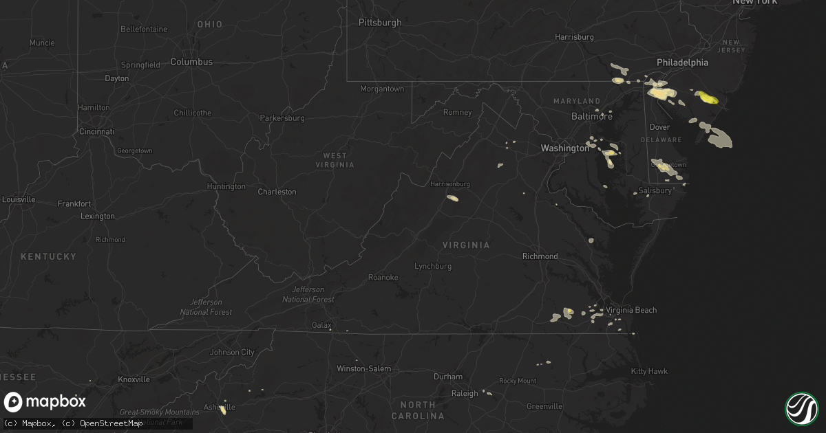
Hail Map in Virginia on July 14, 2017
Get this storm
July 14 map
$229
one time, instant access
Download today. No call, no setup
Keep the $229
Bought the map and want the full workflow? Apply the entire $229 to a subscription within 7 days. None of it is wasted.
Every map, not just this one
This buys you this map. Subscription and you get every map we run, in the markets you choose from a few cities to whole states to nationwide. Plus real-time alerts the moment a storm fires.
Contact data
Name, contact info, occupancy, even credit band for addresses in the footprint. You go from where it hit to who to call.
Become the source they trust
Unlimited branding weather history reports on demand. You already have the documented answer ready for the property owner, and you are the one who showed up with it.
Property data and RoofTrace estimates
Pull up any address you have got, its value and the exact code rules for that jurisdiction, straight from One Click Code. Then RoofTrace estimates the squares, pitch, and roof value, priced the way you price.
Storm reports in Virginia
Virginia
| Date | Description |
|---|---|
| 07/14/20176:56 PM CDT | Large pine tree limb down at pruden center for industry and technology. Time estimated by radar. |
| 07/14/20176:30 PM CDT | Several large limbs down along highway 35 northwest of courtland. |
| 07/14/20175:20 PM CDT | Several trees and power lines downed along route 3 south of oak grove. |
| 07/14/20174:33 PM CDT | Two trees down |
| 07/14/20174:05 PM CDT | Large branches down in dunavant |
| 07/14/20174:05 PM CDT | Tree down in alexandria area |
| 07/14/20173:37 PM CDT | Tree into house at 3528 saylor place |
| 07/14/20173:36 PM CDT | Tree on car at 8th st n and n monroe st. |
| 07/14/20173:28 PM CDT | Tree down at 6900 williamsburg blvd |
| 07/14/20173:24 PM CDT | Trees down on bridal patch lane... Gallant green drive... And jones branch drive |
| 07/14/20173:20 PM CDT | Tree fell onto metro car... No injuries reported |
| 07/14/20173:20 PM CDT | Tree down at guinea road and braeburn drive |
| 07/14/20173:19 PM CDT | Tree down at intersection of maple lane and lee highway |
| 07/14/20173:18 PM CDT | Tree down at pan am shopping center. |
| 07/14/20173:16 PM CDT | Trees down on beulah road and trotting horse lane near leesburg pike |
| 07/14/20173:16 PM CDT | Multiple trees down on browns mill road and towlston road |
| 07/14/20173:16 PM CDT | Tree down at intersection of maple lane and lee highway |
| 07/14/20173:16 PM CDT | Tree down at five oaks road and blake lane |
| 07/14/20173:16 PM CDT | Large tree branch onto lupine den dr. |
| 07/14/20173:14 PM CDT | Tree down at georgetown pike and ellsworth avenue |
| 07/14/20173:11 PM CDT | Tree down at intersection of fox mill road and lake edge way |
| 07/14/20173:05 PM CDT | Tree down onto power lines near intersection of ore bank rd and browns gap rd |
| 07/14/20173:02 PM CDT | Tree down onto power lines at 100 7st |
| 07/14/20173:02 PM CDT | Tree down onto power lines near intersection of ore bank rd and browns gap rd |
| 07/14/20172:45 PM CDT | Tree down in the 7600 block of frogtown road |
| 07/14/20172:37 PM CDT | Tree down in the 2700 block of rokeby road |
| 07/14/20172:37 PM CDT | Tree down in the 3400 block of groves lane |
| 07/14/20172:37 PM CDT | Several trees down and damage to roofing shingles |
| 07/14/20172:37 PM CDT | Tree down in the 3000 block of rokeby road |
| 07/14/201712:48 PM CDT | Numerous trees and power lines down in the town |
| 07/14/201712:21 PM CDT | Thunderstorm winds brought down a few trees along stella road causing minor delays. |
| 07/14/201712:15 PM CDT | Thunderstorm winds knocked down a tree within the community of ararat. |
| 07/13/20177:55 PM CDT | Mesonet station xlyn... Lynnhaven pier. |
All States Impacted by Hail Map on July 14, 2017
Cities Impacted by Hail Map on July 14, 2017
- Granville, ND
- Elgin, ND
- Velva, ND
- Voltaire, ND
- Peach Bottom, PA
- Conowingo, MD
- Nottingham, PA
- Delta, PA
- Whiteford, MD
- Rising Sun, MD
- Scotland Neck, NC
- Norwich, ND
- Drasco, AR
- Chesapeake, VA
- Garber, OK
- Franklin, VA
- Zuni, VA
- Courtland, VA
- Sedley, VA
- Wakefield, VA
- Ivor, VA
- Mountain View, AR
- Shirley, AR
- Pfafftown, NC
- Tobaccoville, NC
- Castleton, VA
- Washington, VA
- Amissville, VA
- Beulah, ND
- Mandan, ND
- Salem, NJ
- Middletown, DE
- Woodstown, NJ
- Delaware City, DE
- New Castle, DE
- Pennsville, NJ
- New Salem, ND
- Fremont, MO
- Van Buren, MO
- Sawyer, ND
- Minot, ND
- Suffolk, VA
- Roseglen, ND
- Golden Valley, ND
- Monette, AR
- Lake City, AR
- Paragould, AR
- Brookland, AR
- Annapolis, MD
- Hazen, ND
- Garrison, ND
- Marland, OK
- Billings, OK
- Red Rock, OK
- Black Canyon City, AZ
- Bishopville, MD
- Selbyville, DE
- Miami, AZ
- Oxford, PA
- Lincoln University, PA
- Elkton, MD
- Landenberg, PA
- Moorcroft, WY
- Clinton, AR
- Lambsburg, VA
- Galax, VA
- Bismarck, ND
- Anamoose, ND
- Martin, ND
- McLaughlin, SD
- McIntosh, SD
- Garrison, TX
- Denhoff, ND
- Goodrich, ND
- Eden, MD
- Ulysses, KS
- Penns Grove, NJ
- Arcadia, LA
- Georgetown, DE
- Seaford, DE
- Bridgeville, DE
- Dagsboro, DE
- Millsboro, DE
- Laurel, DE
- Max, ND
- Douglas, ND
- Center, ND
- Wilton, ND
- Timpson, TX
- Hugoton, KS
- Liberal, KS
- Young, AZ
- Payson, AZ
- Rush, CO
- Greenville, SC
- Hunter, OK
- Summertown, TN
- Ramah, CO
- Center, TX
- Panama City, FL
- Sibley, LA
- Bismarck, AR
- Jonesboro, AR
- Winona, MO
- Panama City Beach, FL
- Lynn Haven, FL
- Plains, KS
- Forgan, OK
- Meade, KS
- Belgrade, MT
- Asheville, NC
- Mays Landing, NJ
- Mooreland, OK
- Tilghman, MD
- Sherwood, MD
- Strawberry, AR
- Easton, MD
- Marion, NC
- Coushatta, LA
- Hammonton, NJ
- Bernice, LA
- Bear, DE
- Fairview, NC
- Dunnellon, FL
- Buena, NJ
- Richland, NJ
- Newtonville, NJ
- Gibsland, LA
- Mount Pleasant, TN
- Hall Summit, LA
- Bunker, MO
- Pencil Bluff, AR
- Vienna, MD
- Coleharbor, ND
- Des Lacs, ND
- Burlington, ND
- Mcdaniel, MD
- Wittman, MD
- Saint Michaels, MD
- Claiborne, MD
- Berlin, MD
- Whaleyville, MD
- Zap, ND
- Claudville, VA
- Ararat, VA
- Windsor, VA
- Upperville, VA
- Zebulon, NC
- Middlesex, NC
- Stevensville, MD
- Neavitt, MD
- Hayden, AL
- Flagstaff, AZ
- Grottoes, VA
- Port Republic, VA
- Benedict, ND
- San Augustine, TX
- Edgewater, MD
- Williford, AR
- Hardy, AR
- Delmont, NJ
- Port Norris, NJ
- Leesburg, NJ
- Dorchester, NJ
- Heislerville, NJ
- Millville, NJ
- Mohawk, WV
- Baisden, WV
- Ruso, ND
- Farmerville, LA
- Spearsville, LA
- Zachary, LA
- King George, VA
- Fessenden, ND
- Alloway, NJ
- Bridgeton, NJ
- Elmer, NJ
- New Leipzig, ND
- Paris, AR
- Roxobel, NC
- Delaplane, VA
- Shreveport, LA
- Morriston, FL
- Bronson, FL
- Inglis, FL
- Turtle Lake, ND
- Capron, VA
- Marshall, TX
- Wilmington, DE
- Sea Isle City, NJ
- Lamont, OK
- Dora, MO
- Mount Crawford, VA
- Weyers Cave, VA
- Drake, ND
- Spotsylvania, VA
- Underwood, ND
- Bono, AR
- Havana, AR
- Bowdon, ND
- Hayden, AZ
- Gold Canyon, AZ
- Frankford, DE
- Harvey, ND
- Hot Springs National Park, AR
- Lost Creek, KY
- Wolford, ND
- Queenstown, MD
- Chester, MD
- Grasonville, MD
- Dodge, ND
- Davidsonville, MD
- Bowie, MD
- Harwood, MD
- Gambrills, MD
- Riva, MD
- Johnson, KS
- Westminster, SC
- Water View, VA
- Jamaica, VA
- Evangeline, LA
- Jennings, LA
- Middle River, MD
- Camden, NY
- Bernhards Bay, NY
- Prescott, AZ
- Glynn, LA
- Erwinville, LA
- Cando, ND
- Willow Street, PA
- Holtwood, PA
- Pequea, PA
- Quarryville, PA
- Kirkwood, PA
- New Providence, PA
- Christiana, PA
- Yellow Spring, WV
- Karlsruhe, ND
- Dubach, LA
- Essex, MD
- Memphis, TN
- Ozone, AR
- Clarksville, AR
- Avalon, NJ
- Cape May Court House, NJ
- Woodbine, NJ
- Ocean View, NJ
- Washington, DC
- Grandview, TN
- Newark, DE
- Saint Georges, DE
- Pedricktown, NJ
- Port Penn, DE
- Clopton, AL
- Newville, AL
- Terlton, OK
- Parkville, MD
- Baltimore, MD
- Nottingham, MD
- Rosedale, MD
- Franklinville, NJ
- Medford, OK
- Deer Creek, OK
- West Monroe, NY
- Parish, NY
- Smithfield, VA
- Belleville, AR
- Danville, AR
- Sherwood, AR
- Fletcher, NC
- Clifton, TN
- Avondale, PA
- Crownsville, MD
- Dennard, AR
- Leslie, AR
- Morganton, NC
- Portsmouth, VA
- Harriman, TN
- Newfield, NJ
- Williamstown, NJ
- Landisville, NJ
- Weaverville, NC
- Beech Grove, AR
- Orlando, OK
- Marshall, OK
- Capon Bridge, WV
- Knotts Island, NC
- Wendell, NC
- Butte, ND
- Ringgold, LA
- Willow City, ND
- Bisbee, ND
- Leeds, ND
- York, ND
- New Iberia, LA
- Egg Harbor City, NJ


