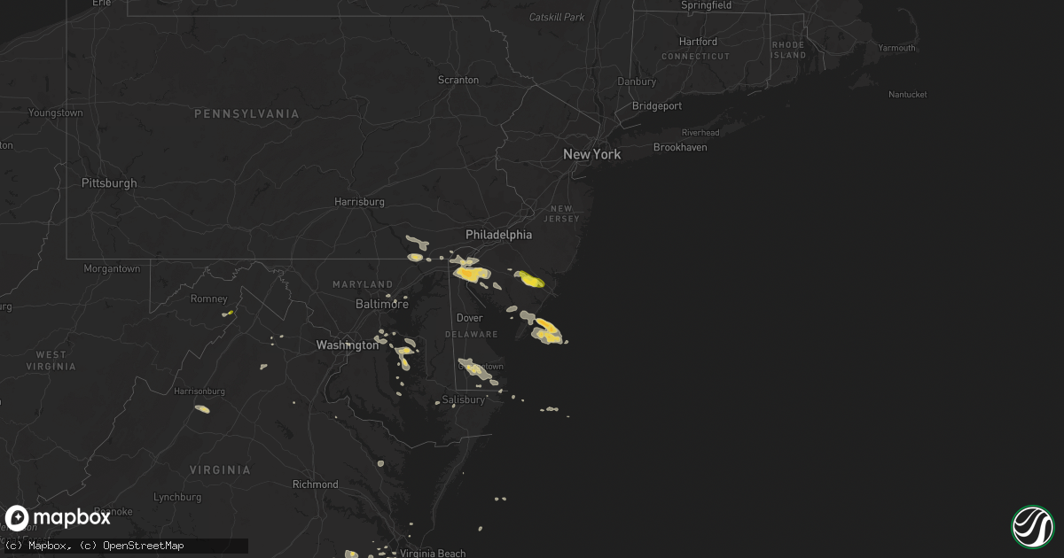
Hail Map on July 14, 2017
Get this storm
July 14 map
$229
one time, instant access
Download today. No call, no setup
Keep the $229
Bought the map and want the full workflow? Apply the entire $229 to a subscription within 7 days. None of it is wasted.
Every map, not just this one
This buys you this map. Subscription and you get every map we run, in the markets you choose from a few cities to whole states to nationwide. Plus real-time alerts the moment a storm fires.
Contact data
Name, contact info, occupancy, even credit band for addresses in the footprint. You go from where it hit to who to call.
Become the source they trust
Unlimited branding weather history reports on demand. You already have the documented answer ready for the property owner, and you are the one who showed up with it.
Property data and RoofTrace estimates
Pull up any address you have got, its value and the exact code rules for that jurisdiction, straight from One Click Code. Then RoofTrace estimates the squares, pitch, and roof value, priced the way you price.
States Impacted by Hail Map on July 14, 2017
Storm reports
Georgia
| Date | Description |
|---|---|
| 07/13/20177:11 PM CDT | Tree down on a structure near the intersection of shoal creek rd and waleska rd. |
District of Columbia
| Date | Description |
|---|---|
| 07/14/20173:50 PM CDT | Numerous trees down including along naylor road se... Alabama avenue se... And branch avenue se |
| 07/14/20173:46 PM CDT | Numerous trees down including along mlk jr blvd se and w street se |
| 07/14/20173:16 PM CDT | Tree down onto house in 5300 block of 32nd street nw |
| 07/14/20173:16 PM CDT | Tree down on jocelyn street northwest |
West Virginia
| Date | Description |
|---|---|
| 07/14/20171:18 PM CDT | Quarter size hail at camp rim rock inc |
Louisiana
| Date | Description |
|---|---|
| 07/14/20176:00 PM CDT | Trees down. |
| 07/14/20175:10 PM CDT | Trees down. |
| 07/14/20174:45 PM CDT | Trees down. |
| 07/14/20174:15 PM CDT | Trees down. |
South Carolina
| Date | Description |
|---|---|
| 07/13/20178:23 PM CDT | 911 call center reported a downed tree on shannon lake cir. Time estimated from radar. |
| 07/13/20178:03 PM CDT | 911 call center reported a downed tree at the intersection of hudson rd. And shady ln. Time estimated from radar. |
| 07/13/20177:30 PM CDT | 911 call center reported a downed tree and powerline at the intersection of chattooga ridge rd. And academy rd. Time estimated from radar. |
| 07/13/20177:26 PM CDT | 911 call center reported a downed tree and powerline at the intersection of woodall shoals rd. And orchard rd. Time estimated from radar. |
North Carolina
| Date | Description |
|---|---|
| 07/14/20176:12 PM CDT | Damage reported near the intersection of jerry post office rd and swain rd with minor structural damage to 2 or 3 homes and one power line down. |
| 07/14/20174:35 PM CDT | Tree down on saint marys church rd. Time estimated from radar. |
| 07/14/20174:05 PM CDT | Trees down along lytle mtn rd |
| 07/14/20174:05 PM CDT | Trees down along south main st |
| 07/14/20174:00 PM CDT | Broadcast media reported two trees down on talmadge st near the intersection with talmadge ct in west asheville. Time estimated from radar. |
| 07/14/20173:45 PM CDT | Trees down along old linville rd |
| 07/14/20173:44 PM CDT | Tree down on nc 226 blocking travel |
| 07/14/20173:30 PM CDT | Several trees down along emmas grove rd near old gap creek rd. |
| 07/14/20173:15 PM CDT | Multiple trees and power lines down. Us 74a closed until obstructions cleared. |
| 07/14/20173:12 PM CDT | Trees and limbs down along with dime size hail |
| 07/14/20173:00 PM CDT | ...corrected for erroneous time... Broadcast media reported two trees down on talmadge st near the intersection with talmadge ct in west asheville. Time estimated from |
| 07/14/201712:15 PM CDT | Thunderstorm winds knocked down a tree within the community of ararat. |
Maryland
| Date | Description |
|---|---|
| 07/14/20175:40 PM CDT | Tree knocked down. Time estimated from radar. |
| 07/14/20174:41 PM CDT | Tree down on a building on clark road. |
| 07/14/20174:06 PM CDT | Tree down at 7909 pinewood dr |
| 07/14/20173:55 PM CDT | A local report indicates 58 MPH wind near 1 NE SEAT PLEASANT |
| 07/14/20173:50 PM CDT | Tree down in the 8600 block of temple hill road |
| 07/14/201712:54 PM CDT | Wires down on mount phillip road |
Florida
| Date | Description |
|---|---|
| 07/14/20174:35 PM CDT | 911 call center reported power lines down on nw 113th ave. Time estimated based on radar data. |
| 07/14/20174:00 PM CDT | 911 call center reported power lines down near sw 116th lane road. Time estimated based on radar data. |
| 07/14/201712:45 PM CDT | Tree debris in the roadway near johnson road and highway 79 created hazardous condition |
South Dakota
| Date | Description |
|---|---|
| 07/13/201710:30 PM CDT | Mesonet station llks2... Eureka 13 ene - time estimated. |
North Dakota
| Date | Description |
|---|---|
| 07/14/20176:58 PM CDT | Measured at mandan airport by automated observing system. |
| 07/14/20176:07 PM CDT | A local report indicates 58 MPH wind near 6 SSE CENTER |
| 07/14/20175:58 PM CDT | Also receiving dime size hail. Wind and hail ongoing at time this report sent. Corrected for duration of report. |
| 07/14/20175:11 PM CDT | Report relayed to nws from media. |
| 07/14/20175:11 PM CDT | Correction to location from voltaire to 11 south voltaire |
| 07/14/20174:55 PM CDT | Lasted 20 minutes with a few as big as ping pong balls. Temperature fell 41 degrees in one half hour... From 104 to 63. |
| 07/14/20174:20 PM CDT | Relayed through broadcast media. |
| 07/13/20177:00 PM CDT | Also accumulated pea size hail. Delayed report. |
Arizona
| Date | Description |
|---|---|
| 07/14/20176:40 PM CDT | Delayed report. Visibility above 1/4 mile. |
| 07/14/20176:37 PM CDT | Power poles down along castle creek north of lake pleasant. Reported via aps web outage map. |
| 07/14/20176:30 PM CDT | Boats capsized... Docks damaged... Numerous water rescues at lake pleasant. Delayed report. |
Kansas
| Date | Description |
|---|---|
| 07/14/20176:27 PM CDT | The wind was measured at the liberal airport. |
Delaware
| Date | Description |
|---|---|
| 07/14/20175:40 PM CDT | Route 20 westbound lane closed at north oak grove road due to downed trees into wires. Time estimated from radar. |
Alabama
| Date | Description |
|---|---|
| 07/14/20174:55 PM CDT | Single tree down events in a few spots in the county. Winds estimated around 40-50mph. Time estimated by radar. |
| 07/14/20173:24 PM CDT | Report of tree down on county rd 52 |
| 07/14/20173:18 PM CDT | Report of tree down on county rd 5 |
| 07/14/20173:12 PM CDT | Report of tree on residence and power lines down |
| 07/14/20173:12 PM CDT | Report of tree down on north union |
| 07/14/20172:54 PM CDT | Report of tree on residence and a power pole snapped |
| 07/13/20177:34 PM CDT | A couple trees and power lines down along hwy 65 near hollytree... In the rocky holler community. Time estimated on radar. |
New Jersey
| Date | Description |
|---|---|
| 07/14/20173:33 PM CDT | Downed tree blocking nj 47 with power lines also down. Time estimated. |
| 07/14/20173:33 PM CDT | A local report indicates 58 MPH wind near MILLVILLE MUNI AIRPORT |
| 07/14/20173:33 PM CDT | Wires blown down at highway 55 and highway 47. Time estimated. |
| 07/14/20173:21 PM CDT | Trees down near route 322. Time estimated. |
| 07/14/20173:07 PM CDT | A local report indicates 1.00 inch wind near HAMILTON TWP |
| 07/14/20173:00 PM CDT | Downed tree and wires blocking us 40. Time estimated from radar. |
| 07/14/20172:47 PM CDT | Damage reported... Type unknown. |
| 07/14/20172:46 PM CDT | With a peak gust to 41 mph. |
| 07/14/20172:45 PM CDT | Trees and wires down in alloway and carneys point as well. |
Virginia
| Date | Description |
|---|---|
| 07/14/20176:56 PM CDT | Large pine tree limb down at pruden center for industry and technology. Time estimated by radar. |
| 07/14/20176:30 PM CDT | Several large limbs down along highway 35 northwest of courtland. |
| 07/14/20175:20 PM CDT | Several trees and power lines downed along route 3 south of oak grove. |
| 07/14/20174:33 PM CDT | Two trees down |
| 07/14/20174:05 PM CDT | Large branches down in dunavant |
| 07/14/20174:05 PM CDT | Tree down in alexandria area |
| 07/14/20173:37 PM CDT | Tree into house at 3528 saylor place |
| 07/14/20173:36 PM CDT | Tree on car at 8th st n and n monroe st. |
| 07/14/20173:28 PM CDT | Tree down at 6900 williamsburg blvd |
| 07/14/20173:24 PM CDT | Trees down on bridal patch lane... Gallant green drive... And jones branch drive |
| 07/14/20173:20 PM CDT | Tree down at guinea road and braeburn drive |
| 07/14/20173:20 PM CDT | Tree fell onto metro car... No injuries reported |
| 07/14/20173:19 PM CDT | Tree down at intersection of maple lane and lee highway |
| 07/14/20173:18 PM CDT | Tree down at pan am shopping center. |
| 07/14/20173:16 PM CDT | Multiple trees down on browns mill road and towlston road |
| 07/14/20173:16 PM CDT | Trees down on beulah road and trotting horse lane near leesburg pike |
| 07/14/20173:16 PM CDT | Large tree branch onto lupine den dr. |
| 07/14/20173:16 PM CDT | Tree down at five oaks road and blake lane |
| 07/14/20173:16 PM CDT | Tree down at intersection of maple lane and lee highway |
| 07/14/20173:14 PM CDT | Tree down at georgetown pike and ellsworth avenue |
| 07/14/20173:11 PM CDT | Tree down at intersection of fox mill road and lake edge way |
| 07/14/20173:05 PM CDT | Tree down onto power lines near intersection of ore bank rd and browns gap rd |
| 07/14/20173:02 PM CDT | Tree down onto power lines near intersection of ore bank rd and browns gap rd |
| 07/14/20173:02 PM CDT | Tree down onto power lines at 100 7st |
| 07/14/20172:45 PM CDT | Tree down in the 7600 block of frogtown road |
| 07/14/20172:37 PM CDT | Tree down in the 3400 block of groves lane |
| 07/14/20172:37 PM CDT | Several trees down and damage to roofing shingles |
| 07/14/20172:37 PM CDT | Tree down in the 2700 block of rokeby road |
| 07/14/20172:37 PM CDT | Tree down in the 3000 block of rokeby road |
| 07/14/201712:48 PM CDT | Numerous trees and power lines down in the town |
| 07/14/201712:21 PM CDT | Thunderstorm winds brought down a few trees along stella road causing minor delays. |
| 07/14/201712:15 PM CDT | Thunderstorm winds knocked down a tree within the community of ararat. |
| 07/13/20177:55 PM CDT | Mesonet station xlyn... Lynnhaven pier. |
Pennsylvania
| Date | Description |
|---|---|
| 07/14/20171:45 PM CDT | Tree down blocking hickory hill road. Time estimated from radar. |
| 07/14/20171:45 PM CDT | Damage to car windows. |
| 07/14/20171:45 PM CDT | Wires down on starr road. |
Oklahoma
| Date | Description |
|---|---|
| 07/14/20175:00 PM CDT | Large tree limbs and fences blown down. Time estimated by the emergency manager and radar data. |
New York
| Date | Description |
|---|---|
| 07/14/20172:16 PM CDT | Tree down in roadway |
| 07/14/20172:12 PM CDT | Tree down blocking the road |
| 07/14/20172:04 PM CDT | Several trees down |
| 07/14/20171:22 PM CDT | Trees down on 17a |
| 07/14/201712:36 PM CDT | Trees down on cty rt 17 |
| 07/14/201712:18 PM CDT | Trees down on 17a |
| 07/14/201712:06 PM CDT | Trees down on voorhees rd |
Cities Impacted by Hail Map on July 14, 2017
- Granville, ND
- Elgin, ND
- Velva, ND
- Voltaire, ND
- Peach Bottom, PA
- Conowingo, MD
- Nottingham, PA
- Delta, PA
- Whiteford, MD
- Rising Sun, MD
- Scotland Neck, NC
- Norwich, ND
- Drasco, AR
- Chesapeake, VA
- Garber, OK
- Franklin, VA
- Zuni, VA
- Courtland, VA
- Sedley, VA
- Wakefield, VA
- Ivor, VA
- Mountain View, AR
- Shirley, AR
- Pfafftown, NC
- Tobaccoville, NC
- Castleton, VA
- Washington, VA
- Amissville, VA
- Beulah, ND
- Mandan, ND
- Salem, NJ
- Middletown, DE
- Woodstown, NJ
- Delaware City, DE
- New Castle, DE
- Pennsville, NJ
- New Salem, ND
- Fremont, MO
- Van Buren, MO
- Sawyer, ND
- Minot, ND
- Suffolk, VA
- Roseglen, ND
- Golden Valley, ND
- Monette, AR
- Lake City, AR
- Paragould, AR
- Brookland, AR
- Annapolis, MD
- Hazen, ND
- Garrison, ND
- Marland, OK
- Billings, OK
- Red Rock, OK
- Black Canyon City, AZ
- Bishopville, MD
- Selbyville, DE
- Miami, AZ
- Oxford, PA
- Lincoln University, PA
- Elkton, MD
- Landenberg, PA
- Moorcroft, WY
- Clinton, AR
- Lambsburg, VA
- Galax, VA
- Bismarck, ND
- Anamoose, ND
- Martin, ND
- McLaughlin, SD
- McIntosh, SD
- Garrison, TX
- Denhoff, ND
- Goodrich, ND
- Eden, MD
- Ulysses, KS
- Penns Grove, NJ
- Arcadia, LA
- Georgetown, DE
- Seaford, DE
- Bridgeville, DE
- Dagsboro, DE
- Millsboro, DE
- Laurel, DE
- Max, ND
- Douglas, ND
- Center, ND
- Wilton, ND
- Timpson, TX
- Hugoton, KS
- Liberal, KS
- Young, AZ
- Payson, AZ
- Rush, CO
- Greenville, SC
- Hunter, OK
- Summertown, TN
- Ramah, CO
- Center, TX
- Panama City, FL
- Sibley, LA
- Bismarck, AR
- Jonesboro, AR
- Winona, MO
- Panama City Beach, FL
- Lynn Haven, FL
- Plains, KS
- Forgan, OK
- Meade, KS
- Belgrade, MT
- Asheville, NC
- Mays Landing, NJ
- Mooreland, OK
- Tilghman, MD
- Sherwood, MD
- Strawberry, AR
- Easton, MD
- Marion, NC
- Coushatta, LA
- Hammonton, NJ
- Bernice, LA
- Bear, DE
- Fairview, NC
- Dunnellon, FL
- Buena, NJ
- Richland, NJ
- Newtonville, NJ
- Gibsland, LA
- Mount Pleasant, TN
- Hall Summit, LA
- Bunker, MO
- Pencil Bluff, AR
- Vienna, MD
- Coleharbor, ND
- Des Lacs, ND
- Burlington, ND
- Mcdaniel, MD
- Wittman, MD
- Saint Michaels, MD
- Claiborne, MD
- Berlin, MD
- Whaleyville, MD
- Zap, ND
- Claudville, VA
- Ararat, VA
- Windsor, VA
- Upperville, VA
- Zebulon, NC
- Middlesex, NC
- Stevensville, MD
- Neavitt, MD
- Hayden, AL
- Flagstaff, AZ
- Grottoes, VA
- Port Republic, VA
- Benedict, ND
- San Augustine, TX
- Edgewater, MD
- Williford, AR
- Hardy, AR
- Delmont, NJ
- Port Norris, NJ
- Leesburg, NJ
- Dorchester, NJ
- Heislerville, NJ
- Millville, NJ
- Mohawk, WV
- Baisden, WV
- Ruso, ND
- Farmerville, LA
- Spearsville, LA
- Zachary, LA
- King George, VA
- Fessenden, ND
- Alloway, NJ
- Bridgeton, NJ
- Elmer, NJ
- New Leipzig, ND
- Paris, AR
- Roxobel, NC
- Delaplane, VA
- Shreveport, LA
- Morriston, FL
- Bronson, FL
- Inglis, FL
- Turtle Lake, ND
- Capron, VA
- Marshall, TX
- Wilmington, DE
- Sea Isle City, NJ
- Lamont, OK
- Dora, MO
- Mount Crawford, VA
- Weyers Cave, VA
- Drake, ND
- Spotsylvania, VA
- Underwood, ND
- Bono, AR
- Havana, AR
- Bowdon, ND
- Hayden, AZ
- Gold Canyon, AZ
- Frankford, DE
- Harvey, ND
- Hot Springs National Park, AR
- Lost Creek, KY
- Wolford, ND
- Queenstown, MD
- Chester, MD
- Grasonville, MD
- Dodge, ND
- Davidsonville, MD
- Bowie, MD
- Harwood, MD
- Gambrills, MD
- Riva, MD
- Johnson, KS
- Westminster, SC
- Water View, VA
- Jamaica, VA
- Evangeline, LA
- Jennings, LA
- Middle River, MD
- Camden, NY
- Bernhards Bay, NY
- Prescott, AZ
- Glynn, LA
- Erwinville, LA
- Cando, ND
- Willow Street, PA
- Holtwood, PA
- Pequea, PA
- Quarryville, PA
- Kirkwood, PA
- New Providence, PA
- Christiana, PA
- Yellow Spring, WV
- Karlsruhe, ND
- Dubach, LA
- Essex, MD
- Memphis, TN
- Ozone, AR
- Clarksville, AR
- Avalon, NJ
- Cape May Court House, NJ
- Woodbine, NJ
- Ocean View, NJ
- Washington, DC
- Grandview, TN
- Newark, DE
- Saint Georges, DE
- Pedricktown, NJ
- Port Penn, DE
- Clopton, AL
- Newville, AL
- Terlton, OK
- Parkville, MD
- Baltimore, MD
- Nottingham, MD
- Rosedale, MD
- Franklinville, NJ
- Medford, OK
- Deer Creek, OK
- West Monroe, NY
- Parish, NY
- Smithfield, VA
- Belleville, AR
- Danville, AR
- Sherwood, AR
- Fletcher, NC
- Clifton, TN
- Avondale, PA
- Crownsville, MD
- Dennard, AR
- Leslie, AR
- Morganton, NC
- Portsmouth, VA
- Harriman, TN
- Newfield, NJ
- Williamstown, NJ
- Landisville, NJ
- Weaverville, NC
- Beech Grove, AR
- Orlando, OK
- Marshall, OK
- Capon Bridge, WV
- Knotts Island, NC
- Wendell, NC
- Butte, ND
- Ringgold, LA
- Willow City, ND
- Bisbee, ND
- Leeds, ND
- York, ND
- New Iberia, LA
- Egg Harbor City, NJ