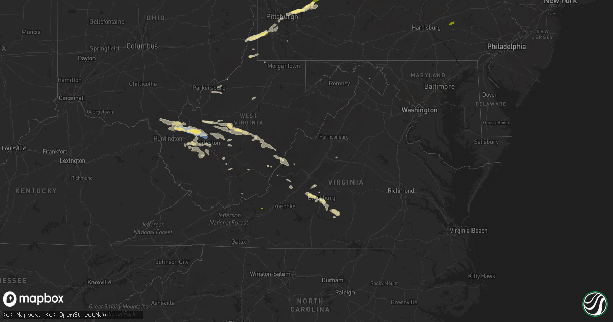
Hail Map in Virginia on July 13, 2023
Get this storm
July 13 map
$229
one time, instant access
Download today. No call, no setup
Keep the $229
Bought the map and want the full workflow? Apply the entire $229 to a subscription within 7 days. None of it is wasted.
Every map, not just this one
This buys you this map. Subscription and you get every map we run, in the markets you choose from a few cities to whole states to nationwide. Plus real-time alerts the moment a storm fires.
Contact data
Name, contact info, occupancy, even credit band for addresses in the footprint. You go from where it hit to who to call.
Become the source they trust
Unlimited branding weather history reports on demand. You already have the documented answer ready for the property owner, and you are the one who showed up with it.
Property data and RoofTrace estimates
Pull up any address you have got, its value and the exact code rules for that jurisdiction, straight from One Click Code. Then RoofTrace estimates the squares, pitch, and roof value, priced the way you price.
Storm reports in Virginia
Virginia
| Date | Description |
|---|---|
| 07/13/20236:45 PM CDT | Tree down in the 90 block of settlers row road in the city of lynchburg. |
| 07/13/20236:45 PM CDT | Trees down near lynchburg. |
| 07/13/20236:29 PM CDT | Tree down on roadway at the intersection of reedy springs road and double springs road. |
| 07/13/20236:29 PM CDT | Power lines down across the road in the 40 blokc of cheatham road near gladys. |
| 07/13/20236:08 PM CDT | Numerous large trees down on lawyers road in red house. Trees were blocking some roads in the area. Pea-sized hail was also observed during the storm. |
| 07/13/20235:58 PM CDT | Tree and power lines down in the 8000 block of red house road near gladys. |
| 07/13/20235:53 PM CDT | Power pole down on a private residence near the intersection of bear creek road and chetham road near gladys. |
| 07/13/20235:39 PM CDT | Trees and power lines down. Time estimated from radar. |
| 07/13/20235:33 PM CDT | Trees and power lines down. Time estimated from radar. |
| 07/13/20235:33 PM CDT | Tree down across pumping station road near breezy hill road. Time estimated from radar. |
| 07/13/20235:33 PM CDT | Tree down. Time estimated from radar. |
| 07/13/20235:30 PM CDT | Several trees down. |
| 07/13/20235:30 PM CDT | Several trees down along wilson highway near bridle creek. |
| 07/13/20235:30 PM CDT | One tree down in the fox creek area on elk creek parkway. |
| 07/13/20235:28 PM CDT | Tree down. Time estimated from radar. |
| 07/13/20235:19 PM CDT | Thunderstorm winds blew a tree down at the intersection of maple road and gold hill road. |
| 07/13/20235:18 PM CDT | Report from mping: 3-inch tree limbs broken; power poles broken. |
| 07/13/20235:17 PM CDT | Tree down on a power line and the adjacent power pole was on fire. |
| 07/13/20235:16 PM CDT | Thunderstorm winds blew a tree down on fox creek road near wilson highway. The tree fell on a vehicle. |
| 07/13/20235:12 PM CDT | Thunderstorm winds blew a tree down at the intersection of county line road and wilson highway. |
| 07/13/20235:05 PM CDT | Numerous trees down including one on house. |
| 07/13/20235:04 PM CDT | Tree down across both lanes of u.s. 460w between odd fellows and candlers mountain road exits. There was also a car with a broken windshield on the shoulder just past t |
| 07/13/20234:45 PM CDT | Numerous trees down near hwy 501 and big island. |
| 07/13/20234:31 PM CDT | Tree down. Time estimated from radar. |
| 07/13/20234:28 PM CDT | Time estimated from radar. |
| 07/13/20234:25 PM CDT | Tree down. Time estimated from radar. |
| 07/13/20234:14 PM CDT | Tree down on road. |
| 07/13/20233:55 PM CDT | Two trees down in lexington. |
| 07/13/20233:51 PM CDT | Largest hailstone was quarter size... But most were dime to nickel size. |
| 07/13/20233:51 PM CDT | Largest hailstone was quarter size... But most were dime to nickel size. |
| 07/13/20233:45 PM CDT | Tree on house- hawkins mill road... Bedford county. |
| 07/13/20233:45 PM CDT | Tree across road - forest road... Near harris tire. |
| 07/13/20233:44 PM CDT | Quarter size hail along us 460. |
| 07/13/20233:20 PM CDT | Tree down. |
| 07/13/20233:13 PM CDT | Tree down across road. Time estimated from radar. |
| 07/13/20232:57 PM CDT | The carroll county emergency manager reports numerous trees down along flower gap road and apple ridge road. Damage spread across a stretch of 2-3 miles. Considerable d |
| 07/13/20232:56 PM CDT | Trees down. |
| 07/13/20232:53 PM CDT | Tree down. Time estimated from radar. |
| 07/13/20232:51 PM CDT | Reported by amateur radio. |
| 07/13/20232:48 PM CDT | Trees and power lines down. |
| 07/13/20232:40 PM CDT | Trees down. |
| 07/13/20232:30 PM CDT | A large tree down on the highway in boones mill. The tree was two feet in diameter and 45 feet tall. Other tree debris was noted in the area. |
| 07/13/20232:15 PM CDT | Several trees down. |
| 07/12/20239:45 PM CDT | Tree down on main street. |
| 07/12/20239:30 PM CDT | Tree down on red house road north of phenix. |
| 07/12/20239:30 PM CDT | Roof blown off a barn on vincent store road. |
| 07/12/20239:01 PM CDT | Tree down on power line and across driveway at a private residence. |
| 07/12/20238:32 PM CDT | Tree down in the 320 block of plum branch road. |
| 07/12/20238:08 PM CDT | Tree down. |
| 07/12/20237:42 PM CDT | Tree down on craig creek road and vise road near eagle rock. |
| 07/12/20237:16 PM CDT | Tree down. |
All States Impacted by Hail Map on July 13, 2023
- Missouri
- Nebraska
- Kansas
- Colorado
- West Virginia
- New York
- Iowa
- Minnesota
- Virginia
- Ohio
- North Dakota
- South Dakota
- Texas
- Vermont
- Oklahoma
- New Mexico
- Montana
- Wyoming
- South Carolina
- North Carolina
- Indiana
- Kentucky
- Florida
- Mississippi
- Arkansas
- Georgia
- Pennsylvania
- Wisconsin
- Illinois
- New Jersey
- New Hampshire
- Massachusetts
- Connecticut
- Michigan
Cities Impacted by Hail Map on July 13, 2023
- Higbee, MO
- Armstrong, MO
- Salisbury, MO
- Fayette, MO
- Clark, MO
- Harrisburg, MO
- Columbia, MO
- Hallsville, MO
- Rocheport, MO
- Fulton, MO
- Ashland, MO
- New Bloomfield, MO
- Holts Summit, MO
- Tebbetts, MO
- Mokane, MO
- Chamois, MO
- Linn, MO
- Bonnots Mill, MO
- Minatare, NE
- Scottsbluff, NE
- Bayard, NE
- Angora, NE
- Bridgeport, NE
- Leslie, MO
- Gerald, MO
- Sullivan, MO
- Bourbon, MO
- Beaufort, MO
- Saint Clair, MO
- Mound City, KS
- Leasburg, MO
- Steelville, MO
- Potosi, MO
- Broadwater, NE
- Amsterdam, MO
- Amoret, MO
- Butler, MO
- Adrian, MO
- Richwoods, MO
- Blackwell, MO
- Cadet, MO
- Mineral Point, MO
- Belgrade, MO
- Montrose, MO
- Urich, MO
- Cope, CO
- Eleanor, WV
- Red House, WV
- Winfield, WV
- Mullen, NE
- Whitman, NE
- Sutherland, NE
- Ripley, WV
- Kenna, WV
- Davisville, WV
- Walker, WV
- Mineral Wells, WV
- Gandeeville, WV
- Given, WV
- Paxton, NE
- Hyannis, NE
- Gay, WV
- Hershey, NE
- Petroleum, WV
- Walton, WV
- Merriman, NE
- North Platte, NE
- Spencer, WV
- Newton, WV
- Chloe, WV
- Looneyville, WV
- Anton, CO
- Ivydale, WV
- Duck, WV
- Frametown, WV
- Yuma, CO
- Joes, CO
- Schroon Lake, NY
- Genoa, CO
- Arriba, CO
- Flagler, CO
- Seibert, CO
- North Hudson, NY
- Buffalo Center, IA
- Thompson, IA
- Scarville, IA
- Titonka, IA
- Woden, IA
- Lakota, IA
- Hugo, CO
- Big Island, VA
- Goode, VA
- Forest, VA
- Bolton Landing, NY
- Warrensburg, NY
- Brant Lake, NY
- Chestertown, NY
- Pottersville, NY
- Adirondack, NY
- Britt, IA
- Garner, IA
- Fraziers Bottom, WV
- Glenwood, WV
- Crown City, OH
- Ashton, WV
- Buffalo, WV
- Milton, WV
- Scott Depot, WV
- Hurricane, WV
- Poca, WV
- Karval, CO
- East Grand Forks, MN
- Grand Forks, ND
- Page, ND
- Hope, ND
- Buffalo, ND
- Wheatland, ND
- Absaraka, ND
- Amenia, ND
- Charleston, WV
- Kanawha, IA
- Goodell, IA
- Klemme, IA
- Dougherty, IA
- Sheffield, IA
- Aredale, IA
- Greene, IA
- Crookston, NE
- Wood Lake, NE
- Stratton, CO
- Kit Carson, CO
- Bethune, CO
- Cheyenne Wells, CO
- Casselton, ND
- Portland, ND
- Mayville, ND
- West Winfield, NY
- Salisbury Center, NY
- Stratford, NY
- Caroga Lake, NY
- Langford, SD
- Eden, SD
- Lake City, SD
- Roslyn, SD
- Peever, SD
- Grenville, SD
- Vega, TX
- Wildorado, TX
- Hereford, TX
- Bradley, SD
- Wallace, SD
- Florence, SD
- Watertown, SD
- South Shore, SD
- Henry, SD
- Doland, SD
- Carpenter, SD
- Willow Lake, SD
- Onida, SD
- Highmore, SD
- Orient, SD
- Johnstown, NE
- Mapleton, ND
- West Fargo, ND
- Harwood, ND
- Haswell, CO
- Bryant, SD
- De Smet, SD
- Miller, SD
- Springfield Center, NY
- Redfield, SD
- Cooperstown, NY
- East Springfield, NY
- Cherry Valley, NY
- Tulare, SD
- Jordanville, NY
- Canajoharie, NY
- Sharon Springs, NY
- Rockham, SD
- Schenevus, NY
- Worcester, NY
- Lynchburg, VA
- Fargo, ND
- Moorhead, MN
- Crowell, TX
- Strandburg, SD
- Pierre, SD
- Blunt, SD
- Arlington, CO
- Erwin, SD
- Sabin, MN
- Glyndon, MN
- Kim, CO
- Pritchett, CO
- Blacksburg, VA
- Lake Preston, SD
- Sprakers, NY
- Sloansville, NY
- Clemons, NY
- Huletts Landing, NY
- Hague, NY
- Whitehall, NY
- Putnam Station, NY
- Silver Bay, NY
- Sheridan Lake, CO
- Barnesville, MN
- Hawley, MN
- Las Animas, CO
- Vernon, TX
- Oklaunion, TX
- Harrold, TX
- Harrison, NE
- Happy, TX
- Crawford, NE
- Whitney, NE
- Fair Haven, VT
- Orwell, VT
- Wounded Knee, SD
- Manderson, SD
- Batesland, SD
- Interior, SD
- Philip, SD
- Kadoka, SD
- Porcupine, SD
- Kyle, SD
- Wanblee, SD
- Midland, SD
- Cherry Creek, SD
- Milesville, SD
- Harrisburg, NE
- Arlington, SD
- Pelican Rapids, MN
- Whiting, VT
- Shoreham, VT
- Sinai, SD
- Volga, SD
- Chadron, NE
- Hudson, NY
- Athens, NY
- Maynard, MN
- Montevideo, MN
- Sacred Heart, MN
- Clara City, MN
- Nunda, SD
- Davidson, OK
- Elkton, SD
- Lake Benton, MN
- Vergas, MN
- Salisbury, VT
- Erhard, MN
- Dent, MN
- Waverly, NY
- Chemung, NY
- Barton, NY
- Nichols, NY
- Stuyvesant, NY
- Raymond, MN
- Prinsburg, MN
- Blomkest, MN
- Lake Lillian, MN
- Hector, MN
- Fairfax, MN
- Gibbon, MN
- New Raymer, CO
- Winthrop, MN
- Mankato, MN
- Janesville, MN
- Stoneham, CO
- Pemberton, MN
- Mapleton, MN
- Minnesota Lake, MN
- Waldorf, MN
- Gering, NE
- Melbeta, NE
- Rutland, SD
- Colman, SD
- Flandreau, SD
- Dalton, NE
- Gordon, NE
- Martin, SD
- Richville, MN
- Battle Lake, MN
- Holly, CO
- Ottertail, MN
- Brooten, MN
- Belgrade, MN
- Cosmos, MN
- Lafayette, MN
- New Richland, MN
- Ruthton, MN
- Pipestone, MN
- Tyler, MN
- Holland, MN
- Egan, SD
- Pueblo, CO
- Henning, MN
- Frederick, OK
- Hollister, OK
- New London, MN
- Nicollet, MN
- New Ulm, MN
- Hartland, MN
- Gurley, NE
- Snyder, CO
- Cody, NE
- Byers, CO
- Deer Trail, CO
- Agate, CO
- Calhan, CO
- Ramah, CO
- Log Lane Village, CO
- Simla, CO
- Fort Morgan, CO
- Vining, MN
- Avondale, CO
- Boone, CO
- Roseau, MN
- Sauk Centre, MN
- Melrose, MN
- Freeport, MN
- Albany, MN
- Granada, CO
- Paynesville, MN
- Grenville, NM
- Malden On Hudson, NY
- Saugerties, NY
- Germantown, NY
- Elizaville, NY
- Saint Peter, MN
- Kasota, MN
- Waseca, MN
- Doniphan, MO
- Gatewood, MO
- Lower Brule, SD
- Grandin, ND
- Hillsboro, ND
- Ava, NY
- North River, NY
- Underwood, MN
- Janesville, IA
- Cedar Falls, IA
- Aneta, ND
- Northwood, ND
- Lower Salem, OH
- Fort Pierre, SD
- Dumont, IA
- Rockwell, IA
- Dupree, SD
- Lake Pleasant, NY
- Bickmore, WV
- Clay, WV
- Dolgeville, NY
- Cohagen, MT
- Malta, MT
- Elizabethtown, NY
- Hogeland, MT
- Richfield Springs, NY
- Brusett, MT
- Jordan, MT
- Wheatland, WY
- Guernsey, WY
- Oglala, SD
- Ceylon, MN
- Fairmont, MN
- Tabor City, NC
- Green Sea, SC
- Johnsburg, NY
- Burke, NY
- Malone, NY
- Chateaugay, NY
- Clinton, NY
- Myrtle, MO
- Osage, IA
- Saint Ansgar, IA
- Stacyville, IA
- Gallipolis, OH
- Vona, CO
- Harlem, MT
- Armstrong, IA
- Swea City, IA
- Badger, MN
- Conde, SD
- Pedro, OH
- Waterloo, OH
- Holabird, SD
- Sharon, ND
- Seymour, IN
- Blue Earth, MN
- Garrison, KY
- Arapahoe, CO
- Lusk, WY
- Marlinton, WV
- White Sulphur Springs, WV
- Catlettsburg, KY
- Rush, KY
- Couch, MO
- Blue Creek, OH
- Winchester, OH
- Ripley, OH
- Russellville, OH
- West Union, OH
- Ledyard, IA
- Remsen, NY
- Holland Patent, NY
- Westernville, NY
- Avon Park, FL
- Forestport, NY
- Cold Brook, NY
- Alder Creek, NY
- Boonville, NY
- Poland, NY
- Prospect, NY
- Ayr, ND
- Wallback, WV
- Elmore, MN
- Yorkville, NY
- Utica, NY
- New York Mills, NY
- New Hartford, NY
- Clewiston, FL
- Athens, OH
- New Marshfield, OH
- Monroe, VA
- Forest City, IA
- Diamond Point, NY
- Swaledale, IA
- Lesage, WV
- Garden City, SD
- Upperglade, WV
- Cowen, WV
- Clear Lake, IA
- Alkol, WV
- Sod, WV
- Sumerco, WV
- Alum Creek, WV
- Yawkey, WV
- Britton, SD
- Wesley, IA
- Northville, NY
- Wells, NY
- Stony Creek, NY
- Hartwick, NY
- Fly Creek, NY
- Burlington Flats, NY
- Harrold, SD
- Castorland, NY
- Carthage, NY
- New Berlin, NY
- Belleville, NY
- Kilgore, NE
- Valentine, NE
- Athol, NY
- Minerva, NY
- North Creek, NY
- Bakers Mills, NY
- Olmstedville, NY
- Paradox, NY
- Jay Em, WY
- Waverly, WV
- Saint Marys, WV
- Birch River, WV
- Webster, SD
- Bristol, SD
- Perkinston, MS
- Ainsworth, NE
- Tornado, WV
- South Charleston, WV
- Saint Albans, WV
- Torrington, WY
- Orlando, FL
- Breesport, NY
- Erin, NY
- Horseheads, NY
- Mohawk, NY
- Greenup, KY
- Rustburg, VA
- Hasty, CO
- Clark, SD
- Roseboom, NY
- Amherst, VA
- Rincon, GA
- Camden, WV
- Weston, WV
- Dazey, ND
- Rome, NY
- Barneveld, NY
- Patriot, OH
- Apple Grove, WV
- Thayer, MO
- Waynesboro, VA
- Fort Stewart, GA
- Granada, MN
- Beverly, OH
- Dexter City, OH
- Colton, SD
- Pine Ridge, SD
- Midway, GA
- Hinesville, GA
- Hot Springs, VA
- Lee Center, NY
- Taberg, NY
- Fleischmanns, NY
- Hillsboro, WV
- Fort Plain, NY
- Saint Johnsville, NY
- Leon, WV
- Scottown, OH
- Nitro, WV
- Gallipolis Ferry, WV
- Willow Wood, OH
- Proctorville, OH
- Clendenin, WV
- Hadley, NY
- Bancroft, IA
- Belmond, IA
- Lewisville, OH
- Woodsfield, OH
- Graysville, OH
- Millboro, VA
- Wessington, SD
- Saint Lawrence, SD
- Sherburne, NY
- Little Falls, NY
- Vernon Center, NY
- Marcy, NY
- Whitesboro, NY
- Oriskany Falls, NY
- Deansboro, NY
- Warm Springs, VA
- Elkview, WV
- Bomont, WV
- Bedford, VA
- Guyton, GA
- Ticonderoga, NY
- Hardeeville, SC
- Gloversville, NY
- Clayville, NY
- Ilion, NY
- Sauquoit, NY
- Frankfort, NY
- Cassville, NY
- Fairburn, SD
- Buffalo Gap, SD
- Blossvale, NY
- Lockwood, NY
- Big Sandy, MT
- Stockport, OH
- Punta Gorda, FL
- Des Moines, NM
- Mount Vision, NY
- New Lisbon, NY
- Garrattsville, NY
- Edmeston, NY
- Catskill, NY
- Palenville, NY
- Nebo, WV
- Webster Springs, WV
- Amma, WV
- Buckeye, WV
- Procious, WV
- Left Hand, WV
- Dille, WV
- Camden On Gauley, WV
- Glenwood, MN
- Madison, IN
- West Hamlin, WV
- Hamlin, WV
- Allenhurst, GA
- Pocahontas, AR
- Avon, MN
- Jasper, MN
- Hardwick, MN
- Kenton, OK
- Craryville, NY
- Ancram, NY
- Fowler, CO
- Eden Valley, MN
- Watkins, MN
- Litchfield, MN
- Saint Joseph, MN
- Eagle Lake, MN
- Madison Lake, MN
- Luverne, MN
- Beulah, CO
- Colorado City, CO
- Darwin, MN
- Dassel, MN
- Owatonna, MN
- Hope, MN
- Saint Cloud, MN
- Cokato, MN
- Blooming Prairie, MN
- Claremont, MN
- Magnolia, MN
- Kenneth, MN
- Adrian, MN
- Ellsworth, MN
- Hillsdale, NY
- Copake, NY
- West Camp, NY
- Hoffman, MN
- Kensington, MN
- Farwell, MN
- Lowry, MN
- Rye, CO
- Walsenburg, CO
- Clear Lake, MN
- Becker, MN
- Howard Lake, MN
- Waverly, MN
- Watertown, MN
- Montrose, MN
- Springfield, CO
- Boise City, OK
- Avella, PA
- Valley Grove, WV
- Claysville, PA
- Washington, PA
- West Alexander, PA
- New Kensington, PA
- Pittsburgh, PA
- Verona, PA
- Lebanon, PA
- Myerstown, PA
- Apollo, PA
- Leechburg, PA
- Spring Church, PA
- Avonmore, PA
- Penrose, CO
- Model, CO
- Big Lake, MN
- Campo, CO
- Elk River, MN
- Clayton, NM
- Shelocta, PA
- Monticello, MN
- Creekside, PA
- Indiana, PA
- Texline, TX
- Little Rock, IA
- Aguilar, CO
- Sibley, IA
- Trinidad, CO
- La Veta, CO
- Weston, CO
- Ocheyedan, IA
- Melvin, IA
- Home, PA
- Marion Center, PA
- Anoka, MN
- Dayton, MN
- Minneapolis, MN
- Andover, MN
- Kellogg, IA
- Albion, IA
- Gilman, IA
- Marshalltown, IA
- Ferguson, IA
- Grinnell, IA
- Dalhart, TX
- Keyes, OK
- Trinchera, CO
- Boncarbo, CO
- Texhoma, OK
- Raton, NM
- Walters, OK
- Fredericksburg, IA
- New Hampton, IA
- Sumner, IA
- Westgate, IA
- Maynard, IA
- Oelwein, IA
- Hazleton, IA
- Folsom, NM
- Plainview, MN
- Millville, MN
- Altura, MN
- Rollingstone, MN
- Lewiston, MN
- Winona, MN
- Maxwell, NM
- Springer, NM
- Felt, OK
- Rushford, MN
- Houston, MN
- Dakota, MN
- La Crescent, MN
- Carlos, MN
- Nelson, MN
- Alexandria, MN
- Garfield, MN
- Brandon, MN
- Renick, WV
- East Greenbush, NY
- East Schodack, NY
- Arthur, NE
- Sauk Rapids, MN
- Sartell, MN
- Foley, MN
- Rice, MN
- Millerton, NY
- Stillwater, NY
- Schuylerville, NY
- Saratoga Springs, NY
- Peytona, WV
- Racine, WV
- Oshkosh, NE
- Ashby, NE
- Montour, IA
- Garwin, IA
- Toledo, IA
- Greeley, PA
- Hawley, PA
- Stanley, WI
- Boyd, WI
- Mayer, MN
- Honesdale, PA
- Livingston Manor, NY
- Saint Paul, MN
- Wheeling, WV
- Clarissa, MN
- Eagle Bend, MN
- Browerville, MN
- Kimball, MN
- South Haven, MN
- Annandale, MN
- Schoharie, NY
- Barrett, MN
- Austerlitz, NY
- Martins Ferry, OH
- Triadelphia, WV
- Bellaire, OH
- Bridgeport, OH
- Tuthill, SD
- Saint Francis, SD
- Hartley, IA
- Melbourne, AR
- Foster, WV
- Wannaska, MN
- Tampico, IL
- Amarillo, TX
- Canyon, TX
- Walnut, IL
- New Bedford, IL
- Deer Grove, IL
- El Reno, OK
- Adrian, TX
- Iowa Falls, IA
- Steamboat Rock, IA
- Williford, AR
- Hardy, AR
- Koshkonong, MO
- Ravenden Springs, AR
- Imboden, AR
- Elmira, NY
- Gillett, PA
- Wellsburg, NY
- Sayre, PA
- Hernshaw, WV
- Bushkill, PA
- Layton, NJ
- Canadensis, PA
- Tamiment, PA
- Columbia, NJ
- Dingmans Ferry, PA
- West Coxsackie, NY
- Iroquois, SD
- Meservey, IA
- Alexander, IA
- Calumet, OK
- Quitaque, TX
- Hickory, NC
- Connelly Springs, NC
- Little Falls, MN
- Swanville, MN
- Wichita Falls, TX
- Byers, TX
- Black Rock, AR
- Ravenden, AR
- Smithville, AR
- Milford, PA
- Montague, NJ
- Temple, OK
- Richmond, MN
- Fort Peck, MT
- Thedford, NE
- Villard, MN
- Shandaken, NY
- West Kill, NY
- Chandler, MN
- Middle Grove, NY
- Groom, TX
- Panhandle, TX
- Porter Corners, NY
- Claryville, NY
- Starbuck, MN
- Traer, IA
- Grey Eagle, MN
- Ionia, IA
- Alta Vista, IA
- Charles City, IA
- Petrolia, TX
- Margaretville, NY
- Grover, CO
- Brattleboro, VT
- Vernon, VT
- Hinsdale, NH
- Montgomery, WV
- Robson, WV
- Great Barrington, MA
- Sheffield, MA
- South Egremont, MA
- Lismore, MN
- Leota, MN
- Edgerton, MN
- Woodstock, MN
- Oneonta, NY
- Milford, NY
- Zumbro Falls, MN
- Kannapolis, NC
- Mooresville, NC
- Albany, NY
- Whitten, IA
- Union, IA
- Liscomb, IA
- Eldora, IA
- Conrad, IA
- Taylor, PA
- Moosic, PA
- Scranton, PA
- White Deer, TX
- Lodgepole, NE
- Dysart, IA
- Keystone, IA
- Garrison, IA
- Van Horne, IA
- Cleveland, NC
- Hampton, IA
- Brandon, VT
- Mount Hope, WV
- Brookneal, VA
- Concord, VA
- Red House, VA
- Appomattox, VA
- Charlotte Court House, VA
- Phenix, VA
- Elbow Lake, MN
- Norcross, MN
- Wayside, TX
- Melrose, WI
- Laurens, NY
- Nassau, NY
- East Nassau, NY
- Averill Park, NY
- Lisco, NE
- Rensselaer, NY
- Schodack Landing, NY
- Castleton On Hudson, NY
- Williamsburg, MA
- Cummington, MA
- Ashfield, MA
- Hinsdale, MA
- Goshen, MA
- Plainfield, MA
- Middlefield, MA
- Worthington, MA
- Fayette City, PA
- Brownsville, PA
- Dalton, MN
- Evansville, MN
- Ashby, MN
- Tivoli, NY
- Cameron, WV
- Proctor, WV
- Glen Easton, WV
- Aleppo, PA
- Wind Ridge, PA
- Waterbury, VT
- Strathcona, MN
- Greenfield Center, NY
- Tama, IA
- Gladbrook, IA
- Beaman, IA
- Pine Island, NY
- Matamoras, PA
- Port Jervis, NY
- Westtown, NY
- Sussex, NJ
- Port Crane, NY
- Binghamton, NY
- Harpursville, NY
- Madrid, NE
- Hutchinson, MN
- Walton, NY
- Murrysville, PA
- Saltsburg, PA
- West Lebanon, PA
- Troutman, NC
- Hazel, SD
- Clarks Grove, MN
- Ellendale, MN
- Hollandale, MN
- Rogers, MN
- Saint Michael, MN
- Bakersville, NC
- Loveland, OK
- Malta, OH
- Fort Ann, NY
- Osakis, MN
- Hubbard, IA
- Grove City, MN
- Bowlus, MN
- Grygla, MN
- Gatzke, MN
- Copake Falls, NY
- Woodstock, NY
- Deer Creek, MN
- Wallace, NE
- Waite Park, MN
- Laurel, IA
- Royalton, MN
- Lawton, OK
- Mayfield, NY
- Worcester, VT
- Wolcott, VT
- Paupack, PA
- Lakeville, PA
- Tafton, PA
- Wilmot, SD
- Middleburgh, NY
- Chatham, NY
- Philmont, NY
- Monterey, MA
- West Stockbridge, MA
- Pittsfield, MA
- Ancramdale, NY
- Ruby, NY
- Mount Tremper, NY
- Claverack, NY
- Leeds, NY
- Glenford, NY
- West Hurley, NY
- Old Chatham, NY
- Elka Park, NY
- Stuyvesant Falls, NY
- New Lebanon, NY
- Stanfordville, NY
- Spencertown, NY
- Mount Marion, NY
- Barrytown, NY
- Clinton Corners, NY
- Ghent, NY
- Bearsville, NY
- Rhinebeck, NY
- Tannersville, NY
- East Chatham, NY
- Kinderhook, NY
- Pine Plains, NY
- Amenia, NY
- Stottville, NY
- Valatie, NY
- Glasco, NY
- Coxsackie, NY
- Canaan, NY
- Red Hook, NY
- Kingston, NY
- Richmond, MA
- Lake Katrine, NY
- Ellenboro, NC
- Oklahoma City, OK
- Yukon, OK
- Edmond, OK
- Peetz, CO
- Oldham, SD
- Madison Heights, VA
- Peterstown, WV
- Scarbro, WV
- Oak Hill, WV
- Broadalbin, NY
- Delancey, NY
- Andes, NY
- Lake City, MN
- Wells, MN
- Hayward, MN
- Hamden, NY
- Augusta, NJ
- Branchville, NJ
- Holdingford, MN
- Pierz, MN
- Hillman, MN
- Lugoff, SC
- Ridgeway, SC
- Elgin, SC
- Covington, VA
- Willow, NY
- Mammoth Spring, AR
- Grundy Center, IA
- Waterbury Center, VT
- Lake Norden, SD
- Elsie, NE
- Greenwich, NY
- Victory Mills, NY
- Long Prairie, MN
- Flensburg, MN
- Claude, TX
- New Germany, MN
- Clitherall, MN
- Swiss, WV
- Warnerville, NY
- Rushmore, MN
- Middlebury, VT
- Dimmitt, TX
- Vale, NC
- Wolsey, SD
- Hitchcock, SD
- Eagle Rock, VA
- Parksville, NY
- Clarksburg, PA
- Sardis, OH
- White, SD
- Newfoundland, PA
- Cresco, PA
- Tobyhanna, PA
- Champlin, MN
- Albertville, MN
- Moscow, PA
- Greenbush, MN
- Lake Ariel, PA
- Greentown, PA
- Gladys, VA
- Lancaster, MN
- Silver Lake, MN
- Selkirk, NY
- South Bethlehem, NY
- Ravena, NY
- Mcdonald, NM
- Lovington, NM
- Mechanicville, NY
- Schaghticoke, NY
- Melrose, NY
- Randlett, OK
- Mcconnelsville, OH
- Dallas, WV
- Moundsville, WV
- Jacobsburg, OH
- Comanche, OK
- New Providence, IA
- Corinth, NY
- Ridgeview, WV
- Costa, WV
- Julian, WV
- Nellis, WV
- Ashford, WV
- Seth, WV
- Bloomingrose, WV
- Griffithsville, WV
- Bethel Park, PA
- Lyle, MN
- Seneca, NE
- Queensbury, NY
- Okarche, OK
- Clifton Park, NY
- Rexford, NY
- Indore, WV
- Ballston Spa, NY
- Rainelle, WV
- Meadow Bridge, WV
- Smoot, WV
- McIntyre, PA
- Caldwell, OH
- Dell Rapids, SD
- Garretson, SD
- Baltic, SD
- Gerrardstown, WV
- Fincastle, VA
- Latimer, IA
- Dows, IA
- Alden, IA
- Rock Falls, IL
- Lyndon, IL
- Morrison, IL
- Prophetstown, IL
- Reinbeck, IA
- Unionville, NY
- Clarendon, TX
- Burton, WV
- Dickens, NE
- Hayti, SD
- Cold Spring, MN
- Tryon, NE
- Shohola, PA
- Gouldsboro, PA
- South Sterling, PA
- Sparrow Bush, NY
- Newton, NJ
- Geronimo, OK
- Castlewood, SD
- Winsted, MN
- Lawrence, PA
- Muse, PA
- Eighty Four, PA
- Venetia, PA
- Bridgeville, PA
- Houston, PA
- Meadow Lands, PA
- Canonsburg, PA
- Strabane, PA
- Lake Luzerne, NY
- Elberon, IA
- Buckingham, IA
- Kellogg, MN
- Fairfax, OK
- Piedmont, OK
- Philipsburg, PA
- Lanse, PA
- Morrisdale, PA
- Allport, PA
- Hawk Run, PA
- West Decatur, PA
- Munson, PA
- Lodge Grass, MT
- Albert Lea, MN
- Minnesota City, MN
- Lampe, MO
- Shell Knob, MO
- Elderton, PA
- Salina, OK
- Rose, OK
- Sheffield, IL
- Pawhuska, OK
- Burbank, OK
- Palmer, MA
- Brimfield, MA
- Warren, MA
- West Warren, MA
- Winfield, KS
- Collinsville, OK
- Black River Falls, WI
- Sparta, WI
- Roland, OK
- Muldrow, OK
- Florida, NY
- Goshen, NY
- Golden, MO
- Eagle Rock, MO
- Somers, NY
- North Salem, NY
- Croton Falls, NY
- Sedan, NM
- Cornwall, NY
- West Point, NY
- Highland Mills, NY
- Cornwall On Hudson, NY
- Highland Falls, NY
- New Windsor, NY
- Brule, NE
- High Falls, NY
- Oaks, OK
- Twin Oaks, OK
- Cambridge, KS
- Waymart, PA
- Rushville, NE
- Mountainville, NY
- Cold Spring, NY
- Bartlesville, OK
- Marland, OK
- Ponca City, OK
- Chouteau, OK
- Pryor, OK
- Inola, OK
- Little Cedar, IA
- Gilboa, NY
- Bostic, NC
- Hay Springs, NE
- Hulbert, OK
- Monson, MA
- Hominy, OK
- Lowell, AR
- Lake Park, IA
- Dolliver, IA
- Grant, NE
- Wales, MA
- Montezuma, IA
- Claremore, OK
- Burden, KS
- Tipton, OK
- Sallisaw, OK
- Estherville, IA
- Ochelata, OK
- Ramona, OK
- Barnsdall, OK
- Grandfield, OK
- Chattanooga, OK
- Hokah, MN
- Millrift, PA
- Mahaffey, PA
- Glen Spey, NY
- Huguenot, NY
- Pond Eddy, NY
- Brewster, NY
- Purdys, NY
- Carmel, NY
- Mahopac, NY
- Grampian, PA
- Glen Campbell, PA
- Rochester Mills, PA
- Curwensville, PA
- Rossiter, PA
- Colcord, OK
- New Hartford, CT
- Canton, CT
- Locust Grove, OK
- Wallingford, CT
- Hamden, CT
- Pawnee, OK
- Warwick, NY
- Blairstown, IA
- Wyanet, IL
- Manlius, IL
- Custer, SD
- Oxford, CT
- Salisbury, CT
- Sandisfield, MA
- Lakeville, CT
- Staatsburg, NY
- Hurley, NY
- Falls Village, CT
- Hamburg, NJ
- Vernon, NJ
- Glenwood, NJ
- Tulsa, OK
- Coweta, OK
- Catoosa, OK
- Wagoner, OK
- Broken Arrow, OK
- Sand Springs, OK
- Oelrichs, SD
- Independence, IA
- Tahlequah, OK
- Proctor, OK
- Archbald, PA
- Skiatook, OK
- Sperry, OK
- La Jose, PA
- Savanna, IL
- New Paltz, NY
- Kansas, OK
- Fort Gibson, OK
- Rowley, IA
- Big Springs, NE
- Luther, OK
- Frost, MN
- Rake, IA
- Sandy Hook, CT
- Newtown, CT
- Bethel, CT
- Redding, CT
- Danbury, CT
- La Crosse, WI
- Stoddard, WI
- Harris, IA
- Smicksburg, PA
- Clearfield, PA
- Drifting, PA
- Mineral Springs, PA
- Grassflat, PA
- Frenchville, PA
- Woodland, PA
- Moshannon, PA
- Kingfisher, OK
- Mooresboro, NC
- Hawkeye, IA
- Fairbank, IA
- Winthrop, IA
- Quasqueton, IA
- Randalia, IA
- Wilkes Barre, PA
- Slate Hill, NY
- New Hampton, NY
- Lafayette, NJ
- Otisville, NY
- Barryville, NY
- Middletown, NY
- Johnson, NY
- Old Forge, PA
- Lock Haven, PA
- Jersey Shore, PA
- Leland, IA
- Lake Mills, IA
- Joice, IA
- Northwood, IA
- Oologah, OK
- Olanta, PA
- Owasso, OK
- Preston Hollow, NY
- Orchard, IA
- Elma, IA
- Riceville, IA
- Putnam Valley, NY
- Ridgefield, CT
- Shrub Oak, NY
- Mohegan Lake, NY
- Garrison, NY
- Yorktown Heights, NY
- Jefferson Valley, NY
- Granite Springs, NY
- Narrowsburg, NY
- Beach Lake, PA
- Utica, MN
- Milford, IA
- Everly, IA
- East Canaan, CT
- Canaan, CT
- Youngsville, NY
- Jeffersonville, NY
- Cashion, OK
- Central Valley, NY
- Monroe, NY
- Washingtonville, NY
- Salisbury Mills, NY
- Viroqua, WI
- Genoa, WI
- Downsville, NY
- Maple City, KS
- Cedar Vale, KS
- Dexter, KS
- Bagley, WI
- Prairie Du Chien, WI
- Lead Hill, AR
- Omaha, AR
- Clutier, IA
- Kirkwood, NY
- Windsor, NY
- Waubay, SD
- Waconia, MN
- Mount Hope, WI
- Woodman, WI
- Nowata, OK
- Vinita, OK
- Chelsea, OK
- Medusa, NY
- Rensselaerville, NY
- Boiceville, NY
- South New Berlin, NY
- Matador, TX
- Arcadia, OK
- Swan Lake, NY
- White Sulphur Springs, NY
- Bordentown, NJ
- Trenton, NJ
- Sedan, KS
- Moline, KS
- Elk Falls, KS
- Grenola, KS
- Forsyth, MO
- Taneyville, MO
- Levittown, PA
- Bristol, PA
- Florence, NJ
- Chaseburg, WI
- Montrose, PA
- Susquehanna, PA
- New Milford, PA
- Jackson, PA
- Harford, PA
- Kingsley, PA
- Hallstead, PA
- Hudgins, VA
- Electra, TX
- Hemingford, NE
- Bluejacket, OK
- Lackawaxen, PA
- Delaware, OK
- Ludington, MI
- Elmer, OK
- Amawalk, NY
- Warminster, PA
- Huntingdon Valley, PA
- Southampton, PA
- Hatboro, PA
- Clarks Summit, PA
- Greenwood, AR
- Huntington, AR
- Haverhill, IA
- Iowa Park, TX
- Springdale, AR
- Lakewood, PA
- Pleasant Mount, PA
- Union Dale, PA
- Thompson, PA
- Sidney Center, NY
- Franklin, NY
- Shidler, OK
- Liberty, NY
- Perryton, TX
- Marsland, NE
- Bear Creek, PA
- Southbury, CT
- Naugatuck, CT
- Prospect, CT
- Beacon Falls, CT
- Fairless Hills, PA
- Arkville, NY
- Pocola, OK
- Arkoma, OK
- Fort Smith, AR
- Le Grand, IA
- Dewey, OK
- Yellville, AR
- Snyder, OK
- Cave Springs, AR
- Guthrie, OK
- Longton, KS
- Hollister, MO
- Peel, AR
- Brownsville, MN
- Wilton, CT
- Weston, CT
- East Meredith, NY
- Delhi, NY
- North Haven, CT
- Andover, NJ
- Hedley, TX
- Bensalem, PA
- Morrisville, PA
- Burlington, NJ
- Croydon, PA
- Chesterfield, NJ
- Luverne, ND
- Blairstown, NJ
- Long Pine, NE
- Aurora, IA
- East Stroudsburg, PA
- Westport, NY
- Robbinsville, NJ
- Cuddebackville, NY
- Titusville, NJ
- Lambertville, NJ
- Pennington, NJ
- Chester, SD
- Alton, MO
- Bassett, NE
- Alliance, NE
- Sparta, NJ
- Milan, PA
- Newtown, PA
- Charleston, AR
- Alma, AR
- Hackett, AR
- Barling, AR
- Magazine, AR
- Booneville, AR
- Lavaca, AR
- Van Buren, AR
- Mansfield, AR
- Branch, AR
- Waldron, AR
- Borger, TX
- Skellytown, TX
- Pampa, TX
- Hartley, TX


