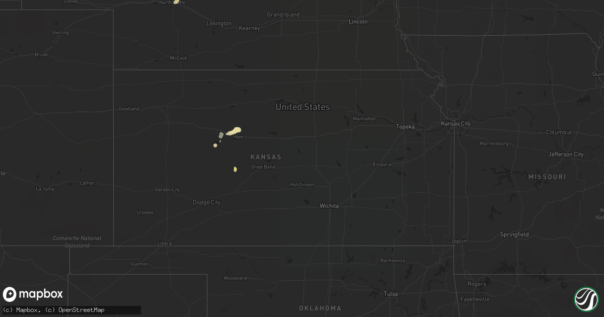
Hail Map in Kansas on July 13, 2021
Get this storm
July 13 map
$229
one time, instant access
Download today. No call, no setup
Keep the $229
Bought the map and want the full workflow? Apply the entire $229 to a subscription within 7 days. None of it is wasted.
Every map, not just this one
This buys you this map. Subscription and you get every map we run, in the markets you choose from a few cities to whole states to nationwide. Plus real-time alerts the moment a storm fires.
Contact data
Name, contact info, occupancy, even credit band for addresses in the footprint. You go from where it hit to who to call.
Become the source they trust
Unlimited branding weather history reports on demand. You already have the documented answer ready for the property owner, and you are the one who showed up with it.
Property data and RoofTrace estimates
Pull up any address you have got, its value and the exact code rules for that jurisdiction, straight from One Click Code. Then RoofTrace estimates the squares, pitch, and roof value, priced the way you price.
Storm reports in Kansas
Kansas
| Date | Description |
|---|---|
| 07/13/20216:40 PM CDT | Large branches blown down. Swing set blown over. Grain bin moved about 6 inches. Report received via social media. Time estimated by radar. |
| 07/13/20216:40 PM CDT | A local report indicates 60 MPH wind near ELLIS |
| 07/13/20212:26 AM CDT | At 726 PM CDT, a severe thunderstorm was located near Cedar Bluff, moving southeast at 10 mph. HAZARD...60 mph wind gusts and half dollar size hail. SOURCE...Radar indicated. IMPACT...Hail damage to vehicles is expected. Expect wind damage to roofs, siding, and trees. This severe thunderstorm will be near... Cedar Bluff around 730 PM CDT.Other locations in the path of this severe thunderstorm includeBrownell. |
| 07/13/20212:11 AM CDT | At 711 PM CDT, a severe thunderstorm was located 7 miles west of Ash Valley, moving northeast at 10 mph. HAZARD...60 mph wind gusts and half dollar size hail. SOURCE...Radar indicated. IMPACT...Hail damage to vehicles is expected. Expect wind damage to roofs, siding, and trees. Locations impacted include... Ash Valley and Rush Center. |
| 07/13/20212:10 AM CDT | At 709 PM CDT, a severe thunderstorm was located near Catherine, moving east at 15 mph. HAZARD...60 mph wind gusts and quarter size hail. SOURCE...Radar indicated. IMPACT...Hail damage to vehicles is expected. Expect wind damage to roofs, siding, and trees. This severe thunderstorm will be near... Catherine around 715 PM CDT.This new warning extends the previous warning for Ellis County.Other locations in the path of this severe thunderstorm includeEmmeram. |
| 07/13/20211:37 AM CDT | At 637 PM CDT, a severe thunderstorm was located very near Yocemento, moving east at 30 mph. HAZARD...60 mph wind gusts and penny size hail. SOURCE...Radar indicated. IMPACT...Expect damage to roofs, siding, and trees. This severe thunderstorm will be near... Hays and Toulon around 655 PM CDT.Other locations in the path of this severe thunderstorm includeCatherine, Victoria, Emmeram and Walker. |
| 07/12/20217:15 PM CDT | Report received via social media. Time estimated by radar. |
All States Impacted by Hail Map on July 13, 2021
Cities Impacted by Hail Map on July 13, 2021
- Gillette, WY
- Valentine, NE
- Harrisburg, NE
- Broadus, MT
- Hulett, WY
- Moorcroft, WY
- Weston, WY
- Alva, WY
- Sparks, NE
- Lowman, NY
- Erin, NY
- Hempstead, TX
- Oelwein, IA
- Maynard, IA
- New Richmond, WI
- Hudson, WI
- Somerset, WI
- Roberts, WI
- Happy Jack, AZ
- Sedona, AZ
- Vail, AZ
- Superior, WI
- Foxboro, WI
- Thomaston, AL
- Ewing, NE
- Clearwater, NE
- North Platte, NE
- Maxwell, NE
- Lilly, PA
- Williamsport, PA
- Cogan Station, PA
- Hawk Springs, WY
- Bloomfield, NE
- Armagh, PA
- Homer City, PA
- New Florence, PA
- Blairsville, PA
- Rozet, WY
- Lyman, NE
- Yoder, WY
- Torrington, WY
- Gering, NE
- Muncy, PA
- Stapleton, NE
- Franklin, MN
- Morgan, MN
- Martin, SD
- Pottersdale, PA
- Sinnamahoning, PA
- Frenchville, PA
- Driftwood, PA
- Westport, PA
- Karthaus, PA
- Petersburg, PA
- Hughesville, PA
- Flagstaff, AZ
- Ogallah, KS
- Ellis, KS
- Watsontown, PA
- Montgomery, PA
- Montoursville, PA
- Allenwood, PA
- Reynoldsville, PA
- Du Bois, PA
- Overton, NV
- Luthersburg, PA
- Mahaffey, PA
- Punxsutawney, PA
- Glen Campbell, PA
- Julesburg, CO
- Nekoma, KS
- Rozel, KS
- Casper, WY
- Glenrock, WY
- Camp Verde, AZ
- Mayer, AZ
- Cubero, NM
- Port Matilda, PA
- Lake Charles, LA
- Sulphur, LA
- Dequincy, LA
- Ashton, ID
- Brewster, NE
- Ovid, CO
- Terra Alta, WV
- Humphrey, NE
- Dresser, WI
- Pinehurst, TX
- Magnolia, TX
- Stanton, NE
- Trinidad, CO
- Thompson, UT
- Morris, PA
- Cedar Run, PA
- Morton, MN
- Redwood Falls, MN
- Hannibal, NY
- Martville, NY
- Sterling, NY
- Ingomar, MT
- Woodward, PA
- Somerville, TX
- Hayward, WI
- Scottsbluff, NE
- Centerville, TX
- Arnold, NE
- Brady, NE
- Saint Croix Falls, WI
- Wakeeney, KS
- Ransom, KS
- Trout Run, PA
- Page, NE
- Orchard, NE
- Royal, NE
- Vale, SD
- Nisland, SD
- Lagrange, WY
- Churchville, NY
- Le Roy, NY
- Paxton, NE
- Tryon, NE
- Laramie, WY
- Blossburg, PA
- Penn Yan, NY
- Weston, CO
- Spring Mills, PA
- Centre Hall, PA
- Pennsylvania Furnace, PA
- Hays, KS
- Ulster, PA
- Milan, PA
- Walsenburg, CO
- Loganton, PA
- Beulah, WY
- Belle Fourche, SD
- Spearfish, SD
- Aladdin, WY
- Sundance, WY
- Tilden, NE
- Neligh, NE
- Oakdale, NE
- Decaturville, TN
- Philipsburg, PA
- Central Square, NY
- Fulton, NY
- Cincinnatus, NY
- Dewey, AZ
- Largo, FL
- Linn Grove, IA
- Sioux Rapids, IA
- Rushville, NE
- Crookston, NE
- Springview, NE
- Bassett, NE
- Cross Fork, PA
- North Bend, PA
- Winslow, AZ
- Whitman, NE
- Scandia, MN
- Minneapolis, MN
- Primghar, IA
- Hartley, IA
- Chemung, NY
- Waverly, NY
- Millerton, PA
- Lockwood, NY
- Pine City, NY
- Gillett, PA
- Elmira, NY
- Barton, NY
- Wellsburg, NY
- Sedgwick, CO
- Milford, UT
- Marksville, LA
- Jonesville, LA
- Lewisburg, PA
- Creighton, NE
- Westfield, IA
- Merrill, IA
- Osceola, WI
- Sutherland, IA
- Kilgore, NE
- Fairfax, MN
- Dundee, NY
- Archer, IA
- Hospers, IA
- Granville, IA
- Oracle, AZ
- Ganado, AZ
- Stillwater, MN
- Marine On Saint Croix, MN
- Ten Sleep, WY
- Winnetoon, NE
- Watkins Glen, NY
- Rock Stream, NY
- Burdett, NY
- Newell, SD
- Cimarron, NM
- Denham Springs, LA
- Walker, LA
- Cotulla, TX
- Julian, PA
- Dickens, IA
- Huntingdon, PA
- Lufkin, TX
- Sleepy Eye, MN
- Oral, SD
- Forest Hill, LA
- Sheridan Lake, CO
- Tyrone, PA
- Spruce Creek, PA
- Warriors Mark, PA
- State College, PA
- University Park, PA
- Oswego, NY
- Beech Creek, PA
- Renovo, PA
- Zuni, NM
- Waller, TX
- Hollidaysburg, PA
- Bosler, WY
- New Creek, WV
- Mifflinburg, PA
- Saint Onge, SD
- Whitewood, SD
- Divide, CO
- Florissant, CO
- Larned, KS
- Alexandria, LA
- Roaring Spring, PA
- Martinsburg, PA
- Bellefonte, PA
- Fayette, IA
- Littlefield, AZ
- Drifting, PA
- Morrisdale, PA
- Winburne, PA
- Grassflat, PA
- Lanse, PA
- Arthur, NE
- Keystone, NE
- Arvada, WY
- Milton, PA
- Rockwood, PA
- Markleton, PA
- Hay Springs, NE
- Robinson, PA
- Bolivar, PA
- Seward, PA
- Wellsboro, PA
- Clearfield, PA
- Muncy Valley, PA
- Hillsgrove, PA
- Hemingford, NE
- Gallitzin, PA
- Ashville, PA
- Sutherland, NE
- Thermopolis, WY
- Cammal, PA
- Gaines, PA
- Montandon, PA
- New Berlin, PA
- Winfield, PA
- Danville, PA
- Tomball, TX
- Pine Hill, AL
- Tuthill, SD
- Jasper, TX
- Batesland, SD
- Everly, IA
- Jersey Shore, PA
- Keyser, WV
- Saint Paul, MN
- Geismar, LA
- Carville, LA
- Saint Gabriel, LA
- Liberty, PA
- Alliance, NE
- Storm Lake, IA
- Rembrandt, IA
- Albert City, IA
- Starks, LA
- Lecompte, LA
- Woodworth, LA
- Hockley, TX
- Cypress, TX
- Houston, TX
- Cable, WI
- Lock Haven, PA
- Jersey Mills, PA
- Curwensville, PA
- Moshannon, PA
- Pennington, TX
- Groveton, TX
- Brookshire, TX
- Marathon, IA
- Andover, MN
- Anoka, MN
- Eads, CO
- Brookeland, TX
- Fordyce, NE
- Sonoita, AZ
- Bergen, NY
- Ligonier, PA
- Brush Valley, PA
- Penn Run, PA
- Indiana, PA
- Vintondale, PA
- Alamo, NV
- Williamsburg, PA
- Alexandria, PA
- Baton Rouge, LA
- Saint Francis, SD
- Boyce, LA
- San Carlos, AZ
- Peridot, AZ
- Roaring Branch, PA
- Ralston, PA
- Millmont, PA
- Horseheads, NY
- Gordon, NE
- Green River, UT
- Mill Run, PA
- Lead, SD
- Spencer, NY
- Candor, NY
- Ridgeland, WI
- Montgomery, TX
- Newell, IA
- Spencer, IA
- Laurelton, PA
- Clarkdale, AZ
- Brewerton, NY
- Pennellville, NY
- Recluse, WY
- Deadwood, SD
- New Underwood, SD
- Lemont, PA
- Townville, PA
- Polk, PA
- Volant, PA
- Grove City, PA
- Franklin, PA
- Guys Mills, PA
- Cooperstown, PA
- Columbus, PA
- Clarks Mills, PA
- Carlton, PA
- Spring Creek, PA
- Titusville, PA
- New Castle, PA
- Bear Lake, PA
- Jackson Center, PA
- Grand Valley, PA
- Hydetown, PA
- Spartansburg, PA
- Centerville, PA
- New Wilmington, PA
- Union City, PA
- Hadley, PA
- Panama, NY
- Sandy Lake, PA
- Clymer, NY
- Cochranton, PA
- Stoneboro, PA
- Utica, PA
- Mercer, PA
- Corry, PA
- Cambridge Springs, PA
- Waterford, PA
- Wattsburg, PA
- Atlantic, PA
- Greenville, PA
- Transfer, PA
- Saegertown, PA
- Meadville, PA
- Conneaut Lake, PA
- Zelienople, PA
- Renfrew, PA
- Butler, PA
- Prospect, PA
- Fombell, PA
- Evans City, PA
- Harmony, PA
- Lickingville, PA
- Marienville, PA
- Shippenville, PA
- Leeper, PA
- Vowinckel, PA
- Kane, PA
- Crown, PA
- Clarion, PA
- Lucinda, PA
- Tionesta, PA
- Sheffield, PA
- Ludlow, PA
- Altoona, PA
- Duncansville, PA
- Dysart, PA
- Howard, PA
- New Columbia, PA
- Camden, NY
- Constableville, NY
- Middleport, NY
- Waterport, NY
- Lyndonville, NY
- Gasport, NY
- Medina, NY
- Lockport, NY
- Barker, NY
- North Tonawanda, NY
- Himrod, NY
- Dresden, NY
- Keuka Park, NY
- Hammondsport, NY
- Beaver Dams, NY
- Savona, NY
- Bradford, NY
- North Pitcher, NY
- Newark Valley, NY
- Richford, NY
- Owego, NY
- Earlville, NY
- Eaton, NY
- Smithville Flats, NY
- South Otselic, NY
- Lisle, NY
- Whitney Point, NY
- De Ruyter, NY
- Pitcher, NY
- Maine, NY
- Berkshire, NY
- Glen Aubrey, NY
- Georgetown, NY
- McDonough, NY
- Marathon, NY
- Willet, NY
- Nichols, NY
- Norwich, NY
- South Plymouth, NY
- New Berlin, NY
- Oxford, NY
- Sherburne, NY
- Plymouth, NY
- Smyrna, NY


