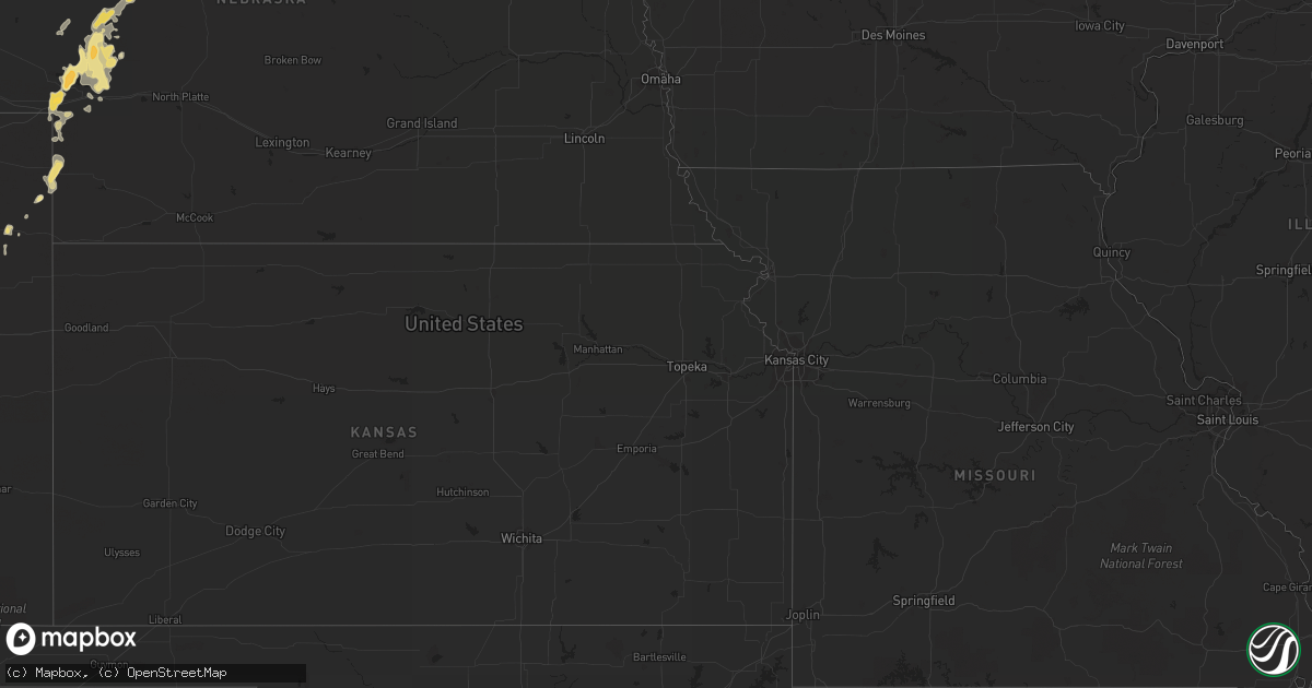
Hail Map in Kentucky on July 13, 2013
Get this storm
July 13 map
$229
one time, instant access
Download today. No call, no setup
Keep the $229
Bought the map and want the full workflow? Apply the entire $229 to a subscription within 7 days. None of it is wasted.
Every map, not just this one
This buys you this map. Subscription and you get every map we run, in the markets you choose from a few cities to whole states to nationwide. Plus real-time alerts the moment a storm fires.
Contact data
Name, contact info, occupancy, even credit band for addresses in the footprint. You go from where it hit to who to call.
Become the source they trust
Unlimited branding weather history reports on demand. You already have the documented answer ready for the property owner, and you are the one who showed up with it.
Property data and RoofTrace estimates
Pull up any address you have got, its value and the exact code rules for that jurisdiction, straight from One Click Code. Then RoofTrace estimates the squares, pitch, and roof value, priced the way you price.
Storm reports in Kentucky
Kentucky
| Date | Description |
|---|---|
| 07/13/20133:55 PM CDT | Tree across road on hwy 52 west going toward irvine. Still within city limits. City of beattyville is without electricity. |
| 07/13/20133:45 PM CDT | Trees down. |
| 07/13/20133:45 PM CDT | In addtion...a tree fell over and landed on powerlines almost hitting a trailer. |
| 07/13/20133:35 PM CDT | Estimated wind speed of 60 mph. Half a dozen tree limbs approximately 4 to 5 inches in diameter in yard. |
| 07/13/20133:32 PM CDT | Estimated winds at least 50 to 60 mph and perhaps higher. |
| 07/13/20133:31 PM CDT | Tree down in city park. Dime sized hail. |
| 07/13/20132:50 PM CDT | A local report indicates 1.25 inch wind near 3 NNE NERINX |
| 07/13/20132:40 PM CDT | One tree down highway 49. |
| 07/13/20132:33 PM CDT | A local report indicates 1.25 inch wind near 3 NE ST. MARY |
| 07/13/20132:24 PM CDT | A local report indicates 1.00 inch wind near 2 WNW LEBANON |
| 07/13/20132:12 PM CDT | A local report indicates 1.50 inch wind near 4 W BRADFORDSVILLE |
| 07/13/20132:00 PM CDT | Several trees blown over off of big cave road. |
| 07/13/20131:45 PM CDT | A local report indicates 1.00 inch wind near 3 NW CLEMENTSVILLE |
| 07/13/20131:20 PM CDT | Goose creek road |
| 07/13/201312:53 PM CDT | Large limbs down and nickel sized hail between mile markers 55 and 57 on i75. |
| 07/13/201312:48 PM CDT | Powerlines were reported to have been blown down onto trees. |
| 07/13/201312:45 PM CDT | Trees were reported down along jasper bend road. |
| 07/13/201312:35 PM CDT | Multiple trees down. One whole side of a barn blown in. Quarter sized hail. |
| 07/13/201311:15 AM CDT | Several trees across state hwy 1350 in the clark community. |
All States Impacted by Hail Map on July 13, 2013
Cities Impacted by Hail Map on July 13, 2013
- Selma, AL
- Douglas, AZ
- Little River, AL
- Luverne, AL
- Rutledge, AL
- Killdeer, ND
- Elbert, CO
- Colorado Springs, CO
- Epping, ND
- Ray, ND
- Williston, ND
- Venango, NE
- Watford City, ND
- Arnegard, ND
- Cartwright, ND
- Arthur, NE
- Huntingburg, IN
- Lebanon, KY
- Loretto, KY
- Springfield, KY
- Roberts, MT
- Sutherland, NE
- Crosby, ND
- Noonan, ND
- Bird City, KS
- Brighton, CO
- Commerce City, CO
- Arriba, CO
- Hugo, CO
- Lacombe, LA
- Liberty, KY
- Columbia, KY
- Dunnville, KY
- Russell Springs, KY
- Gulfport, MS
- Padroni, CO
- Bowman, ND
- Paxton, NE
- Honoraville, AL
- Akron, CO
- Beattyville, KY
- Picayune, MS
- Pearl River, LA
- Stennis Space Center, MS
- Selby, SD
- Amidon, ND
- Johnstown, NE
- Biloxi, MS
- Alamo, ND
- Zahl, ND
- Grenora, ND
- Wray, CO
- Bardstown, KY
- New Haven, KY
- Sundance, WY
- Belle Fourche, SD
- Beulah, WY
- Aladdin, WY
- Campbellsville, KY
- Saint David, AZ
- Bridger, MT
- Lodge Grass, MT
- Lowndesboro, AL
- Detroit, AL
- Sidney, MT
- Alexander, ND
- Milton, FL
- Hope Hull, AL
- Windsor, KY
- Trail City, SD
- Limon, CO
- Eckley, CO
- Yuma, CO
- Plantersville, AL
- Atmore, AL
- Glenham, SD
- Center, NE
- Bloomfield, NE
- Niobrara, NE
- Foley, AL
- Reva, SD
- Champion, NE
- Holyoke, CO
- Alexander City, AL
- Saint Onge, SD
- Tioga, ND
- Brule, NE
- Irvington, AL
- Springview, NE
- Wakpala, SD
- Seminole, AL
- Saint Francis, KS
- Pryor, MT
- Kellyton, AL
- Equality, AL
- McLaughlin, SD
- Century, FL
- McDavid, FL
- Molino, FL
- Robertsdale, AL
- Elk Horn, KY
- Nancy, KY
- Alva, WY
- Marion, AL
- Baxter, TN
- Eagle Butte, SD
- Gettysburg, SD
- Highland Home, AL
- Lapine, AL
- Seibert, CO
- Genoa, CO
- Albany, KY
- Burkesville, KY
- Lemoyne, NE
- Lewellen, NE
- Ogallala, NE
- Keystone, NE
- Grassy Butte, ND
- Brush, CO
- Ramah, CO
- Laramie, WY
- Ainsworth, NE
- Pensacola, FL
- Coffeeville, AL
- Big Springs, NE
- Somerset, KY
- Perkinston, MS
- Herreid, SD
- Whitman, NE
- Hyannis, NE
- Julesburg, CO
- Mullen, NE
- Cantonment, FL
- Roscoe, SD
- Frisco City, AL
- Freeport, FL
- Defuniak Springs, FL
- Whitley City, KY
- Parkers Lake, KY
- Elberta, AL
- Agate, CO
- Palatka, FL
- Vancleave, MS
- Ambrose, ND
- Wells, MN
- Lumberton, MS
- Glencross, SD
- Cheyenne, WY
- Onida, SD
- Pierre, SD
- Agar, SD
- Fortuna, ND
- Kiln, MS
- Platte, SD
- Java, SD
- Quitman, MS
- Millry, AL
- Killen, AL
- Spearfish, SD
- Franklin, GA
- Saraland, AL
- Gulf Shores, AL
- Fairview, MT
- Timber Lake, SD
- McLain, MS
- Elba, AL
- Golden, CO
- Monroeville, AL
- Vredenburgh, AL
- Hillsboro, KS
- Lehigh, KS
- Eight Mile, AL
- Maplesville, AL
- Williamsburg, KY
- State Line, MS
- Saucier, MS
- Slidell, LA
- Grand Bay, AL
- Citronelle, AL
- Lucedale, MS
- Leakesville, MS
- Verdigre, NE
- New Brockton, AL
- Burke, SD
- Clanton, AL
- Liberty, TN
- Alexandria, TN
- Hickman, TN
- Mobridge, SD
- Roggen, CO
- Scranton, ND
- Gregory, SD
- Orrville, AL
- Jones, AL
- Cherokee, AL
- Easton, MN
- Burnside, KY
- Uniontown, AL
- Safford, AL
- Marion Junction, AL
- Pollock, SD
- Pine Knot, KY
- Bay Minette, AL
- Orange Beach, AL
- Vernon, FL
- Satsuma, FL
- Mount Vernon, KY
- Orlando, KY
- Louin, MS
- London, KY
- Long Pine, NE
- Fromberg, MT
- Allred, TN
- Rickman, TN
- Columbus, ND
- Hamilton, AL
- Bainville, MT
- Bradfordsville, KY
- Mannsville, KY


