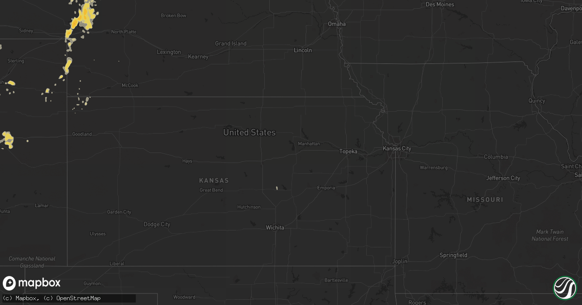
Hail Map on July 13, 2013
Get this storm
July 13 map
$229
one time, instant access
Download today. No call, no setup
Keep the $229
Bought the map and want the full workflow? Apply the entire $229 to a subscription within 7 days. None of it is wasted.
Every map, not just this one
This buys you this map. Subscription and you get every map we run, in the markets you choose from a few cities to whole states to nationwide. Plus real-time alerts the moment a storm fires.
Contact data
Name, contact info, occupancy, even credit band for addresses in the footprint. You go from where it hit to who to call.
Become the source they trust
Unlimited branding weather history reports on demand. You already have the documented answer ready for the property owner, and you are the one who showed up with it.
Property data and RoofTrace estimates
Pull up any address you have got, its value and the exact code rules for that jurisdiction, straight from One Click Code. Then RoofTrace estimates the squares, pitch, and roof value, priced the way you price.
States Impacted by Hail Map on July 13, 2013
Storm reports
Colorado
| Date | Description |
|---|---|
| 07/12/20138:24 PM CDT | A local report indicates 64 MPH wind near 1 N AKRON |
Arizona
| Date | Description |
|---|---|
| 07/12/20138:45 PM CDT | Spotter called in to update 3 4 ins report to 1.00 ins hail after storm passed through. |
| 07/12/20138:20 PM CDT | Spotter called in to update 3 4 ins report to 1.00 ins hail after storm passed through. |
| 07/12/20137:57 PM CDT | Max wind gust recorded on airport asos at 0057z |
Alabama
| Date | Description |
|---|---|
| 07/13/20133:35 PM CDT | Several tops of trees snapped and minor damage reported to a shed in the jones community near the intersections of county road 83 and county road 16. Winds estimated 45 |
| 07/12/20139:35 PM CDT | Several trees down and power outages at county roads 73..34...308 and 224 in the green hill area. |
Indiana
| Date | Description |
|---|---|
| 07/13/20136:53 PM CDT | Tree limbs down. Estimated 45-50 mph winds. |
| 07/13/20136:48 PM CDT | 2 pretty large trees down at north railroad and sycamore street |
| 07/12/20137:10 PM CDT | Tree down near knights of columbus in vincennes |
| 07/12/20137:10 PM CDT | Tree down at s 15th st by the grain elevator |
| 07/12/20137:07 PM CDT | 18 by 21 foot stand alone car port type structure blown into fence. |
Kentucky
| Date | Description |
|---|---|
| 07/13/20133:55 PM CDT | Tree across road on hwy 52 west going toward irvine. Still within city limits. City of beattyville is without electricity. |
| 07/13/20133:45 PM CDT | In addtion...a tree fell over and landed on powerlines almost hitting a trailer. |
| 07/13/20133:45 PM CDT | Trees down. |
| 07/13/20133:35 PM CDT | Estimated wind speed of 60 mph. Half a dozen tree limbs approximately 4 to 5 inches in diameter in yard. |
| 07/13/20133:32 PM CDT | Estimated winds at least 50 to 60 mph and perhaps higher. |
| 07/13/20133:31 PM CDT | Tree down in city park. Dime sized hail. |
| 07/13/20132:50 PM CDT | A local report indicates 1.25 inch wind near 3 NNE NERINX |
| 07/13/20132:40 PM CDT | One tree down highway 49. |
| 07/13/20132:33 PM CDT | A local report indicates 1.25 inch wind near 3 NE ST. MARY |
| 07/13/20132:24 PM CDT | A local report indicates 1.00 inch wind near 2 WNW LEBANON |
| 07/13/20132:12 PM CDT | A local report indicates 1.50 inch wind near 4 W BRADFORDSVILLE |
| 07/13/20132:00 PM CDT | Several trees blown over off of big cave road. |
| 07/13/20131:45 PM CDT | A local report indicates 1.00 inch wind near 3 NW CLEMENTSVILLE |
| 07/13/20131:20 PM CDT | Goose creek road |
| 07/13/201312:53 PM CDT | Large limbs down and nickel sized hail between mile markers 55 and 57 on i75. |
| 07/13/201312:48 PM CDT | Powerlines were reported to have been blown down onto trees. |
| 07/13/201312:45 PM CDT | Trees were reported down along jasper bend road. |
| 07/13/201312:35 PM CDT | Multiple trees down. One whole side of a barn blown in. Quarter sized hail. |
| 07/13/201311:15 AM CDT | Several trees across state hwy 1350 in the clark community. |
North Dakota
| Date | Description |
|---|---|
| 07/13/20136:55 PM CDT | Tree branches broken. Power out in the area. Rain was 1.75 inches in 45 minutes. No hail. |
| 07/13/20136:45 PM CDT | A local report indicates 58 MPH wind near 5 S BOWBELLS |
| 07/13/20136:20 PM CDT | A local report indicates 62 MPH wind near 1 E WATFORD CITY |
| 07/13/20135:50 PM CDT | A local report indicates 60 MPH wind near 6 NNW WILLISTON |
| 07/13/20135:48 PM CDT | Ongoing |
| 07/13/20135:32 PM CDT | A few stones. No damage. |
| 07/13/20135:18 PM CDT | 1.25 inches of rain. |
| 07/13/20135:00 PM CDT | No damage. |
| 07/12/20139:01 PM CDT | A local report indicates 58 MPH wind near 2 N ROLLA |
| 07/12/20138:37 PM CDT | A local report indicates 70 MPH wind near 2 W DUNSEITH |
| 07/12/20138:05 PM CDT | Very heavy rain was also reported. |
| 07/12/20137:53 PM CDT | Public report to nws bismarck facebook page. |
| 07/12/20137:19 PM CDT | Small branches broken off trees. |
| 07/12/20137:19 PM CDT | A local report indicates 58 MPH wind near 5 S ANTLER |
South Dakota
| Date | Description |
|---|---|
| 07/13/20131:47 AM CDT | Estimated wind gusts of 50 to 60 mph. |
| 07/13/20131:10 AM CDT | Estimated wind gusts of 50 to 60 mph. |
| 07/13/201312:59 AM CDT | Asos station mobridge muni ap /mbg/ |
Montana
| Date | Description |
|---|---|
| 07/13/20134:55 PM CDT | Pea to quarter inch hail |
| 07/12/20137:30 PM CDT | Mostly dime sized hail with a few quarter sized hailstones. Also 55 mph convective wind gusts. |
Florida
| Date | Description |
|---|---|
| 07/13/20131:30 PM CDT | Penny and quarter sized hail |
Mississippi
| Date | Description |
|---|---|
| 07/12/201310:55 PM CDT | The roof was blown off a mobile home along county rd 16-142 |
Wyoming
| Date | Description |
|---|---|
| 07/13/20136:25 PM CDT | A local report indicates 1.00 inch wind near 4 E ALADDIN |
| 07/13/20136:25 PM CDT | A local report indicates 60 MPH wind near 4 E ALADDIN |
Cities Impacted by Hail Map on July 13, 2013
- Selma, AL
- Douglas, AZ
- Little River, AL
- Luverne, AL
- Rutledge, AL
- Killdeer, ND
- Elbert, CO
- Colorado Springs, CO
- Epping, ND
- Ray, ND
- Williston, ND
- Venango, NE
- Watford City, ND
- Arnegard, ND
- Cartwright, ND
- Arthur, NE
- Huntingburg, IN
- Lebanon, KY
- Loretto, KY
- Springfield, KY
- Roberts, MT
- Sutherland, NE
- Crosby, ND
- Noonan, ND
- Bird City, KS
- Brighton, CO
- Commerce City, CO
- Arriba, CO
- Hugo, CO
- Lacombe, LA
- Liberty, KY
- Columbia, KY
- Dunnville, KY
- Russell Springs, KY
- Gulfport, MS
- Padroni, CO
- Bowman, ND
- Paxton, NE
- Honoraville, AL
- Akron, CO
- Beattyville, KY
- Picayune, MS
- Pearl River, LA
- Stennis Space Center, MS
- Selby, SD
- Amidon, ND
- Johnstown, NE
- Biloxi, MS
- Alamo, ND
- Zahl, ND
- Grenora, ND
- Wray, CO
- Bardstown, KY
- New Haven, KY
- Sundance, WY
- Belle Fourche, SD
- Beulah, WY
- Aladdin, WY
- Campbellsville, KY
- Saint David, AZ
- Bridger, MT
- Lodge Grass, MT
- Lowndesboro, AL
- Detroit, AL
- Sidney, MT
- Alexander, ND
- Milton, FL
- Hope Hull, AL
- Windsor, KY
- Trail City, SD
- Limon, CO
- Eckley, CO
- Yuma, CO
- Plantersville, AL
- Atmore, AL
- Glenham, SD
- Center, NE
- Bloomfield, NE
- Niobrara, NE
- Foley, AL
- Reva, SD
- Champion, NE
- Holyoke, CO
- Alexander City, AL
- Saint Onge, SD
- Tioga, ND
- Brule, NE
- Irvington, AL
- Springview, NE
- Wakpala, SD
- Seminole, AL
- Saint Francis, KS
- Pryor, MT
- Kellyton, AL
- Equality, AL
- McLaughlin, SD
- Century, FL
- McDavid, FL
- Molino, FL
- Robertsdale, AL
- Elk Horn, KY
- Nancy, KY
- Alva, WY
- Marion, AL
- Baxter, TN
- Eagle Butte, SD
- Gettysburg, SD
- Highland Home, AL
- Lapine, AL
- Seibert, CO
- Genoa, CO
- Albany, KY
- Burkesville, KY
- Lemoyne, NE
- Lewellen, NE
- Ogallala, NE
- Keystone, NE
- Grassy Butte, ND
- Brush, CO
- Ramah, CO
- Laramie, WY
- Ainsworth, NE
- Pensacola, FL
- Coffeeville, AL
- Big Springs, NE
- Somerset, KY
- Perkinston, MS
- Herreid, SD
- Whitman, NE
- Hyannis, NE
- Julesburg, CO
- Mullen, NE
- Cantonment, FL
- Roscoe, SD
- Frisco City, AL
- Freeport, FL
- Defuniak Springs, FL
- Whitley City, KY
- Parkers Lake, KY
- Elberta, AL
- Agate, CO
- Palatka, FL
- Vancleave, MS
- Ambrose, ND
- Wells, MN
- Lumberton, MS
- Glencross, SD
- Cheyenne, WY
- Onida, SD
- Pierre, SD
- Agar, SD
- Fortuna, ND
- Kiln, MS
- Platte, SD
- Java, SD
- Quitman, MS
- Millry, AL
- Killen, AL
- Spearfish, SD
- Franklin, GA
- Saraland, AL
- Gulf Shores, AL
- Fairview, MT
- Timber Lake, SD
- McLain, MS
- Elba, AL
- Golden, CO
- Monroeville, AL
- Vredenburgh, AL
- Hillsboro, KS
- Lehigh, KS
- Eight Mile, AL
- Maplesville, AL
- Williamsburg, KY
- State Line, MS
- Saucier, MS
- Slidell, LA
- Grand Bay, AL
- Citronelle, AL
- Lucedale, MS
- Leakesville, MS
- Verdigre, NE
- New Brockton, AL
- Burke, SD
- Clanton, AL
- Liberty, TN
- Alexandria, TN
- Hickman, TN
- Mobridge, SD
- Roggen, CO
- Scranton, ND
- Gregory, SD
- Orrville, AL
- Jones, AL
- Cherokee, AL
- Easton, MN
- Burnside, KY
- Uniontown, AL
- Safford, AL
- Marion Junction, AL
- Pollock, SD
- Pine Knot, KY
- Bay Minette, AL
- Orange Beach, AL
- Vernon, FL
- Satsuma, FL
- Mount Vernon, KY
- Orlando, KY
- Louin, MS
- London, KY
- Long Pine, NE
- Fromberg, MT
- Allred, TN
- Rickman, TN
- Columbus, ND
- Hamilton, AL
- Bainville, MT
- Bradfordsville, KY
- Mannsville, KY