Hail Map in Wisconsin on July 11, 2011
Get this storm
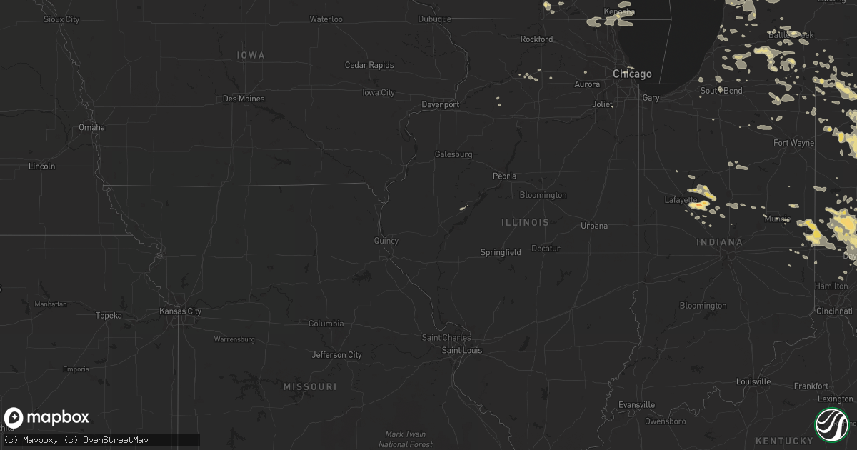
July 11 map
$229
one time, instant access
Download today. No call, no setup
Keep the $229
Bought the map and want the full workflow? Apply the entire $229 to a subscription within 7 days. None of it is wasted.
Every map, not just this one
This buys you this map. Subscription and you get every map we run, in the markets you choose from a few cities to whole states to nationwide. Plus real-time alerts the moment a storm fires.
Contact data
Name, contact info, occupancy, even credit band for addresses in the footprint. You go from where it hit to who to call.
Become the source they trust
Unlimited branding weather history reports on demand. You already have the documented answer ready for the property owner, and you are the one who showed up with it.
Property data and RoofTrace estimates
Pull up any address you have got, its value and the exact code rules for that jurisdiction, straight from One Click Code. Then RoofTrace estimates the squares, pitch, and roof value, priced the way you price.
Storm reports in Wisconsin
Wisconsin
| Date | Description |
|---|---|
| 07/11/20118:30 AM CDT | Numerous 12 to 18 inch diameter trees down across the northern half of the city |
| 07/11/20118:15 AM CDT | Many 4-5 five inch tree limbs down through the area |
| 07/11/20118:12 AM CDT | Numerous small branches down 2 inches or less in diameter. |
| 07/11/20118:02 AM CDT | A local report indicates 58 MPH wind near S WHITEWATER |
| 07/11/20118:02 AM CDT | Multiple 6-12 ft long branches covering road...tree branch down on day care center corner of cty rd h and blue spring lake dr...time estimated from radar |
| 07/11/20117:50 AM CDT | About a dozen trees down across the western half of kenosha county. |
| 07/11/20117:50 AM CDT | 1 ft diameter healthy tree branch found on garage roof...time estimated from radar |
| 07/11/20117:35 AM CDT | Power lines blocking all four lanes of hwy 51 near the airport. Four inch diameter branches and eight inch diameter tree down. Estimated wind gust of 55 mph. |
| 07/11/20117:25 AM CDT | Power lines down. Estimated wind gust of 55 mph. |
| 07/11/20117:25 AM CDT | Power lines down. Estimated wind gust of 55 mph. |
| 07/11/20117:20 AM CDT | A local report indicates 65 MPH wind near BELOIT |
| 07/11/20117:09 AM CDT | Screen house torn apart bending 1 inch square steel tubes. Wind measured at 30 mph. Measured rainfall 0.48 inches. |
All States Impacted by Hail Map on July 11, 2011
Cities Impacted by Hail Map on July 11, 2011
- Georgetown, OH
- Saint Marys, WV
- Newport, OH
- Bethune, CO
- Burlington, CO
- Burwell, NE
- Chambers, NE
- Notre Dame, IN
- South Bend, IN
- Union Bridge, MD
- Keymar, MD
- Summitville, IN
- Elwood, IN
- Lindsay, NE
- Humphrey, NE
- Mullen, NE
- Whitman, NE
- Valentine, NE
- Merriman, NE
- Gordon, NE
- Sterling, CO
- Hellier, KY
- Elkhorn City, KY
- Greenville, OH
- Memphis, TX
- Childress, TX
- Hudsonville, MI
- Richland, MI
- Plainview, NE
- Pierce, NE
- Osmond, NE
- Conover, OH
- Fletcher, OH
- Ovid, CO
- Reisterstown, MD
- Owings Mills, MD
- Lutherville Timonium, MD
- Cambridge, OH
- New Concord, OH
- Tulia, TX
- Kentwood, LA
- Zanesville, OH
- Mount Perry, OH
- Hopewell, OH
- Glenford, OH
- Newark, OH
- Nashport, OH
- Heath, OH
- Fort Stockton, TX
- Ottawa, OH
- Stapleton, NE
- Sayre, OK
- Birney, MT
- Silverton, TX
- Lockney, TX
- Hebron, OH
- Granville, OH
- Westerville, OH
- Alexandria, OH
- Pataskala, OH
- Thornville, OH
- Galena, OH
- New Albany, OH
- Jacksontown, OH
- Johnstown, OH
- Troy, OH
- Dayton, OH
- Vandalia, OH
- Tipp City, OH
- Rushville, NE
- Hay Springs, NE
- Arnold, NE
- Houlton, ME
- Janesville, WI
- Sherwood, MI
- Union City, MI
- Paducah, TX
- Springfield, OH
- Busy, KY
- Bonnyman, KY
- Krypton, KY
- Kress, TX
- Plainview, TX
- Columbus, OH
- Blacklick, OH
- Leesburg, OH
- Wilmington, OH
- New Vienna, OH
- Sabina, OH
- Urbana, OH
- Decker, MT
- Cedar Rapids, NE
- Palestine, WV
- Le Roy, WV
- Moorcroft, WY
- Baker, FL
- Vernon, TX
- Canyon, TX
- Lore City, OH
- Adamsville, OH
- Kimbolton, OH
- Norwich, OH
- Dresden, OH
- Winchester, IN
- Saint Charles, IL
- Geneva, IL
- Mechanicsburg, OH
- Pearson, GA
- Mclean, TX
- Clarendon, TX
- Franktown, CO
- Fountain City, IN
- Ravenswood, WV
- Sandyville, WV
- Rush, KY
- Harrisburg, NE
- Lyman, NE
- Bringhurst, IN
- Flora, IN
- Delphi, IN
- Dillon, MT
- Westminster, MD
- Taneytown, MD
- Wallingford, KY
- Morehead, KY
- Hillsboro, KY
- Yolyn, WV
- Richland, GA
- Preston, GA
- Castle Rock, CO
- Grandville, MI
- Grand Rapids, MI
- Jenison, MI
- Caledonia, MI
- Cecil, OH
- Frazeysburg, OH
- Denniston, KY
- Ezel, KY
- Wellington, KY
- Union City, IN
- Union City, OH
- Lynn, IN
- Palestine, OH
- New Paris, OH
- Richmond, IN
- Hollansburg, OH
- New Madison, OH
- Brandon, MS
- Hazard, KY
- Wooton, KY
- Lance Creek, WY
- Peetz, CO
- Frankfort, OH
- Merino, CO
- Snyder, CO
- Franklin Furnace, OH
- Point Pleasant, WV
- Gallipolis Ferry, WV
- Henderson, WV
- Manchester, OH
- West Union, OH
- Aberdeen, OH
- Albion, IN
- Groom, TX
- Pampa, TX
- Russia, OH
- Covington, OH
- Pleasant Hill, OH
- Versailles, OH
- Piqua, OH
- Houston, OH
- Bradford, OH
- Selma, IN
- Quitaque, TX
- Louisa, KY
- McGuffey, OH
- Alger, OH
- Champion, NE
- Parks, NE
- Sheridan, WY
- Banner, WY
- Clearmont, WY
- Phyllis, KY
- Fedscreek, KY
- Forest, VA
- Goode, VA
- Clarkson, NE
- Reading, MI
- Camden, MI
- Hansen, ID
- Coldwater, MI
- Bronson, MI
- Colon, MI
- Leonidas, MI
- Burns, WY
- Reynolds, IN
- Spencerville, OH
- Grove Hill, AL
- Jackson, AL
- Ripley, WV
- Cottageville, WV
- Leon, WV
- Evans, WV
- Port William, OH
- Jamestown, OH
- Fayette, OH
- Beaver, OK
- Pikeville, KY
- Shade, OH
- Guysville, OH
- Athens, OH
- Ada, OH
- Washington Court House, OH
- Denton, KY
- Webbville, KY
- Clintwood, VA
- Hitchins, KY
- Grayson, KY
- Leipsic, OH
- McComb, OH
- Cloverdale, OH
- Holgate, OH
- Rawson, OH
- Hamler, OH
- Continental, OH
- Findlay, OH
- Malinta, OH
- Pandora, OH
- Fort Jennings, OH
- Benton Ridge, OH
- Defiance, OH
- Miller City, OH
- Bluffton, OH
- Deshler, OH
- New Bavaria, OH
- Mount Cory, OH
- Custar, OH
- North Baltimore, OH
- Napoleon, OH
- Columbus Grove, OH
- Hoytville, OH
- Kalida, OH
- Bartlett, NE
- New Bloomington, OH
- Harpster, OH
- Morral, OH
- La Rue, OH
- Kenton, OH
- Marion, OH
- Quincy, OH
- De Graff, OH
- Milton, WV
- Benson, AZ
- South Vienna, OH
- Vanceburg, KY
- West Portsmouth, OH
- Otway, OH
- Blue Creek, OH
- McDermott, OH
- Peebles, OH
- Stout, OH
- Shamrock, TX
- Holyoke, CO
- Gillette, WY
- Rozet, WY
- Yellow Springs, OH
- Quaker City, OH
- Southside, WV
- Floydada, TX
- Berryville, VA
- Summit Point, WV
- Clear Brook, VA
- Kearneysville, WV
- Charles Town, WV
- Ranger, WV
- Kiahsville, WV
- Maysville, KY
- Mayslick, KY
- Neligh, NE
- Allen, MI
- Litchfield, MI
- Jonesville, MI
- Hillsdale, MI
- Boons Camp, KY
- Tomahawk, KY
- Paintsville, KY
- Lowmansville, KY
- Williamsport, KY
- River, KY
- Ellsworth, NE
- Ashby, NE
- Bingham, NE
- Silas, AL
- Pearce, AZ
- Nokesville, VA
- Catlett, VA
- Quincy, KY
- South Portsmouth, KY
- Dobson, NC
- Jackson, OH
- Mendon, MI
- Quantico, VA
- Sherwood, OH
- Antwerp, OH
- Hicksville, OH
- Mark Center, OH
- Grove City, OH
- Lancaster, OH
- Carroll, OH
- Hilliard, FL
- Purcellville, VA
- Leesburg, VA
- Round Hill, VA
- Bluemont, VA
- Hamilton, VA
- Marietta, OH
- Williamstown, WV
- Morenci, MI
- Chunky, MS
- Butler, IN
- Millersport, OH
- Baltimore, OH
- Salesville, OH
- Hastings, MI
- Freeport, MI
- Hillsboro, OH
- Manhattan, MT
- Bozeman, MT
- Sheridan, IN
- Kirklin, IN
- Kempton, IN
- Douglas, AZ
- West Olive, MI
- Grand Haven, MI
- Van Lear, KY
- Pilgrim, KY
- Prestonsburg, KY
- Debord, KY
- Pittsford, MI
- Waldron, MI
- Wauseon, OH
- Montgomery, MI
- Hamilton, MI
- Allegan, MI
- Kenosha, WI
- Racine, WI
- Dayton, WY
- Wyola, MT
- Arlington, OH
- Belle Center, OH
- Forest, OH
- Williamstown, OH
- Dola, OH
- Ridgeway, OH
- Dunkirk, OH
- Rushsylvania, OH
- Montpelier, OH
- Ovett, MS
- Ellisville, MS
- Mcconnelsville, OH
- Malta, OH
- McNeal, AZ
- Pullman, MI
- Fennville, MI
- Hazel Green, KY
- Sturgis, MI
- Howe, IN
- Avondale, CO
- Lusk, WY
- Needham, AL
- Butler, AL
- Lakeside, NE
- Allen, KY
- Inez, KY
- Springerville, AZ
- Crestline, OH
- Bremen, OH
- Harrison, NE
- Winthrop Harbor, IL
- Pleasant Prairie, WI
- Fleming, CO
- McDavid, FL
- Kent City, MI
- Bailey, MI
- Grant, MI
- Paeonian Springs, VA
- Harpers Ferry, WV
- Centerville, IN
- Greens Fork, IN
- Hart, TX
- Tremont City, OH
- Mulberry, IN
- Frankfort, IN
- Three Rivers, MI
- Portage, MI
- Schoolcraft, MI
- Vicksburg, MI
- Crawford, NE
- Whitney, NE
- Reedy, WV
- Elizabeth, WV
- Rockport, WV
- Croton, OH
- Enon, OH
- Mapleton, ME
- Ranchester, WY
- Davy, WV
- Kitts Hill, OH
- Saint Paris, OH
- Delta, OH
- Angola, IN
- Grover Hill, OH
- Enterprise, MS
- Rose Hill, MS
- Lesage, WV
- Barboursville, WV
- Glenwood, WV
- Proctorville, OH
- Culloden, WV
- Ona, WV
- Huntington, WV
- Davin, WV
- Cyclone, WV
- Amherstdale, WV
- Man, WV
- Lynchburg, OH
- Martinsville, OH
- Oakley, ID
- Manassas, VA
- Middleville, MI
- Akron, CO
- Muncie, IN
- Parker City, IN
- Quemado, NM
- Pedro, OH
- Ironton, OH
- Harrod, OH
- Cusseta, GA
- Middletown, OH
- Monroe, OH
- Parkman, WY
- Eglin Afb, FL
- Crestview, FL
- Athens, MI
- Fulton, MI
- Venango, NE
- Fort Morgan, CO
- Jackson, KY
- Lost Creek, KY
- Edwardsburg, MI
- South Solon, OH
- South Charleston, OH
- London, OH
- Sevierville, TN
- Blaine, KY
- Adams, KY
- Coldwater, OH
- Fort Recovery, OH
- Celina, OH
- Bryant, IN
- Rochelle, IL
- Coeburn, VA
- Clinchco, VA
- McClure, VA
- Edgemont, SD
- Beaver, OH
- Avalon, WI
- Rossburg, OH
- Fort Loramie, OH
- New Weston, OH
- Wellington, TX
- Lakeview, TX
- Paw Paw, MI
- Liberty Center, OH
- Whitehouse, OH
- Neapolis, OH
- Grand Rapids, OH
- Swanton, OH
- Lewistown, IL
- Arcanum, OH
- Vancleve, KY
- West Liberty, KY
- Mize, KY
- Campton, KY
- Frenchburg, KY
- Bowling Green, OH
- Waterville, OH
- Russiaville, IN
- Camden, IN
- Battle Ground, IN
- Michigantown, IN
- Burlington, IN
- Cutler, IN
- Lafayette, IN
- Forest, IN
- Brush, CO
- Lowell, OH
- Whipple, OH
- Chadron, NE
- Rupert, ID
- Redkey, IN
- Roundup, MT
- Cardington, OH
- Mount Gilead, OH
- Amanda, OH
- Alexandria, IN
- Anderson, IN
- Yorktown, IN
- Upton, WY
- Maxwell, NE
- Brady, NE
- Union, MI
- Stoneham, CO
- Oakwood, OH
- Melrose, OH
- Paulding, OH
- Augusta, MI
- Wolcottville, IN
- Lagrange, IN
- Greenup, KY
- Catlettsburg, KY
- Ulysses, KY
- Fort Gay, WV
- Argillite, KY
- South Shore, KY
- Olive Hill, KY
- Thelma, KY
- Tutor Key, KY
- Ashland, KY
- Sandy Hook, KY
- Stambaugh, KY
- Philadelphia, MS
- Malta, ID
- Declo, ID
- Burr Oak, MI
- Orland, IN
- Holland, MI
- Ravenna, MI
- Coopersville, MI
- Marne, MI
- Casnovia, MI
- Sparta, MI
- Conklin, MI
- Kirkersville, OH
- Lewis Center, OH
- Buckeye Lake, OH
- Lawton, MI
- Mattawan, MI
- Ada, MI
- Belmont, MI
- Warsaw, IN
- Macatawa, MI
- Merna, NE
- Jones, MI
- Vandalia, MI
- Winchester, VA
- Stephenson, VA
- Fairborn, OH
- Centreville, MI
- Otsego, MI
- San Manuel, AZ
- Ericson, NE
- Sedalia, CO
- Albin, WY
- Belgrade, MT
- Fleming, OH
- Jeffersonville, OH
- Ceredo, WV
- South Point, OH
- Kenova, WV
- Milton, IN
- Cambridge City, IN
- Long Bottom, OH
- Reedsville, OH
- Racine, OH
- Pomeroy, OH
- Albany, OH
- Coolville, OH
- New Marshfield, OH
- Big Springs, NE
- Zeeland, MI
- Byron Center, MI
- Dorr, MI
- Cedarville, OH
- Bloomingburg, OH
- Mount Sterling, OH
- Beattyville, KY
- Irvine, KY
- Allendale, MI
- Salt Rock, WV
- West Hamlin, WV
- Pachuta, MS
- Holt, FL
- Tiffin, OH
- Bloomville, OH
- Sycamore, OH
- Union, MS
- Genoa, WV
- Wayne, WV
- East Lynn, WV
- Laura, OH
- Circleville, OH
- Ashville, OH
- Wyoming, MI
- Sidney, NE
- Concord, MI
- Hanover, MI
- Lewisburg, OH
- Eldorado, OH
- West Manchester, OH
- Farmland, IN
- Williamsburg, IN
- Clearwater, NE
- Ewing, NE
- Williamson, WV
- Lovely, KY
- Dickerson, MD
- Mount Orab, OH
- Bethel, OH
- Rockbridge, OH
- Laurelville, OH
- Marriottsville, MD
- Elk City, OK
- Hammon, OK
- Butler, OK
- Salem, NE
- West Point, GA
- Lagrange, GA
- Wheelersburg, OH
- Peru, IN
- Marcellus, MI
- Windfall, IN
- West Milton, OH
- Chillicothe, OH
- Alto, MI
- Alvada, OH
- Raymond, OH
- Marysville, OH
- Tryon, NE
- Montpelier, IN
- Brookhaven, MS
- McCall Creek, MS
- Meadow Grove, NE
- Chappell, NE
- Lodgepole, NE
- Sedgwick, CO
- South Haven, MI
- Walnut, IL
- Ravenna, KY
- Clay City, KY
- Branchland, WV
- Elizabeth, CO
- Caledonia, OH
- McArthur, OH
- New Plymouth, OH
- Quincy, MI
- Claude, TX
- Gobles, MI
- Nelsonville, OH
- Yeoman, IN
- Monticello, IN
- Brooksville, KY
- Germantown, KY
- Mount Olivet, KY
- Thedford, NE
- Fredericksburg, VA
- Spotsylvania, VA
- Clarks Hill, IN
- Battle Creek, MI
- Nunica, MI
- Fruitport, MI
- Idaho Falls, ID
- Phoenix, MD
- Hydes, MD
- Baldwin, MD
- Glen Arm, MD
- Sitka, KY
- Martha, KY
- Flatgap, KY
- Imperial, NE
- Nazareth, TX
- Cockeysville, MD
- Holmesville, OH
- Fredericksburg, OH
- Sidney, OH
- Prichard, WV
- Bucyrus, OH
- Amesville, OH
- Millfield, OH
- Windsor Mill, MD
- Gwynn Oak, MD
- Spring Valley, OH
- Bellbrook, OH
- Waynesville, OH
- Patten, ME
- Plymouth, OH
- Shelby, OH
- Bylas, AZ
- San Carlos, AZ
- West Unity, OH
- Stryker, OH
- Bryan, OH
- Sardinia, OH
- Waverly, OH
- Woodbridge, VA
- Ashburn, GA
- Loveland, CO
- West Mansfield, OH
- Xenia, OH
- Botkins, OH
- Anna, OH
- Jackson Center, OH
- New Lenox, IL
- Spalding, NE
- Winchester, OH
- Union Furnace, OH
- Logan, OH
- Marengo, OH
- Orchard, NE
- Mount Airy, NC
- Marshall, MI
- Ceresco, MI
- Williamsport, OH
- Towson, MD
- West Brooklyn, IL
- Ashton, IL
- Steward, IL
- Compton, IL
- Hawk Springs, WY
- Lagrange, WY
- Waterford, OH
- Murtaugh, ID
- Clear Fork, WV
- Coal Mountain, WV
- Colfax, IN
- Waldo, OH
- Gaston, IN
- Plymouth, IN
- Shabbona, IL
- Malta, IL
- Arco, ID
- Moore, ID
- Tiro, OH
- Upper Sandusky, OH
- Lyons, CO
- Deming, NM
- Richwood, OH
- Mount Victory, OH
- Julesburg, CO
- Tollesboro, KY
- Ashcamp, KY
- Kimberly, ID
- Hedley, TX
- Tell, TX
- Clarksburg, OH
- Cardwell, MT
- Chicago, IL
- Dowagiac, MI
- Decatur, MI
- Antioch, IL
- Zion, IL
- Wadsworth, IL
- Lake Villa, IL
- Cassopolis, MI
- Berrien Center, MI
- Clayton, MI
- Hudson, MI
- Dunkirk, IN
- Portland, IN
- Corning, OH
- Crooksville, OH
- Falls City, NE
- Matador, TX
- Blanchester, OH
- Clarksville, OH
- Callaway, NE
- Tarlton, OH
- Stoutsville, OH
- Franklin, OH
- Ripley, OH
- Dover, KY
- Robinson Creek, KY
- Roseville, OH
- Philo, OH
- Blue Rock, OH
- Rocky Ridge, MD
- Emmitsburg, MD
- Thurmont, MD
- Delton, MI
- Dowling, MI
- Midland, OH
- Casstown, OH
- Wilberforce, OH
- Fayetteville, OH
- Englewood, OH
- Gettysburg, OH
- Pitsburg, OH
- Clayton, OH
- Greenfield, OH
- Brookville, OH
- Ludlow Falls, OH
- Christiansburg, OH
- Medway, OH
- New Carlisle, OH
- Hamilton, GA
- Bellville, OH
- Hopkins, MI
- Saugatuck, MI
- Comstock Park, MI
- Wayland, MI
- Rockford, MI
- New Riegel, OH
- Fostoria, OH
- Atwood, CO
- Clarksburg, MD
- Poolesville, MD
- Adamstown, MD
- Tuscarora, MD
- Beallsville, MD
- Boyds, MD
- Barnesville, MD
- Germantown, MD
- Berthoud, CO
- Quail, TX
- Eau Claire, MI
- Cutler, OH
- Little Hocking, OH
- Sugar Grove, OH
- Chandlersville, OH
- New Holland, OH
- Miamisburg, OH
- Mill Creek, IN
- Lenore, WV
- Dingess, WV
- Ringwood, IL
- Bristol, WI
- Fox Lake, IL
- Mchenry, IL
- Twin Lakes, WI
- Richmond, IL
- Burlington, WI
- Ingleside, IL
- Trevor, WI
- Spring Grove, IL
- Wilmot, WI
- Sharpsville, IN
- Tipton, IN
- Wauneta, NE
- Elgin, NE
- Bushnell, NE
- Stockport, OH
- Newaygo, MI
- Primrose, NE
- Minster, OH
- Franklin Grove, IL
- Pleasant Lake, IN
- Orange, VA
- Somerset, VA
- Cygnet, OH
- Archbold, OH
- Van Buren, OH
- Jenera, OH
- McClure, OH
- Carey, OH
- Rudolph, OH
- Ridgeville Corners, OH
- Grelton, OH
- Arcadia, OH
- Weston, OH
- Vanlue, OH
- Mount Blanchard, OH
- Seymour, TN
- Lovettsville, VA
- Dexter City, OH
- Caldwell, OH
- Triangle, VA
- Liberty, IN
- Brownsville, IN
- Cicero, IN
- North Platte, NE
- South Webster, OH
- Happy, TX
- Wabash, IN
- McCutchenville, OH
- Tilden, NE
- Bainbridge, OH
- Haxtun, CO
- Beverly, OH
- Vincent, OH
- Kendallville, IN
- Lebanon, IN
- Powell, OH
- Dublin, OH
- Saint Paul, VA
- Salt Lick, KY
- Cody, NE
- New Washington, OH
- Fredericktown, OH
- Chester, OK
- Glouster, OH
- Stafford, VA
- Tampico, IL
- Deer Grove, IL
- Manchester, KY
- Oneida, KY
- Warfield, KY
- Kermit, WV
- Crum, WV
- Cope, CO
- Brunswick, NE
- Royal, NE
- Patriot, OH
- Gallipolis, OH
- Lima, OH
- Delavan, WI
- Darien, WI
- Padroni, CO
- Iliff, CO
- De Beque, CO
- Kalamazoo, MI
- Beauty, KY
- Newcastle, WY
- Flomot, TX
- New Bremen, OH
- Rome City, IN
- Topeka, IN
- Amherst, CO
- Show Low, AZ
- Edon, OH
- Coffeeville, AL
- Mansfield, OH
- Portsmouth, OH
- Haigler, NE
- Pine Bluffs, WY
- Maryville, TN
- Tallassee, TN
- Nevada, OH
- Little Rock, MS
- Dunlow, WV
- Perkinston, MS
- Mukwonago, WI
- Dousman, WI
- Waukesha, WI
- Delafield, WI
- North Prairie, WI
- Wales, WI
- Oconomowoc, WI
- Lake City, FL
- Whick, KY
- Booneville, KY
- Buckhorn, KY
- Russellville, OH
- Burley, ID
- Cheyenne, OK
- Seaman, OH
- New Lexington, OH
- Shawnee, OH
- New Straitsville, OH
- Junction City, OH
- Londonderry, OH
- Greensburg, LA
- Clinton, WI
- Thomasville, AL
- Rossville, IN
- Amarillo, TX
- Woodstock, OH
- Milford Center, OH
- Camden, OH
- Saint Michaels, MD
- Prospect, OH
- Astoria, IL
- Ipava, IL
- Hickory, MS
- Darlington, MD
- Street, MD
- Conowingo, MD
- Attica, OH
- Baltimore, MD
- Catonsville, MD
- Ellicott City, MD
- Denver, IN
- Gore, VA
- Piketon, OH
- Rarden, OH
- Lucasville, OH
- Thorntown, IN
- Randallstown, MD
- Connersville, IN
- Citronelle, AL
- Niles, MI
- Buchanan, MI
- Sunbury, OH
- Linden, AL
- Clyo, GA
- Springfield, GA
- Lorenzo, TX
- Mims, FL
- Vienna, WV
- Nora, VA
- Castlewood, VA
- Orient, OH
- Grand Junction, MI
- Bangor, MI
- Meadville, MS
- Garrison, KY
- Lynx, OH
- Friendship, OH
- Gallion, AL
- Mexico, IN
- Hartford, MI
- Mineral Wells, WV
- Parkersburg, WV
- Walker, WV
- West Jefferson, OH
- Bloomingdale, MI
- Three Oaks, MI
- Galien, MI
- Covert, MI
- Watervliet, MI
- Mobile, AL
- Scotts, MI
- Climax, MI
- Columbia City, IN
- Pierceton, IN
- Larwill, IN
- Cascade, MT
- Wolf Creek, MT
- Willacoochee, GA
- Osseo, MI
- North Adams, MI
- Alvordton, OH
- Du Pont, GA
- West Columbia, WV
- Letart, WV
- East Leroy, MI
- Fort Gaines, GA
- Winslow, AZ
- Wing, AL
- Andalusia, AL
- Hudson, IN
- West Liberty, OH
- Cable, OH
- North Lewisburg, OH
- Oregon, WI
- New Knoxville, OH
- Cumberland, OH
- Maria Stein, OH
- Barnesville, OH
- Sycamore, GA
- Bellefontaine, OH
- Chesterhill, OH
- Stanville, KY
- Garnett, SC
- Tillman, SC
- Upper Marlboro, MD
- Edgewater, MD
- Harwood, MD
- Davidsonville, MD
- Oceana, WV
- Starke, FL
- Chesapeake, OH
- Shelbiana, KY
- Jenkins, KY
- Shelby Gap, KY
- Gibsonburg, OH
- Helena, OH
- Hartford, WV
- Belleville, WV
- Portland, OH
- Chauncey, OH
- Mount Alto, WV
- Given, WV
- Mason, WV
- Buchtel, OH
- New Haven, WV
- Stewart, OH
- Washington, WV
- Syracuse, OH
- Millwood, WV
- Zaleski, OH
- Harts, WV
- Homer, MI
- Hyden, KY
- Thousandsticks, KY
- Faunsdale, AL
- Ashland, OH
- Republic, OH
- Wray, CO
- Myersville, MD
- Frederick, MD
- Atmore, AL
- Enders, NE
- Jerome, MI
- Elkin, NC
- Somerset, OH
- Goshen, OH
- Pleasant Plain, OH
- Edgerton, OH


