Hail Map in Ohio on July 11, 2011
Get this storm
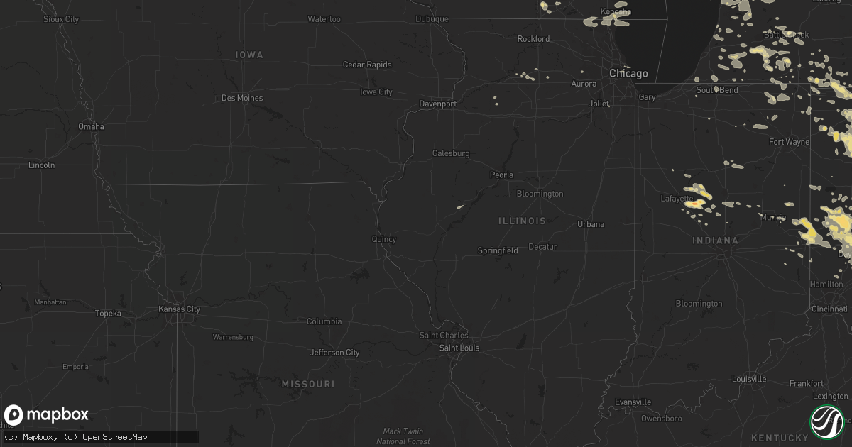
July 11 map
$229
one time, instant access
Download today. No call, no setup
Keep the $229
Bought the map and want the full workflow? Apply the entire $229 to a subscription within 7 days. None of it is wasted.
Every map, not just this one
This buys you this map. Subscription and you get every map we run, in the markets you choose from a few cities to whole states to nationwide. Plus real-time alerts the moment a storm fires.
Contact data
Name, contact info, occupancy, even credit band for addresses in the footprint. You go from where it hit to who to call.
Become the source they trust
Unlimited branding weather history reports on demand. You already have the documented answer ready for the property owner, and you are the one who showed up with it.
Property data and RoofTrace estimates
Pull up any address you have got, its value and the exact code rules for that jurisdiction, straight from One Click Code. Then RoofTrace estimates the squares, pitch, and roof value, priced the way you price.
Storm reports in Ohio
Ohio
| Date | Description |
|---|---|
| 07/11/20116:55 PM CDT | A local report indicates 1.00 inch wind near PIQUA |
| 07/11/20116:55 PM CDT | A local report indicates 1.00 inch wind near 3 SSE PIQUA |
| 07/11/20116:50 PM CDT | A local report indicates 1.75 inch wind near COVINGTON |
| 07/11/20116:50 PM CDT | Corrected covington oh report from 1.75 to 1.50. |
| 07/11/20115:09 PM CDT | Tree down on rte 239. |
| 07/11/20114:15 PM CDT | Trees down in rosemont and numerous other locations in the county. |
| 07/11/20114:07 PM CDT | A local report indicates 1.00 inch wind near HILLSBORO |
| 07/11/20114:00 PM CDT | A local report indicates 1.50 inch wind near 2 W HILLSBORO |
| 07/11/20113:55 PM CDT | A local report indicates 1.00 inch wind near 1 E HILLSBORO |
| 07/11/20113:30 PM CDT | Trees and power lines down across the county...primarily north of moundsville |
| 07/11/20113:30 PM CDT | A local report indicates 1.25 inch wind near 3 WSW SABINA |
| 07/11/20113:28 PM CDT | Trees down |
| 07/11/20113:25 PM CDT | Large tree down |
| 07/11/20113:08 PM CDT | A local report indicates 1.00 inch wind near MARIETTA |
| 07/11/20113:01 PM CDT | A local report indicates 1.00 inch wind near WASHINGTON COURT HOUSE |
| 07/11/20112:55 PM CDT | Trees and power lines down countywide |
| 07/11/20112:55 PM CDT | Trees and power lines down countywide |
| 07/11/20112:54 PM CDT | A local report indicates 1.00 inch wind near LOWELL |
| 07/11/20112:51 PM CDT | Multiple trees down |
| 07/11/20112:51 PM CDT | Multiple trees down |
| 07/11/20112:48 PM CDT | A local report indicates 1.25 inch wind near 3 NW JEFFERSONVILLE |
| 07/11/20112:45 PM CDT | Numerous trees down around the town of waterford |
| 07/11/20112:45 PM CDT | Large tree down |
| 07/11/20112:45 PM CDT | Couple of trees down |
| 07/11/20112:44 PM CDT | Large branches broken. |
| 07/11/20112:36 PM CDT | Trees and power lines down |
| 07/11/20112:30 PM CDT | A local report indicates 1.75 inch wind near SOUTH SOLON |
| 07/11/20112:21 PM CDT | Large branches broken. |
| 07/11/20112:18 PM CDT | Trees and power lines down countywide |
| 07/11/20112:15 PM CDT | One large tree down on irish ridge road |
| 07/11/20112:10 PM CDT | Multiple 6-8 inch diameter tree limbs down as well as power lines down. |
| 07/11/20112:10 PM CDT | Numerous trees down and power poles snapped off 4 ft above ground. |
| 07/11/20112:09 PM CDT | A local report indicates 1.00 inch wind near EAST FULTONHAM |
| 07/11/20112:06 PM CDT | Trees down |
| 07/11/20112:00 PM CDT | Large branches broken. |
| 07/11/20112:00 PM CDT | 2615 high st. Near hospital. |
| 07/11/20111:59 PM CDT | A local report indicates 60 MPH wind near S CANTON |
| 07/11/20111:50 PM CDT | Measured 60 mph wind gusts. |
| 07/11/20111:48 PM CDT | Trees down. |
| 07/11/20111:47 PM CDT | Estimated 59 mph wind gust in doylestown. |
| 07/11/20111:35 PM CDT | A few trees and powerlines down |
| 07/11/20111:35 PM CDT | One tree down. |
| 07/11/20111:20 PM CDT | A local report indicates 67 MPH wind near JOHNSTOWN |
| 07/11/20111:09 PM CDT | Tree and power lines down near township rd 206 in tiverton township. |
| 07/11/20111:00 PM CDT | Large 8 inch diameter tree down. |
| 07/11/20111:00 PM CDT | A few trees and powerlines down between marysville and plain city |
| 07/11/201112:58 PM CDT | 1 tree down |
| 07/11/201112:53 PM CDT | Trees down. |
| 07/11/201112:50 PM CDT | One tree down. |
| 07/11/201112:45 PM CDT | Large branches and small trees down along state route 511. |
| 07/11/201112:40 PM CDT | A couple of trees and some powerlines down near lakeview and harper. |
| 07/11/201112:30 PM CDT | Multiple trees down east of carey. |
| 07/11/201112:28 PM CDT | Large branches broken. |
| 07/11/201112:27 PM CDT | Structural damage. |
| 07/11/201112:18 PM CDT | Estimated 50 mph wind gust. |
| 07/11/201112:16 PM CDT | 5 large branches down alomg with unusual flooding. |
| 07/11/201112:15 PM CDT | Several trees down across western part of county |
| 07/11/201112:04 PM CDT | 2 large trees down along crawford-wyandot county line. |
| 07/11/201112:00 PM CDT | Small tree branches down. |
| 07/11/201111:57 AM CDT | 54 kt gust measured at the lima allen county airport. |
| 07/11/201111:48 AM CDT | Measured 63 mph wind gust. |
| 07/11/201111:47 AM CDT | A few branches and one tree down in columbus grove. Time estimated from radar. |
| 07/11/201111:47 AM CDT | Estimated 65 mph with large tree branches down. Also flash flooding occurring. |
| 07/11/201111:43 AM CDT | Power pole and transformer blown down in fort jennings. Time estimated from radar. |
| 07/11/201111:22 AM CDT | Estimated 65mph wind gusts. |
| 07/11/201111:18 AM CDT | Estimated wind gusts 55-65 mph. Time estimated from radar. |
| 07/11/201111:10 AM CDT | Tree fell onto a house at river and madison streets. Multiple trees reported down throughout antwerp. Time estimated from radar. |
| 07/11/201111:06 AM CDT | 71 mph wind gust recorded at paulding ema office |
| 07/11/201111:00 AM CDT | Large limbs down. |
| 07/11/201110:50 AM CDT | Several 3-5 inch diameter tree limbs down at sycamore springs golf course. |
| 07/10/20119:49 PM CDT | A few trees damaged about 20 to 30 feet above the ground in the yard. |
| 07/10/20119:30 PM CDT | Numerous trees damaged along with power poles and power lines downed on green tree road. |
| 07/10/20119:27 PM CDT | Large branches broken. |
| 07/10/20119:26 PM CDT | Siding was torn off of a garage. A trailer and a flag pole was damaged. |
| 07/10/20119:25 PM CDT | Svrl trees down |
| 07/10/20119:22 PM CDT | Multiple trees and power lines down. |
| 07/10/20119:18 PM CDT | One large tree downed. |
| 07/10/20119:15 PM CDT | Healthy 10 in trees broken at alpha bellbrook rd and tara trail |
| 07/10/20118:59 PM CDT | A local report indicates 63 MPH wind near EATON |
| 07/10/20118:56 PM CDT | A local report indicates 77 MPH wind near KI19 XENIA APT |
| 07/10/20118:55 PM CDT | One tree snapped off with a trunk diameter of about four feet. Numerous large limbs blocking fordyce road. |
| 07/10/20118:50 PM CDT | Several power poles and large limbs down. |
| 07/10/20118:49 PM CDT | Large branches broken. |
| 07/10/20118:48 PM CDT | Half inch hail occurred as well. |
| 07/10/20118:41 PM CDT | A local report indicates 60 MPH wind near KETTERING |
| 07/10/20118:40 PM CDT | Multiple trees down. |
| 07/10/20118:40 PM CDT | Tree limbs down |
| 07/10/20118:38 PM CDT | 4 to 6 inch diameter tree limbs down |
| 07/10/20118:36 PM CDT | Horse shelter destroyed. |
| 07/10/20118:32 PM CDT | Trees down. |
| 07/10/20118:30 PM CDT | Several tree limbs down |
| 07/10/20118:27 PM CDT | Healthy tree branch 12 inch diameter snapped at base |
| 07/10/20118:27 PM CDT | Tree down at 3036 st rte 41. |
| 07/10/20118:23 PM CDT | Trees down. Route 127 north of eaton had several power poles across the roadway. Trees were also blown down in the lewisburg area. |
| 07/10/20118:23 PM CDT | Large branches down. |
| 07/10/20118:23 PM CDT | Two roofs off of two apartment buildings blown into neighboring yard. Wood oak apartments on woodman drive. Numerous trees and power poles down throughout eastern kette |
| 07/10/20118:18 PM CDT | Tree down bocking road wesley chapel road. |
| 07/10/20118:09 PM CDT | A local report indicates 1.00 inch wind near S HOLLANSBURG |
| 07/10/20118:04 PM CDT | Numerous large tree limbs downed in the road. Report is from the culver road and watervliet road area of dayton. |
| 07/10/20118:00 PM CDT | Large tree uprooted. |
| 07/10/20117:59 PM CDT | Large branches broken. |
| 07/10/20117:57 PM CDT | A local report indicates 60 MPH wind near VANDALIA |
| 07/10/20117:57 PM CDT | Power lines and wires were blown down on otterbein ithaca road. Time is estimated. |
| 07/10/20117:48 PM CDT | A 12-inch diameter tree branch was downed. |
| 07/10/20117:43 PM CDT | A local report indicates 1.00 inch wind near NE HUBER HEIGHTS |
| 07/10/20117:42 PM CDT | Reported from huber heights. |
| 07/10/20117:41 PM CDT | Trees down on weavers fort jefferson road. Time is estimated. |
| 07/10/20117:41 PM CDT | Recorded at wright-patterson air force base. |
| 07/10/20117:36 PM CDT | A local report indicates 1.00 inch wind near 3 N VANDALIA |
| 07/10/20117:36 PM CDT | Trees down |
| 07/10/20117:23 PM CDT | Trees down. Route 127 north of eaton had several power poles across the roadway. Trees were also blown down in the lewisburg area. |
| 07/10/20117:00 PM CDT | 3 inch diameter limbs down. |
All States Impacted by Hail Map on July 11, 2011
Cities Impacted by Hail Map on July 11, 2011
- Georgetown, OH
- Saint Marys, WV
- Newport, OH
- Bethune, CO
- Burlington, CO
- Burwell, NE
- Chambers, NE
- Notre Dame, IN
- South Bend, IN
- Union Bridge, MD
- Keymar, MD
- Summitville, IN
- Elwood, IN
- Lindsay, NE
- Humphrey, NE
- Mullen, NE
- Whitman, NE
- Valentine, NE
- Merriman, NE
- Gordon, NE
- Sterling, CO
- Hellier, KY
- Elkhorn City, KY
- Greenville, OH
- Memphis, TX
- Childress, TX
- Hudsonville, MI
- Richland, MI
- Plainview, NE
- Pierce, NE
- Osmond, NE
- Conover, OH
- Fletcher, OH
- Ovid, CO
- Reisterstown, MD
- Owings Mills, MD
- Lutherville Timonium, MD
- Cambridge, OH
- New Concord, OH
- Tulia, TX
- Kentwood, LA
- Zanesville, OH
- Mount Perry, OH
- Hopewell, OH
- Glenford, OH
- Newark, OH
- Nashport, OH
- Heath, OH
- Fort Stockton, TX
- Ottawa, OH
- Stapleton, NE
- Sayre, OK
- Birney, MT
- Silverton, TX
- Lockney, TX
- Hebron, OH
- Granville, OH
- Westerville, OH
- Alexandria, OH
- Pataskala, OH
- Thornville, OH
- Galena, OH
- New Albany, OH
- Jacksontown, OH
- Johnstown, OH
- Troy, OH
- Dayton, OH
- Vandalia, OH
- Tipp City, OH
- Rushville, NE
- Hay Springs, NE
- Arnold, NE
- Houlton, ME
- Janesville, WI
- Sherwood, MI
- Union City, MI
- Paducah, TX
- Springfield, OH
- Busy, KY
- Bonnyman, KY
- Krypton, KY
- Kress, TX
- Plainview, TX
- Columbus, OH
- Blacklick, OH
- Leesburg, OH
- Wilmington, OH
- New Vienna, OH
- Sabina, OH
- Urbana, OH
- Decker, MT
- Cedar Rapids, NE
- Palestine, WV
- Le Roy, WV
- Moorcroft, WY
- Baker, FL
- Vernon, TX
- Canyon, TX
- Lore City, OH
- Adamsville, OH
- Kimbolton, OH
- Norwich, OH
- Dresden, OH
- Winchester, IN
- Saint Charles, IL
- Geneva, IL
- Mechanicsburg, OH
- Pearson, GA
- Mclean, TX
- Clarendon, TX
- Franktown, CO
- Fountain City, IN
- Ravenswood, WV
- Sandyville, WV
- Rush, KY
- Harrisburg, NE
- Lyman, NE
- Bringhurst, IN
- Flora, IN
- Delphi, IN
- Dillon, MT
- Westminster, MD
- Taneytown, MD
- Wallingford, KY
- Morehead, KY
- Hillsboro, KY
- Yolyn, WV
- Richland, GA
- Preston, GA
- Castle Rock, CO
- Grandville, MI
- Grand Rapids, MI
- Jenison, MI
- Caledonia, MI
- Cecil, OH
- Frazeysburg, OH
- Denniston, KY
- Ezel, KY
- Wellington, KY
- Union City, IN
- Union City, OH
- Lynn, IN
- Palestine, OH
- New Paris, OH
- Richmond, IN
- Hollansburg, OH
- New Madison, OH
- Brandon, MS
- Hazard, KY
- Wooton, KY
- Lance Creek, WY
- Peetz, CO
- Frankfort, OH
- Merino, CO
- Snyder, CO
- Franklin Furnace, OH
- Point Pleasant, WV
- Gallipolis Ferry, WV
- Henderson, WV
- Manchester, OH
- West Union, OH
- Aberdeen, OH
- Albion, IN
- Groom, TX
- Pampa, TX
- Russia, OH
- Covington, OH
- Pleasant Hill, OH
- Versailles, OH
- Piqua, OH
- Houston, OH
- Bradford, OH
- Selma, IN
- Quitaque, TX
- Louisa, KY
- McGuffey, OH
- Alger, OH
- Champion, NE
- Parks, NE
- Sheridan, WY
- Banner, WY
- Clearmont, WY
- Phyllis, KY
- Fedscreek, KY
- Forest, VA
- Goode, VA
- Clarkson, NE
- Reading, MI
- Camden, MI
- Hansen, ID
- Coldwater, MI
- Bronson, MI
- Colon, MI
- Leonidas, MI
- Burns, WY
- Reynolds, IN
- Spencerville, OH
- Grove Hill, AL
- Jackson, AL
- Ripley, WV
- Cottageville, WV
- Leon, WV
- Evans, WV
- Port William, OH
- Jamestown, OH
- Fayette, OH
- Beaver, OK
- Pikeville, KY
- Shade, OH
- Guysville, OH
- Athens, OH
- Ada, OH
- Washington Court House, OH
- Denton, KY
- Webbville, KY
- Clintwood, VA
- Hitchins, KY
- Grayson, KY
- Leipsic, OH
- McComb, OH
- Cloverdale, OH
- Holgate, OH
- Rawson, OH
- Hamler, OH
- Continental, OH
- Findlay, OH
- Malinta, OH
- Pandora, OH
- Fort Jennings, OH
- Benton Ridge, OH
- Defiance, OH
- Miller City, OH
- Bluffton, OH
- Deshler, OH
- New Bavaria, OH
- Mount Cory, OH
- Custar, OH
- North Baltimore, OH
- Napoleon, OH
- Columbus Grove, OH
- Hoytville, OH
- Kalida, OH
- Bartlett, NE
- New Bloomington, OH
- Harpster, OH
- Morral, OH
- La Rue, OH
- Kenton, OH
- Marion, OH
- Quincy, OH
- De Graff, OH
- Milton, WV
- Benson, AZ
- South Vienna, OH
- Vanceburg, KY
- West Portsmouth, OH
- Otway, OH
- Blue Creek, OH
- McDermott, OH
- Peebles, OH
- Stout, OH
- Shamrock, TX
- Holyoke, CO
- Gillette, WY
- Rozet, WY
- Yellow Springs, OH
- Quaker City, OH
- Southside, WV
- Floydada, TX
- Berryville, VA
- Summit Point, WV
- Clear Brook, VA
- Kearneysville, WV
- Charles Town, WV
- Ranger, WV
- Kiahsville, WV
- Maysville, KY
- Mayslick, KY
- Neligh, NE
- Allen, MI
- Litchfield, MI
- Jonesville, MI
- Hillsdale, MI
- Boons Camp, KY
- Tomahawk, KY
- Paintsville, KY
- Lowmansville, KY
- Williamsport, KY
- River, KY
- Ellsworth, NE
- Ashby, NE
- Bingham, NE
- Silas, AL
- Pearce, AZ
- Nokesville, VA
- Catlett, VA
- Quincy, KY
- South Portsmouth, KY
- Dobson, NC
- Jackson, OH
- Mendon, MI
- Quantico, VA
- Sherwood, OH
- Antwerp, OH
- Hicksville, OH
- Mark Center, OH
- Grove City, OH
- Lancaster, OH
- Carroll, OH
- Hilliard, FL
- Purcellville, VA
- Leesburg, VA
- Round Hill, VA
- Bluemont, VA
- Hamilton, VA
- Marietta, OH
- Williamstown, WV
- Morenci, MI
- Chunky, MS
- Butler, IN
- Millersport, OH
- Baltimore, OH
- Salesville, OH
- Hastings, MI
- Freeport, MI
- Hillsboro, OH
- Manhattan, MT
- Bozeman, MT
- Sheridan, IN
- Kirklin, IN
- Kempton, IN
- Douglas, AZ
- West Olive, MI
- Grand Haven, MI
- Van Lear, KY
- Pilgrim, KY
- Prestonsburg, KY
- Debord, KY
- Pittsford, MI
- Waldron, MI
- Wauseon, OH
- Montgomery, MI
- Hamilton, MI
- Allegan, MI
- Kenosha, WI
- Racine, WI
- Dayton, WY
- Wyola, MT
- Arlington, OH
- Belle Center, OH
- Forest, OH
- Williamstown, OH
- Dola, OH
- Ridgeway, OH
- Dunkirk, OH
- Rushsylvania, OH
- Montpelier, OH
- Ovett, MS
- Ellisville, MS
- Mcconnelsville, OH
- Malta, OH
- McNeal, AZ
- Pullman, MI
- Fennville, MI
- Hazel Green, KY
- Sturgis, MI
- Howe, IN
- Avondale, CO
- Lusk, WY
- Needham, AL
- Butler, AL
- Lakeside, NE
- Allen, KY
- Inez, KY
- Springerville, AZ
- Crestline, OH
- Bremen, OH
- Harrison, NE
- Winthrop Harbor, IL
- Pleasant Prairie, WI
- Fleming, CO
- McDavid, FL
- Kent City, MI
- Bailey, MI
- Grant, MI
- Paeonian Springs, VA
- Harpers Ferry, WV
- Centerville, IN
- Greens Fork, IN
- Hart, TX
- Tremont City, OH
- Mulberry, IN
- Frankfort, IN
- Three Rivers, MI
- Portage, MI
- Schoolcraft, MI
- Vicksburg, MI
- Crawford, NE
- Whitney, NE
- Reedy, WV
- Elizabeth, WV
- Rockport, WV
- Croton, OH
- Enon, OH
- Mapleton, ME
- Ranchester, WY
- Davy, WV
- Kitts Hill, OH
- Saint Paris, OH
- Delta, OH
- Angola, IN
- Grover Hill, OH
- Enterprise, MS
- Rose Hill, MS
- Lesage, WV
- Barboursville, WV
- Glenwood, WV
- Proctorville, OH
- Culloden, WV
- Ona, WV
- Huntington, WV
- Davin, WV
- Cyclone, WV
- Amherstdale, WV
- Man, WV
- Lynchburg, OH
- Martinsville, OH
- Oakley, ID
- Manassas, VA
- Middleville, MI
- Akron, CO
- Muncie, IN
- Parker City, IN
- Quemado, NM
- Pedro, OH
- Ironton, OH
- Harrod, OH
- Cusseta, GA
- Middletown, OH
- Monroe, OH
- Parkman, WY
- Eglin Afb, FL
- Crestview, FL
- Athens, MI
- Fulton, MI
- Venango, NE
- Fort Morgan, CO
- Jackson, KY
- Lost Creek, KY
- Edwardsburg, MI
- South Solon, OH
- South Charleston, OH
- London, OH
- Sevierville, TN
- Blaine, KY
- Adams, KY
- Coldwater, OH
- Fort Recovery, OH
- Celina, OH
- Bryant, IN
- Rochelle, IL
- Coeburn, VA
- Clinchco, VA
- McClure, VA
- Edgemont, SD
- Beaver, OH
- Avalon, WI
- Rossburg, OH
- Fort Loramie, OH
- New Weston, OH
- Wellington, TX
- Lakeview, TX
- Paw Paw, MI
- Liberty Center, OH
- Whitehouse, OH
- Neapolis, OH
- Grand Rapids, OH
- Swanton, OH
- Lewistown, IL
- Arcanum, OH
- Vancleve, KY
- West Liberty, KY
- Mize, KY
- Campton, KY
- Frenchburg, KY
- Bowling Green, OH
- Waterville, OH
- Russiaville, IN
- Camden, IN
- Battle Ground, IN
- Michigantown, IN
- Burlington, IN
- Cutler, IN
- Lafayette, IN
- Forest, IN
- Brush, CO
- Lowell, OH
- Whipple, OH
- Chadron, NE
- Rupert, ID
- Redkey, IN
- Roundup, MT
- Cardington, OH
- Mount Gilead, OH
- Amanda, OH
- Alexandria, IN
- Anderson, IN
- Yorktown, IN
- Upton, WY
- Maxwell, NE
- Brady, NE
- Union, MI
- Stoneham, CO
- Oakwood, OH
- Melrose, OH
- Paulding, OH
- Augusta, MI
- Wolcottville, IN
- Lagrange, IN
- Greenup, KY
- Catlettsburg, KY
- Ulysses, KY
- Fort Gay, WV
- Argillite, KY
- South Shore, KY
- Olive Hill, KY
- Thelma, KY
- Tutor Key, KY
- Ashland, KY
- Sandy Hook, KY
- Stambaugh, KY
- Philadelphia, MS
- Malta, ID
- Declo, ID
- Burr Oak, MI
- Orland, IN
- Holland, MI
- Ravenna, MI
- Coopersville, MI
- Marne, MI
- Casnovia, MI
- Sparta, MI
- Conklin, MI
- Kirkersville, OH
- Lewis Center, OH
- Buckeye Lake, OH
- Lawton, MI
- Mattawan, MI
- Ada, MI
- Belmont, MI
- Warsaw, IN
- Macatawa, MI
- Merna, NE
- Jones, MI
- Vandalia, MI
- Winchester, VA
- Stephenson, VA
- Fairborn, OH
- Centreville, MI
- Otsego, MI
- San Manuel, AZ
- Ericson, NE
- Sedalia, CO
- Albin, WY
- Belgrade, MT
- Fleming, OH
- Jeffersonville, OH
- Ceredo, WV
- South Point, OH
- Kenova, WV
- Milton, IN
- Cambridge City, IN
- Long Bottom, OH
- Reedsville, OH
- Racine, OH
- Pomeroy, OH
- Albany, OH
- Coolville, OH
- New Marshfield, OH
- Big Springs, NE
- Zeeland, MI
- Byron Center, MI
- Dorr, MI
- Cedarville, OH
- Bloomingburg, OH
- Mount Sterling, OH
- Beattyville, KY
- Irvine, KY
- Allendale, MI
- Salt Rock, WV
- West Hamlin, WV
- Pachuta, MS
- Holt, FL
- Tiffin, OH
- Bloomville, OH
- Sycamore, OH
- Union, MS
- Genoa, WV
- Wayne, WV
- East Lynn, WV
- Laura, OH
- Circleville, OH
- Ashville, OH
- Wyoming, MI
- Sidney, NE
- Concord, MI
- Hanover, MI
- Lewisburg, OH
- Eldorado, OH
- West Manchester, OH
- Farmland, IN
- Williamsburg, IN
- Clearwater, NE
- Ewing, NE
- Williamson, WV
- Lovely, KY
- Dickerson, MD
- Mount Orab, OH
- Bethel, OH
- Rockbridge, OH
- Laurelville, OH
- Marriottsville, MD
- Elk City, OK
- Hammon, OK
- Butler, OK
- Salem, NE
- West Point, GA
- Lagrange, GA
- Wheelersburg, OH
- Peru, IN
- Marcellus, MI
- Windfall, IN
- West Milton, OH
- Chillicothe, OH
- Alto, MI
- Alvada, OH
- Raymond, OH
- Marysville, OH
- Tryon, NE
- Montpelier, IN
- Brookhaven, MS
- McCall Creek, MS
- Meadow Grove, NE
- Chappell, NE
- Lodgepole, NE
- Sedgwick, CO
- South Haven, MI
- Walnut, IL
- Ravenna, KY
- Clay City, KY
- Branchland, WV
- Elizabeth, CO
- Caledonia, OH
- McArthur, OH
- New Plymouth, OH
- Quincy, MI
- Claude, TX
- Gobles, MI
- Nelsonville, OH
- Yeoman, IN
- Monticello, IN
- Brooksville, KY
- Germantown, KY
- Mount Olivet, KY
- Thedford, NE
- Fredericksburg, VA
- Spotsylvania, VA
- Clarks Hill, IN
- Battle Creek, MI
- Nunica, MI
- Fruitport, MI
- Idaho Falls, ID
- Phoenix, MD
- Hydes, MD
- Baldwin, MD
- Glen Arm, MD
- Sitka, KY
- Martha, KY
- Flatgap, KY
- Imperial, NE
- Nazareth, TX
- Cockeysville, MD
- Holmesville, OH
- Fredericksburg, OH
- Sidney, OH
- Prichard, WV
- Bucyrus, OH
- Amesville, OH
- Millfield, OH
- Windsor Mill, MD
- Gwynn Oak, MD
- Spring Valley, OH
- Bellbrook, OH
- Waynesville, OH
- Patten, ME
- Plymouth, OH
- Shelby, OH
- Bylas, AZ
- San Carlos, AZ
- West Unity, OH
- Stryker, OH
- Bryan, OH
- Sardinia, OH
- Waverly, OH
- Woodbridge, VA
- Ashburn, GA
- Loveland, CO
- West Mansfield, OH
- Xenia, OH
- Botkins, OH
- Anna, OH
- Jackson Center, OH
- New Lenox, IL
- Spalding, NE
- Winchester, OH
- Union Furnace, OH
- Logan, OH
- Marengo, OH
- Orchard, NE
- Mount Airy, NC
- Marshall, MI
- Ceresco, MI
- Williamsport, OH
- Towson, MD
- West Brooklyn, IL
- Ashton, IL
- Steward, IL
- Compton, IL
- Hawk Springs, WY
- Lagrange, WY
- Waterford, OH
- Murtaugh, ID
- Clear Fork, WV
- Coal Mountain, WV
- Colfax, IN
- Waldo, OH
- Gaston, IN
- Plymouth, IN
- Shabbona, IL
- Malta, IL
- Arco, ID
- Moore, ID
- Tiro, OH
- Upper Sandusky, OH
- Lyons, CO
- Deming, NM
- Richwood, OH
- Mount Victory, OH
- Julesburg, CO
- Tollesboro, KY
- Ashcamp, KY
- Kimberly, ID
- Hedley, TX
- Tell, TX
- Clarksburg, OH
- Cardwell, MT
- Chicago, IL
- Dowagiac, MI
- Decatur, MI
- Antioch, IL
- Zion, IL
- Wadsworth, IL
- Lake Villa, IL
- Cassopolis, MI
- Berrien Center, MI
- Clayton, MI
- Hudson, MI
- Dunkirk, IN
- Portland, IN
- Corning, OH
- Crooksville, OH
- Falls City, NE
- Matador, TX
- Blanchester, OH
- Clarksville, OH
- Callaway, NE
- Tarlton, OH
- Stoutsville, OH
- Franklin, OH
- Ripley, OH
- Dover, KY
- Robinson Creek, KY
- Roseville, OH
- Philo, OH
- Blue Rock, OH
- Rocky Ridge, MD
- Emmitsburg, MD
- Thurmont, MD
- Delton, MI
- Dowling, MI
- Midland, OH
- Casstown, OH
- Wilberforce, OH
- Fayetteville, OH
- Englewood, OH
- Gettysburg, OH
- Pitsburg, OH
- Clayton, OH
- Greenfield, OH
- Brookville, OH
- Ludlow Falls, OH
- Christiansburg, OH
- Medway, OH
- New Carlisle, OH
- Hamilton, GA
- Bellville, OH
- Hopkins, MI
- Saugatuck, MI
- Comstock Park, MI
- Wayland, MI
- Rockford, MI
- New Riegel, OH
- Fostoria, OH
- Atwood, CO
- Clarksburg, MD
- Poolesville, MD
- Adamstown, MD
- Tuscarora, MD
- Beallsville, MD
- Boyds, MD
- Barnesville, MD
- Germantown, MD
- Berthoud, CO
- Quail, TX
- Eau Claire, MI
- Cutler, OH
- Little Hocking, OH
- Sugar Grove, OH
- Chandlersville, OH
- New Holland, OH
- Miamisburg, OH
- Mill Creek, IN
- Lenore, WV
- Dingess, WV
- Ringwood, IL
- Bristol, WI
- Fox Lake, IL
- Mchenry, IL
- Twin Lakes, WI
- Richmond, IL
- Burlington, WI
- Ingleside, IL
- Trevor, WI
- Spring Grove, IL
- Wilmot, WI
- Sharpsville, IN
- Tipton, IN
- Wauneta, NE
- Elgin, NE
- Bushnell, NE
- Stockport, OH
- Newaygo, MI
- Primrose, NE
- Minster, OH
- Franklin Grove, IL
- Pleasant Lake, IN
- Orange, VA
- Somerset, VA
- Cygnet, OH
- Archbold, OH
- Van Buren, OH
- Jenera, OH
- McClure, OH
- Carey, OH
- Rudolph, OH
- Ridgeville Corners, OH
- Grelton, OH
- Arcadia, OH
- Weston, OH
- Vanlue, OH
- Mount Blanchard, OH
- Seymour, TN
- Lovettsville, VA
- Dexter City, OH
- Caldwell, OH
- Triangle, VA
- Liberty, IN
- Brownsville, IN
- Cicero, IN
- North Platte, NE
- South Webster, OH
- Happy, TX
- Wabash, IN
- McCutchenville, OH
- Tilden, NE
- Bainbridge, OH
- Haxtun, CO
- Beverly, OH
- Vincent, OH
- Kendallville, IN
- Lebanon, IN
- Powell, OH
- Dublin, OH
- Saint Paul, VA
- Salt Lick, KY
- Cody, NE
- New Washington, OH
- Fredericktown, OH
- Chester, OK
- Glouster, OH
- Stafford, VA
- Tampico, IL
- Deer Grove, IL
- Manchester, KY
- Oneida, KY
- Warfield, KY
- Kermit, WV
- Crum, WV
- Cope, CO
- Brunswick, NE
- Royal, NE
- Patriot, OH
- Gallipolis, OH
- Lima, OH
- Delavan, WI
- Darien, WI
- Padroni, CO
- Iliff, CO
- De Beque, CO
- Kalamazoo, MI
- Beauty, KY
- Newcastle, WY
- Flomot, TX
- New Bremen, OH
- Rome City, IN
- Topeka, IN
- Amherst, CO
- Show Low, AZ
- Edon, OH
- Coffeeville, AL
- Mansfield, OH
- Portsmouth, OH
- Haigler, NE
- Pine Bluffs, WY
- Maryville, TN
- Tallassee, TN
- Nevada, OH
- Little Rock, MS
- Dunlow, WV
- Perkinston, MS
- Mukwonago, WI
- Dousman, WI
- Waukesha, WI
- Delafield, WI
- North Prairie, WI
- Wales, WI
- Oconomowoc, WI
- Lake City, FL
- Whick, KY
- Booneville, KY
- Buckhorn, KY
- Russellville, OH
- Burley, ID
- Cheyenne, OK
- Seaman, OH
- New Lexington, OH
- Shawnee, OH
- New Straitsville, OH
- Junction City, OH
- Londonderry, OH
- Greensburg, LA
- Clinton, WI
- Thomasville, AL
- Rossville, IN
- Amarillo, TX
- Woodstock, OH
- Milford Center, OH
- Camden, OH
- Saint Michaels, MD
- Prospect, OH
- Astoria, IL
- Ipava, IL
- Hickory, MS
- Darlington, MD
- Street, MD
- Conowingo, MD
- Attica, OH
- Baltimore, MD
- Catonsville, MD
- Ellicott City, MD
- Denver, IN
- Gore, VA
- Piketon, OH
- Rarden, OH
- Lucasville, OH
- Thorntown, IN
- Randallstown, MD
- Connersville, IN
- Citronelle, AL
- Niles, MI
- Buchanan, MI
- Sunbury, OH
- Linden, AL
- Clyo, GA
- Springfield, GA
- Lorenzo, TX
- Mims, FL
- Vienna, WV
- Nora, VA
- Castlewood, VA
- Orient, OH
- Grand Junction, MI
- Bangor, MI
- Meadville, MS
- Garrison, KY
- Lynx, OH
- Friendship, OH
- Gallion, AL
- Mexico, IN
- Hartford, MI
- Mineral Wells, WV
- Parkersburg, WV
- Walker, WV
- West Jefferson, OH
- Bloomingdale, MI
- Three Oaks, MI
- Galien, MI
- Covert, MI
- Watervliet, MI
- Mobile, AL
- Scotts, MI
- Climax, MI
- Columbia City, IN
- Pierceton, IN
- Larwill, IN
- Cascade, MT
- Wolf Creek, MT
- Willacoochee, GA
- Osseo, MI
- North Adams, MI
- Alvordton, OH
- Du Pont, GA
- West Columbia, WV
- Letart, WV
- East Leroy, MI
- Fort Gaines, GA
- Winslow, AZ
- Wing, AL
- Andalusia, AL
- Hudson, IN
- West Liberty, OH
- Cable, OH
- North Lewisburg, OH
- Oregon, WI
- New Knoxville, OH
- Cumberland, OH
- Maria Stein, OH
- Barnesville, OH
- Sycamore, GA
- Bellefontaine, OH
- Chesterhill, OH
- Stanville, KY
- Garnett, SC
- Tillman, SC
- Upper Marlboro, MD
- Edgewater, MD
- Harwood, MD
- Davidsonville, MD
- Oceana, WV
- Starke, FL
- Chesapeake, OH
- Shelbiana, KY
- Jenkins, KY
- Shelby Gap, KY
- Gibsonburg, OH
- Helena, OH
- Hartford, WV
- Belleville, WV
- Portland, OH
- Chauncey, OH
- Mount Alto, WV
- Given, WV
- Mason, WV
- Buchtel, OH
- New Haven, WV
- Stewart, OH
- Washington, WV
- Syracuse, OH
- Millwood, WV
- Zaleski, OH
- Harts, WV
- Homer, MI
- Hyden, KY
- Thousandsticks, KY
- Faunsdale, AL
- Ashland, OH
- Republic, OH
- Wray, CO
- Myersville, MD
- Frederick, MD
- Atmore, AL
- Enders, NE
- Jerome, MI
- Elkin, NC
- Somerset, OH
- Goshen, OH
- Pleasant Plain, OH
- Edgerton, OH


