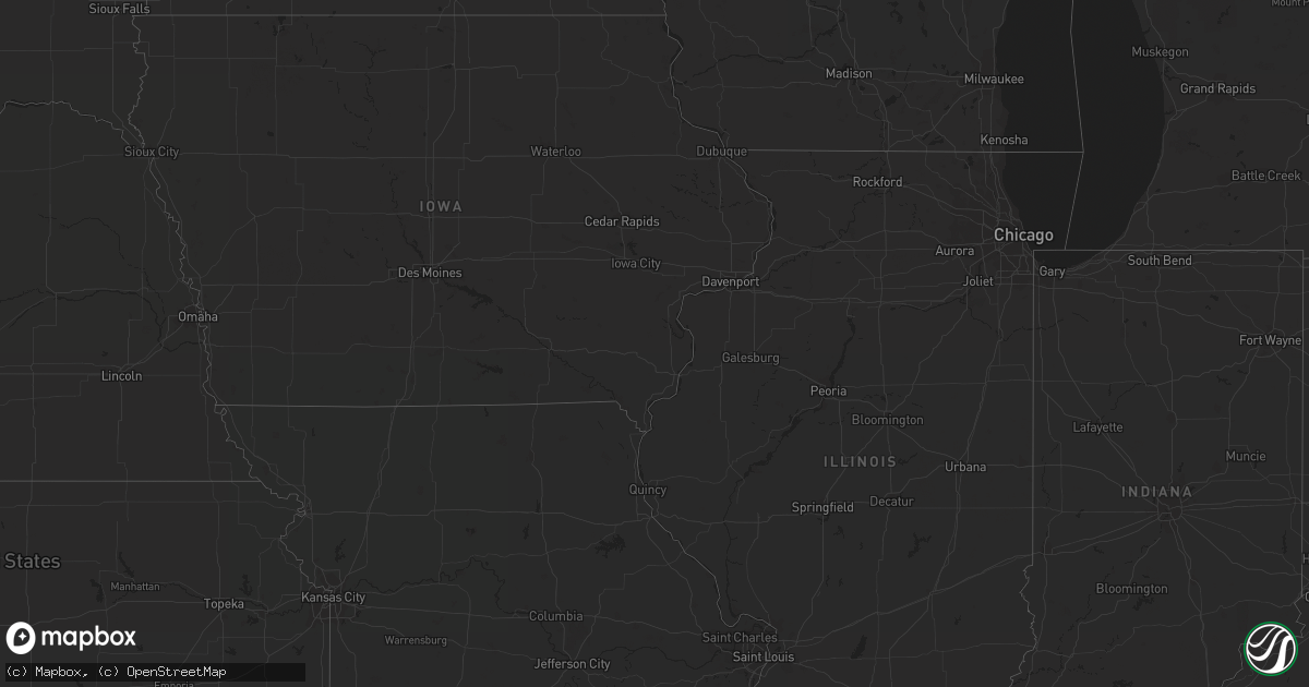
Hail Map in Montana on July 8, 2011
Get this storm
July 8 map
$229
one time, instant access
Download today. No call, no setup
Keep the $229
Bought the map and want the full workflow? Apply the entire $229 to a subscription within 7 days. None of it is wasted.
Every map, not just this one
This buys you this map. Subscription and you get every map we run, in the markets you choose from a few cities to whole states to nationwide. Plus real-time alerts the moment a storm fires.
Contact data
Name, contact info, occupancy, even credit band for addresses in the footprint. You go from where it hit to who to call.
Become the source they trust
Unlimited branding weather history reports on demand. You already have the documented answer ready for the property owner, and you are the one who showed up with it.
Property data and RoofTrace estimates
Pull up any address you have got, its value and the exact code rules for that jurisdiction, straight from One Click Code. Then RoofTrace estimates the squares, pitch, and roof value, priced the way you price.
Storm reports in Montana
Montana
| Date | Description |
|---|---|
| 07/08/20115:43 PM CDT | A local report indicates 60 MPH wind near 11 SE HUNTLEY |
| 07/08/20115:28 PM CDT | A local report indicates 65 MPH wind near 3 SSW BILLINGS |
| 07/08/20115:16 PM CDT | A local report indicates 60 MPH wind near LAUREL |
| 07/08/20114:45 PM CDT | A local report indicates 61 MPH wind near 7 E COLUMBUS |
| 07/08/20114:45 PM CDT | A local report indicates 61 MPH wind near 4 ESE REED POINT |
| 07/08/20112:00 PM CDT | Hail fell for about 7 minutes. Size varied from dime to quarter. Heavy rain is currently falling. |
| 07/07/20118:25 PM CDT | 40 to 50 mph wind gusts |
All States Impacted by Hail Map on July 8, 2011
Cities Impacted by Hail Map on July 8, 2011
- Wolf Point, MT
- Lewellen, NE
- New Salem, ND
- Carson, ND
- Almont, ND
- Elgin, ND
- Waterford Works, NJ
- Hammonton, NJ
- Okaton, SD
- Draper, SD
- Murdo, SD
- Fort Pierre, SD
- Poughkeepsie, NY
- Fishkill, NY
- Beacon, NY
- Newburgh, NY
- Wappingers Falls, NY
- Chelsea, NY
- Genoa, CO
- Burlington, CO
- Bethune, CO
- De Queen, AR
- Brewton, AL
- Milton, FL
- Jay, FL
- Sand Springs, MT
- Jordan, MT
- Dix, NE
- Woodworth, ND
- Selfridge, ND
- Peyton, CO
- Calhan, CO
- Elbert, CO
- Flagler, CO
- Dry Fork, VA
- Danville, VA
- Napoleon, ND
- Wishek, ND
- Sprakers, NY
- Littlefield, AZ
- Joes, CO
- Kirk, CO
- Allenwood, PA
- Fruita, CO
- Mack, CO
- Glade Park, CO
- Brockton, MT
- Springville, PA
- Kingsley, PA
- Montrose, PA
- Seibert, CO
- Vona, CO
- Vida, MT
- Mandan, ND
- Moffit, ND
- Oneida, NY
- Ashley, ND
- Kintyre, ND
- New Leipzig, ND
- Fredonia, ND
- Linton, ND
- Lehr, ND
- Raleigh, ND
- Braddock, ND
- Cannon Ball, ND
- Shields, ND
- Flasher, ND
- Hazelton, ND
- Solen, ND
- Kulm, ND
- Venango, NE
- Kiowa, CO
- Wilmer, AL
- Gillette, WY
- Kanorado, KS
- Fairfield, ND
- Sentinel Butte, ND
- Medora, ND
- Island Park, ID
- Williamsport, PA
- Holyoke, CO
- Amherst, CO
- Grant, NE
- Champion, NE
- Julesburg, CO
- Imperial, NE
- Poplar, MT
- Marianna, FL
- Greenwood, FL
- Anton, CO
- Akron, CO
- Lindon, CO
- Bainbridge, GA
- Oshkosh, NE
- Big Springs, NE
- Ovid, CO
- Brule, NE
- Chappell, NE
- Spencer, ID
- Silt, CO
- Garrison, ND
- Las Animas, CO
- Kim, CO
- Presho, SD
- Elizabeth, CO
- Pueblo, CO
- Tunkhannock, PA
- Meshoppen, PA
- Ambrose, ND
- Arriba, CO
- Hugo, CO
- Pingree, ND
- Kensal, ND
- Buchanan, ND
- Meeker, CO
- Sundance, WY
- Haxtun, CO
- Westminster, CO
- Arvada, CO
- Delanson, NY
- Fultonville, NY
- Brusett, MT
- Upton, WY
- Savage, MT
- Stanley, ND
- Malta, ID
- Sunflower, MS
- Willcox, AZ
- Schlater, MS
- Itta Bena, MS
- New City, NY
- Gordon, AL
- Alamo, ND
- Manning, ND
- Killdeer, ND
- Dunn Center, ND
- Austell, GA
- Beulah, ND
- Zap, ND
- Rebecca, GA
- Ashford, AL
- Pansey, AL
- Hackberry, AZ
- Kingman, AZ
- Rifle, CO
- Trinchera, CO
- Piedmont, SD
- Sturgis, SD
- Deadwood, SD
- Lead, SD
- Nemo, SD
- Eudora, AR
- Cope, CO
- Harrisonburg, VA
- Shady Dale, GA
- Monticello, GA
- Newborn, GA
- Madison, GA
- Matheson, CO
- Simla, CO
- Belfield, ND
- Courtenay, ND
- Dubois, ID
- Hortonville, NY
- North Branch, NY
- Callicoon, NY
- Dickinson, ND
- Halliday, ND
- Pierre, SD
- Schoharie, NY
- Yuma, CO
- Dayton, VA
- Carlisle, NY
- Terry, MT
- Lindsay, MT
- Eatonton, GA
- Munnsville, NY
- Vernon, NY
- Canastota, NY
- Vernon Center, NY
- Wampsville, NY
- Chittenango, NY
- Kirkville, NY
- Sherrill, NY
- Vinemont, AL
- Chester, MA
- Blandford, MA
- Huntington, MA
- Keystone, NE
- Mountainville, NY
- Cornwall On Hudson, NY
- New Windsor, NY
- Monroe, NY
- Central Valley, NY
- Cornwall, NY
- Salisbury Mills, NY
- Highland Mills, NY
- Williston, ND
- Britton, SD
- Douglas, AZ
- Agate, CO
- Limon, CO
- Trinidad, CO
- Dodge, ND
- Oxford, CT
- Tolley, ND
- Ernul, NC
- Spruce Pine, AL
- Southfields, NY
- Fort Montgomery, NY
- Vernal, UT
- Congers, NY
- Portland, AR
- Broomfield, CO
- Vancleave, MS
- Denver, CO
- Schenectady, NY
- Duanesburg, NY
- Pettibone, ND
- Doland, SD
- Rotterdam Junction, NY
- Sedgwick, CO
- Paoli, CO
- Lemoyne, NE
- Arthur, NE
- Richey, MT
- Malad City, ID
- Lake City, SD
- Ogallala, NE
- Bushnell, NE
- Damascus, PA
- Roscoe, NY
- Fremont Center, NY
- Madrid, NE
- Elsie, NE
- Wibaux, MT
- Winslow, AZ
- Glendive, MT
- Sylvester, GA
- Albany, GA
- Fort Peck, MT
- Mifflinburg, PA
- Brandywine, MD
- Stratton, CO
- Loma, CO
- De Beque, CO
- Douglas, ND
- Colquitt, GA
- Moorcroft, WY
- Sidney, NE
- Avondale, CO
- Culbertson, MT
- Franktown, CO
- Donalsonville, GA
- Cortlandt Manor, NY
- Crompond, NY
- Peekskill, NY
- Loganton, PA
- Walsh, CO
- Saint Martinville, LA
- New Iberia, LA
- Ballston Lake, NY
- Ballston Spa, NY
- Burnt Hills, NY
- Whatley, AL
- Orleans, MA
- Commerce City, CO
- Wewahitchka, FL
- Youngsville, LA
- Arlington, GA
- Blackstone, VA
- Fortuna, ND
- Abbeville, GA
- Rochelle, GA
- Walden, NY
- Lambertville, NJ
- Loveland, CO
- Fort Collins, CO
- Windsor, CO
- Russellville, AL
- Hettinger, ND
- Longmont, CO
- Wildrose, ND
- Crosby, ND
- Duck Hill, MS
- Golden Valley, ND
- Fort Washington, MD
- Golden, CO
- Andalusia, AL
- Boone, CO
- Amidon, ND
- Brighton, CO
- Henderson, CO
- McDonald, KS
- Flaxville, MT
- Baker, FL
- Cullman, AL
- Shaw, MS
- Sisseton, SD
- Nicholson, PA
- Dacono, CO
- Erie, CO
- Hayes Center, NE
- Paxton, NE
- Lambert, MT
- Adrian, GA
- Stony Point, NY
- Tomkins Cove, NY
- Troy, VA
- Palmyra, VA
- Sharon Springs, NY
- Canajoharie, NY
- Soperton, GA
- Tarrytown, GA
- Attapulgus, GA
- Eastman, GA
- Fort Yates, ND
- Montrose, AR
- Hamburg, AR
- Montrose, CO


