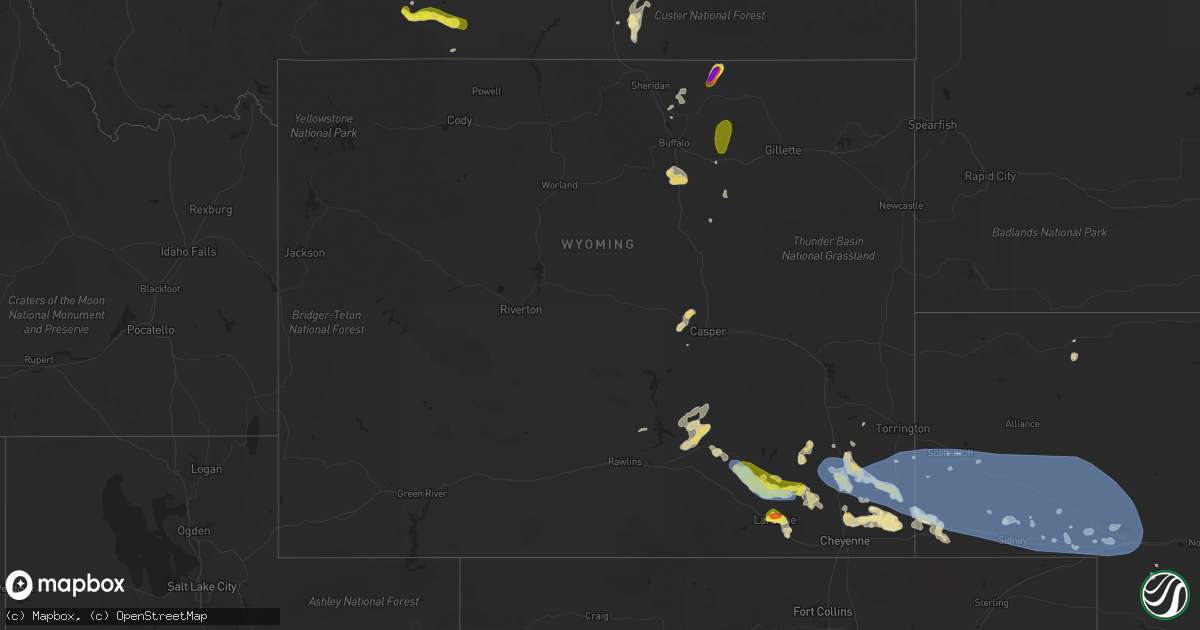
Hail Map in Wyoming on July 6, 2019
Get this storm
July 6 map
$229
one time, instant access
Download today. No call, no setup
Keep the $229
Bought the map and want the full workflow? Apply the entire $229 to a subscription within 7 days. None of it is wasted.
Every map, not just this one
This buys you this map. Subscription and you get every map we run, in the markets you choose from a few cities to whole states to nationwide. Plus real-time alerts the moment a storm fires.
Contact data
Name, contact info, occupancy, even credit band for addresses in the footprint. You go from where it hit to who to call.
Become the source they trust
Unlimited branding weather history reports on demand. You already have the documented answer ready for the property owner, and you are the one who showed up with it.
Property data and RoofTrace estimates
Pull up any address you have got, its value and the exact code rules for that jurisdiction, straight from One Click Code. Then RoofTrace estimates the squares, pitch, and roof value, priced the way you price.
Storm reports in Wyoming
Wyoming
| Date | Description |
|---|---|
| 07/06/20196:45 PM CDT | Upr mesonet station rkrivr. |
| 07/06/20196:42 PM CDT | Cocorahs observer wy-ab-170. Time estimated based on radar. |
| 07/06/20194:58 AM CDT | At 958 PM MDT, severe thunderstorms were located along a line extending from near Albin to 7 miles west of Panorama Point, moving east at 35 mph. HAZARD...70 mph wind gusts. SOURCE...Radar indicated. IMPACT...Expect considerable tree damage. Damage is likely to mobile homes, roofs, and outbuildings. Locations impacted include... Kimball, Pine Bluffs, Dix, Albin, Oliver Campground, Oliver Reservoir, Kimball Airport, Harrisburg and Bushnell.This includes the following highways... Interstate 80 in Wyoming between mile markers 392 and 402. Interstate 80 in Nebraska between mile markers 1 and 30. |
| 07/06/20193:28 AM CDT | At 828 PM MDT, severe thunderstorms were located along a line extending from near Hawk Springs to Hawk Springs Campground to near Meriden Rest Area to 8 miles southwest of Gun Barrel, moving east at 35 mph. HAZARD...Ping pong ball size hail and 60 mph wind gusts. SOURCE...Radar indicated. IMPACT...People and animals outdoors will be injured. Expect hail damage to roofs, siding, windows, and vehicles. Expect wind damage to roofs, siding, and trees. Locations impacted include... Scottsbluff, Gering, Terrytown, Minatare, La Grange, Lyman, Albin, Yoder, Oliver Campground, Wildcat Hills State Recreation Area, Stegall, Wildcat Hills Campground, Hawk Springs, Hawk Springs Campground, Oliver Reservoir, Hubbard Hill, Harrisburg, Gun Barrel, Lake Minatare and Huntley.This includes Interstate 80 in Nebraska between mile markers 9 and12. |
| 07/06/20193:23 AM CDT | At 823 PM MDT, a severe thunderstorm was located 7 miles southeast of Whitaker, or 14 miles north of Cheyenne, moving east at 35 mph. HAZARD...60 mph wind gusts and half dollar size hail. SOURCE...Radar indicated. IMPACT...Hail damage to vehicles is expected. Expect wind damage to roofs, siding, and trees. Locations impacted include... Burns, North Cheyenne, Hillsdale and Ranchettes. This includes the following highways... Interstate 25 in Wyoming between mile markers 16 and 24. Interstate 80 in Wyoming between mile markers 370 and 384. |
| 07/06/20193:06 AM CDT | At 806 PM MDT, severe thunderstorms were located along a line extending from 10 miles east of Slater to 13 miles southwest of Hawk Springs to 10 miles west of Meriden Rest Area to 13 miles east of Whitaker, moving east at 35 mph. HAZARD...60 mph wind gusts and quarter size hail. SOURCE...Radar indicated. IMPACT...Hail damage to vehicles is expected. Expect wind damage to roofs, siding, and trees. Locations impacted include... La Grange, Albin, Hawk Springs Campground, Hawk Springs Recreation Area, Meriden Rest Area, Gun Barrel and Hawk Springs. |
| 07/06/20192:58 AM CDT | At 758 PM MDT, a severe thunderstorm was located near Whitaker, or 20 miles northwest of Cheyenne, moving east at 35 mph. HAZARD...60 mph wind gusts and half dollar size hail. SOURCE...Radar indicated. IMPACT...Hail damage to vehicles is expected. Expect wind damage to roofs, siding, and trees. Locations impacted include... Whitaker and Ranchettes. This includes Interstate 25 in Wyoming between mile markers 21 and40. |
| 07/06/20192:28 AM CDT | At 727 PM MDT, a severe thunderstorm was located near Chugwater, or 22 miles south of Wheatland, moving east at 30 mph. HAZARD...70 mph wind gusts and nickel size hail. SOURCE...Radar indicated. IMPACT...Expect considerable tree damage. Damage is likely to mobile homes, roofs, and outbuildings. Locations impacted include... Chugwater and Slater. This includes Interstate 25 in Wyoming between mile markers 41 and71. |
| 07/06/20192:26 AM CDT | At 726 PM MDT, a severe thunderstorm was located 16 miles northeast of Mayoworth, which is 21 miles north of Kaycee, moving east at 5 mph. HAZARD...60 mph wind gusts and half dollar size hail. SOURCE...Radar indicated. IMPACT...Hail damage to vehicles is expected. Expect wind damage to roofs, siding, and trees. This severe thunderstorm will remain over mainly rural areas of central Johnson County.This includes Interstate 25 between mile markers 272 and 285. |
| 07/06/20192:23 AM CDT | At 723 PM MDT, a severe thunderstorm was located near Iron Mountain, or 23 miles northeast of Laramie, moving east at 20 mph. HAZARD...Ping pong ball size hail and 60 mph wind gusts. SOURCE...Radar indicated. IMPACT...People and animals outdoors will be injured. Expect hail damage to roofs, siding, windows, and vehicles. Expect wind damage to roofs, siding, and trees. Locations impacted include... Horse Creek and Iron Mountain. This includes Interstate 25 in Wyoming between mile markers 34 and40. |
| 07/06/20192:18 AM CDT | At 718 PM MDT, a severe thunderstorm was located 10 miles north of Powder River Rest Area, which is 27 miles east of Buffalo, moving northeast at 20 mph. HAZARD...Quarter size hail. SOURCE...Radar indicated. IMPACT...Damage to vehicles is expected. This severe thunderstorm will remain over mainly rural areas of northeastern Johnson County. |
| 07/06/20192:13 AM CDT | At 712 PM MDT, a severe thunderstorm was located near Tie City Campground, or near Laramie, moving southeast at 25 mph. HAZARD...60 mph wind gusts and half dollar size hail. SOURCE...Radar indicated. This storm has a history of producing hail larger than quarters. IMPACT...Hail damage to vehicles is expected. Expect wind damage to roofs, siding, and trees. Locations impacted include... Laramie, Tie City Campground, Granite Springs Reservoir, North Crow Campground, Vedauwoo, Federal, Granite Springs Campground, Crystal Lake Reservoir, Crystal Lake Campground, Vedauwoo Campground, Buford and Yellow Pine Campground.This includes Interstate 80 in Wyoming between mile markers 315 and349.This replaces the Severe Thunderstorm Warning which was previously in effect for the warned area. |
| 07/06/20192:04 AM CDT | At 704 PM MDT, a severe thunderstorm was located 17 miles south of Buffalo, moving east at 5 mph. HAZARD...60 mph wind gusts and quarter size hail. SOURCE...Radar indicated. IMPACT...Hail damage to vehicles is expected. Expect wind damage to roofs, siding, and trees. This severe thunderstorm will remain over mainly rural areas of central Johnson County.This includes Interstate 25 between mile markers 277 and 287. |
| 07/06/20191:48 AM CDT | At 648 PM MDT, a severe thunderstorm was located near Laramie, moving east at 30 mph. HAZARD...60 mph wind gusts and quarter size hail. SOURCE...Radar indicated. IMPACT...Hail damage to vehicles is expected. Expect wind damage to roofs, siding, and trees. Locations impacted include... Laramie, Tie City Campground, North Crow Campground, Vedauwoo Campground, Yellow Pine Campground and University Of Wyoming War Memorial Stadium.This includes Interstate 80 in Wyoming between mile markers 304 and328. |
| 07/06/201912:58 AM CDT | At 558 PM MDT, a severe thunderstorm was located near Rock River, or 29 miles northwest of Laramie, moving southeast at 20 mph. HAZARD...Golf ball size hail and 70 mph wind gusts. SOURCE...Radar indicated. IMPACT...People and animals outdoors will be injured. Expect hail damage to roofs, siding, windows, and vehicles. Expect considerable tree damage. Wind damage is also likely to mobile homes, roofs, and outbuildings. Locations impacted include... Bosler and Baldy Peak. This includes Interstate 80 in Wyoming between mile markers 296 and303. |
| 07/06/201912:14 AM CDT | At 514 PM MDT, a severe thunderstorm was located near Medicine Bow, or 48 miles northwest of Laramie, moving southeast at 40 mph. HAZARD...70 mph wind gusts and quarter size hail. SOURCE...Radar indicated. IMPACT...Hail damage to vehicles is expected. Expect considerable tree damage. Wind damage is also likely to mobile homes, roofs, and outbuildings. Locations impacted include... Medicine Bow, Rock River and Bosler. |
| 07/05/201911:57 PM CDT | At 457 PM MDT, a severe thunderstorm was located near Emigrant Gap, which is 11 miles west of Casper, moving northeast at 10 mph. HAZARD...Quarter size hail. SOURCE...Radar indicated. IMPACT...Damage to vehicles is expected. This severe thunderstorm will be near... Mills around 535 PM MDT. Northern Casper, Bar Nunn and Homa Hills around 545 PM MDT.Other locations impacted by this severe thunderstorm includeCasper-Natrona County International Airport and Casper Events Center.This includes Interstate 25 between mile markers 187 and 204. |
| 07/05/201911:54 PM CDT | At 454 PM MDT, a severe thunderstorm was located near Battle Mountain, or 51 miles east of Rawlins, moving east at 45 mph. HAZARD...70 mph wind gusts and nickel size hail. SOURCE...Radar indicated. IMPACT...Expect considerable tree damage. Damage is likely to mobile homes, roofs, and outbuildings. Locations impacted include... Medicine Bow, Battle Mountain, Wheatland Reservoir 3 and Garrett. |
| 07/05/201910:04 PM CDT | . |
| 07/05/20199:35 PM CDT | Broke skylights. |
| 07/05/20198:49 PM CDT | Received video on facebook of a few brief spinups... Including one fully condensed tornado. Chaser was on wy 313 east of chugwater looking approximately 5 miles to the |
| 07/05/20198:30 PM CDT | Estimating winds from report. Public reported winds so strong there was roaring... Could not get the front door open... And could barely stand. |
| 07/05/20198:28 PM CDT | Nickel to quarter size hail lasted 2 minutes |
| 07/05/20198:07 PM CDT | . |
| 07/05/20197:59 PM CDT | Received photo via facebook. |
| 07/05/20197:58 PM CDT | . |
| 07/05/20197:57 PM CDT | Public reported damage to windshield of car from half dollar size hail in laramie. Photo shared on twitter. |
| 07/05/20197:53 PM CDT | Quarter size hail covering the road at the corner of scherer and riverside in west laramie. |
| 07/05/20197:50 PM CDT | Cocorahs observer wy-ab-5. |
| 07/05/20197:18 PM CDT | Received video of tornado via twitter. |
All States Impacted by Hail Map on July 6, 2019
Cities Impacted by Hail Map on July 6, 2019
- Wheatland, WY
- Bushnell, NE
- Kimball, NE
- Hanna, WY
- Burns, WY
- Buffalo, WY
- Oxford, ME
- Hebron, ME
- South Paris, ME
- Norway, ME
- Sun River, MT
- Drummond, MT
- Marathon, TX
- Saugerties, NY
- Pontiac, IL
- Cornell, IL
- Malvern, PA
- Rogers, NM
- Cascade, MT
- Ropesville, TX
- Big Springs, NE
- Hamilton, MT
- Corvallis, MT
- Martinsdale, MT
- Lagrange, ME
- Milo, ME
- Chugwater, WY
- Meadow, TX
- Libby, MT
- Kaycee, WY
- Gering, NE
- Scottsbluff, NE
- Arkansas City, KS
- Trego, MT
- Red Lodge, MT
- Roscoe, MT
- White Sulphur Springs, MT
- Crook, CO
- Cheyenne, WY
- Vaughn, MT
- Ney, OH
- Millfield, OH
- Amesville, OH
- Cameron, OK
- Stuart, OK
- Mcalester, OK
- Gordon, NE
- Rushville, NE
- Clearmont, WY
- Muskogee, OK
- Newkirk, OK
- Sand Springs, OK
- Laramie, WY
- Winifred, MT
- Bridgeport, WV
- Shinnston, WV
- Great Falls, MT
- Whitefish, MT
- Washington, DC
- Traphill, NC
- Pine Bluffs, WY
- Albin, WY
- Cuervo, NM
- West Finley, PA
- Cameron, WV
- Dallas, WV
- Burlington, ME
- Purling, NY
- Catskill, NY
- South Cairo, NY
- Cairo, NY
- Bosler, WY
- Rock River, WY
- Greenville, MS
- Freedom, PA
- Lubbock, TX
- Brule, NE
- Lodge Grass, MT
- Dalton, NE
- Wewoka, OK
- Sasakwa, OK
- Mount Sterling, OH
- Balmorhea, TX
- Ogallala, NE
- Wichita, KS
- Roy, MT
- Hilger, MT
- Vilonia, AR
- Cabot, AR
- Jacksonville, AR
- Jal, NM
- Big Sandy, MT
- Wagoner, OK
- Porter, OK
- Havre, MT
- Greenwich, CT
- Sedgwick, CO
- Burnt Cabins, PA
- Neelyton, PA
- Shade Gap, PA
- Konawa, OK
- Fairbury, IL
- Casper, WY
- Hawk Springs, WY
- Meriden, WY
- Lagrange, WY
- Kermit, TX
- Lincoln, ME
- West Enfield, ME
- Okemah, OK
- Fishtail, MT
- Cassville, PA
- Three Springs, PA
- Mapleton Depot, PA
- Gurley, NE
- Tivoli, NY
- Worthington, WV
- Mannington, WV
- Boulder, MT
- Whitehall, MT
- Crookston, NE
- Brownville, ME
- Howland, ME
- Saint Louisville, OH
- McLean, VA
- Mercer, PA
- Muleshoe, TX
- Benton, AR
- Hot Springs National Park, AR
- Lonsdale, AR
- Abernathy, TX
- Niceville, FL
- Stevensville, MT
- East Longmeadow, MA
- Springfield, MA
- Heavener, OK
- Hodgen, OK
- Morton, TX
- Talala, OK
- La Moille, IL
- Bridger, MT
- Roberts, MT
- Garden City, TX
- Montrose, IL
- Mannford, OK
- Farmington, KY
- Murray, KY
- Causey, NM
- Farmville, VA
- Red Hook, NY
- Germantown, NY
- Malden On Hudson, NY
- Throckmorton, TX
- Oshkosh, NE
- Glouster, OH
- Chesterhill, OH
- Andrews, TX
- Glen Burnie, MD
- Curtis Bay, MD
- Broken Arrow, OK
- Herndon, PA
- Bayard, NE
- Freeport, FL
- Charlo, MT
- Valley Center, KS
- Helena, MT
- Coweta, OK
- Redbird, OK
- Lemoyne, NE
- Clarksburg, WV
- Utica, IL
- Troy Grove, IL
- La Salle, IL
- Mendota, IL
- Ulm, MT
- Sudan, TX
- Maize, KS
- Box Elder, MT
- Muenster, TX
- Chappell, NE
- Marianna, AR
- Midkiff, TX
- Augusta, MT
- Stanton, TX
- Todd, PA
- Orbisonia, PA
- Leeds, ME
- Ottawa, IL
- Freehold, NY
- Leeds, NY
- Lowell, IN
- Idalou, TX
- Lone Grove, OK
- Wolfforth, TX
- Bridgeport, OH
- Saint Clairsville, OH
- Harrisburg, NE
- Chinook, MT
- Olney, TX
- Elsie, NE
- Cambridge, MD
- Wynnewood, OK
- Black Eagle, MT
- Burneyville, OK
- Turner, ME
- Greene, ME
- Buckfield, ME
- Yoder, WY
- Passadumkeag, ME
- Doylestown, PA
- New Hope, PA
- Furlong, PA
- Hustontown, PA
- Claysville, PA
- Prosperity, PA
- Swedesboro, NJ
- Bridgeport, NJ
- Altamont, KS
- Newcastle, TX
- Wewahitchka, FL
- Ludlow, MA
- Saint Ignatius, MT
- Checotah, OK
- Wheeling, WV
- Cloudcroft, NM
- Graysville, OH
- Lewisville, OH
- Lloyd, MT
- Minatare, NE
- Huntingdon, PA
- Ardmore, OK
- Power, MT
- Potter, NE
- Blackwell, OK
- West Union, WV
- Armonk, NY
- West Harrison, NY
- Purchase, NY
- Lodgepole, NE
- Fort Hancock, TX
- Spiceland, IN
- Wray, GA
- Buford, WY
- Poteau, OK
- Roaring River, NC
- Ronda, NC
- Lovingston, VA
- Natural Bridge, VA
- Lexington, VA
- Sebec, ME
- Torrington, WY
- Hays, NC
- Loving, TX
- Whitefield, NH
- Absarokee, MT
- Eutaw, AL
- Cadiz, OH
- Waterford, OH
- Fleming, OH
- Wind Ridge, PA
- Broad Top, PA
- Dudley, PA
- Robertsdale, PA
- Boligee, AL
- New Castle, IN
- Lewisville, IN
- Leechburg, PA
- Hyde Park, PA
- Vandergrift, PA
- Tallahassee, FL
- Falls Church, VA
- Arlington, VA
- Busby, MT
- Garryowen, MT
- Carnegie, PA
- Monee, IL
- Rawlins, WY
- Noble, IL
- Belfry, MT
- Davis, OK
- Millinocket, ME
- Danforth, ME
- Brookton, ME
- Litchfield, ME
- Russell, PA
- Warren, PA
- Byrnedale, PA
- Weedville, PA
- Kersey, PA
- Ridgway, PA
- Clearfield, PA
- Du Bois, PA
- Rockton, PA
- Penfield, PA
- Monessen, PA
- Donora, PA
- Belle Vernon, PA
- Monongahela, PA
- Annville, PA
- Dauphin, PA
- Duncannon, PA
- Harrisburg, PA
- Hummelstown, PA
- Hershey, PA
- Marysville, PA
- Palmyra, PA
- Enola, PA
- Newtown, PA
- Ridley Park, PA
- Prospect Park, PA
- Norwood, PA
- Folsom, PA
- East Liverpool, OH
- Newell, WV
- New Cumberland, WV
- Chester, WV
- Toronto, OH
- Irondale, OH
- Hammondsville, OH
- Empire, OH
- Stratton, OH
- Saint Marys, WV
- Friendly, WV
- Lost Creek, WV
- Salem, WV
- Richmond, VT
- Moretown, VT
- Montpelier, VT
- Waterbury, VT
- Middleburg, VA
- Sterling, VA
- Capitol Heights, MD
- District Heights, MD
- Bethesda, MD
- Great Falls, VA
- Purcellville, VA
- Ashburn, VA
- Potomac, MD
- Leesburg, VA
- Aldie, VA
- Herndon, VA
- Vienna, VA
- Chevy Chase, MD
- Hyattsville, MD
- Reston, VA
- Cabin John, MD
- Glen Echo, MD
- Upper Marlboro, MD
- Dickerson, MD
- Boyds, MD
- Clarksburg, MD
- Barnesville, MD
- Rockville, MD
- Gaithersburg, MD
- Silver Spring, MD
- Lanham, MD
- Bladensburg, MD
- Bowie, MD
- Riverdale, MD
- Brentwood, MD
- Ellsworth, NE
- Mcgrew, NE
- Angora, NE
- Morrill, NE
- Melbeta, NE
- Sidney, NE
- Lewellen, NE
- Broadwater, NE
- Keystone, NE
- Lyman, NE
- Dix, NE
- Arthur, NE
- Bridgeport, NE
- Paxton, NE
- Mitchell, NE
- Lisco, NE
- Falls Village, CT
- Lakeville, CT
- New Braintree, MA
- Longmeadow, MA
- Hampden, MA
- Agawam, MA
- Cimarron, KS
- Ingalls, KS
- Hanston, KS
- Ness City, KS
- Bazine, KS
- Hardtner, KS
- Kiowa, KS
- Medicine Lodge, KS
- Isabel, KS
- Arvada, WY
- Kenton, OK
- Boise City, OK
- Keyes, OK
- New Castle, PA
- New Brighton, PA
- Beaver, PA
- Beaver Falls, PA
- Darlington, PA
- Monaca, PA
- Rochester, PA
- Cranberry Township, PA
- Zelienople, PA
- Baden, PA
- Sutersville, PA
- Presto, PA
- Pittsburgh, PA
- Finleyville, PA
- South Park, PA
- Clairton, PA
- Elizabeth, PA
- Smithton, PA
- West Elizabeth, PA
- West Newton, PA
- Bethel Park, PA
- Bridgeville, PA
- Derry, PA
- Bolivar, PA
- Claridge, PA
- Hannastown, PA
- Verona, PA
- Latrobe, PA
- Greensburg, PA
- Jeannette, PA
- Delmont, PA
- Export, PA
- Apollo, PA
- Forbes Road, PA
- Bradenville, PA
- Crabtree, PA
- Cheswick, PA
- Loyalhanna, PA
- Springdale, PA
- Boswell, PA
- New Florence, PA
- New Alexandria, PA
- Luxor, PA
- Murrysville, PA
- Johnstown, PA
- Harwick, PA
- Ligonier, PA
- New Derry, PA
- Creighton, PA
- Tarentum, PA
- New Kensington, PA
- Youngstown, PA
- Bovard, PA
- Hampton, NJ
- High Bridge, NJ
- Clinton, NJ
- Annandale, NJ
- Lebanon, NJ
- Groveton, NH


