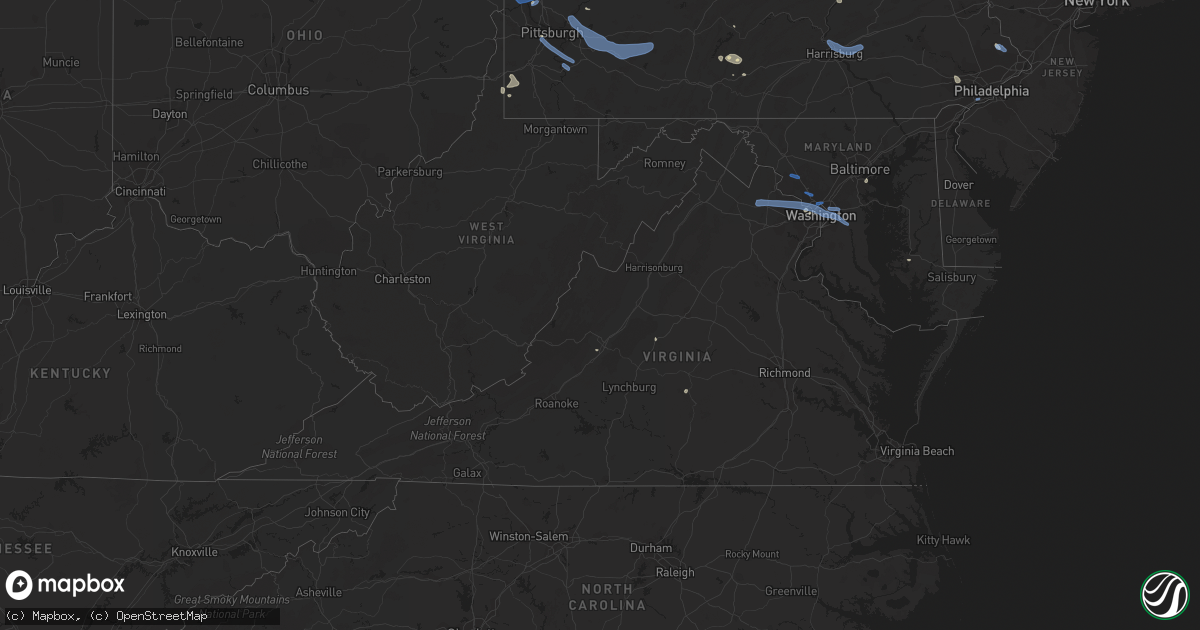
Hail Map in Virginia on July 6, 2019
Get this storm
July 6 map
$229
one time, instant access
Download today. No call, no setup
Keep the $229
Bought the map and want the full workflow? Apply the entire $229 to a subscription within 7 days. None of it is wasted.
Every map, not just this one
This buys you this map. Subscription and you get every map we run, in the markets you choose from a few cities to whole states to nationwide. Plus real-time alerts the moment a storm fires.
Contact data
Name, contact info, occupancy, even credit band for addresses in the footprint. You go from where it hit to who to call.
Become the source they trust
Unlimited branding weather history reports on demand. You already have the documented answer ready for the property owner, and you are the one who showed up with it.
Property data and RoofTrace estimates
Pull up any address you have got, its value and the exact code rules for that jurisdiction, straight from One Click Code. Then RoofTrace estimates the squares, pitch, and roof value, priced the way you price.
Storm reports in Virginia
Virginia
| Date | Description |
|---|---|
| 07/06/20196:10 PM CDT | Tree down blocking right lane of southbound george washington parkway |
| 07/06/20195:46 PM CDT | Tree down over forest ridge rd and crestview dr. |
| 07/06/20195:45 PM CDT | A local report indicates 58 MPH wind near STERLING PARK |
| 07/06/20195:20 PM CDT | Tree down on marcum farm court near intersection with evergreen mills road. |
| 07/06/20193:43 PM CDT | Tree down on powerlines in the 300 block of west duck street |
| 07/06/20193:34 PM CDT | Tree down blocking roadway in the 7000 block of singers glen rd. |
| 07/06/20195:07 AM CDT | At 1007 PM EDT, severe thunderstorms were located along a line extending from 7 miles southeast of Afton to 6 miles southeast of Wintergreen to near Montebello, moving southeast at 15 mph. HAZARD...60 mph wind gusts. SOURCE...Radar indicated. IMPACT...Damaging winds will cause some trees and large branches to fall. This could injure those outdoors, as well as damage homes and vehicles. Roadways may become blocked by downed trees. Localized power outages are possible. Unsecured light objects may become projectiles. Locations impacted include... Shipman, Schuyler, Wintergreen, Nellysford, Arrington, Scottsville, Esmont, Lovingston, North Garden, Covesville, Tyro, Jonesboro, Faber, Massies Mill, Bryant, Tye River, Damon, Roseland, Woodridge and Rockfish. |
| 07/06/20194:47 AM CDT | At 946 PM EDT, a severe thunderstorm was located near Lexington, moving east at 15 mph. HAZARD...60 mph wind gusts. SOURCE...Radar indicated. IMPACT...Expect damage to roofs, siding, and trees. Locations impacted include... Lexington... Buena Vista... Glasgow... Forks Of Buffalo... and Cornwall.This includes The following Location VMI. |
| 07/06/20192:35 AM CDT | At 735 PM EDT, severe thunderstorms were located along a line extending from Langley Park to RFK Stadium to Reagan National Airport, moving east at 20 mph. HAZARD...60 mph wind gusts. SOURCE...Radar indicated. IMPACT...Damaging winds will cause some trees and large branches to fall. This could injure those outdoors, as well as damage homes and vehicles. Roadways may become blocked by downed trees. Localized power outages are possible. Unsecured light objects may become projectiles. Locations impacted include... Arlington, Alexandria, Bowie, Clinton, College Park, Crofton, Greenbelt, Langley Park, Beltsville, Forestville, Largo, Coral Hills, Bladensburg, National Harbor, Upper Marlboro, University of Maryland, Nationals Park, Fedex Field, Gallaudet University and Fort Totten. |
| 07/06/201912:49 AM CDT | At 549 PM EDT, a severe thunderstorm was located near Middleburg, or 14 miles west of Brambleton, moving east at 15 mph. HAZARD...60 mph wind gusts. SOURCE...Radar indicated. IMPACT...Damaging winds will cause some trees and large branches to fall. This could injure those outdoors, as well as damage homes and vehicles. Roadways may become blocked by downed trees. Localized power outages are possible. Unsecured light objects may become projectiles. Locations impacted include... Leesburg, South Riding, Broadlands, Brambleton, Ashburn, Middleburg, Arcola, Oatlands, Saint Louis, Catharpin, Gleedsville, Woolsey, Rectortown, Aldie, Halfway and Philomont. |
| 07/06/201912:04 AM CDT | At 504 PM EDT, a severe thunderstorm was located near Broadway, or 11 miles northeast of Harrisonburg, moving southeast at 20 mph. HAZARD...60 mph wind gusts. SOURCE...Radar indicated. IMPACT...Damaging winds will cause some trees and large branches to fall. This could injure those outdoors, as well as damage homes and vehicles. Roadways may become blocked by downed trees. Localized power outages are possible. Unsecured light objects may become projectiles. Locations impacted include... Shenandoah, Stanley, Big Meadows, Newport, Honeyville, Ingham, Pine Grove and Jollett. |
| 07/05/201911:38 PM CDT | At 438 PM EDT, a severe thunderstorm was located near Front Royal, moving southeast at 20 mph. HAZARD...60 mph wind gusts. SOURCE...Radar indicated. IMPACT...Damaging winds will cause some trees and large branches to fall. This could injure those outdoors, as well as damage homes and vehicles. Roadways may become blocked by downed trees. Localized power outages are possible. Unsecured light objects may become projectiles. Locations impacted include... Front Royal, Hume, Linden, Chester Gap, Flint Hill, Huntly, Arco, Riverton, Hackleys Crossroads, Karo, Glen Echo, Markham, Browntown, Buckton and Riverside. |
| 07/05/201911:34 PM CDT | At 434 PM EDT, a severe thunderstorm was located near Dale Enterprise, or 8 miles north of Harrisonburg, moving southeast at 20 mph. HAZARD...60 mph wind gusts. SOURCE...Radar indicated. IMPACT...Damaging winds will cause some trees and large branches to fall. This could injure those outdoors, as well as damage homes and vehicles. Roadways may become blocked by downed trees. Localized power outages are possible. Unsecured light objects may become projectiles. Locations impacted include... Harrisonburg, Bridgewater, Broadway, Grottoes, Massanutten, Dale Enterprise, Elkton, Dayton, Mount Crawford, Rocky Bar, Penn Laird, Port Republic, Pleasant Valley, Cherry Grove, Lacey Spring, Singers Glen, Linville, Swift Run, Keezletown and Mcgaheysville. |
| 07/05/20199:43 PM CDT | Tree down at intersection of matohe and peters hollow road. |
| 07/05/20199:28 PM CDT | At 228 PM EDT, a severe thunderstorm was located over Woodville, moving east at 15 mph. HAZARD...60 mph wind gusts. SOURCE...Radar indicated. IMPACT...Expect damage to roofs, siding, and trees. Locations impacted include... Pilot Mountain... Francisco... King... Pilot Mountain State Park... and Woodville. |
| 07/05/20198:56 PM CDT | 911 call center reported tree down on wesley chapel rd. Timing estimated by radar. |
| 07/05/20198:50 PM CDT | Tree reported down by 911 call center. Timing estimated by radar. |
All States Impacted by Hail Map on July 6, 2019
Cities Impacted by Hail Map on July 6, 2019
- Wheatland, WY
- Bushnell, NE
- Kimball, NE
- Hanna, WY
- Burns, WY
- Buffalo, WY
- Oxford, ME
- Hebron, ME
- South Paris, ME
- Norway, ME
- Sun River, MT
- Drummond, MT
- Marathon, TX
- Saugerties, NY
- Pontiac, IL
- Cornell, IL
- Malvern, PA
- Rogers, NM
- Cascade, MT
- Ropesville, TX
- Big Springs, NE
- Hamilton, MT
- Corvallis, MT
- Martinsdale, MT
- Lagrange, ME
- Milo, ME
- Chugwater, WY
- Meadow, TX
- Libby, MT
- Kaycee, WY
- Gering, NE
- Scottsbluff, NE
- Arkansas City, KS
- Trego, MT
- Red Lodge, MT
- Roscoe, MT
- White Sulphur Springs, MT
- Crook, CO
- Cheyenne, WY
- Vaughn, MT
- Ney, OH
- Millfield, OH
- Amesville, OH
- Cameron, OK
- Stuart, OK
- Mcalester, OK
- Gordon, NE
- Rushville, NE
- Clearmont, WY
- Muskogee, OK
- Newkirk, OK
- Sand Springs, OK
- Laramie, WY
- Winifred, MT
- Bridgeport, WV
- Shinnston, WV
- Great Falls, MT
- Whitefish, MT
- Washington, DC
- Traphill, NC
- Pine Bluffs, WY
- Albin, WY
- Cuervo, NM
- West Finley, PA
- Cameron, WV
- Dallas, WV
- Burlington, ME
- Purling, NY
- Catskill, NY
- South Cairo, NY
- Cairo, NY
- Bosler, WY
- Rock River, WY
- Greenville, MS
- Freedom, PA
- Lubbock, TX
- Brule, NE
- Lodge Grass, MT
- Dalton, NE
- Wewoka, OK
- Sasakwa, OK
- Mount Sterling, OH
- Balmorhea, TX
- Ogallala, NE
- Wichita, KS
- Roy, MT
- Hilger, MT
- Vilonia, AR
- Cabot, AR
- Jacksonville, AR
- Jal, NM
- Big Sandy, MT
- Wagoner, OK
- Porter, OK
- Havre, MT
- Greenwich, CT
- Sedgwick, CO
- Burnt Cabins, PA
- Neelyton, PA
- Shade Gap, PA
- Konawa, OK
- Fairbury, IL
- Casper, WY
- Hawk Springs, WY
- Meriden, WY
- Lagrange, WY
- Kermit, TX
- Lincoln, ME
- West Enfield, ME
- Okemah, OK
- Fishtail, MT
- Cassville, PA
- Three Springs, PA
- Mapleton Depot, PA
- Gurley, NE
- Tivoli, NY
- Worthington, WV
- Mannington, WV
- Boulder, MT
- Whitehall, MT
- Crookston, NE
- Brownville, ME
- Howland, ME
- Saint Louisville, OH
- McLean, VA
- Mercer, PA
- Muleshoe, TX
- Benton, AR
- Hot Springs National Park, AR
- Lonsdale, AR
- Abernathy, TX
- Niceville, FL
- Stevensville, MT
- East Longmeadow, MA
- Springfield, MA
- Heavener, OK
- Hodgen, OK
- Morton, TX
- Talala, OK
- La Moille, IL
- Bridger, MT
- Roberts, MT
- Garden City, TX
- Montrose, IL
- Mannford, OK
- Farmington, KY
- Murray, KY
- Causey, NM
- Farmville, VA
- Red Hook, NY
- Germantown, NY
- Malden On Hudson, NY
- Throckmorton, TX
- Oshkosh, NE
- Glouster, OH
- Chesterhill, OH
- Andrews, TX
- Glen Burnie, MD
- Curtis Bay, MD
- Broken Arrow, OK
- Herndon, PA
- Bayard, NE
- Freeport, FL
- Charlo, MT
- Valley Center, KS
- Helena, MT
- Coweta, OK
- Redbird, OK
- Lemoyne, NE
- Clarksburg, WV
- Utica, IL
- Troy Grove, IL
- La Salle, IL
- Mendota, IL
- Ulm, MT
- Sudan, TX
- Maize, KS
- Box Elder, MT
- Muenster, TX
- Chappell, NE
- Marianna, AR
- Midkiff, TX
- Augusta, MT
- Stanton, TX
- Todd, PA
- Orbisonia, PA
- Leeds, ME
- Ottawa, IL
- Freehold, NY
- Leeds, NY
- Lowell, IN
- Idalou, TX
- Lone Grove, OK
- Wolfforth, TX
- Bridgeport, OH
- Saint Clairsville, OH
- Harrisburg, NE
- Chinook, MT
- Olney, TX
- Elsie, NE
- Cambridge, MD
- Wynnewood, OK
- Black Eagle, MT
- Burneyville, OK
- Turner, ME
- Greene, ME
- Buckfield, ME
- Yoder, WY
- Passadumkeag, ME
- Doylestown, PA
- New Hope, PA
- Furlong, PA
- Hustontown, PA
- Claysville, PA
- Prosperity, PA
- Swedesboro, NJ
- Bridgeport, NJ
- Altamont, KS
- Newcastle, TX
- Wewahitchka, FL
- Ludlow, MA
- Saint Ignatius, MT
- Checotah, OK
- Wheeling, WV
- Cloudcroft, NM
- Graysville, OH
- Lewisville, OH
- Lloyd, MT
- Minatare, NE
- Huntingdon, PA
- Ardmore, OK
- Power, MT
- Potter, NE
- Blackwell, OK
- West Union, WV
- Armonk, NY
- West Harrison, NY
- Purchase, NY
- Lodgepole, NE
- Fort Hancock, TX
- Spiceland, IN
- Wray, GA
- Buford, WY
- Poteau, OK
- Roaring River, NC
- Ronda, NC
- Lovingston, VA
- Natural Bridge, VA
- Lexington, VA
- Sebec, ME
- Torrington, WY
- Hays, NC
- Loving, TX
- Whitefield, NH
- Absarokee, MT
- Eutaw, AL
- Cadiz, OH
- Waterford, OH
- Fleming, OH
- Wind Ridge, PA
- Broad Top, PA
- Dudley, PA
- Robertsdale, PA
- Boligee, AL
- New Castle, IN
- Lewisville, IN
- Leechburg, PA
- Hyde Park, PA
- Vandergrift, PA
- Tallahassee, FL
- Falls Church, VA
- Arlington, VA
- Busby, MT
- Garryowen, MT
- Carnegie, PA
- Monee, IL
- Rawlins, WY
- Noble, IL
- Belfry, MT
- Davis, OK
- Millinocket, ME
- Danforth, ME
- Brookton, ME
- Litchfield, ME
- Russell, PA
- Warren, PA
- Byrnedale, PA
- Weedville, PA
- Kersey, PA
- Ridgway, PA
- Clearfield, PA
- Du Bois, PA
- Rockton, PA
- Penfield, PA
- Monessen, PA
- Donora, PA
- Belle Vernon, PA
- Monongahela, PA
- Annville, PA
- Dauphin, PA
- Duncannon, PA
- Harrisburg, PA
- Hummelstown, PA
- Hershey, PA
- Marysville, PA
- Palmyra, PA
- Enola, PA
- Newtown, PA
- Ridley Park, PA
- Prospect Park, PA
- Norwood, PA
- Folsom, PA
- East Liverpool, OH
- Newell, WV
- New Cumberland, WV
- Chester, WV
- Toronto, OH
- Irondale, OH
- Hammondsville, OH
- Empire, OH
- Stratton, OH
- Saint Marys, WV
- Friendly, WV
- Lost Creek, WV
- Salem, WV
- Richmond, VT
- Moretown, VT
- Montpelier, VT
- Waterbury, VT
- Middleburg, VA
- Sterling, VA
- Capitol Heights, MD
- District Heights, MD
- Bethesda, MD
- Great Falls, VA
- Purcellville, VA
- Ashburn, VA
- Potomac, MD
- Leesburg, VA
- Aldie, VA
- Herndon, VA
- Vienna, VA
- Chevy Chase, MD
- Hyattsville, MD
- Reston, VA
- Cabin John, MD
- Glen Echo, MD
- Upper Marlboro, MD
- Dickerson, MD
- Boyds, MD
- Clarksburg, MD
- Barnesville, MD
- Rockville, MD
- Gaithersburg, MD
- Silver Spring, MD
- Lanham, MD
- Bladensburg, MD
- Bowie, MD
- Riverdale, MD
- Brentwood, MD
- Ellsworth, NE
- Mcgrew, NE
- Angora, NE
- Morrill, NE
- Melbeta, NE
- Sidney, NE
- Lewellen, NE
- Broadwater, NE
- Keystone, NE
- Lyman, NE
- Dix, NE
- Arthur, NE
- Bridgeport, NE
- Paxton, NE
- Mitchell, NE
- Lisco, NE
- Falls Village, CT
- Lakeville, CT
- New Braintree, MA
- Longmeadow, MA
- Hampden, MA
- Agawam, MA
- Cimarron, KS
- Ingalls, KS
- Hanston, KS
- Ness City, KS
- Bazine, KS
- Hardtner, KS
- Kiowa, KS
- Medicine Lodge, KS
- Isabel, KS
- Arvada, WY
- Kenton, OK
- Boise City, OK
- Keyes, OK
- New Castle, PA
- New Brighton, PA
- Beaver, PA
- Beaver Falls, PA
- Darlington, PA
- Monaca, PA
- Rochester, PA
- Cranberry Township, PA
- Zelienople, PA
- Baden, PA
- Sutersville, PA
- Presto, PA
- Pittsburgh, PA
- Finleyville, PA
- South Park, PA
- Clairton, PA
- Elizabeth, PA
- Smithton, PA
- West Elizabeth, PA
- West Newton, PA
- Bethel Park, PA
- Bridgeville, PA
- Derry, PA
- Bolivar, PA
- Claridge, PA
- Hannastown, PA
- Verona, PA
- Latrobe, PA
- Greensburg, PA
- Jeannette, PA
- Delmont, PA
- Export, PA
- Apollo, PA
- Forbes Road, PA
- Bradenville, PA
- Crabtree, PA
- Cheswick, PA
- Loyalhanna, PA
- Springdale, PA
- Boswell, PA
- New Florence, PA
- New Alexandria, PA
- Luxor, PA
- Murrysville, PA
- Johnstown, PA
- Harwick, PA
- Ligonier, PA
- New Derry, PA
- Creighton, PA
- Tarentum, PA
- New Kensington, PA
- Youngstown, PA
- Bovard, PA
- Hampton, NJ
- High Bridge, NJ
- Clinton, NJ
- Annandale, NJ
- Lebanon, NJ
- Groveton, NH


