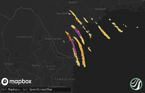
Hail Map in Texas on July 4, 2017
The weather event in Texas on July 4, 2017 includes Hail map. 24 states and 613 cities were impacted and suffered possible damage. The total estimated number of properties impacted is 2,545.

Hail
2,545
Estimated number of impacted properties by a 1.00" hail or larger0
Estimated number of impacted properties by a 1.75" hail or larger0
Estimated number of impacted properties by a 2.50" hail or largerStorm reports in Texas
Texas
| Date | Description |
|---|---|
| 07/04/20176:59 PM CDT | A local report indicates 60 MPH wind near 4 WSW SAN ANGELO |
| 07/04/20176:53 PM CDT | Several 3 to 4 inch diamater tree limbs down |
| 07/04/20176:50 PM CDT | A local report indicates 60 MPH wind near 3 N SAN ANGELO |
| 07/04/20176:40 PM CDT | A local report indicates 60 MPH wind near 3 W BOOTLEG |
| 07/04/20176:13 PM CDT | A local report indicates 59 MPH wind near 11 WNW BOOTLEG |
| 07/04/20175:05 PM CDT | A local report indicates 1.00 inch wind near 1 SE BIG SPRING |
| 07/04/20174:30 PM CDT | Public reported nickel to quarter sized hail. |
| 07/04/20173:12 AM CDT | A local report indicates 58 MPH wind near 4 N WICHITA FALLS |
| 07/04/20172:59 AM CDT | A local report indicates 59 MPH wind near 4 N WICHITA FALLS |
| 07/04/20172:52 AM CDT | Branches off trees. |
| 07/03/201711:30 PM CDT | A local report indicates 67 MPH wind near 3 E SNYDER |
| 07/03/201711:07 PM CDT | A local report indicates 62 MPH wind near 3 NW WINK |
| 07/03/201710:33 PM CDT | Late report of 60 to 70 mph winds. Time estimated by radar. |
| 07/03/201710:13 PM CDT | A local report indicates 59 MPH wind near 4 NNW LAKE TANGLEWOOD |
| 07/03/201710:08 PM CDT | Cwop mesonet |
| 07/03/201710:05 PM CDT | A local report indicates 61 MPH wind near 2 NNE SEMINOLE |
| 07/03/201710:02 PM CDT | A local report indicates 58 MPH wind near WELCH |
| 07/03/20179:52 PM CDT | A local report indicates 61 MPH wind near 3 NNE TAHOKA |
| 07/03/20179:35 PM CDT | Measured by texas tech west texas mesonet. |
| 07/03/20179:20 PM CDT | Late report of strong winds behind outflow along with blowing dust |
| 07/03/20179:15 PM CDT | Measured by texas tech west texas mesonet. |
| 07/03/20179:11 PM CDT | Measured by asos at lubbock international airport. |
| 07/03/20179:05 PM CDT | Measured by texas tech west texas mesonet. |
| 07/03/20179:05 PM CDT | Measured by texas tech west texas mesonet. |
| 07/03/20178:52 PM CDT | A local report indicates 59 MPH wind near 1 SSW MCCAMEY |
| 07/03/20178:35 PM CDT | Measured by the texas tech west texas mesonet. |
| 07/03/20178:30 PM CDT | Measured by the texas tech west texas mesonet. |
| 07/03/20178:23 PM CDT | A local report indicates 1.50 inch wind near 1 S DUMAS |
| 07/03/20178:20 PM CDT | Measured by the texas tech west texas mesonet. |
| 07/03/20178:20 PM CDT | Center pivots overturned along 385 between springlake and littelfield. Near zero visibility in blowing dust. |
| 07/03/20178:14 PM CDT | Measured by the texas tech west texas mesonet. |
| 07/03/20177:50 PM CDT | Measured by the texas tech west texas mesonet. |
| 07/03/20177:45 PM CDT | Measured by the texas tech west texas mesonet. |
| 07/03/20177:41 PM CDT | Light damage reported in springlake. Near zero visibility with wall of dust moving through. |
| 07/03/20177:37 PM CDT | Pea to half dollar size hail. Reported by nws cooperative observer. |
| 07/03/20177:35 PM CDT | Measured by the texas tech west texas mesonet. |
| 07/03/20177:30 PM CDT | A local report indicates 61 MPH wind near 2 NW HEREFORD |
| 07/03/20177:21 PM CDT | Trained spotter and sheriff deputy on the west side of hereford reported thunderstorm wind gusts up to 60 mph with tree limbs broken off. |
| 07/03/20177:15 PM CDT | A local report indicates 60 MPH wind near 2 NW HEREFORD |
| 07/03/20177:00 PM CDT | Measured by the texas tech university west texas mesonet. |
All States Impacted by Hail Map on July 4, 2017
Cities Impacted by Hail Map on July 4, 2017
- Hettinger, ND
- Dassel, MN
- Annandale, MN
- Maple Lake, MN
- Buffalo, MN
- Cokato, MN
- Howard Lake, MN
- Buxton, ND
- Stephen, MN
- Angora, MN
- Cook, MN
- Faith, SD
- Union Center, SD
- Logan, NM
- Colbert, OK
- Galesburg, ND
- Clifford, ND
- Portland, ND
- Hope, ND
- La Junta, CO
- Las Animas, CO
- Wood River, NE
- Littlefork, MN
- Orr, MN
- Memphis, TX
- Childress, TX
- Arthur, IA
- Kiron, IA
- Ida Grove, IA
- Elgin, OK
- Lawton, OK
- Luverne, ND
- Hannaford, ND
- Bussey, IA
- Loraine, TX
- Bronte, TX
- Merkel, TX
- Jackson, MN
- Lakefield, MN
- Nara Visa, NM
- Weinert, TX
- Munday, TX
- Battle Lake, MN
- Murdock, MN
- Clara City, MN
- Raymond, MN
- Austin, AR
- Vilonia, AR
- Jacksonville, AR
- Cabot, AR
- Arnold, NE
- Thompson, ND
- Rapid City, SD
- Palestine, AR
- Goodwin, AR
- Boswell, OK
- Vining, MN
- Clitherall, MN
- Parkers Prairie, MN
- Midkiff, TX
- Griffithville, AR
- Des Arc, AR
- Groom, TX
- Donaldson, MN
- Karlstad, MN
- Strandquist, MN
- Dumas, TX
- Seymour, TX
- New London, MN
- Roswell, NM
- Hershey, NE
- Sutherland, NE
- Paxton, NE
- Athol, KS
- Gaylord, KS
- Kensington, KS
- Ozona, TX
- Lonoke, AR
- Carlisle, AR
- Kanawha, IA
- Milan, MN
- Peru, IA
- Saint Charles, IA
- Murray, IA
- Truro, IA
- Stapleton, NE
- Brady, NE
- Maxwell, NE
- North Platte, NE
- Roosevelt, OK
- Ordway, CO
- Wolverton, MN
- Finley, ND
- Black Hawk, SD
- Deadwood, SD
- Nemo, SD
- Brewster, MN
- Adrian, TX
- Argusville, ND
- Mayville, ND
- Haxtun, CO
- Pacolet, SC
- Altus, OK
- Henrietta, TX
- Ellendale, MN
- Blooming Prairie, MN
- Wallace, NE
- Dickens, NE
- Hawley, MN
- Detroit Lakes, MN
- Garita, NM
- Meadowlands, MN
- Cotton, MN
- Willis, VA
- Harris, IA
- Lake Park, IA
- Round Lake, MN
- Worthington, MN
- Okabena, MN
- Heron Lake, MN
- Vergas, MN
- Pelican Rapids, MN
- Audubon, MN
- Lake Park, MN
- Elsie, NE
- Roaring Springs, TX
- Paducah, TX
- Wrenshall, MN
- Temple, OK
- Britt, IA
- Corwith, IA
- Hallock, MN
- Spicer, MN
- Willmar, MN
- Greenbrier, AR
- Baudette, MN
- Cove, AR
- Watson, OK
- Crete, NE
- Hutchinson, MN
- Grenville, NM
- Crookston, MN
- Nielsville, MN
- Climax, MN
- Bismarck, ND
- Wing, ND
- Tuttle, ND
- Menoken, ND
- Mandan, ND
- Baldwin, ND
- Regan, ND
- Robinson, ND
- Red Lake Falls, MN
- Searcy, AR
- Higginson, AR
- Miami, TX
- Canadian, TX
- Fairbury, IL
- Pontiac, IL
- Forrest, IL
- Saint Petersburg, FL
- Evansville, MN
- Brooten, MN
- Belgrade, MN
- Litchfield, MN
- Darwin, MN
- Scott, AR
- Petrolia, TX
- Wichita Falls, TX
- Claude, TX
- San Jon, NM
- Mentone, TX
- Prairie City, SD
- Sylvester, TX
- Trafford, AL
- Locust Fork, AL
- Cleveland, AL
- Euclid, MN
- Shamrock, TX
- Pennock, MN
- Sunburg, MN
- Ashby, MN
- Underwood, MN
- Henning, MN
- Dalton, MN
- Detroit, TX
- Vail, IA
- Denison, IA
- Hillsboro, ND
- Sentinel, OK
- Gardner, ND
- Elberton, GA
- Dazey, ND
- Wimbledon, ND
- Cooperstown, ND
- Moorhead, MN
- Glyndon, MN
- Tryon, NE
- Trent, TX
- Sweetwater, TX
- Hale Center, TX
- Bellevue, TX
- Redwood Falls, MN
- Olivia, MN
- Glencoe, MN
- Silver Lake, MN
- Newtown, MO
- Frederick, OK
- Snyder, OK
- Glenwood, MN
- Big Spring, TX
- Carson, ND
- Ogema, MN
- Ulen, MN
- Callaway, MN
- Kim, CO
- Avondale, CO
- Pueblo, CO
- Roscoe, TX
- Hugo, OK
- Fort Towson, OK
- International Falls, MN
- Lemmon, SD
- Lindsay, OK
- Coahoma, TX
- Effie, MN
- Moffit, ND
- Sterling, ND
- Kennedy, MN
- Gann Valley, SD
- Sedgwick, CO
- Mcalister, NM
- Melrose, NM
- Elmore, MN
- Hoffman, MN
- Barrett, MN
- Albany, TX
- Valley City, ND
- Lucerne, MO
- Pollock, MO
- Mapleton, ND
- Harwood, ND
- Casselton, ND
- Dexter, IA
- Redfield, IA
- Loving, NM
- Haskell, TX
- Rocky Ford, CO
- Tipton, OK
- Hunter, ND
- Muleshoe, TX
- Kermit, TX
- Rogers, MN
- Hanover, MN
- Masterson, TX
- Amarillo, TX
- Widener, AR
- Tunica, MS
- Atoka, OK
- Coalgate, OK
- Dunning, NE
- Foreman, AR
- Ashdown, AR
- Hatton, ND
- Big Falls, MN
- Blair, OK
- Mangum, OK
- Alexandria, MN
- Atlanta, LA
- Blackwell, TX
- Maryneal, TX
- Warren, MN
- Osceola, IA
- Sugar City, CO
- Mclean, TX
- Marianna, AR
- Hazen, AR
- White Deer, TX
- Altamonte Springs, FL
- Apopka, FL
- Orlando, FL
- Trenton, NC
- Dover, NC
- Debary, FL
- Jal, NM
- Saint Jo, TX
- Ringling, OK
- Hamlin, TX
- Lidgerwood, ND
- Burr, NE
- Grand Forks, ND
- Douglas, NE
- Cook, NE
- Sterling, NE
- Syracuse, NE
- Northome, MN
- Fergus Falls, MN
- Brandon, MN
- Crowell, TX
- Nocona, TX
- Winter Park, FL
- Maitland, FL
- Alden, MN
- Hollandale, MN
- Austin, MN
- Norton, TX
- Solway, MN
- Broken Bow, OK
- Loveland, OK
- Rush Springs, OK
- Marlow, OK
- Rothsay, MN
- Kent, MN
- Shields, ND
- Selfridge, ND
- Portales, NM
- Texico, NM
- Reynolds, ND
- Ada, MN
- Thief River Falls, MN
- Elk River, MN
- Anoka, MN
- Braddock, ND
- Byers, TX
- Clarendon, TX
- Adamsville, TN
- Selmer, TN
- Stringtown, OK
- Howes, SD
- Robert Lee, TX
- Cape Coral, FL
- Waurika, OK
- Ryan, OK
- Hermleigh, TX
- Damascus, AR
- Beebe, AR
- Hereford, TX
- Kensington, MN
- Garfield, MN
- Elbow Lake, MN
- Hawley, TX
- Anson, TX
- Atwater, MN
- Solen, ND
- Flasher, ND
- Smithville, OK
- Plumerville, AR
- Earleton, FL
- Chattanooga, OK
- Loretto, MN
- Maple Grove, MN
- Dayton, MN
- Saint Michael, MN
- Rockford, MN
- Minneapolis, MN
- Osseo, MN
- Champlin, MN
- Hamel, MN
- Arthur, ND
- Trementina, NM
- Pampa, TX
- Bennington, OK
- Shickley, NE
- Geneva, NE
- Avoca, TX
- Stamford, TX
- Winters, TX
- Friona, TX
- Sterling City, TX
- Maple Plain, MN
- Many, LA
- Thonotosassa, FL
- Zephyrhills, FL
- Wesley Chapel, FL
- Bricelyn, MN
- Kiester, MN
- Spirit Lake, IA
- Winterset, IA
- Garden City, TX
- Britt, MN
- Barnesville, MN
- Okahumpka, FL
- Groveland, FL
- Leesburg, FL
- Judsonia, AR
- Albert Lea, MN
- Wells, MN
- Emerado, ND
- Rotan, TX
- Ward, AR
- Artesia, NM
- Punta Gorda, FL
- Fairburn, SD
- Sherwood, AR
- Clarksville, TX
- Little Rock, AR
- North Little Rock, AR
- Fort Sumner, NM
- Lueders, TX
- Skellytown, TX
- Bigfork, MN
- Chisholm, MN
- Rogers, ND
- Hastings, OK
- Randlett, OK
- Borger, TX
- Channing, TX
- Morris, MN
- Westbrook, TX
- Cheraw, CO
- Ivanhoe, TX
- Cedartown, GA
- Wahpeton, ND
- Colfax, ND
- Sacred Heart, MN
- Maynard, MN
- Bagley, MN
- Walters, OK
- McCaulley, TX
- Viking, MN
- Kerkhoven, MN
- Cleveland, ND
- Virginia, MN
- Eads, TN
- Cordova, TN
- Memphis, TN
- Fisher, MN
- East Grand Forks, MN
- Benson, MN
- Lovilia, IA
- Delight, AR
- Wesley, IA
- Fletcher, OK
- Deloit, IA
- Rattan, OK
- Dent, MN
- Abercrombie, ND
- Frazee, MN
- Earlham, IA
- Beltrami, MN
- Bismarck, AR
- Malvern, AR
- Nashville, AR
- Mineral Springs, AR
- Sarasota, FL
- Duncan, OK
- Quitaque, TX
- Lone Wolf, OK
- Buffalo Center, IA
- Villard, MN
- Durant, OK
- Mead, OK
- Augusta, AR
- Bald Knob, AR
- Erhard, MN
- Nesbit, MS
- Merrifield, MN
- Anselmo, NE
- Sawyer, OK
- Murfreesboro, AR
- Snyder, TX
- Halstad, MN
- Blue Earth, MN
- Kress, TX
- Santa Rosa, NM
- Tulia, TX
- Collierville, TN
- Burt, IA
- Windom, MN
- Soper, OK
- Millington, TN
- Jonesville, SC
- Spartanburg, SC
- Roff, OK
- Lakota, IA
- Boone, CO
- Bingham Lake, MN
- Currie, MN
- Hamilton, IA
- Broadview, NM
- Biscoe, AR
- Ira, TX
- Richville, MN
- Naples, FL
- Page, ND
- Sarah, MS
- Beverly Hills, FL
- Lecanto, FL
- Hot Springs National Park, AR
- Donaldson, AR
- Jayton, TX
- Antlers, OK
- Stonewall, OK
- Cyrus, MN
- Hartley, TX
- Renville, MN
- Benton, AR
- Wynne, AR
- South Haven, MN
- Miles, TX
- Ballinger, TX
- Gadsden, AL
- Jamestown, ND
- Meadow, SD
- Mountain Lake, MN
- Butterfield, MN
- Trimont, MN
- Odin, MN
- Indiahoma, OK
- Hobart, OK
- Driscoll, ND
- Bonham, TX
- Savoy, TX
- Shelly, MN
- Panhandle, TX
- Colorado City, TX
- Snow, OK
- Finley, OK
- Moyers, OK
- Chariton, IA
- Erie, ND
- Arlington, TN
- Foster, OK
- Dill City, OK
- Carter, OK
- Colora, MD
- Blakesburg, IA
- Unionville, IA
- Paoli, OK
- Brayton, IA
- Anita, IA
- Starke, FL
- Rufe, OK
- Valliant, OK
- Gotebo, OK
- Hollister, OK
- Canute, OK
- Littlefield, TX
- Steele, ND
- Carlton, MN
- Lowell, IN
- Ackworth, IA
- Traskwood, AR
- Paynesville, MN
- Rule, TX
- Lovington, NM
- Bowman, GA
- Dewy Rose, GA
- Sulphur, OK
- Crosby, MN
- Nisswa, MN
- Stuttgart, AR
- De Valls Bluff, AR
- Fort Sill, OK
- Wilton, AR
- Woden, IA
- Brinkley, AR
- Keldron, SD
- Hastings, NE
- Oakland, TN
- Somerville, TN
- Northwood, ND
- Germantown, TN
- Ovid, CO
- Amity, AR
- Elmer, OK
- Georgetown, MN
- Dilworth, MN
- Fargo, ND
- Farwell, MN
- Sabin, MN
- Moro, AR
- Mountain Park, OK
- Veblen, SD
- Salol, MN
- Bolivar, TN
- Schleswig, IA
- Horatio, AR
- Wheatley, AR
- Cotton Plant, AR
- Columbia, SC
- Madill, OK
- Western, NE
- Bancroft, IA
- Rising Sun, MD
- Pauls Valley, OK
- Plainview, TX
- Mena, AR
- North Fort Myers, FL
- Saint Paul, MN
- Kinston, NC
- Sauk Centre, MN
- Juniata, NE
- Lockesburg, AR
- Morton, MN
- Ree Heights, SD
- Warroad, MN
- Paris, TX
- Williams, MN
- Eatonton, GA
- Conway, AR
- Wynnewood, OK
- Grant, OK
- Aurelia, IA
- Springfield, AR
- Bellflower, IL
- Arrowsmith, IL
- Farmer City, IL
- Barney, ND
- Manilla, IA
- Manning, IA
- Grandin, ND
- Madrid, NE


