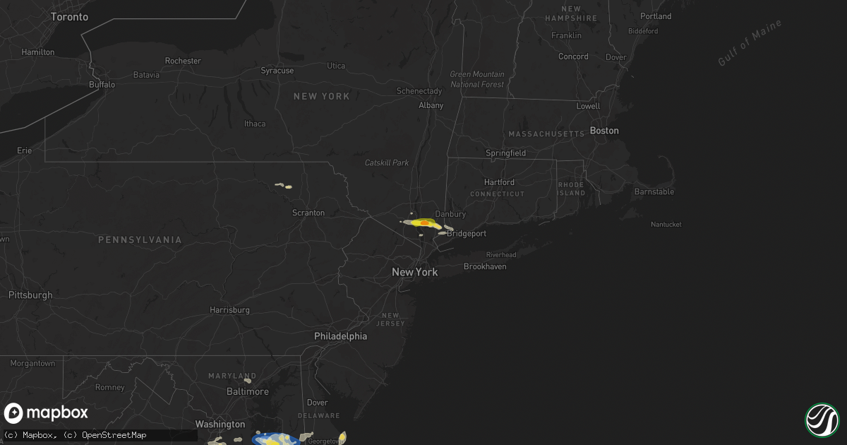
Hail Map on July 3, 2023
Get this storm
July 3 map
$229
one time, instant access
Download today. No call, no setup
Keep the $229
Bought the map and want the full workflow? Apply the entire $229 to a subscription within 7 days. None of it is wasted.
Every map, not just this one
This buys you this map. Subscription and you get every map we run, in the markets you choose from a few cities to whole states to nationwide. Plus real-time alerts the moment a storm fires.
Contact data
Name, contact info, occupancy, even credit band for addresses in the footprint. You go from where it hit to who to call.
Become the source they trust
Unlimited branding weather history reports on demand. You already have the documented answer ready for the property owner, and you are the one who showed up with it.
Property data and RoofTrace estimates
Pull up any address you have got, its value and the exact code rules for that jurisdiction, straight from One Click Code. Then RoofTrace estimates the squares, pitch, and roof value, priced the way you price.
States Impacted by Hail Map on July 3, 2023
Storm reports
Minnesota
| Date | Description |
|---|---|
| 07/02/20239:10 PM CDT | Maximum size with most hail smaller. |
| 07/02/20239:08 PM CDT | A local report indicates 1.00 inch wind near 1 E Lakeville |
| 07/02/20238:55 PM CDT | Biggest hail from 855pm to 905pm. Between 1.5-2 inches. |
| 07/02/20238:52 PM CDT | A local report indicates 1.00 inch wind near 2 NNE Farmington |
| 07/02/20238:45 PM CDT | A local report indicates 1.50 inch wind near 3 SSE Apple Valley |
| 07/02/20238:33 PM CDT | Photo of hail compared to quarter. |
Virginia
| Date | Description |
|---|---|
| 07/03/20236:47 PM CDT | Thunderstorm winds blew down one tree near the intersection of lowesville road and u.s. 60. |
| 07/03/20236:17 PM CDT | Thunderstorm winds blew down a tree near the intersection of elon road and the blue ridge parkway. |
| 07/03/20235:22 PM CDT | 911 call center reported a tree down on lancaster creek drive. Time estimated from radar. |
| 07/03/20235:02 PM CDT | Emergency manager reported structural/roof damage to 6 homes along little florida rd... Including a buckled roof that allowed water to enter the home. |
| 07/03/20234:27 PM CDT | One tree down due to thunderstorm winds along the 10500 block of blemont boulevard. |
| 07/03/20234:27 PM CDT | One tree down due to thunderstorm winds along the 7600 block of wiley drive/ |
| 07/03/20234:27 PM CDT | One tree down due to thunderstorm winds along the 10500 block of belmont boulevard. |
| 07/03/20234:25 PM CDT | A few hailstones as large as a quarter reported at a business on u.s. Highway 360. |
| 07/03/20234:18 PM CDT | 911 call center reported a tree down on irvington road. Time estimated from radar. |
| 07/03/20233:46 PM CDT | Lafayette river tower reported a wind gust of 54kt. |
| 07/03/20233:44 PM CDT | Tree downed on mountain road and rosmarin road. Time estimated from radar. |
| 07/03/20233:40 PM CDT | Report from mping: 1-inch tree limbs broken; shingles blown off. |
| 07/03/20233:40 PM CDT | Trees downed along sandy hook rd. Va-522 near poorhouse road. |
| 07/03/20233:12 PM CDT | Tree downed on river road west. |
| 07/03/20232:50 PM CDT | Multiple trees down due to thunderstorm winds near the intersection of stony point road and turkey sag road. |
| 07/03/20232:28 PM CDT | Tree down across va-35 near farmers bridges rd. Time estimated from radar. |
| 07/03/20232:25 PM CDT | Tree down across route 651 in the vicinity of popes station road. |
| 07/03/20232:15 PM CDT | Tree down at benefit road and blacksmith trail. Time estimated by radar. |
| 07/03/20232:08 PM CDT | Multiple trees down due to thunderstorm winds along patrick henry highway. |
| 07/03/20231:47 PM CDT | Several very large branches blown down by thunderstorm winds on piney grove road. Pea size hail was also observed. |
| 07/02/20238:36 PM CDT | Tree down along us-460 west of prospect. |
| 07/02/20238:34 PM CDT | Tree down on douglas church road. |
| 07/02/20238:24 PM CDT | Thunderstorm winds blew a tree onto the road near the intersection of old evergreen road and old bethany road. |
| 07/02/20238:24 PM CDT | Two trees blown down by thunderstorm winds near ca ira road. |
| 07/02/20238:21 PM CDT | Several trees down due to thunderstorm winds along stony point road. |
| 07/02/20238:21 PM CDT | Thunderstorm winds blew a tree down on rocks church road. |
| 07/02/20238:15 PM CDT | Thunderstorm winds blew a tree down on the road near the intersection of purdum mill road and country club lane. |
| 07/02/20238:07 PM CDT | Thunderstorm winds blew a tree down on the road near police tower road. |
| 07/02/20238:06 PM CDT | Thunderstorms winds blew a tree onto a power line near elliott lane. |
| 07/02/20238:00 PM CDT | Several trees down due to thunderstorm winds in the north garden area. |
| 07/02/20237:41 PM CDT | Thunderstorm winds blew down one tree near west james anderson highway near the appomattox county line. |
| 07/02/20237:38 PM CDT | Multiple trees down on old ridge road near woods mill. Trees also down near ridgecrest baptist church on us-29. |
| 07/02/20237:38 PM CDT | One tree down due to thunderstorm winds along the 3000 block of river road. |
| 07/02/20237:37 PM CDT | Thunderstorm winds blew a tree onto a powerline near the intersection of reedy spring road and richmond highway. |
| 07/02/20237:30 PM CDT | Corrects previous tstm wnd dmg report from 2 sse oakville. Thunderstorm winds blew down at least two trees near the intersection of dean johns place and oakville road. |
| 07/02/20237:30 PM CDT | Thunderstorm winds blew down one tree at the intersection of dean johns place and oakville road. |
| 07/02/20237:24 PM CDT | Multiple trees blew down on us-29 and adjoining roads near lovingston. |
| 07/02/20237:04 PM CDT | A few trees were downed by thunderstorm winds near the intersection of patrick henry highway and canodys store road. |
Alabama
| Date | Description |
|---|---|
| 07/03/20233:53 PM CDT | Tree down onto a roadway. |
| 07/03/20233:26 PM CDT | Trees down around sardis city... Al. |
| 07/03/20232:17 PM CDT | Report from mping: half dollar |
| 07/03/20231:30 PM CDT | Powerlines and trees down extending between hwy 724 & 81 eastward through hwy 91 |
| 07/03/20231:30 PM CDT | Several trees roughly 6-12 inches in diameter blown over or have limbs broken off. Other trees were also blown over east of this location |
Nebraska
| Date | Description |
|---|---|
| 07/02/202311:00 PM CDT | A local report indicates 60 MPH wind near 13 NNW Clinton |
| 07/02/202310:49 PM CDT | Chadron asos. |
| 07/02/202310:44 PM CDT | Asos station kcdr chadron airport - cdr. |
| 07/02/202310:07 PM CDT | Estimated 60 mph wind gust. |
Arkansas
| Date | Description |
|---|---|
| 07/03/20235:45 PM CDT | Tree blown down along hot springs creek. |
| 07/03/20234:25 PM CDT | Trees blown down in story. |
South Carolina
| Date | Description |
|---|---|
| 07/03/20234:20 PM CDT | Trees down at highway 11 and church street... Rainbow lake road and cannon ford road. |
| 07/03/20234:20 PM CDT | Power outage of approx 1500 customers east of fingerville attributed to fallen trees or limbs. Time estimated from radar. |
| 07/03/20234:19 PM CDT | Tree down on hwy 9... North of hwy 11. |
| 07/03/20233:38 PM CDT | Power outage of more than 200 customers attributed to fallen trees and limbs... Northeast of blacksburg between hwy 29 and i-85. |
| 07/03/20233:36 PM CDT | Trees and power lines down on the east side of blacksburg... Including whitaker mountain rd and dye rd. Time estimated from radar. |
| 07/03/20233:25 PM CDT | Trees and power lines down on dravo rd. Time estimated from radar. |
| 07/03/20232:15 PM CDT | Tweet from the public confirmed trees down near the intersection of old reaves ferry road and bear bluff road. |
Wisconsin
| Date | Description |
|---|---|
| 07/03/20236:30 PM CDT | Tree down on roadway per law enforcement. Time estimated based on radar. |
| 07/03/20236:15 PM CDT | Tree on the roadway per law enforcement. Time estimated based on radar. |
| 07/03/20236:15 PM CDT | Tree down in yard and over the owners car. |
| 07/03/20236:15 PM CDT | Time estimated by radar. Reports of trees down of unknown size and quantity. Powerlines down due to strong thunderstorm winds. |
| 07/03/20236:03 PM CDT | Powerlines reported down in butternut due to strong thunderstorm wind gusts. Time estimated by radar. Location approximate. |
| 07/03/20235:44 PM CDT | Powerlines reported down in glidden due to strong thunderstorm winds. Time estimated by radar. Location approximate. |
| 07/03/20235:00 PM CDT | Report of a 18 to 20 inch tree uprooted. |
| 07/03/20235:00 PM CDT | Law enforcement reported a tree fell on a power line in cable and sparked a small fire which was quickly contained and was under control. No lane blockage with this rep |
| 07/03/20234:51 PM CDT | Report of a power pole knocked over and caught fire in ashland due to strong thunderstorm winds. Time estimated by radar. |
| 07/03/20234:45 PM CDT | Report from mping: trees uprooted or snapped... Time estimated based on radar. |
| 07/03/20234:44 PM CDT | Corrects previous tstm wnd dmg report from ashland. 8-inch tree limb down. Time estimated by radar. Corrected time of damage. |
| 07/03/20234:40 PM CDT | Report from mping: quarter |
| 07/03/20234:30 PM CDT | Hail of at least quarter size was getting larger as the report was being made. |
| 07/03/20234:20 PM CDT | Report of a power pole down that caught fire due to strong thunderstorm winds between bayfield and red cliff. Time estimated by radar. |
| 07/03/20233:44 PM CDT | Report of about 5 large trees down due to damaging winds. Approximately a foot to foot and a half in diameter. Some trees uprooted... Others snapped in half. Some appea |
| 07/02/202310:17 PM CDT | Some trees blown down on the edge of lake neshonoc. |
| 07/02/20239:48 PM CDT | 8-inch tree limb down. |
| 07/02/20238:15 PM CDT | 12-18 inch diameter tree fell onto an unoccupied car. Photo shared on social media. Time estimated from radar. |
| 07/02/20237:00 PM CDT | Tree down on the road near pike lake. Time estimated based on radar per report from law enforcement. |
Wyoming
| Date | Description |
|---|---|
| 07/03/20236:50 PM CDT | Camp creek raws. |
| 07/03/20236:41 PM CDT | Asos station krwl 1 ene rawlins. |
| 07/03/20236:15 PM CDT | Mesonet station fw5226 shoshoni. |
| 07/03/20236:15 PM CDT | Mesonet station camw4 muddy gap 7 sw. Raws sensors report on the hour... So estimated time based on gust front arrival for nearby sensors. |
| 07/03/20236:08 PM CDT | Asos station kriw riverton airport. |
| 07/03/20236:06 PM CDT | Mesonet station kbvr beaver rim |
| 07/03/20235:55 PM CDT | A number of tree limbs broke and down. |
| 07/03/20235:53 PM CDT | Asos station klnd lander airport. |
| 07/03/20235:50 PM CDT | Mesonet station andw4 south pass city 8 w. |
| 07/03/20235:46 PM CDT | Corrects previous non-tstm wnd gst report from 10 ne atlantic city... As it was with a thunderstorm. Local terrain funnels wind at this location. Mesonet station krec r |
| 07/03/20235:45 PM CDT | Mesonet station fw3817 kinnear. |
| 07/03/20235:39 PM CDT | Asos station klnd lander airport. |
| 07/03/20235:20 PM CDT | Mesonet sensor. |
| 07/03/20234:42 PM CDT | Mesonet station wy42 farson |
| 07/03/20234:40 PM CDT | Mesonet station pc280 riverside. |
| 07/03/20234:15 PM CDT | About 30 percent of commercial warehouse building tin roof torn back by strong wind. |
| 07/03/20234:13 PM CDT | Asos station kbpi big piney airport. |
| 07/03/20233:45 PM CDT | Mesonet station tetwy teton saddle. |
| 07/02/202311:32 PM CDT | Mesonet station kbvr beaver rim |
| 07/02/202311:32 PM CDT | Mesonet station kctd wamsutter 10.5 e |
| 07/02/202311:26 PM CDT | Mesonet station krec red canyon - south pass. Wind funnels through this gap. This is the second round of thunderstorms to move through today. |
| 07/02/202311:15 PM CDT | A local report indicates 60 MPH wind near 4 SSE Pine Haven |
| 07/02/202310:42 PM CDT | Mostly marble hail with a few quarters |
| 07/02/202310:30 PM CDT | Mostly smaller hail with a few up to an inch. Heavy rainfall. |
| 07/02/202310:17 PM CDT | Asos station krks rock springs airport. |
| 07/02/202310:05 PM CDT | A local report indicates 61 MPH wind near 25 ESE Wright |
| 07/02/202310:00 PM CDT | A local report indicates 1.50 inch wind near 4 ESE Pine Haven |
| 07/02/20239:30 PM CDT | A local report indicates 1.00 inch wind near 13 SE Weston |
| 07/02/20239:23 PM CDT | Asos station ktor torrington airport - tor. |
| 07/02/20239:14 PM CDT | 80' cedar tree reported broken in half. |
| 07/02/20239:14 PM CDT | Em estimated winds of 70 to 80 mph across the town of lusk. |
| 07/02/20239:10 PM CDT | Spotter estimated 50 to 60 mph wind gust. |
| 07/02/20239:10 PM CDT | Caller estimated 60 mph with the front edge of the line of storms. |
| 07/02/20238:45 PM CDT | A local report indicates 1.75 inch wind near Wright |
| 07/02/20238:36 PM CDT | Mesonet station wy56 i25 us26 us87 - platte converse. |
| 07/02/20238:32 PM CDT | Asos station kdgw douglas airport - dgw. |
| 07/02/20238:18 PM CDT | Trees blown down. |
| 07/02/20238:15 PM CDT | Mesonet station ew6313 douglas. |
| 07/02/20238:06 PM CDT | Mesonet station kdrc 1.4 s glenrock |
| 07/02/20238:00 PM CDT | School crossing sign blown off pole. |
| 07/02/20237:57 PM CDT | A local report indicates 73 MPH wind near 3 WNW Evanston |
| 07/02/20237:56 PM CDT | Corrects previous non-tstm wnd gst report from 14 n bar nunn... As it was with a thunderstorm. Mesonet station ktmh bar nunn 13.6 n |
| 07/02/20237:52 PM CDT | Corrects previous non-tstm wnd gst report from 2 sse casper... As it was with a thunderstorm. Mesonet station wy47 casper 2.1 sw |
| 07/02/20237:46 PM CDT | Mesonet station kbrx 1.4 s bordeaux |
| 07/02/20237:42 PM CDT | Asos station kcpr casper airport. |
| 07/02/20237:42 PM CDT | Mesonet station kbrx 1.4 s bordeaux |
| 07/02/20237:35 PM CDT | Asos station kcpr casper airport. |
| 07/02/20237:12 PM CDT | Mesonet station kpat alcova 7 w |
| 07/02/20237:10 PM CDT | Mesonet station rsnw4 hiland 16 s. |
| 07/02/20237:02 PM CDT | Mesonet station kpat alcova 7 w |
West Virginia
| Date | Description |
|---|---|
| 07/03/20233:26 PM CDT | Several trees blown down by thunderstorm winds near the intersection of brickyard road and rocky branch road. |
| 07/03/20233:25 PM CDT | Thunderstorm winds brought down one tree on gardner road about a mile from u.s. Highway 19. |
Louisiana
| Date | Description |
|---|---|
| 07/03/20233:20 PM CDT | Measured at the shreveport downtown airport. |
New Jersey
| Date | Description |
|---|---|
| 07/02/20238:52 PM CDT | Reports of several trees down in upper pittsgrove twp near the intersection of swedesboro road and rte 77. Time estimated via radar. |
| 07/02/20238:49 PM CDT | Received video of a shed flipped on its side near the intersection of rte 40 and pole tavern circle. Time estimated via radar. |
| 07/02/20238:02 PM CDT | Trees down on wires at the sea pine campground near the swainton section of middle twp. Time estimated from radar. Report relayed via media. |
Maryland
| Date | Description |
|---|---|
| 07/03/20236:40 PM CDT | Tree down on sunshine ave near harford road. Tree also down on mt vista road near glen arm road. Numerous branches down nearby. |
| 07/03/20236:40 PM CDT | A tree fell down near belair rd and miller rd. |
| 07/03/20236:37 PM CDT | One tree down onto a utility pole at the intersection of glen arm road and cromwell bridge road due to thunderstorm winds. |
| 07/03/20236:36 PM CDT | One tree into a house due to thunderstorm winds along the 1900 block of haverhill road. |
| 07/03/20236:36 PM CDT | One tree into a house due to thunderstorm winds along the 1900 block of haverhill road. |
| 07/03/20236:35 PM CDT | Trees down. Time estimated from radar. |
| 07/03/20236:31 PM CDT | A tree fell down near morgan mill rd and loch raven dr. |
| 07/03/20236:24 PM CDT | Buoy station camm2 cambridge... Md. |
| 07/03/20236:24 PM CDT | Truck overturned on us 50 choptank river bridge. Time estimated. |
| 07/03/20236:16 PM CDT | Co-op observer relayed a picture of an overturned tractor trailer on the choptank river bridge on us 50. Time estimated via radar. |
| 07/03/20235:48 PM CDT | Weatherflow station xbwh at blackwalnut harbor measured a thunderstorm wind gust of 51kt/59mph. |
| 07/03/20235:44 PM CDT | Received several photos of numerous large trees and power lines down on knapp street on tilghman island. Time estimated via radar. |
| 07/03/20235:44 PM CDT | Wunderground station kmdtilgh14 measured wind gust before power went out on tilghman island. Likely microburst. |
| 07/03/20235:44 PM CDT | Received reports from talbot county emergency management of boats flipped over... Trees down on houses and numerous trees and wires down across much of tilghman island. |
| 07/03/20235:23 PM CDT | Two trees down on 5th street near boyds turn road. |
| 07/03/20234:52 PM CDT | A couple trees and power lines down near waldorf. |
| 07/03/20234:34 PM CDT | Multiple trees down due to thunderstorm winds in the bryans road area. |
| 07/03/20234:32 PM CDT | Multiple trees down due to thunderstorm winds in the potomac heights area. |
| 07/02/20237:29 PM CDT | One tree down due to thunderstorm winds along little egypt road. |
New York
| Date | Description |
|---|---|
| 07/03/20235:08 PM CDT | Metro north railroad train strikes tree near mt kisco. Reported by metro north railroad. |
| 07/03/20235:07 PM CDT | Tree reported down at the mill creek apartments in east greenbush. |
| 07/03/20234:23 PM CDT | Trees down across multiple roads. |
| 07/03/20234:23 PM CDT | Trees blocking two lane road... Hwy 100... Photo verifies. |
| 07/03/20234:22 PM CDT | Multiple reports of trees down. |
| 07/03/20234:18 PM CDT | Tree down on taconic state parkway southbound south of exit 25 - peekskill hollow rd. - cr 21 |
| 07/03/20234:10 PM CDT | Tree down on taconic state parkway southbound between croton reservoir bridge |
| 07/03/20234:10 PM CDT | Multiple reports of trees down on roads... Cars and houses with poles and wires down in multiple locations. Power out for many. |
| 07/03/20234:10 PM CDT | Tree down and road closure on ny 35 both directions at greenwood st |
| 07/03/20234:10 PM CDT | Photo verifies quarter-size hail. |
| 07/03/20233:56 PM CDT | Video confirming ping pong size hail. |
| 07/03/20233:56 PM CDT | Quarter-sized hail observed 1 mile north of buchanan. |
| 07/03/20233:56 PM CDT | Multiple reports of quarter-size hail. |
| 07/03/20233:53 PM CDT | Tree down and road closure on us 9w southbound at academy ave. |
| 07/03/20233:47 PM CDT | Multiple large trees down between 8 and 15 inches in diameter. Some shingles blown off a roof. |
| 07/03/20233:30 PM CDT | *** 1 inj *** tree down on vehicle injuring driver. |
| 07/03/20233:05 PM CDT | Wires down via county dispatch. Radar time estimate. |
| 07/03/20233:00 PM CDT | Multiple trees down along county highway 12. Radar time estimate. |
| 07/03/20233:00 PM CDT | Poles & wires down on orange ave. |
| 07/03/20233:00 PM CDT | Tree on house on lakeview dr. |
| 07/03/20233:00 PM CDT | Trees down on orange ave. |
| 07/03/20233:00 PM CDT | Trees down on south st. |
| 07/03/20233:00 PM CDT | Roof damage to vacant school on 3 maple ave. |
| 07/03/20232:00 PM CDT | Trees down on south st. |
| 07/03/20232:00 PM CDT | Roof damage to vacant school on 3 maple ave. |
| 07/03/20232:00 PM CDT | Tree on house on lakeview dr. |
| 07/03/20232:00 PM CDT | Trees down on orange ave. |
Iowa
| Date | Description |
|---|---|
| 07/03/20236:37 PM CDT | A local report indicates 1.00 inch wind near 5 ENE Jolley |
| 07/03/20235:53 PM CDT | Photo from social media. |
| 07/03/20235:45 PM CDT | Ground is covered while with golf ball sized hail... And row crops are badly damaged. |
| 07/03/20235:07 PM CDT | Quarter sized hail in the southwest part of town. |
Texas
| Date | Description |
|---|---|
| 07/03/20236:50 PM CDT | Damage to a metal structure... Blown over towards highway 271 just north of paris. Photo of damage reported via email from media. |
| 07/03/20233:20 PM CDT | Tree down on hwy 77 east just southeast of atlanta texas. |
| 07/03/20232:35 PM CDT | Damage reported by em between kaufman and kemp. Report of downed telephone pole... Damage to an awning and rv trailer. |
| 07/02/202310:50 PM CDT | Mesonet station twb47 13.9 se toyah lake |
Oklahoma
| Date | Description |
|---|---|
| 07/03/20236:55 PM CDT | A local report indicates 79 MPH wind near 4 NW Walters |
| 07/03/20236:15 PM CDT | A local report indicates 61 MPH wind near 3 S Altus |
| 07/03/20236:05 PM CDT | A local report indicates 58 MPH wind near 3 S Altus |
| 07/03/20236:05 PM CDT | Multiple trees were downed near smithville. Quarter size hail was also observed. Report from social media. |
| 07/03/20236:00 PM CDT | A local report indicates 59 MPH wind near 3 S Altus |
| 07/03/20235:35 PM CDT | Mesonet station burn burneyville. |
| 07/03/20231:45 PM CDT | Power poles snapped. |
| 07/03/20231:36 PM CDT | Report from mping: quarter |
| 07/03/20231:10 PM CDT | A local report indicates 60 MPH wind near Douglas |
Utah
| Date | Description |
|---|---|
| 07/03/20236:50 PM CDT | Mesonet station utdcd 3.3 ne sundance |
| 07/03/20236:45 PM CDT | Large light pole down. |
| 07/03/20236:45 PM CDT | Roof blown off manufactured home. |
| 07/03/20236:45 PM CDT | Tree snapped near base. |
| 07/03/20236:45 PM CDT | Tree down in santaquin. |
| 07/03/20236:40 PM CDT | 3 to 4 inch tree limbs broken. |
| 07/03/20236:34 PM CDT | Asos station kslc salt lake city intl arpt station elevation: 4225 ft. |
| 07/03/20236:34 PM CDT | Faa wind sensor. |
| 07/03/20236:30 PM CDT | Report from mping: 1-inch tree limbs broken; shingles blown off. |
| 07/03/20236:30 PM CDT | Mesonet station utbrc 2.8 n payson |
| 07/03/20236:30 PM CDT | Mesonet station utprb sr-131 at mp 0.5 porter rockwell station elevation: 4516 ft. |
| 07/03/20236:30 PM CDT | Mesonet station utalp 2.9 se bluffdale |
| 07/03/20236:30 PM CDT | Powerlines down. |
| 07/03/20236:24 PM CDT | Power poles down... Multiple trees uprooted. |
| 07/03/20236:20 PM CDT | Mesonet station fg009 0.9 n santaquin |
| 07/03/20236:20 PM CDT | Mesonet station utlak 7.6 se fairfield |
| 07/03/20236:20 PM CDT | Mesonet station fg024 1.8 nw santaquin |
| 07/03/20236:20 PM CDT | Mesonet station ut201 sr-201 at i-80 station elevation: 4271 ft. |
| 07/03/20236:20 PM CDT | Mesonet station ut107 i-80 at mp 107 station elevation: 4225 ft. |
| 07/03/20236:20 PM CDT | Mesonet station utbrc 2.8 n payson |
| 07/03/20236:15 PM CDT | Large tree down including a large root ball. |
| 07/03/20236:15 PM CDT | Mesonet station kcc02 5.6 ne lake pt |
| 07/03/20236:10 PM CDT | Many large branches and trees down in genola. |
| 07/03/20236:00 PM CDT | Mesonet station utedl 1.5 se delle |
| 07/03/20235:58 PM CDT | Mesonet station arau1 aragonite station elevation: 5029 ft. |
| 07/03/20235:50 PM CDT | Mesonet station pc195 eureka ridge station elevation: 7872 ft. |
| 07/03/20235:45 PM CDT | Mesonet station up106 5.4 se clover |
| 07/03/20235:40 PM CDT | Mesonet station pc348 tintic station elevation: 6575 ft. |
| 07/03/20235:40 PM CDT | Mesonet station utjps 5.4 w clover |
| 07/03/20235:20 PM CDT | Mesonet station dpg07 english village |
| 07/03/20235:10 PM CDT | Mesonet station dpg06 14.0 sw dugway |
| 07/02/20237:30 PM CDT | Mesonet station utkno i-80 at mp 40 knolls station elevation: 4243 ft. |
| 07/02/20237:20 PM CDT | Mesonet station ut33 11.5 w knolls |
| 07/02/20237:20 PM CDT | Mesonet station pc298 the head station elevation: 8539 ft. |
| 07/02/20237:20 PM CDT | Mesonet station pc063 brown's canyon station elevation: 6623 ft. |
| 07/02/20237:06 PM CDT | Trees reported down in midway. |
| 07/02/20237:06 PM CDT | Large... Healthy tree snapped near the base at heber city police station. |
| 07/02/20237:06 PM CDT | Power lines down in morgan. |
| 07/02/20237:05 PM CDT | 6 inch limbs snapped off trees. |
| 07/02/20237:04 PM CDT | Report from mping: 1-inch tree limbs broken; shingles blown off. |
| 07/02/20237:00 PM CDT | Mesonet station mby 3.3 s park city |
| 07/02/20237:00 PM CDT | Tree snapped at base. |
| 07/02/20237:00 PM CDT | Mesonet station hdp 0.7 se snowbird |
| 07/02/20237:00 PM CDT | Mesonet station iff 1.7 n snowbird |
North Carolina
| Date | Description |
|---|---|
| 07/03/20234:04 PM CDT | Trees and limbs down on ground across roanoke christian camp damaging playground equipment. Time of damage estimated by radar. |
| 07/03/20234:00 PM CDT | Public reported multiple tree limbs... Tree tops... And trees down throughout neighborhood. |
| 07/03/20234:00 PM CDT | Fire department and police personnel reported pine trees fallen on trailers. Time estimated from radar. |
| 07/03/20233:55 PM CDT | 580 customers without power between chocowinity and washington due to tree limbs falling on power lines. Time estimated via radar. |
| 07/03/20233:46 PM CDT | Numerous customers without power around... And to the south... Of the williamston area. Time estimated based on radar. |
| 07/03/20233:46 PM CDT | Numerous customers without power around... And to the south... Of the williamston area. Time estimated base |
| 07/03/20233:42 PM CDT | Photos of trees fallen on trailer. Time estimated from radar. |
| 07/03/20233:40 PM CDT | Several trees reported down across roads including south post road and s. Lafayette st. In the vicinity of earl. |
| 07/03/20233:23 PM CDT | Reports of trees and power lines down. |
| 07/03/20233:20 PM CDT | Corrects previous hail report from boiling springs nc. Golf ball size hail. |
| 07/03/20233:12 PM CDT | Twitter report of half dollar hail. |
| 07/03/20233:05 PM CDT | 911 call center reported 6 light poles down on nixonton road near the intersection with gum bridge road. Time estimated from radar. |
| 07/03/20233:05 PM CDT | Numerous trees and limbs down in and around forest city. |
| 07/03/20232:49 PM CDT | Numerous trees down along polk county line road. Other trees down across the county also. |
| 07/03/20232:45 PM CDT | Corrects previous tstm wnd dmg report from nixonton. Numerous power outages in the nixonton area along nixontown road due to storm damage. Time is estimated. |
| 07/03/20232:45 PM CDT | Trees reported down on gibbs road. Power outages reported due to storm. |
| 07/03/20232:45 PM CDT | Corrects previous tstm wnd dmg report from nixonton. Numerous power outages in the nixonton area |
| 07/03/20232:37 PM CDT | Report from mping: 3-inch tree limbs broken and/or power poles broken. Time corrected based on radar. |
| 07/03/20232:35 PM CDT | Numerous power outages in the nixonton area along nixontown road due to storm damage. Time is estimated. |
| 07/03/20232:30 PM CDT | Numerous trees down across much of the county including around rutherfordton. Several roads were blocked by falling trees. |
| 07/03/20232:10 PM CDT | Multiple large trees down at the intersection of big level road and rock springs road. |
| 07/03/20232:00 PM CDT | Trees downed along indian river road. Numerous power outages reported in the area. |
| 07/03/20232:00 PM CDT | Corrects previous tstm wnd dmg report from 2 ese quitsna. Trees downed along indian woods river rd. Numerous power outages reported in the area. |
| 07/03/20231:54 PM CDT | Trees down on highway 258. Time estimated by radar. |
| 07/03/20231:47 PM CDT | Multiple trees down along mary chapel road. Time estimated by radar. |
| 07/03/20231:40 PM CDT | Damage to roof of a house along dickens wildwood road. Time estimated by radar. |
| 07/03/20231:40 PM CDT | Trees downed along indian woods river rd. Numerous power outages reported in the area. |
| 07/03/20231:40 PM CDT | Numerous trees reported down across much of western portions of northampton county. |
| 07/03/20231:34 PM CDT | Numerous reports of trees down across halifax county. Most reports coming out of enfield and scotland neck area. |
| 07/03/20231:33 PM CDT | Emergency manager reported straight-line wind damage resulting in numerous downed trees and damage to homes and roofs. Location of damage was along wallace fork rd and |
New Mexico
| Date | Description |
|---|---|
| 07/03/20236:01 PM CDT | A local report indicates 60 MPH wind near 5 NW Hobbs |
Delaware
| Date | Description |
|---|---|
| 07/03/20236:50 PM CDT | Tree limbs down onto power lines. Approximately 2100 customers without power from the bridgeville to seaford to blades areas. Time estimated from radar. |
| 07/03/20236:48 PM CDT | Tree limbs down onto power lines. Power outages reported. Time estimatd from radar. |
| 07/02/20237:15 PM CDT | Some tree limbs down. Time estimated from radar. |
South Dakota
| Date | Description |
|---|---|
| 07/03/20236:49 PM CDT | A local report indicates 2.75 inch wind near 7 E Rockerville |
| 07/03/20236:45 PM CDT | Reptile gardens |
| 07/03/20236:45 PM CDT | A local report indicates 1.50 inch wind near 4 ENE Rockerville |
| 07/03/20236:35 PM CDT | A local report indicates 1.50 inch wind near 4 S Dwtn Rapid City |
| 07/03/20236:34 PM CDT | A local report indicates 1.75 inch wind near Nemo |
| 07/03/20235:20 PM CDT | Elongated hail stone |
| 07/03/20235:20 PM CDT | A local report indicates 1.00 inch wind near 3 W Dwtn Rapid City |
| 07/03/20235:17 PM CDT | Report from mping: ping pong ball |
| 07/03/20235:17 PM CDT | Mping report |
| 07/03/20235:16 PM CDT | A local report indicates 1.75 inch wind near 4 NE Johnson Siding |
| 07/03/20235:15 PM CDT | Knbn |
| 07/03/20235:05 PM CDT | Picture received through social media. |
| 07/03/20234:50 PM CDT | A local report indicates 1.00 inch wind near Summerset |
| 07/03/20234:18 PM CDT | A local report indicates 1.75 inch wind near 1 NNW Piedmont |
| 07/03/20234:09 PM CDT | Delayed report via social media. |
| 07/03/20233:49 PM CDT | A local report indicates 1.00 inch wind near Utica |
| 07/03/20233:41 AM CDT | Mesonet station 201 gann valley |
| 07/03/20231:12 AM CDT | A local report indicates 59 MPH wind near 4 E Cactus Flat |
| 07/03/20231:02 AM CDT | A local report indicates 58 MPH wind near 4 E Cactus Flat |
| 07/03/202312:56 AM CDT | A local report indicates 61 MPH wind near 9 ENE Belvidere |
| 07/03/202312:47 AM CDT | A local report indicates 58 MPH wind near 4 E Cactus Flat |
| 07/03/202312:44 AM CDT | A local report indicates 61 MPH wind near 3 E Philip |
| 07/03/202312:41 AM CDT | A local report indicates 62 MPH wind near 5 NE Porcupine |
| 07/03/202312:37 AM CDT | A local report indicates 61 MPH wind near 4 E Cactus Flat |
| 07/03/202312:30 AM CDT | A local report indicates 67 MPH wind near 2 E Cottonwood |
| 07/03/202312:27 AM CDT | A local report indicates 72 MPH wind near 4 E Cactus Flat |
| 07/03/202312:22 AM CDT | A local report indicates 68 MPH wind near 4 E Cactus Flat |
| 07/03/202312:05 AM CDT | A local report indicates 61 MPH wind near 3 NNW Scenic |
| 07/02/202311:57 PM CDT | A local report indicates 63 MPH wind near 16 ESE Scenic |
| 07/02/202311:52 PM CDT | Report via social media. |
| 07/02/202311:39 PM CDT | Approximate time and location. |
| 07/02/202311:11 PM CDT | A local report indicates 62 MPH wind near 12 E Oelrichs |
| 07/02/202311:01 PM CDT | A local report indicates 65 MPH wind near 12 E Oelrichs |
| 07/02/202310:25 PM CDT | A local report indicates 58 MPH wind near 14 NNW Edgemont |
| 07/02/20238:45 PM CDT | A local report indicates 1.75 inch wind near 5 ENE Custer |
| 07/02/20238:05 PM CDT | A local report indicates 60 MPH wind near 7 SSW Folsom |
| 07/02/20237:33 PM CDT | A local report indicates 1.00 inch wind near Hermosa |
| 07/02/20237:16 PM CDT | Mostly pea size hail |
| 07/02/20237:04 PM CDT | Mping report |
Connecticut
| Date | Description |
|---|---|
| 07/03/20234:48 PM CDT | Downed powerline by tree limbs on silver spring ln. |
| 07/03/20234:48 PM CDT | Tree down across ruscoe rd. |
| 07/02/20238:36 PM CDT | Downed trees on burr st. |
Georgia
| Date | Description |
|---|---|
| 07/03/20234:35 PM CDT | Tree down on powerlines at the intersection of ga hwy 110 and colesburg tompkins rd. Time estimated by radar. Report relayed via social media. |
| 07/03/20234:33 PM CDT | A spotter observed quarter size hail near the intersection of colesburg tompkins road and us highway 17. |
Florida
| Date | Description |
|---|---|
| 07/03/20233:55 PM CDT | Tree down on a house off san jose blvd near julington creek bridge. Time estimated by radar. |
| 07/03/20233:55 PM CDT | Several thousand customers without power between the mandarin to switzerland area due to weather related damage to utility equipment. Time estimated by radar. |
| 07/03/20233:25 PM CDT | Damage to utility equipment on spring park rd. Time estimated by radar. |
| 07/03/20233:10 PM CDT | Trees were blown down near ford avenue... Just nw of the jacksonville zoo. The time of damage was based on radar data. |
| 07/03/20233:10 PM CDT | Damage to utility equipment near marion park caused power outages. Time estimated by radar. |
Cities Impacted by Hail Map on July 3, 2023
- Shipman, VA
- Wingina, VA
- Schuyler, VA
- Esmont, VA
- Howardsville, VA
- Lodge Grass, MT
- Wakita, OK
- Perry, OK
- Waukomis, OK
- Bison, OK
- Town Creek, AL
- Burlington, OK
- Red Rock, OK
- Stillwater, OK
- Fowler, IN
- Ames, OK
- Enid, OK
- Amorita, OK
- Boswell, IN
- Brookston, IN
- Wolcott, IN
- Chalmers, IN
- Earl Park, IN
- Forest City, NC
- Ellenboro, NC
- Mooresboro, NC
- Shelby, NC
- Grover, NC
- Gaffney, SC
- Blacksburg, SC
- Yankton, SD
- Lesterville, SD
- Utica, SD
- Stony Point, NY
- Fort Montgomery, NY
- Cortlandt Manor, NY
- Garrison, NY
- Bear Mountain, NY
- Tomkins Cove, NY
- Yorktown Heights, NY
- Shrub Oak, NY
- Mohegan Lake, NY
- Peekskill, NY
- Lake Peekskill, NY
- Crompond, NY
- Buchanan, NY
- Montrose, NY
- Verplanck, NY
- Putnam Valley, NY
- Jefferson Valley, NY
- Chesapeake, VA
- Portsmouth, VA
- Norfolk, VA
- Virginia Beach, VA
- Piedmont, SD
- Sturgis, SD
- Aylett, VA
- Walkerton, VA
- King William, VA
- Woodbine, GA
- Star Prairie, WI
- New Richmond, WI
- Deer Park, WI
- Hawarden, IA
- Alcester, SD
- Elk Point, SD
- Somers, NY
- Katonah, NY
- Mahopac, NY
- Amawalk, NY
- Granite Springs, NY
- Bruington, VA
- Saint Stephens Church, VA
- Black Hawk, SD
- Rapid City, SD
- Chatsworth, IA
- Akron, IA
- Aurelia, IA
- Alta, IA
- Lead, SD
- Grand View, WI
- Cable, WI
- Hayward, WI
- Mason, WI
- Drummond, WI
- Marengo, WI
- High Bridge, WI
- Clam Lake, WI
- Upson, WI
- Mellen, WI
- Iron Belt, WI
- Glidden, WI
- Butternut, WI
- Solon Springs, WI
- Linn Grove, IA
- Cherokee, IA
- Deadwood, SD
- Oxford, MD
- Cambridge, MD
- Trappe, MD
- Rush Valley, UT
- Dugway, UT
- Stockton, UT
- Tooele, UT
- Vernon, UT
- Lander, WY
- Arapahoe, WY
- Riverton, WY
- Fort Washakie, WY
- Kinnear, WY
- Pavillion, WY
- Hudson, WY
- Shoshoni, WY
- Jeffrey City, WY
- Lysite, WY
- Hermosa, SD
- Rembrandt, IA
- Storm Lake, IA
- North Beach, MD
- Saint Michaels, MD
- Royal Oak, MD
- Easton, MD
- Tilghman, MD
- Bozman, MD
- Sherwood, MD
- Neavitt, MD
- Wittman, MD
- Preston, MD
- Hurlock, MD
- East New Market, MD
- Secretary, MD
- Owings, MD
- Chesapeake Beach, MD
- Mercer, WI
- Park Falls, WI
- Winter, WI
- Hurley, WI
- Phillips, WI
- Fifield, WI
- Cedar Valley, UT
- Eureka, UT
- Orem, UT
- Santaquin, UT
- Spanish Fork, UT
- Goshen, UT
- Payson, UT
- Provo, UT
- Mapleton, UT
- Mona, UT
- Springville, UT
- Salem, UT
- Hill City, SD
- Port Wing, WI
- Houston, MS
- Scotland, SD
- Ashland, WI
- Iron River, WI
- Sheridan, AR
- Maple, WI
- Brule, WI
- Luck, WI
- Cushing, WI
- Frederic, WI
- Soda Springs, ID
- Yates Center, KS
- Cleveland, MS
- Moulton, AL
- Waskom, TX
- Eagle Butte, SD
- Williamston, NC
- Washington, NC
- Hammond, WI
- Baldwin, WI
- Homer, LA
- Gordon, WI
- Beresford, SD
- Shannon, MS
- Story, AR
- Emerson, AR
- Magnolia, AR
- Somerset, WI
- Ada, OK
- Stonewall, OK
- Cumberland, WI
- Martin, SD
- Courtland, VA
- Siren, WI
- Danbury, WI
- Webster, WI
- Nemo, SD
- Truman, MN
- Trimont, MN
- Welcome, MN
- Fairmont, MN
- Scott, AR
- England, AR
- Houlton, WI
- Hudson, WI
- Avon, SD
- Dante, SD
- Suffolk, VA
- Drumright, OK
- Jennings, OK
- Mannford, OK
- Mescalero, NM
- Centerville, SD
- Wakonda, SD
- Cove, AR
- Volin, SD
- Inman, SC
- Campobello, SC
- Pleasant Hill, NC
- Emporia, VA
- Margarettsville, NC
- Seaboard, NC
- Clarksville, TX
- Bagwell, TX
- Marshall, OK
- Union Grove, AL
- Arab, AL
- Hobbsville, NC
- Gatesville, NC
- Laceys Spring, AL
- Somerville, AL
- Valhermoso Springs, AL
- Nash, OK
- Jacksonville, FL
- Amery, WI
- Osceola, WI
- Dresser, WI
- Double Springs, AL
- Sulligent, AL
- Vernon, AL
- Roberts, WI
- Vivian, LA
- Jefferson, TX
- Minong, WI
- Rodessa, LA
- Collierville, TN
- Red Banks, MS
- Holly Springs, MS
- Byhalia, MS
- Pound Ridge, NY
- Bedford, NY
- Atwood, OK
- Longview, TX
- Harrellsville, NC
- Cofield, NC
- Hennepin, OK
- Ratliff City, OK
- Waldorf, MD
- Bryans Road, MD
- Alexandria, VA
- Lorton, VA
- Fort Belvoir, VA
- Fort Washington, MD
- Accokeek, MD
- Sunflower, MS
- Schlater, MS
- Tucker, AR
- Crescent, OK
- Bristow, OK
- Trinity, AL
- Smithville, OK
- Aberdeen, MS
- Okolona, MS
- Bernice, LA
- Mccurtain, OK
- Stigler, OK
- Collinsville, AL
- Wickes, AR
- Capron, VA
- Okemah, OK
- Greenville, NC
- Paden, OK
- Boley, OK
- Addison, AL
- Ranburne, AL
- Heflin, AL
- Bowdon, GA
- Hot Springs National Park, AR
- Fairmont, OK
- Douglas, OK
- McCaskill, AR
- Roff, OK
- Tatum, NM
- Eudora, AR
- Dermott, AR
- Scotland Neck, NC
- Enfield, NC
- Pontotoc, MS
- Gunnison, MS
- Courtland, MS
- Little Rock, AR
- Castle, OK
- Superior, WI
- Marietta, MS
- Fulton, MS
- Mantachie, MS
- Two Harbors, MN
- Stuart, OK
- Mcalester, OK
- Fulton, AR
- Morganton, NC
- Guntersville, AL
- Ireton, IA
- Farmerville, LA
- Central Valley, NY
- Bedford Hills, NY
- Harriman, NY
- Monroe, NY
- Southfields, NY
- Whiteville, NC
- Kingfisher, OK
- Mulhall, OK
- Crossville, AL
- Boaz, AL
- New Hope, AL
- Huntsville, AL
- Owens Cross Roads, AL
- Red Bay, AL
- Leesburg, AL
- Knotts Island, NC
- Umpire, AR
- Glen, MS
- Booneville, MS
- Burnsville, MS
- Rienzi, MS
- Mangham, LA
- Graham, OK
- Healdton, OK
- Clinton, NC
- Tabor City, NC
- Maidens, VA
- Rockville, VA
- Oilville, VA
- Itta Bena, MS
- Greenwood, LA
- Crozier, VA
- Goochland, VA
- Manakin Sabot, VA
- Powhatan, VA
- Mer Rouge, LA
- Atlanta, TX
- Baileyton, AL
- Eva, AL
- Sims, AR
- Mount Ida, AR
- Gregory, SD
- Dallas, SD
- Halifax, NC
- Blossom, TX
- Detroit, TX
- Roland, AR
- Bruce, MS
- Houlka, MS
- Randolph, MS
- Arthur City, TX
- Irene, SD
- Springville, PA
- Meshoppen, PA
- Spearsville, LA
- Junction City, AR
- Lillie, LA
- Ely, MN
- Waverly, GA
- Mounds, OK
- Beggs, OK
- Danville, AR
- Belleville, AR
- Shreveport, LA
- Altus, OK
- Hillsboro, AL
- Courtland, AL
- Darien, GA
- Townsend, GA
- Walters, OK
- Haynesville, LA
- Avinger, TX
- Silver Bay, MN
- Houston, AR
- Perryville, AR
- Ashland, VA
- Cushing, OK
- Yale, OK
- Moorhead, MS
- Henryetta, OK
- Okmulgee, OK
- Amboy, MN
- Chocowinity, NC
- Brunswick, GA
- Belcher, LA
- Mooringsport, LA
- Guthrie, OK
- Edmond, OK
- Blackshear, GA
- Patterson, GA
- Holdenville, OK
- Calvin, OK
- Diana, TX
- Centuria, WI
- Balsam Lake, WI
- Saint Croix Falls, WI
- Laceyville, PA
- Montrose, PA
- El Reno, OK
- Hinton, OK
- Comstock, WI
- Lovington, NM
- Brimson, MN
- Nettleton, MS
- Amory, MS
- Depew, OK
- South Boston, VA
- Halifax, VA
- Victor, ID
- Driggs, ID
- Lava Hot Springs, ID
- Bigelow, AR
- Keo, AR
- Seminole, OK
- Prague, OK
- Olive Branch, MS
- Omega, OK
- Rutherfordton, NC
- Belmont, MS
- Golden, MS
- New Site, MS
- Dennis, MS
- Mission Hill, SD
- Drewryville, VA
- Boykins, VA
- Croton On Hudson, NY
- Sherburn, MN
- Dunnell, MN
- Flomot, TX
- Grapevine, AR
- Rohwer, AR
- Hot Springs Village, AR
- Jessieville, AR
- Mound Bayou, MS
- Rayville, LA
- Rossville, TN
- Oak Ridge, LA
- Hawkinsville, GA
- Tishomingo, MS
- Redfield, AR
- Washington, AR
- Spruce Pine, AL
- Russellville, AL
- Greenwood, MS
- Corinth, MS
- Marshall, TX
- Watson, OK
- South Mills, NC
- Macon, GA
- Orlando, OK
- Mena, AR
- Hallsville, TX
- Sterling, KS
- Oxford, MS
- Albertville, AL
- Hennessey, OK
- Webbers Falls, OK
- Porum, OK
- Malvern, AR
- Drew, MS
- Ruleville, MS
- Merigold, MS
- Duluth, MN
- Culloden, GA
- Yatesville, GA
- Paris, TX
- Spindale, NC
- Kings Mountain, NC
- Mill Spring, NC
- Gilmer, TX
- Ore City, TX
- Hartselle, AL
- Clarkton, NC
- Hatfield, AR
- South Salem, NY
- Gretna, VA
- Lake Waccamaw, NC
- Council, NC
- Mccammon, ID
- Canton, MS
- Folkston, GA
- Anadarko, OK
- Fort Cobb, OK
- Pawnee, OK
- Arcadia, OK
- Pomeroy, IA
- Manson, IA
- Rockwell City, IA
- Jolley, IA
- Salt Lake City, UT
- West Valley City, UT
- Bingham Canyon, UT
- Bountiful, UT
- Magna, UT
- North Salt Lake, UT
- Grantsville, UT
- West Jordan, UT
- Vineyard, UT
- Wallsburg, UT
- American Fork, UT
- Pleasant Grove, UT
- Lindon, UT
- Midway, UT
- Heber City, UT
- Oakley, UT
- Kamas, UT
- Mountain Home, UT
- Fruitland, UT
- Hanna, UT
- Tabiona, UT
- Roosevelt, UT
- Talmage, UT
- Park City, UT
- Coalville, UT
- Peoa, UT
- Saratoga Springs, UT
- Sandy, UT
- Alpine, UT
- Federalsburg, MD
- Wheatland, WY
- Hastings, MN
- Fairburn, SD
- Pine Ridge, SD
- Custer, SD
- Keystone, SD
- Evansville, WY
- Casper, WY
- Mills, WY
- Natrona, WY
- Douglas, WY
- Glenrock, WY
- Glendo, WY
- Shawnee, WY
- Lakeville, MN
- Rosemount, MN
- Farmington, MN
- Saint Paul, MN
- Dundas, MN
- Northfield, MN
- Lingle, WY
- Torrington, WY
- Veteran, WY
- Morrill, NE
- Lance Creek, WY
- Lost Springs, WY
- Manville, WY
- Lusk, WY
- Harrison, NE
- Van Tassell, WY
- Gillette, WY
- Rozet, WY
- Moorcroft, WY
- Imperial, TX
- Upton, WY
- Edgemont, SD
- Newcastle, WY
- Smithwick, SD
- Oelrichs, SD
- Whitney, NE
- Oral, SD
- Crawford, NE
- Chadron, NE
- Tolstoy, SD
- Onaka, SD
- Seneca, SD
- Florence, SD
- Henry, SD
- Oglala, SD
- Rushville, NE
- Hay Springs, NE
- Garretson, SD
- Little Elm, TX
- Bruce, WI
- Menomonie, WI
- Stillwater, MN
- Glen Flora, WI
- Tony, WI
- Gilman, WI
- Livingston, MT
- Washburn, WI
- Hooper, UT
- Ladysmith, WI
- Caddo Gap, AR
- Glenwood, AR
- Sheldon, WI
- Hobbs, NM
- Sundance, WY
- Devils Tower, WY
- Belle Fourche, SD
- Evanston, WY
- Eau Galle, WI
- Elmwood, WI
- Gettysburg, SD
- Springer, OK
- Matador, TX
- Mckinney, TX
- Afton, MN
- River Falls, WI
- White Hall, AR
- Wilson, OK
- Orient, SD
- Seminole, TX
- Cornell, WI
- Honey Grove, TX
- Kennan, WI
- Hawkins, WI
- Commerce, TX
- Campbell, TX
- Wallace, SD
- Fort Stockton, TX
- Garysburg, NC
- Conrath, WI
- Holcombe, WI
- Murdo, SD
- Turtle Lake, WI
- North Garden, VA
- Faber, VA
- Lovingston, VA
- Piney River, VA
- Arrington, VA
- Roseland, VA
- Draper, SD
- Seaford, DE
- Bridgeville, DE
- Collinsville, TX
- Howe, TX
- Marine On Saint Croix, MN
- Scandia, MN
- Cottage Grove, MN
- Tyndall, SD
- Tabor, SD
- Clare, IA
- Frisco, TX
- Prattsville, AR
- Claflin, KS
- Leola, AR
- Carthage, AR
- Lancaster, VA
- Weems, VA
- Monahans, TX
- Saint Paul Park, MN
- Spring Valley, WI
- Woodville, WI
- Center City, MN
- Bald Knob, AR
- Elk Mound, WI
- Mondovi, WI
- Sadler, TX
- Whitesboro, TX
- Sherman, TX
- Couderay, WI
- Lindstrom, MN
- Holstein, IA
- Quimby, IA
- Lublin, WI
- Thorp, WI
- Brookston, TX
- Sarah, MS
- Crenshaw, MS
- Sardis, MS
- Shafer, MN
- Taylors Falls, MN
- Alden, KS
- Kingsley, IA
- Correctionville, IA
- Pierson, IA
- Washta, IA
- Galva, IA
- Batesville, MS
- Peterson, IA
- Plains, TX
- Withee, WI
- Caputa, SD
- Maiden Rock, WI
- Ellsworth, WI
- Arkansaw, WI
- Plum City, WI
- Whitewright, TX
- Bonham, TX
- Trenton, TX
- Stanley, WI
- Boyd, WI
- Celina, TX
- Albert City, IA
- Palmer, IA
- Watson, AR
- Highland Mills, NY
- Cornwall, NY
- Towson, MD
- Branchville, VA
- Columbus, MS
- Como, MS
- Bayport, MN
- Scottsburg, VA
- New Canaan, CT
- Stamford, CT
- Milltown, WI
- Lakeland, MN
- Clear Lake, WI
- Wilson, WI
- Broken Bow, OK
- Telephone, TX
- Gainesville, TX
- Cannon Falls, MN
- Randolph, MN
- Lutherville Timonium, MD
- Loris, SC
- Tunica, MS
- Prosper, TX
- Sledge, MS
- Marks, MS
- Monument, NM
- Grayson, GA
- Lawrenceville, GA
- Loganville, GA
- Valley Cottage, NY
- Congers, NY
- Lake City, MN
- Donaldson, AR
- Friendship, AR
- Arkadelphia, AR
- Sheffield, TX
- Klondike, TX
- Wright, WY
- Ringling, OK
- Powderly, TX
- Roxton, TX
- Petty, TX
- Sumner, TX
- Macon, MS
- Brooksville, MS
- Nerstrand, MN
- Faribault, MN
- Elmore City, OK
- Tillar, AR
- Lonsdale, MN
- Webster, MN
- Gilmore City, IA
- Cumby, TX
- Ladonia, TX
- Greenville, TX
- Pecan Gap, TX
- Waco, GA
- Milburn, OK
- Senatobia, MS
- Chippewa Falls, WI
- Eau Claire, WI
- Westover, MD
- Gunter, TX
- Pilot Point, TX
- Lake Dallas, TX
- McCall Creek, MS
- Union Church, MS
- Brookhaven, MS
- Faulkton, SD
- Orange City, IA
- Maurice, IA
- Hot Springs, SD
- Topping, VA
- White Stone, VA
- Goldens Bridge, NY
- Mount Kisco, NY
- King And Queen Court House, VA
- Muscadine, AL
- Valley View, TX
- Inver Grove Heights, MN
- Many, LA
- Palatka, FL
- Manquin, VA
- Long Valley, SD
- Wanblee, SD
- Valliant, OK
- Dundee, MS
- Vermillion, MN
- Spout Spring, VA
- Concord, VA
- Denver City, TX
- Wilsonville, AL
- Columbiana, AL
- Olustee, OK
- Elmer, OK
- Rich Square, NC
- Hanover, VA
- Center Cross, VA
- West Point, MS
- Minco, OK
- Fitzhugh, OK
- Rosston, TX
- Era, TX
- Forestburg, TX
- Beldenville, WI
- Aubrey, TX
- Savoy, TX
- Wilton, CT
- Ridgefield, CT
- Marion Station, MD
- Princess Anne, MD
- Waltham, MN
- Hugo, OK
- Prescott, WI
- Ector, TX
- Schaller, IA
- Wall, SD
- Scenic, SD
- Interior, SD
- Quinn, SD
- Owanka, SD
- New Underwood, SD
- Kadoka, SD
- Kyle, SD
- Wasta, SD
- Philip, SD
- Vermillion, SD
- Burbank, SD
- Belvidere, SD
- Okaton, SD
- White River, SD
- Midland, SD
- Selby, SD
- Bowdle, SD
- Java, SD
- Hosmer, SD
- Bradley, SD
- Wood, SD
- Hoven, SD
- Redfield, SD
- Huron, SD
- Winner, SD
- Pierre, SD
- Fort Pierre, SD
- Raymond, SD
- Houston, MN
- Randolph, TX
- Turton, SD
- Charlottesville, VA
- Millville, MN
- Alma, WI
- Nelson, WI
- Frankfort, SD
- Doland, SD
- Rhodesdale, MD
- Blunt, SD
- Mechanicsville, VA
- Garden City, SD
- Greenwood, DE
- Kellogg, MN
- Wabasha, MN
- White Plains, MD
- Mission, SD
- Presho, SD
- Lake Preston, SD
- Bivins, TX
- Independence, WI
- Woonsocket, SD
- Dubach, LA
- Wykoff, MN
- Preston, MN
- Spring Valley, MN
- Upper Marlboro, MD
- Brandywine, MD
- Rehoboth Beach, DE
- Lewes, DE
- Bryant, SD
- Yale, SD
- Willow Lake, SD
- Carpenter, SD
- Iroquois, SD
- De Smet, SD
- Le Roy, MN
- Ashton, SD
- Millsboro, DE
- Harbeson, DE
- Mount Holly, AR
- El Dorado, AR
- Altura, MN
- Erwin, SD
- Rollingstone, MN
- Colome, SD
- Moville, IA
- Durand, WI
- Parkville, MD
- Baltimore, MD
- Oil City, LA
- Trempealeau, WI
- Galesville, WI
- Vivian, SD
- Dell Rapids, SD
- Fountain City, WI
- Arcadia, WI
- Saluda, VA
- Manly, IA
- Mason City, IA
- Stoddard, WI
- Clark, SD
- Witten, SD
- La Crescent, MN
- Hokah, MN
- Brownsville, MN
- Tioga, TX
- Plainview, MN
- Crisfield, MD
- Dakota, MN
- Winona, MN
- Pukwana, SD
- Fort Thompson, SD
- Wessington Springs, SD
- Gann Valley, SD
- Kimball, SD
- Reliance, SD
- Chamberlain, SD
- Oacoma, SD
- Artesian, SD
- Platte, SD
- Letcher, SD
- Lawler, IA
- White Lake, SD
- Mount Vernon, SD
- Stickney, SD
- Kennebec, SD
- Belmont, LA
- Carmel, NY
- Mitchell, SD
- Plankinton, SD
- Valentine, NE
- Burke, SD
- New Hampton, IA
- Fredericksburg, IA
- Trail City, SD
- Roscoe, SD
- Waverly, IA
- Shell Rock, IA
- Ethan, SD
- Fort Dodge, IA
- Janesville, IA
- Sacred Heart, MN
- The Colony, TX