Hail Map in Virginia on July 3, 2012
Get this storm
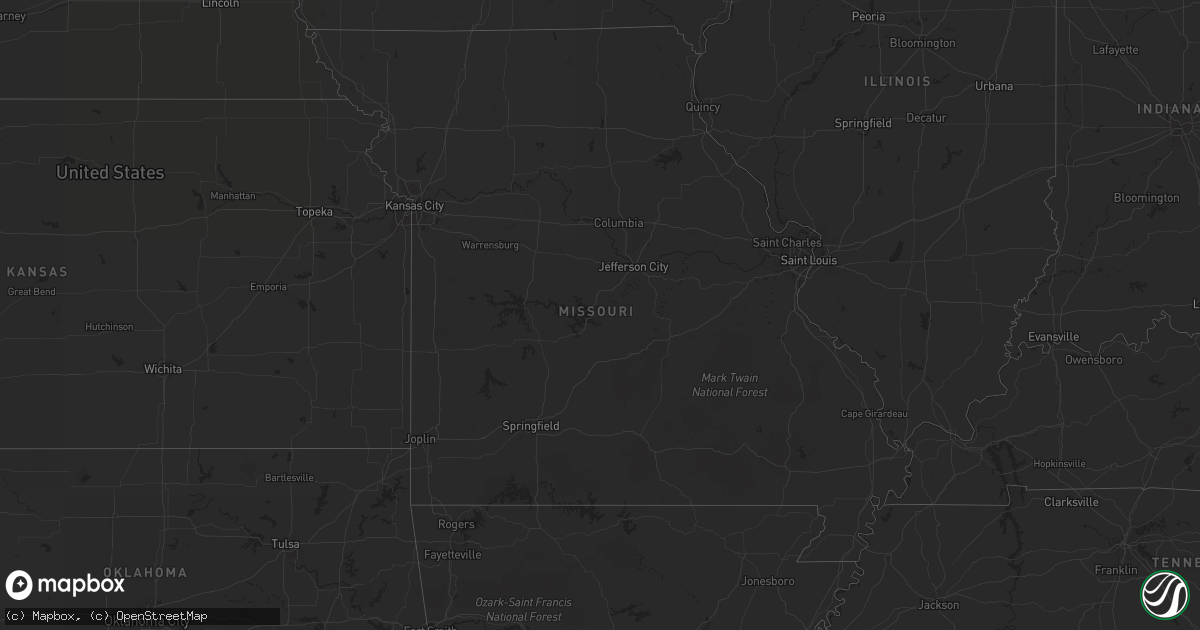
July 3 map
$229
one time, instant access
Download today. No call, no setup
Keep the $229
Bought the map and want the full workflow? Apply the entire $229 to a subscription within 7 days. None of it is wasted.
Every map, not just this one
This buys you this map. Subscription and you get every map we run, in the markets you choose from a few cities to whole states to nationwide. Plus real-time alerts the moment a storm fires.
Contact data
Name, contact info, occupancy, even credit band for addresses in the footprint. You go from where it hit to who to call.
Become the source they trust
Unlimited branding weather history reports on demand. You already have the documented answer ready for the property owner, and you are the one who showed up with it.
Property data and RoofTrace estimates
Pull up any address you have got, its value and the exact code rules for that jurisdiction, straight from One Click Code. Then RoofTrace estimates the squares, pitch, and roof value, priced the way you price.
Storm reports in Virginia
Virginia
| Date | Description |
|---|---|
| 07/03/20126:40 PM CDT | Trees down along withers larue rd |
| 07/03/20126:39 PM CDT | Trrees down along old charles town road |
| 07/03/20126:17 PM CDT | Tree down at cedar grove rd and mountain laurel ln from strong thunderstorm winds. |
| 07/03/20126:04 PM CDT | Tree down along north frederick pike near gainesboro due to strong thunderstorm winds. |
| 07/03/20126:04 PM CDT | Tree down near north frederick pike and ebenezer church road due to strong thunderstorm winds. |
| 07/03/20125:25 PM CDT | A local report indicates 60 MPH wind near 3 WSW KENBRIDGE |
| 07/03/20125:15 PM CDT | Tree down along kings hwy near ontario va. |
| 07/03/20125:10 PM CDT | Tree down |
| 07/03/20125:10 PM CDT | Several trees with powerlines down along mcgehee road...keysville area. |
| 07/03/20125:10 PM CDT | Tree down on 460 |
| 07/03/20125:09 PM CDT | Tree down on poiwer line and caught on fire |
| 07/03/20125:05 PM CDT | Tree down along david bruce avenue. |
| 07/03/20125:05 PM CDT | Power lines down on monroe street |
| 07/03/20124:50 PM CDT | Canopy down on car at uppy gas station |
| 07/03/20124:40 PM CDT | Power lines down on pigeon run road |
| 07/03/20124:30 PM CDT | Several reports of trees and powerlines down. |
| 07/03/20124:24 PM CDT | Tree fell across powerlines...mollies creek road. |
| 07/03/20124:15 PM CDT | Trees and powerlines down along brookneal highway in southern part of county...gladys/brookneal va. |
| 07/03/20124:10 PM CDT | Limbs down on power lines on doewood place |
| 07/03/20123:55 PM CDT | A local report indicates 1.00 inch wind near 3 W BEDFORD CITY |
| 07/03/20123:54 PM CDT | Tree blown down across intersection of brookhill and cifax roads. |
| 07/03/20123:48 PM CDT | A local report indicates 1.50 inch wind near 5 W BEDFORD CITY |
| 07/03/20123:48 PM CDT | Power lines down on crestside drive |
| 07/03/20123:45 PM CDT | Tree blown down. |
| 07/03/20123:30 PM CDT | 2 trees down along wooding road/state rt 689 |
| 07/03/20123:25 PM CDT | Penny to quarter size hail on porter mountain. |
| 07/03/20123:15 PM CDT | Tree down across 2700 fairview church road. |
| 07/03/20123:10 PM CDT | Several trees down at 6340 plank road |
| 07/03/20123:10 PM CDT | Several trees down |
| 07/03/20123:00 PM CDT | Power lines down on church street...third avenue...and hunting hills road |
| 07/03/20122:55 PM CDT | Route 615 and 669 in riner. Mostly pea size hail with some as large as a quarter. |
| 07/03/20122:47 PM CDT | White oak circle and dry fork road |
| 07/03/20122:32 PM CDT | Tree down on egg farm road |
| 07/03/20122:30 PM CDT | Multiple trees down on salem church road |
| 07/03/20122:20 PM CDT | Relayed by nssl shave |
| 07/03/20122:15 PM CDT | Patrick springs post office |
| 07/03/20122:06 PM CDT | Relayed by nssl shave |
| 07/03/20122:05 PM CDT | Trees down on maury river road |
| 07/03/20121:45 PM CDT | Trees down in claudville |
| 07/03/20121:30 PM CDT | Penny to quarter size hail. |
| 07/03/20121:10 PM CDT | One tree down along salt house branch road near the lake |
| 07/02/20127:12 PM CDT | Large limb down along harry byrd hwy |
All States Impacted by Hail Map on July 3, 2012
Cities Impacted by Hail Map on July 3, 2012
- Greensboro, GA
- Milan, GA
- Rhine, GA
- Hatchechubbee, AL
- Hurtsboro, AL
- Williston, ND
- Bisbee, ND
- Agate, ND
- Mylo, ND
- Comer, GA
- Colbert, GA
- Atlanta, GA
- Northville, MI
- Sandersville, GA
- Tennille, GA
- Jackson, AL
- Grove Hill, AL
- Rochester, MI
- Medicine Lake, MT
- Dagmar, MT
- Froid, MT
- Poplar, MT
- Frazer, MT
- Brockton, MT
- Culbertson, MT
- Scobey, MT
- Glasgow, MT
- Whitetail, MT
- Nashua, MT
- Grenora, ND
- Larslan, MT
- Richland, MT
- Wolf Point, MT
- Reserve, MT
- Antelope, MT
- Homestead, MT
- Peerless, MT
- Flaxville, MT
- Chatham, VA
- Dry Fork, VA
- Pelion, SC
- Leesville, SC
- Donaldsonville, LA
- Darrow, LA
- Wellston, OH
- Tallahassee, FL
- Venango, PA
- McKean, PA
- Albion, PA
- Cranesville, PA
- Girard, PA
- Edinboro, PA
- Cambridge Springs, PA
- Winder, GA
- Jefferson, GA
- Statham, GA
- Bartow, GA
- Harrison, GA
- Davisboro, GA
- Wrightsville, GA
- Fremont, OH
- Laurens, SC
- Cape Coral, FL
- Fort Myers, FL
- Lyons, GA
- Lafitte, LA
- Opelika, AL
- Noonan, ND
- Columbus, ND
- Ambrose, ND
- Fortuna, ND
- Crosby, ND
- Alamo, ND
- Portal, ND
- Watkinsville, GA
- Athens, GA
- Bascom, FL
- Dexter, KY
- Benton, KY
- Murray, KY
- Hardin, KY
- Ararat, VA
- Claudville, VA
- Newland, NC
- Perkinston, MS
- Wiggins, MS
- Friendly, WV
- Middlebourne, WV
- New Eagle, PA
- Bunola, PA
- Monongahela, PA
- Finleyville, PA
- Cottonwood, AL
- Hampton, GA
- Locust Grove, GA
- Dallas, GA
- Millersville, MO
- Jackson, MO
- Bakersville, NC
- Collins, GA
- Reidsville, GA
- Tallassee, AL
- Hurricane, WV
- Scott Depot, WV
- Ringgold, VA
- Gulfport, MS
- Saucier, MS
- Belton, SC
- Roanoke, AL
- Mansfield, OH
- Galion, OH
- Mount Gilead, OH
- Painesville, OH
- Saint Albans, WV
- Nitro, WV
- Charleston, WV
- Poca, WV
- Bottineau, ND
- Wadley, GA
- Swainsboro, GA
- Midville, GA
- Westby, MT
- South Lyon, MI
- New Hudson, MI
- Brighton, MI
- Macomb, MI
- New Baltimore, MI
- Vinton, OH
- Bidwell, OH
- Greenville, AL
- Hoffman, NC
- Broxton, GA
- Clarkesville, GA
- Hinsdale, MT
- Fitzgerald, GA
- Hamburg, MI
- Whitmore Lake, MI
- Vida, MT
- Circle, MT
- Chelsea, MI
- Munith, MI
- Gregory, MI
- Grass Lake, MI
- Stockbridge, MI
- Chesterland, OH
- Chardon, OH
- Stuart, VA
- Patrick Springs, VA
- Bassett, VA
- Newborn, GA
- Shady Dale, GA
- Stapleton, AL
- Loxley, AL
- Bay Minette, AL
- Carnegie, PA
- Wytheville, VA
- Guys Mills, PA
- Cochranton, PA
- Covington, GA
- Loganville, GA
- Monroe, GA
- Oxford, GA
- Wooster, OH
- Rockbridge Baths, VA
- Goshen, VA
- Stewart, OH
- Guysville, OH
- Coolville, OH
- Luverne, AL
- Carlton, GA
- Wildrose, ND
- Mcgregor, ND
- Slocomb, AL
- Hartford, AL
- Bonifay, FL
- Clarkston, MI
- Oakland, MI
- Lake Orion, MI
- Oxford, MI
- Grand Blanc, MI
- Metamora, MI
- Leonard, MI
- Washington, MI
- Holly, MI
- Goodrich, MI
- Ortonville, MI
- Wagener, SC
- Elba, AL
- Egeland, ND
- Munich, ND
- Rocklake, ND
- Cando, ND
- Geneva, OH
- Abingdon, VA
- Shady Valley, TN
- Bristol, TN
- Smithville, GA
- Wixom, MI
- Meadville, PA
- Moultrie, GA
- Norman Park, GA
- Warthen, GA
- Webberville, MI
- Little Hocking, OH
- Cullen, VA
- Phenix, VA
- Red House, VA
- Charlotte Court House, VA
- Pamplin, VA
- Smithville, OH
- Fluker, LA
- Sparta, GA
- Columbia, AL
- Taylor, MI
- Romulus, MI
- Maysville, GA
- Pendergrass, GA
- Gillsville, GA
- Burnsville, MN
- Savage, MN
- Palestine, WV
- Arnoldsburg, WV
- Reedy, WV
- Millstone, WV
- Shock, WV
- Rosedale, WV
- Walton, WV
- Orma, WV
- Grantsville, WV
- Ripley, WV
- Creston, WV
- Gay, WV
- Le Roy, WV
- Mount Zion, WV
- Gandeeville, WV
- Big Bend, WV
- Kenna, WV
- Spencer, WV
- Franklin, GA
- Woodland, AL
- Sutherlin, VA
- Ypsilanti, MI
- Ann Arbor, MI
- Thomaston, GA
- Yatesville, GA
- Camp Hill, AL
- Ray, ND
- Epping, ND
- Coolidge, GA
- Thomasville, GA
- Mount Airy, GA
- Columbiaville, MI
- McDavid, FL
- Panama City, FL
- Youngstown, FL
- Clayton, AL
- Louisville, AL
- Hilliard, FL
- Milton, FL
- Flat Rock, MI
- Trenton, MI
- Newport, MI
- Rockwood, MI
- South Rockwood, MI
- Union Springs, AL
- Silverhill, AL
- Moneta, VA
- Vinton, VA
- Blue Ridge, VA
- Bedford, VA
- Thaxton, VA
- Springfield, WV
- Ocala, FL
- Keysville, VA
- Wray, GA
- Ambrose, GA
- West Green, GA
- Plentywood, MT
- Fort Pierce, FL
- Dothan, AL
- Danville, VA
- Keeling, VA
- Burton, MI
- Flint, MI
- Davison, MI
- Lookout, WV
- Rainelle, WV
- Hico, WV
- Danese, WV
- Quinwood, WV
- Nallen, WV
- Fayetteville, WV
- Bush, LA
- Covington, LA
- Bogart, GA
- Clinton, LA
- Norwood, LA
- Eufaula, AL
- Bushnell, NE
- Cave City, AR
- Cleveland, GA
- Cornelia, GA
- Opheim, MT
- Lost Creek, WV
- Apple Creek, OH
- Enoree, SC
- Pittsview, AL
- Mogadore, OH
- Kent, OH
- Glenfield, ND
- Clio, AL
- Gray Court, SC
- Middlebrook, VA
- Craigsville, VA
- Crawfordville, GA
- Binford, ND
- Boston, GA
- Clermont, FL
- Walterboro, SC
- Linville, NC
- Banner Elk, NC
- East Tawas, MI
- New Orleans, LA
- Brookneal, VA
- Gladys, VA
- Blakely, GA
- Jakin, GA
- Lewisburg, WV
- Maxwelton, WV
- Pomeroy, OH
- Coeburn, VA
- Wadley, AL
- Rugby, ND
- Livonia, MI
- Plymouth, MI
- Davisburg, MI
- Fenton, MI
- Saint Marys, WV
- Pennsboro, WV
- Ellenboro, WV
- Gate City, VA
- Church Hill, TN
- Lee, FL
- Madison, FL
- Marengo, OH
- Troy, AL
- Willacoochee, GA
- New Boston, MI
- Swansea, SC
- Gaston, SC
- Griffin, GA
- Martin, SC
- Preston, GA
- Buena Vista, GA
- Milton, WV
- Langsville, OH
- Berlin Center, OH
- Cantonment, FL
- Bloomfield, MT
- Brockway, MT
- Arnoldsville, GA
- Niota, TN
- Sweetwater, TN
- Philadelphia, TN
- Winter Garden, FL
- Butler, GA
- Dry Branch, GA
- Rosemount, MN
- Hannah, ND
- Maida, ND
- Langdon, ND
- Hosford, FL
- Axson, GA
- Nicholls, GA
- Morganton, NC
- Golconda, IL
- Ariton, AL
- Girard, GA
- Allendale, SC
- Brooklyn, MS
- Deland, FL
- Mobile, AL
- Lisbon, OH
- Folsom, LA
- Roberta, GA
- Fort Valley, GA
- Elkview, WV
- Black Mountain, NC
- Lake Lure, NC
- Hendersonville, NC
- Imboden, AR
- Pocahontas, AR
- Hayneville, AL
- Pulaski, IL
- Ullin, IL
- Lapeer, MI
- De Leon Springs, FL
- Orange City, FL
- Atwater, OH
- Guyton, GA
- Fitzpatrick, AL
- Buchanan, VA
- Lexington, VA
- Natural Bridge, VA
- Eagle Rock, VA
- Las Animas, CO
- Sylvester, GA
- Hookstown, PA
- Lodi, OH
- Burbank, OH
- Ellijay, GA
- Kinsey, MT
- Millers Creek, NC
- Long Island, VA
- Milford, MI
- Commerce Township, MI
- Abbeville, GA
- Natural Bridge Station, VA
- Mount Airy, NC
- Moss Point, MS
- Grand Bay, AL
- Macfarlan, WV
- Elizabeth, WV
- Sparks, GA
- Lenox, GA
- Otisville, MI
- Cohagen, MT
- Marathon, TX
- Grafton, OH
- Wellington, OH
- Oberlin, OH
- Lagrange, OH
- Lignite, ND
- Smithland, KY
- Cave In Rock, IL
- Rosiclare, IL
- Hampton, KY
- Elizabethtown, IL
- Marion, KY
- Perry, OH
- Madison, OH
- Critz, VA
- Nashville, GA
- Shade, OH
- Albany, OH
- Rutland, OH
- Goshen, AL
- Grady, AL
- Highland Home, AL
- Woolwine, VA
- Aliquippa, PA
- Lanett, AL
- Middlefield, OH
- Burton, OH
- Wales, ND
- Dunseith, ND
- Flaxton, ND
- Zahl, ND
- Sarles, ND
- Sylvania, GA
- Birmingham, MI
- Bloomfield Hills, MI
- Sterling Heights, MI
- Troy, MI
- Madison Heights, MI
- Warren, MI
- Royal Oak, MI
- Clawson, MI
- Leesburg, GA
- Pembroke, GA
- Ashford, AL
- Mount Carmel, TN
- Surgoinsville, TN
- Belleville, MI
- Telogia, FL
- Scheller, IL
- Hamilton, GA
- West Point, GA
- Valley, AL
- Marion, NC
- Spruce Pine, NC
- Rocky Ford, GA
- Collettsville, NC
- Goode, VA
- Lowry, VA
- Romeo, MI
- Bluefield, WV
- Bluefield, VA
- Millington, MI
- Otter Lake, MI
- Ray, MI
- Amma, WV
- Procious, WV
- Bainbridge, GA
- Butler, TN
- Jasper, GA
- Ruffin, SC
- Dixie, GA
- Youngsville, LA
- Broussard, LA
- Lafayette, LA
- Gordon, AL
- Grosse Ile, MI
- Waynesboro, GA
- Lakeview, MI
- Leeds, ND
- York, ND
- Allardt, TN
- Robbins, TN
- Fort Stewart, GA
- Dodson, LA
- Spencer, OH
- Medina, OH
- Litchfield, OH
- Barboursville, WV
- Chase City, VA
- Skipwith, VA
- Pensacola, FL
- Hettinger, ND
- Reeder, ND
- Ellabell, GA
- Helenwood, TN
- Huntsville, TN
- Athens, OH
- Demorest, GA
- Little River, AL
- Stockton, AL
- Claxton, GA
- Register, GA
- Brantley, AL
- Opp, AL
- Bowman, GA
- Perry, GA
- Dongola, IL
- New Matamoras, OH
- Nicholson, GA
- Rootstown, OH
- Alliance, OH
- Auburn, AL
- Fountain Inn, SC
- Woodruff, SC
- Carleton, MI
- Swartz Creek, MI
- Fort Bragg, NC
- Raeford, NC
- Barnwell, SC
- Novi, MI
- Statesboro, GA
- Oscoda, MI
- Repton, AL
- Tuskegee Institute, AL
- Tuskegee, AL
- Monticello, FL
- Dearborn Heights, MI
- Redford, MI
- Detroit, MI
- Dearborn, MI
- Elberton, GA
- Shiloh, GA
- Gilbert, SC
- Brooklet, GA
- White Cloud, MI
- Brewton, AL
- Utica, MI
- Reynolds, GA
- Talking Rock, GA
- South Charleston, WV
- Dunbar, WV
- Chiefland, FL
- Yulee, FL
- Kingsland, GA
- Blairs, VA
- Pine Bluffs, WY
- Gaffney, SC
- Fort Deposit, AL
- Honoraville, AL
- Letohatchee, AL
- Lapine, AL
- Seale, AL
- Clendenin, WV
- Culloden, WV
- Winfield, WV
- Ona, WV
- Salem, AL
- Hope Hull, AL
- Almont, MI
- Clinton Township, MI
- Atlas, MI
- Waterford, MI
- Keego Harbor, MI
- Auburn Hills, MI
- Pontiac, MI
- Dryden, MI
- Princeton, WV
- Fayetteville, GA
- Mcdonough, GA
- Oneida, TN
- Clyde, OH
- Sopchoppy, FL
- Bristol, FL
- Terry, MT
- Richey, MT
- Bastian, VA
- Willow Spring, NC
- Hugo, MN
- Lambsburg, VA
- Lowgap, NC
- Aberdeen, NC
- Citronelle, AL
- Clio, MI
- Ocilla, GA
- Portal, GA
- Paisley, FL
- Martinsville, VA
- Abbeville, AL
- Chipley, FL
- Atmore, AL
- Pearson, GA
- Wilkesville, OH
- Aguilar, CO
- Bremen, GA
- Carrollton, GA
- Tawas City, MI
- Six Lakes, MI
- Ravenden, AR
- Omega, GA
- Marianna, FL
- Canton, GA
- Starkweather, ND
- Oakfield, GA
- Thompson, OH
- Mentor, OH
- Summersville, WV
- Mount Nebo, WV
- Marston, NC
- Glasgow, VA
- Buena Vista, VA
- Monroe, VA
- Caldwell, WV
- White Sulphur Springs, WV
- Clinton, SC
- Daphne, AL
- Mount Gilead, NC
- Stanwood, MI
- Waterford, PA
- Buckhead, GA
- Willis, MI
- Chunchula, AL
- Warner Robins, GA
- National City, MI
- Draper, VA
- Hiwassee, VA
- Barren Springs, VA
- Kinston, NC
- Fort Peck, MT
- Southington, OH
- Woodbury, GA
- Warm Springs, GA
- Milner, GA
- Barnesville, GA
- Tioga, ND
- Picayune, MS
- Montverde, FL
- McRae Helena, GA
- Chauncey, GA
- Slaughter, LA
- Cuthbert, GA
- Glenwood, AL
- Saluda, SC
- Marble Hill, MO
- Eden, WI
- Campbellsport, WI
- Cascade, WI
- Chester, GA
- Quitman, GA
- Roscommon, MI
- Grifton, NC
- Callands, VA
- Evington, VA
- Alton, VA
- North Royalton, OH
- Broadview Heights, OH
- Mount Morris, MI
- Huddleston, VA
- Lynch Station, VA
- Kenbridge, VA
- Roanoke, VA
- New Iberia, LA
- Rochelle, GA
- Rebecca, GA
- Roan Mountain, TN
- Waleska, GA
- Turner, MI
- Au Gres, MI
- Simpsonville, SC
- Choudrant, LA
- Eros, LA
- Pilot, VA
- Riner, VA
- Fortson, GA
- Pine Mountain Valley, GA
- Cataula, GA
- River Falls, WI
- Reidsville, NC
- Jeffersonville, GA
- Bonaire, GA
- Kathleen, GA
- Defuniak Springs, FL
- Ponce De Leon, FL
- Greenwood, FL
- Malone, FL
- Taylorsville, GA
- Kingston, GA
- Ware Shoals, SC
- Honea Path, SC
- Wolford, ND
- Knox, ND
- Sumner, GA
- Omaha, GA
- Hazlehurst, GA
- Millen, GA
- Bellville, OH
- Eglin Afb, FL
- Phenix City, AL
- Lowell, OH
- Lower Salem, OH
- Macksburg, OH
- Whipple, OH
- Whittemore, MI
- Hale, MI
- Louisville, GA
- Stillwater, MN
- Chatsworth, GA
- Hurt, VA
- Gretna, VA
- Rocky Gap, VA
- Westville, FL
- Fuquay Varina, NC
- Tiffin, OH
- Newport, OH
- Goodview, VA
- Pine Mountain, GA
- Madison, GA
- Saint Helen, MI
- Padroni, CO
- Peetz, CO
- Douglas, GA
- Alamo, GA
- Mountain City, TN
- Vilas, NC
- Frisco City, AL
- West Bloomfield, MI
- Walled Lake, MI
- Farmington, MI
- De Soto, GA
- Meadows Of Dan, VA
- Perth, ND
- Braithwaite, LA
- Junction City, GA
- Spring, TX
- Jackson, OH
- Beaver Falls, PA
- Monaca, PA
- Industry, PA
- Beaver, PA
- Midland, PA
- Liberty, MS
- Headland, AL
- New Brockton, AL
- Kinston, AL
- Dozier, AL
- Diamond, OH
- Twin City, GA
- Plum Branch, SC
- Candor, NC
- Troy, NC
- Ravenswood, WV
- North Branch, MI
- Genesee, MI
- Fostoria, MI
- Vassar, MI
- Mayville, MI
- Brecksville, OH
- Richfield, OH
- Scott, LA
- Rockport, WV
- Windermere, FL
- Normantown, WV
- Commerce, GA
- Danielsville, GA
- Royston, GA
- Midway, AL
- Auburn University, AL
- Vass, NC
- Saint Louis, MI
- Walker, LA
- North Benton, OH
- Deerfield, OH
- Seville, OH
- Creston, OH
- Fort Gaines, GA
- Georgetown, GA
- Keysville, GA
- Matthews, GA
- Tifton, GA
- Enigma, GA
- Henry, VA
- Ceres, VA
- Bland, VA
- Churchville, VA
- Staunton, VA
- Heaters, WV
- Forest, VA
- Vancleave, MS
- Tunnelton, WV
- Thornton, WV
- Newburg, WV
- McHenry, MS
- Glentana, MT
- Robertsdale, AL
- Seminole, AL
- McArthur, OH
- Rudyard, MI
- Hessel, MI
- Pinebluff, NC
- Wagram, NC
- Mansfield, GA
- Cuyahoga Falls, OH
- Winter Park, FL
- Maitland, FL
- Fayetteville, NC
- Fort White, FL
- Pansey, AL
- Outlook, MT
- Washington, WV
- Madisonville, TN
- Vonore, TN
- Manchester, GA
- Lorain, OH
- West Salem, OH
- Elyria, OH
- Homerville, OH
- Orrville, OH
- Westfield Center, OH
- Amherst, OH
- Sterling, OH
- Vienna, IL
- Belknap, IL
- Grantsburg, IL
- Eastlake, OH
- Glenville, WV
- Linn, WV
- Laurel Hill, FL
- Batesburg, SC
- Salley, SC
- Aneta, ND
- Mitchell, GA
- Daviston, AL
- Lynchburg, VA
- Box Springs, GA
- Appomattox, VA
- Patton, MO
- Sedgewickville, MO
- Fairview, NC
- Orlando, FL
- Hot Springs, VA
- Wakeman, OH
- Vermilion, OH
- Greenville, FL
- Jack, AL
- Paducah, KY
- Hanoverton, OH
- Leetonia, OH
- Salem, OH
- Georgiana, AL
- Troutdale, VA
- Mauk, GA
- Cusseta, AL
- Greenwell Springs, LA
- Erath, LA
- Metropolis, IL
- Campbellton, FL
- Alford, FL
- Charleroi, PA
- Dadeville, AL
- Redstone, MT
- Yemassee, SC
- Mayville, WI
- Dexter, MI
- Bainville, MT
- Sunbright, TN
- West Farmington, OH
- Skipperville, AL
- Strongsville, OH
- Stoneville, NC
- Forest Hill, WV
- Hays, NC
- Saint James, LA
- Jacksonville, GA
- Ravenna, OH
- South Branch, MI
- Glennie, MI
- Greenville, VA
- Reno, OH
- Marietta, OH
- Saint Martinville, LA
- Fairhope, AL
- White Lake, MI
- Hartland, MI
- Pinckney, MI
- Highland, MI
- Southfield, MI
- Franklin, MI
- Howell, MI
- Old Fort, NC
- Arlington, CO
- Forsyth, GA
- Rutledge, AL
- Coxs Mills, WV
- Big Springs, WV
- Punta Gorda, FL
- West Union, WV
- Buchanan, GA
- Carencro, LA
- Church Point, LA
- Brundidge, AL
- Warwick, GA
- Poughkeepsie, AR
- Alapaha, GA
- Adel, GA
- Dunnellon, FL
- Morriston, FL
- Hardy, VA
- Bronson, FL
- Attica, MI
- Karnak, IL
- Grand Chain, IL
- Johnsonville, IL
- White Plains, GA
- Shorter, AL
- Rogers, OH
- Negley, OH
- Poplarville, MS
- Franklinton, LA
- Williamsfield, OH
- Fairburn, GA
- Crestview, FL
- Cusseta, GA
- Hadley, MI
- Eastpoint, FL
- Holt, FL
- Fredericktown, MO


