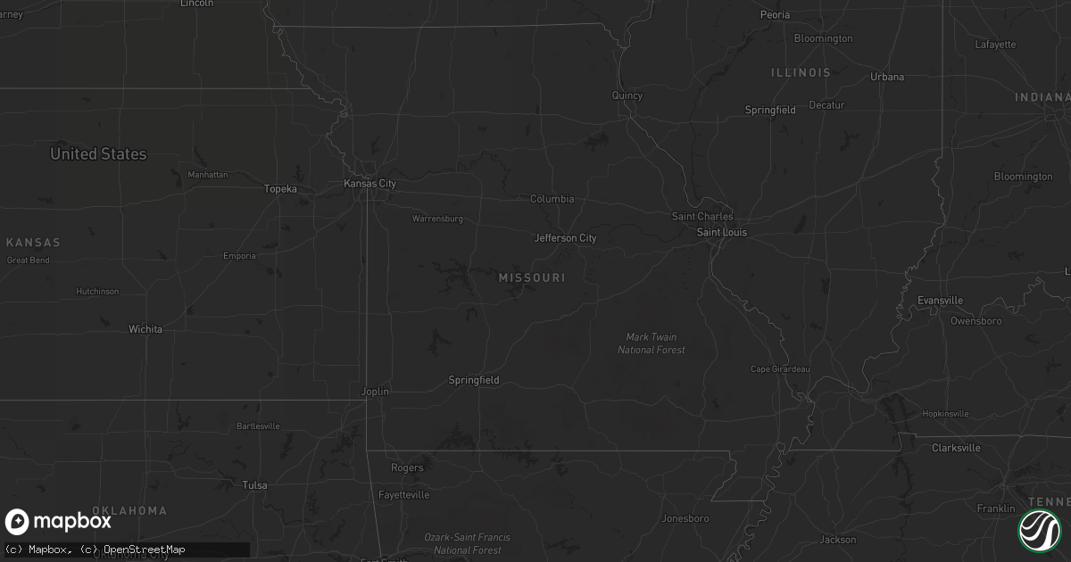
Hail Map in North Dakota on July 3, 2012
Get this storm
July 3 map
$229
one time, instant access
Download today. No call, no setup
Keep the $229
Bought the map and want the full workflow? Apply the entire $229 to a subscription within 7 days. None of it is wasted.
Every map, not just this one
This buys you this map. Subscription and you get every map we run, in the markets you choose from a few cities to whole states to nationwide. Plus real-time alerts the moment a storm fires.
Contact data
Name, contact info, occupancy, even credit band for addresses in the footprint. You go from where it hit to who to call.
Become the source they trust
Unlimited branding weather history reports on demand. You already have the documented answer ready for the property owner, and you are the one who showed up with it.
Property data and RoofTrace estimates
Pull up any address you have got, its value and the exact code rules for that jurisdiction, straight from One Click Code. Then RoofTrace estimates the squares, pitch, and roof value, priced the way you price.
Storm reports in North Dakota
North Dakota
| Date | Description |
|---|---|
| 07/03/20126:05 AM CDT | Crops layed flat in the sarles area. Objects blown over at construction site. Time approximate. |
| 07/03/201212:31 AM CDT | Report from trained spotter at campground just south of international border. Hail ongoing at time of report. |
| 07/03/201212:15 AM CDT | Public report. |
| 07/02/201210:57 PM CDT | Wind gusts up to 50 mph. Leaves were stripped due to wind and hail. |
| 07/02/201210:53 PM CDT | A local report indicates 1.00 inch wind near 3 N GRENORA |
| 07/02/201210:10 PM CDT | Lots of pea sized hail with a few larger stones to 1 inch. |
| 07/02/20128:02 PM CDT | Estimated 70 mph winds. 20ft elm tree knocked down. Power is out. |
| 07/02/20128:02 PM CDT | A 70 foot wall wind break 8 ft high for cattle was flattened... A wooden calf shelter 10x20 ft and 4 feet high was blown into pieces. |
| 07/02/20127:50 PM CDT | Spotter reported that she received a call from a neighbor who reported a tree down on top of a powerline. Occurred approximately 12 miles southwest of grenora at 7...50 |
All States Impacted by Hail Map on July 3, 2012
Cities Impacted by Hail Map on July 3, 2012
- Greensboro, GA
- Milan, GA
- Rhine, GA
- Hatchechubbee, AL
- Hurtsboro, AL
- Williston, ND
- Bisbee, ND
- Agate, ND
- Mylo, ND
- Comer, GA
- Colbert, GA
- Atlanta, GA
- Northville, MI
- Sandersville, GA
- Tennille, GA
- Jackson, AL
- Grove Hill, AL
- Rochester, MI
- Medicine Lake, MT
- Dagmar, MT
- Froid, MT
- Poplar, MT
- Frazer, MT
- Brockton, MT
- Culbertson, MT
- Scobey, MT
- Glasgow, MT
- Whitetail, MT
- Nashua, MT
- Grenora, ND
- Larslan, MT
- Richland, MT
- Wolf Point, MT
- Reserve, MT
- Antelope, MT
- Homestead, MT
- Peerless, MT
- Flaxville, MT
- Chatham, VA
- Dry Fork, VA
- Pelion, SC
- Leesville, SC
- Donaldsonville, LA
- Darrow, LA
- Wellston, OH
- Tallahassee, FL
- Venango, PA
- McKean, PA
- Albion, PA
- Cranesville, PA
- Girard, PA
- Edinboro, PA
- Cambridge Springs, PA
- Winder, GA
- Jefferson, GA
- Statham, GA
- Bartow, GA
- Harrison, GA
- Davisboro, GA
- Wrightsville, GA
- Fremont, OH
- Laurens, SC
- Cape Coral, FL
- Fort Myers, FL
- Lyons, GA
- Lafitte, LA
- Opelika, AL
- Noonan, ND
- Columbus, ND
- Ambrose, ND
- Fortuna, ND
- Crosby, ND
- Alamo, ND
- Portal, ND
- Watkinsville, GA
- Athens, GA
- Bascom, FL
- Dexter, KY
- Benton, KY
- Murray, KY
- Hardin, KY
- Ararat, VA
- Claudville, VA
- Newland, NC
- Perkinston, MS
- Wiggins, MS
- Friendly, WV
- Middlebourne, WV
- New Eagle, PA
- Bunola, PA
- Monongahela, PA
- Finleyville, PA
- Cottonwood, AL
- Hampton, GA
- Locust Grove, GA
- Dallas, GA
- Millersville, MO
- Jackson, MO
- Bakersville, NC
- Collins, GA
- Reidsville, GA
- Tallassee, AL
- Hurricane, WV
- Scott Depot, WV
- Ringgold, VA
- Gulfport, MS
- Saucier, MS
- Belton, SC
- Roanoke, AL
- Mansfield, OH
- Galion, OH
- Mount Gilead, OH
- Painesville, OH
- Saint Albans, WV
- Nitro, WV
- Charleston, WV
- Poca, WV
- Bottineau, ND
- Wadley, GA
- Swainsboro, GA
- Midville, GA
- Westby, MT
- South Lyon, MI
- New Hudson, MI
- Brighton, MI
- Macomb, MI
- New Baltimore, MI
- Vinton, OH
- Bidwell, OH
- Greenville, AL
- Hoffman, NC
- Broxton, GA
- Clarkesville, GA
- Hinsdale, MT
- Fitzgerald, GA
- Hamburg, MI
- Whitmore Lake, MI
- Vida, MT
- Circle, MT
- Chelsea, MI
- Munith, MI
- Gregory, MI
- Grass Lake, MI
- Stockbridge, MI
- Chesterland, OH
- Chardon, OH
- Stuart, VA
- Patrick Springs, VA
- Bassett, VA
- Newborn, GA
- Shady Dale, GA
- Stapleton, AL
- Loxley, AL
- Bay Minette, AL
- Carnegie, PA
- Wytheville, VA
- Guys Mills, PA
- Cochranton, PA
- Covington, GA
- Loganville, GA
- Monroe, GA
- Oxford, GA
- Wooster, OH
- Rockbridge Baths, VA
- Goshen, VA
- Stewart, OH
- Guysville, OH
- Coolville, OH
- Luverne, AL
- Carlton, GA
- Wildrose, ND
- Mcgregor, ND
- Slocomb, AL
- Hartford, AL
- Bonifay, FL
- Clarkston, MI
- Oakland, MI
- Lake Orion, MI
- Oxford, MI
- Grand Blanc, MI
- Metamora, MI
- Leonard, MI
- Washington, MI
- Holly, MI
- Goodrich, MI
- Ortonville, MI
- Wagener, SC
- Elba, AL
- Egeland, ND
- Munich, ND
- Rocklake, ND
- Cando, ND
- Geneva, OH
- Abingdon, VA
- Shady Valley, TN
- Bristol, TN
- Smithville, GA
- Wixom, MI
- Meadville, PA
- Moultrie, GA
- Norman Park, GA
- Warthen, GA
- Webberville, MI
- Little Hocking, OH
- Cullen, VA
- Phenix, VA
- Red House, VA
- Charlotte Court House, VA
- Pamplin, VA
- Smithville, OH
- Fluker, LA
- Sparta, GA
- Columbia, AL
- Taylor, MI
- Romulus, MI
- Maysville, GA
- Pendergrass, GA
- Gillsville, GA
- Burnsville, MN
- Savage, MN
- Palestine, WV
- Arnoldsburg, WV
- Reedy, WV
- Millstone, WV
- Shock, WV
- Rosedale, WV
- Walton, WV
- Orma, WV
- Grantsville, WV
- Ripley, WV
- Creston, WV
- Gay, WV
- Le Roy, WV
- Mount Zion, WV
- Gandeeville, WV
- Big Bend, WV
- Kenna, WV
- Spencer, WV
- Franklin, GA
- Woodland, AL
- Sutherlin, VA
- Ypsilanti, MI
- Ann Arbor, MI
- Thomaston, GA
- Yatesville, GA
- Camp Hill, AL
- Ray, ND
- Epping, ND
- Coolidge, GA
- Thomasville, GA
- Mount Airy, GA
- Columbiaville, MI
- McDavid, FL
- Panama City, FL
- Youngstown, FL
- Clayton, AL
- Louisville, AL
- Hilliard, FL
- Milton, FL
- Flat Rock, MI
- Trenton, MI
- Newport, MI
- Rockwood, MI
- South Rockwood, MI
- Union Springs, AL
- Silverhill, AL
- Moneta, VA
- Vinton, VA
- Blue Ridge, VA
- Bedford, VA
- Thaxton, VA
- Springfield, WV
- Ocala, FL
- Keysville, VA
- Wray, GA
- Ambrose, GA
- West Green, GA
- Plentywood, MT
- Fort Pierce, FL
- Dothan, AL
- Danville, VA
- Keeling, VA
- Burton, MI
- Flint, MI
- Davison, MI
- Lookout, WV
- Rainelle, WV
- Hico, WV
- Danese, WV
- Quinwood, WV
- Nallen, WV
- Fayetteville, WV
- Bush, LA
- Covington, LA
- Bogart, GA
- Clinton, LA
- Norwood, LA
- Eufaula, AL
- Bushnell, NE
- Cave City, AR
- Cleveland, GA
- Cornelia, GA
- Opheim, MT
- Lost Creek, WV
- Apple Creek, OH
- Enoree, SC
- Pittsview, AL
- Mogadore, OH
- Kent, OH
- Glenfield, ND
- Clio, AL
- Gray Court, SC
- Middlebrook, VA
- Craigsville, VA
- Crawfordville, GA
- Binford, ND
- Boston, GA
- Clermont, FL
- Walterboro, SC
- Linville, NC
- Banner Elk, NC
- East Tawas, MI
- New Orleans, LA
- Brookneal, VA
- Gladys, VA
- Blakely, GA
- Jakin, GA
- Lewisburg, WV
- Maxwelton, WV
- Pomeroy, OH
- Coeburn, VA
- Wadley, AL
- Rugby, ND
- Livonia, MI
- Plymouth, MI
- Davisburg, MI
- Fenton, MI
- Saint Marys, WV
- Pennsboro, WV
- Ellenboro, WV
- Gate City, VA
- Church Hill, TN
- Lee, FL
- Madison, FL
- Marengo, OH
- Troy, AL
- Willacoochee, GA
- New Boston, MI
- Swansea, SC
- Gaston, SC
- Griffin, GA
- Martin, SC
- Preston, GA
- Buena Vista, GA
- Milton, WV
- Langsville, OH
- Berlin Center, OH
- Cantonment, FL
- Bloomfield, MT
- Brockway, MT
- Arnoldsville, GA
- Niota, TN
- Sweetwater, TN
- Philadelphia, TN
- Winter Garden, FL
- Butler, GA
- Dry Branch, GA
- Rosemount, MN
- Hannah, ND
- Maida, ND
- Langdon, ND
- Hosford, FL
- Axson, GA
- Nicholls, GA
- Morganton, NC
- Golconda, IL
- Ariton, AL
- Girard, GA
- Allendale, SC
- Brooklyn, MS
- Deland, FL
- Mobile, AL
- Lisbon, OH
- Folsom, LA
- Roberta, GA
- Fort Valley, GA
- Elkview, WV
- Black Mountain, NC
- Lake Lure, NC
- Hendersonville, NC
- Imboden, AR
- Pocahontas, AR
- Hayneville, AL
- Pulaski, IL
- Ullin, IL
- Lapeer, MI
- De Leon Springs, FL
- Orange City, FL
- Atwater, OH
- Guyton, GA
- Fitzpatrick, AL
- Buchanan, VA
- Lexington, VA
- Natural Bridge, VA
- Eagle Rock, VA
- Las Animas, CO
- Sylvester, GA
- Hookstown, PA
- Lodi, OH
- Burbank, OH
- Ellijay, GA
- Kinsey, MT
- Millers Creek, NC
- Long Island, VA
- Milford, MI
- Commerce Township, MI
- Abbeville, GA
- Natural Bridge Station, VA
- Mount Airy, NC
- Moss Point, MS
- Grand Bay, AL
- Macfarlan, WV
- Elizabeth, WV
- Sparks, GA
- Lenox, GA
- Otisville, MI
- Cohagen, MT
- Marathon, TX
- Grafton, OH
- Wellington, OH
- Oberlin, OH
- Lagrange, OH
- Lignite, ND
- Smithland, KY
- Cave In Rock, IL
- Rosiclare, IL
- Hampton, KY
- Elizabethtown, IL
- Marion, KY
- Perry, OH
- Madison, OH
- Critz, VA
- Nashville, GA
- Shade, OH
- Albany, OH
- Rutland, OH
- Goshen, AL
- Grady, AL
- Highland Home, AL
- Woolwine, VA
- Aliquippa, PA
- Lanett, AL
- Middlefield, OH
- Burton, OH
- Wales, ND
- Dunseith, ND
- Flaxton, ND
- Zahl, ND
- Sarles, ND
- Sylvania, GA
- Birmingham, MI
- Bloomfield Hills, MI
- Sterling Heights, MI
- Troy, MI
- Madison Heights, MI
- Warren, MI
- Royal Oak, MI
- Clawson, MI
- Leesburg, GA
- Pembroke, GA
- Ashford, AL
- Mount Carmel, TN
- Surgoinsville, TN
- Belleville, MI
- Telogia, FL
- Scheller, IL
- Hamilton, GA
- West Point, GA
- Valley, AL
- Marion, NC
- Spruce Pine, NC
- Rocky Ford, GA
- Collettsville, NC
- Goode, VA
- Lowry, VA
- Romeo, MI
- Bluefield, WV
- Bluefield, VA
- Millington, MI
- Otter Lake, MI
- Ray, MI
- Amma, WV
- Procious, WV
- Bainbridge, GA
- Butler, TN
- Jasper, GA
- Ruffin, SC
- Dixie, GA
- Youngsville, LA
- Broussard, LA
- Lafayette, LA
- Gordon, AL
- Grosse Ile, MI
- Waynesboro, GA
- Lakeview, MI
- Leeds, ND
- York, ND
- Allardt, TN
- Robbins, TN
- Fort Stewart, GA
- Dodson, LA
- Spencer, OH
- Medina, OH
- Litchfield, OH
- Barboursville, WV
- Chase City, VA
- Skipwith, VA
- Pensacola, FL
- Hettinger, ND
- Reeder, ND
- Ellabell, GA
- Helenwood, TN
- Huntsville, TN
- Athens, OH
- Demorest, GA
- Little River, AL
- Stockton, AL
- Claxton, GA
- Register, GA
- Brantley, AL
- Opp, AL
- Bowman, GA
- Perry, GA
- Dongola, IL
- New Matamoras, OH
- Nicholson, GA
- Rootstown, OH
- Alliance, OH
- Auburn, AL
- Fountain Inn, SC
- Woodruff, SC
- Carleton, MI
- Swartz Creek, MI
- Fort Bragg, NC
- Raeford, NC
- Barnwell, SC
- Novi, MI
- Statesboro, GA
- Oscoda, MI
- Repton, AL
- Tuskegee Institute, AL
- Tuskegee, AL
- Monticello, FL
- Dearborn Heights, MI
- Redford, MI
- Detroit, MI
- Dearborn, MI
- Elberton, GA
- Shiloh, GA
- Gilbert, SC
- Brooklet, GA
- White Cloud, MI
- Brewton, AL
- Utica, MI
- Reynolds, GA
- Talking Rock, GA
- South Charleston, WV
- Dunbar, WV
- Chiefland, FL
- Yulee, FL
- Kingsland, GA
- Blairs, VA
- Pine Bluffs, WY
- Gaffney, SC
- Fort Deposit, AL
- Honoraville, AL
- Letohatchee, AL
- Lapine, AL
- Seale, AL
- Clendenin, WV
- Culloden, WV
- Winfield, WV
- Ona, WV
- Salem, AL
- Hope Hull, AL
- Almont, MI
- Clinton Township, MI
- Atlas, MI
- Waterford, MI
- Keego Harbor, MI
- Auburn Hills, MI
- Pontiac, MI
- Dryden, MI
- Princeton, WV
- Fayetteville, GA
- Mcdonough, GA
- Oneida, TN
- Clyde, OH
- Sopchoppy, FL
- Bristol, FL
- Terry, MT
- Richey, MT
- Bastian, VA
- Willow Spring, NC
- Hugo, MN
- Lambsburg, VA
- Lowgap, NC
- Aberdeen, NC
- Citronelle, AL
- Clio, MI
- Ocilla, GA
- Portal, GA
- Paisley, FL
- Martinsville, VA
- Abbeville, AL
- Chipley, FL
- Atmore, AL
- Pearson, GA
- Wilkesville, OH
- Aguilar, CO
- Bremen, GA
- Carrollton, GA
- Tawas City, MI
- Six Lakes, MI
- Ravenden, AR
- Omega, GA
- Marianna, FL
- Canton, GA
- Starkweather, ND
- Oakfield, GA
- Thompson, OH
- Mentor, OH
- Summersville, WV
- Mount Nebo, WV
- Marston, NC
- Glasgow, VA
- Buena Vista, VA
- Monroe, VA
- Caldwell, WV
- White Sulphur Springs, WV
- Clinton, SC
- Daphne, AL
- Mount Gilead, NC
- Stanwood, MI
- Waterford, PA
- Buckhead, GA
- Willis, MI
- Chunchula, AL
- Warner Robins, GA
- National City, MI
- Draper, VA
- Hiwassee, VA
- Barren Springs, VA
- Kinston, NC
- Fort Peck, MT
- Southington, OH
- Woodbury, GA
- Warm Springs, GA
- Milner, GA
- Barnesville, GA
- Tioga, ND
- Picayune, MS
- Montverde, FL
- McRae Helena, GA
- Chauncey, GA
- Slaughter, LA
- Cuthbert, GA
- Glenwood, AL
- Saluda, SC
- Marble Hill, MO
- Eden, WI
- Campbellsport, WI
- Cascade, WI
- Chester, GA
- Quitman, GA
- Roscommon, MI
- Grifton, NC
- Callands, VA
- Evington, VA
- Alton, VA
- North Royalton, OH
- Broadview Heights, OH
- Mount Morris, MI
- Huddleston, VA
- Lynch Station, VA
- Kenbridge, VA
- Roanoke, VA
- New Iberia, LA
- Rochelle, GA
- Rebecca, GA
- Roan Mountain, TN
- Waleska, GA
- Turner, MI
- Au Gres, MI
- Simpsonville, SC
- Choudrant, LA
- Eros, LA
- Pilot, VA
- Riner, VA
- Fortson, GA
- Pine Mountain Valley, GA
- Cataula, GA
- River Falls, WI
- Reidsville, NC
- Jeffersonville, GA
- Bonaire, GA
- Kathleen, GA
- Defuniak Springs, FL
- Ponce De Leon, FL
- Greenwood, FL
- Malone, FL
- Taylorsville, GA
- Kingston, GA
- Ware Shoals, SC
- Honea Path, SC
- Wolford, ND
- Knox, ND
- Sumner, GA
- Omaha, GA
- Hazlehurst, GA
- Millen, GA
- Bellville, OH
- Eglin Afb, FL
- Phenix City, AL
- Lowell, OH
- Lower Salem, OH
- Macksburg, OH
- Whipple, OH
- Whittemore, MI
- Hale, MI
- Louisville, GA
- Stillwater, MN
- Chatsworth, GA
- Hurt, VA
- Gretna, VA
- Rocky Gap, VA
- Westville, FL
- Fuquay Varina, NC
- Tiffin, OH
- Newport, OH
- Goodview, VA
- Pine Mountain, GA
- Madison, GA
- Saint Helen, MI
- Padroni, CO
- Peetz, CO
- Douglas, GA
- Alamo, GA
- Mountain City, TN
- Vilas, NC
- Frisco City, AL
- West Bloomfield, MI
- Walled Lake, MI
- Farmington, MI
- De Soto, GA
- Meadows Of Dan, VA
- Perth, ND
- Braithwaite, LA
- Junction City, GA
- Spring, TX
- Jackson, OH
- Beaver Falls, PA
- Monaca, PA
- Industry, PA
- Beaver, PA
- Midland, PA
- Liberty, MS
- Headland, AL
- New Brockton, AL
- Kinston, AL
- Dozier, AL
- Diamond, OH
- Twin City, GA
- Plum Branch, SC
- Candor, NC
- Troy, NC
- Ravenswood, WV
- North Branch, MI
- Genesee, MI
- Fostoria, MI
- Vassar, MI
- Mayville, MI
- Brecksville, OH
- Richfield, OH
- Scott, LA
- Rockport, WV
- Windermere, FL
- Normantown, WV
- Commerce, GA
- Danielsville, GA
- Royston, GA
- Midway, AL
- Auburn University, AL
- Vass, NC
- Saint Louis, MI
- Walker, LA
- North Benton, OH
- Deerfield, OH
- Seville, OH
- Creston, OH
- Fort Gaines, GA
- Georgetown, GA
- Keysville, GA
- Matthews, GA
- Tifton, GA
- Enigma, GA
- Henry, VA
- Ceres, VA
- Bland, VA
- Churchville, VA
- Staunton, VA
- Heaters, WV
- Forest, VA
- Vancleave, MS
- Tunnelton, WV
- Thornton, WV
- Newburg, WV
- McHenry, MS
- Glentana, MT
- Robertsdale, AL
- Seminole, AL
- McArthur, OH
- Rudyard, MI
- Hessel, MI
- Pinebluff, NC
- Wagram, NC
- Mansfield, GA
- Cuyahoga Falls, OH
- Winter Park, FL
- Maitland, FL
- Fayetteville, NC
- Fort White, FL
- Pansey, AL
- Outlook, MT
- Washington, WV
- Madisonville, TN
- Vonore, TN
- Manchester, GA
- Lorain, OH
- West Salem, OH
- Elyria, OH
- Homerville, OH
- Orrville, OH
- Westfield Center, OH
- Amherst, OH
- Sterling, OH
- Vienna, IL
- Belknap, IL
- Grantsburg, IL
- Eastlake, OH
- Glenville, WV
- Linn, WV
- Laurel Hill, FL
- Batesburg, SC
- Salley, SC
- Aneta, ND
- Mitchell, GA
- Daviston, AL
- Lynchburg, VA
- Box Springs, GA
- Appomattox, VA
- Patton, MO
- Sedgewickville, MO
- Fairview, NC
- Orlando, FL
- Hot Springs, VA
- Wakeman, OH
- Vermilion, OH
- Greenville, FL
- Jack, AL
- Paducah, KY
- Hanoverton, OH
- Leetonia, OH
- Salem, OH
- Georgiana, AL
- Troutdale, VA
- Mauk, GA
- Cusseta, AL
- Greenwell Springs, LA
- Erath, LA
- Metropolis, IL
- Campbellton, FL
- Alford, FL
- Charleroi, PA
- Dadeville, AL
- Redstone, MT
- Yemassee, SC
- Mayville, WI
- Dexter, MI
- Bainville, MT
- Sunbright, TN
- West Farmington, OH
- Skipperville, AL
- Strongsville, OH
- Stoneville, NC
- Forest Hill, WV
- Hays, NC
- Saint James, LA
- Jacksonville, GA
- Ravenna, OH
- South Branch, MI
- Glennie, MI
- Greenville, VA
- Reno, OH
- Marietta, OH
- Saint Martinville, LA
- Fairhope, AL
- White Lake, MI
- Hartland, MI
- Pinckney, MI
- Highland, MI
- Southfield, MI
- Franklin, MI
- Howell, MI
- Old Fort, NC
- Arlington, CO
- Forsyth, GA
- Rutledge, AL
- Coxs Mills, WV
- Big Springs, WV
- Punta Gorda, FL
- West Union, WV
- Buchanan, GA
- Carencro, LA
- Church Point, LA
- Brundidge, AL
- Warwick, GA
- Poughkeepsie, AR
- Alapaha, GA
- Adel, GA
- Dunnellon, FL
- Morriston, FL
- Hardy, VA
- Bronson, FL
- Attica, MI
- Karnak, IL
- Grand Chain, IL
- Johnsonville, IL
- White Plains, GA
- Shorter, AL
- Rogers, OH
- Negley, OH
- Poplarville, MS
- Franklinton, LA
- Williamsfield, OH
- Fairburn, GA
- Crestview, FL
- Cusseta, GA
- Hadley, MI
- Eastpoint, FL
- Holt, FL
- Fredericktown, MO


