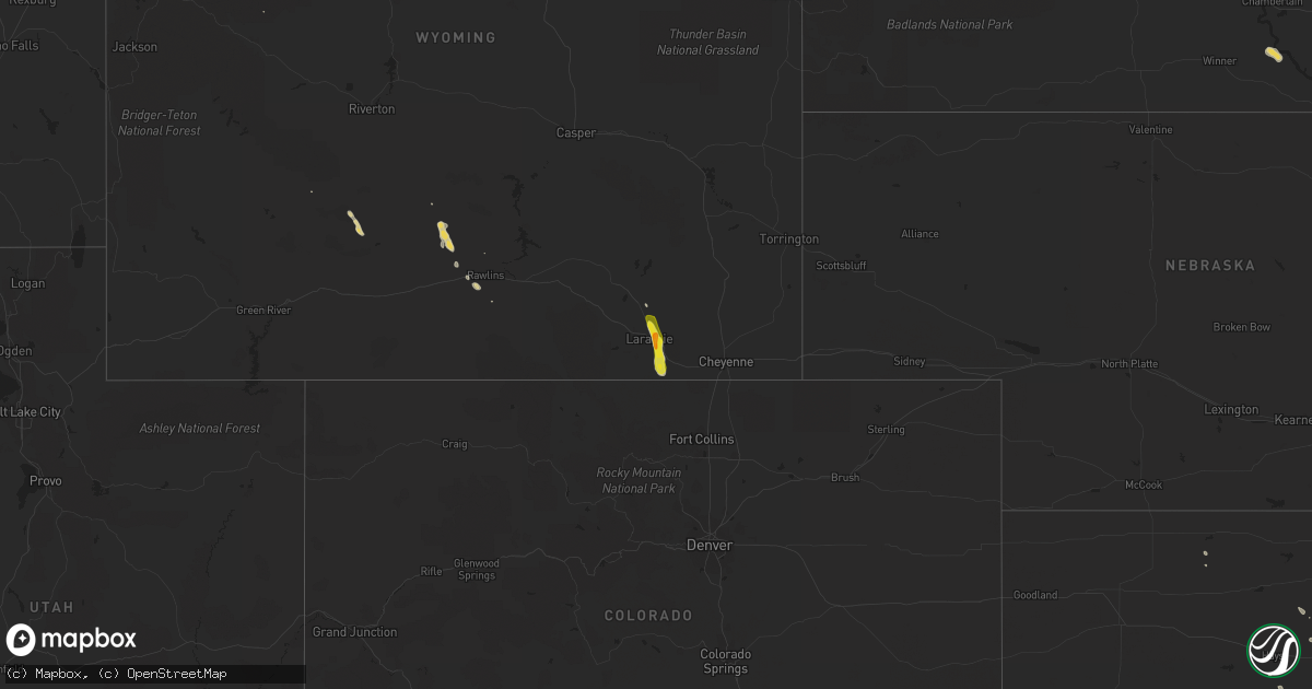
Hail Map on July 2, 2015
Get this storm
July 2 map
$229
one time, instant access
Download today. No call, no setup
Keep the $229
Bought the map and want the full workflow? Apply the entire $229 to a subscription within 7 days. None of it is wasted.
Every map, not just this one
This buys you this map. Subscription and you get every map we run, in the markets you choose from a few cities to whole states to nationwide. Plus real-time alerts the moment a storm fires.
Contact data
Name, contact info, occupancy, even credit band for addresses in the footprint. You go from where it hit to who to call.
Become the source they trust
Unlimited branding weather history reports on demand. You already have the documented answer ready for the property owner, and you are the one who showed up with it.
Property data and RoofTrace estimates
Pull up any address you have got, its value and the exact code rules for that jurisdiction, straight from One Click Code. Then RoofTrace estimates the squares, pitch, and roof value, priced the way you price.
States Impacted by Hail Map on July 2, 2015
Storm reports
Maryland
| Date | Description |
|---|---|
| 07/02/201510:10 AM CDT | Several downed trees just east of intersection of us-13 and north schumaker dr |
| 07/02/201510:05 AM CDT | After collaboration with county emergency management...wet microburst was determined to have downed several trees from marble court to kaywood drive... Including the ti |
Wyoming
| Date | Description |
|---|---|
| 07/02/20155:25 PM CDT | A local report indicates 1.50 inch wind near 3 SE LARAMIE |
| 07/02/20155:24 PM CDT | A local report indicates 1.25 inch wind near 2 ESE LARAMIE |
Mississippi
| Date | Description |
|---|---|
| 07/02/20155:53 AM CDT | Multiple trees down on us highway 51 south of pope. Time is radar estimated. |
South Carolina
| Date | Description |
|---|---|
| 07/02/20156:57 PM CDT | Tree down on orangeburg rd at dorchester rd. |
| 07/02/20156:54 PM CDT | A tree was blown down along dolphin point drive on cat island. Time of event was estimated from radar data. |
| 07/02/20156:54 PM CDT | County warning point reports several trees down on hilton head island. |
| 07/02/20156:54 PM CDT | County warning point reports several trees down on hilton head island. |
| 07/02/20156:46 PM CDT | County warning point reports several trees down on ladys island. |
| 07/02/20156:43 PM CDT | Multiple trees were blown down in the port royal area. Time of event was estimated from radar data. |
| 07/02/20156:40 PM CDT | County warning point reports numerous trees down in and around beaufort. |
| 07/02/20156:35 PM CDT | Several trees were blown down in the burton area. One tree fell on a house. Time of event was estimated from radar data. |
| 07/02/20156:33 PM CDT | A tree was blown down along pinckney colony road. Time of event was estimated from radar data. |
| 07/02/20156:31 PM CDT | Report of tree in roadway on park ave near turbeville hwy. |
| 07/02/20156:25 PM CDT | South carolina highway patrol reported a tree down on jacksonboro road near cottageville. Time of event was estimated from radar data. |
| 07/02/20156:17 PM CDT | Sc state highway patrol reports a tree down in the 9700 block of jacksonboro rd |
| 07/02/20156:06 PM CDT | Sc state hwy patrol reports a tree down on interstate 95 nb at mile marker 46 |
| 07/02/20156:00 PM CDT | Sc state hwy patrol reports tree down in 4800 block of peirce rd |
| 07/02/20155:58 PM CDT | South carolina highway patrol reported a tree down on forks road near the sineath road intersection. Time of event was estimated from radar data. |
| 07/02/20155:55 PM CDT | Sc state highway patrol reports a tree down in the 6700 block of rehoboth rd |
| 07/02/20155:50 PM CDT | Tree down at the intersection of seven acres rd and cypress grove ln |
| 07/02/20155:37 PM CDT | Sc state hwy patrol reports a tree down on us rt 601 just north of crocketville |
| 07/02/20155:34 PM CDT | Sc state hwy patrol reports tree down on hope well rd near the intersection with grass hill rd |
| 07/02/20155:28 PM CDT | A tree was blown down onto power lines and a power pole was snapped at the intersection of reed street and south parler avenue. |
| 07/02/20155:01 PM CDT | Sc highway patrol reported trees down near re davis elementary school. Time estimated from radar. |
| 07/02/20154:58 PM CDT | Report of powerlines down in roadway near at intersection of e old marion hwy and weatherford ln. Time estimated by radar. |
| 07/02/20154:53 PM CDT | Sc highway patrol reported trees in the roadway on plowden mill road and radical road in sumter. Time estimated from radar. |
| 07/02/20154:46 PM CDT | Report of tree in roadway near intersection of gilchrist rd and wire rd. Time estimated by radar. |
| 07/02/20154:38 PM CDT | A tree was reported down near the intersection of pocket road and charleston road. The time was estimated based on radar data. |
| 07/02/20154:36 PM CDT | Report of tree down on e mciver rd near wellman rd. Time estimated by radar. |
| 07/02/20154:24 PM CDT | Trained spotter reported via social media trees down in the town of north and a measured wind gust of 52 mph. |
| 07/02/20154:24 PM CDT | Reported several trees down along gardenia road. |
| 07/02/20154:21 PM CDT | Report of tree in roadway at intersection of pocket rd and oxford rd. Time estimated by radar. |
| 07/02/20154:21 PM CDT | A tree was reported down in the 600 block of gilchrist road. The time was estimated based on radar data. |
| 07/02/20154:17 PM CDT | Report of tree down on n main st near citi trends. Time estimated by radar. |
| 07/02/20153:57 PM CDT | Sc highway patrol reported trees down in north augusta near the 5th street bridge. |
| 07/02/20153:55 PM CDT | Wagt reported a tree on a house along radiance drive in n. Augusta. |
| 07/02/20153:52 PM CDT | Richland county mesonet reported a wind gust of 70 mph atop williams brice stadium. |
| 07/02/20153:47 PM CDT | Public reported through twitter that a tree fell on a house in the olympia neighborhood of columbia. |
| 07/02/20153:45 PM CDT | Sc highway patrol reported trees down near the intersection of gardners terrace road and highway 321. |
| 07/02/20153:29 PM CDT | Sheriff dispatch reported trees down along white oak church road. |
| 07/02/20153:28 PM CDT | Highway department reported trees down along whaley pond road near gooseberry court. |
| 07/02/20153:25 PM CDT | Sc highway patrol reported trees down along old graniteville road and along i 20 near vaucluse. Time estimated from radar. |
| 07/02/20153:25 PM CDT | Sheriff dispatch reported trees down along old river road. |
| 07/02/20153:21 PM CDT | Sheriff dispatch reported trees down along 9th street in winnsboro mills. |
| 07/02/20153:20 PM CDT | Trees down near the town of kershaw. |
| 07/02/20153:20 PM CDT | Public reported large branches down near dutch fork high school via social media. |
| 07/02/20153:05 PM CDT | Sheriff dispatch reported trees down along garrett road. |
| 07/02/20153:04 PM CDT | Trees down along highway 121/72 |
| 07/02/20153:00 PM CDT | Sc highway patrol reported trees down near the intersection of mt pleasant rd and ringer road. |
| 07/02/20152:48 PM CDT | Highway patrol reported trees down near the intersection of highway 176 and route 121. |
| 07/02/20152:44 PM CDT | Highway patrol reported trees down along jalapa road between i-26 and highway 76. |
| 07/02/20152:40 PM CDT | Highway patrol reported trees down along i-26 near mile marker 63. |
| 07/02/20152:40 PM CDT | Trees down on hwy 26 just south of clinton |
| 07/02/20152:40 PM CDT | Tree down on hwy 56 s and hwy 560 |
| 07/02/20152:40 PM CDT | Tree down on hwy 56 s and milton rd |
| 07/02/20152:35 PM CDT | 30 ft tall oak tree down on presbyterian college campus |
| 07/02/20152:15 PM CDT | Power lines down off pond view dr. Time estimated from radar |
| 07/02/20152:15 PM CDT | Tree down near eastside baptist church. Time estimated from radar |
| 07/02/20151:45 PM CDT | Tree down off hwy 25 |
| 07/02/20151:45 PM CDT | Tree down on fairview rd at hwy 418 in simpsonville |
| 07/02/20151:45 PM CDT | Tree and powerlines down off vinewood st in piedmont |
| 07/02/20151:40 PM CDT | Tree down in piedmont near bonanza cir |
| 07/02/20151:40 PM CDT | Trees down at e calhoun st and old colony rd |
| 07/02/20151:00 PM CDT | Trees down on poplar springs rd near seneca post office |
| 07/02/201512:35 PM CDT | Trees down on battlecreek rd and damascus church rd |
| 07/01/20157:28 PM CDT | Large bradford pear tree broken in half by wind on rosemead rd |
| 07/01/20157:28 PM CDT | Tree down on lucas st by shem creek |
Arkansas
| Date | Description |
|---|---|
| 07/02/20155:01 PM CDT | Tree down |
| 07/01/20157:30 PM CDT | Strong thunderstorm wind damaged homes...destroyed a barn...and blew down trees onto homes. Time estimated based on radar. |
Kentucky
| Date | Description |
|---|---|
| 07/02/20154:10 PM CDT | Trees reported down. |
Missouri
| Date | Description |
|---|---|
| 07/02/20156:01 PM CDT | Video on social media showing quarter size hail falling in seligman |
| 07/02/20155:45 PM CDT | Reports of trees blown down between washburn and seligman along highway 37. |
| 07/02/20155:29 PM CDT | Several large trees and power lines blown down. The city of washburn has no power. |
| 07/02/20155:25 PM CDT | Several large tree limbs and branches blown down. |
Alabama
| Date | Description |
|---|---|
| 07/02/201512:57 PM CDT | A couple trees reported down in ashford. |
| 07/02/201512:57 PM CDT | A couple trees down in cottonwood. |
| 07/02/201512:57 PM CDT | Quarter sized hail reported in hollywood. Relayed via social media. |
| 07/02/201512:25 PM CDT | Tree down on church street. |
| 07/02/201512:07 PM CDT | Several trees down between samson and coffee springs. Pea size hail also reported. |
| 07/02/201512:00 PM CDT | Tree down on cr-19. |
| 07/02/201511:51 AM CDT | A large tree branch 18 inches in diameter was reported blown off of a tree. |
| 07/02/201511:49 AM CDT | A tree was reported down over cr 278. |
| 07/02/201511:49 AM CDT | Several trees were reported down along cr 277. Time estimated from radar. |
| 07/02/201511:49 AM CDT | Red light damaged by winds at the intersection of highway 72 east and cr 85. |
| 07/02/201511:49 AM CDT | Trees were reported down along cr 96. Time estimated from radar. |
| 07/02/201511:47 AM CDT | A tree was blown down at the intersection of 2nd street and tennessee avenue. |
| 07/02/201511:44 AM CDT | Large tree uprooted near widows creek. Report relayed via social media. |
Georgia
| Date | Description |
|---|---|
| 07/02/20156:45 PM CDT | A local report indicates 58 MPH wind near 1 SSW TYBEE ISLAND |
| 07/02/20156:00 PM CDT | Liberty county emergency manager reports many trees blown down in and around riceboro extending to the long county border. Trees brought down many power lines resulting |
| 07/02/20155:47 PM CDT | Tree down near the intersection of hwy 119 and hwy 80 north of ellabell. |
| 07/02/20155:45 PM CDT | Numerous large tree limbs...as large as 6 to 8 inches...down around the town of ludowici |
| 07/02/20155:25 PM CDT | Numerous large pine trees and limbs down near the east georgia regional medical center |
| 07/02/20155:13 PM CDT | Tree down across cyril p burkhalter road |
| 07/02/20155:00 PM CDT | Numerous trees down along statesboro highway near sylvania |
| 07/02/20154:57 PM CDT | Tree down on victory dr |
| 07/02/20154:57 PM CDT | Tree down on buttermilk rd just outside sylvania |
| 07/02/20154:56 PM CDT | Reports of trees and power lines down across southeast appling county near the intersection of georgia highway 15 as far as georgia 203. |
| 07/02/20154:56 PM CDT | Powerlines down caused a small fire along hwy 32 near the pierce county border. |
| 07/02/20154:55 PM CDT | Two trees were blown down along highway 129 near the hillview road intersection. Time of event was estimated from radar data. |
| 07/02/20154:52 PM CDT | Thunderstorm winds blew down power lines. |
| 07/02/20154:50 PM CDT | Powerlines blown down along red oak road. |
| 07/02/20154:46 PM CDT | Numerous trees and powerlines down in the city of alma. |
| 07/02/20154:44 PM CDT | Tree down on kemp st |
| 07/02/20154:40 PM CDT | Public reported tree down via social media. Time estimated by radar. |
| 07/02/20154:37 PM CDT | Burke county dispatch reported downed powerlines in the town of sardis. |
| 07/02/20154:37 PM CDT | Spotter saw strong straight line winds estimated at 60 mph. |
| 07/02/20154:32 PM CDT | Numerous large tree limbs...10 inches or more in diameter...blow onto powerlines on harvey street |
| 07/02/20154:24 PM CDT | Trees and powerlines reported down throughout the county including southeast sections along highway 16. |
| 07/02/20154:18 PM CDT | Tree down on spring street. |
| 07/02/20154:18 PM CDT | A tree was blown down along higway 84. |
| 07/02/20154:14 PM CDT | A tree was blown down along west plant avenue in homerville. |
| 07/02/20153:59 PM CDT | Tree down on hwy 122 near the clinch/lanier border. |
| 07/02/20153:55 PM CDT | Trees down along highway 441 north of pearson. Time of event based on radar imagery. |
| 07/02/20153:49 PM CDT | Multiple trees and powerlines down in the northern part of the county. |
| 07/02/20153:49 PM CDT | Numerous trees down across the county. |
| 07/02/20153:49 PM CDT | Tree down at lax hwy and lilac rd. |
| 07/02/20153:44 PM CDT | Trees down on east railroad street in wadley. Time estimated from radar. |
| 07/02/20153:37 PM CDT | Couple trees down across northern lowndes county. |
| 07/02/20153:36 PM CDT | Trees down along clarks mill road in louisville. Time estimated from radar. |
| 07/02/20153:36 PM CDT | 911 center reports numerous trees and powerlines down across northern houston county in the warner robins area. |
| 07/02/20153:36 PM CDT | Multiple trees and powerlines down across the county. |
| 07/02/20153:33 PM CDT | Reported several trees down along walton way. Structure damaged along walton way near the 3400 block. |
| 07/02/20153:22 PM CDT | Numerous trees down countywide. |
| 07/02/20153:18 PM CDT | Wagt reported blanchard road near paxton way impassable due to trees and powerlines down. |
| 07/02/20153:15 PM CDT | Columbia county dispatch reported trees down along halali farm road. Time estimated from radar. |
| 07/02/20153:13 PM CDT | Numerous trees down across the county including on some homes. |
| 07/02/20153:12 PM CDT | Several trees down across northern brooks county near highway 133. |
| 07/02/20153:10 PM CDT | Around a dozen pecan trees down near the town of rochelle. Time estimated from radar. |
| 07/02/20153:08 PM CDT | Large tree down over coffee road...east of hwy 87. Time estimated from radar. |
| 07/02/20153:08 PM CDT | Approx. Half dozen trees down along hull road...near old hull road. Traffic light also out. Reported by ema. Time estimated from radar. |
| 07/02/20153:00 PM CDT | Multiple trees and powerlines down across the county. |
| 07/02/20152:48 PM CDT | Powerlines down on big oad road. |
| 07/02/20152:24 PM CDT | Tree down on highway 3 heading towards meigs |
| 07/02/20152:24 PM CDT | Tree down along hwy 3 north of lee white rd. |
| 07/02/20152:20 PM CDT | Tree and power line down on harney street in camilla |
| 07/02/20152:19 PM CDT | 2 trees down along hwy 93. |
| 07/02/20152:15 PM CDT | Large tree down on back 9 road |
| 07/02/20151:58 PM CDT | Tree down. |
| 07/02/20151:50 PM CDT | Tree down on hwy 253. |
| 07/02/20151:48 PM CDT | A local report indicates 1.00 inch wind near CALHOUN |
| 07/02/20151:25 PM CDT | Fort benning asos |
| 07/02/20151:25 PM CDT | A few trees down in the city of blakely. |
| 07/02/20151:10 PM CDT | Tree limbs and power lines down and wooden sign broken in carnesville |
| 07/02/201512:21 PM CDT | One tree down along childress hollow road |
| 07/02/201512:08 PM CDT | Multiple trees down in sand mountain...trenton and lookout mountain |
Florida
| Date | Description |
|---|---|
| 07/02/20154:15 PM CDT | Nws miami-south florida relayed a quarter sized hail report from a collier county deputy near bonita beach blvd and us41/tamiami trail. |
| 07/02/20154:12 PM CDT | Public report received via social media of a tree downed off of foxhaven lane. Time estimated by radar. |
| 07/02/20152:54 PM CDT | A local report indicates 70 MPH wind near ORLANDO INTERNATIONAL A |
| 07/02/20151:42 PM CDT | Tree down on woods creek road. |
| 07/02/20151:14 PM CDT | Twitter post of large tree down on cochran drive |
| 07/02/201512:45 PM CDT | Broadcast media relayed social media reports of downed trees and tree limbs in wesley chapel. Time estimated from radar. |
| 07/02/201511:56 AM CDT | Tree down near sr-12 and lake mystic road. |
| 07/02/201511:55 AM CDT | Power lines down at 108 ne 9th st |
Kansas
| Date | Description |
|---|---|
| 07/02/20155:14 PM CDT | A local report indicates 1.00 inch wind near 6 S ST. GEORGE |
| 07/02/20155:00 PM CDT | A local report indicates 1.00 inch wind near 10 NW ENGLEWOOD |
Colorado
| Date | Description |
|---|---|
| 07/02/20153:35 PM CDT | A local report indicates 1.50 inch wind near 1 SW HOWARD |
North Carolina
| Date | Description |
|---|---|
| 07/02/20156:01 PM CDT | Power lines reported down in selma... Time estimated by radar |
South Dakota
| Date | Description |
|---|---|
| 07/02/20157:00 AM CDT | Several large trees down in shelterbelt and damage to a calf shelter. Winds estimated over 70 mph. |
Oklahoma
| Date | Description |
|---|---|
| 07/02/20156:43 PM CDT | Numerous tree limbs down. 11th and garnett area. |
| 07/02/20156:41 PM CDT | Several large tree limbs down. |
| 07/02/20156:24 PM CDT | Tree limbs blown down and a dead tree blown over near the clear lake area. |
| 07/02/20156:00 PM CDT | Several high line power poles downed on north-south road 153 a few miles south of highway 412. |
| 07/02/20156:00 PM CDT | Several high line power poles downed on north-south road 153 a few miles south of highway 412. |
| 07/02/20156:00 PM CDT | South of midway church...trees of 8 to 12 inch diamter were downed and a power pole was broken. |
| 07/02/20155:55 PM CDT | Additional gust of 67 mph at 600 pm. Via ok mesonet. |
| 07/02/20155:33 PM CDT | Tree limbs blown down and a dead tree blown over near the clear lake area. |
| 07/02/20155:05 PM CDT | 2-4 in. Tree limbs down on hwy 108. |
Texas
| Date | Description |
|---|---|
| 07/02/20152:35 PM CDT | Power lines and poles reported down along county road 133 off highway 44. |
| 07/01/201510:05 PM CDT | Sherriff office reported portion of roof blown off mobile home at chester and hazel...numerous powerlines and lines down and two large trees uprooted. Trees were blocki |
Tennessee
| Date | Description |
|---|---|
| 07/02/20156:49 PM CDT | Several trees were blown down around the intersection of quarry loop road and quarry road. Minor damage to an outbuilding. |
| 07/02/20156:45 PM CDT | Several trees blown down and minor damage to house on bass lane. Possible tornado. |
| 07/02/20156:44 PM CDT | Ef0 tornado touched down along bass lane with several trees blown down and minor damage to a house. Other trees were blown down on quarry loop road at quarry road and a |
| 07/02/20155:30 PM CDT | Shingles blown from a house and two trees blown down at 4600 block of brownleaf drive. |
| 07/02/20155:22 PM CDT | Ef0 tornado touched down briefly in the langford farms subdivision of green hill and moved northeast across peach orchard drive...kensington drive...brownleaf drive...a |
| 07/02/20155:19 PM CDT | Trees down and minor roof damage in brandywine farms and brandywine pointe subdivisions. Damage appears to be tornadic. Event time estimated using radar. |
| 07/02/20155:15 PM CDT | Ef0 tornado touched down briefly in the brandywine farms subdivision along rolling mill road then moved east before lifting along shannon place in the brandywine point |
| 07/01/20157:37 PM CDT | Power lines down on peyton road just east of lebanon. Small shed blown into roadway. Possible tornado damage. |
| 07/01/20157:36 PM CDT | Trees and powerlines down near bluebird road and old bluebird road. Tree on car. Possible tornado damage. |
| 07/01/20157:36 PM CDT | Ef0 tornado touched down on sparta pike at peyton road then moved across the wilson county fairgrounds before lifting along bluebird road. An outbuilding was destroyed |
| 07/01/20157:35 PM CDT | Roof damage along south cumberland st |
| 07/01/20157:35 PM CDT | Trees down and tin rolled up on roof of portable medical unit at fairgrounds. Possible tornado damage. |
| 07/01/20157:28 PM CDT | Planks from fence at speedway gas station... On highway 231 just south of i-40... Blown into parking lot and onto hartmann drive. Tree limbs also blown down along hartm |
| 07/01/20157:25 PM CDT | Trees down. Possible tornado damage. |
| 07/01/20157:20 PM CDT | Ef0 tornado touched down along old shannon road and moved east across highway 231. A fence and other objects were blown down at a speedway gas station on highway 231 at |
Cities Impacted by Hail Map on July 2, 2015
- Mancos, CO
- Turpin, OK
- Geneva, NE
- Shickley, NE
- Sutton, NE
- Manhattan, KS
- Fowler, KS
- Meade, KS
- Frankford, DE
- Selbyville, DE
- Cimarron, NM
- Perry, OK
- Jemez Springs, NM
- Ravenden, AR
- Mountain Rest, SC
- Walhalla, SC
- Westminster, SC
- Grants, NM
- Nakina, NC
- Cochran, GA
- Hawkinsville, GA
- Sapello, NM
- Loris, SC
- Garden City, KS
- Coweta, OK
- Porter, OK
- Broken Arrow, OK
- Wagoner, OK
- Tulsa, OK
- Hollywood, AL
- Scottsboro, AL
- Willcox, AZ
- La Crosse, KS
- Bison, KS
- Rockledge, FL
- Merritt Island, FL
- Melbourne, FL
- Cocoa, FL
- Chester, OK
- Silver City, NM
- Glendale, UT
- Russell, KS
- Waldo, KS
- Paradise, KS
- Davenport, NE
- Cleveland, NM
- Bellemont, AZ
- Nicholson, GA
- Colbert, GA
- Athens, GA
- Hull, GA
- Stevenson, AL
- York, NE
- Bradshaw, NE
- Polk, NE
- Henderson, NE
- Billings, OK
- Siloam Springs, AR
- Lithia, FL
- Roswell, NM
- Venus, FL
- Perryton, TX
- Howard, CO
- Greenway, AR
- Piggott, AR
- Rector, AR
- Burke, SD
- Reading, KS
- Luther, OK
- Edmond, OK
- Laurel Hill, FL
- Laramie, WY
- Sardis, GA
- Aynor, SC
- Conway, SC
- Galivants Ferry, SC
- Tijeras, NM
- Guthrie, OK
- Englewood, KS
- Plains, KS
- Hulbert, OK
- Dozier, AL
- Brantley, AL
- Eastman, GA
- Metter, GA
- Register, GA
- Owasso, OK
- Douglas, AZ
- Forgan, OK
- Maramec, OK
- Cleveland, OK
- Harriet, AR
- Marshall, AR
- Keysville, GA
- Waynesboro, GA
- Louisville, GA
- Cuba, KS
- Belleville, KS
- Agenda, KS
- Gate, OK
- Supai, AZ
- Beaver, OK
- Mcville, ND
- Pekin, ND
- Calhoun, GA
- Dora, MO
- Brixey, MO
- Flippin, AR
- Mountain Home, AR
- Henryetta, OK
- Okmulgee, OK
- Saint Marys, GA
- Kings Bay, GA
- Kingsland, GA
- Yulee, FL
- Aurora, KS
- East Dublin, GA
- Pittsview, AL
- Panhandle, TX
- Jay, OK
- Booker, TX
- Canadian, TX
- Virginia Beach, VA
- Laurens, SC
- Watts, OK
- Colcord, OK
- Dolores, CO
- Fort Myers, FL
- Lehigh Acres, FL
- Portal, GA
- Clinton, KY
- Claremore, OK
- Buena Vista, NM
- Pitts, GA
- Cordele, GA
- Miami, TX
- Orderville, UT
- Elida, NM
- Portales, NM
- Pep, NM
- Paragould, AR
- Natoma, KS
- Rawlins, WY
- Abilene, KS
- Estancia, NM
- Ripley, OK
- Perkins, OK
- Stillwater, OK
- Shattuck, OK
- Fort Gibson, OK
- Claude, TX
- Reynolds, GA
- North Fort Myers, FL
- Punta Gorda, FL
- Sugar Valley, GA
- Pie Town, NM
- Cassville, MO
- Exeter, MO
- Seligman, MO
- Washburn, MO
- Clay Center, KS
- Laverne, OK
- Forest River, ND
- Follett, TX
- Miltonvale, KS
- Minneapolis, KS
- Fairview, OK
- Weleetka, OK
- Chesapeake, VA
- Abbeville, GA
- Hebron, NE
- Deshler, NE
- Hope, KS
- Muskogee, OK
- Huntsville, AR
- Berryville, AR
- Walnut Ridge, AR
- Bono, AR
- Adrian, GA
- Swainsboro, GA
- Mutual, OK
- Eureka Springs, AR
- Medina, TN
- Humboldt, TN
- Pelham, GA
- New Concord, KY
- Cotopaxi, CO
- Durango, CO
- Purdy, MO
- Butterfield, MO
- Buford, WY
- Tie Siding, WY
- Valrico, FL
- Bradleyville, MO
- Cross, SC
- Wellington, TX
- Shamrock, TX
- Danielsville, GA
- Everton, AR
- Western Grove, AR
- Arcadia, FL
- Belton, SC
- Torreon, NM
- Labelle, FL
- Moore Haven, FL
- Great Bend, KS
- Scandia, KS
- Tompkinsville, KY
- Mount Hermon, KY
- Alicia, AR
- Crestview, FL
- Hephzibah, GA
- Blythe, GA
- Lincolnton, GA
- Lake City, FL
- Lake Placid, FL
- Cuba, NM
- Baker, FL
- Pierceville, KS
- Kathleen, GA
- Bonaire, GA
- Fort Valley, GA
- Perry, GA
- Warner Robins, GA
- Quail, TX
- Mooreland, OK
- Brookland, AR
- Lake City, AR
- Littlefield, AZ
- Oklahoma City, OK
- Arcadia, OK
- Fackler, AL
- Westcliffe, CO
- Trenton, AL
- Woodville, AL
- Monette, AR
- Leachville, AR
- Bluewater, NM
- Jennings, OK
- Towaoc, CO
- Waterloo, SC
- Smithville, AR
- Lynn, AR
- Hampton, NE
- Hordville, NE
- Solomon, KS
- Rochelle, GA
- Hugoton, KS
- Tuckerman, AR
- Newport, AR
- Lakemont, GA
- Munden, KS
- Sylvester, GA
- Strawberry, AR
- Dublin, GA
- Cashion, OK
- Balko, OK
- Kingstree, SC
- Commerce, GA
- Estero, FL
- Brockwell, AR
- Pineville, AR
- Calico Rock, AR
- Salida, CO
- Bristow, OK
- Clarendon, TX
- Loxahatchee, FL
- Jones, OK
- Higdon, AL
- Flat Rock, AL
- Ocate, NM
- Yellville, AR
- Sandia Park, NM
- Ridgeville, SC
- Jonesboro, AR
- Alma, KS
- Hemingway, SC
- Berlin, MD
- Ocean City, MD
- Reeds Spring, MO
- Admire, KS
- Clifton, AZ
- Morenci, AZ
- Pawnee Rock, KS
- Mchenry, ND
- Soperton, GA
- Tarrytown, GA
- Naples, FL
- Datil, NM
- Bayfield, CO
- Willacoochee, GA
- Wray, GA
- Long Creek, SC
- Fargo, OK
- Lenora, KS
- Sperry, OK
- Rush Center, KS
- Wrightsville, GA
- Bonita Springs, FL
- Nekoma, KS
- Arnoldsville, GA
- Crawford, GA
- Blanding, UT
- Hays, KS
- Davisboro, GA
- Hoisington, KS
- Smithfield, NC
- Selma, NC
- Defuniak Springs, FL
- Longford, KS
- Hardy, AR
- Williford, AR
- Appling, GA
- Anderson, SC
- Claxton, GA
- Collins, GA
- Cobbtown, GA
- Hawthorne, FL
- Locust Grove, OK
- Peggs, OK
- Jewell, KS
- Black Rock, AR
- Larned, KS
- Center, CO
- Saguache, CO