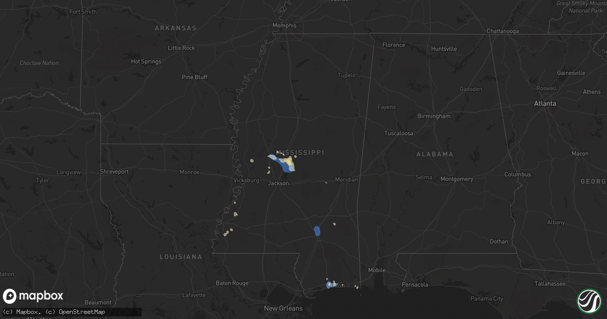
Hail Map in Mississippi on July 1, 2025
Get this storm
July 1 map
$229
one time, instant access
Download today. No call, no setup
Keep the $229
Bought the map and want the full workflow? Apply the entire $229 to a subscription within 7 days. None of it is wasted.
Every map, not just this one
This buys you this map. Subscription and you get every map we run, in the markets you choose from a few cities to whole states to nationwide. Plus real-time alerts the moment a storm fires.
Contact data
Name, contact info, occupancy, even credit band for addresses in the footprint. You go from where it hit to who to call.
Become the source they trust
Unlimited branding weather history reports on demand. You already have the documented answer ready for the property owner, and you are the one who showed up with it.
Property data and RoofTrace estimates
Pull up any address you have got, its value and the exact code rules for that jurisdiction, straight from One Click Code. Then RoofTrace estimates the squares, pitch, and roof value, priced the way you price.
Storm reports in Mississippi
Mississippi
| Date | Description |
|---|---|
| 07/01/20255:43 PM CDT | A utility line was downed off hwy 49 north of magee. |
| 07/01/20255:30 PM CDT | A large oak tree was downed on 15th street near 33rd avenue in gulfport. |
| 07/01/20255:25 PM CDT | A utility line was downed along ms hwy 27. |
| 07/01/20255:09 PM CDT | A few trees down in town... Oak st... Confederate ave. |
| 07/01/20255:00 PM CDT | A large tree fell across the roadway in the 1200 block of greenfield circle. |
| 07/01/20254:59 PM CDT | Public reported a tree down on west pine street. |
| 07/01/20254:59 PM CDT | Public reported power lines down on washington avenue near bayou view. |
| 07/01/20254:59 PM CDT | Asos station kgpt gulfport-biloxi intl airport. |
| 07/01/20254:56 PM CDT | Asos station kgpt gulfport-biloxi intl airport. |
| 07/01/20254:40 PM CDT | Large tree branch down near popps ferry road. |
| 07/01/20254:40 PM CDT | A large pine tree was blown down onto a power line north of the intersection of robinson springs road and pocahontas road. |
| 07/01/20254:40 PM CDT | Lines down and power out. |
| 07/01/20254:20 PM CDT | A utility wire was downed off rice rd. |
| 07/01/20254:15 PM CDT | A tree was blown down onto a power line at the intersection of n railroad street and green acres drive. |
| 07/01/20254:00 PM CDT | Several trees down ne of canton. |
| 07/01/20253:49 PM CDT | Lines down and a large area out of power n of canton. |
| 07/01/20253:34 PM CDT | Kpib measured 60 mph wind gust. |
All States Impacted by Hail Map on July 1, 2025
Cities Impacted by Hail Map on July 1, 2025
- Colora, MD
- Rising Sun, MD
- Jenkintown, PA
- Glenside, PA
- Abington, PA
- Fonda, NY
- Johnstown, NY
- Fort Plain, NY
- Saint Johnsville, NY
- Salem, VA
- Fultonville, NY
- Newton, MS
- Laurel, MS
- Philadelphia, PA
- Bensalem, PA
- Sparrows Point, MD
- Etowah, TN
- Hanover, MD
- Severn, MD
- Fort George G Meade, MD
- Millersville, MD
- Glen Burnie, MD
- Peach Bottom, PA
- Conowingo, MD
- Pasadena, MD
- Curtis Bay, MD
- Fort Howard, MD
- Port Republic, VA
- Grottoes, VA
- Mount Crawford, VA
- Weyers Cave, VA
- Mount Sidney, VA
- Fort Defiance, VA
- Crimora, VA
- Dundalk, MD
- Severna Park, MD
- Pascagoula, MS
- Moss Point, MS
- Oak Grove, LA
- McGaheysville, VA
- Harrisonburg, VA
- Penn Laird, VA
- Worton, MD
- Chestertown, MD
- Reading, PA
- Temple, PA
- Birdsboro, PA
- Essex, MD
- Benton, MS
- Vaughan, MS
- Yazoo City, MS
- Camden, MS
- Greensboro, AL
- Moundville, AL
- Oley, PA
- Douglassville, PA
- Boyertown, PA
- Fleetwood, PA
- Mertztown, PA
- Alburtis, PA
- Still Pond, MD
- Kennedyville, MD
- Betterton, MD
- Bechtelsville, PA
- Gilbertsville, PA
- Topton, PA
- Barto, PA
- Macungie, PA
- Bally, PA
- Marion, AL
- Brent, AL
- Bentonia, MS
- Rolling Fork, MS
- Centreville, AL
- Canton, MS
- Blandon, PA
- Demopolis, AL
- Jackson, NJ
- Ocean Springs, MS
- Earleville, MD
- Moselle, MS
- Hattiesburg, MS
- Seminary, MS
- Petal, MS
- Hereford, PA
- Zionsville, PA
- East Greenville, PA
- Palm, PA
- Emmaus, PA
- Pickens, MS
- Stevensville, MD
- Lakewood, NJ
- Warwick, MD
- Chesapeake City, MD
- Brandon, MS
- Brick, NJ
- Rapid City, SD
- Madison, MS
- Flora, MS
- Biloxi, MS
- Bolton, MS
- Jackson, MS
- Lena, MS
- Saucier, MS
- Gulfport, MS
- Selma, AL
- Weogufka, AL
- Goodwater, AL
- Pine Apple, AL
- Diberville, MS
- Locust Grove, GA
- Kellyton, AL
- Elkton, VA
- Keystone, SD
- Montgomery, AL
- Sylacauga, AL
- Rockford, AL
- Moorcroft, WY
- Capitol, MT
- Jenkinsburg, GA
- Hermosa, SD
- Glen Allen, VA
- Ashland, VA
- Mechanicsville, VA
- Hanover, VA
- Alzada, MT
- Rozet, WY
- Devils Tower, WY
- Grantville, GA
- Ruther Glen, VA
- Aylett, VA
- Doswell, VA
- Manquin, VA
- Kadoka, SD
- Prattville, AL
- Interior, SD
- Fairburn, SD
- Franklin, GA
- Junction City, CA
- Buffalo Gap, SD
- Oral, SD
- Colonial Beach, VA
- Repton, AL
- Monroeville, AL
- Tuckerton, NJ
- Beach Haven, NJ
- Manhattan, MT
- Belgrade, MT
- Bozeman, MT
- Belvidere, SD
- Evergreen, AL
- Lodgepole, NE
- Pine Ridge, SD
- Prescott, AZ
- Issue, MD
- Weaverville, CA
- Buchanan, VA
- Hot Springs, SD
- Murdo, SD
- White River, SD
- Kyle, SD
- Douglas City, CA
- Chino Valley, AZ
- Gaffney, SC
- Livingston, MT
- Gallatin Gateway, MT
- Port Republic, MD
- Saint Leonard, MD
- Lexington Park, MD
- Wanblee, SD
- Okaton, SD
- Oelrichs, SD
- Smithwick, SD
- Marion, LA
- Amelia Court House, VA
- Jetersville, VA
- Porcupine, SD
- Fayette, MS
- Norris, SD
- Lorman, MS
- Alliance, NE
- Buffalo, SD
- Port Gibson, MS
- Chadron, NE
- Batesland, SD
- Allen, SD
- Martin, SD
- Wounded Knee, SD
- Ellsworth, NE
- Belle Fourche, SD
- Rushville, NE
- Hay Springs, NE
- Gordon, NE
- Merriman, NE
- Parmelee, SD
- Roxie, MS
- Natchez, MS
- Winner, SD
- Witten, SD
- Colome, SD
- Ideal, SD
- Klamath Falls, OR
- Oshkosh, NE
- Long Valley, SD
- Tuthill, SD
- Mission, SD
- Wood, SD
- Midland, OR
- Saint Francis, SD
- Rosebud, SD
- Forks Of Salmon, CA
- Cody, NE
- Whitman, NE
- Woodville, MS
- Crosby, MS
- Gazelle, CA
- Yreka, CA
- Burwell, NE
- Redding, CA
- Lewiston, CA
- Valentine, NE
- Mullen, NE
- Naper, NE
- Bassett, NE
- Amelia, NE
- Stuart, NE
- Eureka, SD
- Hosmer, SD
- Bowdle, SD
- Leola, SD
- Ericson, NE
- Greeley, NE
- Spalding, NE
- Grand Island, NE
- Saint Libory, NE
- Frankfort, SD
- Chapman, NE
- Phillips, NE
- Inman, NE
- Page, NE
- Oneill, NE
- Emmet, NE
- Atkinson, NE
- Ewing, NE


