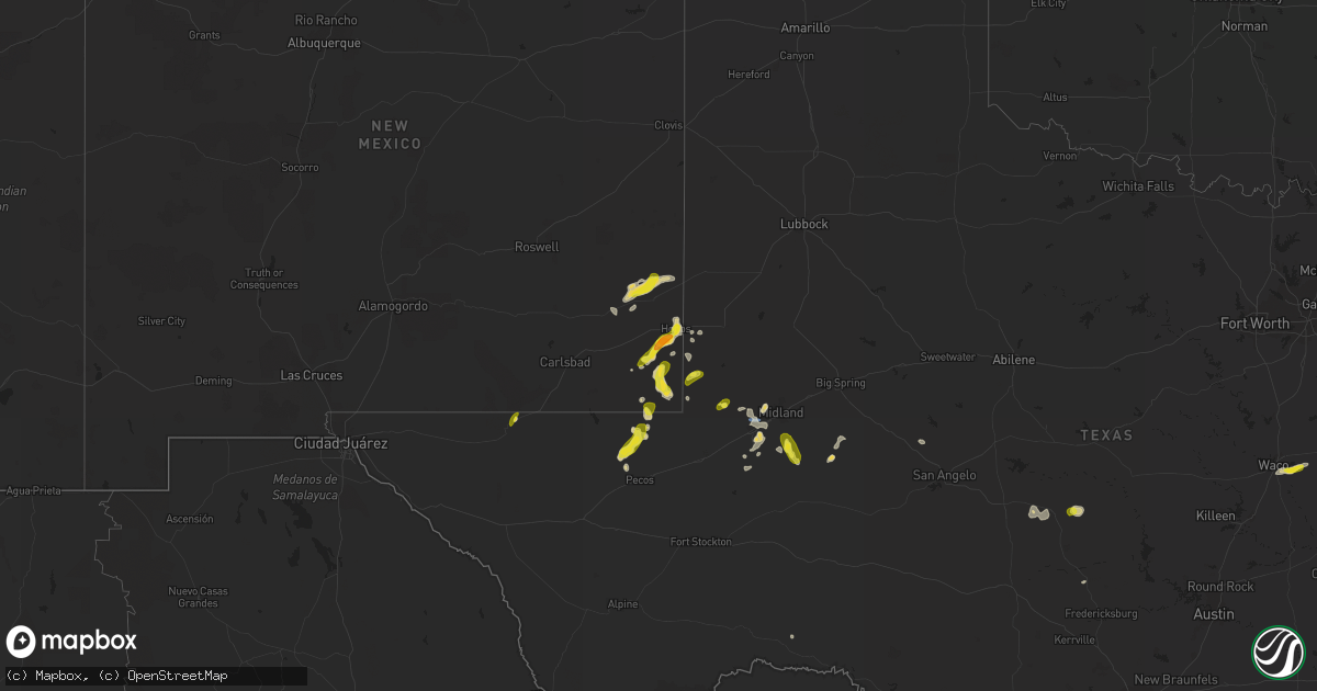
Hail Map on July 1, 2023
Get this storm
July 1 map
$229
one time, instant access
Download today. No call, no setup
Keep the $229
Bought the map and want the full workflow? Apply the entire $229 to a subscription within 7 days. None of it is wasted.
Every map, not just this one
This buys you this map. Subscription and you get every map we run, in the markets you choose from a few cities to whole states to nationwide. Plus real-time alerts the moment a storm fires.
Contact data
Name, contact info, occupancy, even credit band for addresses in the footprint. You go from where it hit to who to call.
Become the source they trust
Unlimited branding weather history reports on demand. You already have the documented answer ready for the property owner, and you are the one who showed up with it.
Property data and RoofTrace estimates
Pull up any address you have got, its value and the exact code rules for that jurisdiction, straight from One Click Code. Then RoofTrace estimates the squares, pitch, and roof value, priced the way you price.
States Impacted by Hail Map on July 1, 2023
Storm reports
Wyoming
| Date | Description |
|---|---|
| 06/30/20239:15 PM CDT | Corrects previous tstm wnd dmg report from pinedale. Reports of trees down by local law enforcement at boyd skinner park. Time estimated based on wind report from nearb |
| 06/30/20237:05 PM CDT | Reports of trees down between alta and grand targhee resort. Time estimated on radar. |
Nevada
| Date | Description |
|---|---|
| 06/30/202311:27 PM CDT | Mesonet station pann2 pancake raws station elevation: 5165 ft. |
Maryland
| Date | Description |
|---|---|
| 07/01/20235:34 PM CDT | Wires... Branches... And trees down on mt victoria road. |
| 07/01/20233:33 PM CDT | A couple trees and branches blew down off of cross road trail near north keys park. |
Tennessee
| Date | Description |
|---|---|
| 07/01/20234:55 PM CDT | Hail fell near windy city road and ashport road. |
| 07/01/20233:40 PM CDT | Trees and powerlines down county-wide. |
| 07/01/20233:30 PM CDT | *** 1 inj *** family swimming at pine tree park when tree fell into the water and landed on family. 1 seriously injured and transported to hospital. |
| 07/01/20233:15 PM CDT | Trees and powerlines down across the county. |
| 07/01/20233:10 PM CDT | Corrects previous tstm wnd dmg report from doyle. Photos received via twitter of large tree fallen near home along mcminnville highway. Report stated the tree pulled th |
| 07/01/20233:09 PM CDT | Several power outages reported over southern parts of the county. Time estimated on radar. |
| 07/01/20232:56 PM CDT | Corrects previous tstm wnd dmg report from 3 ene algood. Trees and power lines down along benson road. Time estimated on radar. |
| 07/01/20232:56 PM CDT | Trees and power lines down. Time estimated on radar. |
| 07/01/20232:56 PM CDT | 2...002 customers without power due to downed trees and power lines. Time estimated on radar. |
| 07/01/20232:53 PM CDT | Photos received via twitter of large tree fallen near home. Report stated the tree pulled the electric service from the home... Causing a fire. Time estimated on radar. |
| 07/01/20232:50 PM CDT | Multiple trees down across the county. |
| 07/01/20232:46 PM CDT | Tress and power lines down. Time estimated on radar. |
| 07/01/20232:46 PM CDT | Trees and power lines down. Time estimated on radar. |
| 07/01/20232:41 PM CDT | Trees and power lines down. Time estimated on radar. |
| 07/01/20232:06 PM CDT | Numerous trees reported down in the nw portion of the county. Time estimated by radar. |
| 07/01/20231:53 PM CDT | Asos station kbna nashville intl airport. |
| 07/01/20231:52 PM CDT | Multiple trees down in downtown lynchburg. Kenyard hill road... Boonville hwy... Campion acres road... And main street north. Some trees down on houses. Some commercial |
| 07/01/20231:50 PM CDT | Report via twitter of a tree down. Time estimated on radar. |
| 07/01/20231:50 PM CDT | Photo received via twitter of tree snapped in half. Time estimated on radar. |
| 07/01/20231:50 PM CDT | Corrects previous tstm wnd dmg report from 1 ese portland. Report via twitter of a tree down near deasy lane. Time estimated on radar. |
| 07/01/20231:46 PM CDT | Corrects previous tstm wnd dmg report from 1 w loretto. Large tree and powerline down blocking highway 43. |
| 07/01/20231:46 PM CDT | Large tree and powerline down blocking highway. |
| 07/01/20231:45 PM CDT | Photo received via twitter of large tree down near home. Time estimated on radar. |
| 07/01/20231:45 PM CDT | Large limb down. |
| 07/01/20231:45 PM CDT | Police department reports numerous trees and power lines down countywide. Time estimated on radar. |
| 07/01/20231:45 PM CDT | Corrects previous tstm wnd dmg report from 2 s inglewood. Large limb down near franklin avenue and scott avenue. |
| 07/01/20231:43 PM CDT | Unoccupied aircraft overturned. |
| 07/01/20231:40 PM CDT | Corrects previous tstm wnd dmg report from 4 nnw walterhill. Two trees down along roadway. Time estimated on radar. |
| 07/01/20231:40 PM CDT | Corrects previous tstm wnd dmg report from 4 nnw walterhill. Two trees down near dinky lane and mona road. Time estimated on radar. |
| 07/01/20231:34 PM CDT | Corrects previous tstm wnd dmg report from 2 nne smyrna. Photo received via twitter of tree down on a power line near weakley lane. Estimated time on radar. |
| 07/01/20231:34 PM CDT | Large tree and power lines down. Photo received via twitter. Time estimated on radar. |
| 07/01/20231:34 PM CDT | Corrects previous tstm wnd dmg report from 2 wsw la vergne. Large tree and power lines down near brookridge drive. Photo received via twitter. Time estimated on radar. |
| 07/01/20231:34 PM CDT | Photo received via twitter of tree down on a power line. Estimated time on radar. |
| 07/01/20231:34 PM CDT | Corrects previous tstm wnd dmg report from 1 nne green hill. Large tree blocking needmore road. Time estimated on radar. |
| 07/01/20231:34 PM CDT | Large tree blocking the road. Time estimated on radar. |
| 07/01/20231:30 PM CDT | Corrects previous tstm wnd dmg report from 2 sw lebanon. Tree and multiple branches down near tuckers gap road and crowell lane. |
| 07/01/20231:30 PM CDT | Tree and multiple branches down. |
| 07/01/20231:29 PM CDT | Photo received via twitter. Large tree uprooted. Time estimated on radar. |
| 07/01/20231:29 PM CDT | Corrects previous tstm wnd dmg report from 2 sse hendersonville. Photo received via twitter. Large tree uprooted near glenn hill drive and lake terrace drive. Time esti |
| 07/01/20231:27 PM CDT | Photo received via twitter of large limbs and sidings of a house scattered throughout neighborhood. |
| 07/01/20231:27 PM CDT | Corrects previous tstm wnd dmg report from 2 nnw lakewood. Photo received via twitter of large limbs and sidings of a house scattered throughout neighborhood near 10th |
| 07/01/20231:27 PM CDT | Photo received via twitter of tree down blocking driveway. Time estimated on radar. |
| 07/01/20231:24 PM CDT | Corrects previous tstm wnd dmg report from 1 sse inglewood. Photo received via twitter of tree fallen on house along porter avenue. Time estimated on radar. |
| 07/01/20231:24 PM CDT | Corrects previous tstm wnd dmg report from 1 sse berry hill. Photo received via twitter of tree snapped in half along thompson lane. Time estimated on radar. |
| 07/01/20231:24 PM CDT | Photo received via twitter of tree snapped in half. Time estimated on radar. |
| 07/01/20231:24 PM CDT | Numerous trees down along county farm road. Time estimated on radar. |
| 07/01/20231:24 PM CDT | Photo received via twitter of tree fallen on house. Time estimated on radar. |
| 07/01/20231:21 PM CDT | Corrects previous tstm wnd dmg report from 1 nnw oak hill. Report via twitter of branches down and power out near battery lane and lealand lane. Time estimated on radar |
| 07/01/20231:21 PM CDT | Report via twitter of branches down and power out. Time estimated on radar. |
| 07/01/20231:21 PM CDT | Photo received via twitter of tree down along roadway. Time estimated on radar. |
| 07/01/20231:21 PM CDT | Photo received via twitter of large limbs down blocking the roadway. Report also states that some telephone lines are down as well. Time estimated on radar. |
| 07/01/20231:21 PM CDT | Report via twitter stating a tree is down on power lines and the roadway is blocked. Time estimated on radar. |
| 07/01/20231:21 PM CDT | Corrects previous tstm wnd dmg report from 3 sw hermitage. Photo received via twitter of large limbs and tree down near old lebanon pike and benson road. Time estimated |
| 07/01/20231:21 PM CDT | Corrects previous tstm wnd dmg report from 2 ssw nashville. Tree fallen on house near grand avenue and 18th avenue s. |
| 07/01/20231:21 PM CDT | Photo received via twitter of large tree down near home. Estimated time on radar. |
| 07/01/20231:21 PM CDT | Photo received via twitter of large limbs and tree down. Time estimated on radar. |
| 07/01/20231:21 PM CDT | Tree fallen on house. |
| 07/01/20231:21 PM CDT | Corrects previous tstm wnd dmg report from 2 sw inglewood. Photo received via twitter of tree down along ellington parkway. Time estimated on radar. |
| 07/01/20231:21 PM CDT | Corrects previous tstm wnd dmg report from 1 n inglewood. Report via twitter stating a tree is down on power lines and the roadway is blocked along saunders avenue. Tim |
| 07/01/20231:21 PM CDT | Corrects previous tstm wnd dmg report from 1 se nashville. Photo received via twitter of large limbs down blocking 2nd avenue. Report also states that some telephone li |
| 07/01/20231:21 PM CDT | Corrects previous tstm wnd dmg report from 3 ssw antioch. Photo received via twitter of large tree down near home along upper mill drive. Estimated time on radar. |
| 07/01/20231:19 PM CDT | Corrects previous tstm wnd dmg report from 3 sw nashville. Large limb down near 37th ave and sentinel drive. Time estimated on radar. |
| 07/01/20231:19 PM CDT | Corrects previous tstm wnd dmg report from 1 e berry hill. Photo received via twitter of fallen tree on fence along peachtree street. Time estimated on radar. |
| 07/01/20231:19 PM CDT | Corrects previous tstm wnd dmg report from 2 w berry hill. Tree down at hillsboro pike and golf club lane. Time estimated on radar. |
| 07/01/20231:19 PM CDT | Photo received via twitter of fallen tree on fence. Time estimated on radar. |
| 07/01/20231:19 PM CDT | Tree down at intersection. Time estimated on radar. |
| 07/01/20231:19 PM CDT | Trees down across neighborhood. Time estimated on radar. |
| 07/01/20231:19 PM CDT | Structure fire caused by lightning. Time estimated on radar. |
| 07/01/20231:19 PM CDT | Large limb down. Time estimated on radar. |
| 07/01/20231:16 PM CDT | Photo received via twitter of tree down. Time estimated on radar. |
| 07/01/20231:16 PM CDT | Large tree down blocking the entire road. Time estimated on radar. |
| 07/01/20231:16 PM CDT | Corrects previous tstm wnd dmg report from 2 e brentwood. Photo received via twitter of tree down along chesapeake drive. Time estimated on radar. |
| 07/01/20231:16 PM CDT | Corrects previous tstm wnd dmg report from 2 nw nolensville. Photo received via twitter of tree down in driveway along oldham drive near nolensville road. Time estimate |
| 07/01/20231:16 PM CDT | Corrects previous tstm wnd dmg report from 3 wsw greenbrier. Large tree down blocking edgar dillard road. Time estimated on radar. |
| 07/01/20231:16 PM CDT | Photo received via twitter of tree down in driveway. Time estimated on radar. |
| 07/01/20231:16 PM CDT | Photo received via twitter of patio furniture blown over. |
| 07/01/20231:16 PM CDT | Corrects previous tstm wnd dmg report from 5 wnw belle meade. Trees down near old charlotte pike. Time estimated on radar. |
| 07/01/20231:16 PM CDT | Trees down. Time estimated on radar. |
| 07/01/20231:14 PM CDT | Corrects previous tstm wnd dmg report from 3 sw antioch. Photo received via twitter of tree down along gauphin place. Time estimated on radar. |
| 07/01/20231:14 PM CDT | Corrects previous tstm wnd dmg report from 2 e oak hill. Photo via twitter. Treetop down on house near bramblewood drive and trousdale drive. Time estimated on radar. |
| 07/01/20231:14 PM CDT | Tree down at intersection. Time estimated on radar. |
| 07/01/20231:14 PM CDT | Corrects previous tstm wnd dmg report from 2 w berry hill. Tree down at intersection at hillsboro pike and woodmont boulevard. Time estimated on radar. |
| 07/01/20231:14 PM CDT | Corrects previous tstm wnd dmg report from 4 w nashville. Large tree down near centennial boulevard and pennsylvania avenue. Time estimated on radar. |
| 07/01/20231:14 PM CDT | Photo received via twitter of tree down. Time estimated on radar. |
| 07/01/20231:14 PM CDT | Photo via twitter. Treetop down on house. Time estimated on radar. |
| 07/01/20231:14 PM CDT | Photo received via twitter of patio furniture blown over. Time estimated on radar. |
| 07/01/20231:11 PM CDT | Corrects previous tstm wnd dmg report from 5 ssw forest hills. Large limb down near harpeth hills drive and hillsboro road. Time estimated on radar. |
| 07/01/20231:11 PM CDT | Corrects previous tstm wnd dmg report from 6 w belle meade. Photo received via twitter. Limbs and trees down along charlotte pike. Time estimated on radar. |
| 07/01/20231:11 PM CDT | Corrects previous tstm wnd dmg report from 2 w belle meade. Video received via twitter of a large tree falling on a power line near jocelyn hollow road. Time estimated |
| 07/01/20231:11 PM CDT | 1...700 customers without power and numerous tress down across the county. Time estimated on radar. |
| 07/01/20231:11 PM CDT | Corrects previous tstm wnd dmg report from 3 sw belle meade. Large tree down near highway 100 and harpeth trace drive. Time estimated on radar. |
| 07/01/20231:11 PM CDT | Corrects previous tstm wnd dmg report from 2 ene belle meade. Photo received of multiple trees down on a power line near green hills village. Time estimated on radar. |
| 07/01/20231:11 PM CDT | Photo received of multiple trees down on a power line. Time estimated on radar. |
| 07/01/20231:11 PM CDT | Video received via twitter of a large tree falling on a power line. Time estimated on radar. |
| 07/01/20231:11 PM CDT | Corrects previous tstm wnd dmg report from 1 nnw forest hills. Trees down across neighborhood near hillsboro road and castlewood ct. Time estimated on radar. |
| 07/01/20231:11 PM CDT | Trees down across neighborhood. Time estimated on radar. |
| 07/01/20231:11 PM CDT | Corrects previous tstm wnd dmg report from 1 sse franklin. Large tree down near murfreesboro road and southwinds drive. Time estimated on radar. |
| 07/01/20231:10 PM CDT | Corrects previous tstm wnd dmg report from 5 ssw forest hills. Photos received via twitter of a tree down partially on a house near hillsboro road and general j b hood |
| 07/01/20231:09 PM CDT | Large tree down. Time estimated on radar. |
| 07/01/20231:08 PM CDT | Photo received via twitter. Limbs and trees down. Time estimated on radar. |
| 07/01/20231:08 PM CDT | Large tree down. Time estimated on radar. |
| 07/01/20231:06 PM CDT | Large tree down. Time estimated on radar. |
| 07/01/20231:03 PM CDT | Photos received via twitter of a tree down partially on a house. Time estimated on radar. |
| 07/01/202312:58 PM CDT | Power outages across the county with trees down. Time estimated on radar. |
| 07/01/202312:56 PM CDT | Power outages being reported via facebook. Time estimated on radar. |
| 07/01/202312:56 PM CDT | Large limb down. Time estimated on radar. |
| 07/01/202312:37 PM CDT | Numerous trees and powerlines down countywide. Time estimated on radar. |
| 07/01/202312:37 PM CDT | Numerous trees and powerlines down across the county. Time estimated on radar. |
| 07/01/202312:35 PM CDT | Numerous trees down county wide. |
| 07/01/202312:10 PM CDT | Several trees and power poles down near natchez trace drive and alberton road. Time is radar estimated. |
| 07/01/202312:05 PM CDT | Power poles down near natchez trace parkway. Time is radar estimated. |
| 07/01/202311:55 AM CDT | Corrects time and location for previous tstm wnd dmg report from 2 ssw lexington. Power poles down off south broad street. Time is radar estimated. |
| 07/01/202311:40 AM CDT | Several trees down across northern mcnairy county. Additionally... Trees down on power lines in the community of bethel springs. Time is radar estimated. |
| 07/01/202311:35 AM CDT | Numerous trees down from camden... Tn into holladay... Tn. A few roadways are blocked. Time is radar estimated. |
| 07/01/202310:48 AM CDT | Several trees down across martin. |
| 07/01/202310:25 AM CDT | Quarter sized hail reported. |
| 07/01/202310:24 AM CDT | Large tree down covering a roadway. |
Utah
| Date | Description |
|---|---|
| 07/01/202312:36 AM CDT | Public reports a tree down in west point. Time estimated based on radar. |
| 06/30/202311:20 PM CDT | Mesonet station hatut 18.1 se lakeside |
Texas
| Date | Description |
|---|---|
| 07/01/20236:58 PM CDT | A local report indicates 63 MPH wind near 5 NNW Odessa |
| 07/01/20234:35 PM CDT | Trained spotter observed quarter to half dollar size hail in mentone. |
| 07/01/20232:51 PM CDT | A local report indicates 61 MPH wind near 4 S Pine Springs |
Kansas
| Date | Description |
|---|---|
| 07/01/20235:46 PM CDT | A local report indicates 60 MPH wind near 6 NNW Carlton |
| 07/01/20235:33 PM CDT | A local report indicates 62 MPH wind near 1 NW Gypsum |
| 07/01/20235:33 PM CDT | A local report indicates 60 MPH wind near 1 SSE Salina |
| 07/01/20235:20 PM CDT | A local report indicates 62 MPH wind near 3 SW Salina |
| 07/01/20235:19 PM CDT | A local report indicates 58 MPH wind near 3 SW Salina |
Florida
| Date | Description |
|---|---|
| 06/30/202310:10 PM CDT | Trees were blown down and a carport was blown from the back porch to the front yard of a residence which went over the roof. There was also a hole in the roof. This dam |
| 06/30/202310:10 PM CDT | Trees were blown down and a carport was blown from the back porch to the front yard of a residence which went over the roof. There was also a hole in the roof. This dam |
North Carolina
| Date | Description |
|---|---|
| 07/01/20236:27 PM CDT | Tree down at the 3000 block of linden rd. |
| 07/01/20236:20 PM CDT | Tree down on high pines church road. |
| 07/01/20236:19 PM CDT | Tree down at n knoll rd and steeplechase way. |
| 07/01/20236:15 PM CDT | Trees and branches fell on a transformer... Causing it to catch fire. |
| 07/01/20236:05 PM CDT | Tree down on pisgah covered bridge road. |
| 07/01/20236:05 PM CDT | Tree down on ridge road. |
| 07/01/20235:54 PM CDT | Tree down at nc highway 24-27 and plank rd. |
| 07/01/20235:38 PM CDT | 911 call center reports a downed tree blocking the road near greenwood road and joe matthews road. |
| 07/01/20235:35 PM CDT | Tree down on erect road. |
| 07/01/20235:34 PM CDT | Tree down near the intersection of south 13th street and west b street in erwin... Nc. Time estimated by radar. |
| 07/01/20235:30 PM CDT | Trees and powerlines down. |
| 07/01/20235:27 PM CDT | Tree down blocking the roadway along nc 27... In between holder road and autry road. Time estimated by radar. |
| 07/01/20235:20 PM CDT | Trees and powerlines down. Murphy fire responding to live powerlines down on occupied vehicle. |
| 07/01/20235:14 PM CDT | Tree down on a powerline near rosser pittman road and mcneil road. Time estimated by radar. |
| 07/01/20235:12 PM CDT | Penny to nickel size hail with a few larger stones around quarter size mixed in. |
| 07/01/20235:05 PM CDT | A tree was reported down near the intersection of rosser rd and lydia perry rd. Time estimated by radar. |
| 07/01/20234:55 PM CDT | A tree was reported down near the intersection of pittsboro goldston rd and dewitt smith rd. Time estimated by radar. |
| 07/01/20234:54 PM CDT | Social media picture of a tree down on power lines across balls creek rd near edwards rd. |
| 07/01/20234:44 PM CDT | A tree was reported down near the intersection of moncure pittsb |
| 07/01/20234:44 PM CDT | A tree was reported down near the intersection of moncure pittsboro rd and highway us-1. Time estimated by radar. |
| 07/01/20234:20 PM CDT | Multiple trees down near grays chapel including a tree down on route 22 and another on old liberty road. |
| 07/01/20234:15 PM CDT | Corrects time from previous tstm wnd dmg report from 4 w liberty. Tree down near ramseur julian road. |
| 07/01/20234:14 PM CDT | Emergency manager reports a tree down across the roadway near the intersection of dairlyland rd and triple crown dr. Time estimated by radar. |
| 07/01/20234:13 PM CDT | Multiple trees down on utility equipment in franklin. |
| 07/01/20234:08 PM CDT | Emergency manager reports a tree was down across the roadway near the 2100 block of moorefields rd in efland. Time estimated by radar. |
| 07/01/20234:06 PM CDT | Large tree down on powerlines near the intersection of katie lane and nc highway 54. Time estimated by radar. |
| 07/01/20233:50 PM CDT | 1 tree down on r dean coleman road. |
| 07/01/20233:50 PM CDT | 1 tree down at friendship rock creek rd and boyd wright rd. |
| 07/01/20233:47 PM CDT | Multiple trees down on nc-49. |
| 07/01/20233:45 PM CDT | 1 tree down at dr pickett rd and friendship patterson mill rd. |
| 07/01/20233:43 PM CDT | Emergency manger reports numerous trees down across alamance... With one tree involving a car. No injuries were reported. Time estimated by radar. |
| 07/01/20233:40 PM CDT | 1 tree down on pond rd. |
| 07/01/20233:16 PM CDT | Multiple reports of trees and powerlines down between aberdeen... Southern pines... And pinehurst. Time estimated by radar. |
| 07/01/20232:52 PM CDT | A tree at a golf course was split by the wind. Other limbs also downed in the area. |
| 07/01/20232:52 PM CDT | The hail came down as icy slush of various sizes from pea sized up to around quarter sized. |
| 07/01/20232:43 PM CDT | Tree down on hannah ford rd near green rd. |
| 07/01/20232:36 PM CDT | Trees and power lines down across the mill spring area. |
| 07/01/20232:30 PM CDT | Emergency manager reports trees down on residence. |
| 07/01/20232:26 PM CDT | Several trees down along lake adger parkway. |
| 07/01/20232:18 PM CDT | Numerous trees and power lines down in the sunny view community. |
| 07/01/20232:09 PM CDT | Social media picture of trees down near lake lure. Nickel size hail also reported. |
| 07/01/20232:09 PM CDT | Trees down on island creek rd. |
| 07/01/20232:04 PM CDT | Trees down on buffalo shoals rd. |
| 07/01/20231:31 PM CDT | Social media picture of 1 inch hail in |
| 07/01/20231:31 PM CDT | Social media picture of 1 inch hail in candler. |
| 07/01/20231:30 PM CDT | Corrects time of previous tstm wnd dmg report from 3 nnw bent creek. Tree down on power lines along sand hill rd. |
| 07/01/20231:30 PM CDT | Trees down in the 93 block of old us 19 23. |
| 07/01/20231:29 PM CDT | Trees down near 2151 smokey park highway. |
| 07/01/20231:28 PM CDT | Tree fell on a car near 66 justice ridge rd. No injuries reported... But tree blocking both lanes of the road. |
| 07/01/20231:25 PM CDT | Picture of 2 inch hail measured by the emergency manager. |
| 07/01/20231:24 PM CDT | Social media picture of quarter size hail in old fort. |
| 07/01/20231:18 PM CDT | Numerous trees down. Also hail reported near maggie valley but no report of the size of the hail. |
| 07/01/20231:17 PM CDT | Social media picture of quarter size hail in maggie valley. |
| 07/01/20231:16 PM CDT | Trees down in the 1700 block of old us highway 70. |
| 07/01/20231:04 PM CDT | Quarter size hail reported by cocorahs observer. |
| 07/01/202312:30 PM CDT | Tree down on power lines along sand hill rd. |
| 06/30/20237:00 PM CDT | Trees down and roof damage. |
Illinois
| Date | Description |
|---|---|
| 07/01/20236:35 PM CDT | A local report indicates 59 MPH wind near Mount Carmel Airport |
| 07/01/20236:31 PM CDT | Numerous trees uprooted and snapped. Roof partially blown off of church. Cars slid on the road in the wind. Spotter estimates 80-90 mph. |
| 07/01/20236:19 PM CDT | Two trees fell... Spotter estimated 70 mph winds. |
| 07/01/20236:00 PM CDT | Trees uprooted and snapped. |
| 07/01/20235:51 PM CDT | Trees and powerlines down. |
| 07/01/20235:45 PM CDT | Multiple large trees blown over or snapped. |
| 07/01/20235:36 PM CDT | Trees down county wide. |
| 07/01/20235:20 PM CDT | Rooftop anemometer recorded a 103mph gust. |
| 07/01/20235:19 PM CDT | Trees down on powerlines. |
| 07/01/20235:09 PM CDT | Several trees snapped... Power lines down... Some roof damage. |
| 07/01/20235:01 PM CDT | Multiple large trees down in ashley. Various locations. |
| 07/01/20234:41 PM CDT | Corrects previous hail report from kampsville. |
| 07/01/20234:38 PM CDT | Roof blown off covered bridge. |
| 07/01/20234:38 PM CDT | A local report indicates 2.00 inch wind near Kampsville |
| 07/01/20234:38 PM CDT | Barn blown onto vehicle. |
| 07/01/20234:35 PM CDT | Via twitter with pictures included: roof of marys river covered bridge heavily damaged. |
| 07/01/20234:30 PM CDT | Via facebook with picture included: large tree uprooted and fallen on home. |
| 07/01/20234:30 PM CDT | Approximately 40 ft tall tree fell onto bike trail nearby. Did not specify whether tree snapped or was uprooted. |
| 07/01/20234:25 PM CDT | Multiple tree limbs down. Time estimated from radar. |
| 07/01/20234:22 PM CDT | Quarter sized hail... 3 trees down... Estimated wind 60 mph. |
| 07/01/20234:14 PM CDT | Also 4-5in tree limbs down. |
| 07/01/20234:12 PM CDT | Report from mping: quarter |
| 07/01/20234:11 PM CDT | 2 foo |
| 07/01/20234:11 PM CDT | A local report indicates 1.00 inch wind near 5 SW Keyesport |
| 07/01/20234:11 PM CDT | 2 foot diameter tree snapped. |
| 07/01/20234:10 PM CDT | Delayed report. Trees down southeast of columbia... Il. Received via facebook. |
| 07/01/20234:08 PM CDT | Via facebook with picture included: medium sized tree branch snapped from otherwise healthy tree. |
| 07/01/20234:05 PM CDT | Via email with pictures included: fallen power lines and siding blown off building. |
| 07/01/20234:00 PM CDT | Multiple tree limbs downed. Time estimated from radar. |
| 07/01/20233:58 PM CDT | Delayed report. Trees down in south roxana... Il via facebook. Time estimated from radar. |
| 07/01/20233:58 PM CDT | Power lines down along crystal lake road west of range line road. |
| 07/01/20233:55 PM CDT | Via facebook with pictures and video included: roof ripped off of home furniture store. |
| 07/01/20233:54 PM CDT | Several power poles snapped off around town. |
| 07/01/20233:53 PM CDT | Trees reported down at lodi road and highway 109. Time estimated from radar. |
| 07/01/20233:52 PM CDT | Spotter reported numerous trees down in and around wilson park. |
| 07/01/20233:46 PM CDT | (ls |
| 07/01/20233:46 PM CDT | A local report indicates 60 MPH wind near 1 NE Granite City |
| 07/01/20233:43 PM CDT | Via twitter with pictures included: roof damage to madison meat market. |
| 07/01/20233:43 PM CDT | Via twitter with picture included: medium to large tree uprooted and laying in street. |
| 07/01/20233:42 PM CDT | Pecan tree split... Trampoline lofted and sent some distance. |
| 07/01/20233:25 PM CDT | Report from mping: half dollar |
| 07/01/20233:20 PM CDT | A local report indicates 1.25 inch wind near 2 NNE Tamaroa |
| 07/01/20233:09 PM CDT | A local report indicates 1.75 inch wind near Tamaroa |
| 07/01/20231:13 AM CDT | Via facebook with picture included: numerous small branches snapped from trees... One medium sized branch snapped. |
| 07/01/202312:59 AM CDT | A local report indicates 60 MPH wind near 2 ESE Belleville |
| 07/01/202312:53 AM CDT | Caller reported numerous limbs fallen from trees ranging from small to large in the vicinity of our lady of the snows. |
| 07/01/202312:49 AM CDT | Report from mping: 3-inch tree limbs broken; power poles broken. |
| 07/01/202312:45 AM CDT | Several large trees down... Uprooted... And snapped. Radar signature indicates microburst. |
Montana
| Date | Description |
|---|---|
| 07/01/20235:38 PM CDT | A local report indicates 58 MPH wind near 6 W Billings |
| 07/01/20235:25 PM CDT | Tree branch down. Time estimated by radar. |
| 07/01/20234:15 PM CDT | Mesonet station dw8455 livingston. |
| 07/01/20234:05 PM CDT | Mesonet station mtbzh bozeman pass |
| 07/01/20233:55 PM CDT | Numerous reports of 60 mph wind gusts from ambient weather stations just east of the city of bozeman. |
| 07/01/20233:45 PM CDT | Mesonet station mtm16 6.6 n dell |
| 07/01/20233:14 PM CDT | Madison county em relayed report of damage to structure between sheridan and twin bridges. |
| 07/01/20232:16 PM CDT | Mesonet station wrsm8 wise river. |
| 07/01/20232:14 PM CDT | From ambient weather station. |
| 07/01/20231:39 PM CDT | From ambient weather. |
Indiana
| Date | Description |
|---|---|
| 07/01/20236:43 PM CDT | A local report indicates 70 MPH wind near Poseyville |
| 07/01/20236:37 PM CDT | Knox county em estimates 70mph winds at intersection of us-41 and in-241 near decker. |
| 07/01/20236:11 PM CDT | Delayed report. Along sr 154 east of hutsonville. |
| 07/01/20239:10 AM CDT | Trees and powerlines down. |
| 07/01/20238:05 AM CDT | Large tree limbs down. Report from mping. |
| 07/01/20234:55 AM CDT | A couple 2 inch tree limbs down. Time estimated by radar. |
| 06/30/20239:39 PM CDT | Several trees down throughout the county... Including near and in batesville. Time estimated by radar. |
| 06/30/20238:16 PM CDT | Tree reported down on power line which caught fire. Fire department on scene. |
| 06/30/20238:12 PM CDT | Tree reported down on power line. |
| 06/30/20237:59 PM CDT | Tree reported down across roadway. |
| 06/30/20237:53 PM CDT | Report of 8 inch diameter tree downed. One other tree and two power poles also downed nearby. Time estimated by radar. |
| 06/30/20237:40 PM CDT | Tree on roadway. |
| 06/30/20237:33 PM CDT | Tree down on a house and power lines. |
| 06/30/20237:15 PM CDT | Clay county em reports a tree on a dwelling in brazil. Size of tree is unknown. |
| 06/30/20237:08 PM CDT | Knox county em reports multiple trees and/or powerlines down across the southern part of the county. |
| 06/30/20237:03 PM CDT | A local report indicates 59 MPH wind near 1 NW Melody Hill |
Ohio
| Date | Description |
|---|---|
| 07/01/20234:45 PM CDT | Report of small tree limbs down and shingles torn off of a barn in sherwood... Oh at a property off of us 127. Occurred around 5:45 pm et. |
| 06/30/202311:16 PM CDT | A local report indicates 59 MPH wind near KDAY DAYTON COX APT |
| 06/30/202310:39 PM CDT | Several trees down. |
| 06/30/202310:08 PM CDT | Roofs damaged... Fence post knocked down... Shutters blown off... Multiple trees down. Time estimated from radar. |
Georgia
| Date | Description |
|---|---|
| 07/01/20236:50 PM CDT | Tree down on willis glenn rd and diamond hill neese rd. |
| 07/01/20236:50 PM CDT | Tre down at moons grove church rd and johnnie chandler rd. |
| 07/01/20236:50 PM CDT | Tree down at booger hill rd and hunt rd. |
| 07/01/20236:48 PM CDT | Tree down at nowhere rd and leon ellis rd. |
| 07/01/20236:08 PM CDT | Powerlines down along ga hwy 11 near eliza doster rd. |
| 07/01/20236:04 PM CDT | Powerlines down along h d atha rd between jersey social circle rd and penland rd. |
| 07/01/20234:21 PM CDT | Tree down at blalock rd se and plainview rd se. |
| 07/01/20234:18 PM CDT | Tree down on paris mountain rd near crawford lake cir. |
| 07/01/20233:45 PM CDT | Tree down at lumpkin rd and us hwy 278 near cedartown. |
| 07/01/20233:05 PM CDT | 1 inch hail reported near the intersection of lon reynolds rd and lyerly dam rd. |
| 07/01/20233:00 PM CDT | Tree down along oak hill rd and oak hill-alpine rd. |
| 06/30/202310:45 PM CDT | A couple of lines were blown down in the coolidge area. |
| 06/30/20239:15 PM CDT | Awos station kbge bainbridge. |
| 06/30/20239:12 PM CDT | Report of a tree down on bussey rd and bethel rd. |
| 06/30/20237:02 PM CDT | Tree down at winterville rd and sartain dr. |
| 06/30/20237:00 PM CDT | Tree down on a car near the intersection of broadnax mill rd and youth monroe rd. |
| 06/30/20237:00 PM CDT | 12 inch diameter tree limb down near hwy 82 around 2 miles south of dawson airport. Public report relayed by nws ffc. |
| 06/30/20237:00 PM CDT | Numerous reports of trees and powerlines down on roads and houses in the winterville area. |
Virginia
| Date | Description |
|---|---|
| 07/01/20236:55 PM CDT | Tree was downed. |
| 07/01/20236:20 PM CDT | Tree was downed. |
| 07/01/20235:53 PM CDT | Tree was downed on redhouse road. Tree was downed on chesdin lake road. |
| 07/01/20235:08 PM CDT | A tree was reported down on redd shop road in farmville... Virginia. Time estimated from radar. |
| 07/01/20235:03 PM CDT | A tree was reported down on abilene road in farmville... Virginia. Time estimated from radar. |
| 07/01/20234:42 PM CDT | A tree was reported down on orchard street in farmville... Virginia. |
| 07/01/20234:18 PM CDT | Trees down near the intersection of sheldon drive and bloomsbury road. |
| 07/01/20234:03 PM CDT | A couple trees and large branches down on la...bs creek church road near turkey acres road. |
| 07/01/20233:55 PM CDT | Multiple trees reported down on comorn road near caledona road. |
| 07/01/20233:48 PM CDT | Several reports of downed trees between passapatanzy and fairview beach. |
| 07/01/20233:37 PM CDT | A couple trees down on va-600 between sugar hill cemetery and st james cemetery. |
| 07/01/20233:25 PM CDT | Tree down blocking entire road near north water st. And moose rd |
| 07/01/20233:21 PM CDT | Trees down between fines corner and the potomac creek. |
Idaho
| Date | Description |
|---|---|
| 07/01/20236:55 PM CDT | Tree down at the intersection of id-33 and valley centre dr. Road has now been cleared. Photo provided by the public via social media. Time estimated. |
| 07/01/20236:55 PM CDT | Tree down on ski hill rd. Reported via facebook. Time estimated. |
| 07/01/20236:55 PM CDT | Large pine tree estimated at 2 feet in diameter snapped off less than half way up from the ground near the intersection of ski hill rd and mountain vista dr. Photo prov |
| 07/01/20236:55 PM CDT | Wood and sheet metal horse shelter flipped over with posts snapped at ground level... And trees down... In the area of fox creek off of s 1000 e. Report and photo provi |
| 07/01/20236:55 PM CDT | Numerous large trees snapped off at various heights along willowbrook dr. Photos submitted via social media. Time estimated. |
| 07/01/20236:53 PM CDT | Tents damaged and destroyed at the craft fair in victor city park. One tent weighted down by 120lbs went airborne. Small tree limbs down across the area. Nearby recorde |
| 07/01/20236:50 PM CDT | 3 large trees... One cottonwood and two aspens... Blown down in driveway along n 1000 e south of e 7000 n. One tree was 16 inches in diameter. Photos provided via socia |
| 07/01/20236:50 PM CDT | Large tree at least 2 feet in diameter down along ashley ave between n 1st st and id-33. Photo provided by the public. Time estimated. |
| 07/01/20236:50 PM CDT | Very strong winds reported in tetonia. 4 foot by 4 foot tarp ripped in half. Tree limb down. Phone line taken off residence. Time estimated based on time of report... R |
| 07/01/20236:50 PM CDT | Very strong winds reported in tetonia. 4 foot by 4 foot tarp ripped in half. Tree limb down. Phone line taken off residence. Greenhouse damaged at tetonia elementary. T |
| 07/01/20236:48 PM CDT | Fall river rural electric cooperative reports 26 customers without power in downtown driggs. Measured wind gust to 58 mph just north at driggs-reed memorial airport. |
| 07/01/20236:47 PM CDT | Tree limbs down. |
| 07/01/20236:46 PM CDT | Tree limb down on a pickup truck with minimal damage along n 5th st. Time estimated. |
| 07/01/20236:46 PM CDT | Ruby carson park littered with large and small downed tree limbs. Photos provided via social media. Time estimated. |
| 07/01/20236:45 PM CDT | Wood and sheet metal horse shed with ground anchors 4 feet deep pulled out of the ground in the area of n 4500 w and 6000 n. Photo and report provided via social media. |
| 07/01/20236:44 PM CDT | Idaho transportation department reports id-33 is blocked in both directions at milepost 141 due to multiple power lines down. Time estimated based on radar... Surroundi |
| 07/01/20236:43 PM CDT | Awos station kdij driggs-reed memorial airport. |
| 07/01/20236:25 PM CDT | Report of a vehicle trapped due to a downed tree across the road. Time estimated. |
| 07/01/20235:40 PM CDT | Fall river rural electric cooperative reports 15 customers without power in big springs. Time estimated based on radar. |
| 07/01/20235:35 PM CDT | Large tree reported down at elk creek estates. Time estimated based on radar. |
| 07/01/20235:35 PM CDT | Tree estimated at almost 1 foot in diameter down across cascade ave between morrison st and luke ln in macks inn. Additional small or dead trees down along s big spring |
| 07/01/20235:35 PM CDT | 1 large tree and 2 smaller trees reported down across a driveway along old highway 191. Time estimated based on radar. |
| 07/01/20235:30 PM CDT | Fall river rural electric cooperative reports 77 customers without power on the us-20 side of macks inn. Time estimated based on radar. |
| 07/01/20235:25 PM CDT | Fremont county emergency management reports tree down on powerlines near the intersection of s beaver springs rd and spruce cir. Fall river rural electric cooperative r |
| 07/01/20233:40 PM CDT | Social media report showing video of the hail. |
| 06/30/20237:05 PM CDT | Fall river rural electric cooperative reports 33 customers without power along n 3000 w south of tetonia. |
| 06/30/20237:00 PM CDT | Fall river rural electr |
| 06/30/20237:00 PM CDT | Fall river rural electric cooperative reports 183 customers without power just west of tetonia. |
| 06/30/20237:00 PM CDT | Fall river rural electric cooperative reports 64 customers without power. |
Alabama
| Date | Description |
|---|---|
| 07/01/20235:40 PM CDT | Multiple trees down near yellow creek camp. |
| 07/01/20235:12 PM CDT | Social media report of a tree blocking the road to lake chinnabee. Motorists were temporarily blocked. Time estimated. |
| 07/01/20234:45 PM CDT | Trees down in pleasant site near pogo. |
| 07/01/20234:45 PM CDT | Trees down near bowman circle. |
| 07/01/20234:22 PM CDT | Trees down with partial road blockage. |
| 07/01/20234:22 PM CDT | Trees down across lake joyce road and robinson street. |
| 07/01/20234:21 PM CDT | Corrects previous tstm wnd dmg report from moody. Trees down near markeeta rd. |
| 07/01/20234:19 PM CDT | Large trees down at crossville city park. |
| 07/01/20234:19 PM CDT | Large trees down at the sand mountain research center |
| 07/01/20234:12 PM CDT | A large tree was blown down onto a car and house at the intersection of dunkin creek road and waterloo road. |
| 07/01/20234:11 PM CDT | Tree down on a house... Power lines down as well. |
| 07/01/20234:05 PM CDT | Corrects previous tstm wnd dmg report from 2 w chula vista. Trees down on hwy 78 and along i-20. |
| 07/01/20234:01 PM CDT | Trees down near markeeta rd. |
| 07/01/20234:01 PM CDT | Trees down near hwy 79 and county rd. 15. |
| 07/01/20233:50 PM CDT | Trees down near blackwood rd. |
| 07/01/20233:43 PM CDT | Video of high winds and blowing debris. Large pecan tree snapped at the base. |
| 07/01/20233:42 PM CDT | Corrects previous tstm wnd dmg report from 2 ne glencoe. Trees down in hokes bluff and glencoe. Fencing also down in hokes bluff city pool. |
| 07/01/20233:35 PM CDT | Large trees down on ryland pike near hudson road. |
| 07/01/20233:28 PM CDT | Trees down in hokes bluff and glencoe. Fencing also down in hokes bluff city pool. |
| 07/01/20233:28 PM CDT | Shingles blown off and a few branches broken. Mping report. |
| 07/01/20233:27 PM CDT | Shingles blown off and tree branches broken. Mping report. |
| 07/01/20233:26 PM CDT | Trees down on hwy 78 and along i-20. |
| 07/01/20233:18 PM CDT | Trees down on county road 700 southeast of cullman. |
| 07/01/20233:18 PM CDT | Large branches down on bailey cove near willowbrook drive. Damage to phone/power lines in the yard. Report relayed via social media. |
| 07/01/20233:11 PM CDT | Trees down on 6th avenue at 8th street in decatur. |
| 07/01/20233:00 PM CDT | Trees down on highway 278 between nesmith and the county line. Time estimated from radar. |
| 07/01/20232:59 PM CDT | Trees down across county road 46 and 99 near broomtown. Time corrected from previous report. |
| 07/01/20232:57 PM CDT | Trees down on hwy 31 south at red bank road. |
| 07/01/20232:41 PM CDT | Numerous large trees down. Potential microburst. |
| 07/01/20232:41 PM CDT | Large trees down on 3 houses on cr 222 in skyline. Major damage to roofs/homes due to the trees. Microburst. |
| 07/01/20232:28 PM CDT | Trees down on boys ranch road and roberts road. |
| 07/01/20232:23 PM CDT | Three to four trees were blown down blocking the road on cr 502. Time was estimated by radar. |
| 07/01/20232:11 PM CDT | Trees down across county r. 46 & 99. |
| 07/01/20231:31 PM CDT | Tree struck by lightning and caught on fire on mulberry lane in cherokee. Time estimated by radar. |
| 07/01/20231:14 PM CDT | A tree was blown down near the intersection of moody lane and mulberry lane. |
| 07/01/20231:10 PM CDT | Lighting struck a tree on wynn drive near the technology drive intersection... Downing power poles and lines in the area. Widespread power outage as a result. |
| 07/01/20231:06 PM CDT | A power pole was at knocked down at 79890 underwood mountain road. Time was estimated from radar. |
| 07/01/202312:25 PM CDT | Winds gusted to between 70 and 85 mph at this location between 12:25 and 12:28 pm. |
| 07/01/202312:25 PM CDT | 70-85mph gusts measured at the decatur asos. |
| 07/01/202312:25 PM CDT | Trees down on powerlines near the decatur asos. |
| 06/30/202311:15 PM CDT | Tree down in geneva. |
| 06/30/202310:55 PM CDT | Tree down on county road 55 near black. |
| 06/30/202310:30 PM CDT | Tree down in slocomb. |
New Mexico
| Date | Description |
|---|---|
| 06/30/20237:30 PM CDT | Member of the public sent in a picture of half dollar size hail from in hobbs. |
| 06/30/20237:00 PM CDT | Member of the public shared a photo on facebook with ping pong ball size hail. |
North Dakota
| Date | Description |
|---|---|
| 06/30/202310:32 PM CDT | A local report indicates 1.00 inch wind near 5 E Bottineau |
| 06/30/202310:30 PM CDT | A local report indicates 1.00 inch wind near 4 ESE Bottineau |
| 06/30/202310:07 PM CDT | Nickel size to quarter size hail. Lasted about 10 to 15 mins. Ground was covered. |
| 06/30/20237:32 PM CDT | Hail lasted 7 minutes. Time estimated via radar. |
| 06/30/20237:30 PM CDT | Some crops were blown over. Very small hail. Smaller than pea size. |
South Carolina
| Date | Description |
|---|---|
| 07/01/20235:22 PM CDT | Multiple trees down. |
| 07/01/20235:20 PM CDT | Trees down on roadway. |
| 07/01/20235:17 PM CDT | Multiple large tree limbs down in parking lot. |
| 07/01/20234:39 PM CDT | Metal shed blown across yard... Destroyed. |
| 07/01/20234:20 PM CDT | 911 call center reports numerous trees and powerlines down across oconee county. |
| 07/01/20234:13 PM CDT | Power lines downed on east saluda lake rd. |
| 07/01/20234:13 PM CDT | Tree blown onto a home. |
| 07/01/20234:08 PM CDT | Trees down on utility equipment. |
| 07/01/20234:08 PM CDT | Tree blown onto a home. |
| 07/01/20233:50 PM CDT | 911 call center reports numerous trees and powerlines down across oconee county. |
| 07/01/20233:45 PM CDT | Further discussion with the pickens county emergency manager in conjunction with a plethora of social media pictures revealed that an extensive swath of wind damage occ |
| 07/01/20233:45 PM CDT | Social media pictures of numerous trees and power lines down across the city of pickens. |
| 07/01/20233:39 PM CDT | Corrects time of previous tstm wnd dmg report from 3 nne pickens. Metal shed blown across yard... Destroyed. |
| 07/01/20233:35 PM CDT | Large tree limbs down on property. Dime hail also reported. |
| 07/01/20233:30 PM CDT | Small trees down on property. |
Missouri
| Date | Description |
|---|---|
| 07/01/20235:32 PM CDT | Trees down on powerlines in new madrid. |
| 07/01/20235:17 PM CDT | Measured at malden municipal airport |
| 07/01/20234:55 PM CDT | A local report indicates 1.00 inch wind near Clarkton |
| 07/01/20234:45 PM CDT | Numerous trees down across town. |
| 07/01/20234:44 PM CDT | Measured at kcgi. |
| 07/01/20234:28 PM CDT | Tree down damaging a vehicle in ste. Genevieve. Time estimated from radar. |
| 07/01/20234:28 PM CDT | 1ft tree limbs down. |
| 07/01/20234:05 PM CDT | Trees down into power lines... And roof and fascia damage to stoddard county ambulance station 4 in puxico. |
| 07/01/20234:01 PM CDT | Via facebook with picture included: tree toppled over. Tree had no substantial root system. |
| 07/01/20234:01 PM CDT | Powerlines down near lake wappapelo. Spotters in the area report 50-60 mph winds. |
| 07/01/20234:00 PM CDT | Trees down along highway cc and lee pyle road. |
| 07/01/20234:00 PM CDT | Corrects previous tstm wnd dmg report from 3 nne olympian village. Trees down along highway cc and lee pyle road. Time estimated from radar. |
| 07/01/20233:58 PM CDT | Trees down in many locations across st. Francis county... Including bonne terre... Knob lick... And the goose creek lake areas. Time for knob lick estimated from radar. |
| 07/01/20233:58 PM CDT | Tree down on a truck. |
| 07/01/20233:56 PM CDT | 2ft tree toppled. |
| 07/01/20233:53 PM CDT | 1ft diameter branches down at garden baptist church. |
| 07/01/20233:50 PM CDT | Power lines down on larimore rd. |
| 07/01/20233:45 PM CDT | 1.5ft tree snapped in half... Picture via twitter. |
| 07/01/20233:42 PM CDT | Trees down in hillsboro. |
| 07/01/20233:41 PM CDT | 1-2ft trees uprooted... 6in branches snapped. |
| 07/01/20233:40 PM CDT | Resident called in a report of a 10 inch diameter sycamore tree was broken in half about halfway up. |
| 07/01/20233:40 PM CDT | 8 inch diameter tree limb on house. |
| 07/01/20233:38 PM CDT | Report from mping: 3-inch tree limbs broken; power poles broken. |
| 07/01/20233:37 PM CDT | *** 1 fatal *** law enforcement reported a tree fell on a parked car and crushed a vehicle. A woman who was inside the vehicle died. |
| 07/01/20233:35 PM CDT | 6-12in tree limbs down... Power lines down. |
| 07/01/20233:34 PM CDT | Via twitter with pictures included: several large limbs snapped from trees around the city. |
| 07/01/20233:34 PM CDT | Via facebook with picture included: large branch partially split from main branch of tree. |
| 07/01/20233:34 PM CDT | Via facebook with picture included: large branch of tree snapped and fallen on vehicles. |
| 07/01/20233:31 PM CDT | 20 inch diameter tree snapped. |
| 07/01/20233:30 PM CDT | Via facebook with picture included: several small to medium trees branches down in different areas of town. Damage to some outdoor structures. |
| 07/01/20233:28 PM CDT | Multiple large trees down. |
| 07/01/20233:25 PM CDT | Tree down at garden baptist church. |
| 07/01/20233:25 PM CDT | Via twitter with picture and video included: a tree branch approximately 2 feet in diameter snapped and fell onto a car. |
| 07/01/20233:23 PM CDT | Trees down along highway k between st. Clair and sullivan. Time estimated from radar. |
| 07/01/20233:19 PM CDT | Via facebook with picture included: numerous trees down along hwy 185... Hwy k... Hwy 30. Damage to camper in that area due to fallen tree. |
| 07/01/20233:17 PM CDT | 7 inch branches blown down. |
| 07/01/20233:15 PM CDT | Unknown diameter tree blown down. |
| 07/01/20233:10 PM CDT | Numerous campers... Awnings... Trees... And power lines damaged in the woodland lakes community. Time estimated. |
| 07/01/20233:08 PM CDT | Via facebook with picture included: tree toppled over. Does not seem to have substantial root system. |
| 07/01/20233:08 PM CDT | Via email with pictures included: maple tree snapped. |
| 07/01/20233:00 PM CDT | Via twitter with picture included: large tree uprooted. Damaged corner of a home on way down. |
| 07/01/20232:54 PM CDT | Large tree toppled over... Reported via twitter with picture. |
| 07/01/20232:46 PM CDT | Trees down blocking multiple roads in the cherryville area. Time estimated from radar. |
| 07/01/20232:38 PM CDT | Tree top broken off and tree branches downed. |
| 07/01/20232:30 PM CDT | Trees and powerlines down. |
| 07/01/20232:27 PM CDT | A local report indicates 1.00 inch wind near 2 S Salem |
| 07/01/20232:20 PM CDT | Report from social media has pictures showing healthy trees snapped due to thunderstorm wind damage in the rhyse area. |
| 07/01/20232:15 PM CDT | 2 large oak trees and several roofs damaged in the licking area. Time estimated from radar. |
| 07/01/20231:35 PM CDT | Corrects previous hail report from west plains. House windows broken from hail. |
| 07/01/20231:35 PM CDT | Tree branches down on highway 51. |
| 07/01/20231:35 PM CDT | Corrects previous tstm wnd dmg report from west plains. Thunderstorm winds downed tree limbs 6 to 8 inches in diameter. |
| 07/01/20231:32 PM CDT | Thunderstorm winds downed tree limbs 6 to 8 inches in diameter. |
| 07/01/20231:32 PM CDT | House windows broken from hail. |
| 07/01/20231:32 PM CDT | A local report indicates 1.00 inch wind near 1 WSW West Plains |
| 07/01/20231:30 PM CDT | Multiple medium size limbs were knocked down in hartville. A limb fell on power lines knocking power out. A tent in the park in hartville was blown into the lake at the |
| 07/01/20231:30 PM CDT | Reports of powerlines down and tree downed causing damage to a house and barn on county rd 6540 southwest of west plains. |
| 07/01/202312:47 AM CDT | Large tree blown over... Numerous large tree limbs blown down. |
| 07/01/202312:46 AM CDT | Via facebook with pictures included: large tree uprooted and moderately sized branches snapped from trees. |
| 07/01/202312:46 AM CDT | Via facebook with picture included: large part of tree snapped from trunk. |
| 07/01/202312:36 AM CDT | Photo included: large branch snapped and fallen on parked cars. |
| 07/01/202312:36 AM CDT | Via facebook with picture included: healthy tree approximately 7 inches in diameter snapped 4 feet up from base. |
| 07/01/202312:33 AM CDT | Via twitter with picture included: small limbs down in road. No power from 1230 to 9am. |
| 07/01/202312:33 AM CDT | Via facebook with picture included: large branch snapped off tree. |
| 07/01/202312:00 AM CDT | Widespread trees and branches down between augusta and defiance. Reported via social media. Time estimated from radar. |
| 06/30/202311:50 PM CDT | At washington memorial airport... 51kts wind gust. |
| 06/30/202311:44 PM CDT | Via twitter with picture included: several large limbs down in neighborhood. |
| 06/30/202311:32 PM CDT | A local report indicates 1.50 inch wind near 3 SSW New Haven |
| 06/30/202311:15 PM CDT | Wind and hail damage to crops. Pictures received on social media of damage. Time estimated. |
| 06/30/202310:01 PM CDT | Law enforcement reported trees down in roadway near hwy 87 and olean. |
| 06/30/20239:02 PM CDT | Corrects previous tstm wnd dmg report from 5 s wolf island. Trees and powerlines down across the area. Trees down on houses. |
| 06/30/20238:25 PM CDT | A local report indicates 60 MPH wind near 1 SE Tightwad |
| 06/30/20238:25 PM CDT | A local report indicates 1.00 inch wind near 1 SE Tightwad |
| 06/30/20237:20 PM CDT | Public reported multiple rounds quarter size hail and heavy rain. Time estimated via radar. |
Kentucky
| Date | Description |
|---|---|
| 07/01/20236:44 PM CDT | A few trees down near viola and on tim road. |
| 07/01/20236:38 PM CDT | Large tree down. |
| 07/01/20236:22 PM CDT | A local report indicates 1.25 inch wind near 1 NW Hickman |
| 07/01/20236:18 PM CDT | Tree down along highway 51. |
| 07/01/202311:57 AM CDT | Damage to a tool shed. Multiple trees downed... Minor damage to porch decking on a home. Spotter estimated wind at 60 mph outside the core of a probable microburst. |
| 07/01/20235:26 AM CDT | Large limb was blown down and blocked northbound lane of ky route 213 near slate creek. |
| 06/30/20239:40 PM CDT | Corrects previous tstm wnd dmg report from 2 ene paducah. A few trees down in the county. |
| 06/30/20239:30 PM CDT | 60 mph estimated gust as the storm passed by the wfo. Asos sensor failed. |
| 06/30/20239:29 PM CDT | Corrects previous tstm wnd dmg report from 1 ese cunningham. Trees down. |
| 06/30/20238:54 PM CDT | Tree down. |
| 06/30/20238:54 PM CDT | Tree down. |
| 06/30/20237:46 PM CDT | Mutiple trees reported down at moors campground. Em reports trees and powerlines down in several places. |
| 06/30/20237:20 PM CDT | Trees down. |
| 06/30/20237:00 PM CDT | Numerous campers destroyed and trees downed. Witnesses in the area reported seeing funnel clouds. Reports of several trees down across the lake in marshall county near |
Arkansas
| Date | Description |
|---|---|
| 07/01/20233:05 PM CDT | Large pine trees blown down. |
| 07/01/202312:43 PM CDT | A local report indicates 1.75 inch wind near 2 ENE New Hope |
| 06/30/20238:20 PM CDT | Several trees down across piggott. Time is estimated via radar. |
Pennsylvania
| Date | Description |
|---|---|
| 07/01/20236:35 PM CDT | Section of metal roof missing along with downed power lines. Debris across 281. |
West Virginia
| Date | Description |
|---|---|
| 07/01/20233:44 PM CDT | Tree down on delray road near n texas road. |
| 07/01/20233:40 PM CDT | One tree down due to thunderstorm winds along south fork road. |
| 07/01/20233:25 PM CDT | A couple trees down on mill gap road east of lost river. |
| 07/01/20233:08 PM CDT | Multiple trees down on howards lick road. |
Cities Impacted by Hail Map on July 1, 2023
- Springer, NM
- Gladstone, NM
- Roy, NM
- Waldron, IN
- Shelbyville, IN
- Greensburg, IN
- Hope, IN
- Hartsville, IN
- Bogue, KS
- Stockton, KS
- Penokee, KS
- Damar, KS
- Hill City, KS
- Alton, KS
- Colby, KS
- Rexford, KS
- Paradise, KS
- Plainville, KS
- Brewster, KS
- Edson, KS
- Hoxie, KS
- Kanorado, KS
- Osborne, KS
- Goodland, KS
- Natoma, KS
- Gem, KS
- Woodston, KS
- Morland, KS
- Waldo, KS
- Levant, KS
- Palco, KS
- Selden, KS
- Alpena, AR
- Omaha, AR
- Kirbyville, MO
- Hurricane Mills, TN
- Waverly, TN
- Nunnelly, TN
- McEwen, TN
- Dickson, TN
- Bon Aqua, TN
- Burns, TN
- White Bluff, TN
- Kingston Springs, TN
- Fairview, TN
- Nashville, TN
- Pegram, TN
- Franklin, TN
- Antioch, TN
- Brentwood, TN
- Only, TN
- Lyles, TN
- Hermitage, TN
- Old Hickory, TN
- Mount Juliet, TN
- Madison, TN
- La Vergne, TN
- West Plains, MO
- Golden Gate, IL
- Gainesville, MO
- Zanoni, MO
- Salvisa, KY
- Harrodsburg, KY
- Parsons, TN
- Sugar Tree, TN
- Linden, TN
- Dora, MO
- Dover, TN
- Cumberland City, TN
- Waynesville, NC
- Tecumseh, MO
- Hardenville, MO
- Palmyra, TN
- Indian Mound, TN
- Owensville, IN
- Cynthiana, IN
- Fort Branch, IN
- Thornfield, MO
- Griffin, IN
- Mount Carmel, IL
- Stewart, TN
- Tennessee Ridge, TN
- Erin, TN
- Savannah, TN
- Courtland, AL
- Browns, IL
- Five Points, TN
- Anderson, AL
- Lexington, AL
- Mansfield, TN
- Jackson, TN
- Pulaski, TN
- Ethridge, TN
- Henderson, TN
- Toone, TN
- Gadsden, TN
- Medina, TN
- Oakfield, TN
- Humboldt, TN
- Bells, TN
- Portland, TN
- Bethpage, TN
- Petersburg, IN
- West Salem, IL
- Iuka, MS
- Theodosia, MO
- Protem, MO
- Allendale, IL
- Saint Francisville, IL
- Sumner, IL
- Town Creek, AL
- Cedarcreek, MO
- Green Forest, AR
- Lead Hill, AR
- Cumberland Furnace, TN
- Waynesboro, TN
- Hohenwald, TN
- Martin, TN
- Rives, TN
- Bath Springs, TN
- Clifton, TN
- Alma, NE
- Poseyville, IN
- Pocahontas, AR
- Rutherford, TN
- Newbern, TN
- Kenton, TN
- Dyer, TN
- Woodburn, KY
- Franklin, KY
- Bowling Green, KY
- Leoma, TN
- Mount Pleasant, TN
- Counce, TN
- Albion, IL
- Finger, TN
- Enville, TN
- Bethel Springs, TN
- Bristow, IN
- Tell City, IN
- Saint Meinrad, IN
- Crenshaw, MS
- Como, MS
- Sardis, MS
- Olivehill, TN
- Primm Springs, TN
- Elkmont, AL
- Elizabethtown, KY
- Cecilia, KY
- Harned, KY
- Hardinsburg, KY
- Grayville, IL
- Mount Erie, IL
- Decker, IN
- Robert Lee, TX
- Hampshire, TN
- Columbia, TN
- Gaylord, KS
- South Fulton, TN
- Dukedom, TN
- Haubstadt, IN
- Holland, IN
- Stendal, IN
- Stephensport, KY
- Union Star, KY
- Cannelton, IN
- Derby, IN
- Leopold, IN
- Newport, AR
- Medon, TN
- Alamo, TN
- Prim, AR
- Deer Lodge, MT
- Oakland City, IN
- Tipton, IN
- Dale, IN
- Dyersburg, TN
- Lobelville, TN
- Centerville, TN
- Holladay, TN
- Batesville, MS
- Winslow, IN
- Rossville, TN
- Moscow, TN
- Red Banks, MS
- Coldwater, MS
- Holly Springs, MS
- Byhalia, MS
- Senatobia, MS
- Lamar, MS
- Isabella, MO
- Bone Gap, IL
- Lexington, TN
- Charlotte, TN
- Southside, TN
- Cunningham, TN
- Clarksville, TN
- Ashland City, TN
- Adamsville, TN
- Bolivar, TN
- Huntingburg, IN
- Tennyson, IN
- Parkersburg, IL
- Summertown, TN
- Mountain Home, AR
- Union City, TN
- Trimble, TN
- Sharon, TN
- Athens, AL
- Sardis, TN
- Auburn, KY
- Scottsville, KY
- Branchville, IN
- Ferdinand, IN
- Santa Claus, IN
- Lincoln City, IN
- Caulfield, MO
- Maynard, AR
- Imboden, AR
- Ripley, TN
- Olney, IL
- New Johnsonville, TN
- Westport, TN
- Ellery, IL
- Covington, TN
- Henning, TN
- Brownsville, TN
- Prospect, TN
- Calhoun, IL
- Elberfeld, IN
- Princeton, IN
- Patoka, IN
- Bellmont, IL
- Hazleton, IN
- Francisco, IN
- Lamar, IN
- Gentryville, IN
- Velpen, IN
- Decaturville, TN
- Lynnville, IN
- Lawrenceburg, TN
- Big Sandy, TN
- Springville, TN
- Vanleer, TN
- Chapmansboro, TN
- Pleasant View, TN
- Goodlettsville, TN
- Springfield, TN
- Joelton, TN
- Greenbrier, TN
- Cedar Hill, TN
- Whites Creek, TN
- Gallatin, TN
- Hendersonville, TN
- Nolensville, TN
- Murfreesboro, TN
- Lascassas, TN
- Lebanon, TN
- Smyrna, TN
- Castalian Springs, TN
- Watertown, TN
- Carthage, TN
- Riddleton, TN
- Hartsville, TN
- Brush Creek, TN
- Liberty, TN
- Auburntown, TN
- Alexandria, TN
- Gordonsville, TN
- Milton, TN
- Dowelltown, TN
- Pleasant Shade, TN
- Hickman, TN
- Lancaster, TN
- Elmwood, TN
- Old Fort, NC
- Bloomington Springs, TN
- Buffalo Valley, TN
- Chestnut Mound, TN
- Granville, TN
- Cookeville, TN
- Gainesboro, TN
- Baxter, TN
- Silver Point, TN
- Smithville, TN
- Salem, MO
- Rector, AR
- Piggott, AR
- Holcomb, MO
- Van Buren, MO
- Fremont, MO
- Coulterville, IL
- Oakdale, IL
- Nashville, IL
- Pinckneyville, IL
- Du Quoin, IL
- Tamaroa, IL
- Du Bois, IL
- Elkville, IL
- Murphysboro, IL
- Vergennes, IL
- De Soto, IL
- Grandin, MO
- Salt Flat, TX
- Fredericksburg, VA
- King George, VA
- Maryland Heights, MO
- Saint Louis, MO
- Ballwin, MO
- Chesterfield, MO
- Bridgeton, MO
- Earth City, MO
- Hazelwood, MO
- Saint Ann, MO
- Florissant, MO
- Hartford, IL
- East Saint Louis, IL
- Caseyville, IL
- Lovejoy, IL
- Fairview Heights, IL
- East Alton, IL
- Venice, IL
- Collinsville, IL
- Madison, IL
- Granite City, IL
- Wood River, IL
- Rolla, MO
- Lenox, MO
- Licking, MO
- Edgar Springs, MO
- Saint James, MO
- Cook Sta, MO
- Steelville, MO
- Wesco, MO
- Leasburg, MO
- Cherryville, MO
- Bourbon, MO
- Sullivan, MO
- Saint Clair, MO
- Union, MO
- Robertsville, MO
- Lonedell, MO
- Luebbering, MO
- Richwoods, MO
- Potosi, MO
- Grubville, MO
- Davisville, MO
- West Frankfort, IL
- Carlyle, IL
- Batchtown, IL
- Hardin, IL
- Hamburg, IL
- Eldred, IL
- Maryville, IL
- South Roxana, IL
- Troy, IL
- Edwardsville, IL
- Alhambra, IL
- Hamel, IL
- Glen Carbon, IL
- Roxana, IL
- Worden, IL
- O'Fallon, IL
- Highland, IL
- Marine, IL
- Saint Jacob, IL
- Pocahontas, IL
- New Douglas, IL
- Sorento, IL
- Greenville, IL
- Lebanon, IL
- Kampsville, IL
- Pecos, TX
- Mentone, TX
- Rochelle, TX
- Snow Camp, NC
- Liberty, NC
- Haw River, NC
- Burlington, NC
- Mebane, NC
- Graham, NC
- Chapel Hill, NC
- Hillsborough, NC
- Carrboro, NC
- Efland, NC
- Pittsboro, NC
- Fuquay Varina, NC
- Holly Springs, NC
- Apex, NC
- New Hill, NC
- Moncure, NC
- Cary, NC
- Raleigh, NC
- Garner, NC
- Durham, NC
- Gideon, MO
- Goldsmith, TX
- Lindsborg, KS
- Salina, KS
- Assaria, KS
- Gypsum, KS
- Willow Springs, MO
- Benton, IL
- Campbell, MO
- Parma, MO
- Malden, MO
- Jal, NM
- Hickory, NC
- Abilene, KS
- Solomon, KS
- Lillington, NC
- Willow Spring, NC
- Angier, NC
- Bunnlevel, NC
- Dunn, NC
- Coats, NC
- Erwin, NC
- Clayton, NC
- Four Oaks, NC
- Benson, NC
- Waco, TX
- Riesel, TX
- Mart, TX
- Eunice, NM
- Ashley, IL
- Mount Vernon, IL
- Waltonville, IL
- Woodlawn, IL
- Opdyke, IL
- Scheller, IL
- Keenes, IL
- Bluford, IL
- Wayne City, IL
- Sims, IL
- Ina, IL
- Belle Rive, IL
- Bonnie, IL
- Dahlgren, IL
- Fairfield, IL
- Barnhill, IL
- Burnt Prairie, IL
- Mill Shoals, IL
- Carmi, IL
- McLeansboro, IL
- Springerton, IL
- Crossville, IL
- Enfield, IL
- Jonesboro, IL
- Olive Branch, IL
- Tamms, IL
- Pulaski, IL
- Thebes, IL
- Ullin, IL
- Dongola, IL
- Scott City, MO
- Villa Ridge, IL
- Mounds, IL
- Chaffee, MO
- McClure, IL
- Anna, IL
- Grand Chain, IL
- Cypress, IL
- Karnak, IL
- New Burnside, IL
- Carrier Mills, IL
- Creal Springs, IL
- Goreville, IL
- Ozark, IL
- Simpson, IL
- Belknap, IL
- Olmsted, IL
- Vienna, IL
- Buncombe, IL
- Stonefort, IL
- Herod, IL
- Eddyville, IL
- Grantsburg, IL
- Harrisburg, IL
- Golconda, IL
- Cairo, IL
- Benton, MO
- Miller City, IL
- Cape Girardeau, MO
- Eldorado, IL
- Equality, IL
- Junction, IL
- Vincennes, IN
- Wheatland, IN
- Monroe City, IN
- Boonville, IN
- Evansville, IN
- Chandler, IN
- Wadesville, IN
- New Harmony, IN
- Hobbs, NM
- Monument, NM
- Hull, GA
- Comer, GA
- Danielsville, GA
- Colbert, GA
- Winterville, GA
- Annapolis, IL
- Powell, WY
- Clancy, MT
- Jefferson City, MT
- Gorham, IL
- Beckemeyer, IL
- Orleans, NE
- Conover, NC
- Ava, IL
- Tecumseh, NE
- Hodges, AL
- Houston, MO
- Cabool, MO
- Bucyrus, MO
- Success, MO
- Mountain Grove, MO
- Seneca, KS
- Mountain Rest, SC
- Graysville, TN
- Flaxville, MT
- Henderson, KY
- Robards, KY
- Melvin, TX
- Livingston, MT
- Franklin, NC
- Covington, GA
- Burke, NY
- Constable, NY
- Nebo, IL
- Harrison, AR
- Burchard, NE
- Siler City, NC
- Thompsonville, IL
- Macedonia, IL
- Dahlonega, GA
- Formoso, KS
- Beloit, KS
- Simpson, KS
- Glasco, KS
- Columbus, NC
- Mill Spring, NC
- Lake Lure, NC
- Rutherfordton, NC
- Birch Tree, MO
- Alton, MO
- Logan, AL
- Moore, ID
- Corning, AR
- Decatur, AL
- Ardmore, TN
- Qulin, MO
- Peace Valley, MO
- Wetmore, KS
- Helena, MT
- Johnson, NE
- Brock, NE
- Cook, NE
- Burlington, WY
- Gadsden, AL
- Fackler, AL
- Stevenson, AL
- Gardendale, AL
- Morris, AL
- Birmingham, AL
- La Fayette, GA
- Chickamauga, GA
- Rock Spring, GA
- Syracuse, NE
- Estillfork, AL
- Belvidere, TN
- Huntland, TN
- New Market, AL
- Esbon, KS
- Vanzant, MO
- Ellsinore, MO
- Poplar Bluff, MO
- Wappapello, MO
- Williamsville, MO
- Soddy Daisy, TN
- Jewell, KS
- Oakland, AR
- Yellville, AR
- Pontiac, MO
- Bull Shoals, AR
- Kissee Mills, MO
- Royalton, IL
- Mulkeytown, IL
- Black Mountain, NC
- Pomona, MO
- Cedar Bluff, AL
- Centre, AL
- Gaylesville, AL
- Saluda, NC
- Drury, MO
- Drasco, AR
- Chattanooga, TN
- Cawker City, KS
- Ellaville, GA
- Buena Vista, GA
- Pinehurst, NC
- West End, NC
- Bee Branch, AR
- Waldron, AR
- Cleveland, AR
- Hattieville, AR
- Doniphan, MO
- Gatewood, MO
- Edgemont, AR
- Hayden, AL
- Blountsville, AL
- Johnston City, IL
- Orient, IL
- Dubois, ID
- Bardwell, KY
- Beattie, KS
- Zalma, MO
- Lowndes, MO
- Gipsy, MO
- Ringgold, GA
- Ooltewah, TN
- Rossville, GA
- Sylvan Grove, KS
- Hunter, KS
- Fieldon, IL
- Jerseyville, IL
- Brownsboro, AL
- Warm Springs, AR
- Richview, IL
- Marissa, IL
- Sparta, IL
- Addieville, IL
- Tilden, IL
- Hoyleton, IL
- Lenzburg, IL
- Oak Ridge, MO
- Anderson, SC
- Huggins, MO
- Plato, MO
- Graff, MO
- Brady, TX
- Gatlinburg, TN
- Viburnum, MO
- Le Roy, NY
- Baileyton, AL
- Joppa, AL
- Sesser, IL
- Liberty, NE
- East Helena, MT
- Neelyville, MO
- Kennett, MO
- Portageville, MO
- Gibson, MO
- Pollard, AR
- Lafe, AR
- Saint Francis, AR
- Clarkton, MO
- Greenway, AR
- Trinity, AL
- Moulton, AL
- Danville, AL
- Parrish, AL
- Ellis, KS
- Hays, KS
- Staunton, VA
- Middlebrook, VA
- Swoope, VA
- Robinson, IL
- Hutsonville, IL
- Palestine, IL
- Tiptonville, TN
- Hickman, KY
- Loretto, TN
- Tallapoosa, GA
- Buchanan, GA
- Cleveland, TN
- Lutts, TN
- Jamestown, NC
- Greensboro, NC
- Dunlap, TN
- Signal Mountain, TN
- Palmer, TN
- Cypress Inn, TN
- Cave Spring, GA
- Higden, AR
- Bartelso, IL
- Candler, NC
- Mansfield, GA
- Lyerly, GA
- Summerville, GA
- Menlo, GA
- Arley, AL
- Iron City, TN
- Moody, MO
- Bakersfield, MO
- Couch, MO
- Cherokee, AL
- Whitwell, TN
- Hixson, TN
- Glenallen, MO
- Maggie Valley, NC
- Florence, AL
- Claremont, NC
- Cedartown, GA
- Crossville, AL
- Phil Campbell, AL
- Spruce Pine, AL
- Resaca, GA
- Ranger, GA
- Calhoun, GA
- Pell City, AL
- Cropwell, AL
- Red Bay, AL
- Vina, AL
- Russellville, AL
- Peel, AR
- Greenville, SC
- Easley, SC
- Kirwin, KS
- Greenville, VA
- Pottersville, MO
- Mount Judea, AR
- Kensington, KS
- Cedar, KS
- Moody, AL
- Odenville, AL
- Trussville, AL
- Leeds, AL
- Haleyville, AL
- Double Springs, AL
- Big Lake, TX
- Westpoint, TN
- Bernie, MO
- Essex, MO
- Dexter, MO
- Frohna, MO
- Uniontown, MO
- Jacob, IL
- Altenburg, MO
- Cordova, AL
- Jamestown, KS
- Concordia, KS
- Central, SC
- Trion, GA
- Apison, TN
- Vinemont, AL
- Belmont, MS
- Hamilton, AL
- Golden, MS
- Rockmart, GA
- Dora, AL
- Flintstone, GA
- Keyesport, IL
- Ramseur, NC
- Cullman, AL
- Garden City, TX
- Marble Hill, MO
- Taylorsville, NC
- Piedmont, AL
- Jacksonville, AL
- Duck River, TN
- Rappahannock Academy, VA
- Denmark, TN
- Cutler, IL
- Chatsworth, GA
- Dalton, GA
- Carterville, IL
- Logan, IL
- Herrin, IL
- Hurst, IL
- Zeigler, IL
- Midland, TX
- Buckingham, VA
- Killen, AL
- Collinwood, TN
- Rockwood, IL
- Biggers, AR
- Franklinville, NC
- Climax, NC
- Tuscumbia, AL
- Havana, AR
- Clarkridge, AR
- Piedmont, SC
- Ashville, AL
- Brookwood, AL
- Brevard, NC
- Brandsville, MO
- Koshkonong, MO
- Waterloo, AL
- Pickens, SC
- Somerville, TN
- Winfield, AL
- Guin, AL
- Saint Charles, MO
- Elsberry, MO
- Foley, MO
- Winfield, MO
- New Madrid, MO
- East Prairie, MO
- Ava, MO
- Norwood, MO
- Goodspring, TN
- Anniston, AL
- Cisne, IL
- Andrews, TX
- Jerusalem, AR
- Hector, AR
- Shirley, AR
- Fayetteville, TN
- Aberdeen, NC
- Heflin, AL
- Adairsville, GA
- Huntsville, AL
- Meridianville, AL
- Carrollton, IL
- Hanceville, AL
- Marshall, AR
- Sanford, NC
- Ragland, AL
- Rochester, NY
- Odessa, TX
- Benton, KY
- Calvert City, KY
- Gilbertsville, KY
- Spurgeon, IN
- Loogootee, IN
- Jasper, IN
- Washington, IN
- Cannelburg, IN
- Montgomery, IN
- Otwell, IN
- Eddyville, KY
- Kuttawa, KY
- Grand Rivers, KY
- Dawson Springs, KY
- Princeton, KY
- Butler, MO
- Lexington, GA
- Crawford, GA
- Culloden, GA
- Monticello, GA
- Madison, GA
- Watkinsville, GA
- Forsyth, GA
- Shady Dale, GA
- Shoals, IN
- Dubois, IN
- French Lick, IN
- Saint Anthony, IN
- Birdseye, IN
- Schnellville, IN
- Celestine, IN
- Cerulean, KY
- Midkiff, TX
- Campbellsburg, IN
- Paoli, IN
- West Baden Springs, IN
- Mitchell, IN
- Orleans, IN
- English, IN
- Hardinsburg, IN
- Carpio, ND
- Donnybrook, ND
- Clinton, MO
- Deepwater, MO
- Warsaw, MO
- Lovington, NM
- Mcdonald, NM
- Tatum, NM
- Bottineau, ND
- Souris, ND
- Willow City, ND
- Dunseith, ND
- Rolette, ND
- Owensville, MO
- Berger, MO
- Hermann, MO
- New Haven, MO
- Gerald, MO
- Washington, MO
- Marthasville, MO
- Augusta, MO
- Foristell, MO
- Defiance, MO
- Schell City, MO
- Walker, MO
- Concordia, MO
- Lansford, ND
- Dayton, WY
- Richmond, KS
- Garnett, KS
- Wilsonville, AL
- Columbiana, AL
- Raeford, NC
- Wagram, NC
- Clinton, KY
- Cottondale, AL
- Bonaire, GA
- Warner Robins, GA
- Nicholson, GA
- Creighton, MO
- Garden City, MO
- Harrisonville, MO
- Archie, MO
- Childersburg, AL
- Lincoln, MO
- Edwards, MO
- Boaz, KY
- Paducah, KY
- Mercer, TN
- Pleasanton, KS
- Waverly Hall, GA
- Midland, GA
- Ellerslie, GA
- Stanfield, NC
- Holton, IN
- Dawson, GA
- Boonville, MO
- Nelson, MO
- Pilot Grove, MO
- Blackwater, MO
- Moundville, AL
- Adrian, MO
- Big Timber, MT
- Sycamore, GA
- Medicine Lake, MT
- Homestead, MT
- Columbus, GA
- Fort Benning, GA
- Mound City, KS
- Fredonia, KY
- Circle, MT
- Mason, TX
- Rich Hill, MO
- Rockville, MO
- Sweet Springs, MO
- La Monte, MO
- Athens, GA
- Pinson, AL
- Tennille, GA
- Talladega, AL
- Lincoln, AL
- Fulton, KY
- Ellijay, GA
- Montrose, MO
- Bainbridge, GA
- Wedowee, AL
- Fontana, KS
- Paola, KS
- La Cygne, KS
- Hume, MO
- East Lynne, MO
- Brookville, IN
- Scobey, MT
- Amoret, MO
- Amsterdam, MO
- Brockton, MT
- Reserve, MT
- Hudson, KY
- Arnoldsville, GA
- Plains, GA
- Williamsburg, KS
- Newton, NC
- Stockton, MO
- Houstonia, MO
- Dryden, TX
- Mapleton, KS
- Foster, MO
- Richards, MO
- Fulton, KS
- Prescott, KS
- Blue Mound, KS
- Fort Scott, KS
- Parker, KS
- Centerville, KS
- Hagarville, AR
- Clarksville, MO
- Cusseta, GA
- Preston, GA
- San Saba, TX
- West York, IL
- Big Clifty, KY
- Eastview, KY
- Redstone, MT
- Maljamar, NM
- Asheboro, NC
- Arnegard, ND
- Mauk, GA
- Hughesville, MO
- Sedalia, MO
- Lagrange, GA
- Marston, MO
- Northport, AL
- Adger, AL
- Jefferson, GA
- Ashburn, GA
- Iberia, MO
- Appleton City, MO
- Clarkson, KY
- Duncanville, AL
- Butlerville, IN
- North Vernon, IN
- Lineville, AL
- Fort Valley, GA
- Kathleen, GA
- Box Springs, GA
- Colquitt, GA
- Kennedy, AL
- Reform, AL
- Gordo, AL
- Millport, AL
- Batesville, IN
- Cottonwood, AL
- Campbellton, FL
- Hamilton, GA
- Munford, AL
- Eastaboga, AL
- Chrisney, IN
- Martinsville, IL
- Oblong, IL
- Fairbanks, IN
- Fayette, AL
- Sullivan, IN
- Watford City, ND
- Knoxville, AL
- Commerce, GA
- Cataula, GA
- Okeana, OH
- Appomattox, VA
- Dillwyn, VA
- Gladstone, VA
- Clarkesville, GA
- Fortson, GA
- Tuscaloosa, AL
- Bronwood, GA
- Wolf Point, MT
- Gardendale, TX
- Berry, AL
- Ohatchee, AL
- El Dorado Springs, MO
- Ravenden Springs, AR
- Hickory, KY
- Smithland, KY
- Melber, KY
- Fancy Farm, KY
- Arlington, KY
- Cunningham, KY
- Brookport, IL
- Symsonia, KY
- Ledbetter, KY
- Coolidge, GA
- Pavo, GA
- Bonnieville, KY
- Munfordville, KY
- Magnolia, KY
- Harpersville, AL
- Leitchfield, KY
- Wardell, MO
- Knobel, AR
- Paragould, AR
- Waterloo, IL
- Smithton, IL
- Columbia, IL
- Belleville, IL
- Millstadt, IL
- Freeburg, IL
- Scott Air Force Base, IL
- Mascoutah, IL
- New Baden, IL
- Leeds, ND
- York, ND
- Minnewaukan, ND
- Maddock, ND
- Oxford, OH
- Hamilton, OH
- Kingsville, MO
- Holden, MO
- Cub Run, KY
- Matthews, MO
- Catron, MO
- Marion, KY
- Harwood, MO
- Nevada, MO
- Terre Haute, IN
- Alvaton, KY
- Morrison, MO
- Linn, MO
- Harrison, OH
- Cleves, OH
- Cincinnati, OH
- Irvington, KY
- Garfield, KY
- Pleasant Hill, MO
- Rineyville, KY
- Henley, MO
- Livermore, CO
- Trenton, OH
- Buffalo, KY
- Campbellsville, KY
- Mount Sherman, KY
- Summersville, KY
- Greensburg, KY
- Chamois, MO
- East Carondelet, IL
- Dupo, IL
- Slocomb, AL
- Graceville, FL
- Bardstown, KY
- Dixon, MO
- Custer, KY
- Vine Grove, KY
- Lebanon, KY
- Kevil, KY
- West Chester, OH
- Newburg, MO
- Seagrove, NC
- Lilbourn, MO
- Metropolis, IL
- Asherton, TX
- Bertrand, MO
- Hartford, AL
- Plentywood, MT
- Bonifay, FL
- Roundhill, KY
- Climax Springs, MO
- Lake Village, AR
- New Rockford, ND
- Loretto, KY
- Beaufort, MO
- Esmond, ND
- Hornbeak, TN
- Troy, TN
- Boston, KY
- Greenville, MS
- Willisburg, KY
- Marshall, IL
- West Terre Haute, IN
- New Haven, KY
- New Hope, KY
- Wickliffe, KY
- Leslie, MO
- Shelburn, IN
- Warrenton, MO
- Merom, IN