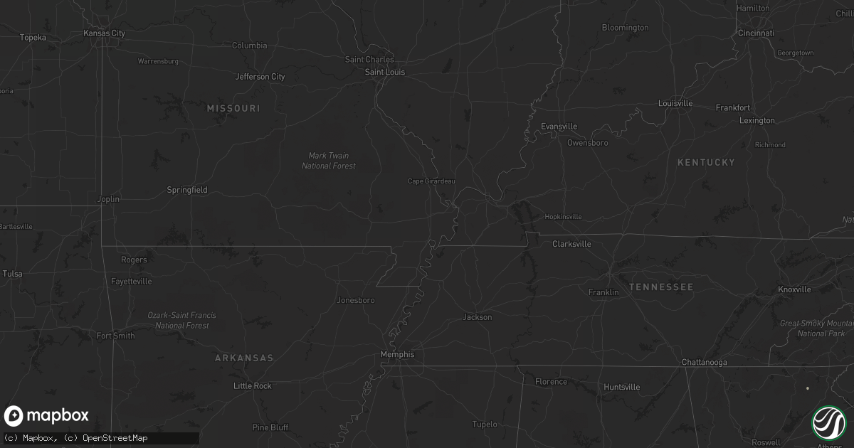
Hail Map in Wisconsin on July 1, 2011
Get this storm
July 1 map
$229
one time, instant access
Download today. No call, no setup
Keep the $229
Bought the map and want the full workflow? Apply the entire $229 to a subscription within 7 days. None of it is wasted.
Every map, not just this one
This buys you this map. Subscription and you get every map we run, in the markets you choose from a few cities to whole states to nationwide. Plus real-time alerts the moment a storm fires.
Contact data
Name, contact info, occupancy, even credit band for addresses in the footprint. You go from where it hit to who to call.
Become the source they trust
Unlimited branding weather history reports on demand. You already have the documented answer ready for the property owner, and you are the one who showed up with it.
Property data and RoofTrace estimates
Pull up any address you have got, its value and the exact code rules for that jurisdiction, straight from One Click Code. Then RoofTrace estimates the squares, pitch, and roof value, priced the way you price.
Storm reports in Wisconsin
Wisconsin
| Date | Description |
|---|---|
| 07/01/20116:45 PM CDT | Estimated from a submitted photo. |
| 06/30/201111:55 PM CDT | One tree down in packwaukee. |
| 06/30/201111:52 PM CDT | A local report indicates 60 MPH wind near BIG FLATS |
| 06/30/201111:45 PM CDT | Several trees down across highway 21 north of necedah. |
| 06/30/201111:42 PM CDT | A local report indicates 63 MPH wind near 5 E NECEDAH |
| 06/30/201111:40 PM CDT | Trees down along hwy 80 and county road f |
| 06/30/201111:35 PM CDT | Trailer tipped over in marshfield. At least 100 trees down across wood county. Reports via wsaw-tv and amateur radio. |
| 06/30/201111:35 PM CDT | Trees down. |
| 06/30/201111:30 PM CDT | Numerous trees down in wausau. Power outages also reported. |
| 06/30/201111:30 PM CDT | Numerous trees and power lines down. One tree fell on a house. |
| 06/30/201111:01 PM CDT | Reports of large trees down. |
| 06/30/201110:59 PM CDT | Large tree blown down and some roof damage to building on water street. |
| 06/30/201110:55 PM CDT | Numerous tree limbs down around town and also some roof damage to a few buildings. |
| 06/30/201110:51 PM CDT | Trained spotter reported a tree down |
| 06/30/201110:51 PM CDT | Trained spotter reported metal shed siding and roof damage |
| 06/30/201110:45 PM CDT | Tree blown down on vehicle. |
| 06/30/201110:33 PM CDT | A local report indicates 60 MPH wind near ONALASKA |
| 06/30/201110:30 PM CDT | Numerous trees snapped off and uprooted along the shoreline of lake onalaska. Estimated wind gusts of 70 mph. |
| 06/30/201110:30 PM CDT | Tree down in copeland park |
| 06/30/201110:30 PM CDT | 8-10 trees uprooted along well st...between oak ave and 11th ave. A couple trees also had their tops snapped off. |
| 06/30/201110:20 PM CDT | Trees and power lines down. |
| 06/30/201110:02 PM CDT | Power lines down |
| 06/30/201110:00 PM CDT | Numerous trees down around barnes wisconsin. |
| 06/30/20119:30 PM CDT | Tree down across road. |
| 06/30/20119:07 PM CDT | Trees and power lines down north of butternut along highway 13. |
| 06/30/20119:00 PM CDT | Numerous trees down |
| 06/30/20119:00 PM CDT | Numerous trees and power lines down in south and east portion of polk county. |
| 06/30/20118:50 PM CDT | Numerous trees down. Corrected time. |
| 06/30/20118:45 PM CDT | Couple of trees down |
| 06/30/20118:35 PM CDT | Trees blown down blocking county road b. |
| 06/30/20118:30 PM CDT | Numerous trees blown down and uprooted. Power lines down. Across much of western sawyer county. |
| 06/30/20118:20 PM CDT | Numerous trees blown down and uprooted. Power lines down. Across much of western sawyer county. Corrected time and location. |
| 06/30/20118:15 PM CDT | Stop sign snapped off on main street. |
| 06/30/20118:10 PM CDT | Large billboard blown down. |
| 06/30/20118:10 PM CDT | Power out. Numerous trees down. |
| 06/30/20118:10 PM CDT | Straight line winds estimated between 50 and 60 mph. Power is out. Numerous trees down. |
| 06/30/20118:09 PM CDT | A local report indicates 1.00 inch wind near CLOVERLAND |
| 06/30/20118:05 PM CDT | Numerous trees down around barnes wisconsin. Corrected time. |
| 06/30/20118:05 PM CDT | Stop sign snapped off on main street. Corrected time. |
| 06/30/20118:05 PM CDT | Trees blown down. Some trees took down power lines. |
| 06/30/20118:04 PM CDT | Many trees down |
| 06/30/20117:55 PM CDT | Airport hangar collapsed. Roof blown off a building and found laying 1/8 mile to the east. |
| 06/30/20117:55 PM CDT | Measured at cumberland airport |
| 06/30/20117:55 PM CDT | A local report indicates 1.00 inch wind near MAPLE |
| 06/30/20117:51 PM CDT | Nws survey determined ef-2 tornado struck sw of solon springs. A house was destroyed...and several other structures and houses were damaged. Many trees were snapped or |
| 06/30/20117:51 PM CDT | At red lake resort...many trees blown down. Campers and cars smashed. Time estimated from radar. |
| 06/30/20117:50 PM CDT | Numerous trees blown down. Some power lines also down. |
| 06/30/20117:45 PM CDT | Roof blown off a business along highway 53. |
| 06/30/20117:35 PM CDT | Widespread wind damage to trees in dairyland area. Lots of homes impacted by falling trees. One tree fell through the roof of a house. Time estimated on radar. |
| 06/30/20117:30 PM CDT | 3.5 acre yard has lost nearly every tree some large oak trees over 50 years old. Damage looks like straight line winds. Fireworks tent blown over. |
| 06/30/20117:30 PM CDT | Large six inch diameter tree branch felled. |
| 06/30/20117:30 PM CDT | Three inch diameter tree branch down. |
| 06/30/20117:28 PM CDT | Corridor of intense downburst wind damage found just west of danbury. 1/4 mile wide and 500 yd long area where every tree was snapped or flattened. Consistent with stra |
| 06/30/20117:28 PM CDT | Corridor of intense downburst wind damage found just west of danbury. 1/4 mile wide and 500 yd long area where every tree was snapped or flattened. Consistent with stra |
| 06/30/20117:25 PM CDT | Numberous trees down along county road a from bushy road through sand lake and voyagers village area. Numberous trees on homes/cabins and blocking driveways. |
| 06/30/20117:25 PM CDT | Trees blown down...several falling on cars or structures. Mobile home damaged. Relayed by media. |
| 06/30/20117:25 PM CDT | Widespread tree damage and power lines down. Several large trees uprooted. Many trees on buildings and blocking roads/driveways. |
| 06/30/20117:25 PM CDT | Widespread tree damage. All powerlines along county road h between webb lake and fish lake were down. |
| 06/30/20117:23 PM CDT | Many large trees blown down...including 18 inch diameter norway pines. |
| 06/30/20117:22 PM CDT | Swath of trees snapped off along county road u. Several trees on homes and blocking driveways. |
| 06/30/20117:22 PM CDT | Two homes on east side of johnson lake had entire roof lifted off along with widespread tree damage and several trees snapped off. Damage seen from aerial survey conduc |
| 06/30/20117:22 PM CDT | Measured with hand held anemometer. |
| 06/30/20117:21 PM CDT | County road f and ff. Trees down. Siding coming off his house. Roof damage. |
| 06/30/20117:20 PM CDT | In the herbster area. Time estimated from radar. |
| 06/30/20117:20 PM CDT | Widespread tree damage in wester and surrounding area. Many trees had fallen on buildings and campers. No power. |
| 06/30/20117:20 PM CDT | 3.5 acre yard has lost nearly every tree some large oak trees over 50 years old. Damage looks like straight line winds. Fireworks tent blown over. Corrected time. |
| 06/30/20117:19 PM CDT | Widespread tree damage around yellow lake. Many trees uprooted. Widespread structure and powerline damage from trees. |
| 06/30/20117:18 PM CDT | Camper-trailed recieved significant damage with only one wall left intact. No one was inside at time of storm. |
| 06/30/20117:18 PM CDT | Significant wind damage. Numerous trees blown down. Boats flipped and blown on shore. Spotter indicated this was likely straight line wind damage. |
| 06/30/20117:16 PM CDT | A local report indicates 1.00 inch wind near BRULE |
| 06/30/20117:16 PM CDT | A local report indicates 1.00 inch wind near 2 W MAPLE |
| 06/30/20117:15 PM CDT | Shingle damage to roof on 2 story home along highway 77. Several trees down in area. |
| 06/30/20117:14 PM CDT | Partial roof loss to two buildings. Widespread tree damage with large trees uprooted. Highway 70 and many side roads impassable. No power. Red cross opened shelter to d |
| 06/30/20117:14 PM CDT | Numerous trees down and power out. |
| 06/30/20117:08 PM CDT | Route 53 and county road b |
| 06/30/20117:05 PM CDT | Hail slightly larger than golf ball size. From a submitted photo. |
All States Impacted by Hail Map on July 1, 2011
Cities Impacted by Hail Map on July 1, 2011
- Portage, IN
- Lake Station, IN
- Gary, IN
- Hobart, IN
- Crown Point, IN
- Merrillville, IN
- Colton, SD
- Chester, SD
- Big Lake, MN
- Becker, MN
- Monticello, MN
- Algona, IA
- Redwood Falls, MN
- Huron, SD
- La Pointe, WI
- Sartell, MN
- Fulda, MN
- Chesterton, IN
- Beverly Shores, IN
- Westville, IN
- Michigan City, IN
- Ashkum, IL
- Danforth, IL
- Bogata, TX
- Charles City, IA
- Sandstone, MN
- Bruno, MN
- Hinckley, MN
- Askov, MN
- Idalia, CO
- Tyler, MN
- Brookings, SD
- Volga, SD
- Guyton, GA
- Grandville, MI
- Jenison, MI
- Slayton, MN
- Dassel, MN
- Wausau, WI
- Aniwa, WI
- Summerville, SC
- Lyle, MN
- Le Sueur, MN
- Saint Peter, MN
- Courtland, MN
- New Ulm, MN
- Byron Center, MI
- Brook Park, MN
- Ceylon, MN
- Dolliver, IA
- Fairmont, MN
- Armstrong, IA
- White, SD
- Astoria, SD
- Arco, MN
- Lake Benton, MN
- Russell, MN
- Minneapolis, MN
- Milaca, MN
- Princeton, MN
- Dalbo, MN
- Le Roy, MN
- Lake Lillian, MN
- Blomkest, MN
- Willow Lake, SD
- Clark, SD
- Avon, MN
- Cold Spring, MN
- Albany, MN
- Saint Joseph, MN
- Glidden, IA
- Carroll, IA
- Herbster, WI
- Hutchinson, MN
- Wall Lake, IA
- Litchfield, MN
- Darwin, MN
- Wheatland, WY
- Gordon, WI
- Nunica, MI
- Grand Haven, MI
- Spring Lake, MI
- Georgetown, SC
- Ladson, SC
- Moncks Corner, SC
- Goose Creek, SC
- Watkins, MN
- Ringsted, IA
- Fenton, IA
- Ivanhoe, MN
- Waseca, MN
- Pemberton, MN
- Janesville, MN
- Ghent, MN
- Wood Lake, MN
- Ruthton, MN
- Tracy, MN
- Lynd, MN
- Balaton, MN
- Vesta, MN
- Minneota, MN
- Marshall, MN
- Cottonwood, MN
- Canistota, SD
- De Berry, TX
- Madison, SD
- Kimball, SD
- Ostrander, MN
- Foxboro, WI
- Superior, WI
- South Range, WI
- Lafayette, LA
- Waucoma, IA
- Ionia, IA
- Elma, IA
- Calmar, IA
- New Hampton, IA
- Alta Vista, IA
- Fort Atkinson, IA
- Lawler, IA
- Willow River, MN
- Jolley, IA
- Rockwell City, IA
- Palmer, IA
- Manson, IA
- Pomeroy, IA
- Bellvue, CO
- Chamberlain, SD
- Pukwana, SD
- Olivia, MN
- Wesley, IA
- Scranton, IA
- White Cloud, MI
- Ridgeway, IA
- Decorah, IA
- Edgerton, MN
- Hardwick, MN
- Cokato, MN
- Bridgewater, SD
- Salem, SD
- Montrose, SD
- Webster City, IA
- Holland, MI
- West Olive, MI
- Drake, CO
- Loveland, CO
- Westbrook, MN
- Reading, MN
- Canova, SD
- Winfred, SD
- Gregory, SD
- Stacy, MN
- Wyoming, MN
- Sac City, IA
- Raymond, SD
- Carpenter, SD
- Chatsworth, IL
- Heron Lake, MN
- Wolsey, SD
- Virgil, SD
- Alpena, SD
- Wessington Springs, SD
- Wagener, SC
- Echo, MN
- Milroy, MN
- Prinsburg, MN
- Morton, MN
- Wabasso, MN
- Lucan, MN
- Danube, MN
- Willmar, MN
- Renville, MN
- Seaforth, MN
- Belview, MN
- Porter, MN
- Sacred Heart, MN
- Welcome, MN
- Breda, IA
- Auburn, IA
- Fort Myers, FL
- Statesboro, GA
- Register, GA
- Bayard, IA
- Brewster, MN
- Rutland, SD
- Ledyard, IA
- Elmore, MN
- Graettinger, IA
- Blue Earth, MN
- Granada, MN
- Cylinder, IA
- Swea City, IA
- Emmetsburg, IA
- Maple Lake, MN
- Elk River, MN
- Buffalo, MN
- Zimmerman, MN
- Ellabell, GA
- Brooklet, GA
- Pembroke, GA
- Bayfield, WI
- Lytton, IA
- Fonda, IA
- Flandreau, SD
- Ramona, SD
- Nunda, SD
- Elkton, SD
- Colman, SD
- Aurora, SD
- Pipestone, MN
- Wentworth, SD
- Egan, SD
- Rush, CO
- Amboy, MN
- Adair, IA
- Coopersville, MI
- Marne, MI
- Conklin, MI
- Vero Beach, FL
- Hudsonville, MI
- Zeeland, MI
- Mattawan, MI
- Paw Paw, MI
- Gobles, MI
- Garner, IA
- Klemme, IA
- Waite Park, MN
- Saint Cloud, MN
- Maple, WI
- Parkersburg, IA
- Wellsburg, IA
- Holland, IA
- Elkton, MN
- Ogden, IA
- Woodward, IA
- Madrid, IA
- Boone, IA
- Springview, NE
- Winner, SD
- Jackson, MN
- Spirit Lake, IA
- Estherville, IA
- Alpha, MN
- Dunnell, MN
- Wallingford, IA
- Trimont, MN
- Sherburn, MN
- Kimball, MN
- Broussard, LA
- Ona, FL
- Titonka, IA
- Lakota, IA
- Ackley, IA
- Steamboat Rock, IA
- Iowa Falls, IA
- Stewart, MN
- El Dorado, AR
- Estill, SC
- Rose Creek, MN
- Adams, MN
- Tillman, SC
- Pineland, SC
- Denmark, SC
- Stuart, IA
- Osage, IA
- Bingham Lake, MN
- Bird Island, MN
- Saint Paul, MN
- Silver Lake, MN
- Rice, MN
- Sauk Rapids, MN
- Medford, MN
- Faribault, MN
- Morristown, MN
- Joice, IA
- Emmet, AR
- Nemaha, IA
- Early, IA
- Britt, IA
- Corwith, IA
- Century, FL
- McDavid, FL
- Greene, IA
- Marble Rock, IA
- Stratford, IA
- Otho, IA
- Duncombe, IA
- Gowrie, IA
- Lohrville, IA
- Farnhamville, IA
- Callender, IA
- Moorland, IA
- Somers, IA
- Fort Dodge, IA
- Rolfe, IA
- Mallard, IA
- Havelock, IA
- Cedar Springs, MI
- Rockford, MI
- Sparta, MI
- Ayrshire, IA
- Curlew, IA
- Churdan, IA
- Solon Springs, WI
- Springfield, GA
- Marathon, WI
- McClellanville, SC
- Jamestown, SC
- Awendaw, SC
- Huger, SC
- Orchard, IA
- Conway, SC
- Cambridge, MN
- Stanchfield, MN
- Mora, MN
- Ogilvie, MN
- Braham, MN
- Clermont, IA
- Walterboro, SC
- Varnville, SC
- Ridgeland, SC
- Early Branch, SC
- Yemassee, SC
- Garnett, SC
- Ruffin, SC
- Tuskegee, AL
- Grand Rapids, MI
- Ravenna, MI
- Allendale, MI
- Riceville, IA
- Colome, SD
- Antigo, WI
- Merrill, WI
- Brokaw, WI
- Poplar, WI
- Humboldt, SD
- Dallas, SD
- Bushnell, FL
- Nora Springs, IA
- Rudd, IA
- Dell Rapids, SD
- South Haven, MN
- Vail, IA
- Madelia, MN
- Mankato, MN
- Nicollet, MN
- Hanska, MN
- Lake Crystal, MN
- Sleepy Eye, MN
- Lafayette, MN
- Port Wing, WI
- Franklin, MN
- Hector, MN
- Fairfax, MN
- Windom, MN
- Truman, MN
- Inglis, FL
- Bethel, MN
- Cedar, MN
- Momence, IL
- Chapin, IA
- Sheffield, IA
- Hampton, IA
- Fennville, MI
- South Haven, MI
- Donalsonville, GA
- Muskegon, MI
- Buffalo Center, IA
- Alden, MN
- Kiester, MN
- Thompson, IA
- Twin Lakes, MN
- Emmons, MN
- Forest City, IA
- Albert Lea, MN
- Lake Mills, IA
- Glenville, MN
- Hayward, MN
- Leland, IA
- Scarville, IA
- Northwood, IA
- Fort Collins, CO
- North Branch, MN
- Gilman, IL
- Texarkana, TX
- Pine City, MN
- Lime Springs, IA
- Wayland, MI
- Annandale, MN
- Duluth, MN
- Midway, AL
- Vernon Center, MN
- Lewisville, MN
- Winnebago, MN
- Saint James, MN
- Luverne, MN
- Williams, IA
- Grant, MI
- Sand Lake, MI
- Howard City, MI
- Strawn, IL
- Dougherty, IA
- Finlayson, MN
- Lake Nebagamon, WI
- Waverly, MN
- Montrose, MN
- Cope, CO
- Arriba, CO
- Anton, CO
- Lindon, CO
- Washburn, WI
- Tennille, GA
- Covert, MI
- Coloma, MI
- Caledonia, MI
- Paisley, FL
- Jeanerette, LA
- Waldo, AR
- Holyoke, MN
- Guthrie Center, IA
- Boyne Falls, MI
- Abbeville, LA
- New Iberia, LA
- Erath, LA
- Youngsville, LA
- Easton, MN
- Minnesota Lake, MN
- Ridgeville, SC
- Rockville, MN
- Saint Stephen, MN
- Clearwater, MN
- Holdingford, MN
- Chandler, MN
- Cusseta, GA
- Grand Junction, IA
- Kilkenny, MN
- Waterville, MN
- Fellsmere, FL
- Hemingway, SC
- Myrtle Beach, SC
- Melrose, WI
- Austin, MN
- Immokalee, FL
- Saint Francis, MN
- Harris, MN
- Isanti, MN
- Howard Lake, MN
- Richmond, MN
- Butterfield, MN
- Whittemore, IA
- Burt, IA
- Lone Rock, IA
- Stanhope, IA
- Kensett, IA
- Hanlontown, IA
- Grand Saline, TX
- Pierz, MN
- Foley, MN
- Royalton, MN
- Doland, SD
- Vienna, SD
- Deloit, IA
- Denison, IA
- Hopkins, MI
- Anoka, MN
- Dayton, MN
- Brownsdale, MN
- Wilmont, MN
- Rushmore, MN
- Eldora, IA
- Greenville, GA
- Lake City, IA
- Cresco, IA
- Rosston, AR
- Kirk, CO
- Darfur, MN
- Naples, FL
- Zumbrota, MN
- Fort Pierce, FL
- Laurens, IA
- Pocahontas, IA
- Livingston, LA
- Stacyville, IA
- Taopi, MN
- McIntire, IA
- Grantsburg, WI
- Yoder, CO
- Jasper, MN
- Apopka, FL
- Stratton, CO
- Bethune, CO
- Kiron, IA
- Circle Pines, MN
- Eagle Lake, MN
- Madison Lake, MN
- Isle, MN
- Orlando, FL
- Kasson, MN
- Fulton, SD
- Gann Valley, SD
- Roscoe, MN
- Paynesville, MN
- Rush City, MN
- Tuskegee Institute, AL
- Blooming Prairie, MN
- Ideal, SD
- Witten, SD
- Thawville, IL
- Hugo, MN
- Rockford, MN
- Loretto, MN
- Atwater, MN
- Groveland, FL
- Clermont, FL
- Union Mills, IN
- Wanatah, IN
- Glencoe, MN
- Montague, MI
- Holton, MI
- Whitehall, MI
- Rothbury, MI
- Twin Lake, MI
- Ashland, WI
- Alden, IA
- Mount Holly, AR
- Clifton, IL
- Martinton, IL
- Bagley, IA
- Cosmos, MN
- Buffalo Lake, MN
- Ormsby, MN
- Clear Lake, IA
- Ventura, IA
- Northfield, MN
- Dundas, MN
- Nerstrand, MN
- Aplington, IA
- Akron, CO
- Beaver Creek, MN
- Gaylord, MN
- Brownton, MN
- Iron River, WI
- Brule, WI
- Frost, MN
- Bancroft, IA
- Woden, IA
- Kanawha, IA
- Chebanse, IL
- Otsego, MI
- Belle Plaine, MN
- Henderson, MN
- Hamill, SD
- Lindstrom, MN
- Chisago City, MN
- Grove City, MN
- Andover, MN
- Coulter, IA
- Dows, IA
- Latimer, IA
- Rowan, IA
- Alexander, IA
- Geneva, IA
- Yale, SD
- Grant Park, IL
- Perry, IA
- Dawson, IA
- Yoder, WY
- Hawk Springs, WY
- Hubbard, IA
- Saint Anne, IL
- Danbury, WI
- Chetek, WI
- Junction City, AR
- Kenyon, MN
- Clarkfield, MN
- Lake Wilson, MN
- Belmond, IA
- Plymouth, IA
- Manly, IA
- Grafton, IA
- Atoka, OK
- Kenton, OH
- Forest, OH
- Onamia, MN
- Camp Hill, AL
- Glencoe, NM
- Ruidoso, NM
- Ellsworth, IA
- Jewell, IA
- Hillman, MN
- Hamel, MN
- Dedham, IA
- Coon Rapids, IA
- Wells, MN
- Spring Valley, MN
- Yale, IA
- Panora, IA
- Walloon Lake, MI
- Petoskey, MI
- Boyne City, MI
- Wabasha, MN
- Allegan, MI
- Hamilton, MI
- Edgar, WI
- Athens, WI
- Casnovia, MI
- Currie, NC
- Burgaw, NC
- Marine On Saint Croix, MN
- Kankakee, IL
- Rincon, GA
- Clyo, GA
- Dow City, IA
- Arion, IA
- Cavour, SD
- Hartford, SD
- Raymond, MN
- Hanley Falls, MN
- Taunton, MN
- Altoona, FL
- Saint Ansgar, IA
- Onarga, IL
- Green Isle, MN
- Magnolia, AR
- Colquitt, GA
- Strong, AR
- Perdido, AL
- Camden, AR
- Bricelyn, MN
- Clewiston, FL
- Mountain Lake, MN
- Holland, MN
- Maple Plain, MN
- Albertville, MN
- Delano, MN
- Rogers, MN
- Hanover, MN
- Grandy, MN
- Spencer, SD
- Saint Michael, MN
- Arlington, SD
- Garvin, MN
- Hendricks, MN
- Avoca, MN
- Mapleton, MN
- Delavan, MN
- Owatonna, MN
- Blairsburg, IA
- Walker, LA
- Denham Springs, LA
- Hartland, MN
- New Richland, MN
- Gibbon, MN
- Winthrop, MN
- Talco, TX
- Mason City, IA
- Ralston, IA
- Lanesboro, IA
- Portal, GA
- Wyoming, MI
- Dorr, MI
- Decatur, MI
- Linden, IA
- Plover, IA
- Minburn, IA
- Livermore, IA
- Hopkins, MN
- Menlo, IA
- Casey, IA
- Jefferson, IA
- Gilmore City, IA
- Daviston, AL
- Waverly, AL
- Lafayette, AL
- Lake View, IA
- Sautee Nacoochee, GA
- Helen, GA
- Springfield, MN
- Eden Prairie, MN
- Valparaiso, IN
- West Concord, MN
- Radcliffe, IA
- Fertile, IA
- La Porte, IN
- Lewiston, MN
- Rushford, MN
- Winona, MN
- Fruitport, MI
- Bailey, MI
- Thornton, IA
- Buena Vista, GA
- Pembroke Township, IL
- Bolivia, NC
- Warsaw, MN
- Wahkon, MN
- Osceola, WI
- Islandton, SC
- Kensal, ND
- Toronto, SD
- Arlington, MN
- Lismore, MN
- Kalamazoo, MI
- Adel, IA
- Boxholm, IA
- Exira, IA
- Jamaica, IA
- Redfield, IA
- Paton, IA
- Dana, IA
- Garden City, MN
- Swaledale, IA
- Good Thunder, MN
- Rock Falls, IA
- Little Cedar, IA
- Floyd, IA
- Colwell, IA
- Rockwell, IA
- Nashua, IA
- Meservey, IA
- Protivin, IA
- Rockford, IA
- Spillville, IA
- Genoa, CO
- Bangor, MI
- Chatfield, MN
- Fountain, MN
- Ellendale, MN
- Excelsior, MN
- Chanhassen, MN
- Wayzata, MN
- Minnetonka, MN
- Osseo, MN
- Champlin, MN
- Maple Grove, MN
- Stratford, WI
- Shelby, MI
- Hart, MI
- Hesperia, MI
- Alto, NM
- Cornucopia, WI
- Opelika, AL
- Auburn, AL
- Clear Lake, MN
- Lafayette, CO
- Louisville, CO
- Clarion, IA
- Galt, IA
- Morgan, MN
- Clements, MN
- Renwick, IA
- Lu Verne, IA
- Lillie, LA
- Summerfield, LA
- Alexandria, SD
- Dayton, IA
- Lehigh, IA
- Eden Valley, MN
- Center Point, LA
- Hayfield, MN
- Dresser, WI
- Shafer, MN
- Lyons, CO
- Lansing, MN
- Waltham, MN
- Grand Meadow, MN
- Dexter, MN
- Genoa, WI
- Odebolt, IA
- Jeffers, MN
- Sumterville, FL
- Wildwood, FL
- Bayboro, NC
- Dadeville, AL
- Lawrence, MI
- Clarks Grove, MN
- Watseka, IL
- Comfrey, MN
- Foreston, MN
- Saint Martin, MN
- Oak Park, MN
- Wrenshall, MN
- Goodwater, AL
- West Bend, IA
- Roberts, IL
- Piper City, IL
- Mascotte, FL
- Arcadia, WI
- Lagrange, WY
- Forest Lake, MN
- Dunkirk, OH
- Fort Benning, GA
- Estero, FL
- Fremont, MI
- Kasota, MN


