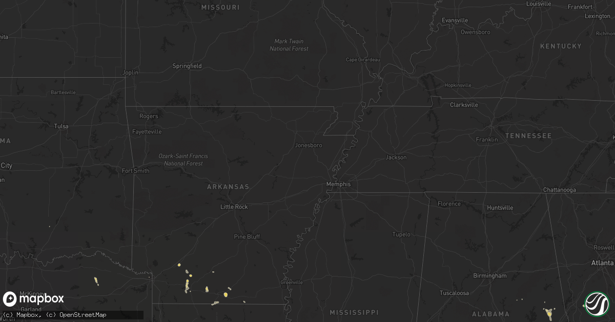
Hail Map on July 1, 2011
Get this storm
July 1 map
$229
one time, instant access
Download today. No call, no setup
Keep the $229
Bought the map and want the full workflow? Apply the entire $229 to a subscription within 7 days. None of it is wasted.
Every map, not just this one
This buys you this map. Subscription and you get every map we run, in the markets you choose from a few cities to whole states to nationwide. Plus real-time alerts the moment a storm fires.
Contact data
Name, contact info, occupancy, even credit band for addresses in the footprint. You go from where it hit to who to call.
Become the source they trust
Unlimited branding weather history reports on demand. You already have the documented answer ready for the property owner, and you are the one who showed up with it.
Property data and RoofTrace estimates
Pull up any address you have got, its value and the exact code rules for that jurisdiction, straight from One Click Code. Then RoofTrace estimates the squares, pitch, and roof value, priced the way you price.
States Impacted by Hail Map on July 1, 2011
Storm reports
Louisiana
| Date | Description |
|---|---|
| 07/01/20116:34 PM CDT | Tree downed and trampoline tossed in yard along with pea sized hail reported by the media on walker south road. |
| 07/01/20116:31 PM CDT | Livingston sheriffs department reported trees down along gaylord road in south walker. |
| 07/01/20116:28 PM CDT | Emenrgency manager reported tree damage...power lines down and some damage to an apartment complex along eden church road near us 190 between walker and denham springs. |
| 07/01/20113:55 PM CDT | Tree reported down at the corner of marteau and fairfield street in broussard. |
South Carolina
| Date | Description |
|---|---|
| 07/01/20115:07 PM CDT | Highway patrol reported tree down on calf pen bay rd near cypress branch rd. |
| 07/01/20114:59 PM CDT | Dime to quarter size hail |
| 07/01/20114:58 PM CDT | Trees down on woodsville rd. |
| 07/01/20114:50 PM CDT | Trained spotter reported quarter size hail and 40 mph wind gusts. |
| 07/01/20114:46 PM CDT | Trees down at heritage rd and grays hwy. |
| 07/01/20114:46 PM CDT | Tree down on sc hwy 3 outside of grays. |
| 07/01/20114:18 PM CDT | Dispatch center reported a tree down near intersection of ficken rd and old salkehatchie rd. |
| 07/01/20113:41 PM CDT | Nickel to quarter size hail. |
| 07/01/20113:37 PM CDT | Public report of quarter size hail. |
| 07/01/20113:36 PM CDT | Former nws employee reported large tree down at post office. |
| 07/01/20113:24 PM CDT | Ladson fire department reported trees on treeland dr and college park rd. |
| 07/01/20113:24 PM CDT | Quarter size hail. |
| 07/01/20112:26 PM CDT | Public report of nickel to quarter size hail...tree limbs down and 0.50 inches of rain. |
| 07/01/20111:54 PM CDT | Dispatch center reported trees down on hwy 45 between shulerville and honey hill. |
| 07/01/20111:45 PM CDT | Hail to up to the size of quarters lasted for 5 minutes |
Arkansas
| Date | Description |
|---|---|
| 07/01/20114:53 PM CDT | Several power lines down along wheeler ave. In west fort smith. |
Texas
| Date | Description |
|---|---|
| 06/30/20117:55 PM CDT | Metal roofs torn off of buildings at salt mines outside of grand saline |
Georgia
| Date | Description |
|---|---|
| 07/01/20115:44 PM CDT | Spotter reported a tree blown down. |
| 07/01/20115:31 PM CDT | Dispatch center reported trees down on stillwell clyo rd. |
| 07/01/20115:31 PM CDT | Dispatch center reported trees down on union spring rd. |
| 07/01/20114:40 PM CDT | Nws employee observes a couple of trees down around peachtree city. |
| 07/01/20114:40 PM CDT | Nws employee observes a couple of trees down on the east side of sharpsburg near georgia highway 54. |
| 07/01/20113:45 PM CDT | Spalding county 911 center and an amateur radio operator report that several trees and power lines were down around the city of griffin. There was also one report of ha |
| 06/30/20117:40 PM CDT | Hail the size the quarters was reported at the unicoi lodge. |
Alabama
| Date | Description |
|---|---|
| 07/01/20115:30 PM CDT | Several trees and powerlines reported down along highway 82 |
| 07/01/20115:21 PM CDT | Trees were blown down along highway 199. |
| 07/01/20115:06 PM CDT | Several trees reported down around freddie drive southeast of tuskegee. |
| 07/01/20115:06 PM CDT | Significant structural damage to a restaurant. The roof was blown off and it landed on 2 vehicles. Numerous trees down in and around the city of tuskegee. |
| 07/01/20114:56 PM CDT | At least 5 trees down...mostly in the vicinity of pinckard |
| 07/01/20114:45 PM CDT | Several trees down along state highway 50. |
| 07/01/20113:50 PM CDT | Trees down on hwy 147 just south of hwy 280 |
| 07/01/20113:18 PM CDT | Trees down on u.s. Highway 280 in smiths station. |
Wisconsin
| Date | Description |
|---|---|
| 07/01/20116:45 PM CDT | Estimated from a submitted photo. |
| 06/30/201111:55 PM CDT | One tree down in packwaukee. |
| 06/30/201111:52 PM CDT | A local report indicates 60 MPH wind near BIG FLATS |
| 06/30/201111:45 PM CDT | Several trees down across highway 21 north of necedah. |
| 06/30/201111:42 PM CDT | A local report indicates 63 MPH wind near 5 E NECEDAH |
| 06/30/201111:40 PM CDT | Trees down along hwy 80 and county road f |
| 06/30/201111:35 PM CDT | Trees down. |
| 06/30/201111:35 PM CDT | Trailer tipped over in marshfield. At least 100 trees down across wood county. Reports via wsaw-tv and amateur radio. |
| 06/30/201111:30 PM CDT | Numerous trees and power lines down. One tree fell on a house. |
| 06/30/201111:30 PM CDT | Numerous trees down in wausau. Power outages also reported. |
| 06/30/201111:01 PM CDT | Reports of large trees down. |
| 06/30/201110:59 PM CDT | Large tree blown down and some roof damage to building on water street. |
| 06/30/201110:55 PM CDT | Numerous tree limbs down around town and also some roof damage to a few buildings. |
| 06/30/201110:51 PM CDT | Trained spotter reported a tree down |
| 06/30/201110:51 PM CDT | Trained spotter reported metal shed siding and roof damage |
| 06/30/201110:45 PM CDT | Tree blown down on vehicle. |
| 06/30/201110:33 PM CDT | A local report indicates 60 MPH wind near ONALASKA |
| 06/30/201110:30 PM CDT | Numerous trees snapped off and uprooted along the shoreline of lake onalaska. Estimated wind gusts of 70 mph. |
| 06/30/201110:30 PM CDT | Tree down in copeland park |
| 06/30/201110:30 PM CDT | 8-10 trees uprooted along well st...between oak ave and 11th ave. A couple trees also had their tops snapped off. |
| 06/30/201110:20 PM CDT | Trees and power lines down. |
| 06/30/201110:02 PM CDT | Power lines down |
| 06/30/201110:00 PM CDT | Numerous trees down around barnes wisconsin. |
| 06/30/20119:30 PM CDT | Tree down across road. |
| 06/30/20119:07 PM CDT | Trees and power lines down north of butternut along highway 13. |
| 06/30/20119:00 PM CDT | Numerous trees down |
| 06/30/20119:00 PM CDT | Numerous trees and power lines down in south and east portion of polk county. |
| 06/30/20118:50 PM CDT | Numerous trees down. Corrected time. |
| 06/30/20118:45 PM CDT | Couple of trees down |
| 06/30/20118:35 PM CDT | Trees blown down blocking county road b. |
| 06/30/20118:30 PM CDT | Numerous trees blown down and uprooted. Power lines down. Across much of western sawyer county. |
| 06/30/20118:20 PM CDT | Numerous trees blown down and uprooted. Power lines down. Across much of western sawyer county. Corrected time and location. |
| 06/30/20118:15 PM CDT | Stop sign snapped off on main street. |
| 06/30/20118:10 PM CDT | Large billboard blown down. |
| 06/30/20118:10 PM CDT | Power out. Numerous trees down. |
| 06/30/20118:10 PM CDT | Straight line winds estimated between 50 and 60 mph. Power is out. Numerous trees down. |
| 06/30/20118:09 PM CDT | A local report indicates 1.00 inch wind near CLOVERLAND |
| 06/30/20118:05 PM CDT | Numerous trees down around barnes wisconsin. Corrected time. |
| 06/30/20118:05 PM CDT | Stop sign snapped off on main street. Corrected time. |
| 06/30/20118:05 PM CDT | Trees blown down. Some trees took down power lines. |
| 06/30/20118:04 PM CDT | Many trees down |
| 06/30/20117:55 PM CDT | A local report indicates 1.00 inch wind near MAPLE |
| 06/30/20117:55 PM CDT | Measured at cumberland airport |
| 06/30/20117:55 PM CDT | Airport hangar collapsed. Roof blown off a building and found laying 1/8 mile to the east. |
| 06/30/20117:51 PM CDT | At red lake resort...many trees blown down. Campers and cars smashed. Time estimated from radar. |
| 06/30/20117:51 PM CDT | Nws survey determined ef-2 tornado struck sw of solon springs. A house was destroyed...and several other structures and houses were damaged. Many trees were snapped or |
| 06/30/20117:50 PM CDT | Numerous trees blown down. Some power lines also down. |
| 06/30/20117:45 PM CDT | Roof blown off a business along highway 53. |
| 06/30/20117:35 PM CDT | Widespread wind damage to trees in dairyland area. Lots of homes impacted by falling trees. One tree fell through the roof of a house. Time estimated on radar. |
| 06/30/20117:30 PM CDT | Three inch diameter tree branch down. |
| 06/30/20117:30 PM CDT | Large six inch diameter tree branch felled. |
| 06/30/20117:30 PM CDT | 3.5 acre yard has lost nearly every tree some large oak trees over 50 years old. Damage looks like straight line winds. Fireworks tent blown over. |
| 06/30/20117:28 PM CDT | Corridor of intense downburst wind damage found just west of danbury. 1/4 mile wide and 500 yd long area where every tree was snapped or flattened. Consistent with stra |
| 06/30/20117:28 PM CDT | Corridor of intense downburst wind damage found just west of danbury. 1/4 mile wide and 500 yd long area where every tree was snapped or flattened. Consistent with stra |
| 06/30/20117:25 PM CDT | Widespread tree damage and power lines down. Several large trees uprooted. Many trees on buildings and blocking roads/driveways. |
| 06/30/20117:25 PM CDT | Trees blown down...several falling on cars or structures. Mobile home damaged. Relayed by media. |
| 06/30/20117:25 PM CDT | Numberous trees down along county road a from bushy road through sand lake and voyagers village area. Numberous trees on homes/cabins and blocking driveways. |
| 06/30/20117:25 PM CDT | Widespread tree damage. All powerlines along county road h between webb lake and fish lake were down. |
| 06/30/20117:23 PM CDT | Many large trees blown down...including 18 inch diameter norway pines. |
| 06/30/20117:22 PM CDT | Swath of trees snapped off along county road u. Several trees on homes and blocking driveways. |
| 06/30/20117:22 PM CDT | Measured with hand held anemometer. |
| 06/30/20117:22 PM CDT | Two homes on east side of johnson lake had entire roof lifted off along with widespread tree damage and several trees snapped off. Damage seen from aerial survey conduc |
| 06/30/20117:21 PM CDT | County road f and ff. Trees down. Siding coming off his house. Roof damage. |
| 06/30/20117:20 PM CDT | In the herbster area. Time estimated from radar. |
| 06/30/20117:20 PM CDT | Widespread tree damage in wester and surrounding area. Many trees had fallen on buildings and campers. No power. |
| 06/30/20117:20 PM CDT | 3.5 acre yard has lost nearly every tree some large oak trees over 50 years old. Damage looks like straight line winds. Fireworks tent blown over. Corrected time. |
| 06/30/20117:19 PM CDT | Widespread tree damage around yellow lake. Many trees uprooted. Widespread structure and powerline damage from trees. |
| 06/30/20117:18 PM CDT | Significant wind damage. Numerous trees blown down. Boats flipped and blown on shore. Spotter indicated this was likely straight line wind damage. |
| 06/30/20117:18 PM CDT | Camper-trailed recieved significant damage with only one wall left intact. No one was inside at time of storm. |
| 06/30/20117:16 PM CDT | A local report indicates 1.00 inch wind near BRULE |
| 06/30/20117:16 PM CDT | A local report indicates 1.00 inch wind near 2 W MAPLE |
| 06/30/20117:15 PM CDT | Shingle damage to roof on 2 story home along highway 77. Several trees down in area. |
| 06/30/20117:14 PM CDT | Numerous trees down and power out. |
| 06/30/20117:14 PM CDT | Partial roof loss to two buildings. Widespread tree damage with large trees uprooted. Highway 70 and many side roads impassable. No power. Red cross opened shelter to d |
| 06/30/20117:08 PM CDT | Route 53 and county road b |
| 06/30/20117:05 PM CDT | Hail slightly larger than golf ball size. From a submitted photo. |
Indiana
| Date | Description |
|---|---|
| 07/01/20118:25 AM CDT | A local report indicates 1.75 inch wind near BEVERLY SHORES |
South Dakota
| Date | Description |
|---|---|
| 07/01/20113:47 PM CDT | A local report indicates 65 MPH wind near 9 W LAKE BENTON |
| 07/01/20113:25 PM CDT | 4 semi-trailer trucks and a camper were blown over by winds at the flandreau exit on interstate 29. |
| 07/01/20113:15 PM CDT | A local report indicates 60 MPH wind near 3 ESE NUNDA |
| 07/01/20113:12 PM CDT | A local report indicates 1.75 inch wind near NUNDA |
| 07/01/20113:00 PM CDT | A local report indicates 58 MPH wind near 1 NE MADISON |
| 07/01/20112:57 PM CDT | A local report indicates 1.75 inch wind near MONTROSE |
| 07/01/20112:45 PM CDT | A local report indicates 1.75 inch wind near CANISTOTA |
| 07/01/20112:28 PM CDT | A local report indicates 60 MPH wind near 3 NNE DOLTON |
| 07/01/20112:15 PM CDT | A local report indicates 2.50 inch wind near 5 ESE CANOVA |
| 07/01/20111:40 PM CDT | Largest hail was ping pong ball sized...followed by quarter sized hail. Minor damge to corn crop. |
| 07/01/20111:08 PM CDT | A local report indicates 1.00 inch wind near 8 W WESSINGTON SPRINGS |
Wyoming
| Date | Description |
|---|---|
| 07/01/20113:08 PM CDT | At the intersection of cr 50 and 13. |
Colorado
| Date | Description |
|---|---|
| 07/01/20112:30 AM CDT | A local report indicates 1.25 inch wind near 3 NW THURMAN |
| 07/01/20111:55 AM CDT | A local report indicates 1.25 inch wind near FORT COLLINS |
Minnesota
| Date | Description |
|---|---|
| 07/01/20116:57 PM CDT | Trees down over roads in town |
| 07/01/20116:56 PM CDT | 2 foot trees down. Damage is in the town of orrock. |
| 07/01/20116:53 PM CDT | Top of large trees being snapped |
| 07/01/20116:52 PM CDT | 24 inch tree down at 261st street and cty 5 |
| 07/01/20116:52 PM CDT | 12 inch pine tree down by hwy 55 and hwy 25 |
| 07/01/20116:50 PM CDT | Trees down around highway 169...4 miles south of 49th ave. Time estimated. |
| 07/01/20116:45 PM CDT | One foot diameter tree down. |
| 07/01/20116:45 PM CDT | Trees down |
| 07/01/20116:45 PM CDT | 6 inch to 8 inch branches down |
| 07/01/20116:41 PM CDT | 14 inch to 16 inch trees down |
| 07/01/20116:41 PM CDT | 50-60 mph measured |
| 07/01/20116:38 PM CDT | Benton drive being closed due to trees in roadway. |
| 07/01/20116:36 PM CDT | A local report indicates 1.25 inch wind near SSE CAMBRIDGE |
| 07/01/20116:35 PM CDT | A local report indicates 1.75 inch wind near CAMBRIDGE |
| 07/01/20116:32 PM CDT | A local report indicates 68 MPH wind near MAPLE LAKE |
| 07/01/20116:32 PM CDT | A local report indicates 1.00 inch wind near 12 N MORA |
| 07/01/20116:32 PM CDT | Numerous trees down |
| 07/01/20116:31 PM CDT | A local report indicates 1.50 inch wind near ISANTI |
| 07/01/20116:30 PM CDT | Tree down 20 inches in diameter |
| 07/01/20116:30 PM CDT | 2 large 12 inch diameter trees down across pauls lake road. 6 inch diameter pine tree down on fence along 16th st se. Time estimated. |
| 07/01/20116:30 PM CDT | Three to four inch tree limbs downed. |
| 07/01/20116:30 PM CDT | 18 to 24 inch trees uprooted near northdale and foley. Tree fell on truck. |
| 07/01/20116:29 PM CDT | Roof blown off. Junction of 155th and 165th ave.estimated 3 miles from benton county border. |
| 07/01/20116:29 PM CDT | A local report indicates 1.00 inch wind near CAMBRIDGE |
| 07/01/20116:25 PM CDT | Multiple reports of downed trees blocking roads. Power lines down over roads. |
| 07/01/20116:23 PM CDT | A local report indicates 1.00 inch wind near 1 SW ZIMMERMAN |
| 07/01/20116:23 PM CDT | Tornado rated ef-0. It touched down just northeast of the intersection of i-94 and highway 23. Dozens of trees were broken... Toppled or pushed over as the tornado move |
| 07/01/20116:22 PM CDT | Measured at princeton airport |
| 07/01/20116:20 PM CDT | Downburst winds of 65 to 70 mph began hitting the northern portion of st cloud. Hundreds of trees were toppled or broken across several square miles near the hospital. |
| 07/01/20116:17 PM CDT | A local report indicates 1.00 inch wind near 14 N MILACA |
| 07/01/20116:17 PM CDT | Many large trees downed. Roof damage to home residence. |
| 07/01/20116:15 PM CDT | A local report indicates 71 MPH wind near 1 S BIG LAKE |
| 07/01/20116:15 PM CDT | A local report indicates 70 MPH wind near 4 W BIG LAKE |
| 07/01/20116:14 PM CDT | Measured at buffalo airport |
| 07/01/20116:13 PM CDT | Largest hailstone size 3.5 inches measured. |
| 07/01/20116:10 PM CDT | Numerous trees down just north of downtown by hospital. Time estimated. |
| 07/01/20116:10 PM CDT | 12 to 18 inch trees down by centerville road and cty 14 |
| 07/01/20116:08 PM CDT | A local report indicates 1.00 inch wind near ST AUGUSTA |
| 07/01/20116:06 PM CDT | A local report indicates 1.00 inch wind near 1 N SOUTH HAVEN |
| 07/01/20116:02 PM CDT | A local report indicates 2.75 inch wind near 5 N BIG LAKE |
| 07/01/20116:01 PM CDT | A local report indicates 70 MPH wind near 1 S BIG LAKE |
| 07/01/20116:00 PM CDT | Estimated 70 mph wind gusts took out several large tree limbs and uprooted a tree. |
| 07/01/20116:00 PM CDT | Several large trees down...a few homes damaged. |
| 07/01/20116:00 PM CDT | 24 inch diameter tree uprooted. |
| 07/01/20116:00 PM CDT | A local report indicates 1.25 inch wind near 4 ENE BECKER |
| 07/01/20116:00 PM CDT | 24 inch tree down |
| 07/01/20116:00 PM CDT | Big trees down. 24 inch tree split off. |
| 07/01/20115:58 PM CDT | A local report indicates 1.75 inch wind near 2 NNE BIG LAKE |
| 07/01/20115:58 PM CDT | Dents on truck |
| 07/01/20115:56 PM CDT | A local report indicates 1.75 inch wind near 8 SSE FULDA |
| 07/01/20115:56 PM CDT | County road 81 and highway 10 |
| 07/01/20115:56 PM CDT | Utility power lost. |
| 07/01/20115:55 PM CDT | Large trees down. Trees up to 36 inches snapped in half. Roof off a vet clinic. Estimated time. |
| 07/01/20115:52 PM CDT | A local report indicates 1.00 inch wind near RICE |
| 07/01/20115:50 PM CDT | A local report indicates 1.00 inch wind near 7 NNW BREWSTER |
| 07/01/20115:46 PM CDT | A local report indicates 1.00 inch wind near MONTICELLO |
| 07/01/20115:46 PM CDT | Semi blown off the road into the ditch. |
| 07/01/20115:45 PM CDT | Time estimated. |
| 07/01/20115:45 PM CDT | Numerous trees downed or uprooted on highway 212. Two businesses have portions of roofs off. One business had wall blown in. |
| 07/01/20115:45 PM CDT | A local report indicates 1.75 inch wind near SARTELL |
| 07/01/20115:44 PM CDT | A local report indicates 1.00 inch wind near 5 NNW ST CLOUD |
| 07/01/20115:44 PM CDT | A local report indicates 1.00 inch wind near 3 N FOLEY |
| 07/01/20115:43 PM CDT | A local report indicates 1.00 inch wind near 7 SW MONTICELLO |
| 07/01/20115:41 PM CDT | A local report indicates 1.00 inch wind near GROVE CITY |
| 07/01/20115:40 PM CDT | 2 inch to 4 inch diameter branches down. Main street. |
| 07/01/20115:40 PM CDT | A local report indicates 1.00 inch wind near DASSEL |
| 07/01/20115:40 PM CDT | A local report indicates 1.75 inch wind near DARWIN |
| 07/01/20115:40 PM CDT | Main street |
| 07/01/20115:40 PM CDT | A local report indicates 2.00 inch wind near 4 S DASSEL |
| 07/01/20115:40 PM CDT | Semi trailer blown over. |
| 07/01/20115:40 PM CDT | A local report indicates 2.00 inch wind near 2 S MONTICELLO |
| 07/01/20115:39 PM CDT | A local report indicates 1.00 inch wind near ANNANDALE |
| 07/01/20115:38 PM CDT | Power poles down |
| 07/01/20115:34 PM CDT | Reported at hutchinson airport |
| 07/01/20115:32 PM CDT | Interstate 94 and county road 2 |
| 07/01/20115:31 PM CDT | A local report indicates 1.00 inch wind near 4 SSE SILVER CREEK |
| 07/01/20115:30 PM CDT | One foot diameter trees down along with power lines. |
| 07/01/20115:30 PM CDT | One and a half inch diameter branches down. Highway 15. |
| 07/01/20115:30 PM CDT | Upper third of large tree toppled onto mini-van...crushing severely. Eight year old girl with multiple injuries admitted to local hospital. |
| 07/01/20115:30 PM CDT | A local report indicates 1.00 inch wind near OLIVIA |
| 07/01/20115:26 PM CDT | A local report indicates 2.00 inch wind near 1 WSW BUFFALO |
| 07/01/20115:25 PM CDT | Two foot trees down. |
| 07/01/20115:25 PM CDT | Two foot trees down. |
| 07/01/20115:25 PM CDT | Semi-trailer rolled into ditch on county road 15...three miles south of intersection of state road 212 and county road 15. Driver injured. |
| 07/01/20115:25 PM CDT | Highway 55 and county road 12 |
| 07/01/20115:24 PM CDT | A local report indicates 1.00 inch wind near COLLEGEVILLE |
| 07/01/20115:17 PM CDT | Via spotter network |
| 07/01/20115:17 PM CDT | Numerous trees down...some as wide as 2.5 feet. Several power lines down...some roof damage. All reported in downtown area. |
| 07/01/20115:15 PM CDT | A local report indicates 2.00 inch wind near 2 S DASSEL |
| 07/01/20115:12 PM CDT | A local report indicates 1.00 inch wind near DASSEL |
| 07/01/20115:11 PM CDT | Measured from the redwood falls airport |
| 07/01/20115:09 PM CDT | A local report indicates 1.00 inch wind near 2 SE DASSEL |
| 07/01/20115:08 PM CDT | Three power lines down. |
| 07/01/20115:05 PM CDT | A local report indicates 1.00 inch wind near 2 N MANANNAH |
| 07/01/20115:04 PM CDT | Estimated time |
| 07/01/20115:04 PM CDT | Strong thunderstorm winds downed trees and powerlines. Truck blown over. |
| 07/01/20115:03 PM CDT | A local report indicates 1.75 inch wind near DARWIN |
| 07/01/20115:03 PM CDT | Tornado rated ef-1. Touched down about 1/2 mile northwest of danube and moved north-northeast. It dissipated 3 n danube. Path length 2.5 miles and maximum width 300 yar |
| 07/01/20115:02 PM CDT | A local report indicates 2.75 inch wind near 2 S DASSEL |
| 07/01/20115:00 PM CDT | 3 power poles down. Top part of an 80 foot tree roughly 2.5 feet in diameter taken off. Report from spotter a-20. |
| 07/01/20115:00 PM CDT | Ripped metal sheets off building exterior. |
| 07/01/20115:00 PM CDT | Path of damage near county road 11...including at least 4 barns...house...school house...silo...and downed trees. Time estimated. |
| 07/01/20115:00 PM CDT | A local report indicates 1.25 inch wind near REDWOOD FALLS |
| 07/01/20114:58 PM CDT | Measured with car anemometer. |
| 07/01/20114:57 PM CDT | 5 inch diameter branches down |
| 07/01/20114:56 PM CDT | Measured at redwood valley high school |
| 07/01/20114:51 PM CDT | Measured at redwood falls airport |
| 07/01/20114:50 PM CDT | Time estimated. 5 inch diameter tree branches down. |
| 07/01/20114:41 PM CDT | Barn and outbuilding damage. Widespread tree damage. |
| 07/01/20114:40 PM CDT | Numerous trees down up to 3 feet in diameter. Some fell onto houses and buildings. Time was estimated. |
| 07/01/20114:31 PM CDT | Tornado rated ef-1. It touched down in redwood county... Moved across a corner of yellow medicine county... Back into redwood county where it moved through belview... T |
| 07/01/20114:31 PM CDT | Tornado rated ef-1. Touched down just east of the border with lyon county and moved northeast to 8 n milroy. Path length 2.5 miles with a maximum width of 300 yards. Tr |
| 07/01/20114:28 PM CDT | Severe wind damage reported in marshall minnesota. |
| 07/01/20114:25 PM CDT | 70 to 80 mile an hour thunderstorm winds in marshall minnesota. Lots of wind related damage. |
| 07/01/20114:25 PM CDT | Power is out in marshall with numerous trees down and windows blown out. Thunderstorm winds were estimated between 65 and 70 miles an hour. |
| 07/01/20114:25 PM CDT | 12+ inch trees down all across town |
| 07/01/20114:22 PM CDT | Large trees down in excess of 2.5 feet in diameter in garvin park |
| 07/01/20114:15 PM CDT | Large trees down in excess of 2.5 feet in diameter in garvin park |
| 07/01/20114:15 PM CDT | Barn destroyed...lots of significant tree damage |
| 07/01/20114:12 PM CDT | Trees uprooted. |
| 07/01/20114:10 PM CDT | Also very strong stright line winds uprooted trees. |
| 07/01/20114:08 PM CDT | 60 plus mile an hour thunderstorm winds. |
| 07/01/20114:08 PM CDT | Lost of tree damage. |
| 07/01/20114:05 PM CDT | Truck blown over and lots of tree damage in pipestone. |
| 07/01/20114:00 PM CDT | Strong thunderstorm winds downed trees and powerlines. Truck blown over. |
| 07/01/20114:00 PM CDT | Lots of tree damage. |
| 07/01/20113:59 PM CDT | A local report indicates 1.75 inch wind near TYLER |
| 07/01/20113:57 PM CDT | A local report indicates a tornado near TYLER |
| 07/01/20113:51 PM CDT | Nickel sized hail and 4 inch plus diameter tree limbs down |
| 07/01/20113:50 PM CDT | 6-8 inch diameter tree branches down...weather observation site blown down. |
| 07/01/20113:50 PM CDT | Numerous powerlines down on highway 14 |
| 07/01/20113:50 PM CDT | A local report indicates a tornado near RUTHTON |
| 07/01/20117:31 AM CDT | 6-8 inch branches down |
| 06/30/201110:27 PM CDT | Trees and power lines down. |
| 06/30/201110:22 PM CDT | A local report indicates 75 MPH wind near GRAND MEADOW |
| 06/30/201110:22 PM CDT | Trees down in town |
| 06/30/201110:22 PM CDT | Tree blown down |
| 06/30/201110:15 PM CDT | A local report indicates 61 MPH wind near 4 NW HOKAH |
| 06/30/20119:58 PM CDT | A local report indicates 72 MPH wind near 5 W PRESTON |
| 06/30/20119:56 PM CDT | A local report indicates 63 MPH wind near 2 SE EYOTA |
| 06/30/20119:52 PM CDT | Law enforcement reported roof damage to the wykoff middle school |
| 06/30/20119:42 PM CDT | Tree blown down |
| 06/30/20119:30 PM CDT | A couple of 6-8 inch in diameter trees down on southeast side of town. |
| 06/30/20119:16 PM CDT | A local report indicates 60 MPH wind near ELGIN |
| 06/30/20119:12 PM CDT | Some damage to trees and powerlines...time of report is an estimate based on radar and information from law enforcement. |
| 06/30/20119:10 PM CDT | A local report indicates 66 MPH wind near 3 SW PLAINVIEW |
| 06/30/20119:09 PM CDT | A local report indicates 58 MPH wind near 5 S ROCHESTER |
| 06/30/20119:03 PM CDT | Some damage to trees and powerlines |
| 06/30/20119:02 PM CDT | A local report indicates 60 MPH wind near HAYFIELD |
| 06/30/20118:55 PM CDT | 10 inch diameter tree and power line pole uprooted. |
| 06/30/20118:48 PM CDT | Two foot diameter tree down on home. |
| 06/30/20118:00 PM CDT | There was also lots of tree damage and powerlines down in and around the town of waseca |
| 06/30/20118:00 PM CDT | There was also lots of tree damage and powerlines down in and around the town of waseca |
| 06/30/20117:38 PM CDT | 2 foot diameter tree down |
| 06/30/20117:30 PM CDT | At glencoe airport. Estimated time. |
| 06/30/20117:30 PM CDT | Large trees blown down. |
| 06/30/20117:25 PM CDT | Trees down along hwy 15 toward brownton. Estimated time. |
| 06/30/20117:20 PM CDT | 2 foot diameter trees down. |
| 06/30/20117:20 PM CDT | Numerous trees down in pine city and to the east. Pine county sheriff. |
| 06/30/20117:20 PM CDT | Numerous trees down east of hinckley. Pine county sheriff dispatch. |
| 06/30/20117:17 PM CDT | Many 2 foot diamter trees down |
| 06/30/20117:17 PM CDT | Numerous trees down east of hinckley. Pine county sheriff dispatch. Corrected time and location. |
| 06/30/20117:15 PM CDT | Second story of house was slightly rotated. Damage to out building roof. Many trees down. One large healthy tree uprooted in yard. |
| 06/30/20117:10 PM CDT | Few trees down |
| 06/30/20117:07 PM CDT | A local report indicates 1.00 inch wind near MORRISTOWN |
| 06/30/20117:04 PM CDT | Numerous trees down in pine city and to the east. Pine county sheriff. Corrected time. |
| 06/30/20117:00 PM CDT | 3 foot tree down. Power outages. Roof of vet hospital. |
| 06/30/20117:00 PM CDT | Widespread wind damage around rush city including multiple 12 inch diameter trees snapped. |
| 06/30/20117:00 PM CDT | Large branches blocking highway 15 |
Iowa
| Date | Description |
|---|---|
| 07/01/20116:55 PM CDT | A local report indicates 1.75 inch wind near DELOIT |
| 07/01/20119:40 AM CDT | Two power lines down and tree branches down. From kglo am radio. |
| 07/01/20119:40 AM CDT | Windows blown out of house. From who tv. Time approximate. |
| 06/30/201111:29 PM CDT | Fire department estimated 60mph winds... |
| 06/30/201111:19 PM CDT | Nickel hail...with 4-6 inch tree limbs down across town... |
| 06/30/201110:50 PM CDT | Large tree limbs down...one caused damage to a porch. |
| 06/30/201110:43 PM CDT | Officer estimated quarter size hail... |
| 06/30/201110:40 PM CDT | A local report indicates 1.00 inch wind near 2 W PANORA |
| 06/30/201110:20 PM CDT | Delayed report. Time estimated from radar. Numerous large tree limbs down. Road department had to clean up. |
| 06/30/201110:17 PM CDT | A few trees blown down |
| 06/30/201110:15 PM CDT | Numerous 4 to 8 inch diameter tree branches down. |
| 06/30/201110:08 PM CDT | A local report indicates 1.00 inch wind near 1 NNW MASON CITY |
| 06/30/201110:06 PM CDT | Large tree down |
| 06/30/201110:06 PM CDT | Large tree down |
| 06/30/20119:50 PM CDT | Spotter returning from work early this morning reported multiple large tree branches still down in town. Time approximate. |
| 06/30/20119:40 PM CDT | Windows blown out of house. From who tv. Time approximate. |
| 06/30/20119:40 PM CDT | Two power lines down and tree branches down. From kglo am radio. |
| 06/30/20119:26 PM CDT | One-foot diameter tree downed. |
| 06/30/20119:16 PM CDT | Delayed report. Numerous trees down...with trees on powerlines. |
| 06/30/20119:00 PM CDT | A local report indicates 1.50 inch wind near LAKE MILLS |
| 06/30/20119:00 PM CDT | Numerous trees down from thompson to lake mills to scarville. |
| 06/30/20118:15 PM CDT | Few full trees down in town...but mostly branches |
| 06/30/20118:10 PM CDT | Em reported several trees down in town...estimated winds 60-70 |
| 06/30/20117:20 PM CDT | Delayed report. Time estimated from radar. Large branch fell on car causing significant damage. |
| 06/30/20117:20 PM CDT | Several 4 to 6 inch diameter large tree branches down. Small hail also accompanied the storm. |
Michigan
| Date | Description |
|---|---|
| 07/01/20111:00 PM CDT | At 44th and kenowa. |
| 07/01/201112:54 PM CDT | A local report indicates 1.00 inch wind near GRANDVILLE |
| 06/30/201110:50 PM CDT | 150 yard stretch of approximately 40 trees uprooted or snapped ranging from 6 inches to around 1.5 feet in diameter. Trees fell in the same general direction. Several o |
| 06/30/201110:45 PM CDT | Multiple locations along caledonia street had tree damage. One house had a tree branch at about 1.5 ft in diameter that fell onto his deck. Various other 6 inch to 1 ft |
| 06/30/201110:45 PM CDT | Golf course sustained tree damage. Several oak trees approximately 1 ft in diameter snapped. Several pine tree branches broken...approximately 6 inches in diameter. One |
| 06/30/201110:45 PM CDT | Approx. 2 ft diameter pine tree uprooted in backyard on rockland street. Broken off in the north to northeast direction. Time estimated by radar. |
| 06/30/201110:45 PM CDT | Damage to home. Windows partially broken and garage door bowing inward. Rollers blown off the garage door. Garage was shifted 1 inch off foundation. Garage door and dam |
| 06/30/201110:36 PM CDT | Powerlines downed. Trees down but dimensions unknown. |
| 06/30/201110:30 PM CDT | Powerlines downed. Also reports of trees down-no dimensions known. |
New Mexico
| Date | Description |
|---|---|
| 06/30/20117:46 PM CDT | T-storm wind gust measured at wfo epz. |
Cities Impacted by Hail Map on July 1, 2011
- Portage, IN
- Lake Station, IN
- Gary, IN
- Hobart, IN
- Crown Point, IN
- Merrillville, IN
- Colton, SD
- Chester, SD
- Big Lake, MN
- Becker, MN
- Monticello, MN
- Algona, IA
- Redwood Falls, MN
- Huron, SD
- La Pointe, WI
- Sartell, MN
- Fulda, MN
- Chesterton, IN
- Beverly Shores, IN
- Westville, IN
- Michigan City, IN
- Ashkum, IL
- Danforth, IL
- Bogata, TX
- Charles City, IA
- Sandstone, MN
- Bruno, MN
- Hinckley, MN
- Askov, MN
- Idalia, CO
- Tyler, MN
- Brookings, SD
- Volga, SD
- Guyton, GA
- Grandville, MI
- Jenison, MI
- Slayton, MN
- Dassel, MN
- Wausau, WI
- Aniwa, WI
- Summerville, SC
- Lyle, MN
- Le Sueur, MN
- Saint Peter, MN
- Courtland, MN
- New Ulm, MN
- Byron Center, MI
- Brook Park, MN
- Ceylon, MN
- Dolliver, IA
- Fairmont, MN
- Armstrong, IA
- White, SD
- Astoria, SD
- Arco, MN
- Lake Benton, MN
- Russell, MN
- Minneapolis, MN
- Milaca, MN
- Princeton, MN
- Dalbo, MN
- Le Roy, MN
- Lake Lillian, MN
- Blomkest, MN
- Willow Lake, SD
- Clark, SD
- Avon, MN
- Cold Spring, MN
- Albany, MN
- Saint Joseph, MN
- Glidden, IA
- Carroll, IA
- Herbster, WI
- Hutchinson, MN
- Wall Lake, IA
- Litchfield, MN
- Darwin, MN
- Wheatland, WY
- Gordon, WI
- Nunica, MI
- Grand Haven, MI
- Spring Lake, MI
- Georgetown, SC
- Ladson, SC
- Moncks Corner, SC
- Goose Creek, SC
- Watkins, MN
- Ringsted, IA
- Fenton, IA
- Ivanhoe, MN
- Waseca, MN
- Pemberton, MN
- Janesville, MN
- Ghent, MN
- Wood Lake, MN
- Ruthton, MN
- Tracy, MN
- Lynd, MN
- Balaton, MN
- Vesta, MN
- Minneota, MN
- Marshall, MN
- Cottonwood, MN
- Canistota, SD
- De Berry, TX
- Madison, SD
- Kimball, SD
- Ostrander, MN
- Foxboro, WI
- Superior, WI
- South Range, WI
- Lafayette, LA
- Waucoma, IA
- Ionia, IA
- Elma, IA
- Calmar, IA
- New Hampton, IA
- Alta Vista, IA
- Fort Atkinson, IA
- Lawler, IA
- Willow River, MN
- Jolley, IA
- Rockwell City, IA
- Palmer, IA
- Manson, IA
- Pomeroy, IA
- Bellvue, CO
- Chamberlain, SD
- Pukwana, SD
- Olivia, MN
- Wesley, IA
- Scranton, IA
- White Cloud, MI
- Ridgeway, IA
- Decorah, IA
- Edgerton, MN
- Hardwick, MN
- Cokato, MN
- Bridgewater, SD
- Salem, SD
- Montrose, SD
- Webster City, IA
- Holland, MI
- West Olive, MI
- Drake, CO
- Loveland, CO
- Westbrook, MN
- Reading, MN
- Canova, SD
- Winfred, SD
- Gregory, SD
- Stacy, MN
- Wyoming, MN
- Sac City, IA
- Raymond, SD
- Carpenter, SD
- Chatsworth, IL
- Heron Lake, MN
- Wolsey, SD
- Virgil, SD
- Alpena, SD
- Wessington Springs, SD
- Wagener, SC
- Echo, MN
- Milroy, MN
- Prinsburg, MN
- Morton, MN
- Wabasso, MN
- Lucan, MN
- Danube, MN
- Willmar, MN
- Renville, MN
- Seaforth, MN
- Belview, MN
- Porter, MN
- Sacred Heart, MN
- Welcome, MN
- Breda, IA
- Auburn, IA
- Fort Myers, FL
- Statesboro, GA
- Register, GA
- Bayard, IA
- Brewster, MN
- Rutland, SD
- Ledyard, IA
- Elmore, MN
- Graettinger, IA
- Blue Earth, MN
- Granada, MN
- Cylinder, IA
- Swea City, IA
- Emmetsburg, IA
- Maple Lake, MN
- Elk River, MN
- Buffalo, MN
- Zimmerman, MN
- Ellabell, GA
- Brooklet, GA
- Pembroke, GA
- Bayfield, WI
- Lytton, IA
- Fonda, IA
- Flandreau, SD
- Ramona, SD
- Nunda, SD
- Elkton, SD
- Colman, SD
- Aurora, SD
- Pipestone, MN
- Wentworth, SD
- Egan, SD
- Rush, CO
- Amboy, MN
- Adair, IA
- Coopersville, MI
- Marne, MI
- Conklin, MI
- Vero Beach, FL
- Hudsonville, MI
- Zeeland, MI
- Mattawan, MI
- Paw Paw, MI
- Gobles, MI
- Garner, IA
- Klemme, IA
- Waite Park, MN
- Saint Cloud, MN
- Maple, WI
- Parkersburg, IA
- Wellsburg, IA
- Holland, IA
- Elkton, MN
- Ogden, IA
- Woodward, IA
- Madrid, IA
- Boone, IA
- Springview, NE
- Winner, SD
- Jackson, MN
- Spirit Lake, IA
- Estherville, IA
- Alpha, MN
- Dunnell, MN
- Wallingford, IA
- Trimont, MN
- Sherburn, MN
- Kimball, MN
- Broussard, LA
- Ona, FL
- Titonka, IA
- Lakota, IA
- Ackley, IA
- Steamboat Rock, IA
- Iowa Falls, IA
- Stewart, MN
- El Dorado, AR
- Estill, SC
- Rose Creek, MN
- Adams, MN
- Tillman, SC
- Pineland, SC
- Denmark, SC
- Stuart, IA
- Osage, IA
- Bingham Lake, MN
- Bird Island, MN
- Saint Paul, MN
- Silver Lake, MN
- Rice, MN
- Sauk Rapids, MN
- Medford, MN
- Faribault, MN
- Morristown, MN
- Joice, IA
- Emmet, AR
- Nemaha, IA
- Early, IA
- Britt, IA
- Corwith, IA
- Century, FL
- McDavid, FL
- Greene, IA
- Marble Rock, IA
- Stratford, IA
- Otho, IA
- Duncombe, IA
- Gowrie, IA
- Lohrville, IA
- Farnhamville, IA
- Callender, IA
- Moorland, IA
- Somers, IA
- Fort Dodge, IA
- Rolfe, IA
- Mallard, IA
- Havelock, IA
- Cedar Springs, MI
- Rockford, MI
- Sparta, MI
- Ayrshire, IA
- Curlew, IA
- Churdan, IA
- Solon Springs, WI
- Springfield, GA
- Marathon, WI
- McClellanville, SC
- Jamestown, SC
- Awendaw, SC
- Huger, SC
- Orchard, IA
- Conway, SC
- Cambridge, MN
- Stanchfield, MN
- Mora, MN
- Ogilvie, MN
- Braham, MN
- Clermont, IA
- Walterboro, SC
- Varnville, SC
- Ridgeland, SC
- Early Branch, SC
- Yemassee, SC
- Garnett, SC
- Ruffin, SC
- Tuskegee, AL
- Grand Rapids, MI
- Ravenna, MI
- Allendale, MI
- Riceville, IA
- Colome, SD
- Antigo, WI
- Merrill, WI
- Brokaw, WI
- Poplar, WI
- Humboldt, SD
- Dallas, SD
- Bushnell, FL
- Nora Springs, IA
- Rudd, IA
- Dell Rapids, SD
- South Haven, MN
- Vail, IA
- Madelia, MN
- Mankato, MN
- Nicollet, MN
- Hanska, MN
- Lake Crystal, MN
- Sleepy Eye, MN
- Lafayette, MN
- Port Wing, WI
- Franklin, MN
- Hector, MN
- Fairfax, MN
- Windom, MN
- Truman, MN
- Inglis, FL
- Bethel, MN
- Cedar, MN
- Momence, IL
- Chapin, IA
- Sheffield, IA
- Hampton, IA
- Fennville, MI
- South Haven, MI
- Donalsonville, GA
- Muskegon, MI
- Buffalo Center, IA
- Alden, MN
- Kiester, MN
- Thompson, IA
- Twin Lakes, MN
- Emmons, MN
- Forest City, IA
- Albert Lea, MN
- Lake Mills, IA
- Glenville, MN
- Hayward, MN
- Leland, IA
- Scarville, IA
- Northwood, IA
- Fort Collins, CO
- North Branch, MN
- Gilman, IL
- Texarkana, TX
- Pine City, MN
- Lime Springs, IA
- Wayland, MI
- Annandale, MN
- Duluth, MN
- Midway, AL
- Vernon Center, MN
- Lewisville, MN
- Winnebago, MN
- Saint James, MN
- Luverne, MN
- Williams, IA
- Grant, MI
- Sand Lake, MI
- Howard City, MI
- Strawn, IL
- Dougherty, IA
- Finlayson, MN
- Lake Nebagamon, WI
- Waverly, MN
- Montrose, MN
- Cope, CO
- Arriba, CO
- Anton, CO
- Lindon, CO
- Washburn, WI
- Tennille, GA
- Covert, MI
- Coloma, MI
- Caledonia, MI
- Paisley, FL
- Jeanerette, LA
- Waldo, AR
- Holyoke, MN
- Guthrie Center, IA
- Boyne Falls, MI
- Abbeville, LA
- New Iberia, LA
- Erath, LA
- Youngsville, LA
- Easton, MN
- Minnesota Lake, MN
- Ridgeville, SC
- Rockville, MN
- Saint Stephen, MN
- Clearwater, MN
- Holdingford, MN
- Chandler, MN
- Cusseta, GA
- Grand Junction, IA
- Kilkenny, MN
- Waterville, MN
- Fellsmere, FL
- Hemingway, SC
- Myrtle Beach, SC
- Melrose, WI
- Austin, MN
- Immokalee, FL
- Saint Francis, MN
- Harris, MN
- Isanti, MN
- Howard Lake, MN
- Richmond, MN
- Butterfield, MN
- Whittemore, IA
- Burt, IA
- Lone Rock, IA
- Stanhope, IA
- Kensett, IA
- Hanlontown, IA
- Grand Saline, TX
- Pierz, MN
- Foley, MN
- Royalton, MN
- Doland, SD
- Vienna, SD
- Deloit, IA
- Denison, IA
- Hopkins, MI
- Anoka, MN
- Dayton, MN
- Brownsdale, MN
- Wilmont, MN
- Rushmore, MN
- Eldora, IA
- Greenville, GA
- Lake City, IA
- Cresco, IA
- Rosston, AR
- Kirk, CO
- Darfur, MN
- Naples, FL
- Zumbrota, MN
- Fort Pierce, FL
- Laurens, IA
- Pocahontas, IA
- Livingston, LA
- Stacyville, IA
- Taopi, MN
- McIntire, IA
- Grantsburg, WI
- Yoder, CO
- Jasper, MN
- Apopka, FL
- Stratton, CO
- Bethune, CO
- Kiron, IA
- Circle Pines, MN
- Eagle Lake, MN
- Madison Lake, MN
- Isle, MN
- Orlando, FL
- Kasson, MN
- Fulton, SD
- Gann Valley, SD
- Roscoe, MN
- Paynesville, MN
- Rush City, MN
- Tuskegee Institute, AL
- Blooming Prairie, MN
- Ideal, SD
- Witten, SD
- Thawville, IL
- Hugo, MN
- Rockford, MN
- Loretto, MN
- Atwater, MN
- Groveland, FL
- Clermont, FL
- Union Mills, IN
- Wanatah, IN
- Glencoe, MN
- Montague, MI
- Holton, MI
- Whitehall, MI
- Rothbury, MI
- Twin Lake, MI
- Ashland, WI
- Alden, IA
- Mount Holly, AR
- Clifton, IL
- Martinton, IL
- Bagley, IA
- Cosmos, MN
- Buffalo Lake, MN
- Ormsby, MN
- Clear Lake, IA
- Ventura, IA
- Northfield, MN
- Dundas, MN
- Nerstrand, MN
- Aplington, IA
- Akron, CO
- Beaver Creek, MN
- Gaylord, MN
- Brownton, MN
- Iron River, WI
- Brule, WI
- Frost, MN
- Bancroft, IA
- Woden, IA
- Kanawha, IA
- Chebanse, IL
- Otsego, MI
- Belle Plaine, MN
- Henderson, MN
- Hamill, SD
- Lindstrom, MN
- Chisago City, MN
- Grove City, MN
- Andover, MN
- Coulter, IA
- Dows, IA
- Latimer, IA
- Rowan, IA
- Alexander, IA
- Geneva, IA
- Yale, SD
- Grant Park, IL
- Perry, IA
- Dawson, IA
- Yoder, WY
- Hawk Springs, WY
- Hubbard, IA
- Saint Anne, IL
- Danbury, WI
- Chetek, WI
- Junction City, AR
- Kenyon, MN
- Clarkfield, MN
- Lake Wilson, MN
- Belmond, IA
- Plymouth, IA
- Manly, IA
- Grafton, IA
- Atoka, OK
- Kenton, OH
- Forest, OH
- Onamia, MN
- Camp Hill, AL
- Glencoe, NM
- Ruidoso, NM
- Ellsworth, IA
- Jewell, IA
- Hillman, MN
- Hamel, MN
- Dedham, IA
- Coon Rapids, IA
- Wells, MN
- Spring Valley, MN
- Yale, IA
- Panora, IA
- Walloon Lake, MI
- Petoskey, MI
- Boyne City, MI
- Wabasha, MN
- Allegan, MI
- Hamilton, MI
- Edgar, WI
- Athens, WI
- Casnovia, MI
- Currie, NC
- Burgaw, NC
- Marine On Saint Croix, MN
- Kankakee, IL
- Rincon, GA
- Clyo, GA
- Dow City, IA
- Arion, IA
- Cavour, SD
- Hartford, SD
- Raymond, MN
- Hanley Falls, MN
- Taunton, MN
- Altoona, FL
- Saint Ansgar, IA
- Onarga, IL
- Green Isle, MN
- Magnolia, AR
- Colquitt, GA
- Strong, AR
- Perdido, AL
- Camden, AR
- Bricelyn, MN
- Clewiston, FL
- Mountain Lake, MN
- Holland, MN
- Maple Plain, MN
- Albertville, MN
- Delano, MN
- Rogers, MN
- Hanover, MN
- Grandy, MN
- Spencer, SD
- Saint Michael, MN
- Arlington, SD
- Garvin, MN
- Hendricks, MN
- Avoca, MN
- Mapleton, MN
- Delavan, MN
- Owatonna, MN
- Blairsburg, IA
- Walker, LA
- Denham Springs, LA
- Hartland, MN
- New Richland, MN
- Gibbon, MN
- Winthrop, MN
- Talco, TX
- Mason City, IA
- Ralston, IA
- Lanesboro, IA
- Portal, GA
- Wyoming, MI
- Dorr, MI
- Decatur, MI
- Linden, IA
- Plover, IA
- Minburn, IA
- Livermore, IA
- Hopkins, MN
- Menlo, IA
- Casey, IA
- Jefferson, IA
- Gilmore City, IA
- Daviston, AL
- Waverly, AL
- Lafayette, AL
- Lake View, IA
- Sautee Nacoochee, GA
- Helen, GA
- Springfield, MN
- Eden Prairie, MN
- Valparaiso, IN
- West Concord, MN
- Radcliffe, IA
- Fertile, IA
- La Porte, IN
- Lewiston, MN
- Rushford, MN
- Winona, MN
- Fruitport, MI
- Bailey, MI
- Thornton, IA
- Buena Vista, GA
- Pembroke Township, IL
- Bolivia, NC
- Warsaw, MN
- Wahkon, MN
- Osceola, WI
- Islandton, SC
- Kensal, ND
- Toronto, SD
- Arlington, MN
- Lismore, MN
- Kalamazoo, MI
- Adel, IA
- Boxholm, IA
- Exira, IA
- Jamaica, IA
- Redfield, IA
- Paton, IA
- Dana, IA
- Garden City, MN
- Swaledale, IA
- Good Thunder, MN
- Rock Falls, IA
- Little Cedar, IA
- Floyd, IA
- Colwell, IA
- Rockwell, IA
- Nashua, IA
- Meservey, IA
- Protivin, IA
- Rockford, IA
- Spillville, IA
- Genoa, CO
- Bangor, MI
- Chatfield, MN
- Fountain, MN
- Ellendale, MN
- Excelsior, MN
- Chanhassen, MN
- Wayzata, MN
- Minnetonka, MN
- Osseo, MN
- Champlin, MN
- Maple Grove, MN
- Stratford, WI
- Shelby, MI
- Hart, MI
- Hesperia, MI
- Alto, NM
- Cornucopia, WI
- Opelika, AL
- Auburn, AL
- Clear Lake, MN
- Lafayette, CO
- Louisville, CO
- Clarion, IA
- Galt, IA
- Morgan, MN
- Clements, MN
- Renwick, IA
- Lu Verne, IA
- Lillie, LA
- Summerfield, LA
- Alexandria, SD
- Dayton, IA
- Lehigh, IA
- Eden Valley, MN
- Center Point, LA
- Hayfield, MN
- Dresser, WI
- Shafer, MN
- Lyons, CO
- Lansing, MN
- Waltham, MN
- Grand Meadow, MN
- Dexter, MN
- Genoa, WI
- Odebolt, IA
- Jeffers, MN
- Sumterville, FL
- Wildwood, FL
- Bayboro, NC
- Dadeville, AL
- Lawrence, MI
- Clarks Grove, MN
- Watseka, IL
- Comfrey, MN
- Foreston, MN
- Saint Martin, MN
- Oak Park, MN
- Wrenshall, MN
- Goodwater, AL
- West Bend, IA
- Roberts, IL
- Piper City, IL
- Mascotte, FL
- Arcadia, WI
- Lagrange, WY
- Forest Lake, MN
- Dunkirk, OH
- Fort Benning, GA
- Estero, FL
- Fremont, MI
- Kasota, MN