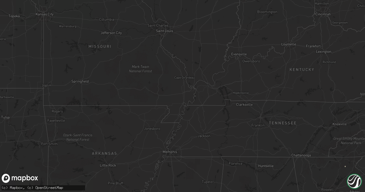
Hail Map in Minnesota on July 1, 2011
Get this storm
July 1 map
$229
one time, instant access
Download today. No call, no setup
Keep the $229
Bought the map and want the full workflow? Apply the entire $229 to a subscription within 7 days. None of it is wasted.
Every map, not just this one
This buys you this map. Subscription and you get every map we run, in the markets you choose from a few cities to whole states to nationwide. Plus real-time alerts the moment a storm fires.
Contact data
Name, contact info, occupancy, even credit band for addresses in the footprint. You go from where it hit to who to call.
Become the source they trust
Unlimited branding weather history reports on demand. You already have the documented answer ready for the property owner, and you are the one who showed up with it.
Property data and RoofTrace estimates
Pull up any address you have got, its value and the exact code rules for that jurisdiction, straight from One Click Code. Then RoofTrace estimates the squares, pitch, and roof value, priced the way you price.
Storm reports in Minnesota
Minnesota
| Date | Description |
|---|---|
| 07/01/20116:57 PM CDT | Trees down over roads in town |
| 07/01/20116:56 PM CDT | 2 foot trees down. Damage is in the town of orrock. |
| 07/01/20116:53 PM CDT | Top of large trees being snapped |
| 07/01/20116:52 PM CDT | 12 inch pine tree down by hwy 55 and hwy 25 |
| 07/01/20116:52 PM CDT | 24 inch tree down at 261st street and cty 5 |
| 07/01/20116:50 PM CDT | Trees down around highway 169...4 miles south of 49th ave. Time estimated. |
| 07/01/20116:45 PM CDT | One foot diameter tree down. |
| 07/01/20116:45 PM CDT | 6 inch to 8 inch branches down |
| 07/01/20116:45 PM CDT | Trees down |
| 07/01/20116:41 PM CDT | 50-60 mph measured |
| 07/01/20116:41 PM CDT | 14 inch to 16 inch trees down |
| 07/01/20116:38 PM CDT | Benton drive being closed due to trees in roadway. |
| 07/01/20116:36 PM CDT | A local report indicates 1.25 inch wind near SSE CAMBRIDGE |
| 07/01/20116:35 PM CDT | A local report indicates 1.75 inch wind near CAMBRIDGE |
| 07/01/20116:32 PM CDT | A local report indicates 1.00 inch wind near 12 N MORA |
| 07/01/20116:32 PM CDT | A local report indicates 68 MPH wind near MAPLE LAKE |
| 07/01/20116:32 PM CDT | Numerous trees down |
| 07/01/20116:31 PM CDT | A local report indicates 1.50 inch wind near ISANTI |
| 07/01/20116:30 PM CDT | 18 to 24 inch trees uprooted near northdale and foley. Tree fell on truck. |
| 07/01/20116:30 PM CDT | Three to four inch tree limbs downed. |
| 07/01/20116:30 PM CDT | Tree down 20 inches in diameter |
| 07/01/20116:30 PM CDT | 2 large 12 inch diameter trees down across pauls lake road. 6 inch diameter pine tree down on fence along 16th st se. Time estimated. |
| 07/01/20116:29 PM CDT | Roof blown off. Junction of 155th and 165th ave.estimated 3 miles from benton county border. |
| 07/01/20116:29 PM CDT | A local report indicates 1.00 inch wind near CAMBRIDGE |
| 07/01/20116:25 PM CDT | Multiple reports of downed trees blocking roads. Power lines down over roads. |
| 07/01/20116:23 PM CDT | A local report indicates 1.00 inch wind near 1 SW ZIMMERMAN |
| 07/01/20116:23 PM CDT | Tornado rated ef-0. It touched down just northeast of the intersection of i-94 and highway 23. Dozens of trees were broken... Toppled or pushed over as the tornado move |
| 07/01/20116:22 PM CDT | Measured at princeton airport |
| 07/01/20116:20 PM CDT | Downburst winds of 65 to 70 mph began hitting the northern portion of st cloud. Hundreds of trees were toppled or broken across several square miles near the hospital. |
| 07/01/20116:17 PM CDT | Many large trees downed. Roof damage to home residence. |
| 07/01/20116:17 PM CDT | A local report indicates 1.00 inch wind near 14 N MILACA |
| 07/01/20116:15 PM CDT | A local report indicates 70 MPH wind near 4 W BIG LAKE |
| 07/01/20116:15 PM CDT | A local report indicates 71 MPH wind near 1 S BIG LAKE |
| 07/01/20116:14 PM CDT | Measured at buffalo airport |
| 07/01/20116:13 PM CDT | Largest hailstone size 3.5 inches measured. |
| 07/01/20116:10 PM CDT | 12 to 18 inch trees down by centerville road and cty 14 |
| 07/01/20116:10 PM CDT | Numerous trees down just north of downtown by hospital. Time estimated. |
| 07/01/20116:08 PM CDT | A local report indicates 1.00 inch wind near ST AUGUSTA |
| 07/01/20116:06 PM CDT | A local report indicates 1.00 inch wind near 1 N SOUTH HAVEN |
| 07/01/20116:02 PM CDT | A local report indicates 2.75 inch wind near 5 N BIG LAKE |
| 07/01/20116:01 PM CDT | A local report indicates 70 MPH wind near 1 S BIG LAKE |
| 07/01/20116:00 PM CDT | Big trees down. 24 inch tree split off. |
| 07/01/20116:00 PM CDT | 24 inch tree down |
| 07/01/20116:00 PM CDT | Several large trees down...a few homes damaged. |
| 07/01/20116:00 PM CDT | 24 inch diameter tree uprooted. |
| 07/01/20116:00 PM CDT | A local report indicates 1.25 inch wind near 4 ENE BECKER |
| 07/01/20116:00 PM CDT | Estimated 70 mph wind gusts took out several large tree limbs and uprooted a tree. |
| 07/01/20115:58 PM CDT | A local report indicates 1.75 inch wind near 2 NNE BIG LAKE |
| 07/01/20115:58 PM CDT | Dents on truck |
| 07/01/20115:56 PM CDT | Utility power lost. |
| 07/01/20115:56 PM CDT | A local report indicates 1.75 inch wind near 8 SSE FULDA |
| 07/01/20115:56 PM CDT | County road 81 and highway 10 |
| 07/01/20115:55 PM CDT | Large trees down. Trees up to 36 inches snapped in half. Roof off a vet clinic. Estimated time. |
| 07/01/20115:52 PM CDT | A local report indicates 1.00 inch wind near RICE |
| 07/01/20115:50 PM CDT | A local report indicates 1.00 inch wind near 7 NNW BREWSTER |
| 07/01/20115:46 PM CDT | A local report indicates 1.00 inch wind near MONTICELLO |
| 07/01/20115:46 PM CDT | Semi blown off the road into the ditch. |
| 07/01/20115:45 PM CDT | Time estimated. |
| 07/01/20115:45 PM CDT | Numerous trees downed or uprooted on highway 212. Two businesses have portions of roofs off. One business had wall blown in. |
| 07/01/20115:45 PM CDT | A local report indicates 1.75 inch wind near SARTELL |
| 07/01/20115:44 PM CDT | A local report indicates 1.00 inch wind near 5 NNW ST CLOUD |
| 07/01/20115:44 PM CDT | A local report indicates 1.00 inch wind near 3 N FOLEY |
| 07/01/20115:43 PM CDT | A local report indicates 1.00 inch wind near 7 SW MONTICELLO |
| 07/01/20115:41 PM CDT | A local report indicates 1.00 inch wind near GROVE CITY |
| 07/01/20115:40 PM CDT | Main street |
| 07/01/20115:40 PM CDT | A local report indicates 2.00 inch wind near 4 S DASSEL |
| 07/01/20115:40 PM CDT | A local report indicates 1.75 inch wind near DARWIN |
| 07/01/20115:40 PM CDT | A local report indicates 1.00 inch wind near DASSEL |
| 07/01/20115:40 PM CDT | A local report indicates 2.00 inch wind near 2 S MONTICELLO |
| 07/01/20115:40 PM CDT | 2 inch to 4 inch diameter branches down. Main street. |
| 07/01/20115:40 PM CDT | Semi trailer blown over. |
| 07/01/20115:39 PM CDT | A local report indicates 1.00 inch wind near ANNANDALE |
| 07/01/20115:38 PM CDT | Power poles down |
| 07/01/20115:34 PM CDT | Reported at hutchinson airport |
| 07/01/20115:32 PM CDT | Interstate 94 and county road 2 |
| 07/01/20115:31 PM CDT | A local report indicates 1.00 inch wind near 4 SSE SILVER CREEK |
| 07/01/20115:30 PM CDT | One foot diameter trees down along with power lines. |
| 07/01/20115:30 PM CDT | One and a half inch diameter branches down. Highway 15. |
| 07/01/20115:30 PM CDT | Upper third of large tree toppled onto mini-van...crushing severely. Eight year old girl with multiple injuries admitted to local hospital. |
| 07/01/20115:30 PM CDT | A local report indicates 1.00 inch wind near OLIVIA |
| 07/01/20115:26 PM CDT | A local report indicates 2.00 inch wind near 1 WSW BUFFALO |
| 07/01/20115:25 PM CDT | Semi-trailer rolled into ditch on county road 15...three miles south of intersection of state road 212 and county road 15. Driver injured. |
| 07/01/20115:25 PM CDT | Two foot trees down. |
| 07/01/20115:25 PM CDT | Highway 55 and county road 12 |
| 07/01/20115:25 PM CDT | Two foot trees down. |
| 07/01/20115:24 PM CDT | A local report indicates 1.00 inch wind near COLLEGEVILLE |
| 07/01/20115:17 PM CDT | Via spotter network |
| 07/01/20115:17 PM CDT | Numerous trees down...some as wide as 2.5 feet. Several power lines down...some roof damage. All reported in downtown area. |
| 07/01/20115:15 PM CDT | A local report indicates 2.00 inch wind near 2 S DASSEL |
| 07/01/20115:12 PM CDT | A local report indicates 1.00 inch wind near DASSEL |
| 07/01/20115:11 PM CDT | Measured from the redwood falls airport |
| 07/01/20115:09 PM CDT | A local report indicates 1.00 inch wind near 2 SE DASSEL |
| 07/01/20115:08 PM CDT | Three power lines down. |
| 07/01/20115:05 PM CDT | A local report indicates 1.00 inch wind near 2 N MANANNAH |
| 07/01/20115:04 PM CDT | Strong thunderstorm winds downed trees and powerlines. Truck blown over. |
| 07/01/20115:04 PM CDT | Estimated time |
| 07/01/20115:03 PM CDT | Tornado rated ef-1. Touched down about 1/2 mile northwest of danube and moved north-northeast. It dissipated 3 n danube. Path length 2.5 miles and maximum width 300 yar |
| 07/01/20115:03 PM CDT | A local report indicates 1.75 inch wind near DARWIN |
| 07/01/20115:02 PM CDT | A local report indicates 2.75 inch wind near 2 S DASSEL |
| 07/01/20115:00 PM CDT | A local report indicates 1.25 inch wind near REDWOOD FALLS |
| 07/01/20115:00 PM CDT | Path of damage near county road 11...including at least 4 barns...house...school house...silo...and downed trees. Time estimated. |
| 07/01/20115:00 PM CDT | Ripped metal sheets off building exterior. |
| 07/01/20115:00 PM CDT | 3 power poles down. Top part of an 80 foot tree roughly 2.5 feet in diameter taken off. Report from spotter a-20. |
| 07/01/20114:58 PM CDT | Measured with car anemometer. |
| 07/01/20114:57 PM CDT | 5 inch diameter branches down |
| 07/01/20114:56 PM CDT | Measured at redwood valley high school |
| 07/01/20114:51 PM CDT | Measured at redwood falls airport |
| 07/01/20114:50 PM CDT | Time estimated. 5 inch diameter tree branches down. |
| 07/01/20114:41 PM CDT | Barn and outbuilding damage. Widespread tree damage. |
| 07/01/20114:40 PM CDT | Numerous trees down up to 3 feet in diameter. Some fell onto houses and buildings. Time was estimated. |
| 07/01/20114:31 PM CDT | Tornado rated ef-1. It touched down in redwood county... Moved across a corner of yellow medicine county... Back into redwood county where it moved through belview... T |
| 07/01/20114:31 PM CDT | Tornado rated ef-1. Touched down just east of the border with lyon county and moved northeast to 8 n milroy. Path length 2.5 miles with a maximum width of 300 yards. Tr |
| 07/01/20114:28 PM CDT | Severe wind damage reported in marshall minnesota. |
| 07/01/20114:25 PM CDT | 70 to 80 mile an hour thunderstorm winds in marshall minnesota. Lots of wind related damage. |
| 07/01/20114:25 PM CDT | Power is out in marshall with numerous trees down and windows blown out. Thunderstorm winds were estimated between 65 and 70 miles an hour. |
| 07/01/20114:25 PM CDT | 12+ inch trees down all across town |
| 07/01/20114:22 PM CDT | Large trees down in excess of 2.5 feet in diameter in garvin park |
| 07/01/20114:15 PM CDT | Barn destroyed...lots of significant tree damage |
| 07/01/20114:15 PM CDT | Large trees down in excess of 2.5 feet in diameter in garvin park |
| 07/01/20114:12 PM CDT | Trees uprooted. |
| 07/01/20114:10 PM CDT | Also very strong stright line winds uprooted trees. |
| 07/01/20114:08 PM CDT | 60 plus mile an hour thunderstorm winds. |
| 07/01/20114:08 PM CDT | Lost of tree damage. |
| 07/01/20114:05 PM CDT | Truck blown over and lots of tree damage in pipestone. |
| 07/01/20114:00 PM CDT | Lots of tree damage. |
| 07/01/20114:00 PM CDT | Strong thunderstorm winds downed trees and powerlines. Truck blown over. |
| 07/01/20113:59 PM CDT | A local report indicates 1.75 inch wind near TYLER |
| 07/01/20113:57 PM CDT | A local report indicates a tornado near TYLER |
| 07/01/20113:51 PM CDT | Nickel sized hail and 4 inch plus diameter tree limbs down |
| 07/01/20113:50 PM CDT | A local report indicates a tornado near RUTHTON |
| 07/01/20113:50 PM CDT | Numerous powerlines down on highway 14 |
| 07/01/20113:50 PM CDT | 6-8 inch diameter tree branches down...weather observation site blown down. |
| 07/01/20117:31 AM CDT | 6-8 inch branches down |
| 06/30/201110:27 PM CDT | Trees and power lines down. |
| 06/30/201110:22 PM CDT | A local report indicates 75 MPH wind near GRAND MEADOW |
| 06/30/201110:22 PM CDT | Tree blown down |
| 06/30/201110:22 PM CDT | Trees down in town |
| 06/30/201110:15 PM CDT | A local report indicates 61 MPH wind near 4 NW HOKAH |
| 06/30/20119:58 PM CDT | A local report indicates 72 MPH wind near 5 W PRESTON |
| 06/30/20119:56 PM CDT | A local report indicates 63 MPH wind near 2 SE EYOTA |
| 06/30/20119:52 PM CDT | Law enforcement reported roof damage to the wykoff middle school |
| 06/30/20119:42 PM CDT | Tree blown down |
| 06/30/20119:30 PM CDT | A couple of 6-8 inch in diameter trees down on southeast side of town. |
| 06/30/20119:16 PM CDT | A local report indicates 60 MPH wind near ELGIN |
| 06/30/20119:12 PM CDT | Some damage to trees and powerlines...time of report is an estimate based on radar and information from law enforcement. |
| 06/30/20119:10 PM CDT | A local report indicates 66 MPH wind near 3 SW PLAINVIEW |
| 06/30/20119:09 PM CDT | A local report indicates 58 MPH wind near 5 S ROCHESTER |
| 06/30/20119:03 PM CDT | Some damage to trees and powerlines |
| 06/30/20119:02 PM CDT | A local report indicates 60 MPH wind near HAYFIELD |
| 06/30/20118:55 PM CDT | 10 inch diameter tree and power line pole uprooted. |
| 06/30/20118:48 PM CDT | Two foot diameter tree down on home. |
| 06/30/20118:00 PM CDT | There was also lots of tree damage and powerlines down in and around the town of waseca |
| 06/30/20118:00 PM CDT | There was also lots of tree damage and powerlines down in and around the town of waseca |
| 06/30/20117:38 PM CDT | 2 foot diameter tree down |
| 06/30/20117:30 PM CDT | At glencoe airport. Estimated time. |
| 06/30/20117:30 PM CDT | Large trees blown down. |
| 06/30/20117:25 PM CDT | Trees down along hwy 15 toward brownton. Estimated time. |
| 06/30/20117:20 PM CDT | 2 foot diameter trees down. |
| 06/30/20117:20 PM CDT | Numerous trees down east of hinckley. Pine county sheriff dispatch. |
| 06/30/20117:20 PM CDT | Numerous trees down in pine city and to the east. Pine county sheriff. |
| 06/30/20117:17 PM CDT | Numerous trees down east of hinckley. Pine county sheriff dispatch. Corrected time and location. |
| 06/30/20117:17 PM CDT | Many 2 foot diamter trees down |
| 06/30/20117:15 PM CDT | Second story of house was slightly rotated. Damage to out building roof. Many trees down. One large healthy tree uprooted in yard. |
| 06/30/20117:10 PM CDT | Few trees down |
| 06/30/20117:07 PM CDT | A local report indicates 1.00 inch wind near MORRISTOWN |
| 06/30/20117:04 PM CDT | Numerous trees down in pine city and to the east. Pine county sheriff. Corrected time. |
| 06/30/20117:00 PM CDT | Large branches blocking highway 15 |
| 06/30/20117:00 PM CDT | 3 foot tree down. Power outages. Roof of vet hospital. |
| 06/30/20117:00 PM CDT | Widespread wind damage around rush city including multiple 12 inch diameter trees snapped. |
All States Impacted by Hail Map on July 1, 2011
Cities Impacted by Hail Map on July 1, 2011
- Portage, IN
- Lake Station, IN
- Gary, IN
- Hobart, IN
- Crown Point, IN
- Merrillville, IN
- Colton, SD
- Chester, SD
- Big Lake, MN
- Becker, MN
- Monticello, MN
- Algona, IA
- Redwood Falls, MN
- Huron, SD
- La Pointe, WI
- Sartell, MN
- Fulda, MN
- Chesterton, IN
- Beverly Shores, IN
- Westville, IN
- Michigan City, IN
- Ashkum, IL
- Danforth, IL
- Bogata, TX
- Charles City, IA
- Sandstone, MN
- Bruno, MN
- Hinckley, MN
- Askov, MN
- Idalia, CO
- Tyler, MN
- Brookings, SD
- Volga, SD
- Guyton, GA
- Grandville, MI
- Jenison, MI
- Slayton, MN
- Dassel, MN
- Wausau, WI
- Aniwa, WI
- Summerville, SC
- Lyle, MN
- Le Sueur, MN
- Saint Peter, MN
- Courtland, MN
- New Ulm, MN
- Byron Center, MI
- Brook Park, MN
- Ceylon, MN
- Dolliver, IA
- Fairmont, MN
- Armstrong, IA
- White, SD
- Astoria, SD
- Arco, MN
- Lake Benton, MN
- Russell, MN
- Minneapolis, MN
- Milaca, MN
- Princeton, MN
- Dalbo, MN
- Le Roy, MN
- Lake Lillian, MN
- Blomkest, MN
- Willow Lake, SD
- Clark, SD
- Avon, MN
- Cold Spring, MN
- Albany, MN
- Saint Joseph, MN
- Glidden, IA
- Carroll, IA
- Herbster, WI
- Hutchinson, MN
- Wall Lake, IA
- Litchfield, MN
- Darwin, MN
- Wheatland, WY
- Gordon, WI
- Nunica, MI
- Grand Haven, MI
- Spring Lake, MI
- Georgetown, SC
- Ladson, SC
- Moncks Corner, SC
- Goose Creek, SC
- Watkins, MN
- Ringsted, IA
- Fenton, IA
- Ivanhoe, MN
- Waseca, MN
- Pemberton, MN
- Janesville, MN
- Ghent, MN
- Wood Lake, MN
- Ruthton, MN
- Tracy, MN
- Lynd, MN
- Balaton, MN
- Vesta, MN
- Minneota, MN
- Marshall, MN
- Cottonwood, MN
- Canistota, SD
- De Berry, TX
- Madison, SD
- Kimball, SD
- Ostrander, MN
- Foxboro, WI
- Superior, WI
- South Range, WI
- Lafayette, LA
- Waucoma, IA
- Ionia, IA
- Elma, IA
- Calmar, IA
- New Hampton, IA
- Alta Vista, IA
- Fort Atkinson, IA
- Lawler, IA
- Willow River, MN
- Jolley, IA
- Rockwell City, IA
- Palmer, IA
- Manson, IA
- Pomeroy, IA
- Bellvue, CO
- Chamberlain, SD
- Pukwana, SD
- Olivia, MN
- Wesley, IA
- Scranton, IA
- White Cloud, MI
- Ridgeway, IA
- Decorah, IA
- Edgerton, MN
- Hardwick, MN
- Cokato, MN
- Bridgewater, SD
- Salem, SD
- Montrose, SD
- Webster City, IA
- Holland, MI
- West Olive, MI
- Drake, CO
- Loveland, CO
- Westbrook, MN
- Reading, MN
- Canova, SD
- Winfred, SD
- Gregory, SD
- Stacy, MN
- Wyoming, MN
- Sac City, IA
- Raymond, SD
- Carpenter, SD
- Chatsworth, IL
- Heron Lake, MN
- Wolsey, SD
- Virgil, SD
- Alpena, SD
- Wessington Springs, SD
- Wagener, SC
- Echo, MN
- Milroy, MN
- Prinsburg, MN
- Morton, MN
- Wabasso, MN
- Lucan, MN
- Danube, MN
- Willmar, MN
- Renville, MN
- Seaforth, MN
- Belview, MN
- Porter, MN
- Sacred Heart, MN
- Welcome, MN
- Breda, IA
- Auburn, IA
- Fort Myers, FL
- Statesboro, GA
- Register, GA
- Bayard, IA
- Brewster, MN
- Rutland, SD
- Ledyard, IA
- Elmore, MN
- Graettinger, IA
- Blue Earth, MN
- Granada, MN
- Cylinder, IA
- Swea City, IA
- Emmetsburg, IA
- Maple Lake, MN
- Elk River, MN
- Buffalo, MN
- Zimmerman, MN
- Ellabell, GA
- Brooklet, GA
- Pembroke, GA
- Bayfield, WI
- Lytton, IA
- Fonda, IA
- Flandreau, SD
- Ramona, SD
- Nunda, SD
- Elkton, SD
- Colman, SD
- Aurora, SD
- Pipestone, MN
- Wentworth, SD
- Egan, SD
- Rush, CO
- Amboy, MN
- Adair, IA
- Coopersville, MI
- Marne, MI
- Conklin, MI
- Vero Beach, FL
- Hudsonville, MI
- Zeeland, MI
- Mattawan, MI
- Paw Paw, MI
- Gobles, MI
- Garner, IA
- Klemme, IA
- Waite Park, MN
- Saint Cloud, MN
- Maple, WI
- Parkersburg, IA
- Wellsburg, IA
- Holland, IA
- Elkton, MN
- Ogden, IA
- Woodward, IA
- Madrid, IA
- Boone, IA
- Springview, NE
- Winner, SD
- Jackson, MN
- Spirit Lake, IA
- Estherville, IA
- Alpha, MN
- Dunnell, MN
- Wallingford, IA
- Trimont, MN
- Sherburn, MN
- Kimball, MN
- Broussard, LA
- Ona, FL
- Titonka, IA
- Lakota, IA
- Ackley, IA
- Steamboat Rock, IA
- Iowa Falls, IA
- Stewart, MN
- El Dorado, AR
- Estill, SC
- Rose Creek, MN
- Adams, MN
- Tillman, SC
- Pineland, SC
- Denmark, SC
- Stuart, IA
- Osage, IA
- Bingham Lake, MN
- Bird Island, MN
- Saint Paul, MN
- Silver Lake, MN
- Rice, MN
- Sauk Rapids, MN
- Medford, MN
- Faribault, MN
- Morristown, MN
- Joice, IA
- Emmet, AR
- Nemaha, IA
- Early, IA
- Britt, IA
- Corwith, IA
- Century, FL
- McDavid, FL
- Greene, IA
- Marble Rock, IA
- Stratford, IA
- Otho, IA
- Duncombe, IA
- Gowrie, IA
- Lohrville, IA
- Farnhamville, IA
- Callender, IA
- Moorland, IA
- Somers, IA
- Fort Dodge, IA
- Rolfe, IA
- Mallard, IA
- Havelock, IA
- Cedar Springs, MI
- Rockford, MI
- Sparta, MI
- Ayrshire, IA
- Curlew, IA
- Churdan, IA
- Solon Springs, WI
- Springfield, GA
- Marathon, WI
- McClellanville, SC
- Jamestown, SC
- Awendaw, SC
- Huger, SC
- Orchard, IA
- Conway, SC
- Cambridge, MN
- Stanchfield, MN
- Mora, MN
- Ogilvie, MN
- Braham, MN
- Clermont, IA
- Walterboro, SC
- Varnville, SC
- Ridgeland, SC
- Early Branch, SC
- Yemassee, SC
- Garnett, SC
- Ruffin, SC
- Tuskegee, AL
- Grand Rapids, MI
- Ravenna, MI
- Allendale, MI
- Riceville, IA
- Colome, SD
- Antigo, WI
- Merrill, WI
- Brokaw, WI
- Poplar, WI
- Humboldt, SD
- Dallas, SD
- Bushnell, FL
- Nora Springs, IA
- Rudd, IA
- Dell Rapids, SD
- South Haven, MN
- Vail, IA
- Madelia, MN
- Mankato, MN
- Nicollet, MN
- Hanska, MN
- Lake Crystal, MN
- Sleepy Eye, MN
- Lafayette, MN
- Port Wing, WI
- Franklin, MN
- Hector, MN
- Fairfax, MN
- Windom, MN
- Truman, MN
- Inglis, FL
- Bethel, MN
- Cedar, MN
- Momence, IL
- Chapin, IA
- Sheffield, IA
- Hampton, IA
- Fennville, MI
- South Haven, MI
- Donalsonville, GA
- Muskegon, MI
- Buffalo Center, IA
- Alden, MN
- Kiester, MN
- Thompson, IA
- Twin Lakes, MN
- Emmons, MN
- Forest City, IA
- Albert Lea, MN
- Lake Mills, IA
- Glenville, MN
- Hayward, MN
- Leland, IA
- Scarville, IA
- Northwood, IA
- Fort Collins, CO
- North Branch, MN
- Gilman, IL
- Texarkana, TX
- Pine City, MN
- Lime Springs, IA
- Wayland, MI
- Annandale, MN
- Duluth, MN
- Midway, AL
- Vernon Center, MN
- Lewisville, MN
- Winnebago, MN
- Saint James, MN
- Luverne, MN
- Williams, IA
- Grant, MI
- Sand Lake, MI
- Howard City, MI
- Strawn, IL
- Dougherty, IA
- Finlayson, MN
- Lake Nebagamon, WI
- Waverly, MN
- Montrose, MN
- Cope, CO
- Arriba, CO
- Anton, CO
- Lindon, CO
- Washburn, WI
- Tennille, GA
- Covert, MI
- Coloma, MI
- Caledonia, MI
- Paisley, FL
- Jeanerette, LA
- Waldo, AR
- Holyoke, MN
- Guthrie Center, IA
- Boyne Falls, MI
- Abbeville, LA
- New Iberia, LA
- Erath, LA
- Youngsville, LA
- Easton, MN
- Minnesota Lake, MN
- Ridgeville, SC
- Rockville, MN
- Saint Stephen, MN
- Clearwater, MN
- Holdingford, MN
- Chandler, MN
- Cusseta, GA
- Grand Junction, IA
- Kilkenny, MN
- Waterville, MN
- Fellsmere, FL
- Hemingway, SC
- Myrtle Beach, SC
- Melrose, WI
- Austin, MN
- Immokalee, FL
- Saint Francis, MN
- Harris, MN
- Isanti, MN
- Howard Lake, MN
- Richmond, MN
- Butterfield, MN
- Whittemore, IA
- Burt, IA
- Lone Rock, IA
- Stanhope, IA
- Kensett, IA
- Hanlontown, IA
- Grand Saline, TX
- Pierz, MN
- Foley, MN
- Royalton, MN
- Doland, SD
- Vienna, SD
- Deloit, IA
- Denison, IA
- Hopkins, MI
- Anoka, MN
- Dayton, MN
- Brownsdale, MN
- Wilmont, MN
- Rushmore, MN
- Eldora, IA
- Greenville, GA
- Lake City, IA
- Cresco, IA
- Rosston, AR
- Kirk, CO
- Darfur, MN
- Naples, FL
- Zumbrota, MN
- Fort Pierce, FL
- Laurens, IA
- Pocahontas, IA
- Livingston, LA
- Stacyville, IA
- Taopi, MN
- McIntire, IA
- Grantsburg, WI
- Yoder, CO
- Jasper, MN
- Apopka, FL
- Stratton, CO
- Bethune, CO
- Kiron, IA
- Circle Pines, MN
- Eagle Lake, MN
- Madison Lake, MN
- Isle, MN
- Orlando, FL
- Kasson, MN
- Fulton, SD
- Gann Valley, SD
- Roscoe, MN
- Paynesville, MN
- Rush City, MN
- Tuskegee Institute, AL
- Blooming Prairie, MN
- Ideal, SD
- Witten, SD
- Thawville, IL
- Hugo, MN
- Rockford, MN
- Loretto, MN
- Atwater, MN
- Groveland, FL
- Clermont, FL
- Union Mills, IN
- Wanatah, IN
- Glencoe, MN
- Montague, MI
- Holton, MI
- Whitehall, MI
- Rothbury, MI
- Twin Lake, MI
- Ashland, WI
- Alden, IA
- Mount Holly, AR
- Clifton, IL
- Martinton, IL
- Bagley, IA
- Cosmos, MN
- Buffalo Lake, MN
- Ormsby, MN
- Clear Lake, IA
- Ventura, IA
- Northfield, MN
- Dundas, MN
- Nerstrand, MN
- Aplington, IA
- Akron, CO
- Beaver Creek, MN
- Gaylord, MN
- Brownton, MN
- Iron River, WI
- Brule, WI
- Frost, MN
- Bancroft, IA
- Woden, IA
- Kanawha, IA
- Chebanse, IL
- Otsego, MI
- Belle Plaine, MN
- Henderson, MN
- Hamill, SD
- Lindstrom, MN
- Chisago City, MN
- Grove City, MN
- Andover, MN
- Coulter, IA
- Dows, IA
- Latimer, IA
- Rowan, IA
- Alexander, IA
- Geneva, IA
- Yale, SD
- Grant Park, IL
- Perry, IA
- Dawson, IA
- Yoder, WY
- Hawk Springs, WY
- Hubbard, IA
- Saint Anne, IL
- Danbury, WI
- Chetek, WI
- Junction City, AR
- Kenyon, MN
- Clarkfield, MN
- Lake Wilson, MN
- Belmond, IA
- Plymouth, IA
- Manly, IA
- Grafton, IA
- Atoka, OK
- Kenton, OH
- Forest, OH
- Onamia, MN
- Camp Hill, AL
- Glencoe, NM
- Ruidoso, NM
- Ellsworth, IA
- Jewell, IA
- Hillman, MN
- Hamel, MN
- Dedham, IA
- Coon Rapids, IA
- Wells, MN
- Spring Valley, MN
- Yale, IA
- Panora, IA
- Walloon Lake, MI
- Petoskey, MI
- Boyne City, MI
- Wabasha, MN
- Allegan, MI
- Hamilton, MI
- Edgar, WI
- Athens, WI
- Casnovia, MI
- Currie, NC
- Burgaw, NC
- Marine On Saint Croix, MN
- Kankakee, IL
- Rincon, GA
- Clyo, GA
- Dow City, IA
- Arion, IA
- Cavour, SD
- Hartford, SD
- Raymond, MN
- Hanley Falls, MN
- Taunton, MN
- Altoona, FL
- Saint Ansgar, IA
- Onarga, IL
- Green Isle, MN
- Magnolia, AR
- Colquitt, GA
- Strong, AR
- Perdido, AL
- Camden, AR
- Bricelyn, MN
- Clewiston, FL
- Mountain Lake, MN
- Holland, MN
- Maple Plain, MN
- Albertville, MN
- Delano, MN
- Rogers, MN
- Hanover, MN
- Grandy, MN
- Spencer, SD
- Saint Michael, MN
- Arlington, SD
- Garvin, MN
- Hendricks, MN
- Avoca, MN
- Mapleton, MN
- Delavan, MN
- Owatonna, MN
- Blairsburg, IA
- Walker, LA
- Denham Springs, LA
- Hartland, MN
- New Richland, MN
- Gibbon, MN
- Winthrop, MN
- Talco, TX
- Mason City, IA
- Ralston, IA
- Lanesboro, IA
- Portal, GA
- Wyoming, MI
- Dorr, MI
- Decatur, MI
- Linden, IA
- Plover, IA
- Minburn, IA
- Livermore, IA
- Hopkins, MN
- Menlo, IA
- Casey, IA
- Jefferson, IA
- Gilmore City, IA
- Daviston, AL
- Waverly, AL
- Lafayette, AL
- Lake View, IA
- Sautee Nacoochee, GA
- Helen, GA
- Springfield, MN
- Eden Prairie, MN
- Valparaiso, IN
- West Concord, MN
- Radcliffe, IA
- Fertile, IA
- La Porte, IN
- Lewiston, MN
- Rushford, MN
- Winona, MN
- Fruitport, MI
- Bailey, MI
- Thornton, IA
- Buena Vista, GA
- Pembroke Township, IL
- Bolivia, NC
- Warsaw, MN
- Wahkon, MN
- Osceola, WI
- Islandton, SC
- Kensal, ND
- Toronto, SD
- Arlington, MN
- Lismore, MN
- Kalamazoo, MI
- Adel, IA
- Boxholm, IA
- Exira, IA
- Jamaica, IA
- Redfield, IA
- Paton, IA
- Dana, IA
- Garden City, MN
- Swaledale, IA
- Good Thunder, MN
- Rock Falls, IA
- Little Cedar, IA
- Floyd, IA
- Colwell, IA
- Rockwell, IA
- Nashua, IA
- Meservey, IA
- Protivin, IA
- Rockford, IA
- Spillville, IA
- Genoa, CO
- Bangor, MI
- Chatfield, MN
- Fountain, MN
- Ellendale, MN
- Excelsior, MN
- Chanhassen, MN
- Wayzata, MN
- Minnetonka, MN
- Osseo, MN
- Champlin, MN
- Maple Grove, MN
- Stratford, WI
- Shelby, MI
- Hart, MI
- Hesperia, MI
- Alto, NM
- Cornucopia, WI
- Opelika, AL
- Auburn, AL
- Clear Lake, MN
- Lafayette, CO
- Louisville, CO
- Clarion, IA
- Galt, IA
- Morgan, MN
- Clements, MN
- Renwick, IA
- Lu Verne, IA
- Lillie, LA
- Summerfield, LA
- Alexandria, SD
- Dayton, IA
- Lehigh, IA
- Eden Valley, MN
- Center Point, LA
- Hayfield, MN
- Dresser, WI
- Shafer, MN
- Lyons, CO
- Lansing, MN
- Waltham, MN
- Grand Meadow, MN
- Dexter, MN
- Genoa, WI
- Odebolt, IA
- Jeffers, MN
- Sumterville, FL
- Wildwood, FL
- Bayboro, NC
- Dadeville, AL
- Lawrence, MI
- Clarks Grove, MN
- Watseka, IL
- Comfrey, MN
- Foreston, MN
- Saint Martin, MN
- Oak Park, MN
- Wrenshall, MN
- Goodwater, AL
- West Bend, IA
- Roberts, IL
- Piper City, IL
- Mascotte, FL
- Arcadia, WI
- Lagrange, WY
- Forest Lake, MN
- Dunkirk, OH
- Fort Benning, GA
- Estero, FL
- Fremont, MI
- Kasota, MN


