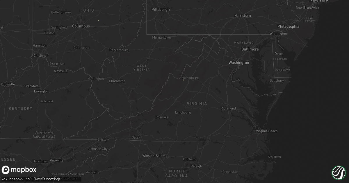
Hail Map in Virginia on June 28, 2025
Get this storm
June 28 map
$229
one time, instant access
Download today. No call, no setup
Keep the $229
Bought the map and want the full workflow? Apply the entire $229 to a subscription within 7 days. None of it is wasted.
Every map, not just this one
This buys you this map. Subscription and you get every map we run, in the markets you choose from a few cities to whole states to nationwide. Plus real-time alerts the moment a storm fires.
Contact data
Name, contact info, occupancy, even credit band for addresses in the footprint. You go from where it hit to who to call.
Become the source they trust
Unlimited branding weather history reports on demand. You already have the documented answer ready for the property owner, and you are the one who showed up with it.
Property data and RoofTrace estimates
Pull up any address you have got, its value and the exact code rules for that jurisdiction, straight from One Click Code. Then RoofTrace estimates the squares, pitch, and roof value, priced the way you price.
Storm reports in Virginia
Virginia
| Date | Description |
|---|---|
| 06/28/20256:58 PM CDT | A 73 mph gust was measured at the roanoke-blacksburg regional airport. |
| 06/28/20256:46 PM CDT | Power lines down in the 4000 block of kentucky avenue. Time estimated from radar. |
| 06/28/20256:45 PM CDT | Tree down on dickenson highway in clinchco. |
| 06/28/20256:18 PM CDT | A powerpoll was snapped along green spring road. |
| 06/28/20255:59 PM CDT | Tree downed onto power lines in the 4900 block of lee highway. Time estimated from radar. |
| 06/28/20255:35 PM CDT | One tree down in barren springs. |
| 06/28/20255:15 PM CDT | Tree down in south of the mountain rd near clintwood. |
| 06/28/20254:18 PM CDT | Tree down on 215 spring branch road. |
| 06/28/20254:09 PM CDT | Tree reported down on the 100 block of jonesboro road. |
| 06/28/20254:03 PM CDT | Numerous trees down north of madison on hampton village road... Hebron church road... And ruth road. |
| 06/28/20253:06 PM CDT | Trees down on power lines on shenandoah avenue in elkton. |
| 06/28/20252:38 PM CDT | Two trees reported down on weyers cave road between the 1000 block and the 1600 block. |
| 06/28/20251:02 PM CDT | Thunderstorm winds blew down one tree along the 600 block of dillons fork road. |
| 06/27/20258:28 PM CDT | A powerpoll was snapped along green spring road. |
| 06/27/20257:35 PM CDT | A few trees were down along wardensville grade and mcdonald road. |
| 06/27/20257:04 PM CDT | Thunderstorm winds blew down a large tree limb that fell on to a wire along the 900 block of grove lane. |
All States Impacted by Hail Map on June 28, 2025
Cities Impacted by Hail Map on June 28, 2025
- Erwin, SD
- De Smet, SD
- Hitchcock, SD
- Arlington, SD
- Lake Preston, SD
- Huron, SD
- Lake Norden, SD
- Badger, SD
- Worthington, MN
- Volga, SD
- Bruce, SD
- Brookings, SD
- Aurora, SD
- White, SD
- Elkton, SD
- Hartland, MN
- Albert Lea, MN
- Alden, MN
- Walnut Grove, MN
- Kevil, KY
- Metropolis, IL
- West Paducah, KY
- Paducah, KY
- Buchanan, TN
- Murray, KY
- Saint Louisville, OH
- Newark, OH
- Lebanon, TN
- Mount Solon, VA
- Lithia, FL
- Durham, NC
- Pittsboro, NC
- Stanton, TN
- Somerville, TN
- Corydon, IN
- Kensal, ND
- Chambersburg, PA
- Bradenton, FL
- Salisbury, NC
- Asheville, NC
- Auburndale, FL
- Waterville, PA
- Glenfield, ND
- Jersey Shore, PA
- Granville, OH
- Lexington, NC
- Winter Haven, FL
- Chapel Hill, TN
- Eagleville, TN
- Madison, FL
- Cogan Station, PA
- Grace City, ND
- Lock Haven, PA
- Brownsville, TN
- Linden, PA
- Williamsport, PA
- Lake Alfred, FL
- Mchenry, ND
- Berryville, VA
- Campbellsville, KY
- Myakka City, FL
- Jacksonville, FL
- Montoursville, PA
- Hulett, WY
- Henderson, NC
- Kittrell, NC
- Tolna, ND
- New Rockford, ND
- Pekin, ND
- Mocksville, NC
- Jacksonville Beach, FL
- Alzada, MT
- Belle Fourche, SD
- Vero Beach, FL
- Saint Cloud, FL
- Fort Pierce, FL
- Ripley, TN
- Summertown, TN
- Kimbolton, OH
- Kenansville, FL
- Okeechobee, FL
- Culleoka, TN
- Lakota, ND
- Michigan, ND
- Buffalo, SD
- Sutton, ND
- Tatum, NM
- Courtenay, ND
- Cleveland, GA
- Sautee Nacoochee, GA
- Clarkesville, GA
- Binford, ND
- Petersburg, ND
- Cambridge, OH
- Avon Park, FL
- Corinth, MS
- Nisland, SD
- Newell, SD
- Newcomerstown, OH
- Demorest, GA
- Martinsburg, WV
- Falling Waters, WV
- Williamsport, MD
- Page, ND
- Erie, ND
- Pembina, ND
- Saint Vincent, MN
- Hallock, MN
- Lancaster, MN
- Vale, SD
- Whitewood, SD
- Cooperstown, ND
- Wimbledon, ND
- Hannaford, ND
- Warwick, ND
- Hagerstown, MD
- Boonsboro, MD
- Union Springs, AL
- Shepherdstown, WV
- Fairfield, OH
- Hamilton, OH
- West Chester, OH
- Middletown, OH
- Venus, FL
- Rogers, ND
- Sebring, FL
- Punta Gorda, FL
- North Fort Myers, FL
- Arcadia, FL
- Lorida, FL
- Hunter, ND
- Arthur, ND
- Elizabeth, PA
- Monongahela, PA
- Clairton, PA
- Millersport, OH
- Gardner, ND
- Sanborn, ND
- Valley City, ND
- Sturgis, SD
- Union Center, SD
- Deer Lodge, TN
- Allardt, TN
- Manila, AR
- Webster, PA
- Belle Vernon, PA
- Lovington, NM
- Leachville, AR
- Troy, AL
- Mcdonald, NM
- Lake Placid, FL
- Labelle, FL
- Cincinnati, OH
- Moore Haven, FL
- New Underwood, SD
- Jamestown, TN
- Lake Bronson, MN
- Argusville, ND
- Enning, SD
- Box Elder, SD
- Sidney, NE
- Peetz, CO
- Crook, CO
- Lodgepole, NE
- Augusta, WV
- Romney, WV
- Sunbright, TN
- Robbins, TN
- Wasta, SD
- Howes, SD
- Piedmont, SD
- Blairsville, GA
- Healy, KS
- Felda, FL
- Immokalee, FL
- Caputa, SD
- Owanka, SD
- Manchester, OH
- Aberdeen, OH
- Castlewood, SD
- Galax, VA
- Fries, VA
- Morrow, OH
- Maineville, OH
- Junction City, OH
- New Straitsville, OH
- Rugby, TN
- Stoutsville, OH
- Circleville, OH
- Laurelville, OH
- Amanda, OH
- Tarlton, OH
- Lititz, PA
- Newmanstown, PA
- Monroe, OH
- South Lebanon, OH
- Mason, OH
- Blanchester, OH
- Pleasant Plain, OH
- Kings Mills, OH
- Badger, MN
- Greenbush, MN
- Leonard, ND
- Davenport, ND
- Kindred, ND
- Milbank, SD
- Big Stone City, SD
- Odessa, MN
- Bellingham, MN
- Marietta, MN
- Watertown, SD
- Goodwin, SD
- Clear Lake, SD
- Wall, SD
- Appleton, MN
- Hebron, OH
- Gunnison, MS
- Bloomery, WV
- Capon Bridge, WV
- Rapid City, SD
- Scenic, SD
- Hancock, MN
- Danvers, MN
- Lancaster, OH
- Hillsville, VA
- Austinville, VA
- Union, SC
- Horace, ND
- Willis, VA
- Decatur, AR
- Gravette, AR
- Buffalo, ND
- Hobbs, NM
- Labolt, SD
- Revillo, SD
- Wheatland, ND
- Mapleton, ND
- Quinn, SD
- Hope, IN
- Flat Rock, IN
- Walcott, ND
- Benson, MN
- Clontarf, MN
- Gary, SD
- Big Springs, NE
- Brule, NE
- Waynesville, OH
- Thornville, OH
- Pleasantville, OH
- Lebanon, OH
- Franklin, OH
- Clarksville, OH
- Bella Vista, AR
- Bentonville, AR
- Kadoka, SD
- Philip, SD
- Fairplay, MD
- Goshen, OH
- Loveland, OH
- Interior, SD
- Wanblee, SD
- Alliance, NE
- Ellsworth, NE
- Yuma, CO
- Haxtun, CO
- Holyoke, CO
- Wray, CO
- Amherst, CO
- Comstock, MN
- Moorhead, MN
- Holloway, MN
- Centerton, AR
- De Witt, AR
- Pryor, MT
- Lodge Grass, MT
- Bremen, OH
- Dacula, GA
- Buford, GA
- Madison, MN
- Sheridan Lake, CO
- Sabin, MN
- Rushville, OH
- Seminole, TX
- Barnesville, MN
- Inwood, WV
- Kearneysville, WV
- Hedgesville, WV
- Farwell, MN
- Morris, MN
- Fort Stockton, TX
- Wolverton, MN
- Rothsay, MN
- Pelican Rapids, MN
- Sheldon, ND
- Wyndmere, ND
- Mcleod, ND
- Alexandria, MN
- Garfield, MN
- Kensington, MN
- Carlos, MN
- Osakis, MN
- Long Prairie, MN
- Eagle Bend, MN
- Chokio, MN
- Alberta, MN
- Mooreton, ND
- Wahpeton, ND
- Colfax, ND
- Leoti, KS
- Cyrus, MN
- Winchester, OH
- Seaman, OH
- Lowry, MN
- Long Valley, SD
- Breckenridge, MN
- Campbell, MN
- Hankinson, ND
- Mantador, ND
- Nelson, MN
- Washington Boro, PA
- Conestoga, PA
- Peebles, OH
- Millersville, PA
- Stevens, PA
- Lebanon, PA
- Ephrata, PA
- Columbia, PA
- Mount Joy, PA
- Marietta, PA
- Lancaster, PA
- East Petersburg, PA
- Manheim, PA
- West Union, OH
- Angora, NE
- Bridgeport, NE
- Belvidere, SD
- White River, SD
- Norris, SD
- Saint Xavier, MT
- Garryowen, MT
- Fairmount, ND
- Strandburg, SD
- Canby, MN
- Julesburg, CO
- Salem, VA
- Points, WV
- Grey Eagle, MN
- Burtrum, MN
- Allen, SD
- Swanville, MN
- Marienthal, KS
- Barney, ND
- Kent, MN
- Logan, OH
- Sugar Grove, OH
- Pequea, PA
- Willow Street, PA
- Starbuck, MN
- Lidgerwood, ND
- Martin, SD
- Busby, MT
- Decker, MT
- Birney, MT
- Porcupine, SD
- Batesland, SD
- Clinton, SC
- Grantsville, WV
- Rosholt, SD
- New Effington, SD
- Sauk Centre, MN
- Melrose, MN
- Freeport, MN
- Correll, MN
- Laurens, SC
- Hazel, SD
- Sundance, WY
- Hill City, SD
- Hermosa, SD
- Recluse, WY
- Moorcroft, WY
- Weston, WY
- Lead, SD
- Gillette, WY
- Otter, MT
- Hayti, SD
- Boyd, MN
- Minneota, MN
- Porter, MN
- Taunton, MN
- Brandt, SD
- Estelline, SD
- Browerville, MN
- Brasstown, NC
- Greensburg, KY
- Clarissa, MN
- Deerfield, KS
- Holcomb, KS
- Garden City, KS
- Upsala, MN
- Johnson, KS
- Ware Shoals, SC
- Holdingford, MN
- Bowlus, MN
- Albany, MN
- Cushing, MN
- Astoria, SD
- Wheaton, MN
- Broadus, MT
- Glenwood, MN
- Villard, MN
- Charleston, MS
- Rosedale, MS
- Murdock, MN
- Avon, MN
- Royalton, MN
- Foley, MN
- Pierz, MN
- Saint Joseph, MN
- Rice, MN
- Saint Stephen, MN
- Sartell, MN
- Saint Cloud, MN
- Sauk Rapids, MN
- Foreston, MN
- Hillman, MN
- Oak Park, MN
- Toronto, SD
- Clarkfield, MN
- Granite Falls, MN
- Sacred Heart, MN
- Dawson, MN
- Hanley Falls, MN
- Wood Lake, MN
- Ivanhoe, MN
- Cottonwood, MN
- Hendricks, MN
- Sublette, KS
- Pierceville, KS
- Lakin, KS
- Hot Springs, SD
- Burton, WV
- Kyle, SD
- Bryant, SD
- Colome, SD
- Mount Zion, WV
- Springview, NE
- Winner, SD
- Valentine, NE
- Sparks, NE
- Buffalo Gap, SD
- Mission, SD
- Harrison, NE
- Minter City, MS
- Olive Hill, KY
- Dallas, SD
- Renville, MN
- Marshall, MN
- Echo, MN
- Ghent, MN
- Belview, MN
- Arco, MN
- Danube, MN
- Olivia, MN
- Lynd, MN
- Johnstown, NE
- Wood Lake, NE
- Copeland, KS
- Ingalls, KS
- Gregory, SD
- Burke, SD
- Ulysses, KS
- Jacksonburg, WV
- Smithfield, WV
- Montezuma, KS
- Cedar Bluff, VA
- Willow Lake, SD
- Kendall, KS
- Richfield, KS
- Willmar, MN
- Bandy, VA
- Mills, NE
- Pine Ridge, SD
- North Tazewell, VA
- Iroquois, SD
- Platte, SD
- Ainsworth, NE
- Long Pine, NE
- Plains, KS
- Devils Tower, WY
- Howard Lake, MN
- Brainerd, MN
- Oldham, SD
- Maple Lake, MN
- Annandale, MN
- Kimball, MN
- Monticello, MN
- Clearwater, MN
- South Haven, MN
- Clear Lake, MN
- Harrison, SD
- Corsica, SD
- Cold Spring, MN
- Buffalo, MN
- Hector, MN
- Bird Island, MN
- Brownton, MN
- Stewart, MN
- Buffalo Lake, MN
- Redwood Falls, MN
- Morton, MN
- Hutchinson, MN
- Vesta, MN
- Glencoe, MN
- Balaton, MN
- Seaforth, MN
- Russell, MN
- Milroy, MN
- Fairfax, MN
- Lucan, MN
- Tracy, MN
- Wabasso, MN
- Garvin, MN
- Franklin, MN
- Big Lake, MN
- Hemingford, NE
- Silver Lake, MN
- Winsted, MN
- Deerwood, MN
- Moscow, KS
- Cokato, MN
- Waverly, MN
- Ramona, SD
- Howard, SD
- Bassett, NE
- Saint Michael, MN
- Winfred, SD
- Young America, MN
- Cologne, MN
- Green Isle, MN
- Arlington, MN
- Norwood Young America, MN
- Morgan, MN
- Plato, MN
- New Auburn, MN
- Hamburg, MN
- Waconia, MN
- Winthrop, MN
- Lester Prairie, MN
- Chaska, MN
- Gaylord, MN
- Gibbon, MN
- Clements, MN
- Carver, MN
- New Germany, MN
- Maple Plain, MN
- Mound, MN
- Delano, MN
- Victoria, MN
- Watertown, MN
- Montrose, MN
- Excelsior, MN
- Saint Bonifacius, MN
- Mayer, MN
- Chanhassen, MN
- Hanover, MN
- Rockford, MN
- Hamel, MN
- Loretto, MN
- Wayzata, MN
- Long Lake, MN
- Rogers, MN
- Spring Park, MN
- Lusk, WY
- Herrick, SD
- Minneapolis, MN
- Osseo, MN
- Dayton, MN
- Eden Prairie, MN
- Minnetonka, MN
- Maple Grove, MN
- Alexandria, SD
- Alva, WY
- Belle Plaine, MN
- Lamberton, MN
- Hopkins, MN
- Henderson, MN
- Shakopee, MN
- Sleepy Eye, MN
- Sanborn, MN
- New Ulm, MN
- Springfield, MN
- Le Sueur, MN
- Wanda, MN
- Saint Peter, MN
- Lafayette, MN
- Comfrey, MN
- Courtland, MN
- Revere, MN
- Hanska, MN
- Nicollet, MN
- Lake Benton, MN
- Ruthton, MN
- Pipestone, MN
- Flandreau, SD
- Aladdin, WY
- Manderson, SD
- Tuthill, SD
- Wounded Knee, SD
- Sturgeon Lake, MN
- Saint Charles, SD
- Madison, SD
- Nunda, SD
- Merriman, NE
- Newport, NE
- Stuart, NE
- Bonesteel, SD
- Savage, MN
- Holland, MN
- Tyler, MN
- Woodstock, MN
- Rutland, SD
- Fedora, SD
- Jordan, MN
- Gordon, WI
- Solon Springs, WI
- Beulah, WY
- Saint Francis, SD
- Cody, NE
- Spearfish, SD
- Saint Onge, SD
- Artesian, SD
- Canova, SD
- Parmelee, SD
- Kilgore, NE
- Lake Wilson, MN
- Currie, MN
- Slayton, MN
- Springbrook, WI
- Carthage, SD
- Minong, WI
- Reva, SD
- Prairie City, SD
- Wentworth, SD
- Colman, SD
- Naper, NE
- Spencer, SD
- Crookston, NE
- Nenzel, NE
- Tripp, SD
- Avon, SD
- Bison, SD
- Wagner, SD
- Avoca, MN
- Satanta, KS
- Atkinson, NE
- Hayward, WI
- Prior Lake, MN
- Edgemont, SD
- Dante, SD
- Saint Paul, MN
- Lake Elmo, MN
- Stillwater, MN
- Afton, MN
- South Saint Paul, MN
- Hudson, WI
- Saint Paul Park, MN
- Houlton, WI
- Bayport, MN
- Hastings, MN
- Cottage Grove, MN
- Inver Grove Heights, MN
- Newport, MN
- Burnsville, MN
- River Falls, WI
- Lakeland, MN
- Mendota, MN
- Circle Pines, MN
- Hugo, MN
- Marine On Saint Croix, MN
- Willernie, MN
- Somerset, WI
- Roberts, WI
- New Richmond, WI
- Rosebud, SD
- Mud Butte, SD
- Fulda, MN
- Egan, SD
- Trent, SD
- Heron Lake, MN
- Westbrook, MN
- Lesterville, SD
- Niobrara, NE
- Center, NE
- Winter, WI
- Utica, SD
- Oral, SD
- Menno, SD
- Scotland, SD
- Springfield, SD
- Verdigre, NE
- Brewster, MN
- Delmont, SD
- Chambers, NE
- Lance Creek, WY
- Mission Hill, SD
- Volin, SD
- Bloomfield, NE
- Gilman, WI
- Fairburn, SD
- Ewing, NE
- Oelrichs, SD
- Crofton, NE
- Winnetoon, NE
- Yankton, SD
- Irene, SD
- Sheldon, WI
- Dell Rapids, SD
- Edgerton, MN
- Kennan, WI
- Catawba, WI
- Medford, WI
- Withee, WI
- Chadron, NE
- Fordyce, NE
- Saint Helena, NE
- Osage City, KS
- Gayville, SD
- Wausa, NE
- Amelia, NE
- Whitney, NE
- Westboro, WI
- Prentice, WI
- Decker, IN
- Vincennes, IN
- Baltic, SD
- Bartlett, NE
- Jasper, MN
- Hartington, NE
- Wynot, NE
- Phillips, WI
- Brantwood, WI
- Garretson, SD
- Beresford, SD
- Plainview, NE
- Neligh, NE
- Ogema, WI
- Dover, DE
- Lebo, KS
- Hammond, WI
- Baldwin, WI
- Inwood, IA
- Petersburg, NE
- Canton, SD
- Vermillion, SD
- Rib Lake, WI
- Camden Wyoming, DE
- Alcester, SD
- Hudson, SD
- Melvern, KS
- Fairview, SD
- Rock Valley, IA
- Merrill, WI
- Tripoli, WI
- Letcher, SD
- Plankinton, SD
- Lublin, WI
- Irma, WI
- Tomahawk, WI
- Stickney, SD
- Mount Vernon, SD
- Albion, NE
- Athens, WI
- Waverly, KS
- Hawarden, IA
- Pierce, NE
- Fort Meade, SD
- Lyndon, KS
- Garnett, KS
- Richmond, KS
- Norfolk, NE
- Brokaw, WI
- Wausau, WI
- Greeley, KS
- Marathon, WI
- Maurice, IA
- Orange City, IA
- Sioux Center, IA
- Stanton, NE
- Ireton, IA
- Independence, WI
- Le Mars, IA
- Atchison, KS
- Alton, IA
- Remsen, IA
- Oyens, IA
- Marcus, IA
- Granville, IA
- Oskaloosa, KS
- Ozawkie, KS
- Dodge, NE
- Howells, NE
- Nortonville, KS
- Pierre, SD
- Valley Falls, KS
- Deerbrook, WI
- Clarkson, NE
- Bryant, WI
- Macy, NE
- Parker, KS
- Lane, KS
- Wisner, NE
- Pilger, NE
- Leavenworth, KS
- Kingsley, IA
- Pierson, IA
- Tutwiler, MS
- Bridgewater, SD
- Columbus, NE
- Schuyler, NE
- West Point, NE
- Washta, IA
- Correctionville, IA
- Cleghorn, IA
- Quimby, IA
- Cherokee, IA
- Oakland, NE
- Blunt, SD
- Bellwood, NE
- McLouth, KS
- Lansing, KS
- Meriden, KS
- Easton, KS
- Winchester, KS
- Holstein, IA
- Scribner, NE
- Humboldt, NE
- Dawson, NE
- Kansas City, MO
- Platte City, MO
- Bruno, NE
- Linwood, NE
- David City, NE
- Blair, NE
- Fort Calhoun, NE
- Arlington, NE
- Mead, NE
- Yutan, NE
- Fremont, NE
- Bennington, NE
- Washington, NE
- Nickerson, NE
- Missouri Valley, IA
- Valley, NE
- Kennard, NE
- Crescent, IA
- Honey Creek, IA
- Omaha, NE
- Elkhorn, NE
- Council Bluffs, IA
- Neola, IA
- Waterloo, NE
- Underwood, IA
- Boys Town, NE
- Papillion, NE
- Gretna, NE
- Ashland, NE
- La Vista, NE
- McClelland, IA
- Carter Lake, IA
- Springfield, NE
- Ithaca, NE
- Verdon, NE
- Rock, MI
- Tonganoxie, KS
- Colon, NE
- Sturgeon Bay, WI
- Prague, NE
- Bark River, MI
- Escanaba, MI
- Bellevue, NE
- Hull, IA
- Sheldon, IA
- Boyden, IA
- Archer, IA
- Paullina, IA
- Primghar, IA
- Hartley, IA
- Sanborn, IA
- Sutherland, IA
- Hospers, IA
- Calumet, IA
- Meriden, IA
- Galva, IA
- Storm Lake, IA
- Peterson, IA
- Early, IA
- Larrabee, IA
- Aurelia, IA
- Schaller, IA
- Nemaha, IA
- Alta, IA
- Moville, IA
- Cushing, IA
- Akron, IA
- Lawton, IA
- Hinton, IA
- Chatsworth, IA
- Merrill, IA
- Brunsville, IA
- Westfield, IA
- Elk Point, SD
- Harrold, SD
- Highmore, SD
- Holabird, SD
- Onida, SD
- Stephan, SD
- Ree Heights, SD
- Miller, SD
- Independence, MO
- Dwight, NE
- Cornell, MI
- Valparaiso, NE
- Sabetha, KS
- Brussels, WI
- Salem, NE
- Falls City, NE
- Wahoo, NE
- Ceresco, NE
- Marinette, WI
- Abie, NE
- Weston, NE
- Forestville, WI
- Gann Valley, SD
- Wessington, SD
- Saint Lawrence, SD
- Wessington Springs, SD
- Danbury, IA
- Kiron, IA
- Battle Creek, IA
- Arthur, IA
- Anthon, IA
- Odebolt, IA
- Ida Grove, IA
- Pacific Junction, IA
- Offutt Afb, NE
- Plattsmouth, NE
- Murray, NE
- Louisville, NE
- Cedar Creek, NE
- Weeping Water, NE
- Nehawka, NE
- Glenwood, IA
- Newcastle, WY
- Talmage, NE
- Baileys Harbor, WI
- Fish Creek, WI
- Stella, NE
- Spearville, KS
- Seneca, KS
- Robinson, KS
- Highland, KS
- Baileyville, KS
- Egg Harbor, WI
- Basehor, KS
- Algoma, WI
- Wolsey, SD
- Virgil, SD
- Auburn, NE
- Nebraska City, NE
- Bern, KS
- Custer, SD
- Troy, KS
- Brock, NE
- Mountville, PA


