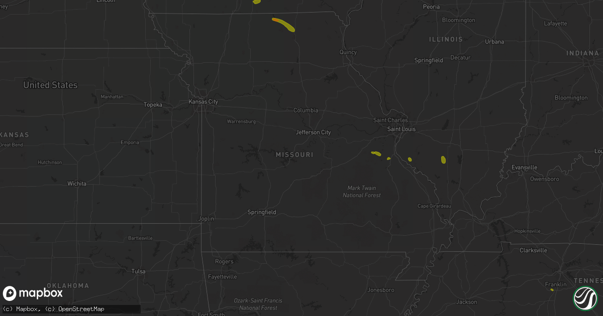
Hail Map in Missouri on June 28, 2018
Get this storm
June 28 map
$229
one time, instant access
Download today. No call, no setup
Keep the $229
Bought the map and want the full workflow? Apply the entire $229 to a subscription within 7 days. None of it is wasted.
Every map, not just this one
This buys you this map. Subscription and you get every map we run, in the markets you choose from a few cities to whole states to nationwide. Plus real-time alerts the moment a storm fires.
Contact data
Name, contact info, occupancy, even credit band for addresses in the footprint. You go from where it hit to who to call.
Become the source they trust
Unlimited branding weather history reports on demand. You already have the documented answer ready for the property owner, and you are the one who showed up with it.
Property data and RoofTrace estimates
Pull up any address you have got, its value and the exact code rules for that jurisdiction, straight from One Click Code. Then RoofTrace estimates the squares, pitch, and roof value, priced the way you price.
Storm reports in Missouri
Missouri
| Date | Description |
|---|---|
| 06/28/20186:50 PM CDT | *** 1 inj *** a person was hit by awning at intersection of hwy 51 and 61 due to strong winds. |
| 06/28/20185:57 PM CDT | Report via social media of tree down. Time estimated from radar. |
| 06/28/20185:56 PM CDT | Large healthy trees toppled. |
| 06/28/20185:54 PM CDT | Media report via social media. Trees and power lines down. Time estimated from radar. |
| 06/28/20185:42 PM CDT | Light pole snapped near base. Time estimated from radar. Twitter report. |
| 06/28/20185:41 PM CDT | Large tree uprooted blocking fountain avenue. |
| 06/28/20185:41 PM CDT | Report via social media of large tree limb down. |
| 06/28/20185:41 PM CDT | Delayed report: large tree down near the round about heading into forrest park near the zoo off 64/40. |
| 06/28/20185:38 PM CDT | Report via social media of tree down. |
| 06/28/20185:38 PM CDT | Large tree branches on power lines and blocking riverview drive near chambers road. |
| 06/28/20185:36 PM CDT | Corrects previous tstm wnd dmg report from 2 wnw spanish lake. Bus stop bench blown into the street and many limbs down. |
| 06/28/20185:33 PM CDT | Large tree fell onto house breaking through half of the house and destroying the entire room. |
| 06/28/20185:33 PM CDT | Corrects previous tstm wnd dmg report from spanish lake. Report via social media of tree down. Also a shed torn off. Time estimated from radar. |
| 06/28/20185:33 PM CDT | Corrects previous tstm wnd dmg report from spanish lake. Report via social media of tree down. Also a shed torn off. Time estimated from radar. |
| 06/28/20185:31 PM CDT | Delayed report: several trees down in areas along 94 and dwiggins. One largest tree was blocking 94. |
| 06/28/20185:28 PM CDT | Several large branches down across the area. |
| 06/28/20185:28 PM CDT | High voltage power lines down; pole to pole. Time estimated by radar. |
| 06/28/20185:28 PM CDT | Measured by oregon scientific instrument at hwy 270 and lindenberg blvd. |
| 06/28/20185:23 PM CDT | Damage to docks... A capsized boat... And wires down at liberty docks. |
| 06/28/20185:23 PM CDT | Two large trees snapped at base. Time estimated by radar. |
| 06/28/20185:18 PM CDT | Wooden barn flattened. |
| 06/28/20185:17 PM CDT | Wires down on veterans memorial and elm street near lindenwood university. Twitter report. |
| 06/28/20185:17 PM CDT | A local report indicates 59 MPH wind near 3 NNE ORCHARD FARMS |
| 06/28/20185:15 PM CDT | Delayed report: photo submitted on social media of a large silver maple tree down by wind near harvester and 94. Time estimated by radar. |
| 06/28/20184:40 PM CDT | Multiple reports of trees knocked down. |
| 06/28/20184:38 PM CDT | Large tree blocking riverview dr. Time estimated by radar. |
| 06/28/20184:22 PM CDT | A tree was downed and a stop sign was knocked over. |
| 06/28/20184:20 PM CDT | Power line down. |
| 06/28/20183:45 PM CDT | Tree across road. |
| 06/28/20182:15 PM CDT | Time estimated. 12 inch diameter tree downed by thunderstorm winds. |
| 06/28/20182:05 PM CDT | Winds occurred around 205 pm. |
| 06/28/20182:05 PM CDT | A local report indicates 60 MPH wind near KIRKSVILLE |
| 06/28/20181:55 PM CDT | *** 1 inj *** delayed report and time estimated from radar. Woman hospitalized from falling tree. Reported by wgem. |
| 06/28/20181:03 PM CDT | Quarter to ping pong ball size hail. |
| 06/28/201810:26 AM CDT | Several thousand customers without power in southern cape girardeau county and northern scott county. |
| 06/28/201810:15 AM CDT | Power lines down... Power outages reported. Report received via social media. |
| 06/28/201810:02 AM CDT | Wind gusts estimated 60 to 65 mph. |
| 06/28/201810:00 AM CDT | Numerous trees and power lines down. Report received via social media. |
| 06/28/20189:45 AM CDT | Large tree limbs down. Received via social media. |
| 06/28/20189:40 AM CDT | Tree down and hail... Size of hail unknown |
| 06/28/20187:57 AM CDT | At 1256 PM CDT, severe thunderstorms were located along a line extending from near Corydon to near Mercer, moving east at 40 mph. HAZARD...60 mph wind gusts and penny size hail. SOURCE...Radar indicated. IMPACT...Expect damage to roofs, siding, and trees. Locations impacted include... Centerville, Corydon, Seymour, Allerton, Humeston, Cincinnati, Lineville, Exline, Promise City, Numa, Clio, Plano, Pleasanton and Centerville Municipal Airport. |
| 06/28/20187:04 AM CDT | At 1202 PM CDT, severe thunderstorms were located along a line extending from 8 miles north of Lakeside Casino to 8 miles southwest of Osceola to 7 miles east of Mount Ayr, moving southeast at 55 mph. HAZARD...70 mph wind gusts and nickel size hail. SOURCE...Trained weather spotters. These storms have produced widespread 60 to 70 mph wind gusts with widespread wind damage. IMPACT...Expect considerable tree damage. Damage is likely to mobile homes, roofs, and outbuildings. Locations impacted include... Osceola, Chariton, Leon, Mount Ayr, Corydon, Lamoni, Sun Valley Lake, Lakeside Casino, Rathbun Lake, Murray, Seymour, Russell, Allerton, Humeston, New Virginia, Kellerton, Grand River, Van Wert, Lineville and Lucas.This includes Interstate 35 between mile markers 1 and 51. |
| 06/28/20186:24 AM CDT | At 1124 PM CDT, a severe thunderstorm was located near Bay, moving southwest at 55 mph. HAZARD...60 mph wind gusts. SOURCE...Radar indicated. IMPACT...Expect damage to roofs, siding, and trees. Locations impacted include... Jonesboro, Paragould, Trumann, Pocahontas, Walnut Ridge, Hoxie, Marked Tree, Harrisburg, Bono, Lake City, Lepanto, Bay, Brookland, Monette, Caraway, Tyronza, Black Rock, Lake Charles State Park, Crowleys Ridge State Park and Lake Frierson State Park. |
| 06/28/20185:54 AM CDT | At 1054 PM CDT, a severe thunderstorm was located over Lafe, or near Marmaduke, moving southwest at 50 mph. HAZARD...60 mph wind gusts and quarter size hail. SOURCE...Radar indicated. IMPACT...Hail damage to vehicles is expected. Expect wind damage to roofs, siding, and trees. Locations impacted include... Paragould, Pocahontas, Walnut Ridge, Corning, Hoxie, Marmaduke, Black Rock, Crowleys Ridge State Park, Lake Frierson State Park, Oak Grove Heights, Cardwell, Imboden, Arbyrd, Ravenden, Lafe, Reyno, College City, Portia, Maynard and Biggers. |
| 06/28/20184:57 AM CDT | At 957 AM CDT, a severe thunderstorm was located near Delta, or 8 miles northwest of Chaffee, moving southeast at 40 mph. HAZARD...70 mph wind gusts and quarter size hail. SOURCE...Radar indicated. IMPACT...Hail damage to vehicles is expected. Expect considerable tree damage. Wind damage is also likely to mobile homes, roofs, and outbuildings. Locations impacted include... Cape Girardeau, Sikeston, Scott City, Chaffee, Advance, Oran, Miner, Benton, Morley, Kelso, Bell City, Delta, Dutchtown, Hay-Wood City, Horseshoe Lake Conservation Area, Olive Branch, Thebes, Vanduser, Blodgett and Baker. |
| 06/28/20183:59 AM CDT | At 858 AM CDT, a severe thunderstorm was located over Fredericktown, moving southeast at 35 mph. HAZARD...Quarter size hail. SOURCE...Radar indicated. IMPACT...Damage to vehicles is expected. Locations impacted include... Fredericktown, Junction City, Cobalt, Marquand, Buckhorn, Mine La Motte and Catherine Place. |
| 06/28/20183:53 AM CDT | At 853 AM CDT, a severe thunderstorm was located over Perry, moving southeast at 25 mph. HAZARD...Quarter size hail. SOURCE...Radar indicated. IMPACT...Damage to vehicles is expected. Locations impacted include... Vandalia, Perry, Laddonia, Center, Farber, Curryville and Spencerburg. |
| 06/28/20183:14 AM CDT | At 814 PM CDT, severe thunderstorms were located along a line extending from near Eddyville to 6 miles south of Lone Oak to near Mound City, moving southeast at 70 mph. HAZARD...60 mph wind gusts. SOURCE...Radar indicated. IMPACT...Expect damage to roofs, siding, and trees. Locations impacted include... Paducah, Cairo, La Center, Wickliffe, Reidland, Lone Oak, Brookport, Mounds, Barlow, Mound City, Ledbetter, West Paducah, Lovelaceville, Ullin, Kevil, Olmsted, Smithland, Pulaski, Hamletsburg and Blandville. |
| 06/28/20183:03 AM CDT | At 803 AM CDT, a severe thunderstorm was located over Cedar Hill Lakes, moving southeast at 25 mph. HAZARD...Quarter size hail. SOURCE...Radar indicated. IMPACT...Damage to vehicles is expected. Locations impacted include... Festus, De Soto, Pevely, Crystal City, Herculaneum, Hillsboro, Byrnes Mill, Cedar Hill, Olympian Village, Cedar Hill Lakes, Dittmer, Horine, Scotsdale, Hematite, Victoria, Morse Mill, Oermann, Mapaville, Valles Mill and Grubville.This includes Interstate 55 in Missouri between exits 170 and 178. This also includes Sandy Creek Covered Bridge Historic Site. |
| 06/28/20182:58 AM CDT | At 758 AM CDT, a severe thunderstorm was located near Monroe City, moving southeast at 25 mph. HAZARD...Quarter size hail. SOURCE...Radar indicated. IMPACT...Damage to vehicles is expected. Locations impacted include... Center, Spaulding and The Landing. |
| 06/28/20182:35 AM CDT | At 734 PM CDT, severe thunderstorms were located along a line extending from near Equality to 10 miles north of Dixon Springs to near Goreville to near Cobden, moving southeast at 70 mph. HAZARD...70 mph wind gusts and quarter size hail. SOURCE...Trained weather spotters. IMPACT...Hail damage to vehicles is expected. Expect considerable tree damage. Wind damage is also likely to mobile homes, roofs, and outbuildings. Locations impacted include... Paducah, Metropolis, La Center, Wickliffe, Reidland, Lone Oak, Marion, Rosiclare, Brookport, Mounds, Salem, Barlow, Golconda, Mound City, Karnak, Burna, Ledbetter, Lovelaceville, New Columbia and Dixon Springs. |
| 06/28/20182:34 AM CDT | At 734 AM CDT, a severe thunderstorm was located near Perry, moving southeast at 20 mph. HAZARD...Quarter size hail. SOURCE...Radar indicated. IMPACT...Damage to vehicles is expected. Locations impacted include... Vandalia, Perry and Florida. This also includes Mark Twain Lake Recreational Area. |
| 06/28/20182:00 AM CDT | At 659 PM CDT, severe thunderstorms were located along a line extending from near Bluford to near Christopher to Percy, moving southeast at 50 mph. HAZARD...70 mph wind gusts and half dollar size hail. SOURCE...Radar indicated. IMPACT...Hail damage to vehicles is expected. Expect considerable tree damage. Wind damage is also likely to mobile homes, roofs, and outbuildings. Locations impacted include... Carbondale, Marion, Herrin, Harrisburg, Murphysboro, Carterville, Anna, Eldorado, Johnston City, Jonesboro, Vienna, Crainville, Cambria, Cobden, Energy, Goreville, Galatia, Ridgway, Hurst and Dongola. |
| 06/28/20181:10 AM CDT | At 610 AM CDT, a severe thunderstorm was located over Browning, or 9 miles south of Milan, moving southeast at 25 mph. HAZARD...60 mph wind gusts and quarter size hail. SOURCE...Radar indicated. IMPACT...Hail damage to vehicles is expected. Expect wind damage to roofs, siding, and trees. Locations impacted include... Linneus, Browning and Purdin. |
| 06/28/201812:58 AM CDT | At 557 AM CDT, a severe thunderstorm was located over Murry, moving south at 15 mph. HAZARD...Ping pong ball size hail and 60 mph wind gusts. SOURCE...Radar indicated. IMPACT...People and animals outdoors will be injured. Expect hail damage to roofs, siding, windows, and vehicles. Expect wind damage to roofs, siding, and trees. Locations impacted include... Columbia, Fulton, Columbia Regional Airport, Hallsville, Murry and Carrington.This includes Interstate 70 in Missouri between exits 131 and 144. |
| 06/28/201812:38 AM CDT | At 537 AM CDT, a severe thunderstorm was located 8 miles west of Milan, moving south at 25 mph. HAZARD...60 mph wind gusts and half dollar size hail. SOURCE...Radar indicated. IMPACT...Hail damage to vehicles is expected. Expect wind damage to roofs, siding, and trees. Locations impacted include... Milan, Browning, Galt, Humphreys, Osgood and Reger. |
| 06/28/201812:22 AM CDT | At 521 PM CDT, severe thunderstorms were located along a line extending from near Taylorville to Witt to near Carlinville to near Orchard Farms, moving southeast at 60 mph. HAZARD...60 mph wind gusts. SOURCE...Trained weather spotters. Numerous trees and power lines have been reported down when this line of storms moved through parts of Missouri and Illinois. IMPACT...Expect damage to roofs, siding, and trees. Locations impacted include... St. Louis, Chesterfield, Belleville, University City, Ballwin, Granite City, O'Fallon, Kirkwood, Maryland Heights, East St. Louis, Collinsville, Edwardsville, Webster Groves, Ferguson, Arnold, Manchester, Creve Coeur, Fairview Heights, Overland and Clayton.This includes the following highways... Interstate 70 in Illinois between exits 21 and 76. Interstate 55 in Illinois between exits 23 and 44. Interstate 57 in Illinois between exits 116 and 135. Interstate 64 in Illinois between exits 9 and 41. Interstate 44 in Missouri between exits 272 and 277. Interstate 55 in Missouri between exits 187 and 191.This also includes Scott Joplin Historic Site, Mastodon HistoricSite, Ramsey Lake State Park, Carlyle Lake Recreational Area, andHorseshoe Lake State Park. |
| 06/28/201812:18 AM CDT | At 517 AM CDT, a severe thunderstorm was located near Sturgeon, moving southeast at 25 mph. HAZARD...60 mph wind gusts and half dollar size hail. SOURCE...Radar indicated. IMPACT...Hail damage to vehicles is expected. Expect wind damage to roofs, siding, and trees. Locations impacted include... Centralia, Hallsville, Auxvasse, Sturgeon, Murry, Kingdom City and Hatton.This includes Interstate 70 in Missouri between exits 137 and 148. |
| 06/28/201812:13 AM CDT | At 513 AM CDT, a severe thunderstorm was located 10 miles southwest of Marceline, moving southeast at 30 mph. HAZARD...60 mph wind gusts and quarter size hail. SOURCE...Radar indicated. IMPACT...Hail damage to vehicles is expected. Expect wind damage to roofs, siding, and trees. Locations impacted include... Marceline, Brunswick, Keytesville, Mendon, Sumner, Rothville, Triplett, Dalton and Prairie Hill. |
| 06/28/201812:12 AM CDT | At 511 AM CDT, a severe thunderstorm was located over Sturgeon, moving southeast at 25 mph. HAZARD...60 mph wind gusts and quarter size hail. SOURCE...Radar indicated. IMPACT...Hail damage to vehicles is expected. Expect wind damage to roofs, siding, and trees. Locations impacted include... Centralia, Hallsville and Sturgeon. |
| 06/28/201812:05 AM CDT | At 505 AM CDT, a severe thunderstorm was located 8 miles east of Princeton, or 21 miles northwest of Milan, moving southeast at 20 mph. HAZARD...60 mph wind gusts and half dollar size hail. SOURCE...Radar indicated. IMPACT...Hail damage to vehicles is expected. Expect wind damage to roofs, siding, and trees. Locations impacted include... Princeton, Newtown, Lucerne, Harris and Osgood. |
| 06/27/201811:51 PM CDT | At 451 AM CDT, a severe thunderstorm was located near Martinsburg, moving east at 25 mph. HAZARD...Quarter size hail. SOURCE...Radar indicated. IMPACT...Damage to vehicles is expected. Locations impacted include... Laddonia, Martinsburg, New Hartford, Middletown and Rush Hill. |
| 06/27/201811:42 PM CDT | At 442 AM CDT, a severe thunderstorm was located near Laclede, or 7 miles west of Brookfield, moving southeast at 30 mph. HAZARD...60 mph wind gusts and half dollar size hail. SOURCE...Radar indicated. IMPACT...Hail damage to vehicles is expected. Expect wind damage to roofs, siding, and trees. Locations impacted include... Brookfield, Marceline, Meadville, Laclede, Mendon, Sumner, Rothville, Triplett and Saint Catherine. |
| 06/27/201811:34 PM CDT | At 433 AM CDT, a severe thunderstorm was located over Hallsville, moving southeast at 10 mph. HAZARD...Quarter size hail. SOURCE...Radar indicated. IMPACT...Damage to vehicles is expected. Locations impacted include... Columbia, Hallsville and Murry. This includes Interstate 70 in Missouri between exits 131 and 133. This also includes Finger Lakes State Park. |
| 06/27/201811:21 PM CDT | At 421 AM CDT, a severe thunderstorm was located near Linneus, or 13 miles northwest of Brookfield, moving southeast at 25 mph. HAZARD...60 mph wind gusts and quarter size hail. SOURCE...Radar indicated. IMPACT...Hail damage to vehicles is expected. Expect wind damage to roofs, siding, and trees. Locations impacted include... Brookfield, Meadville, Laclede, Linneus and Purdin. |
| 06/27/201810:53 PM CDT | At 353 AM CDT, a severe thunderstorm was located near Galt, or 10 miles east of Trenton, moving southeast at 25 mph. HAZARD...60 mph wind gusts and quarter size hail. SOURCE...Radar indicated. IMPACT...Hail damage to vehicles is expected. Expect wind damage to roofs, siding, and trees. Locations impacted include... Browning, Galt, Laredo and Humphreys. |
| 06/27/201810:02 PM CDT | Trees down. |
| 06/27/20189:43 PM CDT | Trees down. |
| 06/27/20189:29 PM CDT | At 227 PM CDT, severe thunderstorms were located along a line extending from near Lowell to near Wayland to near Colony, moving southeast at 50 mph. HAZARD...60 mph wind gusts and penny size hail. SOURCE...Radar indicated. IMPACT...Expect damage to roofs, siding, and trees. Locations impacted include... Burlington, Fort Madison, Keokuk, Carthage, Nauvoo, West Burlington, Hamilton, Warsaw, La Harpe, Dallas City, Danville, Montrose, Stronghurst, Bowen, Middletown, Carman, Terre Haute, West Point, Ferris and Gulf Port. |
| 06/27/20189:05 PM CDT | At 205 PM CDT, a severe thunderstorm was located near La Plata, moving southeast at 30 mph. HAZARD...60 mph wind gusts and quarter size hail. SOURCE...Radar indicated. IMPACT...Hail damage to vehicles is expected. Expect wind damage to roofs, siding, and trees. Locations impacted include... La Plata, Millard and Kirksville Regional. |
| 06/27/20189:00 PM CDT | At 200 PM CDT, severe thunderstorms were located along a line extending from near Cantril to near Greentop, moving southeast at 70 mph. HAZARD...60 mph wind gusts and quarter size hail. SOURCE...Radar indicated. IMPACT...Hail damage to vehicles is expected. Expect wind damage to roofs, siding, and trees. Locations impacted include... Edina, La Belle, Lewistown, Ewing, Knox City, Greensburg, Plevna, Steffenville, Colony, Hurdland, Novelty, Baring, Bethel, Monticello, Newark and Leonard. |
| 06/27/20188:54 PM CDT | At 153 PM CDT, severe thunderstorms were located along a line extending from near Delta to Birmingham to 6 miles southwest of Memphis, moving east at 55 mph. HAZARD...70 mph wind gusts and quarter size hail. SOURCE...Radar indicated. IMPACT...Hail damage to vehicles is expected. Expect considerable tree damage. Wind damage is also likely to mobile homes, roofs, and outbuildings. Locations impacted include... Fort Madison, Fairfield, Mount Pleasant, Kahoka, New London, Winfield, West Point, Donnellson, Brighton, Wayland, Birmingham, Bonaparte, Salem, Stockport, Lockridge, Olds, Wyaconda, Hillsboro, Franklin and St. Paul. |
| 06/27/20188:20 PM CDT | Large tree down near teen challenge in jackson |
| 06/27/20188:12 PM CDT | At 111 PM CDT, severe thunderstorms were located along a line extending from near Pella to 7 miles east of Unionville, moving east at 50 mph. HAZARD...70 mph wind gusts and nickel size hail. SOURCE...Radar indicated. IMPACT...Expect considerable tree damage. Damage is likely to mobile homes, roofs, and outbuildings. Locations impacted include... Fairfield, Sigourney, Memphis, Keosauqua, Hedrick, What Cheer, Richland, Batavia, Birmingham, Milton, Delta, Libertyville, Maharishi Vedic City, Keswick, Cantril, South English, Packwood, Harper, Martinsburg and Rutledge. |
| 06/27/20188:06 PM CDT | At 106 PM CDT, severe thunderstorms were located along a line extending from near Pella to near Albia to near Centerville, moving east at 50 mph. These are very dangerous storms. HAZARD...80 mph wind gusts and penny size hail. SOURCE...Trained weather spotters. These storms have a history of widespread wind damage. IMPACT...Flying debris will be dangerous to those caught without shelter. Mobile homes will be heavily damaged. Expect considerable damage to roofs, windows, and vehicles. Extensive tree damage and power outages are likely. Locations impacted include... Ottumwa, Oskaloosa, Bloomfield, Eddyville, Ottumwa Industrial Airport, Eldon, Fremont, Agency, University Park, Blakesburg, Pulaski, Drakesville, Barnes City, Rose Hill, Kirkville, Floris, Chillicothe, Keomah Village, Oskaloosa Municipal Airport and Lake Wapello State Park. |
| 06/27/20188:01 PM CDT | Public photo on social media: large limb or part of a large tree was blown down. Limb caused minor damage to the gutter of the house. |
| 06/27/20188:00 PM CDT | Trees and power lines down across highway n. |
| 06/27/20187:53 PM CDT | Large tree down near teen challenge in jackson |
| 06/27/20187:50 PM CDT | *** 1 inj *** a person was hit by awning at intersection of hwy 51 and 61 due to strong winds. |
| 06/27/20187:40 PM CDT | Correction from earlier report: delayed report: public photo shared via social media. Time is estimated by radar. |
| 06/27/20187:40 PM CDT | Delayed report: public photo shared via social media. Time is estimated by radar. |
| 06/27/20187:22 PM CDT | Large tree down by railroad crossing. |
All States Impacted by Hail Map on June 28, 2018
Cities Impacted by Hail Map on June 28, 2018
- Hettinger, ND
- Bowman, ND
- Elgin, ND
- Rhame, ND
- Carson, ND
- Strasburg, ND
- Shields, ND
- Reeder, ND
- New Leipzig, ND
- Pollock, SD
- Selfridge, ND
- Mott, ND
- Fort Yates, ND
- Scranton, ND
- Watauga, SD
- McLaughlin, SD
- McIntosh, SD
- Arvilla, ND
- Larimore, ND
- Niagara, ND
- Williston, ND
- Epping, ND
- Alexander, ND
- Watford City, ND
- Arnegard, ND
- Dunn Center, ND
- Halliday, ND
- Drake, ND
- Mcclusky, ND
- Anamoose, ND
- Butte, ND
- Martin, ND
- Underwood, ND
- Stanton, ND
- Harvey, ND
- Esmond, ND
- East Grand Forks, MN
- Grand Forks, ND
- Garrison, ND
- Golden Valley, ND
- Beulah, ND
- Roseglen, ND
- Douglas, ND
- Max, ND
- Dodge, ND
- Ryder, ND
- Cummings, ND
- Hillsboro, ND
- Marmarth, ND
- Killdeer, ND
- Westhope, ND
- Maxbass, ND
- Benedict, ND
- Ruso, ND
- New England, ND
- Regent, ND
- Amidon, ND
- Zap, ND
- Hazen, ND
- New Salem, ND
- Washburn, ND
- Turtle Lake, ND
- Mercer, ND
- Baldwin, ND
- Center, ND
- Wilton, ND
- Sterling, ND
- Steele, ND
- Driscoll, ND
- Chaseley, ND
- Hurdsfield, ND
- Bowdon, ND
- Tuttle, ND
- Robinson, ND
- New Rockford, ND
- Sheyenne, ND
- Grand Rapids, MN
- Deer River, MN
- Cohasset, MN
- Hill City, MN
- Remer, MN
- Federal Dam, MN
- Crookston, MN
- Cass Lake, MN
- Pennington, MN
- Bemidji, MN
- Bena, MN
- Wright, MN
- Bruno, MN
- Floodwood, MN
- Jacobson, MN
- Barnum, MN
- Mcgregor, MN
- Holyoke, MN
- Tamarack, MN
- Kerrick, MN
- Cromwell, MN
- Moose Lake, MN
- Swatara, MN
- Palisade, MN
- Aitkin, MN
- Sturgeon Lake, MN
- Kettle River, MN
- Finlayson, MN
- Willow River, MN
- Askov, MN
- McGrath, MN
- Shelly, MN
- Nielsville, MN
- Beltrami, MN
- Bejou, MN
- Winger, MN
- Fertile, MN
- Oklee, MN
- Mcintosh, MN
- Trail, MN
- Clearbrook, MN
- Corydon, IA
- Green Castle, MO
- Novinger, MO
- Unionville, MO
- Livonia, MO
- Worthington, MO
- Kirksville, MO
- Greentop, MO
- Eldon, IA
- Agency, IA
- Batavia, IA
- Ottumwa, IA
- Blakesburg, IA
- Exira, IA
- Westphalia, IA
- Panama, IA
- Audubon, IA
- Portsmouth, IA
- Brayton, IA
- Elk Horn, IA
- Harlan, IA
- Kimballton, IA
- Earling, IA
- Grass Range, MT
- Winnett, MT
- Brusett, MT
- Sand Springs, MT
- Mosby, MT
- Moore, MT
- Hobson, MT
- Buffalo, MT
- Otter, MT
- Broadus, MT
- Olive, MT
- Wilsall, MT
- Livingston, MT
- Cohagen, MT
- Vida, MT
- Circle, MT
- Buffalo, SD
- Boyes, MT
- Alzada, MT
- Camp Crook, SD
- Capitol, MT
- Hammond, MT
- Ludlow, SD
- Garryowen, MT
- Busby, MT
- Lame Deer, MT
- Powderville, MT
- Forsyth, MT
- Volborg, MT
- Big Timber, MT
- Fort Peck, MT
- Frazer, MT
- Wolf Point, MT
- Birney, MT
- Lodge Grass, MT
- Decker, MT
- Miles City, MT
- Ashland, MT
- Biddle, MT
- Ekalaka, MT
- Ismay, MT
- Melville, MT
- Rapelje, MT
- Reed Point, MT
- Ryegate, MT
- Saint Xavier, MT
- Recluse, WY
- Sheridan, WY
- Arvada, WY
- Clearmont, WY
- Franklin, TN
- Thompsons Station, TN
- Selmer, TN
- Hornsby, TN
- Pocahontas, TN
- Bethel Springs, TN
- Booneville, MS
- Rienzi, MS
- Corinth, MS
- Mantachie, MS
- Tupelo, MS
- Belden, MS
- Albion, NE
- Ewing, NE
- Tilden, NE
- Petersburg, NE
- Elgin, NE
- Newman Grove, NE
- Hay Springs, NE
- Hemingford, NE
- Du Quoin, IL
- Tamaroa, IL
- Pinckneyville, IL
- Evansville, IL
- Prairie Du Rocher, IL
- Red Bud, IL
- De Soto, MO
- Lonedell, MO
- Grubville, MO
- Dittmer, MO
- Hillsboro, MO
- Leesburg, AL
- Cedar Bluff, AL
- Grand Forks Afb, ND
- Mcville, ND
- Puposky, MN
- Ingomar, MT
- Emily, MN
- Outing, MN
- Lovilia, IA
- Novelty, MO
- Gibbs, MO
- La Plata, MO
- Brashear, MO
- Edwardsville, IL
- Golconda, IL
- Rosiclare, IL
- Herod, IL
- Herrin, IL
- Marion, IL
- Pittsburg, IL
- Creal Springs, IL
- Johnston City, IL
- Richwoods, MO
- Eddyville, IL
- Simpson, IL
- Stonefort, IL
- Las Animas, CO
- Duck River, TN
- Centerville, TN
- Princeton, KY
- Dawson Springs, KY
- Stevenson, AL
- Hollywood, AL
- Lyles, TN
- Burns, TN
- Dickson, TN
- Bon Aqua, TN
- Menlo, GA
- Stanton, TN
- Plummer, MN
- Orr, MN
- Squaw Lake, MN
- Wirt, MN
- Bigfork, MN
- Max, MN
- Talmoon, MN
- Blackduck, MN
- Northome, MN
- Spring Lake, MN
- Quinton, AL
- Jordan, MT
- Five Points, AL
- Lafayette, AL
- Roanoke, AL
- Fort Totten, ND
- Saint Michael, ND
- Hereford, AZ
- Mohall, ND
- Caledonia, ND
- Thorsby, AL
- Jemison, AL
- Roundup, MT
- Osceola, IA
- Murray, IA
- Annada, MO
- Trenton, IL
- Breese, IL
- Highland, IL
- Germantown, IL
- Aviston, IL
- Bethalto, IL
- Moro, IL
- Worden, IL
- Wood River, IL
- East Alton, IL
- Tennessee Ridge, TN
- Carlyle, IL
- Lawrenceburg, TN
- Danville, AL
- Uriah, AL
- Smithville, MS
- Warba, MN
- Swan River, MN
- Oakdale, IL
- Addieville, IL
- Leonard, MO
- Mount Pleasant, TN
- Nunnelly, TN
- Mound City, SD
- Glenham, SD
- House Springs, MO
- Cedar Hill, MO
- Culleoka, TN
- Belfield, ND
- Marble Hill, MO
- Nettleton, MS
- Mondamin, IA
- Pisgah, IA
- Lignite, ND
- Perry, MO
- Martinsdale, MT
- Joes, CO
- Powers Lake, ND
- Richey, MT
- Lambert, MT
- Shevlin, MN
- Angora, MN
- Tenstrike, MN
- Menoken, ND
- Sanborn, ND
- Spiritwood, ND
- Prole, IA
- Indianola, IA
- Saint Charles, IA
- Greeley, NE
- Menlo, IA
- Fontanelle, IA
- Stuart, IA
- Earlham, IA
- Adair, IA
- Van Meter, IA
- Winterset, IA
- Casey, IA
- Greenfield, IA
- Dexter, IA
- Hardin, IL
- Elsberry, MO
- Batchtown, IL
- Fieldon, IL
- Hamburg, IL
- Shelbyville, MO
- Salem, KY
- Marion, KY
- Marquand, MO
- Farmington, MO
- Fredericktown, MO
- Millersville, MO
- Burfordville, MO
- Whitewater, MO
- Jackson, MO
- Glenallen, MO
- Patton, MO
- Sedgewickville, MO
- Fletcher, MO
- Charleston, MO
- Sikeston, MO
- Clarksville, TN
- Hopkinsville, KY
- Walnut, MS
- Collinsville, AL
- Guntown, MS
- Saltillo, MS
- Fultondale, AL
- Birmingham, AL
- Mount Olive, AL
- Tuskegee, AL
- Clarksdale, MS
- Jackson, AL
- Coffeeville, AL
- Georgiana, AL
- Antler, ND
- Cook, MN
- Bowbells, ND
- Oberon, ND
- Leonard, MN
- Okawville, IL
- Nashville, IL
- Coulterville, IL
- Tiline, KY
- Sainte Genevieve, MO
- Mayfield, KY
- Boaz, KY
- Hickory, KY
- Detroit, AL
- Hamilton, AL
- Dadeville, AL
- Camp Hill, AL
- Rome, GA
- Salem, AL
- Opelika, AL
- Kinsey, MT
- McEwen, TN
- Fredonia, KY
- Munford, AL
- Talladega, AL
- Fulton, MS
- Lavina, MT
- Tekamah, NE
- Little Sioux, IA
- Lorimor, IA
- Stoutsville, MO
- Alamo, ND
- Godfrey, IL
- Wakpala, SD
- Pinson, AL
- Cathay, ND
- Festus, MO
- Buena Vista, GA
- Spring Hill, TN
- Ava, IL
- Vergennes, IL
- Potosi, MO
- Steelville, MO
- Pembroke, KY
- Oak Grove, KY
- Climax, MN
- Belleville, IL
- Mascoutah, IL
- O'Fallon, IL
- Saint Jacob, IL
- Scott Air Force Base, IL
- Lebanon, IL
- Prospect, TN
- Lansford, ND
- Buxton, ND
- Mentor, MN
- Erskine, MN
- Red Lake Falls, MN
- Orient, IA
- Macksburg, IA
- Shelbyville, TN
- Lynchburg, TN
- Fayetteville, TN
- Mulberry, TN
- Belvidere, TN
- Petersburg, TN
- Souris, ND
- Oakland, NE
- Monroe City, MO
- New London, MO
- Cornersville, TN
- Lynnville, TN
- Columbia, TN
- South Heart, ND
- Dickinson, ND
- Harrisburg, IL
- Devils Lake, ND
- Euclid, MN
- Fisher, MN
- Cloquet, MN
- Saginaw, MN
- Grand Junction, IA
- Blue Springs, MS
- Flat Rock, AL
- Louisiana, MO
- Kirk, CO
- Clearwater, NE
- Oakdale, NE
- Bartlett, NE
- Elsah, IL
- Alton, IL
- West Alton, MO
- Dow, IL
- Grafton, IL
- Jerseyville, IL
- West Point, NE
- Paris, MO
- Shelbina, MO
- Center, MO
- Williamsport, TN
- Hampshire, TN
- Hohenwald, TN
- Ethridge, TN
- Summertown, TN
- Sesser, IL
- Scheller, IL
- Minor Hill, TN
- Five Points, TN
- Leoma, TN
- Atlantic, IA
- Woodbine, IA
- Craig, NE
- Logan, IA
- Dunlap, IA
- Marne, IA
- Magnolia, IA
- Lyons, NE
- Missouri Valley, IA
- Walnut, IA
- Kirkman, IA
- Shelby, IA
- Murphysboro, IL
- Northwood, ND
- Santa Fe, TN
- College Grove, TN
- Lewisburg, TN
- Decatur, TN
- Park Hills, MO
- Bonne Terre, MO
- Eclectic, AL
- Equality, AL
- Wetumpka, AL
- Elkville, IL
- Wildrose, ND
- Kenmare, ND
- Hines, MN
- Hardin, MT
- Marissa, IL
- Woodlawn, IL
- Ashley, IL
- Waltonville, IL
- Bunker Hill, IL
- Shipman, IL
- Fults, IL
- Modoc, IL
- Waterloo, IL
- Allerton, IA
- Humeston, IA
- Saint Mary, MO
- Perryville, MO
- Smithland, KY
- Higdon, AL
- South Pittsburg, TN
- Ider, AL
- Rising Fawn, GA
- Bryant, AL
- Bridgeport, AL
- Paris, TN
- Litchville, ND
- Valley City, ND
- Ypsilanti, ND
- Rockwood, IL
- Chester, IL
- Iuka, IL
- Salem, IL
- Only, TN
- Rugby, ND
- Summerville, GA
- Pulaski, TN
- Emigrant, MT
- New Berlin, IL
- Marine, IL
- Mekinock, ND
- Littlefork, MN
- Walker, MN
- Big Falls, MN
- Marcell, MN
- Belgrade, MO
- Caledonia, MO
- Belleview, MO
- Whitwell, TN
- Ramsey, IL
- Brighton, IL
- Golden, MS
- Fosston, MN
- Bagley, MN
- Michie, TN
- Guys, TN
- Brierfield, AL
- West Blocton, AL
- West Frankfort, IL
- Thompsonville, IL
- Gleason, TN
- Midway, AL
- Union Springs, AL
- Robertsville, MO
- Mahnomen, MN
- Albia, IA
- Alhambra, IL
- Murray, KY
- Henderson, TN
- Holladay, TN
- Flora, IL
- Xenia, IL
- Barnhart, MO
- Elizabethtown, IL
- Hillsboro, AL
- Nashua, MT
- Morristown, SD
- Pleasant Plains, IL
- Loami, IL
- Mason City, IL
- Dorsey, IL
- Cottage Hills, IL
- Hamel, IL
- Bartelso, IL
- Louisville, IL
- Ramer, TN
- Dover, TN
- Stewart, TN
- Cumberland City, TN
- Erin, TN
- Frankewing, TN
- Dellrose, TN
- Minter, AL
- Orrville, AL
- Stockton, AL
- Hartselle, AL
- Hurtsboro, AL
- Waverly, TN
- Athens, TN
- Sherwood, ND
- Aneta, ND
- Columbus, ND
- Reynolds, ND
- Kilbourne, IL
- Melcher Dallas, IA
- Lacona, IA
- Wayland, MO
- Saint Patrick, MO
- Alexandria, MO
- Kahoka, MO
- Pevely, MO
- Seale, AL
- Pisgah, AL
- Ariton, AL
- Ohatchee, AL
- Alexandria, AL
- Town Creek, AL
- Leighton, AL
- Gardendale, AL
- New Town, ND
- Gonvick, MN
- Gully, MN
- Herreid, SD
- Lobelville, TN
- Glasgow, MT
- Brooks, MN
- Greenview, IL
- Ericson, NE
- Kampsville, IL
- Eddyville, IA
- Melrose, IA
- Mooreville, MS
- Shannon, MS
- Shawneetown, IL
- Rockbridge, IL
- Medora, IL
- Mentone, AL
- Mescalero, NM
- Randolph, AL
- Centreville, AL
- Parrish, AL
- Cordova, AL
- Primm Springs, TN
- Gary, MN
- Golden Eagle, IL
- Saint Charles, MO
- Lyerly, GA
- Pettibone, ND
- New Athens, IL
- Sherwood, TN
- Fairview Heights, IL
- Troy, IL
- Freeburg, IL
- Caseyville, IL
- Summerfield, IL
- Trinity, AL
- Lefor, ND
- Sandoval, IL
- Ecru, MS
- Pontotoc, MS
- Abbeville, GA
- Wyola, MT
- Crystal City, MO
- Herculaneum, MO
- Valmeyer, IL
- Benton, IL
- Ray, ND
- Borup, MN
- Montpelier, ND
- Marion, ND
- Longville, MN
- Gallatin Gateway, MT
- Big Sky, MT
- Edina, MO
- Big Sandy, TN
- Fairview, TN
- Chapel Hill, TN
- Tullahoma, TN
- Wartrace, TN
- Valley Head, AL
- Brockton, MT
- Pekin, ND
- Maddock, ND
- Bloomfield, MT
- Lindsay, MT
- Glendive, MT
- Woodworth, ND
- Argusville, ND
- Wing, ND
- Regan, ND
- Bismarck, ND
- Mandan, ND
- Moffit, ND
- Walcott, ND
- Christine, ND
- Wishek, ND
- Reva, SD
- Hosmer, SD
- Bloomfield, IA
- Unionville, IA
- Drakesville, IA
- Edinburg, IL
- Mechanicsburg, IL
- Neola, IA
- Persia, IA
- Okaton, SD
- Jacksonville, IL
- Vona, CO
- Cowden, IL
- Herrick, IL
- Nokomis, IL
- Irving, IL
- Witt, IL
- De Soto, IL
- Royalton, IL
- Carterville, IL
- Saint Louis, MO
- Arnold, MO
- Watson, IL
- Oran, MO
- Scott City, MO
- Chaffee, MO
- Benton, MO
- McGee, MO
- Benton, KY
- Indian Mound, TN
- Big Rock, TN
- Herndon, KY
- Trenton, KY
- Fort Campbell, KY
- Junction, IL
- Anna, IL
- Cerulean, KY
- Gracey, KY
- Dunlap, TN
- Pikeville, TN
- Evensville, TN
- Millington, TN
- Palmyra, TN
- Gaylesville, AL
- Baldwyn, MS
- Vinemont, AL
- Cullman, AL
- Horton, AL
- Piedmont, AL
- Lambert, MS
- Gadsden, AL
- Attalla, AL
- Leeds, AL
- Hogansville, GA
- Rainbow City, AL
- Hanceville, AL
- Houston, MS
- Trussville, AL
- Mulga, AL
- Adamsville, AL
- Morris, AL
- Mauk, GA
- Prattville, AL
- Eutaw, AL
- Boligee, AL
- Perry, GA
- Tallassee, AL
- Notasulga, AL
- Hayneville, AL
- Quitman, MS
- Mendenhall, MS
- Hawkinsville, GA
- Eastman, GA
- Beatrice, AL
- Cottondale, FL
- Marianna, FL
- Collins, MS
- Tallahassee, FL
- Sopchoppy, FL
- Elba, AL
- Glenwood, AL
- Brantley, AL
- Badger, MN
- Thompson, ND
- Mandaree, ND
- Mountain Iron, MN
- Solway, MN
- Hunter, ND
- Dawson, ND
- Flasher, ND
- Kennebec, SD
- Rushville, NE
- Braddock, ND
- Hazelton, ND
- Pilger, NE
- Wisner, NE
- Lineville, IA
- Clio, IA
- Weldon, IA
- Howells, NE
- Clarkson, NE
- Springfield, IL
- Riverton, IL
- Dawson, IL
- Palmyra, MO
- White Hall, IL
- Easton, IL
- Oakford, IL
- Bath, IL
- Petersburg, IL
- Athens, IL
- Greenfield, IL
- Bono, AR
- Section, AL
- Fort Payne, AL
- Palmer, TN
- Signal Mountain, TN
- Ironton, MO
- Wayne City, IL
- Luebbering, MO
- Blackwell, MO
- Catawissa, MO
- Villa Ridge, MO
- Pacific, MO
- Ardmore, TN
- Cadiz, KY
- Ellis Grove, IL
- Hazel, KY
- Frohna, MO
- Camden, TN
- Woodlawn, TN
- Eva, AL
- Joppa, AL
- Baileyton, AL
- Centre, AL
- Arab, AL
- Vandiver, AL
- Docena, AL
- Oneonta, AL
- Calera, AL
- Woodstock, AL
- Montevallo, AL
- Cottondale, AL
- Brookwood, AL
- Knoxville, AL
- Eufaula, AL
- Ozark, AL
- Gainesville, FL
- Sykeston, ND
- Lewistown, MT
- Hendrum, MN
- Halstad, MN
- Linton, ND
- White River, SD
- Madison, NE
- Freeman Spur, IL
- Brentwood, TN
- Thayer, IA
- Henry, TN
- Cottage Grove, TN
- Rogersville, AL
- Athens, AL
- Trion, GA
- Millbrook, AL
- Taylorville, IL
- Muscle Shoals, AL
- Greenwood Springs, MS
- Amory, MS
- Duncanville, AL
- Brent, AL
- Jones, AL
- Plantersville, AL
- Billingsley, AL
- Evergreen, AL
- Crofton, KY
- Lagrange, GA
- Wrightsville, GA
- Draper, SD
- Anniston, AL
- Knox City, MO
- Wingo, KY
- Cumberland Furnace, TN
- Cunningham, TN
- Jasper, AL
- Truro, IA
- Centerville, IA
- Cape Girardeau, MO
- Bloomfield, MO
- Hurricane Mills, TN
- Washington, IA
- Centralia, IL
- Logan, AL
- Hayden, AL
- Divide, MT
- Stanton, NE
- Leigh, NE
- Decatur, AL
- Yuma, CO
- La Vergne, TN
- Antioch, TN
- Smyrna, TN
- Waverly, AL
- Oak Ridge, MO
- Falkville, AL
- La Belle, MO
- Cookeville, TN
- Baxter, TN
- Fessenden, ND
- Warwick, ND
- Froid, MT
- Emerado, ND
- Grandin, ND
- Tolna, ND
- Oriska, ND
- Tower City, ND
- Dazey, ND
- Buffalo, ND
- Courtenay, ND
- Glyndon, MN
- Hawley, MN
- Sheldon, ND
- Enderlin, ND
- Almont, ND
- Chatham, IL
- Stratton, CO
- Milo, IA
- Columbia, IA
- Knoxville, IA
- Harvel, IL
- Farmersville, IL
- Waggoner, IL
- Brownstown, IL
- Saint Elmo, IL
- Altamont, IL
- Bertrand, MO
- Cadet, MO
- Dexter, MO
- Piggott, AR
- Manila, AR
- Puryear, TN
- Buchanan, TN
- Turrell, AR
- Sewanee, TN
- Fackler, AL
- Trenton, GA
- Blountsville, AL
- Auburn, GA
- Winder, GA
- Scottsboro, AL
- Altoona, AL
- Boaz, AL
- Eupora, MS
- Empire, AL
- Heflin, AL
- Atlanta, GA
- Concord, GA
- Gay, GA
- Williamson, GA
- Newnan, GA
- Toomsboro, GA
- Rockford, AL
- Upatoi, GA
- Pittsview, AL
- Clanton, AL
- Maplesville, AL
- Thomaston, AL
- Arlington, AL
- Jack, AL
- Brundidge, AL
- Frisco City, AL
- Gainestown, AL
- Wagarville, AL
- Williston, FL
- Archer, FL
- Jamestown, ND
- Fargo, ND
- Manning, ND
- Baker, MT
- Moorhead, MN
- Carrington, ND
- Medora, ND
- Felton, MN
- Pingree, ND
- Avoca, IA
- Beemer, NE
- Modale, IA
- Blencoe, IA
- Bancroft, NE
- Irwin, IA
- Norfolk, NE
- Huntsville, IL
- Camden, IL
- Rochester, IL
- Chariton, IA
- Bethel, MO
- Auburn, IL
- Virden, IL
- Eldred, IL
- Carrollton, IL
- Clarksville, MO
- Rockport, IL
- Pleasant Hill, IL
- Pana, IL
- Owaneco, IL
- Bingham, IL
- Alma, IL
- Kinmundy, IL
- East Saint Louis, IL
- Albers, IL
- New Baden, IL
- High Ridge, MO
- Keenes, IL
- Millstadt, IL
- Columbia, IL
- Altenburg, MO
- Baldwin, IL
- Friedheim, MO
- Eddyville, KY
- Burna, KY
- Dongola, IL
- Elkton, KY
- Dukedom, TN
- East Prairie, MO
- Vaughn, NM
- Cleveland, TN
- Cohutta, GA
- Paragould, AR
- Crossville, TN
- Wedowee, AL
- Crossville, AL
- Albertville, AL
- Cave Spring, GA
- Griffin, GA
- Fortson, GA
- Marshallville, GA
- Auburn, AL
- Louin, MS
- Raleigh, MS
- Grassy Butte, ND
- Stanley, ND
- Mchenry, ND
- Britt, MN
- Fairfield, ND
- Presho, SD
- Cumming, IA
- Norwalk, IA
- Anita, IA
- Bevington, IA
- Patterson, IA
- Martensdale, IA
- Saint Marys, IA
- Burlington, CO
- Rushville, IL
- Nebo, IL
- Logan, IL
- Hoyleton, IL
- Kell, IL
- Macedonia, IL
- Ewing, IL
- Alto Pass, IL
- Cairo, IL
- Carbondale, IL
- Clinton, KY
- White Bluff, TN
- Charlotte, TN
- Nashville, TN
- Vanleer, TN
- Linden, TN
- Bruceton, TN
- Kingston Springs, TN
- Belfast, TN
- Atwood, TN
- Drummonds, TN
- Estill Springs, TN
- Winchester, TN
- Flintville, TN
- Chickamauga, GA
- Rossville, GA
- Ringgold, GA
- Cleveland, AL
- Remlap, AL
- Lindale, GA
- Warrior, AL
- Union City, GA
- Tularosa, NM
- Bent, NM
- Fort Valley, GA
- Byron, GA
- McKenzie, AL
- Umatilla, FL
- Bottineau, ND
- Petersburg, ND
- New Concord, KY
- Dresden, TN
- Lexington, AL
- Henagar, AL
- West Point, GA
- Hardin, KY
- Dexter, KY
- Almo, KY
- French Camp, MS
- Kilmichael, MS
- Philadelphia, MO
- Medon, TN
- Coleharbor, ND
- Litchfield, IL
- Dodge, NE
- New Virginia, IA
- Columbus, GA
- Freeport, FL
- Gilbertown, AL
- Foxworth, MS
- Saint Libory, IL
- Glen Carbon, IL
- Hecker, IL
- Lenzburg, IL
- Smithton, IL
- Bluford, IL
- Mount Vernon, IL
- Mineral Point, MO
- Leadwood, MO
- McIntosh, AL
- Hannaford, ND
- Guin, AL
- Ramer, AL
- Solen, ND
- Thomasville, AL
- Hunnewell, MO
- Laddonia, MO
- Santa Fe, MO
- Sparta, IL
- Plantersville, MS
- Verona, MS
- Cooperstown, ND
- Binford, ND
- Saint Anthony, ND
- Readyville, TN
- Bradyville, TN
- Vance, AL
- Riverdale, ND
- Ada, MN
- Perley, MN
- Glen Ullin, ND
- Greycliff, MT
- Hurdland, MO
- Baring, MO
- Buffalo, WY
- Montrose, IA
- Argyle, IA
- Farmington, IA
- Hannibal, MO
- Lewistown, MO
- Ashland, IL
- Alexander, IL
- Palmersville, TN
- Patoka, IL
- Vandalia, IL
- McClure, IL
- Thebes, IL
- Mulberry Grove, IL
- Smithboro, IL
- Cobden, IL
- Belle Rive, IL
- Grand Tower, IL
- Pomona, IL
- Eolia, MO
- Portage Des Sioux, MO
- Venice, IL
- Pocahontas, IL
- Brussels, IL
- Madison, IL
- Florissant, MO
- Beckemeyer, IL
- Granite City, IL
- Burkesville, KY
- Tuscaloosa, AL
- Smiths Station, AL
- Franklin, GA
- Suwanee, GA
- Addison, AL
- Middleton, TN
- Rose Hill, MS
- Phenix City, AL
- Goodridge, MN
- Lengby, MN
- Bovey, MN
- Java, SD
- Meadow Grove, NE
- Moravia, IA
- Buffalo, IL
- Johnsonville, IL
- Collinsville, IL
- Donnellson, IL
- Frankford, MO
- Oconee, IL
- Ina, IL
- Bonnie, IL
- Du Bois, IL
- Whittington, IL
- Bloomsdale, MO
- Valles Mines, MO
- French Village, MO
- Leopold, MO
- Advance, MO
- White Plains, KY
- Rector, AR
- Alamo, TN
- Osceola, AR
- Bell Buckle, TN
- Normandy, TN
- Wildwood, GA
- Goodspring, TN
- Loretto, TN
- Tremont, MS
- Moulton, AL
- Jacksonville, AL
- Aberdeen, MS
- Douglasville, GA
- Vardaman, MS
- Muscadine, AL
- Fayetteville, GA
- Box Springs, GA
- Grantville, GA
- Chunky, MS
- Enterprise, MS
- Hickory, MS
- Ellisville, MS
- Monroeville, AL
- Weogufka, AL
- Fitzgerald, GA
- Rochelle, GA
- Repton, AL
- Chelsea, AL
- Sterrett, AL
- Stonewall, MS
- Hatchechubbee, AL
- Montgomery, AL
- Bunnell, FL
- Redlake, MN
- Laporte, MN
- Redby, MN
- Kelliher, MN
- Carlton, MN
- Michigan, ND
- Iron, MN
- Buchanan, ND
- Fort Ransom, ND
- Nome, ND
- Kathryn, ND
- Garden Grove, IA
- New Douglas, IL
- Staunton, IL
- Beardstown, IL
- Beecher City, IL
- Buncombe, IL
- Kirksey, KY
- Bumpus Mills, TN
- Cypress, IL
- Springville, TN
- Carrier Mills, IL
- New Burnside, IL
- Equality, IL
- Ozark, IL
- Ashland City, TN
- Bolivar, TN
- Graysville, TN
- Soddy Daisy, TN
- Dayton, TN
- Sequatchie, TN
- Jasper, TN
- Decherd, TN
- Cowan, TN
- Sulligent, AL
- Spencer, TN
- Brownsville, TN
- Ashville, AL
- Ragland, AL
- Trafford, AL
- Vincent, AL
- Alpine, AL
- Northport, AL
- Woodland, AL
- Newton, MS
- Midland, GA
- Silas, AL
- Millry, AL
- Ty Ty, GA
- Sumner, GA
- Abbeville, AL
- Crawfordville, FL


