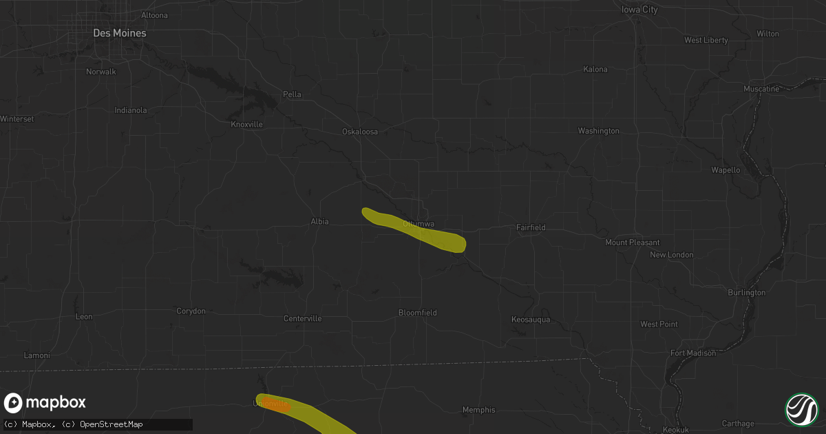
Hail Map in Ottumwa, IA on June 28, 2018
Get this storm
June 28 map
$229
one time, instant access
Download today. No call, no setup
Keep the $229
Bought the map and want the full workflow? Apply the entire $229 to a subscription within 7 days. None of it is wasted.
Every map, not just this one
This buys you this map. Subscription and you get every map we run, in the markets you choose from a few cities to whole states to nationwide. Plus real-time alerts the moment a storm fires.
Contact data
Name, contact info, occupancy, even credit band for addresses in the footprint. You go from where it hit to who to call.
Become the source they trust
Unlimited branding weather history reports on demand. You already have the documented answer ready for the property owner, and you are the one who showed up with it.
Property data and RoofTrace estimates
Pull up any address you have got, its value and the exact code rules for that jurisdiction, straight from One Click Code. Then RoofTrace estimates the squares, pitch, and roof value, priced the way you price.
Storm reports in Ottumwa, IA
Ottumwa, IA
| Date | Description |
|---|---|
| 06/28/20181:38 PM CDT | Via social media. |
| 06/28/20181:38 PM CDT | Via social media. |
| 06/28/20181:32 PM CDT | Rwis report. |
| 06/28/20181:25 PM CDT | Tree down on house. Time estimated by radar. |
All States Impacted by Hail Map on June 28, 2018
All Cities Impacted by Hail Map on June 28, 2018
- Hettinger, ND
- Bowman, ND
- Elgin, ND
- Rhame, ND
- Carson, ND
- Strasburg, ND
- Shields, ND
- Reeder, ND
- New Leipzig, ND
- Pollock, SD
- Selfridge, ND
- Mott, ND
- Fort Yates, ND
- Scranton, ND
- Watauga, SD
- McLaughlin, SD
- McIntosh, SD
- Arvilla, ND
- Larimore, ND
- Niagara, ND
- Williston, ND
- Epping, ND
- Alexander, ND
- Watford City, ND
- Arnegard, ND
- Dunn Center, ND
- Halliday, ND
- Drake, ND
- Mcclusky, ND
- Anamoose, ND
- Butte, ND
- Martin, ND
- Underwood, ND
- Stanton, ND
- Harvey, ND
- Esmond, ND
- East Grand Forks, MN
- Grand Forks, ND
- Garrison, ND
- Golden Valley, ND
- Beulah, ND
- Roseglen, ND
- Douglas, ND
- Max, ND
- Dodge, ND
- Ryder, ND
- Cummings, ND
- Hillsboro, ND
- Marmarth, ND
- Killdeer, ND
- Westhope, ND
- Maxbass, ND
- Benedict, ND
- Ruso, ND
- New England, ND
- Regent, ND
- Amidon, ND
- Zap, ND
- Hazen, ND
- New Salem, ND
- Washburn, ND
- Turtle Lake, ND
- Mercer, ND
- Baldwin, ND
- Center, ND
- Wilton, ND
- Sterling, ND
- Steele, ND
- Driscoll, ND
- Chaseley, ND
- Hurdsfield, ND
- Bowdon, ND
- Tuttle, ND
- Robinson, ND
- New Rockford, ND
- Sheyenne, ND
- Grand Rapids, MN
- Deer River, MN
- Cohasset, MN
- Hill City, MN
- Remer, MN
- Federal Dam, MN
- Crookston, MN
- Cass Lake, MN
- Pennington, MN
- Bemidji, MN
- Bena, MN
- Wright, MN
- Bruno, MN
- Floodwood, MN
- Jacobson, MN
- Barnum, MN
- Mcgregor, MN
- Holyoke, MN
- Tamarack, MN
- Kerrick, MN
- Cromwell, MN
- Moose Lake, MN
- Swatara, MN
- Palisade, MN
- Aitkin, MN
- Sturgeon Lake, MN
- Kettle River, MN
- Finlayson, MN
- Willow River, MN
- Askov, MN
- McGrath, MN
- Shelly, MN
- Nielsville, MN
- Beltrami, MN
- Bejou, MN
- Winger, MN
- Fertile, MN
- Oklee, MN
- Mcintosh, MN
- Trail, MN
- Clearbrook, MN
- Corydon, IA
- Green Castle, MO
- Novinger, MO
- Unionville, MO
- Livonia, MO
- Worthington, MO
- Kirksville, MO
- Greentop, MO
- Eldon, IA
- Agency, IA
- Batavia, IA
- Ottumwa, IA
- Blakesburg, IA
- Exira, IA
- Westphalia, IA
- Panama, IA
- Audubon, IA
- Portsmouth, IA
- Brayton, IA
- Elk Horn, IA
- Harlan, IA
- Kimballton, IA
- Earling, IA
- Grass Range, MT
- Winnett, MT
- Brusett, MT
- Sand Springs, MT
- Mosby, MT
- Moore, MT
- Hobson, MT
- Buffalo, MT
- Otter, MT
- Broadus, MT
- Olive, MT
- Wilsall, MT
- Livingston, MT
- Cohagen, MT
- Vida, MT
- Circle, MT
- Buffalo, SD
- Boyes, MT
- Alzada, MT
- Camp Crook, SD
- Capitol, MT
- Hammond, MT
- Ludlow, SD
- Garryowen, MT
- Busby, MT
- Lame Deer, MT
- Powderville, MT
- Forsyth, MT
- Volborg, MT
- Big Timber, MT
- Fort Peck, MT
- Frazer, MT
- Wolf Point, MT
- Birney, MT
- Lodge Grass, MT
- Decker, MT
- Miles City, MT
- Ashland, MT
- Biddle, MT
- Ekalaka, MT
- Ismay, MT
- Melville, MT
- Rapelje, MT
- Reed Point, MT
- Ryegate, MT
- Saint Xavier, MT
- Recluse, WY
- Sheridan, WY
- Arvada, WY
- Clearmont, WY
- Franklin, TN
- Thompsons Station, TN
- Selmer, TN
- Hornsby, TN
- Pocahontas, TN
- Bethel Springs, TN
- Booneville, MS
- Rienzi, MS
- Corinth, MS
- Mantachie, MS
- Tupelo, MS
- Belden, MS
- Albion, NE
- Ewing, NE
- Tilden, NE
- Petersburg, NE
- Elgin, NE
- Newman Grove, NE
- Hay Springs, NE
- Hemingford, NE
- Du Quoin, IL
- Tamaroa, IL
- Pinckneyville, IL
- Evansville, IL
- Prairie Du Rocher, IL
- Red Bud, IL
- De Soto, MO
- Lonedell, MO
- Grubville, MO
- Dittmer, MO
- Hillsboro, MO
- Leesburg, AL
- Cedar Bluff, AL
- Grand Forks Afb, ND
- Mcville, ND
- Puposky, MN
- Ingomar, MT
- Emily, MN
- Outing, MN
- Lovilia, IA
- Novelty, MO
- Gibbs, MO
- La Plata, MO
- Brashear, MO
- Edwardsville, IL
- Golconda, IL
- Rosiclare, IL
- Herod, IL
- Herrin, IL
- Marion, IL
- Pittsburg, IL
- Creal Springs, IL
- Johnston City, IL
- Richwoods, MO
- Eddyville, IL
- Simpson, IL
- Stonefort, IL
- Las Animas, CO
- Duck River, TN
- Centerville, TN
- Princeton, KY
- Dawson Springs, KY
- Stevenson, AL
- Hollywood, AL
- Lyles, TN
- Burns, TN
- Dickson, TN
- Bon Aqua, TN
- Menlo, GA
- Stanton, TN
- Plummer, MN
- Orr, MN
- Squaw Lake, MN
- Wirt, MN
- Bigfork, MN
- Max, MN
- Talmoon, MN
- Blackduck, MN
- Northome, MN
- Spring Lake, MN
- Quinton, AL
- Jordan, MT
- Five Points, AL
- Lafayette, AL
- Roanoke, AL
- Fort Totten, ND
- Saint Michael, ND
- Hereford, AZ
- Mohall, ND
- Caledonia, ND
- Thorsby, AL
- Jemison, AL
- Roundup, MT
- Osceola, IA
- Murray, IA
- Annada, MO
- Trenton, IL
- Breese, IL
- Highland, IL
- Germantown, IL
- Aviston, IL
- Bethalto, IL
- Moro, IL
- Worden, IL
- Wood River, IL
- East Alton, IL
- Tennessee Ridge, TN
- Carlyle, IL
- Lawrenceburg, TN
- Danville, AL
- Uriah, AL
- Smithville, MS
- Warba, MN
- Swan River, MN
- Oakdale, IL
- Addieville, IL
- Leonard, MO
- Mount Pleasant, TN
- Nunnelly, TN
- Mound City, SD
- Glenham, SD
- House Springs, MO
- Cedar Hill, MO
- Culleoka, TN
- Belfield, ND
- Marble Hill, MO
- Nettleton, MS
- Mondamin, IA
- Pisgah, IA
- Lignite, ND
- Perry, MO
- Martinsdale, MT
- Joes, CO
- Powers Lake, ND
- Richey, MT
- Lambert, MT
- Shevlin, MN
- Angora, MN
- Tenstrike, MN
- Menoken, ND
- Sanborn, ND
- Spiritwood, ND
- Prole, IA
- Indianola, IA
- Saint Charles, IA
- Greeley, NE
- Menlo, IA
- Fontanelle, IA
- Stuart, IA
- Earlham, IA
- Adair, IA
- Van Meter, IA
- Winterset, IA
- Casey, IA
- Greenfield, IA
- Dexter, IA
- Hardin, IL
- Elsberry, MO
- Batchtown, IL
- Fieldon, IL
- Hamburg, IL
- Shelbyville, MO
- Salem, KY
- Marion, KY
- Marquand, MO
- Farmington, MO
- Fredericktown, MO
- Millersville, MO
- Burfordville, MO
- Whitewater, MO
- Jackson, MO
- Glenallen, MO
- Patton, MO
- Sedgewickville, MO
- Fletcher, MO
- Charleston, MO
- Sikeston, MO
- Clarksville, TN
- Hopkinsville, KY
- Walnut, MS
- Collinsville, AL
- Guntown, MS
- Saltillo, MS
- Fultondale, AL
- Birmingham, AL
- Mount Olive, AL
- Tuskegee, AL
- Clarksdale, MS
- Jackson, AL
- Coffeeville, AL
- Georgiana, AL
- Antler, ND
- Cook, MN
- Bowbells, ND
- Oberon, ND
- Leonard, MN
- Okawville, IL
- Nashville, IL
- Coulterville, IL
- Tiline, KY
- Sainte Genevieve, MO
- Mayfield, KY
- Boaz, KY
- Hickory, KY
- Detroit, AL
- Hamilton, AL
- Dadeville, AL
- Camp Hill, AL
- Rome, GA
- Salem, AL
- Opelika, AL
- Kinsey, MT
- McEwen, TN
- Fredonia, KY
- Munford, AL
- Talladega, AL
- Fulton, MS
- Lavina, MT
- Tekamah, NE
- Little Sioux, IA
- Lorimor, IA
- Stoutsville, MO
- Alamo, ND
- Godfrey, IL
- Wakpala, SD
- Pinson, AL
- Cathay, ND
- Festus, MO
- Buena Vista, GA
- Spring Hill, TN
- Ava, IL
- Vergennes, IL
- Potosi, MO
- Steelville, MO
- Pembroke, KY
- Oak Grove, KY
- Climax, MN
- Belleville, IL
- Mascoutah, IL
- O'Fallon, IL
- Saint Jacob, IL
- Scott Air Force Base, IL
- Lebanon, IL
- Prospect, TN
- Lansford, ND
- Buxton, ND
- Mentor, MN
- Erskine, MN
- Red Lake Falls, MN
- Orient, IA
- Macksburg, IA
- Shelbyville, TN
- Lynchburg, TN
- Fayetteville, TN
- Mulberry, TN
- Belvidere, TN
- Petersburg, TN
- Souris, ND
- Oakland, NE
- Monroe City, MO
- New London, MO
- Cornersville, TN
- Lynnville, TN
- Columbia, TN
- South Heart, ND
- Dickinson, ND
- Harrisburg, IL
- Devils Lake, ND
- Euclid, MN
- Fisher, MN
- Cloquet, MN
- Saginaw, MN
- Grand Junction, IA
- Blue Springs, MS
- Flat Rock, AL
- Louisiana, MO
- Kirk, CO
- Clearwater, NE
- Oakdale, NE
- Bartlett, NE
- Elsah, IL
- Alton, IL
- West Alton, MO
- Dow, IL
- Grafton, IL
- Jerseyville, IL
- West Point, NE
- Paris, MO
- Shelbina, MO
- Center, MO
- Williamsport, TN
- Hampshire, TN
- Hohenwald, TN
- Ethridge, TN
- Summertown, TN
- Sesser, IL
- Scheller, IL
- Minor Hill, TN
- Five Points, TN
- Leoma, TN
- Atlantic, IA
- Woodbine, IA
- Craig, NE
- Logan, IA
- Dunlap, IA
- Marne, IA
- Magnolia, IA
- Lyons, NE
- Missouri Valley, IA
- Walnut, IA
- Kirkman, IA
- Shelby, IA
- Murphysboro, IL
- Northwood, ND
- Santa Fe, TN
- College Grove, TN
- Lewisburg, TN
- Decatur, TN
- Park Hills, MO
- Bonne Terre, MO
- Eclectic, AL
- Equality, AL
- Wetumpka, AL
- Elkville, IL
- Wildrose, ND
- Kenmare, ND
- Hines, MN
- Hardin, MT
- Marissa, IL
- Woodlawn, IL
- Ashley, IL
- Waltonville, IL
- Bunker Hill, IL
- Shipman, IL
- Fults, IL
- Modoc, IL
- Waterloo, IL
- Allerton, IA
- Humeston, IA
- Saint Mary, MO
- Perryville, MO
- Smithland, KY
- Higdon, AL
- South Pittsburg, TN
- Ider, AL
- Rising Fawn, GA
- Bryant, AL
- Bridgeport, AL
- Paris, TN
- Litchville, ND
- Valley City, ND
- Ypsilanti, ND
- Rockwood, IL
- Chester, IL
- Iuka, IL
- Salem, IL
- Only, TN
- Rugby, ND
- Summerville, GA
- Pulaski, TN
- Emigrant, MT
- New Berlin, IL
- Marine, IL
- Mekinock, ND
- Littlefork, MN
- Walker, MN
- Big Falls, MN
- Marcell, MN
- Belgrade, MO
- Caledonia, MO
- Belleview, MO
- Whitwell, TN
- Ramsey, IL
- Brighton, IL
- Golden, MS
- Fosston, MN
- Bagley, MN
- Michie, TN
- Guys, TN
- Brierfield, AL
- West Blocton, AL
- West Frankfort, IL
- Thompsonville, IL
- Gleason, TN
- Midway, AL
- Union Springs, AL
- Robertsville, MO
- Mahnomen, MN
- Albia, IA
- Alhambra, IL
- Murray, KY
- Henderson, TN
- Holladay, TN
- Flora, IL
- Xenia, IL
- Barnhart, MO
- Elizabethtown, IL
- Hillsboro, AL
- Nashua, MT
- Morristown, SD
- Pleasant Plains, IL
- Loami, IL
- Mason City, IL
- Dorsey, IL
- Cottage Hills, IL
- Hamel, IL
- Bartelso, IL
- Louisville, IL
- Ramer, TN
- Dover, TN
- Stewart, TN
- Cumberland City, TN
- Erin, TN
- Frankewing, TN
- Dellrose, TN
- Minter, AL
- Orrville, AL
- Stockton, AL
- Hartselle, AL
- Hurtsboro, AL
- Waverly, TN
- Athens, TN
- Sherwood, ND
- Aneta, ND
- Columbus, ND
- Reynolds, ND
- Kilbourne, IL
- Melcher Dallas, IA
- Lacona, IA
- Wayland, MO
- Saint Patrick, MO
- Alexandria, MO
- Kahoka, MO
- Pevely, MO
- Seale, AL
- Pisgah, AL
- Ariton, AL
- Ohatchee, AL
- Alexandria, AL
- Town Creek, AL
- Leighton, AL
- Gardendale, AL
- New Town, ND
- Gonvick, MN
- Gully, MN
- Herreid, SD
- Lobelville, TN
- Glasgow, MT
- Brooks, MN
- Greenview, IL
- Ericson, NE
- Kampsville, IL
- Eddyville, IA
- Melrose, IA
- Mooreville, MS
- Shannon, MS
- Shawneetown, IL
- Rockbridge, IL
- Medora, IL
- Mentone, AL
- Mescalero, NM
- Randolph, AL
- Centreville, AL
- Parrish, AL
- Cordova, AL
- Primm Springs, TN
- Gary, MN
- Golden Eagle, IL
- Saint Charles, MO
- Lyerly, GA
- Pettibone, ND
- New Athens, IL
- Sherwood, TN
- Fairview Heights, IL
- Troy, IL
- Freeburg, IL
- Caseyville, IL
- Summerfield, IL
- Trinity, AL
- Lefor, ND
- Sandoval, IL
- Ecru, MS
- Pontotoc, MS
- Abbeville, GA
- Wyola, MT
- Crystal City, MO
- Herculaneum, MO
- Valmeyer, IL
- Benton, IL
- Ray, ND
- Borup, MN
- Montpelier, ND
- Marion, ND
- Longville, MN
- Gallatin Gateway, MT
- Big Sky, MT
- Edina, MO
- Big Sandy, TN
- Fairview, TN
- Chapel Hill, TN
- Tullahoma, TN
- Wartrace, TN
- Valley Head, AL
- Brockton, MT
- Pekin, ND
- Maddock, ND
- Bloomfield, MT
- Lindsay, MT
- Glendive, MT
- Woodworth, ND
- Argusville, ND
- Wing, ND
- Regan, ND
- Bismarck, ND
- Mandan, ND
- Moffit, ND
- Walcott, ND
- Christine, ND
- Wishek, ND
- Reva, SD
- Hosmer, SD
- Bloomfield, IA
- Unionville, IA
- Drakesville, IA
- Edinburg, IL
- Mechanicsburg, IL
- Neola, IA
- Persia, IA
- Okaton, SD
- Jacksonville, IL
- Vona, CO
- Cowden, IL
- Herrick, IL
- Nokomis, IL
- Irving, IL
- Witt, IL
- De Soto, IL
- Royalton, IL
- Carterville, IL
- Saint Louis, MO
- Arnold, MO
- Watson, IL
- Oran, MO
- Scott City, MO
- Chaffee, MO
- Benton, MO
- McGee, MO
- Benton, KY
- Indian Mound, TN
- Big Rock, TN
- Herndon, KY
- Trenton, KY
- Fort Campbell, KY
- Junction, IL
- Anna, IL
- Cerulean, KY
- Gracey, KY
- Dunlap, TN
- Pikeville, TN
- Evensville, TN
- Millington, TN
- Palmyra, TN
- Gaylesville, AL
- Baldwyn, MS
- Vinemont, AL
- Cullman, AL
- Horton, AL
- Piedmont, AL
- Lambert, MS
- Gadsden, AL
- Attalla, AL
- Leeds, AL
- Hogansville, GA
- Rainbow City, AL
- Hanceville, AL
- Houston, MS
- Trussville, AL
- Mulga, AL
- Adamsville, AL
- Morris, AL
- Mauk, GA
- Prattville, AL
- Eutaw, AL
- Boligee, AL
- Perry, GA
- Tallassee, AL
- Notasulga, AL
- Hayneville, AL
- Quitman, MS
- Mendenhall, MS
- Hawkinsville, GA
- Eastman, GA
- Beatrice, AL
- Cottondale, FL
- Marianna, FL
- Collins, MS
- Tallahassee, FL
- Sopchoppy, FL
- Elba, AL
- Glenwood, AL
- Brantley, AL
- Badger, MN
- Thompson, ND
- Mandaree, ND
- Mountain Iron, MN
- Solway, MN
- Hunter, ND
- Dawson, ND
- Flasher, ND
- Kennebec, SD
- Rushville, NE
- Braddock, ND
- Hazelton, ND
- Pilger, NE
- Wisner, NE
- Lineville, IA
- Clio, IA
- Weldon, IA
- Howells, NE
- Clarkson, NE
- Springfield, IL
- Riverton, IL
- Dawson, IL
- Palmyra, MO
- White Hall, IL
- Easton, IL
- Oakford, IL
- Bath, IL
- Petersburg, IL
- Athens, IL
- Greenfield, IL
- Bono, AR
- Section, AL
- Fort Payne, AL
- Palmer, TN
- Signal Mountain, TN
- Ironton, MO
- Wayne City, IL
- Luebbering, MO
- Blackwell, MO
- Catawissa, MO
- Villa Ridge, MO
- Pacific, MO
- Ardmore, TN
- Cadiz, KY
- Ellis Grove, IL
- Hazel, KY
- Frohna, MO
- Camden, TN
- Woodlawn, TN
- Eva, AL
- Joppa, AL
- Baileyton, AL
- Centre, AL
- Arab, AL
- Vandiver, AL
- Docena, AL
- Oneonta, AL
- Calera, AL
- Woodstock, AL
- Montevallo, AL
- Cottondale, AL
- Brookwood, AL
- Knoxville, AL
- Eufaula, AL
- Ozark, AL
- Gainesville, FL
- Sykeston, ND
- Lewistown, MT
- Hendrum, MN
- Halstad, MN
- Linton, ND
- White River, SD
- Madison, NE
- Freeman Spur, IL
- Brentwood, TN
- Thayer, IA
- Henry, TN
- Cottage Grove, TN
- Rogersville, AL
- Athens, AL
- Trion, GA
- Millbrook, AL
- Taylorville, IL
- Muscle Shoals, AL
- Greenwood Springs, MS
- Amory, MS
- Duncanville, AL
- Brent, AL
- Jones, AL
- Plantersville, AL
- Billingsley, AL
- Evergreen, AL
- Crofton, KY
- Lagrange, GA
- Wrightsville, GA
- Draper, SD
- Anniston, AL
- Knox City, MO
- Wingo, KY
- Cumberland Furnace, TN
- Cunningham, TN
- Jasper, AL
- Truro, IA
- Centerville, IA
- Cape Girardeau, MO
- Bloomfield, MO
- Hurricane Mills, TN
- Washington, IA
- Centralia, IL
- Logan, AL
- Hayden, AL
- Divide, MT
- Stanton, NE
- Leigh, NE
- Decatur, AL
- Yuma, CO
- La Vergne, TN
- Antioch, TN
- Smyrna, TN
- Waverly, AL
- Oak Ridge, MO
- Falkville, AL
- La Belle, MO
- Cookeville, TN
- Baxter, TN
- Fessenden, ND
- Warwick, ND
- Froid, MT
- Emerado, ND
- Grandin, ND
- Tolna, ND
- Oriska, ND
- Tower City, ND
- Dazey, ND
- Buffalo, ND
- Courtenay, ND
- Glyndon, MN
- Hawley, MN
- Sheldon, ND
- Enderlin, ND
- Almont, ND
- Chatham, IL
- Stratton, CO
- Milo, IA
- Columbia, IA
- Knoxville, IA
- Harvel, IL
- Farmersville, IL
- Waggoner, IL
- Brownstown, IL
- Saint Elmo, IL
- Altamont, IL
- Bertrand, MO
- Cadet, MO
- Dexter, MO
- Piggott, AR
- Manila, AR
- Puryear, TN
- Buchanan, TN
- Turrell, AR
- Sewanee, TN
- Fackler, AL
- Trenton, GA
- Blountsville, AL
- Auburn, GA
- Winder, GA
- Scottsboro, AL
- Altoona, AL
- Boaz, AL
- Eupora, MS
- Empire, AL
- Heflin, AL
- Atlanta, GA
- Concord, GA
- Gay, GA
- Williamson, GA
- Newnan, GA
- Toomsboro, GA
- Rockford, AL
- Upatoi, GA
- Pittsview, AL
- Clanton, AL
- Maplesville, AL
- Thomaston, AL
- Arlington, AL
- Jack, AL
- Brundidge, AL
- Frisco City, AL
- Gainestown, AL
- Wagarville, AL
- Williston, FL
- Archer, FL
- Jamestown, ND
- Fargo, ND
- Manning, ND
- Baker, MT
- Moorhead, MN
- Carrington, ND
- Medora, ND
- Felton, MN
- Pingree, ND
- Avoca, IA
- Beemer, NE
- Modale, IA
- Blencoe, IA
- Bancroft, NE
- Irwin, IA
- Norfolk, NE
- Huntsville, IL
- Camden, IL
- Rochester, IL
- Chariton, IA
- Bethel, MO
- Auburn, IL
- Virden, IL
- Eldred, IL
- Carrollton, IL
- Clarksville, MO
- Rockport, IL
- Pleasant Hill, IL
- Pana, IL
- Owaneco, IL
- Bingham, IL
- Alma, IL
- Kinmundy, IL
- East Saint Louis, IL
- Albers, IL
- New Baden, IL
- High Ridge, MO
- Keenes, IL
- Millstadt, IL
- Columbia, IL
- Altenburg, MO
- Baldwin, IL
- Friedheim, MO
- Eddyville, KY
- Burna, KY
- Dongola, IL
- Elkton, KY
- Dukedom, TN
- East Prairie, MO
- Vaughn, NM
- Cleveland, TN
- Cohutta, GA
- Paragould, AR
- Crossville, TN
- Wedowee, AL
- Crossville, AL
- Albertville, AL
- Cave Spring, GA
- Griffin, GA
- Fortson, GA
- Marshallville, GA
- Auburn, AL
- Louin, MS
- Raleigh, MS
- Grassy Butte, ND
- Stanley, ND
- Mchenry, ND
- Britt, MN
- Fairfield, ND
- Presho, SD
- Cumming, IA
- Norwalk, IA
- Anita, IA
- Bevington, IA
- Patterson, IA
- Martensdale, IA
- Saint Marys, IA
- Burlington, CO
- Rushville, IL
- Nebo, IL
- Logan, IL
- Hoyleton, IL
- Kell, IL
- Macedonia, IL
- Ewing, IL
- Alto Pass, IL
- Cairo, IL
- Carbondale, IL
- Clinton, KY
- White Bluff, TN
- Charlotte, TN
- Nashville, TN
- Vanleer, TN
- Linden, TN
- Bruceton, TN
- Kingston Springs, TN
- Belfast, TN
- Atwood, TN
- Drummonds, TN
- Estill Springs, TN
- Winchester, TN
- Flintville, TN
- Chickamauga, GA
- Rossville, GA
- Ringgold, GA
- Cleveland, AL
- Remlap, AL
- Lindale, GA
- Warrior, AL
- Union City, GA
- Tularosa, NM
- Bent, NM
- Fort Valley, GA
- Byron, GA
- McKenzie, AL
- Umatilla, FL
- Bottineau, ND
- Petersburg, ND
- New Concord, KY
- Dresden, TN
- Lexington, AL
- Henagar, AL
- West Point, GA
- Hardin, KY
- Dexter, KY
- Almo, KY
- French Camp, MS
- Kilmichael, MS
- Philadelphia, MO
- Medon, TN
- Coleharbor, ND
- Litchfield, IL
- Dodge, NE
- New Virginia, IA
- Columbus, GA
- Freeport, FL
- Gilbertown, AL
- Foxworth, MS
- Saint Libory, IL
- Glen Carbon, IL
- Hecker, IL
- Lenzburg, IL
- Smithton, IL
- Bluford, IL
- Mount Vernon, IL
- Mineral Point, MO
- Leadwood, MO
- McIntosh, AL
- Hannaford, ND
- Guin, AL
- Ramer, AL
- Solen, ND
- Thomasville, AL
- Hunnewell, MO
- Laddonia, MO
- Santa Fe, MO
- Sparta, IL
- Plantersville, MS
- Verona, MS
- Cooperstown, ND
- Binford, ND
- Saint Anthony, ND
- Readyville, TN
- Bradyville, TN
- Vance, AL
- Riverdale, ND
- Ada, MN
- Perley, MN
- Glen Ullin, ND
- Greycliff, MT
- Hurdland, MO
- Baring, MO
- Buffalo, WY
- Montrose, IA
- Argyle, IA
- Farmington, IA
- Hannibal, MO
- Lewistown, MO
- Ashland, IL
- Alexander, IL
- Palmersville, TN
- Patoka, IL
- Vandalia, IL
- McClure, IL
- Thebes, IL
- Mulberry Grove, IL
- Smithboro, IL
- Cobden, IL
- Belle Rive, IL
- Grand Tower, IL
- Pomona, IL
- Eolia, MO
- Portage Des Sioux, MO
- Venice, IL
- Pocahontas, IL
- Brussels, IL
- Madison, IL
- Florissant, MO
- Beckemeyer, IL
- Granite City, IL
- Burkesville, KY
- Tuscaloosa, AL
- Smiths Station, AL
- Franklin, GA
- Suwanee, GA
- Addison, AL
- Middleton, TN
- Rose Hill, MS
- Phenix City, AL
- Goodridge, MN
- Lengby, MN
- Bovey, MN
- Java, SD
- Meadow Grove, NE
- Moravia, IA
- Buffalo, IL
- Johnsonville, IL
- Collinsville, IL
- Donnellson, IL
- Frankford, MO
- Oconee, IL
- Ina, IL
- Bonnie, IL
- Du Bois, IL
- Whittington, IL
- Bloomsdale, MO
- Valles Mines, MO
- French Village, MO
- Leopold, MO
- Advance, MO
- White Plains, KY
- Rector, AR
- Alamo, TN
- Osceola, AR
- Bell Buckle, TN
- Normandy, TN
- Wildwood, GA
- Goodspring, TN
- Loretto, TN
- Tremont, MS
- Moulton, AL
- Jacksonville, AL
- Aberdeen, MS
- Douglasville, GA
- Vardaman, MS
- Muscadine, AL
- Fayetteville, GA
- Box Springs, GA
- Grantville, GA
- Chunky, MS
- Enterprise, MS
- Hickory, MS
- Ellisville, MS
- Monroeville, AL
- Weogufka, AL
- Fitzgerald, GA
- Rochelle, GA
- Repton, AL
- Chelsea, AL
- Sterrett, AL
- Stonewall, MS
- Hatchechubbee, AL
- Montgomery, AL
- Bunnell, FL
- Redlake, MN
- Laporte, MN
- Redby, MN
- Kelliher, MN
- Carlton, MN
- Michigan, ND
- Iron, MN
- Buchanan, ND
- Fort Ransom, ND
- Nome, ND
- Kathryn, ND
- Garden Grove, IA
- New Douglas, IL
- Staunton, IL
- Beardstown, IL
- Beecher City, IL
- Buncombe, IL
- Kirksey, KY
- Bumpus Mills, TN
- Cypress, IL
- Springville, TN
- Carrier Mills, IL
- New Burnside, IL
- Equality, IL
- Ozark, IL
- Ashland City, TN
- Bolivar, TN
- Graysville, TN
- Soddy Daisy, TN
- Dayton, TN
- Sequatchie, TN
- Jasper, TN
- Decherd, TN
- Cowan, TN
- Sulligent, AL
- Spencer, TN
- Brownsville, TN
- Ashville, AL
- Ragland, AL
- Trafford, AL
- Vincent, AL
- Alpine, AL
- Northport, AL
- Woodland, AL
- Newton, MS
- Midland, GA
- Silas, AL
- Millry, AL
- Ty Ty, GA
- Sumner, GA
- Abbeville, AL
- Crawfordville, FL


