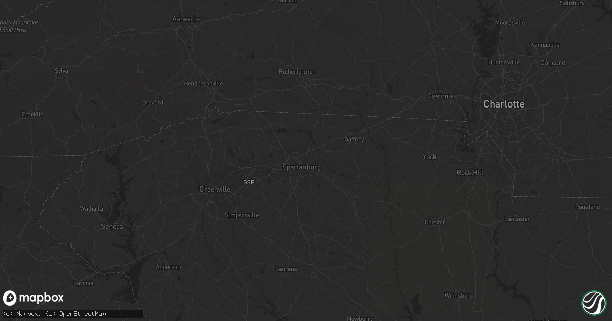
Hail Map in Birmingham, AL on June 27, 2011
Get this storm
June 27 map
$229
one time, instant access
Download today. No call, no setup
Keep the $229
Bought the map and want the full workflow? Apply the entire $229 to a subscription within 7 days. None of it is wasted.
Every map, not just this one
This buys you this map. Subscription and you get every map we run, in the markets you choose from a few cities to whole states to nationwide. Plus real-time alerts the moment a storm fires.
Contact data
Name, contact info, occupancy, even credit band for addresses in the footprint. You go from where it hit to who to call.
Become the source they trust
Unlimited branding weather history reports on demand. You already have the documented answer ready for the property owner, and you are the one who showed up with it.
Property data and RoofTrace estimates
Pull up any address you have got, its value and the exact code rules for that jurisdiction, straight from One Click Code. Then RoofTrace estimates the squares, pitch, and roof value, priced the way you price.
Storm reports in Birmingham, AL
Birmingham, AL
| Date | Description |
|---|---|
| 06/27/20114:34 PM CDT | Golf ball size hail reported in cahaba heights. |
| 06/27/20114:32 PM CDT | Half dollar size hail reported at the intersection of collonade blvd and highway 280. |
| 06/27/20114:32 PM CDT | Golf ball size hail reported at the intersection of interstate 459 and highway 280. |
| 06/27/20114:27 PM CDT | Quarter size hail reported at the collonnade on us highway 280. |
| 06/27/20114:23 PM CDT | Trees down across blue lake drive. |
All States Impacted by Hail Map on June 27, 2011
All Cities Impacted by Hail Map on June 27, 2011
- Watonga, OK
- Glencoe, AR
- Ash Flat, AR
- Grovespring, MO
- Windsor, NC
- Ahoskie, NC
- Colerain, NC
- Plum Branch, SC
- Edgefield, SC
- Modoc, SC
- Eddyville, KY
- Guthrie, KY
- Woodland, GA
- Elbert, CO
- Richlands, NC
- Ava, MO
- New Bern, NC
- Clarksville, FL
- Ewen, MI
- Lebanon, TN
- Gallatin, TN
- Mount Juliet, TN
- Trinidad, CO
- Capitan, NM
- Corona, NM
- Greenville, FL
- Monticello, FL
- Newark, AR
- Brixey, MO
- Gainesville, MO
- Hartville, MO
- Niangua, MO
- Yellville, AR
- Flippin, AR
- Taneyville, MO
- Garrison, MO
- Bradleyville, MO
- Oldfield, MO
- Ashford, AL
- Pansey, AL
- Clovis, NM
- Ernul, NC
- Cove City, NC
- Beulaville, NC
- Hobbsville, NC
- Sunbury, NC
- Corapeake, NC
- South Mills, NC
- Elizabeth City, NC
- Murray, KY
- Dexter, KY
- Anderson, SC
- South Greenfield, MO
- Cohasset, MN
- Remer, MN
- Ivanhoe, NC
- Harrells, NC
- Castalia, NC
- Ellington, MO
- Garland, NC
- Jasper, FL
- Lee, FL
- Cassville, MO
- Weir, KS
- Pittsburg, KS
- Swatara, MN
- Shirley, AR
- Fox, AR
- Mountain View, AR
- Lafayette, AL
- Roanoke, AL
- West Plains, MO
- Pomona, MO
- Lagrange, GA
- Lanett, AL
- Isabella, OK
- Fairview, OK
- Hickory Ridge, AR
- Fisher, AR
- Cherry Valley, AR
- Weiner, AR
- Farwell, TX
- Purdy, MO
- Monett, MO
- Verona, MO
- Sidney, AR
- Evening Shade, AR
- Horseshoe Bend, AR
- Madison, TN
- Whites Creek, TN
- Goodlettsville, TN
- Joelton, TN
- Hendersonville, TN
- Hardy, AR
- Callahan, FL
- Hilliard, FL
- Fuquay Varina, NC
- Apex, NC
- Raleigh, NC
- Chadwick, MO
- Carrizozo, NM
- Wadley, AL
- Harrison, AR
- Clayton, NC
- Garner, NC
- Wendell, NC
- Knightdale, NC
- Okarche, OK
- Calumet, OK
- Geary, OK
- Fancy Gap, VA
- Galax, VA
- Brentwood, TN
- Nashville, TN
- Warsaw, NC
- East Bend, NC
- Lewisville, NC
- Pfafftown, NC
- Park Falls, WI
- Scotland Neck, NC
- Marenisco, MI
- Kinston, NC
- Deep Run, NC
- Fowler, CO
- Model, CO
- Sedalia, CO
- Guion, AR
- Raton, NM
- Springer, NM
- Mountain Grove, MO
- Mammoth Spring, AR
- Cherokee Village, AR
- Whiteville, NC
- Hallsboro, NC
- Faison, NC
- Clinton, NC
- Turkey, NC
- Box Springs, GA
- Talbotton, GA
- Laverne, OK
- Friona, TX
- Plato, MO
- Huggins, MO
- Wake Forest, NC
- Zebulon, NC
- Lead Hill, AR
- Peel, AR
- Moriarty, NM
- Aurora, NC
- Elida, NM
- Floyd, NM
- Portales, NM
- Cedar Mountain, NC
- Pleasant Hope, MO
- Fair Grove, MO
- Encino, NM
- Seiling, OK
- Tuckerman, AR
- Newport, AR
- Lincolnton, GA
- Iva, SC
- Calhoun Falls, SC
- Lowndesville, SC
- Abbeville, SC
- Thayer, MO
- Willow Spring, NC
- Holly Springs, NC
- Cary, NC
- Marianna, FL
- Council, NC
- Clarkton, NC
- Lake Waccamaw, NC
- Rural Hall, NC
- Pinnacle, NC
- King, NC
- Tobaccoville, NC
- Hopkinsville, KY
- Oklahoma City, OK
- Tecumseh, MO
- Mooreland, OK
- Chester, OK
- Tallahassee, FL
- Outing, MN
- Pequot Lakes, MN
- Fifty Lakes, MN
- Pine River, MN
- Emily, MN
- Crosslake, MN
- Crosby, MN
- Balko, OK
- Beaver, OK
- Panama City, FL
- Youngstown, FL
- Shattuck, OK
- Pink Hill, NC
- Kenansville, NC
- Hereford, TX
- Westminster, SC
- Lincoln, NM
- Zanoni, MO
- Rueter, MO
- Noble, MO
- Mountain Home, AR
- Squires, MO
- Thornfield, MO
- Cotter, AR
- Clarkridge, AR
- Wasola, MO
- Gassville, AR
- Lakeview, AR
- Bull Shoals, AR
- Midway, AR
- Isabella, MO
- Pontiac, MO
- Dora, MO
- Theodosia, MO
- Hardenville, MO
- Whitakers, NC
- Enfield, NC
- Union Mills, NC
- Lake Lure, NC
- Merritt, NC
- Oriental, NC
- Grantsboro, NC
- Bayboro, NC
- Pampa, TX
- Harriet, AR
- Big Flat, AR
- Batesville, AR
- Marcella, AR
- Larkspur, CO
- Fort Supply, OK
- Woodward, OK
- Tyner, NC
- White House, TN
- Cottontown, TN
- Ash Grove, MO
- Walnut Grove, MO
- Shell Knob, MO
- Trenton, NC
- Mount Airy, NC
- Perry, FL
- Marshall, AR
- Hillsville, VA
- Ararat, VA
- Roswell, NM
- Birmingham, AL
- Pembroke, KY
- Oak Grove, KY
- Herndon, KY
- Wooton, KY
- Evergreen, NC
- Bladenboro, NC
- Cadiz, KY
- Gracey, KY
- Wilson, NC
- Elm City, NC
- Lockwood, MO
- Golden City, MO
- Lamar, MO
- Defuniak Springs, FL
- Nashville, NC
- Spring Hope, NC
- Greenville, NC
- Crab Orchard, KY
- Rocky Mount, NC
- Pinetops, NC
- Cave City, AR
- Bardwell, KY
- Eufaula, AL
- Waverly, TN
- New Johnsonville, TN
- Aurora, MO
- Seymour, MO
- Mansfield, MO
- Tarboro, NC
- Macclesfield, NC
- Springfield, MO
- Oakland, KY
- Bowling Green, KY
- Portland, TN
- Bradford, AR
- Old Town, FL
- Cross City, FL
- Lake Mary, FL
- Welch, OK
- Kingfisher, OK
- Mims, FL
- Oviedo, FL
- Drury, MO
- Palmersville, TN
- Black Rock, AR
- Ravenden, AR
- Imboden, AR
- Melbourne, AR
- Oronogo, MO
- Liberal, MO
- Clarkson, KY
- Leitchfield, KY
- Morgantown, KY
- Pottersville, MO
- Willow Springs, MO
- Cerulean, KY
- Hazel, KY
- New Concord, KY
- Almo, KY
- Buchanan, TN
- Poughkeepsie, AR
- Oswego, KS
- Muleshoe, TX
- Granby, MO
- Pierce City, MO
- Stark City, MO
- Blue Eye, MO
- Oak Grove, AR
- Wentworth, MO
- Lampe, MO
- Berryville, AR
- Diamond, MO
- Onia, AR
- Timbo, AR
- Robersonville, NC
- Bethel, NC
- May, OK
- Fargo, OK
- Buffalo, OK
- Palisade, MN
- Hill City, MN
- Altha, FL
- Cashion, OK
- Ninety Six, SC
- Saluda, SC
- Mutual, OK
- Crane, MO
- Marshfield, MO
- Grand Ridge, FL
- Des Moines, NM
- Williamsport, TN
- Mount Pleasant, TN
- Columbia, TN
- Hampshire, TN
- Nazareth, TX
- Tulia, TX
- Dimmitt, TX
- Colquitt, GA
- Grand Rapids, MN
- Hindsville, AR
- Huntsville, AR
- Hobucken, NC
- Lowland, NC
- Vanzant, MO
- Seneca, SC
- Townville, SC
- Fountain, FL
- Ware Shoals, SC
- Laurens, SC
- Waterloo, SC
- Washington, NC
- Kelly, NC
- Saint Joe, AR
- Gilbert, AR
- Texico, NM
- Broadview, NM
- Leslie, AR
- Crossville, TN
- Omaha, AR
- Pelham, AL
- Kirksey, KY
- Canyon, TX
- Canton, GA
- Western Grove, AR
- Vendor, AR
- Mount Judea, AR
- Elizabeth, CO
- Kiowa, CO
- Freeport, FL
- Castle Rock, CO
- Franktown, CO
- Gatesville, NC
- La Junta, CO
- Horse Branch, KY
- Cromwell, KY
- Mclean, TX
- Carmen, OK
- Sulphur Rock, AR
- Eureka Springs, AR
- Salem, AR
- Sturkie, AR
- Hurtsboro, AL
- Elberton, GA
- Bovina, TX
- Smiths Grove, KY
- Camilla, GA
- Battleboro, NC
- Thomas, OK
- Jasper, MO
- Adamsville, TN
- Morris Chapel, TN
- Chatsworth, GA
- Louisville, AL
- Springfield, TN
- Ponce De Leon, FL
- Bethpage, TN
- Pleasant View, TN
- Castalian Springs, TN
- Hermitage, TN
- Antioch, TN
- Ashland City, TN
- Greenbrier, TN
- Cross Plains, TN
- Chapmansboro, TN
- Old Hickory, TN
- Deland, FL
- Sparta, MO
- Yanceyville, NC
- Sparta, TN
- Travelers Rest, SC
- Hagerman, NM
- Saluda, NC
- Vero Beach, FL
- Edenton, NC
- Couch, MO
- Myrtle, MO
- Cash, AR
- Eminence, MO
- Charlotte, AR
- Locust Grove, AR
- Pleasant Grove, AR
- West Point, GA
- Brevard, NC
- Olmstead, KY
- Russellville, KY
- Ocate, NM
- Carl Junction, MO
- Greenville, GA
- Saint Charles, KY
- Dawson Springs, KY
- Primm Springs, TN
- Lyles, TN
- Santa Fe, TN
- Barbourville, KY
- Gray, KY
- Girdler, KY
- Hollister, MO
- Baxter, KY
- Bledsoe, KY
- Joplin, MO
- Carthage, MO
- Carterville, MO
- Mershon, GA
- Manchester, GA
- Shiloh, GA
- Fairmount, GA
- Franklin, KY
- Scottsville, KY
- Las Vegas, NM
- Newton, GA
- Vega, TX
- Wildorado, TX
- Willard, MO
- Brighton, MO
- Edmond, OK
- Aline, OK
- Norwood, MO
- Snow Hill, NC
- Walstonburg, NC
- Stantonsburg, NC
- Rich Square, NC
- Jackson, NC
- Edna, KS
- Bartlett, KS
- Altamont, KS
- Fargo, GA
- Altamonte Springs, FL
- Longwood, FL
- Pine Mountain, GA
- Keokee, VA
- Apopka, FL
- Hoxie, AR
- Lynn, AR
- Alicia, AR
- Powhatan, AR
- Saint George, GA
- Kingsland, GA
- Folkston, GA
- Hardin, KY
- Benton, KY
- Deer River, MN
- Clarendon, TX
- Elizabethtown, NC
- Rose Hill, NC
- Hasty, AR
- Tompkinsville, KY
- Mount Hermon, KY
- Moody, AL
- Odenville, AL
- Pell City, AL
- Leeds, AL
- Phillips, WI
- Clayton, AL
- Clarksville, TN
- Adairville, KY
- Trenton, KY
- Allensville, KY
- Elkton, KY
- Lewisburg, KY
- Morganton, NC
- Camp, AR
- Ravenden Springs, AR
- Pocahontas, AR
- Beaver Dam, KY
- Rochester, KY
- Niceville, FL
- Eglin Afb, FL
- Kenly, NC
- Canton, OK
- Vanceboro, NC
- Hyden, KY
- Stinnett, KY
- Mount Pleasant, AR
- Minocqua, WI
- Charleston, MO
- Happy, TX
- Tignall, GA
- Cofield, NC
- Harrellsville, NC
- London, KY
- Panhandle, TX
- White Deer, TX
- Hartwell, GA
- Farmville, NC
- McGrady, NC
- White Oak, GA
- Chesapeake, VA
- Waynesburg, KY
- Marion, NC
- Rutherfordton, NC
- Old Fort, NC
- Jacksonville, NC
- Galena, MO
- Reeds Spring, MO
- Everton, AR
- Midway, GA
- Longville, MN
- Chiefland, FL
- Princeton, KY
- Central City, KY
- Centertown, KY
- Rockport, KY
- Shellman, GA
- Albertson, NC
- Seven Springs, NC
- Salem, MO
- Hydro, OK
- Hinton, OK
- Loyal, OK
- Guthrie, OK
- Perryville, MO
- Lac Du Flambeau, WI
- Mount Olive, NC
- New Tazewell, TN
- Waleska, GA
- Oil Trough, AR
- Rosie, AR
- Magness, AR
- Centerville, TN
- Steelville, MO
- Camden, NC
- Shawboro, NC
- Lewiston Woodville, NC
- Watrous, NM
- Calhan, CO
- Manchester, KY
- Oneida, KY
- Sharon Springs, KS
- Green Forest, AR
- Ridgedale, MO
- Koshkonong, MO
- Branson, MO
- Pengilly, MN
- Pyatt, AR
- Walnut Ridge, AR
- Madison, FL
- Dawson, GA
- Longdale, OK
- Quitman, GA
- Fountain Run, KY
- Holland, KY
- Austin, KY
- Greenwood, SC
- Cabool, MO
- Pindall, AR
- Cherokee, KS
- Scammon, KS
- Auburn, KY
- Mountville, SC
- Hodges, SC
- Putney, KY
- Willard, NC
- Alpharetta, GA
- Dahlonega, GA
- Bay Minette, AL
- Connelly Springs, NC
- Claude, TX
- Newton, NC
- Hickory, NC
- Vale, NC
- Jasper, AR
- Atlanta, GA
- Kress, TX
- Cana, VA
- Hartsfield, GA
- Moultrie, GA
- Roseboro, NC
- Bruce Crossing, MI
- Golden, MO
- Exeter, MO
- Alpena, AR
- Norfork, AR
- Kimberling City, MO
- Butterfield, MO
- Valley Springs, AR
- Clinton, AR
- Kirbyville, MO
- Lenoir, NC
- Fremont, NC
- Swifton, AR
- Brownsville, KY
- Backus, MN
- Franklin, TN
- Delaplaine, AR
- Middlesex, NC
- Martin, GA
- Toccoa, GA
- Cookeville, TN
- Rickman, TN
- Edgemont, AR
- Sims, NC
- Pikeville, NC
- Selma, NC
- Lucama, NC
- Alvaton, KY
- Suffolk, VA
- Adams, TN
- Cedar Hill, TN
- Hertford, NC
- Bethel Springs, TN
- Pisgah Forest, NC
- Dexter, NM
- Calhoun, TN
- Riceville, TN
- Dover, TN
- Blakely, GA
- Bon Aqua, TN
- Nunnelly, TN
- Dickson, TN
- McEwen, TN
- Hohenwald, TN
- Belvidere, NC
- Mill Spring, NC
- Columbus, NC
- Jakin, GA
- Frohna, MO
- Success, AR
- Hazard, KY
- Hobgood, NC
- Tinnie, NM
- Omaha, GA
- Lamont, FL
- Boaz, AL
- Damascus, GA
- Essie, KY
- Sizerock, KY
- Webb City, MO
- New Hill, NC
- Caneyville, KY
- Albertville, AL
- Jennings, FL
- Dunmor, KY
- Belton, KY
- Columbus, KS
- Chipley, FL
- Butler, GA
- Walnut Cove, NC
- Carlisle, KY
- La Grange, NC
- Goldsboro, NC
- Clarks Hill, SC
- Williford, AR
- Henderson, AR
- Atkinson, NC
- Lake Tomahawk, WI
- Weatherford, OK
- Ironwood, MI
- Fruitland Park, FL
- Metropolis, IL
- Sanderson, FL
- Glen Saint Mary, FL
- Landrum, SC
- Zirconia, NC
- Eastanollee, GA
- Casar, NC
- Ellenboro, NC
- White Oak, NC
- Drakesboro, KY
- Asbury, MO
- Bunn, NC
- Anton Chico, NM
- Oakwood, OK
- Williamston, NC
- Ozark, MO
- Rogersville, MO
- Crofton, KY
- Southard, OK
- Vici, OK
- Birch Tree, MO
- Summersville, MO
- Jonesboro, AR
- Beech Grove, AR
- Peach Orchard, AR
- Biggers, AR
- Stockton, AL
- Winter, WI
- Dover, NC
- Duck River, TN
- Van Buren, MO
- Roundhill, KY
- Abbeville, AL
- Hurricane Mills, TN
- Angora, MN
- Lyons, GA
- Mount Dora, FL
- Portia, AR
- Smithville, AR
- Rockfield, KY
- Sextons Creek, KY
- Tyner, KY
- Pavo, GA
- Dixie, GA
- Roxobel, NC
- Millwood, KY
- Bono, AR
- Magnolia, NC
- Brundidge, AL
- Sanford, NC
- Ribera, NM
- La Loma, NM


