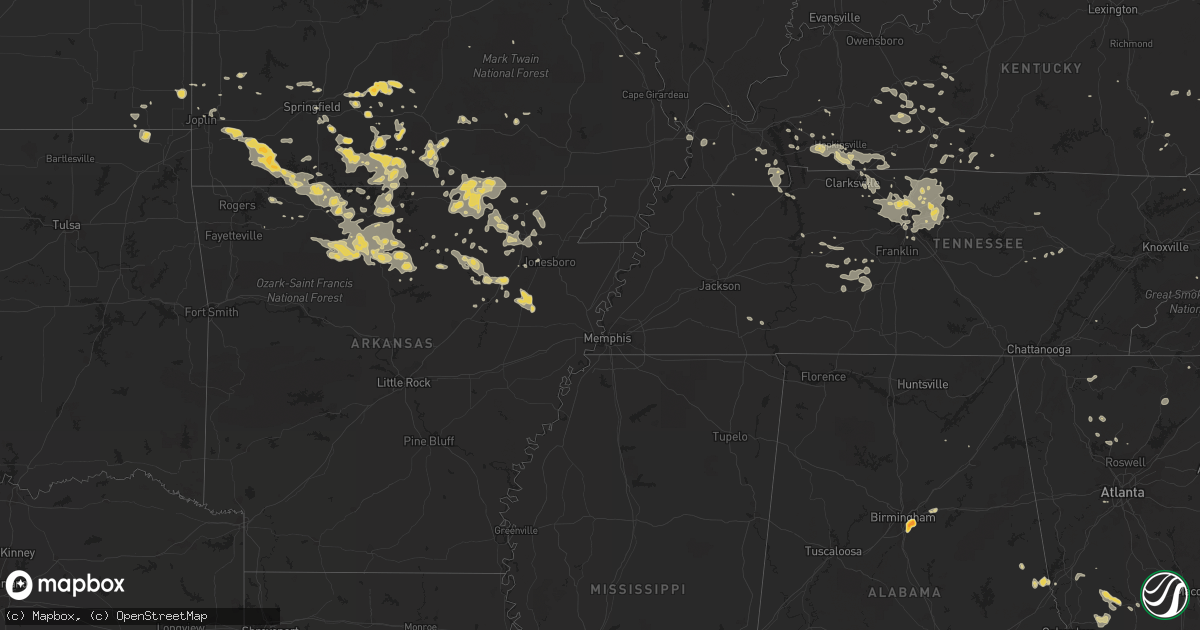
Hail Map on June 27, 2011
Get this storm
June 27 map
$229
one time, instant access
Download today. No call, no setup
Keep the $229
Bought the map and want the full workflow? Apply the entire $229 to a subscription within 7 days. None of it is wasted.
Every map, not just this one
This buys you this map. Subscription and you get every map we run, in the markets you choose from a few cities to whole states to nationwide. Plus real-time alerts the moment a storm fires.
Contact data
Name, contact info, occupancy, even credit band for addresses in the footprint. You go from where it hit to who to call.
Become the source they trust
Unlimited branding weather history reports on demand. You already have the documented answer ready for the property owner, and you are the one who showed up with it.
Property data and RoofTrace estimates
Pull up any address you have got, its value and the exact code rules for that jurisdiction, straight from One Click Code. Then RoofTrace estimates the squares, pitch, and roof value, priced the way you price.
States Impacted by Hail Map on June 27, 2011
Storm reports
Wisconsin
| Date | Description |
|---|---|
| 06/27/20116:30 PM CDT | Pole barn blown down on white clover road in manawa. Also some trees down. |
Arkansas
| Date | Description |
|---|---|
| 06/27/20116:56 AM CDT | Trees fallen over hwy 63 north of imboden. |
| 06/27/20116:53 AM CDT | A local report indicates 1.25 inch wind near SNOWBALL |
| 06/27/20116:45 AM CDT | Several trees down and a 6 foot fence blown over. |
| 06/27/20116:45 AM CDT | Tree down on observers house on 8th street and main street. Trees down around neighborhood. |
| 06/27/20116:45 AM CDT | Quarter sized hail in pocahontas |
| 06/27/20116:43 AM CDT | Several trees down and power lines down. Large tree fell on home. |
| 06/27/20116:40 AM CDT | Multiple trees were down along hwy 14 east of mountain view and hwy 5 north of mountain view. |
| 06/27/20116:36 AM CDT | Multiple trees are down. |
| 06/27/20116:30 AM CDT | A local report indicates 1.00 inch wind near SULPHUR ROCK |
| 06/27/20116:30 AM CDT | Several trees down and power lines down. Large tree fell on home. |
| 06/27/20116:28 AM CDT | Tree limbs greater than six inches in diamter have fallen. Hail up to the size of quarters was also reported. |
| 06/27/20116:02 AM CDT | Multiple large oak trees were uprooted and displaced. Several firework stands were completely destroyed. Several buildings had minor damage including roof and siding be |
| 06/27/20115:58 AM CDT | Large limbs were blown down. |
| 06/27/20115:58 AM CDT | Trees and powerlines were down. |
| 06/27/20115:45 AM CDT | A local report indicates 1.00 inch wind near 1 S GASSVILLE |
| 06/27/20115:37 AM CDT | Multiple trees were down south and east of mountain home. |
| 06/27/20115:25 AM CDT | Large tree limbs and branches have fallen. Wind speed was measured at 61 mph and penny sized hail fell. Some minor property damage was noted. |
| 06/27/20115:20 AM CDT | A local report indicates 1.00 inch wind near OMAHA |
| 06/27/20114:48 AM CDT | A tree was downed along lassiter road in smithville. |
Texas
| Date | Description |
|---|---|
| 06/27/20113:50 AM CDT | A local report indicates 59 MPH wind near 6 ENE AMARILLO |
| 06/27/20113:31 AM CDT | A local report indicates 61 MPH wind near 6 ENE AMARILLO |
| 06/27/20113:15 AM CDT | Metal out building blown over a fence on the south side of highway 60 |
| 06/27/20113:07 AM CDT | Part of a roof blown off a vacant house...lead to broken windows in neighboring homes. Delayed report |
| 06/27/20112:53 AM CDT | A local report indicates 69 MPH wind near 6 ENE AMARILLO |
| 06/27/20112:41 AM CDT | A local report indicates 60 MPH wind near 2 S AMARILLO |
| 06/26/201111:18 PM CDT | A local report indicates 58 MPH wind near 7 N BOOTLEG |
| 06/26/201110:45 PM CDT | Wind estimated at 70 mph or greater in combination with hail caused damage to corn fields |
| 06/26/201110:45 PM CDT | Wind estimated at 70 mph or greater in combination with hail caused damage to corn fields |
| 06/26/201110:00 PM CDT | A local report indicates 60 MPH wind near 2 SE FARWELL |
Colorado
| Date | Description |
|---|---|
| 06/26/20119:47 PM CDT | A local report indicates 1.25 inch wind near 5 NE ELBERT |
| 06/26/20119:25 PM CDT | A local report indicates 1.00 inch wind near 3 NW ELBERT |
| 06/26/20119:20 PM CDT | A local report indicates 2.50 inch wind near 2 W ELBERT |
| 06/26/20119:15 PM CDT | A local report indicates 1.50 inch wind near 17 NNW DELHI |
| 06/26/20119:13 PM CDT | A local report indicates 1.50 inch wind near 12 ENE LARKSPUR |
| 06/26/20119:09 PM CDT | A local report indicates 1.00 inch wind near 7 SSE CASTLEWOOD CANYON |
| 06/26/20119:09 PM CDT | A local report indicates 1.00 inch wind near CASTLEWOOD CANYON |
| 06/26/20119:00 PM CDT | A local report indicates 1.00 inch wind near 17 NNW DELHI |
| 06/26/20118:57 PM CDT | A local report indicates 1.00 inch wind near 7 NE GREENLAND |
| 06/26/20118:50 PM CDT | A local report indicates 1.00 inch wind near 1 S LARKSPUR |
Florida
| Date | Description |
|---|---|
| 06/27/20114:40 PM CDT | The sheriffs office reported two trees blown down that were blocking the roads. One was on bay road and the other was on georgia street. The time given was based on rad |
| 06/27/20114:06 PM CDT | Multiple trees down in the town of chaires. |
| 06/27/20113:50 PM CDT | A local report indicates 1.75 inch wind near FOUNTAIN |
| 06/27/20113:44 PM CDT | Trees down. 3 pine trees snapped and 1 sycamore top twisted off. Trees landed on powerlines.power is out. |
Indiana
| Date | Description |
|---|---|
| 06/27/201112:40 PM CDT | Large building nearly leveled. At least one other smaller building destroyed. Several tree limbs down. Minor damage to a couple of homes...including the loss of a few s |
Missouri
| Date | Description |
|---|---|
| 06/27/20113:45 AM CDT | A few trees reported down near hartville. Time of event estimated. |
New Mexico
| Date | Description |
|---|---|
| 06/26/20118:51 PM CDT | Roof ripped off house |
| 06/26/20118:51 PM CDT | Krow asos. |
North Carolina
| Date | Description |
|---|---|
| 06/27/20114:07 PM CDT | Multiple trees down along harry arys road |
| 06/27/20113:50 PM CDT | Golfball size hail along rte 158 in the great dismal swamp |
| 06/27/20113:50 PM CDT | Numerous trees down just off of lewiston road |
| 06/27/20113:45 PM CDT | Multiple trees down along us-117 and in calypso |
| 06/27/20113:44 PM CDT | Trees down near county home rd and nc hwy 102 |
| 06/27/20113:35 PM CDT | A local report indicates 60 MPH wind near OAK CITY |
| 06/27/20113:28 PM CDT | Large branches down. |
| 06/27/20113:27 PM CDT | Tree down on nc 125 near scotland neck. |
| 06/27/20113:15 PM CDT | Numerous trees down on indian woods road...just west of windsor |
| 06/27/20113:01 PM CDT | Multiple trees and powerlines down near kingsboro road and us 64 alt |
| 06/27/20112:50 PM CDT | Golfball size hail along rte 158 in the great dismal swamp |
| 06/27/20112:43 PM CDT | Tree down on a house on benton pond road in freemont... People still in the house |
| 06/27/20112:36 PM CDT | Tree down on west castalia road. |
| 06/27/20112:31 PM CDT | Tree down on house |
| 06/27/20112:18 PM CDT | One tree across road near intersection of boykin bridge road and peterson road |
| 06/27/20112:16 PM CDT | Tree down on seven paths road. |
| 06/27/20112:16 PM CDT | Tree down on webbs mill road. |
| 06/27/20112:01 PM CDT | Tree down near bailey |
| 06/27/20112:01 PM CDT | Tree down on powerline |
| 06/27/20112:01 PM CDT | Tree down on powerlines on old nash road |
| 06/27/20112:00 PM CDT | Three trees down near the intersection of nc-181 and frank whisnant road in the oak hill community. |
| 06/27/20111:55 PM CDT | Lee co 911 reported tree down at 2551 buckhorn rd. |
| 06/27/20111:51 PM CDT | Powerline down on hanes avenue |
| 06/27/20111:50 PM CDT | Tree down on squirrel den road |
| 06/27/20111:40 PM CDT | One tree down near the intersection of wendell road and salem church road |
| 06/27/20111:35 PM CDT | Wind gust to 48 mph during thunderstorm at the nws office on ncsu centennial campus. Numerous limbs down. |
| 06/27/20111:35 PM CDT | A local report indicates 1.00 inch wind near 6 NNW LAKE WACCAMAW |
| 06/27/20111:30 PM CDT | Tree down blocking hwy 55 in stonewall |
| 06/27/20111:27 PM CDT | Nws employee reported quarter size hail |
| 06/27/20111:20 PM CDT | Tree down near buffaloe lanes on highway 401. |
| 06/27/20111:18 PM CDT | One tree down on lake wheeler road |
| 06/27/20111:18 PM CDT | Several trees down near mid pines road... Time estimated by radar |
| 06/27/20111:17 PM CDT | Multiple trees down in downtown new bern near main and chatman rd |
| 06/27/20111:16 PM CDT | Several limbs up to 10 inch diameter and small trees down near manor ridge dr |
| 06/27/20111:11 PM CDT | Wect reports multiple trees down about three quarters of a mile from the intersection of highway 210 and 53 near kelly. Some trees were uprooted and some were snapped. |
| 06/27/20111:09 PM CDT | Skywarn spotter observed estimated wind gust 62 mph and penny size hail. |
| 06/27/20111:05 PM CDT | Tree down on trent rd. Time estimated by radar. |
| 06/27/201112:50 PM CDT | Tree down |
| 06/27/20114:57 AM CDT | 5 trees down at a residence on powell farm rd near anderson creek. |
| 06/26/20119:52 PM CDT | Tree down along corbett ridge road |
| 06/26/20119:27 PM CDT | Two trees down along burton chapel road |
| 06/26/20119:10 PM CDT | Tree down along oak level church road |
| 06/26/20119:10 PM CDT | Tree down along hatchett road |
| 06/26/20118:31 PM CDT | Several trees down across city of danbury |
| 06/26/20118:31 PM CDT | Several trees down |
| 06/26/20118:31 PM CDT | Tree down on house |
| 06/26/20118:10 PM CDT | Tree down along friendly road |
| 06/26/20118:00 PM CDT | Trees down at the intersection of reynolds st/harris st |
| 06/26/20117:57 PM CDT | Roof off of a house on 1033 klyce street. |
| 06/26/20117:54 PM CDT | Tree down on us 52 near winston-salem. |
| 06/26/20117:54 PM CDT | Tree down on business 40 near winston-salem. |
| 06/26/20117:35 PM CDT | Trees down in the city of king |
| 06/26/20117:34 PM CDT | Tree down on foxpark drive |
Kentucky
| Date | Description |
|---|---|
| 06/27/20115:21 PM CDT | Multiple large tree limbs and branches down in yard and in roadway. 0.90 inches of rainfall also measured. |
| 06/27/20115:15 PM CDT | Trees down approximately 3 inch in diameter in yards and branches down in the roads. Espotter report. |
| 06/27/20113:53 PM CDT | Trees damaged and down on copley road and copley lane off of echo valley. |
| 06/27/20113:50 PM CDT | Trees down along hatcher road. One tree on mobile home. |
| 06/27/20111:32 PM CDT | Two trees down on route 973 at elm street in dunmor kentucky. Time of damage radar-estimated. |
| 06/27/201112:59 PM CDT | Measured in downtown owensboro along parrish street. |
| 06/27/201112:52 PM CDT | Measured on west side of town. |
| 06/27/201112:50 PM CDT | Time estimated. Numerous large tree limbs down on the west side of town. |
| 06/27/201112:37 PM CDT | Estimated winds 60 to 70 mph. Numerous large tree limbs down. |
| 06/27/201112:27 PM CDT | Large limbs down. Siding blown off of a house. |
| 06/27/201112:10 PM CDT | Large tree down on roadway on mayfield-metropolis road. |
| 06/27/201112:02 PM CDT | Wind gust reported along highway 60 just west of paducah. |
| 06/27/201111:56 AM CDT | 2 trees down on stratford road between la center and kevil. |
| 06/27/20112:38 AM CDT | Two trees down in the city of franklin. |
| 06/27/20111:50 AM CDT | Trees down in plum springs and trees down on glasgow road and moreman lane. |
| 06/27/20111:50 AM CDT | Trees down on scottsville road. |
Virginia
| Date | Description |
|---|---|
| 06/27/20116:19 PM CDT | Several trees and power lines down in the rye cove area. |
Tennessee
| Date | Description |
|---|---|
| 06/27/20114:55 PM CDT | Numerous trees down across the county. |
| 06/27/20114:10 PM CDT | Few trees down. |
| 06/27/20114:00 PM CDT | Several trees down on demory road |
| 06/27/20116:07 AM CDT | A tree was downed near ethridge. |
| 06/27/20116:03 AM CDT | A few trees were downed in and around lewisburg. |
| 06/27/20116:02 AM CDT | Several trees were downed across the county. |
| 06/27/20115:50 AM CDT | One tree down on hwy 101. |
| 06/27/20115:45 AM CDT | A few trees were downed in and around columbia. |
| 06/27/20115:45 AM CDT | A local report indicates 60 MPH wind near MANCHESTER |
| 06/27/20115:40 AM CDT | Tree limbs down in the southern portion of the county. |
| 06/27/20114:05 AM CDT | A large tree limb was downed and was blocking tulip grove road. |
| 06/27/20114:00 AM CDT | A large tree limb was downed and was also blocking the road near the intersection of firefly and lebanon dirt road. |
| 06/27/20113:45 AM CDT | A tree was reported downed near the intersection of highway 25 and highway 76. |
| 06/27/20113:25 AM CDT | A local report indicates 60 MPH wind near SPRINGFIELD |
| 06/27/20113:15 AM CDT | Several trees were split in two with some shingles off an apartment complex near henersonville close to the intersection of vietnam veterans blvd and center point road. |
| 06/27/20113:05 AM CDT | Delayed report. Fort campbell weather observer reported several trees were blown down with damage to siding of homes in the tylertown subdivision. |
| 06/27/20112:50 AM CDT | Tree down 4 miles north of lafayette. |
Oklahoma
| Date | Description |
|---|---|
| 06/27/20114:45 AM CDT | Fairview police department reported nickel to quarter sized hail. Time estimated based on radar. |
| 06/27/20114:32 AM CDT | A local report indicates 1.00 inch wind near 1 W SLAPOUT |
Ohio
| Date | Description |
|---|---|
| 06/27/20116:54 PM CDT | Trees and wires down near us 68/sr 125 and day hill-arnheim rd. 4 barns damaged or destroyed. Time estimated from radar. Corrected reference city from gertrude to georg |
| 06/27/20116:54 PM CDT | Possible tornado. Trees and wires down near us 68/sr 125 and day hill-arnheim rd. Time estimated from radar. |
| 06/27/20116:54 PM CDT | Trees and wires down near us 68/sr 125 and day hill-arnheim rd. 4 barns damaged or destroyed. Time estimated from radar. |
| 06/26/20118:49 PM CDT | Possible tornado. Couple of trees down on horns mill rd. Time estimated from radar. |
| 06/26/20118:16 PM CDT | Public witnessed brief touchdown near intersection of sr 104 and cr 28. One tree reported down. |
| 06/26/20117:54 PM CDT | Spotter was located at airborne rd and sr 73 looking south. Saw brief touchdown in field with dirt circulation. The touchdown was near accomodation rd between sr 73 and |
Georgia
| Date | Description |
|---|---|
| 06/27/20116:15 PM CDT | Preliminary reports of numerous trees down east of quitman. |
| 06/27/20114:20 PM CDT | 4 trees down at hwy 145 and hwy 106. |
| 06/27/201112:04 PM CDT | Douglas county emergency management relayed a report of a downed tree on dorsett bridge road. |
| 06/27/201110:16 AM CDT | Upson emc reported over half a dozen lines down in the area of hwy 36...harvey ingram road...and mountain valley road. |
| 06/27/201110:15 AM CDT | Upson emc crew member reports nickle and quarter size hail in woodland. |
| 06/27/20116:45 AM CDT | Sheriff dispatch reported a tree blocking wire road. |
| 06/27/20115:30 AM CDT | Sheriff dispatch reported wires down along doug barnard pkwy. |
Alabama
| Date | Description |
|---|---|
| 06/27/20114:34 PM CDT | Golf ball size hail reported in cahaba heights. |
| 06/27/20114:32 PM CDT | Half dollar size hail reported at the intersection of collonade blvd and highway 280. |
| 06/27/20114:32 PM CDT | Golf ball size hail reported at the intersection of interstate 459 and highway 280. |
| 06/27/20114:27 PM CDT | Quarter size hail reported at the collonnade on us highway 280. |
| 06/27/20114:23 PM CDT | Trees down across blue lake drive. |
| 06/27/20112:39 PM CDT | Hail lasted 10 min. |
| 06/27/20112:39 PM CDT | Treesdown across highway 75. |
Illinois
| Date | Description |
|---|---|
| 06/27/201112:37 PM CDT | Estimated winds 60 to 70 mph. Numerous large tree limbs down. /corrected location from eddyville ky to unionville il/. |
Minnesota
| Date | Description |
|---|---|
| 06/27/20118:58 AM CDT | Trees blown down on county roads 8 and 56 near nashwauk. Time estimated. A few trees on power lines and power outages in the grand rapids area and to the east near nash |
| 06/27/20118:40 AM CDT | Trees down in the grand rapids area. |
Cities Impacted by Hail Map on June 27, 2011
- Watonga, OK
- Glencoe, AR
- Ash Flat, AR
- Grovespring, MO
- Windsor, NC
- Ahoskie, NC
- Colerain, NC
- Plum Branch, SC
- Edgefield, SC
- Modoc, SC
- Eddyville, KY
- Guthrie, KY
- Woodland, GA
- Elbert, CO
- Richlands, NC
- Ava, MO
- New Bern, NC
- Clarksville, FL
- Ewen, MI
- Lebanon, TN
- Gallatin, TN
- Mount Juliet, TN
- Trinidad, CO
- Capitan, NM
- Corona, NM
- Greenville, FL
- Monticello, FL
- Newark, AR
- Brixey, MO
- Gainesville, MO
- Hartville, MO
- Niangua, MO
- Yellville, AR
- Flippin, AR
- Taneyville, MO
- Garrison, MO
- Bradleyville, MO
- Oldfield, MO
- Ashford, AL
- Pansey, AL
- Clovis, NM
- Ernul, NC
- Cove City, NC
- Beulaville, NC
- Hobbsville, NC
- Sunbury, NC
- Corapeake, NC
- South Mills, NC
- Elizabeth City, NC
- Murray, KY
- Dexter, KY
- Anderson, SC
- South Greenfield, MO
- Cohasset, MN
- Remer, MN
- Ivanhoe, NC
- Harrells, NC
- Castalia, NC
- Ellington, MO
- Garland, NC
- Jasper, FL
- Lee, FL
- Cassville, MO
- Weir, KS
- Pittsburg, KS
- Swatara, MN
- Shirley, AR
- Fox, AR
- Mountain View, AR
- Lafayette, AL
- Roanoke, AL
- West Plains, MO
- Pomona, MO
- Lagrange, GA
- Lanett, AL
- Isabella, OK
- Fairview, OK
- Hickory Ridge, AR
- Fisher, AR
- Cherry Valley, AR
- Weiner, AR
- Farwell, TX
- Purdy, MO
- Monett, MO
- Verona, MO
- Sidney, AR
- Evening Shade, AR
- Horseshoe Bend, AR
- Madison, TN
- Whites Creek, TN
- Goodlettsville, TN
- Joelton, TN
- Hendersonville, TN
- Hardy, AR
- Callahan, FL
- Hilliard, FL
- Fuquay Varina, NC
- Apex, NC
- Raleigh, NC
- Chadwick, MO
- Carrizozo, NM
- Wadley, AL
- Harrison, AR
- Clayton, NC
- Garner, NC
- Wendell, NC
- Knightdale, NC
- Okarche, OK
- Calumet, OK
- Geary, OK
- Fancy Gap, VA
- Galax, VA
- Brentwood, TN
- Nashville, TN
- Warsaw, NC
- East Bend, NC
- Lewisville, NC
- Pfafftown, NC
- Park Falls, WI
- Scotland Neck, NC
- Marenisco, MI
- Kinston, NC
- Deep Run, NC
- Fowler, CO
- Model, CO
- Sedalia, CO
- Guion, AR
- Raton, NM
- Springer, NM
- Mountain Grove, MO
- Mammoth Spring, AR
- Cherokee Village, AR
- Whiteville, NC
- Hallsboro, NC
- Faison, NC
- Clinton, NC
- Turkey, NC
- Box Springs, GA
- Talbotton, GA
- Laverne, OK
- Friona, TX
- Plato, MO
- Huggins, MO
- Wake Forest, NC
- Zebulon, NC
- Lead Hill, AR
- Peel, AR
- Moriarty, NM
- Aurora, NC
- Elida, NM
- Floyd, NM
- Portales, NM
- Cedar Mountain, NC
- Pleasant Hope, MO
- Fair Grove, MO
- Encino, NM
- Seiling, OK
- Tuckerman, AR
- Newport, AR
- Lincolnton, GA
- Iva, SC
- Calhoun Falls, SC
- Lowndesville, SC
- Abbeville, SC
- Thayer, MO
- Willow Spring, NC
- Holly Springs, NC
- Cary, NC
- Marianna, FL
- Council, NC
- Clarkton, NC
- Lake Waccamaw, NC
- Rural Hall, NC
- Pinnacle, NC
- King, NC
- Tobaccoville, NC
- Hopkinsville, KY
- Oklahoma City, OK
- Tecumseh, MO
- Mooreland, OK
- Chester, OK
- Tallahassee, FL
- Outing, MN
- Pequot Lakes, MN
- Fifty Lakes, MN
- Pine River, MN
- Emily, MN
- Crosslake, MN
- Crosby, MN
- Balko, OK
- Beaver, OK
- Panama City, FL
- Youngstown, FL
- Shattuck, OK
- Pink Hill, NC
- Kenansville, NC
- Hereford, TX
- Westminster, SC
- Lincoln, NM
- Zanoni, MO
- Rueter, MO
- Noble, MO
- Mountain Home, AR
- Squires, MO
- Thornfield, MO
- Cotter, AR
- Clarkridge, AR
- Wasola, MO
- Gassville, AR
- Lakeview, AR
- Bull Shoals, AR
- Midway, AR
- Isabella, MO
- Pontiac, MO
- Dora, MO
- Theodosia, MO
- Hardenville, MO
- Whitakers, NC
- Enfield, NC
- Union Mills, NC
- Lake Lure, NC
- Merritt, NC
- Oriental, NC
- Grantsboro, NC
- Bayboro, NC
- Pampa, TX
- Harriet, AR
- Big Flat, AR
- Batesville, AR
- Marcella, AR
- Larkspur, CO
- Fort Supply, OK
- Woodward, OK
- Tyner, NC
- White House, TN
- Cottontown, TN
- Ash Grove, MO
- Walnut Grove, MO
- Shell Knob, MO
- Trenton, NC
- Mount Airy, NC
- Perry, FL
- Marshall, AR
- Hillsville, VA
- Ararat, VA
- Roswell, NM
- Birmingham, AL
- Pembroke, KY
- Oak Grove, KY
- Herndon, KY
- Wooton, KY
- Evergreen, NC
- Bladenboro, NC
- Cadiz, KY
- Gracey, KY
- Wilson, NC
- Elm City, NC
- Lockwood, MO
- Golden City, MO
- Lamar, MO
- Defuniak Springs, FL
- Nashville, NC
- Spring Hope, NC
- Greenville, NC
- Crab Orchard, KY
- Rocky Mount, NC
- Pinetops, NC
- Cave City, AR
- Bardwell, KY
- Eufaula, AL
- Waverly, TN
- New Johnsonville, TN
- Aurora, MO
- Seymour, MO
- Mansfield, MO
- Tarboro, NC
- Macclesfield, NC
- Springfield, MO
- Oakland, KY
- Bowling Green, KY
- Portland, TN
- Bradford, AR
- Old Town, FL
- Cross City, FL
- Lake Mary, FL
- Welch, OK
- Kingfisher, OK
- Mims, FL
- Oviedo, FL
- Drury, MO
- Palmersville, TN
- Black Rock, AR
- Ravenden, AR
- Imboden, AR
- Melbourne, AR
- Oronogo, MO
- Liberal, MO
- Clarkson, KY
- Leitchfield, KY
- Morgantown, KY
- Pottersville, MO
- Willow Springs, MO
- Cerulean, KY
- Hazel, KY
- New Concord, KY
- Almo, KY
- Buchanan, TN
- Poughkeepsie, AR
- Oswego, KS
- Muleshoe, TX
- Granby, MO
- Pierce City, MO
- Stark City, MO
- Blue Eye, MO
- Oak Grove, AR
- Wentworth, MO
- Lampe, MO
- Berryville, AR
- Diamond, MO
- Onia, AR
- Timbo, AR
- Robersonville, NC
- Bethel, NC
- May, OK
- Fargo, OK
- Buffalo, OK
- Palisade, MN
- Hill City, MN
- Altha, FL
- Cashion, OK
- Ninety Six, SC
- Saluda, SC
- Mutual, OK
- Crane, MO
- Marshfield, MO
- Grand Ridge, FL
- Des Moines, NM
- Williamsport, TN
- Mount Pleasant, TN
- Columbia, TN
- Hampshire, TN
- Nazareth, TX
- Tulia, TX
- Dimmitt, TX
- Colquitt, GA
- Grand Rapids, MN
- Hindsville, AR
- Huntsville, AR
- Hobucken, NC
- Lowland, NC
- Vanzant, MO
- Seneca, SC
- Townville, SC
- Fountain, FL
- Ware Shoals, SC
- Laurens, SC
- Waterloo, SC
- Washington, NC
- Kelly, NC
- Saint Joe, AR
- Gilbert, AR
- Texico, NM
- Broadview, NM
- Leslie, AR
- Crossville, TN
- Omaha, AR
- Pelham, AL
- Kirksey, KY
- Canyon, TX
- Canton, GA
- Western Grove, AR
- Vendor, AR
- Mount Judea, AR
- Elizabeth, CO
- Kiowa, CO
- Freeport, FL
- Castle Rock, CO
- Franktown, CO
- Gatesville, NC
- La Junta, CO
- Horse Branch, KY
- Cromwell, KY
- Mclean, TX
- Carmen, OK
- Sulphur Rock, AR
- Eureka Springs, AR
- Salem, AR
- Sturkie, AR
- Hurtsboro, AL
- Elberton, GA
- Bovina, TX
- Smiths Grove, KY
- Camilla, GA
- Battleboro, NC
- Thomas, OK
- Jasper, MO
- Adamsville, TN
- Morris Chapel, TN
- Chatsworth, GA
- Louisville, AL
- Springfield, TN
- Ponce De Leon, FL
- Bethpage, TN
- Pleasant View, TN
- Castalian Springs, TN
- Hermitage, TN
- Antioch, TN
- Ashland City, TN
- Greenbrier, TN
- Cross Plains, TN
- Chapmansboro, TN
- Old Hickory, TN
- Deland, FL
- Sparta, MO
- Yanceyville, NC
- Sparta, TN
- Travelers Rest, SC
- Hagerman, NM
- Saluda, NC
- Vero Beach, FL
- Edenton, NC
- Couch, MO
- Myrtle, MO
- Cash, AR
- Eminence, MO
- Charlotte, AR
- Locust Grove, AR
- Pleasant Grove, AR
- West Point, GA
- Brevard, NC
- Olmstead, KY
- Russellville, KY
- Ocate, NM
- Carl Junction, MO
- Greenville, GA
- Saint Charles, KY
- Dawson Springs, KY
- Primm Springs, TN
- Lyles, TN
- Santa Fe, TN
- Barbourville, KY
- Gray, KY
- Girdler, KY
- Hollister, MO
- Baxter, KY
- Bledsoe, KY
- Joplin, MO
- Carthage, MO
- Carterville, MO
- Mershon, GA
- Manchester, GA
- Shiloh, GA
- Fairmount, GA
- Franklin, KY
- Scottsville, KY
- Las Vegas, NM
- Newton, GA
- Vega, TX
- Wildorado, TX
- Willard, MO
- Brighton, MO
- Edmond, OK
- Aline, OK
- Norwood, MO
- Snow Hill, NC
- Walstonburg, NC
- Stantonsburg, NC
- Rich Square, NC
- Jackson, NC
- Edna, KS
- Bartlett, KS
- Altamont, KS
- Fargo, GA
- Altamonte Springs, FL
- Longwood, FL
- Pine Mountain, GA
- Keokee, VA
- Apopka, FL
- Hoxie, AR
- Lynn, AR
- Alicia, AR
- Powhatan, AR
- Saint George, GA
- Kingsland, GA
- Folkston, GA
- Hardin, KY
- Benton, KY
- Deer River, MN
- Clarendon, TX
- Elizabethtown, NC
- Rose Hill, NC
- Hasty, AR
- Tompkinsville, KY
- Mount Hermon, KY
- Moody, AL
- Odenville, AL
- Pell City, AL
- Leeds, AL
- Phillips, WI
- Clayton, AL
- Clarksville, TN
- Adairville, KY
- Trenton, KY
- Allensville, KY
- Elkton, KY
- Lewisburg, KY
- Morganton, NC
- Camp, AR
- Ravenden Springs, AR
- Pocahontas, AR
- Beaver Dam, KY
- Rochester, KY
- Niceville, FL
- Eglin Afb, FL
- Kenly, NC
- Canton, OK
- Vanceboro, NC
- Hyden, KY
- Stinnett, KY
- Mount Pleasant, AR
- Minocqua, WI
- Charleston, MO
- Happy, TX
- Tignall, GA
- Cofield, NC
- Harrellsville, NC
- London, KY
- Panhandle, TX
- White Deer, TX
- Hartwell, GA
- Farmville, NC
- McGrady, NC
- White Oak, GA
- Chesapeake, VA
- Waynesburg, KY
- Marion, NC
- Rutherfordton, NC
- Old Fort, NC
- Jacksonville, NC
- Galena, MO
- Reeds Spring, MO
- Everton, AR
- Midway, GA
- Longville, MN
- Chiefland, FL
- Princeton, KY
- Central City, KY
- Centertown, KY
- Rockport, KY
- Shellman, GA
- Albertson, NC
- Seven Springs, NC
- Salem, MO
- Hydro, OK
- Hinton, OK
- Loyal, OK
- Guthrie, OK
- Perryville, MO
- Lac Du Flambeau, WI
- Mount Olive, NC
- New Tazewell, TN
- Waleska, GA
- Oil Trough, AR
- Rosie, AR
- Magness, AR
- Centerville, TN
- Steelville, MO
- Camden, NC
- Shawboro, NC
- Lewiston Woodville, NC
- Watrous, NM
- Calhan, CO
- Manchester, KY
- Oneida, KY
- Sharon Springs, KS
- Green Forest, AR
- Ridgedale, MO
- Koshkonong, MO
- Branson, MO
- Pengilly, MN
- Pyatt, AR
- Walnut Ridge, AR
- Madison, FL
- Dawson, GA
- Longdale, OK
- Quitman, GA
- Fountain Run, KY
- Holland, KY
- Austin, KY
- Greenwood, SC
- Cabool, MO
- Pindall, AR
- Cherokee, KS
- Scammon, KS
- Auburn, KY
- Mountville, SC
- Hodges, SC
- Putney, KY
- Willard, NC
- Alpharetta, GA
- Dahlonega, GA
- Bay Minette, AL
- Connelly Springs, NC
- Claude, TX
- Newton, NC
- Hickory, NC
- Vale, NC
- Jasper, AR
- Atlanta, GA
- Kress, TX
- Cana, VA
- Hartsfield, GA
- Moultrie, GA
- Roseboro, NC
- Bruce Crossing, MI
- Golden, MO
- Exeter, MO
- Alpena, AR
- Norfork, AR
- Kimberling City, MO
- Butterfield, MO
- Valley Springs, AR
- Clinton, AR
- Kirbyville, MO
- Lenoir, NC
- Fremont, NC
- Swifton, AR
- Brownsville, KY
- Backus, MN
- Franklin, TN
- Delaplaine, AR
- Middlesex, NC
- Martin, GA
- Toccoa, GA
- Cookeville, TN
- Rickman, TN
- Edgemont, AR
- Sims, NC
- Pikeville, NC
- Selma, NC
- Lucama, NC
- Alvaton, KY
- Suffolk, VA
- Adams, TN
- Cedar Hill, TN
- Hertford, NC
- Bethel Springs, TN
- Pisgah Forest, NC
- Dexter, NM
- Calhoun, TN
- Riceville, TN
- Dover, TN
- Blakely, GA
- Bon Aqua, TN
- Nunnelly, TN
- Dickson, TN
- McEwen, TN
- Hohenwald, TN
- Belvidere, NC
- Mill Spring, NC
- Columbus, NC
- Jakin, GA
- Frohna, MO
- Success, AR
- Hazard, KY
- Hobgood, NC
- Tinnie, NM
- Omaha, GA
- Lamont, FL
- Boaz, AL
- Damascus, GA
- Essie, KY
- Sizerock, KY
- Webb City, MO
- New Hill, NC
- Caneyville, KY
- Albertville, AL
- Jennings, FL
- Dunmor, KY
- Belton, KY
- Columbus, KS
- Chipley, FL
- Butler, GA
- Walnut Cove, NC
- Carlisle, KY
- La Grange, NC
- Goldsboro, NC
- Clarks Hill, SC
- Williford, AR
- Henderson, AR
- Atkinson, NC
- Lake Tomahawk, WI
- Weatherford, OK
- Ironwood, MI
- Fruitland Park, FL
- Metropolis, IL
- Sanderson, FL
- Glen Saint Mary, FL
- Landrum, SC
- Zirconia, NC
- Eastanollee, GA
- Casar, NC
- Ellenboro, NC
- White Oak, NC
- Drakesboro, KY
- Asbury, MO
- Bunn, NC
- Anton Chico, NM
- Oakwood, OK
- Williamston, NC
- Ozark, MO
- Rogersville, MO
- Crofton, KY
- Southard, OK
- Vici, OK
- Birch Tree, MO
- Summersville, MO
- Jonesboro, AR
- Beech Grove, AR
- Peach Orchard, AR
- Biggers, AR
- Stockton, AL
- Winter, WI
- Dover, NC
- Duck River, TN
- Van Buren, MO
- Roundhill, KY
- Abbeville, AL
- Hurricane Mills, TN
- Angora, MN
- Lyons, GA
- Mount Dora, FL
- Portia, AR
- Smithville, AR
- Rockfield, KY
- Sextons Creek, KY
- Tyner, KY
- Pavo, GA
- Dixie, GA
- Roxobel, NC
- Millwood, KY
- Bono, AR
- Magnolia, NC
- Brundidge, AL
- Sanford, NC
- Ribera, NM
- La Loma, NM