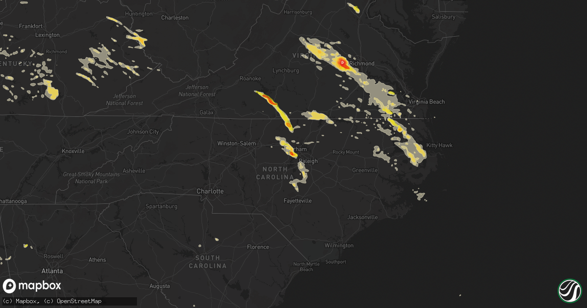
Hail Map on June 25, 2015
Get this storm
June 25 map
$229
one time, instant access
Download today. No call, no setup
Keep the $229
Bought the map and want the full workflow? Apply the entire $229 to a subscription within 7 days. None of it is wasted.
Every map, not just this one
This buys you this map. Subscription and you get every map we run, in the markets you choose from a few cities to whole states to nationwide. Plus real-time alerts the moment a storm fires.
Contact data
Name, contact info, occupancy, even credit band for addresses in the footprint. You go from where it hit to who to call.
Become the source they trust
Unlimited branding weather history reports on demand. You already have the documented answer ready for the property owner, and you are the one who showed up with it.
Property data and RoofTrace estimates
Pull up any address you have got, its value and the exact code rules for that jurisdiction, straight from One Click Code. Then RoofTrace estimates the squares, pitch, and roof value, priced the way you price.
States Impacted by Hail Map on June 25, 2015
Storm reports
Kansas
| Date | Description |
|---|---|
| 06/25/20156:48 PM CDT | There was a lot of dime hail. |
| 06/25/20156:45 PM CDT | A local report indicates 3.00 inch wind near 5 SSE CIMARRON |
| 06/25/20156:06 PM CDT | Landspout tornado |
| 06/25/20155:58 PM CDT | A local report indicates a tornado near 9 ENE KALVESTA |
| 06/25/20152:10 AM CDT | 18 inch tree down and lots of limbs also down. |
| 06/25/20152:03 AM CDT | Large oak tree down on a dirt road off of county rd 1700 |
| 06/25/20151:55 AM CDT | Tree damage reported in baldwin city. |
| 06/25/20151:50 AM CDT | Ojc measured 55 knots |
| 06/25/20151:50 AM CDT | Half inch hail and 60 mph winds at 150 am in overland park |
| 06/25/20151:49 AM CDT | A local report indicates 70 MPH wind near OLATHE |
| 06/25/20151:40 AM CDT | 6 ft diameter tree uprooted |
| 06/25/20151:39 AM CDT | Large part of tree snapped off... Falling on a car and adjacent house. Pic via facebook. |
| 06/25/20151:34 AM CDT | Oak trees snapped. Pictures via facebook. |
| 06/25/20151:32 AM CDT | Large trees down in overbrook. |
| 06/25/20151:28 AM CDT | A local report indicates 70 MPH wind near LYNDON |
| 06/25/20151:27 AM CDT | A local report indicates 60 MPH wind near FORBES FIELD |
| 06/25/20151:23 AM CDT | Tree into power lines in west leavenworth caused blown transformer. |
| 06/25/20151:18 AM CDT | Public reports trees down at 29th and oakley in topeka. |
| 06/25/20151:07 AM CDT | Tree down across power line in auburn. |
| 06/25/201512:21 AM CDT | Old tree had fallen across a road. |
| 06/24/201511:25 PM CDT | At nws goodland |
| 06/24/201510:15 PM CDT | Delayed report of nickle to quarter size hail with heavy rain measured at 2.70 inches for the storm. |
| 06/24/20158:50 PM CDT | A local report indicates 1.25 inch wind near 4 NNW FRIZELL |
| 06/24/20158:30 PM CDT | A local report indicates 1.00 inch wind near 9 NNW MISSLER |
| 06/24/20158:17 PM CDT | This was the second occurrence of quarter sized hail at this location. |
| 06/24/20158:00 PM CDT | A local report indicates 1.75 inch wind near 6 NE ASH VALLEY |
| 06/24/20157:55 PM CDT | A 2 inch tree branch was broken. |
| 06/24/20157:49 PM CDT | A local report indicates 1.00 inch wind near 2 W MONTEZUMA |
| 06/24/20157:40 PM CDT | A local report indicates 1.00 inch wind near 6 ENE ASH VALLEY |
| 06/24/20157:34 PM CDT | Trained spotter reports tree limbs and several scattered trampolines. Spotter also reported dime sized hail. |
| 06/24/20157:28 PM CDT | Trained spotter reports golf ball to tennis ball sized hail. Time is estimated from radar. |
| 06/24/20157:27 PM CDT | There were several episodes of damaging hail at this location. The corn crop was shredded and the wheat was at least 50 percent destroyed. |
| 06/24/20157:26 PM CDT | Law enforcement reports 60 to 70 mph winds with tree limbs breaking in heizer. |
| 06/24/20157:25 PM CDT | A local report indicates 1.25 inch wind near 6 ENE ASH VALLEY |
| 06/24/20157:18 PM CDT | An irrigation circle was blown down. |
| 06/24/20157:15 PM CDT | Picture sent via twitter courtesy of kake of quarter to half dollar sized hail. Time is estimated from radar. |
| 06/24/20157:03 PM CDT | Picture sent via twitter of a tree limb of 9 inches in diameter down in their yard. Time is based on radar and previous report. |
| 06/24/20157:02 PM CDT | A local report indicates 1.00 inch wind near 4 NNW THE HAGGARD ELEV |
Florida
| Date | Description |
|---|---|
| 06/25/20153:15 PM CDT | Large tree uprooted in rockridge. |
| 06/25/20152:24 PM CDT | Sheet metal roof peeled off clubhouse along the shore of little lake harris on country club drive in the lake harris shores neighborhood. Information received via wftv. |
| 06/25/20151:54 PM CDT | Em reported tree down on powerlines off of fort caroline lane. Time estimated by radar. |
| 06/25/20151:42 PM CDT | Media reported via social media power lines downed off of boulevard center drive. Time estimated by radar. |
Alabama
| Date | Description |
|---|---|
| 06/25/20156:58 AM CDT | A few trees were blown down in and around valley. |
North Dakota
| Date | Description |
|---|---|
| 06/25/20154:56 PM CDT | Hail lasted about 5 minutes before spotter drove out of it. |
| 06/25/20154:55 PM CDT | Very few stones 1 inch diameter...mostly pea size hail. A little standing water in the yard. Hail lasted about 4 minutes. |
| 06/25/20154:12 PM CDT | Pea and penny size hail increased to quarter sized hail. Was still hailing when this report was sent. South side of minot. |
Arizona
| Date | Description |
|---|---|
| 06/24/20158:14 PM CDT | Microburst produced gust at ktus asos of 60 mph...confirmed with tia tower. |
Oklahoma
| Date | Description |
|---|---|
| 06/25/20153:20 AM CDT | A local report indicates 60 MPH wind near BEAVER |
| 06/25/20153:15 AM CDT | Report received via oklahoma mesonet. |
South Dakota
| Date | Description |
|---|---|
| 06/25/20152:47 PM CDT | A local report indicates 74 MPH wind near 7 SW HERMOSA |
| 06/25/20152:35 PM CDT | A local report indicates 65 MPH wind near 8 W HERMOSA |
| 06/25/20152:28 PM CDT | A local report indicates 60 MPH wind near 4 ESE KEYSTONE |
Wyoming
| Date | Description |
|---|---|
| 06/25/20155:45 PM CDT | Storm chasers observed a narrow rope tornado over open country in far southwest goshen county lasting 3 minutes from 445-448 pm on june 25. |
| 06/25/201510:18 AM CDT | A local report indicates 1.00 inch wind near 17 NE DOUGLAS |
| 06/24/20158:57 PM CDT | A local report indicates 1.75 inch wind near 10 ENE CHEYENNE |
| 06/24/20158:57 PM CDT | A local report indicates 1.00 inch wind near 12 E CHEYENNE |
Virginia
| Date | Description |
|---|---|
| 06/25/20156:45 PM CDT | Tree downed onto a power line along old hundred road va-10 in chesterfield |
| 06/25/20156:00 PM CDT | Large tree downed on hull street road at brandermill |
| 06/25/20155:35 PM CDT | Spotter observed ping-pong ball sized hail at his home. |
| 06/25/20154:41 PM CDT | 1 inch hail along marion rd |
| 06/25/20154:39 PM CDT | 1 inch hail along hodnetts mill rd. Outside of chatham... Va. |
| 06/25/20154:30 PM CDT | A local report indicates 1.00 inch wind near 1 S CLIMAX |
| 06/25/20154:30 PM CDT | A local report indicates 1.00 inch wind near CARRSVILLE |
| 06/25/20154:27 PM CDT | Golf ball sized hail sw of climax... Va. |
| 06/25/20154:15 PM CDT | A local report indicates 1.00 inch wind near HUNTERDALE |
| 06/25/20154:00 PM CDT | A local report indicates 1.00 inch wind near WINDSOR |
| 06/25/20153:53 PM CDT | 1 inch hail |
| 06/25/20153:10 PM CDT | Trees down and roof damage at a trailer park |
| 06/24/201511:55 PM CDT | 4 to 6 inch diameter tree branch downed along us-58 in suffolk near pitchkettle road |
| 06/24/201511:30 PM CDT | Large power transformer blown down on buffalo ave in norfolk |
| 06/24/20159:35 PM CDT | Powerlines down on lamore drive in prince george |
| 06/24/20159:30 PM CDT | A local report indicates 70 MPH wind near RICHMOND |
| 06/24/20159:30 PM CDT | Trees and power lines down on old hundred road from previous line of storms |
| 06/24/20159:10 PM CDT | Numerous powerlines down on sutherland road. Scattered power outages. |
| 06/24/20159:05 PM CDT | A local report indicates 1.25 inch wind near CLAYVILLE |
| 06/24/20159:00 PM CDT | Small tree limbs down |
| 06/24/20158:57 PM CDT | A local report indicates 1.75 inch wind near PLAIN VIEW |
| 06/24/20158:55 PM CDT | A local report indicates 1.25 inch wind near CLAYVILLE |
| 06/24/20158:45 PM CDT | A local report indicates 1.75 inch wind near FLAT ROCK |
| 06/24/20158:40 PM CDT | Tree down. |
| 06/24/20158:30 PM CDT | A local report indicates 1.00 inch wind near 1 NE HEFLIN |
| 06/24/20158:30 PM CDT | A local report indicates 3.00 inch wind near POWHATAN |
| 06/24/20158:30 PM CDT | Trees down in numerous locations along broad street in henrico. Time is radar estimated. |
| 06/24/20158:10 PM CDT | Trees down north end of county near rt. 45. |
| 06/24/20158:10 PM CDT | 5 trees down along highway 20 near scottsville. |
| 06/24/20158:06 PM CDT | Multiple trees down near the 300 block of irish rd |
| 06/24/20158:00 PM CDT | Several trees downed in fork union. Time radar estimated. |
| 06/24/20158:00 PM CDT | Spotter reported multiple trees down off of rt 718. Time is estimated by radar |
| 06/24/20157:43 PM CDT | Trees down near intersesction of albevanna spring rd and solo dr |
| 06/24/20157:34 PM CDT | Trees down near intersection of scottsville rd and red hill rd |
| 06/24/20157:32 PM CDT | Few trees down near intersection of old lynchburg rd and richland dr |
| 06/24/20157:29 PM CDT | Trees down near 4100 block of monacan trail rd |
| 06/24/20157:15 PM CDT | Trees down near craigs store rd and black oak ridge |
| 06/24/20157:15 PM CDT | Several trees down near intersection of langford dr and dick woods rd |
| 06/24/20157:12 PM CDT | Trees downed on venable road. Time is radar estimated. |
| 06/24/20157:11 PM CDT | Tree down near intersection of owensville rd and tilman rd |
| 06/24/20157:10 PM CDT | Numerous medium to large sized tree limbs down |
West Virginia
| Date | Description |
|---|---|
| 06/25/20156:49 PM CDT | Half dollar hail |
| 06/24/20157:00 PM CDT | After the storm....found a few ping pong balls |
Texas
| Date | Description |
|---|---|
| 06/25/20154:40 AM CDT | West texas mesonet report |
North Carolina
| Date | Description |
|---|---|
| 06/25/20156:36 PM CDT | A local report indicates 1.00 inch wind near 3 NW PARKWOOD |
| 06/25/20156:30 PM CDT | Numerous trees down in winfall |
| 06/25/20156:20 PM CDT | Quarter size hail. |
| 06/25/20156:15 PM CDT | Golf ball hail and trees downed. |
| 06/25/20156:15 PM CDT | Golf ball hail and trees downed. |
| 06/25/20156:14 PM CDT | Quarter sized hail lasted through approx 714 pm. |
| 06/25/20156:10 PM CDT | Quarter size hail reported on triple creek dr in efland. |
| 06/25/20156:10 PM CDT | Tree down in a yard on the 3056 block of burlington rd near roxboro. |
| 06/25/20156:00 PM CDT | Quarter to ping pong ball sized hail reported in the olive hill community. |
| 06/25/20155:55 PM CDT | Hail size ranged from quarters to almost ping pong ball. |
| 06/25/20155:55 PM CDT | Quarter size hail occurring near corner of jack hambrick rd and morton-pulliam rd. |
| 06/25/20155:40 PM CDT | Time is radar estimated. |
| 06/25/20155:20 PM CDT | Time estimated by radar. |
| 06/25/20155:10 PM CDT | Large tree downed and partially blocking roadway at intersection of 158/13 near town of eure |
| 06/25/20155:05 PM CDT | Quarter size hail for several minutes at the hillsborough bbq company |
| 06/25/20155:00 PM CDT | A local report indicates 1.25 inch wind near 1 SSW SOMERTON |
| 06/25/20154:27 PM CDT | Tree down across the road on lannie drive in hillsborough |
| 06/25/20154:20 PM CDT | Tree blown down on a home. |
| 06/25/201512:35 AM CDT | Trees and powerlines down on oak rd |
| 06/24/201510:00 PM CDT | Harnett co dot - large gum tree across bill shaw road. |
| 06/24/20158:32 PM CDT | Quarter size hail. |
| 06/24/20158:22 PM CDT | Quarter size hail. |
| 06/24/20157:45 PM CDT | Tree down on newland rd in creswell. |
| 06/24/20157:40 PM CDT | A local report indicates 1.25 inch wind near 2 NNW CARPENTER |
| 06/24/20157:34 PM CDT | Quarter size hail. Time estimated by radar. |
| 06/24/20157:30 PM CDT | A local report indicates 1.00 inch wind near 3 NW PARKWOOD |
| 06/24/20157:27 PM CDT | Quarter sized hail reported on taylor hall place in chapel hill. Nickel size hail from 820-826. |
| 06/24/20157:20 PM CDT | Quarter to half dollar sized hail reported on interstate 40 and hwy 54 west. |
| 06/24/20157:20 PM CDT | A local report indicates 1.00 inch wind near 3 E CHAPEL HILL |
| 06/24/20157:19 PM CDT | Golf ball size hail reported near fordham blvd and e franklin st in chapel hill. |
Indiana
| Date | Description |
|---|---|
| 06/25/20156:25 PM CDT | Wires down with a pole near the intersection of slusher rd and n. Webster rd. |
| 06/25/20154:25 PM CDT | Healthy 4.5-6 inch diameter branches down over the road. |
| 06/24/201511:10 PM CDT | Roof partially removed from barn |
| 06/24/201511:05 PM CDT | Many trees broken off high near park. One house had a porch damaged. |
Nebraska
| Date | Description |
|---|---|
| 06/25/20156:53 PM CDT | A local report indicates 1.00 inch wind near ALLIANCE |
| 06/25/20156:45 PM CDT | A local report indicates 1.75 inch wind near ALLIANCE |
| 06/25/20156:40 PM CDT | A local report indicates 1.50 inch wind near 3 E BAYARD |
| 06/25/20156:35 PM CDT | National weather service employee driving through the area encountered 65 mph winds and 1.25 inch diameter hail north of alliance |
| 06/25/20156:30 PM CDT | A local report indicates 60 MPH wind near 18 NNW ELLSWORTH |
| 06/25/20156:27 PM CDT | Tornado just went by his house. 1/8 mile wide. Golf ball sized hail. |
| 06/25/20156:25 PM CDT | Via twitter picture |
| 06/25/20156:25 PM CDT | A local report indicates a tornado near 1 NE BAYARD |
| 06/25/20156:24 PM CDT | A local report indicates 1.75 inch wind near HEMINGFORD |
| 06/25/20156:23 PM CDT | A local report indicates a tornado near 2 N BAYARD |
| 06/25/20156:12 PM CDT | A local report indicates 1.50 inch wind near 7 N HEMINGFORD |
| 06/25/20156:00 PM CDT | A local report indicates 60 MPH wind near 10 E DUNNING |
| 06/25/20155:55 PM CDT | Hail ranged from pea to quarter size. Est 40mph wind |
| 06/25/20155:38 PM CDT | A local report indicates 1.75 inch wind near CRAWFORD |
| 06/25/20155:35 PM CDT | A local report indicates 60 MPH wind near 5 SE HALSEY |
| 06/25/20155:25 PM CDT | A local report indicates 60 MPH wind near 4 W DUNNING |
| 06/25/20155:20 PM CDT | A local report indicates 1.50 inch wind near 4 E ROSCOE |
| 06/25/20155:02 PM CDT | A local report indicates 75 MPH wind near 1 WSW KINGSLEY DAM |
| 06/25/20155:02 PM CDT | A local report indicates 1.00 inch wind near KINGSLEY DAM |
| 06/25/20155:01 PM CDT | A local report indicates 67 MPH wind near 1 S OGALLALA |
| 06/25/20154:59 PM CDT | 50mph wind also reported |
| 06/25/20154:45 PM CDT | Est. Wind 50mph |
| 06/25/20152:55 PM CDT | Hail and 40 to 50 mph wind gusts broke windows on north side of house. |
| 06/25/20152:45 PM CDT | A local report indicates 1.75 inch wind near 4 N ANTIOCH |
| 06/25/20152:30 PM CDT | A local report indicates 80 MPH wind near 3 W ANTIOCH |
| 06/25/20152:30 PM CDT | Duration 30 minutes. |
| 06/25/20152:30 PM CDT | Duration 10 minutes. |
| 06/25/20152:26 PM CDT | Duration 34 minutes. |
| 06/25/20152:24 PM CDT | Duration 10 minutes. |
| 06/25/20152:20 PM CDT | Hail lasted from 120 to 127pm. 55mph wind gusts measured. Windows broken out of garage and basement. 0.31 inches of liquid measured. |
| 06/25/20152:20 PM CDT | Duration 15 minutes. |
| 06/25/20152:20 PM CDT | Duration 10 minutes. |
| 06/25/20152:20 PM CDT | Duration 5 minutes. |
| 06/25/20152:20 PM CDT | A local report indicates 1.75 inch wind near 7 NE ALLIANCE |
| 06/25/20152:20 PM CDT | Duration 5 minutes. |
| 06/25/20152:20 PM CDT | Duration 30 minutes. |
| 06/25/20152:18 PM CDT | A local report indicates 4.25 inch wind near 6 NE ALLIANCE |
| 06/25/20152:18 PM CDT | A local report indicates 1.75 inch wind near 5 NNE ALLIANCE |
| 06/25/20152:15 PM CDT | Duration 20 minutes. |
| 06/25/20152:10 PM CDT | Duration 20 minutes. |
| 06/25/20151:50 PM CDT | Duration 5 minutes. |
| 06/25/20151:50 PM CDT | Duration 20 minutes. |
| 06/24/20159:08 PM CDT | A local report indicates 65 MPH wind near VENANGO |
| 06/24/20159:01 PM CDT | A local report indicates 60 MPH wind near VENANGO |
| 06/24/20158:35 PM CDT | A local report indicates 60 MPH wind near CHAPPELL |
| 06/24/20158:30 PM CDT | 3-4inch tree branches broken... Healthy trees. |
| 06/24/20158:00 PM CDT | 6-8 inch tree branches snapped off healthy trees. |
| 06/24/20157:40 PM CDT | Hail ranged from pea to quarter size. Est. 40mph wind |
| 06/24/20157:00 PM CDT | 6-8 inch tree branches snapped off healthy trees. |
Georgia
| Date | Description |
|---|---|
| 06/25/20155:44 PM CDT | Several trees down on captola rd about 4 miles north of halcyondale. |
| 06/25/20154:00 PM CDT | Several trees were blown down in bartow county. |
| 06/25/20153:45 PM CDT | Employee of jumping jeremys moonwalks reported quarter size hail....at the company location just due west of kingston |
Ohio
| Date | Description |
|---|---|
| 06/25/201512:22 AM CDT | Delayed report. Numerous large trees uprooted or snapped in madison twnshp. Time estimated by radar. |
Colorado
| Date | Description |
|---|---|
| 06/25/20156:24 PM CDT | A local report indicates 1.00 inch wind near 2 E PONDEROSA PARK |
| 06/25/20156:20 PM CDT | Began 515 pm |
| 06/25/20156:12 PM CDT | A local report indicates 1.50 inch wind near 4 S STRASBURG |
| 06/25/20156:12 PM CDT | A local report indicates 1.50 inch wind near 4 SSE BENNETT |
| 06/25/20155:55 PM CDT | A local report indicates 1.00 inch wind near 1 S BENNETT |
| 06/25/20155:49 PM CDT | A local report indicates 1.00 inch wind near 5 SW BLACK FOREST |
| 06/25/20155:39 PM CDT | A local report indicates 1.50 inch wind near 8 S PROSPECT VALLEY |
| 06/25/20155:35 PM CDT | A local report indicates 2.50 inch wind near 8 S KEENESBURG |
| 06/25/20155:20 PM CDT | A local report indicates 1.50 inch wind near 3 W PROSPECT VALLEY |
| 06/25/20155:15 PM CDT | A local report indicates 2.00 inch wind near 4 SW KEENESBURG |
| 06/25/20155:15 PM CDT | One window in the house was broken |
| 06/25/20155:00 PM CDT | A local report indicates 1.25 inch wind near 5 SSE MILTON RESERVOIR |
| 06/25/20154:59 PM CDT | A local report indicates 1.50 inch wind near ENE KEENESBURG |
| 06/25/20154:55 PM CDT | A local report indicates 1.00 inch wind near 2 SE MILTON RESERVOIR |
| 06/24/201511:55 PM CDT | A local report indicates 1.00 inch wind near LOVELAND |
| 06/24/201510:10 PM CDT | 3/4 inch hail and 0.50 inches of rain |
| 06/24/201510:10 PM CDT | Wind gust to 42 mph and rainfall over 0.50 inches |
| 06/24/20158:42 PM CDT | A local report indicates 1.00 inch wind near 2 NE SPRINGFIELD |
| 06/24/20157:02 PM CDT | A local report indicates 1.00 inch wind near 13 ENE KIOWA |
Missouri
| Date | Description |
|---|---|
| 06/25/20156:58 PM CDT | A local report indicates 1.75 inch wind near TROY |
| 06/25/20156:56 PM CDT | A local report indicates 1.25 inch wind near MARSHALL |
| 06/25/20156:51 PM CDT | A local report indicates 1.75 inch wind near MARSHALL |
| 06/25/20156:50 PM CDT | A local report indicates 1.00 inch wind near MARSHALL |
| 06/25/20156:47 PM CDT | Received via social media |
| 06/25/20156:45 PM CDT | A local report indicates 1.00 inch wind near MARSHALL |
| 06/25/20156:36 PM CDT | Report came in via social media. |
| 06/25/20156:30 PM CDT | Power lines and tree limbs down from strong winds. |
| 06/25/20156:27 PM CDT | Large tree blown down on hwy 24 |
| 06/25/20156:25 PM CDT | Tree limbs down |
| 06/25/20156:19 PM CDT | A local report indicates 1.25 inch wind near SUMNER |
| 06/25/20156:10 PM CDT | Several tree limbs broken in the wind. Lasted for several minutes |
| 06/25/20156:10 PM CDT | Broken tree limb... 12 inches in diameter. |
| 06/25/20155:58 PM CDT | Tree limbs down... 18 inches in diameter. |
| 06/25/20155:55 PM CDT | Numerous 6 to 10 inch tree limbs laying across hwy 36 near meadville. |
| 06/25/20155:30 PM CDT | A local report indicates 1.75 inch wind near CHULA |
| 06/25/20155:28 PM CDT | A local report indicates 1.00 inch wind near 2 W CHULA |
| 06/25/20154:17 AM CDT | A large tree was blown over blocking a road and two fire work tents collapse in the city of laurie. |
| 06/25/20154:00 AM CDT | Tree blown down highway 7 - time estimated. Reported by volunteer weather observer ben402. |
| 06/25/20153:52 AM CDT | 2 trees over highway 254. Road closed. |
| 06/25/20153:46 AM CDT | Large trees down near north street and n spur. |
| 06/25/20153:40 AM CDT | Several reports of trees down in city limits. Around 0340 am a report of a tree down near polk street and hillcrest lane. |
| 06/25/20153:38 AM CDT | A local report indicates 70 MPH wind near OSCEOLA |
| 06/25/20153:27 AM CDT | Tree limb 10 inches in diameter down on power line at 2nd and missouri ave.... Which caused power line to break. Portion of limb went through roof of outbuilding. |
| 06/25/20153:22 AM CDT | Power line down at 3rd st. And cherry st. |
| 06/25/20152:30 AM CDT | 8 inch tree broken along with others. Damaged roof and fence observed. |
| 06/25/20152:20 AM CDT | Large tree down 2 miles south of independence |
| 06/25/20152:12 AM CDT | A local report indicates 65 MPH wind near PLEASANT HILL |
| 06/25/20152:10 AM CDT | Broken tree limb 6 inches in diameter. |
| 06/25/20152:09 AM CDT | Large portion of tree snapped off... Blocking road. Pic via facebook. |
| 06/25/20152:08 AM CDT | Uprooted tree in blue springs... Partially destroying a deck on a house. Pics via twitter. |
| 06/25/20152:04 AM CDT | Numerous large branches down... Including half of a tree split due to wind |
| 06/25/20152:02 AM CDT | 60 mph winds |
| 06/25/20151:56 AM CDT | Lxt measured 53 knots |
| 06/25/20151:51 AM CDT | A local report indicates 75 MPH wind near 1 SE KANSAS CITY |
| 06/25/20151:51 AM CDT | Tree limb snapped... 20 inches in diameter. |
| 06/25/20151:51 AM CDT | Large tree branches and limbs down near 39th st and phelps rd in independence. Pics via twitter. |
| 06/25/20151:50 AM CDT | Large tree 4 feet in diameter down along with multiple power lines. |
| 06/25/20151:50 AM CDT | Estimaed 70 to 80 mph with trees down. Unknow how big the trees are. |
| 06/25/20151:49 AM CDT | Roof damage to a building. Picture via facebook. |
| 06/25/20151:49 AM CDT | A local report indicates 80 MPH wind near RIVERSIDE |
| 06/25/20151:48 AM CDT | Large tree branches and limbs down in raytown near 47th st and sterling ave. Pics via twitter. |
| 06/25/20151:45 AM CDT | Large tree blown over and blocking s delaware ave |
| 06/25/20151:42 AM CDT | Mkc measured 51 knots |
| 06/25/20151:40 AM CDT | Large pin oak tree blown down |
| 06/25/20151:38 AM CDT | 12 inch tree snapped on city hall property |
| 06/25/20151:35 AM CDT | Numerous trees blocking roads just southwest of avondale |
| 06/25/20151:30 AM CDT | 16 inch trees reportedly uprooted |
| 06/25/20151:30 AM CDT | 12 to 15 inch diameter limbs down at n anita dr and n northwood rd. |
| 06/24/201510:13 PM CDT | A couple trees were downed near laurie. |
| 06/24/20159:24 PM CDT | A local report indicates 60 MPH wind near CHESTERFIELD |
| 06/24/20158:40 PM CDT | Roof blown off a mobile home and trees and power lines down |
| 06/24/20158:22 PM CDT | Multiple limbs down. Some six inches in diameter. |
| 06/24/20158:15 PM CDT | Trees and limbs down |
| 06/24/20158:15 PM CDT | Off highway a in wellsville. Overturned two car carport...1 fence panel thrown 10ft into pool...another fence panel torn through patio screen room...screen room ceiling |
| 06/24/20158:15 PM CDT | Trees down |
| 06/24/20158:10 PM CDT | Trees and limbs down |
| 06/24/20158:05 PM CDT | Tree snapped and fell ontu a home. Time estimated from radar. |
| 06/24/20157:55 PM CDT | Large tree down |
| 06/24/20157:55 PM CDT | Large tree down on jefferson road |
| 06/24/20157:55 PM CDT | Strong winds overturned several railroad cars which are blocking intersections on county road 509 and also on locust street |
| 06/24/20157:35 PM CDT | 55 kts measured in marshall |
| 06/24/20157:32 PM CDT | Trees and limbs down in paris and just south of paris |
| 06/24/20157:22 PM CDT | Large branches down |
| 06/24/20157:20 PM CDT | Trees blown across hwy z and hwy dd. Parts of moberly are currently without power. Clifton hill is also without power. |
| 06/24/20157:20 PM CDT | Several trees damaged and down along hwy 24 between moberly and route yy. |
| 06/24/20157:15 PM CDT | A local report indicates 1.00 inch wind near 5 W MADISON |
| 06/24/20157:15 PM CDT | A local report indicates 1.00 inch wind near MARSHALL |
| 06/24/20157:15 PM CDT | A local report indicates 1.50 inch wind near 1 SW MARSHALL |
| 06/24/20157:15 PM CDT | A local report indicates 60 MPH wind near 1 SW MARSHALL |
| 06/24/20157:12 PM CDT | 61 kts measured at moberly |
| 06/24/20157:10 PM CDT | Isolated tree damage. Limb of 6 inches snapped. Via social media |
| 06/24/20157:07 PM CDT | Shed blown away and tree limbs down...a 35 to 40 foot tall tree was blown down from the winds |
| 06/24/20157:05 PM CDT | A local report indicates 1.00 inch wind near MARSHALL |
Illinois
| Date | Description |
|---|---|
| 06/25/20156:05 PM CDT | Corn fields flattened and trees and limbs down |
| 06/25/20155:50 PM CDT | Corn fields flattened and trees and limbs down |
| 06/24/201510:15 PM CDT | A local report indicates 63 MPH wind near 2 ENE CARMI |
| 06/24/201510:00 PM CDT | Several trees and power lines down in town |
| 06/24/201510:00 PM CDT | Tree down across right lane heading eastbound on i-64 |
| 06/24/20159:45 PM CDT | Barn destroyed in belle rive area. Trees down near belle rive and dahlgren. |
| 06/24/20159:24 PM CDT | Several large tree branches down 6-8 inches in diameter. |
| 06/24/20157:55 PM CDT | Power out in part of town near highway 15 and frank scott parkway. |
| 06/24/20157:40 PM CDT | Trees and branches down in several locations |
| 06/24/20157:26 PM CDT | A local report indicates 1.00 inch wind near FAIRVIEW HEIGHTS |
| 06/24/20157:25 PM CDT | A local report indicates 1.00 inch wind near 4 W GIRARD |
| 06/24/20157:23 PM CDT | Foot and a half diameter ash tree snapped about 10 feet up. |
| 06/24/20157:17 PM CDT | A local report indicates 1.00 inch wind near GRANITE CITY |
South Carolina
| Date | Description |
|---|---|
| 06/25/20155:41 PM CDT | Tree down on poplar st at hayden st. |
| 06/25/20155:23 PM CDT | A tree was blown down across both lanes at the intersection of poplar and hayden streets. Time of event was estimated from radar data. |
| 06/25/20155:12 PM CDT | Tree down on bells highway at mcclure lane. |
| 06/25/20155:11 PM CDT | A tree was blown down across one lane at the intersection of bells highway and mclure lane. |
| 06/25/20155:03 PM CDT | Tree in roadway on kimbrell st at bells highway. |
| 06/25/20155:00 PM CDT | A pine tree was blown down onto the road and the top was snapped off another pine tree near the intersection of bells highway and kimbrell street. |
| 06/25/20153:25 PM CDT | Dispatcher reported tree down on knowles island rd near palm key. |
| 06/25/20152:45 PM CDT | Two trees down on black swamp rd near cotton hill rd. |
| 06/24/20158:20 PM CDT | Tree down near flint hill rd and sr 97. Time estimated |
| 06/24/20158:05 PM CDT | Lynches river electric coop reported trees and power lines down on lystra rd... And on kiowa trail... And kanawha trail. |
Kentucky
| Date | Description |
|---|---|
| 06/25/20156:40 PM CDT | A local report indicates 1.00 inch wind near ROCKHOUSE |
| 06/25/20156:25 PM CDT | Quarter sized hail observed along hwy 541. |
| 06/25/20156:22 PM CDT | A local report indicates 1.00 inch wind near 4 SW SHELBIANA |
| 06/25/20156:20 PM CDT | Tree down along 610 between mile markers 3-4. Time estimated from radar. |
| 06/25/20156:15 PM CDT | Tree down along rt. 134 between mile markers 4-6. |
| 06/25/20156:10 PM CDT | Large tree limb broken out of tree. |
| 06/25/20156:10 PM CDT | A local report indicates 1.00 inch wind near GRETHEL |
| 06/25/20156:00 PM CDT | A local report indicates 1.00 inch wind near HYDEN |
| 06/25/20155:48 PM CDT | A local report indicates 1.00 inch wind near 1 S MARTIN |
| 06/25/20155:26 PM CDT | A local report indicates 1.25 inch wind near HITCHINS |
| 06/25/20155:25 PM CDT | Fell on wells rd. Just north of hwy 773. Time estimated from radar. |
| 06/25/20155:17 PM CDT | Quarter sized hail along hwy 1350. |
| 06/25/20155:10 PM CDT | Fell near community of gregoryville on hwy 60. Time estimated from radar. |
| 06/25/20153:55 AM CDT | Harris grocery reported quarter size hail and two trees down. One large tree had to be removed from a roadway. |
| 06/25/20152:55 AM CDT | Tree down along grapevine rd. Time estimated from radar. |
| 06/25/20152:52 AM CDT | Large tree limbs down in monticello. Report relayed via twitter. |
| 06/25/20152:27 AM CDT | A large tree blown down. |
| 06/25/20152:17 AM CDT | A large tree down on little clifty creek road. Delayed report. Time estimated from radar. |
| 06/25/20152:12 AM CDT | Trees blocking roads |
| 06/25/20152:10 AM CDT | Tree down |
| 06/25/20151:59 AM CDT | Trees down |
| 06/25/20151:43 AM CDT | A large tree down on montgomery court |
| 06/25/20151:43 AM CDT | A large tree down |
| 06/25/20151:41 AM CDT | Trees down |
| 06/25/20151:35 AM CDT | A large tree blown down. |
| 06/25/20151:20 AM CDT | Three large to medium trees blown over one half mile west of bonnieville. |
| 06/25/20151:10 AM CDT | Powerline down |
| 06/24/201511:03 PM CDT | A large tree blown down. |
| 06/24/20158:40 PM CDT | Damage to carport and minor roof damage. Estimated winds 70mph. |
| 06/24/20158:24 PM CDT | A local report indicates 1.00 inch wind near 2 ESE GALLUP |
| 06/24/20157:22 PM CDT | Tree down on ky 550 near the town of dwarf. |
Cities Impacted by Hail Map on June 25, 2015
- Dawson, NE
- Stella, NE
- Humboldt, NE
- Table Rock, NE
- Verdon, NE
- Mankato, KS
- Formoso, KS
- Harrisburg, MO
- Columbia, MO
- Bennett, CO
- La Salle, CO
- Strasburg, CO
- Keenesburg, CO
- Hudson, CO
- McDowell, KY
- Grethel, KY
- San Jose, NM
- Harrisburg, NE
- Bayard, NE
- Yuma, CO
- Eckley, CO
- Wray, CO
- Bridgeport, NE
- Chapel Hill, NC
- Durham, NC
- Topeka, KS
- Gravois Mills, MO
- Edwards, MO
- Stover, MO
- Climax Springs, MO
- Edgemont, SD
- Hanover, KS
- Bremen, KS
- Buckner, MO
- Sibley, MO
- Independence, MO
- Beattie, KS
- Oketo, KS
- Liberty, NE
- Hettick, IL
- Palmyra, IL
- Greenfield, IL
- Oakley, KS
- Winona, KS
- Montezuma, KS
- New Baden, IL
- Albers, IL
- Okawville, IL
- Tyner, KY
- Manchester, KY
- Sizerock, KY
- Sextons Creek, KY
- Bear Branch, KY
- Oneida, KY
- Booneville, KY
- Kingston, GA
- Horton, KS
- Hiawatha, KS
- Everest, KS
- Holly, CO
- Sublette, KS
- Satanta, KS
- Wallace, KS
- Magnolia, KY
- Buffalo, KY
- Mount Sherman, KY
- Rockbridge, IL
- Waldo, KS
- Paradise, KS
- Sedley, VA
- Louisa, KY
- Hay Springs, NE
- Booker, TX
- Perryton, TX
- Balko, OK
- Venice, IL
- Madison, IL
- Granite City, IL
- East Saint Louis, IL
- Lusk, WY
- Manville, WY
- Ellsworth, NE
- Bonnie, IL
- Johnsonville, IL
- Opdyke, IL
- Kell, IL
- Ina, IL
- Mount Vernon, IL
- Bluford, IL
- Centralia, IL
- Texico, IL
- Belle Rive, IL
- Salem, IL
- Iuka, IL
- Keenes, IL
- Harrodsburg, KY
- Lancaster, KY
- Danville, KY
- Marienthal, KS
- Suffolk, VA
- Barnes, KS
- Waterville, KS
- Randolph, KS
- Garfield, KY
- Harned, KY
- Pendleton, NC
- Como, NC
- Cartersville, GA
- Lithia, FL
- Bowling Green, FL
- Mulberry, FL
- Courtland, VA
- Ivor, VA
- Wakefield, VA
- Carrsville, VA
- Waverly, VA
- Franklin, VA
- Clarksville, VA
- Delia, KS
- Junction City, KS
- Troy, IL
- O'Fallon, IL
- Lebanon, IL
- Collinsville, IL
- Robinson Creek, KY
- Pikeville, KY
- Deer Trail, CO
- Marshall, MO
- Slater, MO
- Sweet Springs, MO
- Great Bend, KS
- Rush Center, KS
- Hoisington, KS
- Pawnee Rock, KS
- Larned, KS
- Albert, KS
- Otis, KS
- Olmitz, KS
- Saint Joseph, MO
- Coulterville, IL
- Corydon, IN
- Cedartown, GA
- Rozel, KS
- Scottsville, VA
- Moseley, VA
- Midlothian, VA
- Powhatan, VA
- Ulmer, SC
- Nunn, CO
- Cheyenne, WY
- Ault, CO
- Shelbiana, KY
- Elkhorn City, KY
- Alliance, NE
- Carbondale, KS
- Falls Of Rough, KY
- Lillington, NC
- Broadway, NC
- Chula, MO
- Trenton, MO
- Turtle Lake, ND
- Mercer, ND
- Washburn, ND
- Wilton, ND
- New Cambria, MO
- Callao, MO
- Cary, NC
- Burlington, NC
- Carrboro, NC
- Mebane, NC
- Morrisville, NC
- Cedar Grove, NC
- Hillsborough, NC
- Apex, NC
- Efland, NC
- Farmersville, IL
- Girard, IL
- Keystone, SD
- Rapid City, SD
- Hermosa, SD
- St John, KS
- Greenville, IN
- Georgetown, IN
- Keaton, KY
- Flatgap, KY
- West Liberty, KY
- Bahama, NC
- Gatesville, NC
- Gates, NC
- Lakeland, FL
- Williamsburg, KS
- Pomona, KS
- Hardinsburg, KY
- Cannelton, IN
- Cloverport, KY
- Oak Grove, MO
- Bates City, MO
- Campbellsville, KY
- Lance Creek, WY
- Blue Springs, NE
- Wymore, NE
- Gypsum, KS
- Seibert, CO
- Howe, IN
- Shipshewana, IN
- Wolcottville, IN
- Lagrange, IN
- Auxvasse, MO
- Dillwyn, VA
- Buckingham, VA
- Beaver, OK
- Franktown, CO
- Columbia, NC
- Lagrange, WY
- Nashville, IL
- Edenton, NC
- Hertford, NC
- Colerain, NC
- Tyner, NC
- Trementina, NM
- Salyersville, KY
- Cimarron, KS
- Sheridan Lake, CO
- Lamar, CO
- Upton, WY
- Sidney, NE
- Cuba, AL
- Toomsuba, MS
- Santa Claus, IN
- Lamar, IN
- Walterboro, SC
- Ruffin, SC
- Blackburn, MO
- Henderson, NC
- Boydton, VA
- Hemingford, NE
- Chillicothe, MO
- Concordia, KS
- Emporia, VA
- Syracuse, KS
- Macon, NC
- Norlina, NC
- Warrenton, NC
- Prince George, VA
- Stafford, VA
- Leasburg, NC
- Roxboro, NC
- Mandan, ND
- Whitney, NE
- Burns, WY
- Esmont, VA
- Schuyler, VA
- Arvonia, VA
- Keene, VA
- Palmyra, VA
- Bremo Bluff, VA
- Howardsville, VA
- New Canton, VA
- Chadron, NE
- Copeland, KS
- Colorado Springs, CO
- Princeton, KY
- Fredonia, KY
- Gasburg, VA
- White Plains, VA
- Littleton, NC
- Henrico, NC
- Campbellsburg, IN
- Sonora, KY
- Glendale, KY
- Hodgenville, KY
- Elizabethtown, KY
- Hugoton, KS
- Liberal, KS
- Kiowa, CO
- Malta Bend, MO
- Taylorsville, KY
- Boise City, OK
- Myakka City, FL
- Bernalillo, NM
- Algodones, NM
- Parrish, FL
- Crawford, NE
- Glenvil, NE
- Glendo, WY
- Hartville, WY
- Jay Em, WY
- Thousandsticks, KY
- Hyden, KY
- Fayette, MS
- Kansas City, KS
- Kit Carson, CO
- Cheyenne Wells, CO
- Eugene, MO
- Gladstone, NM
- Carpenter, WY
- Hillsdale, WY
- Center, ND
- Piedmont, AL
- Eolia, MO
- Bowling Green, MO
- Church Road, VA
- Amelia Court House, VA
- Leoti, KS
- Moscow, KS
- Grafton, IL
- Bardstown, KY
- Beloit, KS
- Winfield, MO
- Old Monroe, MO
- Hobbsville, NC
- Belvidere, NC
- Morganville, KS
- Clyde, KS
- Saint Thomas, MO
- Westphalia, MO
- Meta, MO
- Jefferson City, MO
- Hasty, CO
- Jameson, MO
- Pattonsburg, MO
- Madrid, NE
- Soldier, KS
- Dodge City, KS
- Wright, KS
- Jetmore, KS
- Okeechobee, FL
- Cairo, MO
- Excello, MO
- Jacksonville, MO
- Moberly, MO
- Mineral, VA
- Louisa, VA
- New Middletown, IN
- Elizabeth, IN
- Semora, NC
- Lees Summit, MO
- Levasy, MO
- Liberty, MO
- Pleasant Hill, MO
- Orrick, MO
- Holden, MO
- Greenwood, MO
- Wellington, MO
- Grain Valley, MO
- Strasburg, MO
- Blue Springs, MO
- Centerview, MO
- Mayview, MO
- Lexington, MO
- Lone Jack, MO
- Kansas City, MO
- Odessa, MO
- Smithville, MO
- Kingsville, MO
- Napoleon, MO
- Centralia, MO
- Montgomery City, MO
- Wellsville, MO
- Hazen, ND
- Lemoyne, NE
- Keystone, NE
- Grenville, NM
- Rushville, MO
- Atchison, KS
- Weston, MO
- Elsberry, MO
- Foley, MO
- Moscow Mills, MO
- Hawk Point, MO
- Silex, MO
- Brussels, IL
- Troy, MO
- Golden Eagle, IL
- Batchtown, IL
- Vevay, IN
- Canaan, IN
- Madison, IN
- Springfield, CO
- Hazel Green, KY
- Campton, KY
- Bingham, NE
- Lakeside, NE
- Oshkosh, NE
- Paxton, NE
- Ogallala, NE
- Lisco, NE
- Marsland, NE
- Arthur, NE
- Lewellen, NE
- Newcastle, WY
- Windsor, VA
- Elizabeth, CO
- Parker, CO
- Madison, MO
- Lake Wales, FL
- Belleville, IL
- Chesterfield, VA
- Goochland, VA
- Waverly, MO
- Dover, MO
- Somerset, KY
- Turpin, OK
- Tyrone, OK
- Windsor, MO
- Bullock, NC
- Manson, NC
- Buffalo Junction, VA
- Skipwith, VA
- Plains, KS
- Tipton, MO
- Abilene, KS
- Chapman, KS
- Enterprise, KS
- Cope, CO
- Flagler, CO
- Olsburg, KS
- Gallion, AL
- Claflin, KS
- Easton, KS
- De Witt, NE
- Pickrell, NE
- Kampsville, IL
- Eldred, IL
- Carrollton, IL
- Saint Meinrad, IN
- Dale, IN
- Evanston, IN
- Ferdinand, IN
- Kingman, KS
- Cunningham, KS
- Rich Square, NC
- Jackson, NC
- Woodland, NC
- Pecos, TX
- Kings Mountain, KY
- Liberty, KY
- Yosemite, KY
- Middleburg, KY
- Goldvein, VA
- Midland, VA
- Catlett, VA
- Angora, NE
- Kermit, WV
- Lovely, KY
- Sutherlin, VA
- Milton, NC
- Keeling, VA
- Ringgold, VA
- Alton, VA
- Blairs, VA
- Richland, IN
- Chrisney, IN
- Rome, GA
- Gadsden, AL
- Covesville, VA
- Merriman, NE
- Broadwater, NE
- Rushville, NE
- Harrison, NE
- Ashby, NE
- Hyannis, NE
- Edgar, NE
- Ong, NE
- Wheatland, WY
- Centralia, KS
- Middletown, MO
- Stanford, KY
- Hustonville, KY
- Waynesburg, KY
- Minatare, NE
- Gering, NE
- Birdseye, IN
- Eckerty, IN
- Taswell, IN
- Dubois, IN
- Celestine, IN
- French Lick, IN
- Virgilina, VA
- Silver Lake, KS
- Holyrood, KS
- Bushton, KS
- Lanesville, IN
- Louisville, KY
- English, IN
- Leavenworth, IN
- Fairdale, KY
- Brooks, KY
- Depauw, IN
- West Point, KY
- Laconia, IN
- Shepherdsville, KY
- Wingina, VA
- Viola, KS
- Agenda, KS
- Trenton, ND
- Williston, ND
- Fort Knox, KY
- Radcliff, KY
- Lebanon Junction, KY
- Teaberry, KY
- Byers, CO
- Penhook, VA
- Chatham, VA
- Westmoreland, KS
- Bethelridge, KY
- Eubank, KY
- Briggsdale, CO
- Kersey, CO
- Hale, MO
- Jackson, KY
- Sunbury, NC
- Wilsondale, WV
- Dunlow, WV
- Crum, WV
- Fort Gay, WV
- Crothersville, IN
- Alma, IL
- Alberta, VA
- Union Hall, VA
- Glade Hill, VA
- Loveland, CO
- Windsor, CO
- Fort Collins, CO
- Corning, KS
- Parkers Lake, KY
- London, KY
- Warrensburg, MO
- Huntsville, MO
- Bonner Springs, KS
- Russell Springs, KY
- Calhoun, MO
- Colby, KS
- Brule, NE
- Milltown, IN
- Marengo, IN
- Max, ND
- Stapleton, NE
- Effingham, KS
- Muscotah, KS
- Leavenworth, KS
- New Salem, ND
- Cheney, KS
- Grandview, MO
- Hazard, KY
- Bonnyman, KY
- Greenville, KY
- Meade, KS
- Ensign, KS
- Willisburg, KY
- Plant City, FL
- Windsor, NC
- Willow Spring, NC
- Angier, NC
- Fuquay Varina, NC
- Kaycee, WY
- Chugwater, WY
- Wheeling, MO
- Laclede, MO
- Meadville, MO
- Russell, KS
- Minot, ND
- Bristow, IN
- Grayson, KY
- Hitchins, KY
- Olive Hill, KY
- Burnside, KY
- Bronston, KY
- Laredo, MO
- Beatrice, NE
- Fayette, MO
- Manhattan, KS
- Scottsburg, IN
- Springfield, KY
- Stockton, KS
- Ghent, KY
- Warsaw, KY
- Carrollton, KY
- Glenrock, WY
- Douglas, WY
- Overland Park, KS
- Tamaroa, IL
- Pinckneyville, IL
- Roggen, CO
- Crozier, VA
- Zuni, VA
- Clarksville, MO
- Pacific, MO
- Catawissa, MO
- Cedar Hill, MO
- Gallatin, MO
- Immokalee, FL
- Dry Fork, VA
- Sandy Level, VA
- Natoma, KS
- Rosendale, MO
- Savannah, MO
- Fork Union, VA
- Kents Store, VA
- Columbia, VA
- Fargo, GA
- Homerville, GA
- Halliday, ND
- Brookfield, MO
- Nancy, KY
- Smithfield, VA
- Elberon, VA
- Vona, CO
- Genoa, WV
- Esbon, KS
- Casper, WY
- Wright City, MO
- Foristell, MO
- Harper, KS
- Simpson, KS
- High Hill, MO
- New Florence, MO
- Montrose, MO
- Macon, MO
- Seneca, KS
- Thompson, MO
- Ulysses, KS
- Burkesville, KY
- Crab Orchard, KY
- Leopold, IN
- Tell City, IN
- Branchville, IN
- Jamesport, MO
- Rousseau, KY
- Agate, CO
- Vandalia, MO
- Perry, MO
- Cecilia, KY
- Creswell, NC
- Bucyrus, KS
- Macedonia, IL
- Ewing, IL
- McLeansboro, IL
- Castle Rock, CO
- Lowmansville, KY
- Harts, WV
- Breeden, WV
- Adams, NE
- Tecumseh, NE
- Limon, CO
- Science Hill, KY
- Corbin, KY
- White Hall, IL
- Eastview, KY
- Big Clifty, KY
- White Mills, KY
- Filley, NE
- Nebo, IL
- Chesapeake, VA
- Eutaw, AL
- Afton, VA
- Blue Rapids, KS
- Garysburg, NC
- Skippers, VA
- Gaston, NC
- Roanoke Rapids, NC
- Branchville, VA
- Murfreesboro, NC
- Pawnee City, NE
- Burchard, NE
- Eureka, MO
- Granada, CO
- Clay Center, KS
- Merritt Island, FL
- Patrick Afb, FL
- Cocoa, FL
- Peck, KS
- Clearwater, KS
- Mackville, KY
- Roper, NC
- Scott City, KS
- Blackstone, VA
- Axtell, KS
- Baileyville, KS
- Du Bois, NE
- Jamesville, NC
- Cummings, KS
- Lancaster, KS
- Columbia, KY
- Glens Fork, KY
- Fieldon, IL
- Edson, KS
- Hollenberg, KS
- Diller, NE
- Odell, NE
- Marysville, KS
- Holton, KS
- Benton City, MO
- Ekron, KY
- Muldraugh, KY
- Brandenburg, KY
- Vine Grove, KY
- Elnora, IN
- Newberry, IN
- Danville, VA
- Timberlake, NC
- Linden, NC
- Bunnlevel, NC
- Spring Lake, NC
- Appleton City, MO
- Rockville, MO
- Elk Horn, KY
- Oakdale, IL
- Mexico, MO
- Lincoln, MO
- Phelps, KY
- Steele, KY
- Phyllis, KY
- Kimper, KY
- La Monte, MO
- Houstonia, MO
- Chandler, IN
- Elberfeld, IN
- Bradenton, FL
- Scranton, KS
- Burlingame, KS
- Hooker, OK
- Smiths Grove, KY
- Monticello, KY
- Camden, MO
- Lackey, KY
- Prestonsburg, KY
- Eastern, KY
- Printer, KY
- Minnie, KY
- Drift, KY
- Virgie, KY
- Harold, KY
- Langley, KY
- Raccoon, KY
- Garrett, KY
- Hueysville, KY
- Howey In The Hills, FL
- Cartersville, VA
- Charlottesville, VA
- Cumberland, VA
- North Garden, VA
- Union Star, MO
- King City, MO
- Bolckow, MO
- Rea, MO
- Franklinton, NC
- Two Buttes, CO
- Grant, NE
- Denver, CO
- Greenleaf, KS
- Harrellsville, NC
- Cofield, NC
- Ahoskie, NC
- Winton, NC
- Sarasota, FL
- Ramah, CO
- Petersburg, VA
- Martinsburg, MO
- Laddonia, MO
- Stanton, ND
- Worthville, KY
- New Liberty, KY
- Turners Station, KY
- Sanders, KY
- Owenton, KY
- Halifax, NC
- Enfield, NC
- Scotland Neck, NC
- Snyder, CO
- Steamboat Springs, CO
- Knob Noster, MO
- Concordia, MO
- Shawnee, WY
- Santa Fe, MO
- Nelson, MO
- Alma, MO
- Disputanta, VA
- Fort Lee, VA
- Clayton, NM
- Lake Placid, FL
- Venus, FL
- Livingston, AL
- Demopolis, AL
- York, AL
- Camden, SC
- Ridgeway, SC
- Palestine, IL
- Merom, IN
- Hutsonville, IL
- Brodhead, KY
- Gilliam, MO
- Pekin, IN
- Borden, IN
- Greensburg, KY
- Farmville, VA
- Hartford, KY
- Tatum, NM
- Hillview, IL
- Pearl, IL
- Belton, KY
- Morgantown, KY
- Dunmor, KY
- Lewisburg, KY
- West Paducah, KY
- Paducah, KY
- Forgan, OK
- Seymour, IN
- Pleasant Hill, NC
- Eure, NC
- Virden, IL
- Wamego, KS
- Onaga, KS
- Louisburg, KS
- Buckhorn, KY
- Ricetown, KY
- Beattyville, KY
- Elizabeth City, NC
- Chester, VA
- State Farm, VA
- Richmond, VA
- Maidens, VA
- Hopewell, VA
- Sutherland, VA
- Faber, VA
- Colonial Heights, VA
- Surry, VA
- Corapeake, NC
- Spring Grove, VA
- Stony Creek, VA
- Yale, VA
- Carson, VA
- Dendron, VA
- Las Animas, CO
- Edwardsville, IL
- New Hope, KY
- Loretto, KY
- Saint Francis, KY
- Gravel Switch, KY
- Bradfordsville, KY
- Carr, CO
- Wellington, CO
- Clay Center, NE
- Moore Haven, FL
- Upton, KY
- Rineyville, KY
- Hughesville, MO
- Rock Port, MO
- Lewiston Woodville, NC
- Simla, CO
- Shawnee, KS
- Daytona Beach, FL
- Gaylord, KS
- Saint Louis, MO
- Osceola, MO
- Olathe, KS
- Stilwell, KS
- Belton, MO
- Leawood, KS
- Denton, KY
- Windsor, KY
- West Monroe, LA
- Grand Marais, MN
- Gunlock, KY
- Vest, KY
- Mize, KY
- Vancleve, KY
- Cannel City, KY
- Lost Creek, KY
- Clayhole, KY
- Chester, OK
- Turon, KS
- Sylvia, KS
- Plevna, KS
- Paola, KS
- Baskerville, VA
- Nelson, VA
- Garden City, KS
- Peyton, CO
- Orleans, IN
- Paoli, IN
- Hardinsburg, IN
- Coolidge, KS
- Hugo, CO
- California, MO
- Dawson Springs, KY
- Virginia Beach, VA
- Norfolk, VA
- Linneus, MO
- Mount Vernon, KY
- Paris, MO
- Pilot Grove, MO
- Conway, NC
- Astatula, FL
- Clermont, FL
- Hillrose, CO
- La Junta, CO
- Aliceville, AL
- Harveyville, KS
- Hoyt, KS
- Germantown, IL
- Crandall, IN
- New Salisbury, IN
- Eskridge, KS
- Auburn, KS
- Maple Hill, KS
- Wentzville, MO
- Du Quoin, IL
- Williamston, NC
- Cole Camp, MO
- Lowry City, MO
- Clermont, KY
- Spivey, KS
- Grady, NM
- Glasco, KS
- Champion, NE
- Imperial, NE
- Mascoutah, IL
- Fordsville, KY
- Custer, KY
- Hudson, KY
- Westview, KY
- Pantego, NC
- Pinetown, NC
- Plymouth, NC
- Birmingham, AL
- Falls City, NE
- Gower, MO
- Agency, MO
- Johnson, KS
- Whittington, IL
- Benton, IL
- Stafford, KS
- Salem, IN
- Jasper, IN
- Grantsburg, IN
- Erwin, NC
- Fayetteville, NC
- Sanford, NC
- Holly Springs, NC
- Raleigh, NC
- Dunn, NC
- Coats, NC
- Jenkins, KY
- Robinson, IL
- Alcova, WY
- Bloomfield, KY
- Bealeton, VA
- Fredericksburg, VA
- Ballwin, MO
- Chesterfield, MO
- Aurora, KS
- Summersville, KY
- Shoals, IN
- Olaton, KY
- Bulan, KY
- Ary, KY
- Rowdy, KY
- Waggoner, IL
- Sterling, NE
- Manor, GA
- Argyle, GA
- Newport News, VA
- Dundas, VA
- Ramsey, IN
- Creedmoor, NC
- Rociada, NM
- Ridgeland, SC
- Russellville, MO
- Drewryville, VA
- Boykins, VA
- Gordon, NE
- Norborne, MO
- Central City, KY
- Drakesboro, KY
- Brewster, KS
- Dwight, KS
- Grandview, IN
- Jamestown, KY
- Miami, MO
- Carrollton, MO
- Loose Creek, MO
- Almont, ND
- Sumner, MO
- Bucklin, MO
- Garrett, WY
- Clark, MO
- Higginsville, MO
- Boonville, IN
- Gentryville, IN
- Tennyson, IN
- Zephyrhills, FL
- Bismarck, ND
- Columbia, IL
- Lawrenceville, VA
- Freeman, VA
- Dolphin, VA
- Seaboard, NC
- Margarettsville, NC
- Wiley, CO
- Ingalls, KS
- Mendon, MO
- Rothville, MO
- Summerfield, KS
- Clifton, KS
- Tipton, KS
- McClave, CO
- O'Fallon, MO
- Bellflower, MO
- Truxton, MO
- Warrenton, MO
- Jonesburg, MO
- Annada, MO
- Hamburg, IL
- Alma, KS
- Eros, LA
- Paint Lick, KY
- Henley, MO
- Olean, MO
- New Haven, KY
- Boston, KY
- Mortons Gap, KY
- Madisonville, KY
- Sedalia, MO
- Garden Plain, KS
- Haysville, KS
- Murdock, KS
- Goddard, KS
- Sedalia, CO
- Littleton, CO
- Saint Jacob, IL
- Marine, IL
- Palmer, IL
- Owaneco, IL
- Morrisonville, IL
- Taylorville, IL
- Assumption, IL
- Blythewood, SC
- Clarksburg, MO
- Wagon Mound, NM
- White Plains, KY
- McKenney, VA
- Dewitt, VA
- Ford, VA
- Wilsons, VA
- Caneyville, KY
- Horse Branch, KY
- Jarratt, VA
- Bypro, KY
- Topmost, KY
- Dema, KY
- Hi Hat, KY
- Bevinsville, KY
- Wheelwright, KY
- Rocky Mount, VA
- Florissant, MO
- Saint Charles, MO
- West Alton, MO
- Otterville, MO
- Fortuna, MO
- Florence, MO
- Bunceton, MO
- Syracuse, MO
- New England, ND
- Elbert, CO
- Beaver Dam, KY
- Rochester, KY
- De Kalb, MS
- Powhattan, KS
- Webbville, KY
- Ward, AL
- Belvue, KS
- Cosby, MO
- Dahlgren, IL
- Brodnax, VA
- Bunnell, FL
- Willow Hill, IL
- Stephensport, KY
- Union Star, KY
- Belleville, KS
- Boons Camp, KY
- Tomahawk, KY
- Gordo, AL
- Battletown, KY
- Payneville, KY
- Belhaven, NC
- Hanover, IN
- Lexington, IN
- Eads, CO
- Potter, NE
- Fairbury, NE
- Oblong, IL
- Manakin Sabot, VA
- Rockville, VA
- Leeton, MO
- Fort Meade, FL
- Coxs Creek, KY
- Gurley, NE
- Hawesville, KY
- Troy, IN
- Lewisport, KY
- Pine Bluffs, WY
- Albin, WY
- Frankfort, KS
- Brooklet, GA
- Grundy, VA
- Hurley, VA
- Maryville, IL
- Caseyville, IL
- Hazelwood, MO
- Lovejoy, IL
- East Carondelet, IL
- Dupo, IL
- Millstadt, IL
- Fairview Heights, IL
- New Smyrna Beach, FL
- Inez, KY
- Ulysses, KY
- Warfield, KY
- Lenore, WV
- Beauty, KY
- Pilgrim, KY
- Las Vegas, NM
- Walnut Hill, IL
- Dix, IL
- Freeburg, MO
- Henrico, VA
- Wauneta, NE
- Elsie, NE
- Mauckport, IN
- Oxford, NC
- Amazonia, MO
- Holliday, MO
- Latham, MO
- Haven, KS
- Dundee, KY
- Bern, KS
- Rome, IN
- Derby, IN
- Rhodelia, KY
- Henderson, KY
- Evansville, IN
- Green, KS
- Herington, KS
- Saint Catharine, KY
- Wakarusa, KS
- Elk Creek, NE
- Trinchera, CO
- Portage Des Sioux, MO
- Alta Vista, KS
- Mulkeytown, IL
- Deland, FL
- Gretna, VA
- Platteville, CO
- Johnstown, CO
- Burlington, ND