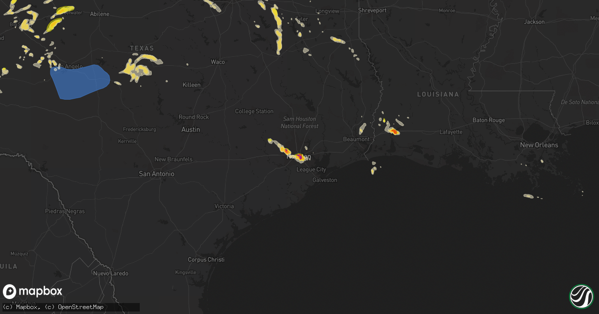
Hail Map on June 23, 2023
Get this storm
June 23 map
$229
one time, instant access
Download today. No call, no setup
Keep the $229
Bought the map and want the full workflow? Apply the entire $229 to a subscription within 7 days. None of it is wasted.
Every map, not just this one
This buys you this map. Subscription and you get every map we run, in the markets you choose from a few cities to whole states to nationwide. Plus real-time alerts the moment a storm fires.
Contact data
Name, contact info, occupancy, even credit band for addresses in the footprint. You go from where it hit to who to call.
Become the source they trust
Unlimited branding weather history reports on demand. You already have the documented answer ready for the property owner, and you are the one who showed up with it.
Property data and RoofTrace estimates
Pull up any address you have got, its value and the exact code rules for that jurisdiction, straight from One Click Code. Then RoofTrace estimates the squares, pitch, and roof value, priced the way you price.
States Impacted by Hail Map on June 23, 2023
Storm reports
Nebraska
| Date | Description |
|---|---|
| 06/23/20236:45 PM CDT | 4 center pivots overturned. Time estimated from radar. |
| 06/23/20236:45 PM CDT | A local report indicates 73 MPH wind near 7 SSW Fordyce |
| 06/23/20236:43 PM CDT | Temporary traffic signal blown over. Time estimated from radar. |
| 06/23/202311:35 AM CDT | Awos reports 60 mph and 3mi visibility. |
| 06/23/20233:24 AM CDT | From a personal weather station. |
| 06/23/20232:50 AM CDT | Delayed report of 60 mph winds. |
| 06/23/20232:41 AM CDT | Ambient weather station. |
| 06/23/20232:30 AM CDT | Awos station konl o''neill airport. |
| 06/23/20232:17 AM CDT | Asos station kodx ord airport. |
| 06/23/20231:38 AM CDT | Delayed report of thunderstorm winds speeds of at least 60 mph. |
| 06/23/20231:09 AM CDT | Pws reports 66 mph gust via ambient weather. |
| 06/23/202312:34 AM CDT | Em relayed report from north platte police of a large tree down across 2300 block west leota street. Tree was a foot in diamter. |
| 06/23/202312:34 AM CDT | Em relayed report from north platte police of a large tree down across 2300 block west leota street. Tree was a foot in diamter. |
| 06/23/202312:19 AM CDT | Pws via wundermap reports 60 mph peak gust. |
| 06/23/202312:00 AM CDT | Pws reports 59 mph gust. |
| 06/22/202311:55 PM CDT | Pws nw of sutherland reports 82 mph gust. |
| 06/22/202311:50 PM CDT | Pws reports wind gust of 74 mph nw of sutherland. |
| 06/22/202311:25 PM CDT | A local report indicates 1.00 inch wind near 3 W Gering |
| 06/22/202311:20 PM CDT | Estimated 70 mph winds. |
| 06/22/202311:20 PM CDT | A local report indicates 64 MPH wind near Ogallala |
| 06/22/202311:11 PM CDT | Pws report of 63 mph gust north side of lake mac via wunderground station id: knelemoy4. |
| 06/22/202311:00 PM CDT | Pws reports 62 mph gust via ambient weather and wunderground station id: knehyann9. |
| 06/22/202311:00 PM CDT | Pws report of 62 mph gust via ambient weather. |
| 06/22/202310:16 PM CDT | Asos station ksny sidney airport. |
| 06/22/202310:09 PM CDT | Repor |
| 06/22/202310:09 PM CDT | Report from mping: hen egg+ |
| 06/22/202310:09 PM CDT | Report from mping: ping pong ball |
| 06/22/202310:08 PM CDT | Hail was almost reaching golf ball size. |
| 06/22/202310:08 PM CDT | Re |
| 06/22/202310:08 PM CDT | Report from mping: hen egg |
| 06/22/202310:07 PM CDT | Report from mping: hen egg |
| 06/22/202310:06 PM CDT | Report from mping: golf ball |
| 06/22/202310:05 PM CDT | Report from mping: baseball+ |
| 06/22/202310:05 PM CDT | Reports of wind driven baseball sized hail in scottsbluff. Numerous damaged vehicles and windshields. |
| 06/22/202310:05 PM CDT | Report from mping: golf ball |
| 06/22/202310:03 PM CDT | Baseball sized hail in scottsbluff. |
| 06/22/202310:01 PM CDT | Wind driven hail of quarter sized in scottsbluff. |
| 06/22/20239:58 PM CDT | Cwop station fw8225 sidney. |
| 06/22/20239:55 PM CDT | Softball sized hail se of lewellen... Sand dollar sized hail report in the town of lewellen. |
| 06/22/20239:49 PM CDT | Corrects previous non-tstm wnd gst report from 2 ssw sidney. Asos station ksny sidney airport. Now correctly says thunderstorm wind gust. |
| 06/22/20239:45 PM CDT | Report via public. |
| 06/22/20239:40 PM CDT | Golf ball sized hail reported by public via social media. |
| 06/22/20239:30 PM CDT | Nickel to quarter sized hail report via trained spotter. |
| 06/22/20239:23 PM CDT | Received via social media. |
| 06/22/20239:19 PM CDT | A local report indicates 3.25 inch wind near 7 N Bayard |
| 06/22/20239:12 PM CDT | A local report indicates 2.75 inch wind near 5 NE Minatare |
| 06/22/20239:05 PM CDT | A local report indicates a tornado near 2 WNW Minatare |
| 06/22/20238:50 PM CDT | Report from mping: golf ball |
| 06/22/20238:50 PM CDT | Rain wrapped tornado with lofted debris located at cr 26 and hwy 92. |
| 06/22/20238:45 PM CDT | A local report indicates 2.75 inch wind near Scottsbluff |
| 06/22/20238:43 PM CDT | Report from mping: ping pong ball |
| 06/22/20238:36 PM CDT | A local report indicates 1.75 inch wind near 2 W Scottsbluff |
| 06/22/20238:11 PM CDT | Softball sized hail reported on robiduex rd se of stegall. |
| 06/22/20237:20 PM CDT | Roof blown off of machine shed. Time estimated from radar. |
North Carolina
| Date | Description |
|---|---|
| 06/23/20234:59 PM CDT | Several hundred without power due to fallen trees on power equipment. |
| 06/23/20234:54 PM CDT | A few trees reported down on westminster drive and mlk jr. Blvd. |
| 06/23/20237:36 AM CDT | Downed tree and powerline. Time estimated from radar. |
Oklahoma
| Date | Description |
|---|---|
| 06/23/20233:51 PM CDT | A few light poles blown down. Large limbs and trees broken. Time estimated by radar. |
| 06/23/20233:45 PM CDT | Oklahoma mesonet. |
| 06/23/20232:19 PM CDT | A local report indicates 60 MPH wind near 2 NE Ada |
| 06/23/20231:00 PM CDT | Tree down. |
| 06/23/202312:32 PM CDT | A local report indicates 59 MPH wind near 2 WNW Warr Acres |
| 06/23/202312:30 PM CDT | 8-inch diameter tree snapped. Time estimated via radar. |
| 06/23/202312:15 PM CDT | A local report indicates 60 MPH wind near 5 SSW El Reno |
| 06/23/202312:00 PM CDT | A local report indicates 76 MPH wind near 3 SSE Fort Cobb Reservo |
| 06/23/202311:54 AM CDT | Report from mping: half dollar |
| 06/23/202311:45 AM CDT | A local report indicates 69 MPH wind near 2 W Kingfisher |
| 06/23/202311:45 AM CDT | Corrects previous tstm wnd gst report from 2 w kingfisher. Wind gust occurred at watonga mesonet site. |
| 06/23/202310:53 AM CDT | A local report indicates 63 MPH wind near 1 WSW Burns Flat |
| 06/23/202310:45 AM CDT | A local report indicates 66 MPH wind near 3 WNW Foss Reservoir |
| 06/23/202310:38 AM CDT | Report from mping: 3-inch tree limbs broken; power poles broken. |
| 06/23/202310:33 AM CDT | Report from mping: quarter |
| 06/22/20239:17 PM CDT | Time estimated by radar. |
| 06/22/20237:50 PM CDT | Based on pictures and spotter reports. Still on the ground as of 8:13 pm cdt. |
| 06/22/20237:08 PM CDT | Time estimated by radar. |
Utah
| Date | Description |
|---|---|
| 06/23/20234:25 PM CDT | Peak thunderstorm wind gust measured on fremont island in the great salt lake |
| 06/23/20234:15 PM CDT | Measured on gunnsion island on the great salt lake |
New Mexico
| Date | Description |
|---|---|
| 06/23/20234:19 PM CDT | Awos station kcvs cannon air force base. |
Idaho
| Date | Description |
|---|---|
| 06/23/20235:26 PM CDT | Moody raws. Time estimated based on radar. |
| 06/23/20233:18 PM CDT | Quarter to marble sized hail. Brief moderate to heavy rain. Stong wind gusts. |
| 06/23/20231:30 PM CDT | At around 12:30 pm... A tornado was observed west of soda springs and north of grace with numerous pictures and videos confirming the tornado. Location based upon publi |
Iowa
| Date | Description |
|---|---|
| 06/23/20235:49 AM CDT | Report from mping: 3-inch tree limbs broken. |
| 06/23/20235:20 AM CDT | 10 inch diameter tree limbs and power lines damaged by thunderstorm winds. Time estimated by radar. |
| 06/23/20235:20 AM CDT | 10 inch diameter tree limbs and power lines damaged by thunderstorm winds. Time estimated by radar. |
| 06/23/20234:56 AM CDT | Photo via social media of large tree limbs broken by thunderstorm winds. Time estimated by radar. |
| 06/23/20234:56 AM CDT | Photo via social media of large tree limbs broken by thunderstorm winds. Time estimated by radar. |
| 06/23/20234:52 AM CDT | Photos of multiple large tree limbs broken via social media. Time estimated from radar. |
| 06/23/20234:30 AM CDT | Photos of trees down and roof shingles blown off via social media. Time estimated by radar. |
Wyoming
| Date | Description |
|---|---|
| 06/23/20236:46 PM CDT | Additional reports of ongoing cycling tornado east of chugwater. |
| 06/23/20236:32 PM CDT | Multiple reports of tornado touchdown ene of chugwater. |
| 06/23/20236:22 PM CDT | A local report indicates 2.25 inch wind near 8 NE Chugwater |
| 06/23/20236:15 PM CDT | Report from mping: ping pong ball |
| 06/23/20236:14 PM CDT | A local report indicates a tornado near 4 ENE Chugwater |
| 06/23/20236:04 PM CDT | A local report indicates 1.75 inch wind near 4 NE Chugwater |
| 06/23/20235:54 PM CDT | Recieved via social media. |
| 06/23/20235:33 PM CDT | Public reported tornado near converse/campbell county line at 4:33 pm... Has since lifted. Photo recieved via social media. |
| 06/23/20235:30 PM CDT | Report from mping: golf ball |
| 06/23/20235:25 PM CDT | Report from mping: quarter |
| 06/23/20235:18 PM CDT | Report from mping: hen egg |
| 06/23/20235:17 PM CDT | A local report indicates 1.50 inch wind near 2 NNW Wheatland |
| 06/23/20235:12 PM CDT | A local report indicates 1.75 inch wind near 8 NNW Chugwater |
| 06/23/20234:30 PM CDT | Delayed report. Damage to a residence between mile marker 21 and 22 on wy hwy 259. Hail estimated at 2.5 inch dimeter based on picture. Horse trailer flipped... Fuel ta |
| 06/23/20234:30 PM CDT | Multiple reports and videos of tornado south and southwest of midwest. |
| 06/23/20234:15 PM CDT | Delayed report. Social media picture showing large cone tornado on the ground looking southwest from edgerton. Estimated location based on radar rotation... Time of pic |
| 06/23/20233:40 PM CDT | Brief tornado on the ground reported by rancher to sheriffs office3. |
| 06/23/20233:38 PM CDT | Delayed report. Social media with picture of thin rope tornado touching down in distance north of natrona wy. Exact location estimated based on radar rotation and pictu |
| 06/23/20233:37 PM CDT | A local report indicates 1.00 inch wind near Kaycee |
| 06/23/20233:33 PM CDT | Delayed report. Rancher reported quarter sized hail and swirling clouds. No tornado or touchdown best they knew. |
| 06/23/20233:15 PM CDT | Public report relayed to em. |
| 06/23/20232:35 PM CDT | A local report indicates a tornado near 9 NE Granger |
| 06/23/20231:45 PM CDT | A local report indicates 2.00 inch wind near 2 N Lysite |
| 06/23/20231:05 PM CDT | A local report indicates 1.75 inch wind near 1 W Riverton |
| 06/23/20231:05 PM CDT | A local report indicates 1.25 inch wind near 2 W Riverton |
| 06/23/20231:05 PM CDT | A local report indicates 1.25 inch wind near 1 WSW Riverton |
| 06/23/20231:05 PM CDT | A local report indicates 1.75 inch wind near 1 NNE Riverton |
| 06/23/20231:05 PM CDT | A local report indicates 2.00 inch wind near 1 NE Riverton |
| 06/23/20231:02 PM CDT | A local report indicates 1.00 inch wind near 4 W Riverton |
| 06/23/20231:02 PM CDT | A local report indicates 1.00 inch wind near 6 WNW Riverton |
| 06/23/202312:20 PM CDT | Delayed report. Slightly larger than quarter-sized hail. Gusty winds damaged a gutter slightly. |
| 06/22/20238:35 PM CDT | A local report indicates 1.75 inch wind near 7 ENE Rochelle |
| 06/22/20238:19 PM CDT | A local report indicates a tornado near 5 E Rochelle |
| 06/22/20238:18 PM CDT | A local report indicates 1.75 inch wind near 8 S Fort Laramie |
| 06/22/20237:44 PM CDT | A local report indicates 60 MPH wind near 7 SW Aladdin |
| 06/22/20237:40 PM CDT | A local report indicates 83 MPH wind near 25 ESE Wright |
| 06/22/20237:40 PM CDT | A local report indicates 2.75 inch wind near 4 SE Hawk Springs |
| 06/22/20237:32 PM CDT | Numerous reports of large... Damaging... And rain wrapped torando located east of hawk springs moving east. |
| 06/22/20237:24 PM CDT | Recieved via social media. |
| 06/22/20237:06 PM CDT | Spotters report large tornado on the ground west of hawk springs. |
| 06/22/20237:02 PM CDT | Tornado struck north antelope mine. |
Louisiana
| Date | Description |
|---|---|
| 06/22/20239:13 PM CDT | A local report indicates 1.00 inch wind near Lake Charles |
| 06/22/20238:15 PM CDT | Ping pong ball size hail reported in moss bluff. |
| 06/22/20238:10 PM CDT | Multiple reports of golf ball size hail in westlake. |
Kansas
| Date | Description |
|---|---|
| 06/22/202310:33 PM CDT | A local report indicates 1.00 inch wind near 3 E Dodge City |
| 06/22/20239:30 PM CDT | A local report indicates 1.00 inch wind near 7 SSW Rolla |
| 06/22/20239:15 PM CDT | Public report confirmed a tornado north of big bow. |
| 06/22/20239:12 PM CDT | A local report indicates a tornado near 6 NE Big Bow |
| 06/22/20239:09 PM CDT | The storm report came via the spotternetwork. |
| 06/22/20239:06 PM CDT | A local report indicates 2.50 inch wind near 8 N Big Bow |
| 06/22/20239:05 PM CDT | A local report indicates 4.00 inch wind near 2 E Elkhart |
| 06/22/20238:57 PM CDT | A local report indicates 2.75 inch wind near Elkhart |
| 06/22/20238:40 PM CDT | The storm report came via the spotternetwork. |
| 06/22/20237:48 PM CDT | Lasted about 10 minutes. |
| 06/22/20237:45 PM CDT | Delayed report of quarter sized hail at location received via social media. Time is radar estimated. |
Montana
| Date | Description |
|---|---|
| 06/23/20235:00 PM CDT | A local report indicates 1.25 inch wind near 10 NE Moorhead |
| 06/22/20239:11 PM CDT | From 630 pm to 705 pm... Observer reports receiving two inches of rainfall... With lots of dime to mostly quarter size hail... Causing a great deal of crop damage and d |
| 06/22/20239:11 PM CDT | From 630 pm to 705 pm... Observer reports receiving two inches of rainfall... W |
| 06/22/20237:36 PM CDT | Updated report and correction for time of event. Nws conducted storm survey on reported crop damage destruction... But found no evidence of any crop damage occurring. P |
Florida
| Date | Description |
|---|---|
| 06/23/20236:50 PM CDT | Tree down near centerville road and pimlico dr. |
| 06/23/20236:50 PM CDT | Tree down near centerville road and mclaughlin dr. |
| 06/23/20236:45 PM CDT | Tree down on county road 305 near canal ave. Time estimated by radar. |
| 06/23/20236:30 PM CDT | Trained spotter reports dime to quarter size hail in buena ventura lakes near the intersectioon simpson rd and pebble pointe way. Time estimated via radar. |
| 06/23/20236:30 PM CDT | Florida state watch office relayed a report a tree down on sr-26 causing a partial road closure. Peak wind gusts from nearby gainesville asos were measured at 44 mph ar |
| 06/23/20234:34 PM CDT | A local report indicates 1.00 inch wind near Ave Maria |
| 06/23/20234:30 PM CDT | A local report indicates 1.25 inch wind near Ave Maria |
| 06/23/20234:20 PM CDT | A local report indicates 1.00 inch wind near Immokalee |
| 06/22/20237:00 PM CDT | Tree down near mahan and baum road. |
Texas
| Date | Description |
|---|---|
| 06/23/20236:58 PM CDT | A local report indicates 62 MPH wind near 1 NNW Sherwood |
| 06/23/20236:51 PM CDT | A local report indicates 60 MPH wind near 6 W Arden |
| 06/23/20236:49 PM CDT | Fm 1585 and highway 87 |
| 06/23/20236:49 PM CDT | A local report indicates 4.00 inch wind near 1 N Woodrow |
| 06/23/20236:42 PM CDT | Time estimated by radar. |
| 06/23/20236:34 PM CDT | 122nd st and knoxville ave |
| 06/23/20236:34 PM CDT | A local report indicates 1.75 inch wind near 4 NW Woodrow |
| 06/23/20236:31 PM CDT | Large volume of quarter size hail with a few golf balls mixed in. Size estimated. A secondary round of a quarter to golf ball size mix occurred approximately 10 minutes |
| 06/23/20236:30 PM CDT | A local report indicates 3.00 inch wind near 7 SW Lubbock |
| 06/23/20236:30 PM CDT | Near 73rd st and milwaukee ave |
| 06/23/20236:27 PM CDT | A local report indicates 4.50 inch wind near 9 SSW Lubbock |
| 06/23/20236:27 PM CDT | 98th st and upland ave |
| 06/23/20236:26 PM CDT | A local report indicates 2.75 inch wind near 4 SSW Lubbock |
| 06/23/20236:26 PM CDT | Near 103rd st and york ave |
| 06/23/20236:26 PM CDT | A local report indicates 2.50 inch wind near 7 SW Lubbock |
| 06/23/20236:26 PM CDT | Hail shattering on impact |
| 06/23/20236:23 PM CDT | A local report indicates 2.00 inch wind near Lubbock Int. Airport |
| 06/23/20236:23 PM CDT | Contract weather observer |
| 06/23/20236:19 PM CDT | Mostly peas to nickels with a few quarters mixed in; observed at the nws amarillo office. |
| 06/23/20236:18 PM CDT | A local report indicates 2.75 inch wind near 2 E Wolfforth |
| 06/23/20236:15 PM CDT | A local report indicates 1.75 inch wind near 4 NE Wolfforth |
| 06/23/20236:12 PM CDT | Report from mping. |
| 06/23/20236:12 PM CDT | Picture from facebook. |
| 06/23/20236:07 PM CDT | A local report indicates 1.25 inch wind near 3 NE Wolfforth |
| 06/23/20236:04 PM CDT | Report from mping. |
| 06/23/20236:00 PM CDT | A local report indicates 1.25 inch wind near 2 N Canyon |
| 06/23/20236:00 PM CDT | A local report indicates 68 MPH wind near 4 NW Water Valley |
| 06/23/20236:00 PM CDT | A local report indicates 1.00 inch wind near 1 E Smyer |
| 06/23/20235:53 PM CDT | Terrell asos reports wind gust of 54kt/62mph. |
| 06/23/20235:48 PM CDT | Delayed report. Tree down across power lines to a home. Time estimated by radar. |
| 06/23/20235:48 PM CDT | Large tree down with power lines and several power poles down. Road closed. Time estimated by radar. |
| 06/23/20235:48 PM CDT | Delayed report. Large |
| 06/23/20235:47 PM CDT | Report from mping: quarter |
| 06/23/20235:45 PM CDT | Report from social media with picture. |
| 06/23/20235:18 PM CDT | Significant roof damage to a home. Tree on rv on adjacent property on cr 382. |
| 06/23/20235:09 PM CDT | Tree down on a residence on forrest street. |
| 06/23/20234:50 PM CDT | Social media report of ping-pong sized hail 5 miles northeast of mckinney. |
| 06/23/20234:48 PM CDT | A local report indicates 1.75 inch wind near Mccamey |
| 06/23/20234:46 PM CDT | Report from mping: half dollar |
| 06/23/20234:46 PM CDT | Report from mping: quarter |
| 06/23/20234:38 PM CDT | Delayed report. Time estimated by radar. Report from mping: half dollar |
| 06/23/20234:34 PM CDT | Delayed report. Time estimated by radar. Report from mping: quarter |
| 06/23/20234:32 PM CDT | Em relays report of golf ball sized hail and some larger sized hail in far north celina... On the grayson/collin county line. |
| 06/23/20234:25 PM CDT | Media relays spotter report of egg sized hail in gunter. Time estimated by radar. |
| 06/23/20234:17 PM CDT | Delayed report. Media relays report of tennis ball sized hail in gunter. Time estimated by radar. |
| 06/23/20234:17 PM CDT | Social media report of trees down on road on sherman st |
| 06/23/20233:57 PM CDT | Em reports powerlines down over hwy 82 on the east side of whitesboro. Time estimated by radar. |
| 06/23/20233:55 PM CDT | Em reports car crash with semi blown over on us hwy 82 near riley rd. Time estimated by radar. |
| 06/23/20233:52 PM CDT | Delayed report. Em reports destroyed self-storage building in whitesboro. |
| 06/23/20233:50 PM CDT | Delayed report. Social media report of damage in whitesboro; telephone pole snapped; car port collapsed. Time estimated by radar. |
| 06/23/202311:23 AM CDT | A local report indicates 1.00 inch wind near 3 SE Kamay |
| 06/23/20238:11 AM CDT | A local report indicates 1.00 inch wind near 2 W Borger |
| 06/23/20238:00 AM CDT | A local report indicates 1.00 inch wind near Fritch |
| 06/22/202311:30 PM CDT | A local report indicates 72 MPH wind near 3 NW Seymour |
| 06/22/202311:25 PM CDT | A local report indicates 69 MPH wind near 3 NW Seymour |
| 06/22/202311:10 PM CDT | A local report indicates 67 MPH wind near 4 NNW Goree |
| 06/22/202310:38 PM CDT | Peak gust from the west texas mesonet as an outflow boundary moved through. |
| 06/22/202310:26 PM CDT | Peak wind gust reported from the west texas mesonet. Additional severe gusts occurred between 10:20 pm and 10:30 pm. |
| 06/22/20239:15 PM CDT | West texas mesonet measurement of outflow from a collapsing thunderstorm. |
| 06/22/20239:10 PM CDT | West texas mesonet. |
| 06/22/20239:05 PM CDT | A local report indicates 1.00 inch wind near Jayton |
| 06/22/20239:00 PM CDT | Hail fell near park hollow ct. |
| 06/22/20238:55 PM CDT | Penny to quarter sized hail observed near the intersection of fm 529 and highway 6. |
| 06/22/20238:50 PM CDT | Egg sized hail was observed to the west of jersey village. |
| 06/22/20238:46 PM CDT | Numerous reports of quarter sized hail just west of jersey village. |
| 06/22/20238:45 PM CDT | A local report indicates 58 MPH wind near 3 W Goodlett |
| 06/22/20238:45 PM CDT | Hail up to egg sized observed near the west little york road and highway 6 intersection. |
| 06/22/20238:33 PM CDT | A local report indicates 69 MPH wind near 3 W Goodlett |
| 06/22/20238:21 PM CDT | A local report indicates 60 MPH wind near 1 NW Eden |
| 06/22/20238:12 PM CDT | Corrects previous hail report from 2 nnw houston. Golf ball to egg sized hail was observed. |
| 06/22/20238:12 PM CDT | Golf ball to egg sized hail was observed. |
| 06/22/20238:04 PM CDT | Quarter sized hail was observed. |
| 06/22/20237:57 PM CDT | A local report indicates 1.00 inch wind near 4 W Plainview |
| 06/22/20237:52 PM CDT | Quarter sized hail was observed. |
| 06/22/20237:51 PM CDT | Egg sized hail observed. |
| 06/22/20237:50 PM CDT | Ping pong ball sized hail was observed. |
| 06/22/20237:50 PM CDT | Egg sized hail broke a window at a home. |
| 06/22/20237:49 PM CDT | A local report indicates 70 MPH wind near 4 SW Christoval |
| 06/22/20237:47 PM CDT | A local report indicates 70 MPH wind near 2 NNE Knickerbocker |
| 06/22/20237:46 PM CDT | Slightly larger than quarter sized hail observed. |
| 06/22/20237:46 PM CDT | Quarter sized hail was observed. |
| 06/22/20237:45 PM CDT | A local report indicates 1.75 inch wind near 2 SE Southland |
| 06/22/20237:45 PM CDT | Several trees reported down between cavalcade street and 610 north. |
| 06/22/20237:45 PM CDT | Roofs off carports and sheds in mount enterprise texas. |
| 06/22/20237:43 PM CDT | Trees and power lines down on county road 186. |
| 06/22/20237:30 PM CDT | Large 6 inch branches down on fm 584 south of mathis field airport. Time estimated on radar. |
| 06/22/20237:27 PM CDT | Power lines and large tree limbs down in the city of henderson. |
| 06/22/20237:27 PM CDT | A local report indicates 69 MPH wind near 7 SSW San Angelo |
| 06/22/20237:25 PM CDT | Multiple trees down making tx hwy 323 impassible between henderson and new london. |
| 06/22/20237:25 PM CDT | Lots of 2-3 inch branches down trapping some vehicles at spring creek marina. Time estimated on radar. |
| 06/22/20237:22 PM CDT | Report from facebook. Large limbs came off tree and took down some power lines. Time estimated on radar. |
| 06/22/20237:22 PM CDT | A local report indicates 62 MPH wind near 7 SSW San Angelo |
| 06/22/20237:15 PM CDT | Report from facebook. Tree limbs down across yard - largest was 12 inches in diameter. |
| 06/22/20237:11 PM CDT | A local report indicates 1.75 inch wind near 1 S Slaton |
Colorado
| Date | Description |
|---|---|
| 06/23/20236:58 PM CDT | Public report of golf ball size up to baseball size hail with first round of storms around 6pm mdt. |
| 06/23/20236:51 PM CDT | Time estimated by radar. |
| 06/23/20236:50 PM CDT | Public report via social media with photo of hail ping pong ball to baseball size. |
| 06/23/20236:50 PM CDT | Delayed report of quarter size hail in stratton... Co. Hail began at 5:50 pm mdt and lasted for approximately 5 minutes. |
| 06/23/20236:49 PM CDT | Location estimated by radar. |
| 06/23/20236:40 PM CDT | Trained spotter reports 2 inch hail. |
| 06/23/20236:40 PM CDT | Corrects previous hail report from 10 n stratton. Trained spotter reports 2 inch hail with photo of measured hailstone sent in via social media. |
| 06/23/20236:20 PM CDT | Trained spotter reports pea to quarter size hail in stratton... Colorado. |
| 06/23/20236:19 PM CDT | Quarter sized hail reported at location. |
| 06/23/20236:18 PM CDT | Quarter sized hail reported at location. |
| 06/23/20235:54 PM CDT | A local report indicates 1.75 inch wind near 11 SSW Lamar |
| 06/23/20235:13 PM CDT | Time estimated by radar. |
| 06/23/20234:08 PM CDT | Small limb damage. |
| 06/22/20239:37 PM CDT | Report via spotternetwork. |
| 06/22/20239:35 PM CDT | A local report indicates 1.25 inch wind near 6 E Antelope Springs |
| 06/22/20239:35 PM CDT | Report and photos relayed through social media. Time estimated by radar. |
| 06/22/20239:35 PM CDT | Corrects previous hail report from julesburg. |
| 06/22/20239:35 PM CDT | A local report indicates 2.25 inch wind near Julesburg |
| 06/22/20239:14 PM CDT | Report and photo relayed through social media. Time estimated from radar. |
| 06/22/20238:07 PM CDT | Report on social media of a damaged structure. Possible tornado. |
| 06/22/20238:00 PM CDT | Public report of quarter to ping pong ball size hail with second round of storms around 7 pm mdt. |
| 06/22/20237:45 PM CDT | Location estimated by radar. Relayed through nws amarillo. |
| 06/22/20237:33 PM CDT | Trained spotter reports quarter size hail... Maybe a little bigger southeast of wray. |
| 06/22/20237:23 PM CDT | A local report indicates a tornado near 13 S Holly |
| 06/22/20237:15 PM CDT | Quarter size hail reported. |
| 06/22/20237:11 PM CDT | Live video feed. |
| 06/22/20237:11 PM CDT | Live video feed. |
| 06/22/20237:00 PM CDT | Public report of primarily nickel to dime size with some hail up to half dollar size. Time estimated from radar. |
South Dakota
| Date | Description |
|---|---|
| 06/23/20236:10 PM CDT | Lots of hail about 6 inches deep. |
| 06/23/20235:50 PM CDT | A local report indicates 60 MPH wind near 2 NW Saint Onge |
| 06/23/20235:50 PM CDT | A local report indicates 1.00 inch wind near 2 NW Saint Onge |
| 06/23/20235:40 PM CDT | A local report indicates 1.00 inch wind near 6 NW Olivet |
| 06/23/20235:37 PM CDT | Mostly quarter sized with a few larger. Time estimated from radar. Delayed report. |
| 06/23/20235:30 PM CDT | A local report indicates 1.00 inch wind near 5 E Tripp |
| 06/23/20234:50 PM CDT | Mostly half-dollar size... A few golf balls |
| 06/23/20234:44 AM CDT | Personal weather station. |
| 06/23/20234:41 AM CDT | Asos station kfsd sioux falls airport. |
| 06/23/20234:35 AM CDT | Photo of 3 inch diameter tree branch broken in sw sioux falls via social media. Time estimated from radar. |
| 06/23/20234:26 AM CDT | Mesonet station 16 sd rwis beresford. |
| 06/23/20233:58 AM CDT | Photo of large tree limb broken and laying front of swing set via social media. Time estimated from radar. |
| 06/23/20233:50 AM CDT | Roof blown off a building on the north side of yankton. Time estimated by radar. |
| 06/23/20233:47 AM CDT | Photo of multiple large tree limbs broken at lewis and clark campground via social media. Time estimated from radar. |
| 06/23/20233:34 AM CDT | Personal weather station. |
| 06/23/20233:24 AM CDT | Personal weather station. |
| 06/23/20232:35 AM CDT | Mesonet station 312 ree heights |
| 06/23/20232:30 AM CDT | Mesonet station 312 ree heights |
| 06/23/20232:20 AM CDT | Mesonet station 215 jct sd47/sd26 |
| 06/23/20232:11 AM CDT | A local report indicates 61 MPH wind near Wewela |
| 06/23/20232:09 AM CDT | Mesonet station 289 lees corner |
| 06/23/20231:59 AM CDT | Mesonet station 201 gann valley |
| 06/23/20231:59 AM CDT | Mesonet station 289 lees corner |
| 06/23/20231:58 AM CDT | Mesonet station 183 macs corner |
| 06/23/20231:55 AM CDT | Awos station k0d8 1 s gettysburg. |
| 06/23/20231:54 AM CDT | Mesonet station 289 lees corner |
| 06/23/20231:53 AM CDT | Mesonet station 183 macs corner |
| 06/23/20231:44 AM CDT | A local report indicates 60 MPH wind near Holabird |
| 06/23/20231:39 AM CDT | Mesonet station 212 sd rwis agar. |
| 06/23/20231:32 AM CDT | A local report indicates 66 MPH wind near 5 NNW Fort Thompson |
| 06/23/20231:30 AM CDT | A local report indicates 59 MPH wind near 8 N West Bend Rec Area |
| 06/23/20231:29 AM CDT | Mesonet station 212 sd rwis agar. |
| 06/23/20231:27 AM CDT | Asos station k9v9 chamberlain municipal airport. |
| 06/23/20231:25 AM CDT | Mesonet station ocms2 oacoma 2w |
| 06/23/20231:20 AM CDT | Corrects location from previous lsr sent for 82 mph 6 sw joe creek rec area. |
| 06/23/20231:20 AM CDT | A local report indicates 70 MPH wind near 1 SSE Onida |
| 06/23/20231:20 AM CDT | Lower brule sdsu site. |
| 06/23/20231:14 AM CDT | A local report indicates 60 MPH wind near 6 SSE Whitlocks Bay Rec |
| 06/23/20231:10 AM CDT | A local report indicates 66 MPH wind near 2 W Hamill |
| 06/23/20231:09 AM CDT | Mesonet station 185 blunt |
| 06/23/20231:08 AM CDT | Mesonet station 157 forest city |
| 06/23/20231:03 AM CDT | Asos station kpir pierre muni ap. |
| 06/23/202312:45 AM CDT | A local report indicates 67 MPH wind near 6 W Parmelee |
| 06/23/202312:39 AM CDT | A local report indicates 63 MPH wind near 11 SW Parmelee |
| 06/23/202312:35 AM CDT | Mesonet station 204 ridgeview |
| 06/23/202312:29 AM CDT | A local report indicates 65 MPH wind near 11 SW Parmelee |
| 06/23/202312:25 AM CDT | A local report indicates 65 MPH wind near 4 WNW Cedar Butte |
| 06/23/202312:19 AM CDT | A local report indicates 60 MPH wind near 1 NE Midland |
| 06/23/202312:08 AM CDT | A local report indicates 70 MPH wind near 1 NE Midland |
| 06/23/202312:05 AM CDT | A local report indicates 61 MPH wind near 7 E Wanblee |
| 06/23/202312:04 AM CDT | A local report indicates 68 MPH wind near 1 NE Midland |
| 06/22/202311:55 PM CDT | A local report indicates 64 MPH wind near 7 E Wanblee |
| 06/22/202311:44 PM CDT | A local report indicates 60 MPH wind near 4 E Cactus Flat |
| 06/22/202311:37 PM CDT | A local report indicates 58 MPH wind near 3 E Philip |
| 06/22/202311:30 PM CDT | Mesonet station hams2 hayes 7sw |
| 06/22/202311:29 PM CDT | A local report indicates 58 MPH wind near 4 E Cactus Flat |
| 06/22/202311:24 PM CDT | A local report indicates 58 MPH wind near 9 ENE Belvidere |
| 06/22/202310:59 PM CDT | A local report indicates 63 MPH wind near 9 ENE Belvidere |
| 06/22/202310:55 PM CDT | A local report indicates 1.00 inch wind near 4 NW Okaton |
| 06/22/202310:45 PM CDT | A local report indicates 1.25 inch wind near 2 NE Kadoka |
| 06/22/202310:33 PM CDT | A local report indicates 1.00 inch wind near 7 ENE Belvidere |
| 06/22/202310:00 PM CDT | Damage to crops from estimated quarter to half dollar hail. Radar estimated time. |
| 06/22/20239:39 PM CDT | A local report indicates 60 MPH wind near 8 W Jewel Cave |
| 06/22/20239:25 PM CDT | A local report indicates 2.00 inch wind near 2 SSW Opal |
| 06/22/20239:07 PM CDT | A local report indicates 1.00 inch wind near 2 W Box Elder |
| 06/22/20239:03 PM CDT | A local report indicates 72 MPH wind near 3 NNW Scenic |
| 06/22/20239:00 PM CDT | A local report indicates 60 MPH wind near 5 N Scenic |
| 06/22/20238:41 PM CDT | Mostly 3/4 inch some 1 inch |
| 06/22/20238:15 PM CDT | A local report indicates 1.75 inch wind near 9 S Mud Butte |
| 06/22/20238:00 PM CDT | A local report indicates 1.50 inch wind near 5 SW Sharps Corner |
Minnesota
| Date | Description |
|---|---|
| 06/23/20235:26 PM CDT | Asos station kmic crystal ap. |
| 06/23/20234:54 PM CDT | 9.5 inch diameter tree snapped. Photos and time relayed via hennepin county em meteorologist. |
| 06/23/20234:34 PM CDT | A local report indicates 1.00 inch wind near 4 ESE West Union |
| 06/23/20234:34 PM CDT | 20 inch pine tree snapped. |
| 06/23/20233:54 PM CDT | Corrects previous tstm wnd dmg report from 1 e north branch. Corrected for time. 9.5 inch diameter tree snapped. Photos and time relayed via hennepin county em meteorol |
| 06/23/20233:30 PM CDT | Photos of multiple trees down relayed via social media. Time estimated from radar. |
| 06/23/20236:02 AM CDT | Photo of large tree limb down in end-o-line railroad park via social media. Time estimated by radar. |
| 06/23/20235:50 AM CDT | Mesonet station mn160 u.s.14 - florence - mp 21.2. |
| 06/23/20235:50 AM CDT | Mesonet station mn160 u.s.14 - florence - mp |
| 06/23/20235:14 AM CDT | Photo of large tree limb broken via social media. Time estimated by radar. |
Cities Impacted by Hail Map on June 23, 2023
- Perry, FL
- Mayo, FL
- Day, FL
- Daphne, AL
- Channing, TX
- Masterson, TX
- Dumas, TX
- Amarillo, TX
- Fritch, TX
- Panhandle, TX
- Borger, TX
- Canadian, TX
- Briscoe, TX
- Reydon, OK
- Wheeler, TX
- Mobeetie, TX
- Sweetwater, OK
- Hammon, OK
- Butler, OK
- Cheyenne, OK
- Custer City, OK
- Clinton, OK
- Cordell, OK
- Elk City, OK
- Dill City, OK
- Sentinel, OK
- Sayre, OK
- Canute, OK
- Foss, OK
- Arapaho, OK
- Electra, TX
- Iowa Park, TX
- Bessie, OK
- Thomas, OK
- Corn, OK
- Weatherford, OK
- Gotebo, OK
- Rocky, OK
- Hobart, OK
- Holliday, TX
- Hydro, OK
- Colony, OK
- Carnegie, OK
- Mountain View, OK
- Fort Cobb, OK
- Gracemont, OK
- Lookeba, OK
- Binger, OK
- Anadarko, OK
- Hinton, OK
- Geary, OK
- Calumet, OK
- Watonga, OK
- Greenfield, OK
- Okarche, OK
- Kingfisher, OK
- Omega, OK
- Minco, OK
- El Reno, OK
- Union City, OK
- Pocasset, OK
- Chickasha, OK
- Oklahoma City, OK
- Yukon, OK
- Piedmont, OK
- Edmond, OK
- Mustang, OK
- Tuttle, OK
- Bethany, OK
- Newcastle, OK
- Wheatland, OK
- Gordon, NE
- Sharon, OK
- Fargo, OK
- Arnett, OK
- Apache, OK
- Lander, WY
- Mutual, OK
- Woodward, OK
- Gage, OK
- Shattuck, OK
- Wichita Falls, TX
- Skellytown, TX
- Justin, TX
- Argyle, TX
- Frederick, OK
- Davidson, OK
- Loveland, OK
- Elgin, OK
- Pampa, TX
- Grandfield, OK
- Burkburnett, TX
- Chester, OK
- Cody, NE
- Cut Off, LA
- Carter, OK
- Crowell, TX
- Loving, TX
- Olney, TX
- Merriman, NE
- Vernon, TX
- Miami, TX
- Valentine, NE
- Lockport, LA
- Jermyn, TX
- Seymour, TX
- Decatur, TX
- Scotland, TX
- Archer City, TX
- Windthorst, TX
- Fletcher, OK
- Mooreland, OK
- Cyril, OK
- Flower Mound, TX
- Shamrock, TX
- Laverne, OK
- Shoshoni, WY
- Riverton, WY
- Lysite, WY
- Jeffrey City, WY
- Arapahoe, WY
- Seminole, OK
- Bowlegs, OK
- Maud, OK
- Wewoka, OK
- Earlsboro, OK
- Konawa, OK
- Sasakwa, OK
- Holdenville, OK
- Stonewall, OK
- Ada, OK
- Allen, OK
- Asher, OK
- Stratford, OK
- Byars, OK
- Wanette, OK
- Ten Sleep, WY
- Tupelo, OK
- Atwood, OK
- Wetumka, OK
- Calvin, OK
- Okemah, OK
- Casper, WY
- Hiland, WY
- Centrahoma, OK
- Coalgate, OK
- Stuart, OK
- Lamar, OK
- Dustin, OK
- Arminto, WY
- Kaycee, WY
- Gainesville, TX
- Whitesboro, TX
- Sadler, TX
- Canton, TX
- Snow, OK
- Stigler, OK
- Whitefield, OK
- Las Animas, CO
- Collinsville, TX
- Gunter, TX
- Howe, TX
- Tioga, TX
- Sherman, TX
- Midwest, WY
- Pilot Point, TX
- Celina, TX
- Van Alstyne, TX
- Anna, TX
- Immokalee, FL
- Spearfish, SD
- Lead, SD
- Mckinney, TX
- Melissa, TX
- Hasty, CO
- Friona, TX
- Dimmitt, TX
- Hereford, TX
- Midkiff, TX
- Harrold, SD
- Onida, SD
- Saint Onge, SD
- Sauk Centre, MN
- Glenrock, WY
- Broadus, MT
- Otter, MT
- Muleshoe, TX
- Douglas, WY
- Wheatland, WY
- Tripp, SD
- Kim, CO
- Lamar, CO
- Littlefield, TX
- Fieldton, TX
- Amherst, TX
- Levelland, TX
- Ropesville, TX
- Lubbock, TX
- Olivet, SD
- Niobrara, NE
- Center, NE
- Canyon, TX
- Verdigre, NE
- Holly, CO
- Granada, CO
- Hart, TX
- Belle Fourche, SD
- Nisland, SD
- Pritchett, CO
- Hale Center, TX
- Olton, TX
- Wolfforth, TX
- Smyer, TX
- Bloomfield, NE
- Gail, TX
- Shallowater, TX
- Yoder, WY
- Stratton, CO
- Vona, CO
- Loraine, TX
- Colorado City, TX
- Westbrook, TX
- Newell, SD
- Plainview, TX
- Springlake, TX
- Ree Heights, SD
- Miller, SD
- Campo, CO
- Kress, TX
- Wausa, NE
- Crofton, NE
- Hartington, NE
- Sudan, TX
- Earth, TX
- Slaton, TX
- Gillette, WY
- Groom, TX
- Roscoe, TX
- Ransom Canyon, TX
- Bethune, CO
- Mertzon, TX
- San Angelo, TX
- Burlington, CO
- Kirk, CO
- Idalia, CO
- Danbury, WI
- Hulett, WY
- Roberts, ID
- Brimson, MN
- Lame Deer, MT
- Clovis, NM
- Fairfield, MT
- Idaho Falls, ID
- Iron Belt, WI
- White Sulphur Springs, MT
- Fort Shaw, MT
- Vaughn, MT
- Buffalo, WY
- Alzada, MT
- Jacksonville, TX
- Bullard, TX
- Clearmont, WY
- Talihina, OK
- Dryden, TX
- Lafitte, LA
- Belle Chasse, LA
- Tyler, TX
- Frostproof, FL
- Athens, TX
- Wagner, SD
- North Bend, NE
- Ozona, TX
- Big Lake, TX
- Murchison, TX
- Ben Wheeler, TX
- Henderson, TX
- Clayton, OK
- Sheridan, WY
- Kenansville, FL
- Duncan, OK
- Marlow, OK
- Farmersville, TX
- Dodge, NE
- Tussy, OK
- Elmore City, OK
- Lenorah, TX
- Knott, TX
- Eustace, TX
- Blackshear, GA
- Garden City, TX
- Edgerton, WY
- Fort Worth, TX
- Burleson, TX
- Mansfield, TX
- River Ranch, FL
- Lake Wales, FL
- Finley, OK
- Daisy, OK
- Antlers, OK
- Pittsburg, OK
- Stringtown, OK
- Rattan, OK
- Robert Lee, TX
- Burneyville, OK
- Sylvania, GA
- Weston, WY
- North Branch, MN
- Jacksboro, TX
- Palestine, TX
- Rusk, TX
- Thackerville, OK
- Marietta, OK
- Sterling City, TX
- Alto, TX
- Hennepin, OK
- Overbrook, OK
- Ardmore, OK
- Prosper, TX
- Princeton, TX
- Gordonville, TX
- Long Branch, TX
- Garrison, TX
- Melbourne, FL
- Floyd, NM
- Portales, NM
- Elida, NM
- Stacy, MN
- Kinta, OK
- Ratliff City, OK
- Farwell, TX
- Madill, OK
- Wills Point, TX
- Terrell, TX
- Cumby, TX
- Watson, OK
- Saint Cloud, FL
- Avon, SD
- Dante, SD
- Flint, TX
- Midlothian, TX
- Alvarado, TX
- Arlington, TX
- Kennedale, TX
- Venus, TX
- Freeport, MN
- Melrose, MN
- Choteau, MT
- Mcalester, OK
- Kiowa, OK
- Wardville, OK
- Homerville, GA
- Brownsboro, TX
- Mount Enterprise, TX
- Timpson, TX
- Punta Gorda, FL
- Graham, OK
- Springer, OK
- Montalba, TX
- Lynch, NE
- Bristow, NE
- Broadview, MT
- Simms, MT
- Cascade, MT
- Coleridge, NE
- Lorenzo, TX
- Vernon, CO
- Wray, CO
- Christoval, TX
- Houston, TX
- Galena Park, TX
- Sweetwater, TX
- Kissimmee, FL
- Wilson, TX
- Post, TX
- Hawk Springs, WY
- Torrington, WY
- Dequincy, LA
- Singer, LA
- Lyman, NE
- Mitchell, NE
- Morrill, NE
- Mud Butte, SD
- Newcastle, WY
- Shawnee, WY
- Syracuse, KS
- Wall, TX
- Vancourt, TX
- Eola, TX
- Miles, TX
- Paint Rock, TX
- Mereta, TX
- Eldorado, TX
- Aladdin, WY
- Union Center, SD
- Sulphur, LA
- Lake Charles, LA
- Westlake, LA
- Haigler, NE
- Goodland, KS
- Briggsdale, CO
- Millersview, TX
- Eden, TX
- Menard, TX
- Kendall, KS
- Rule, TX
- Idalou, TX
- Old Glory, TX
- Haskell, TX
- Dickens, TX
- Petersburg, TX
- Crosbyton, TX
- Ralls, TX
- Spur, TX
- Abernathy, TX
- Sturgis, SD
- Boise City, OK
- New Underwood, SD
- Keyes, OK
- Elkhart, KS
- Goodwell, OK
- Walsh, CO
- Scottsbluff, NE
- Manderson, SD
- Gering, NE
- Porcupine, SD
- Pine Ridge, SD
- Kyle, SD
- Rapid City, SD
- Hermosa, SD
- Keystone, SD
- Long Valley, SD
- White River, SD
- Murdo, SD
- Johnson, KS
- Cypress, TX
- Box Elder, SD
- Holyoke, CO
- Haxtun, CO
- Ovid, CO
- Minatare, NE
- Philip, SD
- Quinn, SD
- Milesville, SD
- Midland, SD
- Ulysses, KS
- Scenic, SD
- Caputa, SD
- Rolla, KS
- Belvidere, SD
- Draper, SD
- New Raymer, CO
- Bayard, NE
- Angora, NE
- Orchard, CO
- Weldona, CO
- Ellsworth, NE
- Rushville, NE
- Fort Morgan, CO
- Faith, SD
- Julesburg, CO
- Melvin, TX
- Justiceburg, TX
- Big Springs, NE
- Chappell, NE
- Aspermont, TX
- Jayton, TX
- Snyder, TX
- Girard, TX
- Oshkosh, NE
- Lodgepole, NE
- Wanblee, SD
- Guymon, OK
- Hugoton, KS
- Interior, SD
- Presho, SD
- Kennebec, SD
- Lewellen, NE
- Hempstead, TX
- Waller, TX
- Oakdale, NE
- Neligh, NE
- Tilden, NE
- Snyder, CO
- Stoneham, CO
- Merino, CO
- Bingham, NE
- Ashby, NE
- Kadoka, SD
- Satanta, KS
- Meadow Grove, NE
- Ewing, NE
- Inman, NE
- Page, NE
- Garden City, KS
- Hooker, OK
- Orchard, NE
- Plainview, NE
- Bridgeport, NE
- Dodge City, KS
- Wright, KS
- Dupree, SD
- Whitman, NE
- Okaton, SD
- Dix, NE
- Sidney, NE
- Potter, NE
- Peetz, CO
- Padroni, CO
- Sterling, CO
- Iliff, CO
- Crook, CO
- Sedgwick, CO
- Fleming, CO
- Hyannis, NE
- Atwood, CO
- Lakeside, NE
- Lemoyne, NE
- Brule, NE
- Venango, NE
- Ogallala, NE
- Arthur, NE
- Keystone, NE
- Fort Laramie, WY
- Paxton, NE
- Sutherland, NE
- Tryon, NE
- Hayes, SD
- Fort Pierre, SD
- Royal, NE
- Springview, NE
- Paducah, TX
- Hershey, NE
- North Platte, NE
- Knox City, TX
- Crookston, NE
- Munday, TX
- Goree, TX
- Benjamin, TX
- Brady, TX
- Lohn, TX
- Vivian, SD
- Stapleton, NE
- Seneca, NE
- Mullen, NE
- Thedford, NE
- Chandler, TX
- Foley, MN
- Orting, WA
- Carlsbad, TX
- Eatonville, WA
- Labelle, FL
- Sundance, WY
- Orlando, FL
- Hermleigh, TX
- Center, TX
- Big Spring, TX
- Oneill, NE
- Katy, TX
- Burke, SD
- Venus, FL
- Moore Haven, FL
- Piedmont, SD
- Devils Tower, WY
- Beulah, WY
- Kaufman, TX
- Lusk, WY
- Lance Creek, WY
- Platte, SD
- Big Sandy, TX
- Royse City, TX
- Winner, SD
- Wayne, NE
- Wakefield, NE
- Hay Springs, NE
- Coahoma, TX
- Larue, TX
- Tennessee Colony, TX
- Edgewood, TX
- Childress, TX
- Deer Park, TX
- Tenaha, TX
- Shelbyville, TX
- San Augustine, TX
- Whitehouse, TX
- Rockledge, FL
- Iowa, LA
- Ragley, LA
- Kinder, LA
- Chugwater, WY
- Altamonte Springs, FL
- Maitland, FL
- Casselberry, FL
- Humble, TX
- Rocky Ford, GA
- Bassett, NE
- Vidor, TX
- Buna, TX
- Deweyville, TX
- Starks, LA
- Guernsey, WY
- Jay Em, WY
- Hockley, TX
- Maryneal, TX
- Chillicothe, TX
- Quanah, TX
- Bellaire, TX
- Pasadena, TX
- South Houston, TX
- Randolph, NE
- Springfield, SD
- McCamey, TX
- Kilgore, TX
- Gladewater, TX
- Whitewood, SD
- Reeves, LA
- Troup, TX
- Ideal, SD
- Anton, TX
- Ackerly, TX
- Laurel, NE
- Nazareth, TX
- Overton, TX
- Clearwater, NE
- Long Pine, NE
- Pierson, FL
- Lavon, TX
- Nevada, TX
- Happy, TX
- Decker, MT
- Kerens, TX
- Lake Mary, FL
- Longwood, FL
- Rice, TX
- Lehigh Acres, FL
- Cocoa Beach, FL
- Iraan, TX
- Astor, FL
- Veteran, WY
- Brashear, TX
- Lamesa, TX
- Tulia, TX
- Apopka, FL
- Highlands, TX
- Maxwell, NE
- Brady, NE
- Arnold, NE
- Norris, SD
- Parmelee, SD
- Sparks, NE
- Mission, SD
- Colome, SD
- Dutton, MT
- Terreton, ID
- Dunning, NE
- Anselmo, NE
- Halsey, NE
- Purdum, NE
- Brewster, NE
- Lower Brule, SD
- Dallas, SD
- Gregory, SD
- Mills, NE
- Saint Francis, SD
- Rosebud, SD
- Eagle Butte, SD
- Ridgeview, SD
- Agar, SD
- Gettysburg, SD
- Pierre, SD
- Blunt, SD
- Hamill, SD
- Chamberlain, SD
- Oacoma, SD
- Pukwana, SD
- Reliance, SD
- Fort Thompson, SD
- Gann Valley, SD
- Herrick, SD
- Stuart, NE
- Naper, NE
- Newport, NE
- Broken Bow, NE
- Sargent, NE
- Burwell, NE
- Taylor, NE
- Ainsworth, NE
- Lebanon, SD
- Saint Charles, SD
- Bonesteel, SD
- Atkinson, NE
- Butte, NE
- Kimball, SD
- White Lake, SD
- Woonsocket, SD
- Wessington Springs, SD
- Wessington, SD
- Holabird, SD
- Stephan, SD
- Highmore, SD
- Alpena, SD
- Saint Lawrence, SD
- Wolsey, SD
- Virgil, SD
- Huron, SD
- Hitchcock, SD
- Redfield, SD
- Tulare, SD
- Ord, NE
- Elyria, NE
- Rockham, SD
- Orient, SD
- Doland, SD
- Ashton, SD
- Frankfort, SD
- Scotia, NE
- Spalding, NE
- Greeley, NE
- Ericson, NE
- Albion, NE
- Elgin, NE
- Petersburg, NE
- Bartlett, NE
- Emmet, NE
- Amelia, NE
- Chambers, NE
- Saint Helena, NE
- Yankton, SD
- Winnetoon, NE
- Tabor, SD
- Tyndall, SD
- Lesterville, SD
- Utica, SD
- Mission Hill, SD
- Vermillion, SD
- Volin, SD
- Centerville, SD
- Beresford, SD
- Irene, SD
- Wakonda, SD
- Menno, SD
- Viborg, SD
- Lennox, SD
- Marion, SD
- Parker, SD
- Hurley, SD
- Davis, SD
- Freeman, SD
- Fordyce, NE
- Gayville, SD
- Alcester, SD
- Hawarden, IA
- Wynot, NE
- Elk Point, SD
- Burbank, SD
- Hudson, SD
- Canton, SD
- Chancellor, SD
- Sioux Falls, SD
- Hartford, SD
- Worthing, SD
- Tea, SD
- Harrisburg, SD
- Scotland, SD
- Rock Valley, IA
- Fairview, SD
- Inwood, IA
- Larchwood, IA
- Brandon, SD
- Renner, SD
- Valley Springs, SD
- Garretson, SD
- Dell Rapids, SD
- Baltic, SD
- Crooks, SD
- Spencer, NE
- Farwell, NE
- Saint Paul, NE
- Kimball, NE
- Richland Springs, TX
- Comstock, NE
- Palmer, NE
- Fullerton, NE
- Rochelle, TX
- Goldthwaite, TX
- Mullin, TX
- San Saba, TX
- Lagrange, WY
- Harrisburg, NE
- Rockville, NE
- Cimarron, KS
- Gatesville, TX
- Brookesmith, TX
- Brownwood, TX
- Ingalls, KS
- Pierceville, KS
- Lakin, KS
- Central City, NE
- Lost Springs, WY
- Brunswick, NE
- Creighton, NE
- Alliance, NE
- Mcadoo, TX
- Early, TX
- Ashton, NE
- Clarks, NE
- Holcomb, KS
- Fairfax, SD
- Zephyr, TX
- Hamilton, TX
- Pickstown, SD
- Lake Andes, SD
- Broadwater, NE
- Kilgore, NE
- Dalton, NE
- Gurley, NE
- Lampasas, TX
- Prairie View, TX
- Trent, SD
- Flandreau, SD
- Luverne, MN
- Jasper, MN
- Pipestone, MN
- Holland, MN
- Ruthton, MN
- Balaton, MN
- Ivanhoe, MN
- Elkton, SD
- Russell, MN
- Lake Benton, MN
- Arco, MN
- Tyler, MN
- Marshall, MN
- Lynd, MN
- Ghent, MN
- Minneota, MN
- Taunton, MN
- Edgerton, MN
- Woodstock, MN
- Deadwood, SD
- Genoa, NE
- Blair, NE
- Lawton, IA
- Hinton, IA
- Le Mars, IA
- Merrill, IA
- Sioux City, IA
- Kenneth, MN
- Boelus, NE
- Silver Creek, NE
- Kennard, NE
- Modale, IA
- Arlington, NE
- Missouri Valley, IA
- Herman, NE
- Nickerson, NE
- Litchfield, NE
- Ravenna, NE
- Loup City, NE
- Granville, IA
- Alton, IA
- Wood, SD
- Delmont, SD
- Monroe, NE
- Columbus, NE
- Clarkson, NE
- Madison, SD
- Ramona, SD
- Lismore, MN
- Marcus, IA
- Chandler, MN
- Remsen, IA
- Wolbach, NE
- Belgrade, NE
- Duncan, NE
- Lake Preston, SD
- Erwin, SD
- Holstein, IA
- Battle Creek, IA
- Sioux Rapids, IA
- Alta, IA
- Galva, IA
- Schaller, IA
- Cleghorn, IA
- Laurens, IA
- Albert City, IA
- Linn Grove, IA