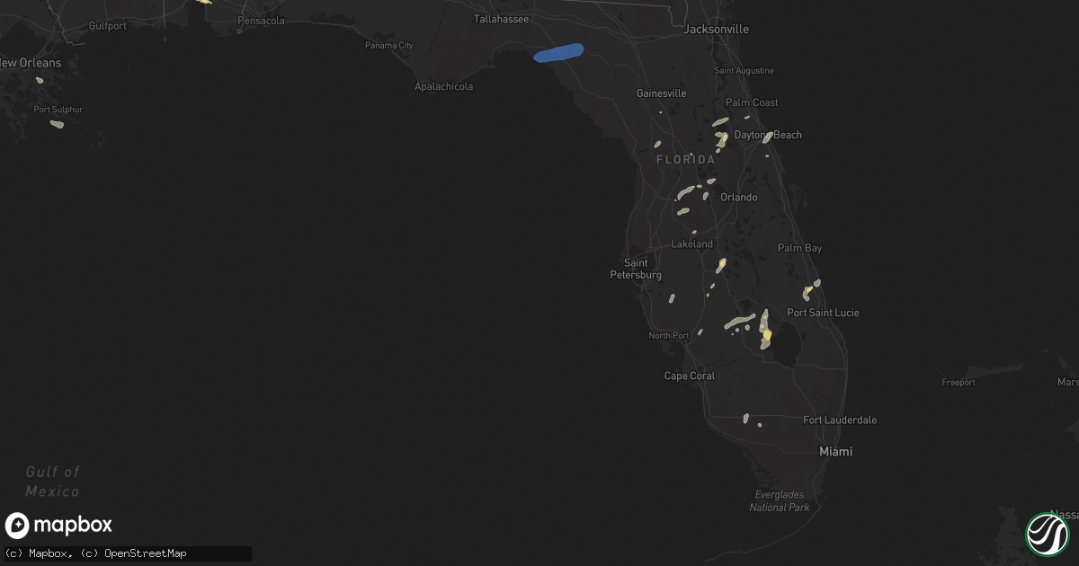
Hail Map in Florida on June 22, 2023
Get this storm
June 22 map
$229
one time, instant access
Download today. No call, no setup
Keep the $229
Bought the map and want the full workflow? Apply the entire $229 to a subscription within 7 days. None of it is wasted.
Every map, not just this one
This buys you this map. Subscription and you get every map we run, in the markets you choose from a few cities to whole states to nationwide. Plus real-time alerts the moment a storm fires.
Contact data
Name, contact info, occupancy, even credit band for addresses in the footprint. You go from where it hit to who to call.
Become the source they trust
Unlimited branding weather history reports on demand. You already have the documented answer ready for the property owner, and you are the one who showed up with it.
Property data and RoofTrace estimates
Pull up any address you have got, its value and the exact code rules for that jurisdiction, straight from One Click Code. Then RoofTrace estimates the squares, pitch, and roof value, priced the way you price.
Storm reports in Florida
Florida
| Date | Description |
|---|---|
| 06/22/20236:00 PM CDT | Trees down in the graceville area. |
| 06/22/20233:33 PM CDT | The asos at cape canaveral space force station |
| 06/22/20233:17 PM CDT | The asos at vero beach regional airport |
| 06/22/20232:06 PM CDT | The asos at orlando executive airport |
| 06/22/20232:00 PM CDT | Twitter report of trampolines flipped over by winds and damage to a shed roof in the s section of palm coast. Time estimated from radar. |
| 06/22/20231:55 PM CDT | Emergency manager relayed report of trees down on us 1 near cr 304. |
| 06/22/20231:14 AM CDT | 911 call center reported a power line was knocked down along beach road in perry. |
| 06/21/202310:26 PM CDT | Tree down on a power line in calhoun county. Location approximated. |
| 06/21/20239:27 PM CDT | Report of a power line down in south walton. Location approximated based on outage map. |
| 06/21/20238:58 PM CDT | Power line down along county road 12. |
| 06/21/20238:25 PM CDT | Trees down in the marianna area. |
| 06/21/20237:54 PM CDT | Mai asos measured 55 knot gust. |
| 06/21/20237:07 PM CDT | Trees down in the campbellton area. |
All States Impacted by Hail Map on June 22, 2023
Cities Impacted by Hail Map on June 22, 2023
- Holly, CO
- Granada, CO
- Satanta, KS
- Kismet, KS
- Liberal, KS
- Guymon, OK
- Hooker, OK
- Coyle, OK
- Hennessey, OK
- Sallisaw, OK
- Mooreland, OK
- Morris, OK
- Shattuck, OK
- Balko, OK
- Crescent, OK
- Perkins, OK
- Gans, OK
- Muskogee, OK
- Depew, OK
- Ames, OK
- Woodward, OK
- Webbers Falls, OK
- Bristow, OK
- Fargo, OK
- Fairview, OK
- Vian, OK
- Fort Supply, OK
- Chester, OK
- Beggs, OK
- Cushing, OK
- Oktaha, OK
- Warner, OK
- Arkoma, OK
- Stroud, OK
- Okeene, OK
- Isabella, OK
- Agra, OK
- Roland, OK
- Mulhall, OK
- Marshall, OK
- Tryon, OK
- Boynton, OK
- Okmulgee, OK
- Beaver, OK
- Muldrow, OK
- Fort Smith, AR
- Laverne, OK
- Goodwell, OK
- Kendall, KS
- Forgan, OK
- Lakin, KS
- Ulysses, KS
- Myakka City, FL
- Immokalee, FL
- Turpin, OK
- Micanopy, FL
- Manter, KS
- Hardesty, OK
- Plains, KS
- Sublette, KS
- Moscow, KS
- Arcadia, FL
- Ocala, FL
- Dunnellon, FL
- Wauchula, FL
- Zolfo Springs, FL
- Perryton, TX
- Booker, TX
- Higgins, TX
- Canadian, TX
- Evergreen, CO
- Kittredge, CO
- Golden, CO
- Weston, CO
- Trinidad, CO
- Trinchera, CO
- Morrison, CO
- Idledale, CO
- Indian Hills, CO
- Denver, CO
- Littleton, CO
- Raton, NM
- Englewood, CO
- Briscoe, TX
- Sweetwater, OK
- Reydon, OK
- Mclean, TX
- Clarendon, TX
- Cheyenne, OK
- Sedalia, CO
- Louviers, CO
- Lone Tree, CO
- Castle Rock, CO
- Parker, CO
- Sayre, OK
- Elk City, OK
- Aurora, CO
- Franktown, CO
- Quail, TX
- Wellington, TX
- Chugwater, WY
- Cheyenne, WY
- Elizabeth, CO
- Foss, OK
- Canute, OK
- Butler, OK
- Springer, NM
- Maxwell, NM
- Seymour, TX
- Holliday, TX
- Dill City, OK
- Cordell, OK
- Cimarron, NM
- Kiowa, CO
- Elbert, CO
- Bessie, OK
- Corn, OK
- Clinton, OK
- Hawk Springs, WY
- Childress, TX
- Colony, OK
- Weatherford, OK
- Hydro, OK
- Dodson, TX
- Peyton, CO
- Quanah, TX
- Central City, CO
- Black Hawk, CO
- Idaho Springs, CO
- Orange, TX
- Okeechobee, FL
- Vivian, SD
- Presho, SD
- Boulder, CO
- Gibson, LA
- Baudette, MN
- Sinclair, WY
- Custer, SD
- Hill City, SD
- Wamsutter, WY
- Colome, SD
- Ideal, SD
- Babson Park, FL
- Lake Wales, FL
- Hamill, SD
- Gregory, SD
- Venus, FL
- Chamberlain, SD
- Moultrie, GA
- Norman Park, GA
- Dallas, SD
- Lebanon, SD
- Seneca, SD
- Faulkton, SD
- Winner, SD
- Sulphur, LA
- Bell City, LA
- Iowa, LA
- Lake Charles, LA
- Westlake, LA
- Lorida, FL
- Daphne, AL
- Fort Pierce, FL
- Vero Beach, FL
- Bosler, WY
- Morgan City, LA
- Pierre Part, LA
- Gruver, TX
- Miami, TX
- Rawlins, WY
- Centennial, WY
- Laramie, WY
- Rock River, WY
- Groveland, FL
- Mount Dora, FL
- Leesburg, FL
- Center Hill, FL
- Webster, FL
- Astatula, FL
- Clermont, FL
- Howey In The Hills, FL
- Wheatland, WY
- Sunray, TX
- Onaka, SD
- Daytona Beach, FL
- Jay Em, WY
- Port Orange, FL
- Frostproof, FL
- Altoona, FL
- Summerfield, FL
- Pierson, FL
- Astor, FL
- Lakeland, FL
- Lake Placid, FL
- Moore Haven, FL
- Vidor, TX
- Berwick, LA
- Theriot, LA
- Patterson, LA
- Moss Point, MS
- Ochopee, FL
- Braithwaite, LA
- Port Sulphur, LA
- Milbank, SD
- Port Neches, TX
- Port Arthur, TX
- Grand Chenier, LA
- Long Pine, NE
- Tolstoy, SD
- Boncarbo, CO
- Hanna, WY
- Kennebec, SD
- Dade City, FL
- Buras, LA
- Raceland, LA
- Spearman, TX
- Georgetown, FL
- Crescent City, FL
- New Smyrna Beach, FL
- Calhan, CO
- Ramah, CO
- Trementina, NM
- Crowell, TX
- Lookeba, OK
- Binger, OK
- Hinton, OK
- Carnegie, OK
- Gracemont, OK
- Anadarko, OK
- Minco, OK
- Pocasset, OK
- Monument, CO
- Palmer Lake, CO
- Larkspur, CO
- Colorado Springs, CO
- Solano, NM
- Mosquero, NM
- Gladstone, NM
- Conchas Dam, NM
- Grenville, NM
- Roy, NM
- Tuttle, OK
- Clayton, NM
- Munday, TX
- Goree, TX
- Weinert, TX
- Matheson, CO
- Conifer, CO
- Logan, NM
- Yoder, CO
- Rush, CO
- Limon, CO
- Garita, NM
- Las Vegas, NM
- Burns, WY
- Pine Bluffs, WY
- Hugo, CO
- Strasburg, CO
- Yoder, WY
- Lizella, GA
- Byron, GA
- Macon, GA
- Bingham, NE
- Augusta, GA
- Lagrange, WY
- Simla, CO
- Harrison, NE
- Call, TX
- Kirbyville, TX
- Buna, TX
- Morrill, NE
- Mitchell, NE
- Lyman, NE
- Welsh, LA
- Dothan, AL
- Newton, AL
- Hammon, OK
- Rockham, SD
- Ashton, SD
- Northville, SD
- Miami, NM
- Des Moines, NM
- Graceville, FL
- Geneva, AL
- Saraland, AL
- Mobile, AL
- Chipley, FL
- Gueydan, LA
- Morse, LA
- Weirsdale, FL
- Douglas, WY
- Alliance, NE
- Wagon Mound, NM
- Memphis, TX
- Bennett, CO
- Manville, WY
- Jackson, SC
- Beech Island, SC
- Cokeville, WY
- Scottsbluff, NE
- Rock Springs, WY
- Sandersville, GA
- Lake Arthur, LA
- Tennille, GA
- Vancleave, MS
- Slocomb, AL
- Hartford, AL
- Bonifay, FL
- Bunnell, FL
- Roanoke, LA
- Shamrock, TX
- Liberty, TX
- Eight Mile, AL
- Perry, FL
- Mayo, FL
- Day, FL
- Oshkosh, NE
- Lakeside, NE
- Cuervo, NM
- Amistad, NM
- San Jon, NM
- Adrian, TX
- Bard, NM
- Grey Eagle, MN
- Swanville, MN
- Burtrum, MN
- Ocate, NM
- Lisco, NE
- Pukwana, SD
- Ellsworth, NE
- Bayard, NE
- Nunn, CO
- Pierce, CO
- Pine, CO
- Dalhart, TX
- Hartley, TX
- Mountain Park, OK
- Channing, TX
- Mills, NM
- Nara Visa, NM
- Ocean Springs, MS
- Dumas, TX
- Snyder, OK


