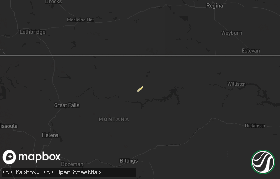
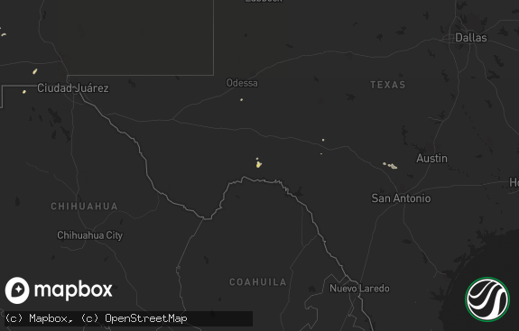
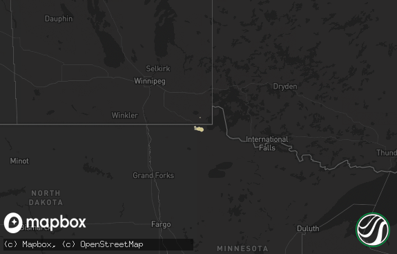
Hail Map in Montana on June 19, 2022
The weather event in Montana on June 19, 2022 includes Hail, Wind, and Tornado maps. 13 states and 221 cities were impacted and suffered possible damage. The total estimated number of properties impacted is 310.

Hail
Wind
Tornado
310
Estimated number of impacted properties by a 1.00" hail or larger0
Estimated number of impacted properties by a 1.75" hail or larger40
Estimated number of impacted properties by a 2.50" hail or largerStorm reports in Montana
Montana
| Date | Description |
|---|---|
| 06/19/20225:30 PM CDT | A local report indicates 63 MPH wind near 3 SSE CROW AGENCY |
| 06/19/20227:07 AM CDT | At 1206 AM MDT, a severe thunderstorm was located 12 miles southwest of Hinsdale, or 26 miles west of Glasgow, moving northeast at 35 mph. HAZARD...70 mph wind gusts and half dollar size hail. SOURCE...Radar indicated. IMPACT...Hail damage to vehicles is expected. Expect considerable tree damage. Wind damage is also likely to mobile homes, roofs, and outbuildings. Locations impacted include... Glasgow, Saco, Tampico, Hinsdale, St. Marie, Vandalia, Content, The Bentonite Plant and Frenchman Reservoir. |
| 06/19/20221:45 AM CDT | At 645 PM MDT, a severe thunderstorm was located 6 miles west of Gustave, or 34 miles southwest of Buffalo, moving northeast at 45 mph. HAZARD...Two inch hail and 60 mph wind gusts. SOURCE...Radar indicated. IMPACT...People and animals outdoors will be injured. Expect hail damage to roofs, siding, windows, and vehicles. Expect wind damage to roofs, siding, and trees. This severe thunderstorm will be near... Gustave around 650 PM MDT. West Short Pines around 700 PM MDT. Harding around 705 PM MDT.Other locations in the path of this severe thunderstorm includeBuffalo and Lake Gardner. |
| 06/18/202211:57 PM CDT | At 456 AM MDT, a severe thunderstorm was located 11 miles northeast of Devils Creek Rec Area, or 35 miles northwest of Jordan, moving northeast at 40 mph. HAZARD...70 mph wind gusts and ping pong ball size hail. SOURCE...Radar indicated. IMPACT...People and animals outdoors will be injured. Expect hail damage to roofs, siding, windows, and vehicles. Expect considerable tree damage. Wind damage is also likely to mobile homes, roofs, and outbuildings. Locations impacted include... Devils Creek Rec Area, The Bentonite Plant, Content and Sun Prairie. |
| 06/18/202211:45 PM CDT | At 445 PM MDT, a severe thunderstorm was located 6 miles east of Recluse, or 33 miles north of Gillette, moving northeast at 45 mph. HAZARD...60 mph wind gusts and quarter size hail. SOURCE...Radar indicated. IMPACT...Hail damage to vehicles is expected. Expect wind damage to roofs, siding, and trees. This severe thunderstorm will remain over mainly rural areas of northeastern Campbell County, north of Recluse. |
| 06/18/202211:11 PM CDT | At 410 AM MDT, a severe thunderstorm was located 9 miles southeast of Crooked Creek Rec Area, or 31 miles northeast of Winnett, moving northeast at 30 mph. HAZARD...70 mph wind gusts and ping pong ball size hail. SOURCE...Radar indicated. IMPACT...People and animals outdoors will be injured. Expect hail damage to roofs, siding, windows, and vehicles. Expect considerable tree damage. Wind damage is also likely to mobile homes, roofs, and outbuildings. Locations impacted include... Devils Creek Rec Area, Crooked Creek Rec Area and U L Bend Rec Area. |
| 06/18/20228:37 PM CDT | At 136 AM MDT, a severe thunderstorm was located 10 miles south of Opheim, moving northeast at 45 mph. HAZARD...70 mph wind gusts and ping pong ball size hail. SOURCE...Radar indicated. IMPACT...People and animals outdoors will be injured. Expect hail damage to roofs, siding, windows, and vehicles. Expect considerable tree damage. Wind damage is also likely to mobile homes, roofs, and outbuildings. Locations impacted include... Opheim, Richland, Port Of Opheim, Baylor and Glentana. |
| 06/18/20227:09 PM CDT | A local report indicates 2.50 inch wind near 8 NW ALZADA |
All States Impacted by Hail Map on June 19, 2022
Cities Impacted by Hail Map on June 19, 2022
- Ness City, KS
- Grants, NM
- Shields, ND
- Carson, ND
- Raleigh, ND
- Buchanan, ND
- Jamestown, ND
- Cooperstown, ND
- Sharon, ND
- Finley, ND
- Napoleon, ND
- Linton, ND
- Wishek, ND
- Kintyre, ND
- Tombstone, AZ
- Saint David, AZ
- Groveton, TX
- Greenville, TX
- Gackle, ND
- Cushing, TX
- Bismarck, ND
- Apopka, FL
- Sorrento, FL
- Gettysburg, SD
- Eagle Butte, SD
- North Fort Myers, FL
- Plant City, FL
- Houghton, MI
- Chassell, MI
- South Range, MI
- Painesdale, MI
- Atlantic Mine, MI
- Farmington, NM
- Bloomfield, NM
- Denhoff, ND
- Van Alstyne, TX
- Nacogdoches, TX
- Dequincy, LA
- Datil, NM
- Brooker, FL
- Dulce, NM
- Weston, WY
- Mineola, TX
- Trenton, FL
- Chiefland, FL
- Hague, ND
- Martin, SD
- Zeeland, ND
- Strasburg, ND
- Mound City, SD
- Pollock, SD
- Glenham, SD
- Herreid, SD
- Beaumont, TX
- Old Town, FL
- Mchenry, ND
- Akaska, SD
- Flasher, ND
- Jud, ND
- Glenfield, ND
- Bison, SD
- Meadow, SD
- Faith, SD
- Mud Butte, SD
- Baraga, MI
- Lanse, MI
- Goodrich, ND
- Clifton, AZ
- Morenci, AZ
- Bushnell, FL
- Floral City, FL
- Fredonia, ND
- Lehr, ND
- Oviedo, FL
- Hannaford, ND
- Binford, ND
- Courtenay, ND
- Sutton, ND
- Paguate, NM
- Pueblo Of Acoma, NM
- San Fidel, NM
- Cubero, NM
- Casa Blanca, NM
- Ignacio, CO
- Bayfield, CO
- Durango, CO
- Maddock, ND
- Archer, FL
- Williston, FL
- Tyler, TX
- Overton, TX
- Montpelier, ND
- Wing, ND
- Lake Charles, LA
- Garrison, TX
- Hanston, KS
- Mcalister, NM
- Willcox, AZ
- Bell, FL
- Towaoc, CO
- Mancos, CO
- Minnewaukan, ND
- Wamsutter, WY
- Newell, SD
- Ashley, ND
- Bronson, TX
- Jasper, TX
- Ocala, FL
- Elgin, ND
- Sherman, TX
- Howe, TX
- Trinidad, TX
- Mabank, TX
- Thatcher, AZ
- Newton, TX
- Inglis, FL
- Morriston, FL
- Buckhorn, NM
- Glenwood, NM
- Inverness, FL
- Lake Panasoffkee, FL
- Hettinger, ND
- Wimbledon, ND
- Mandan, ND
- Baldwin, ND
- Aneta, ND
- Sadler, TX
- Pottsboro, TX
- Rogers, ND
- Valley City, ND
- Luverne, ND
- Thoreau, NM
- Hoven, SD
- Selby, SD
- Covington, MI
- Sanford, FL
- Tampa, FL
- Sumterville, FL
- Center Hill, FL
- Webster, FL
- Alzada, MT
- Buffalo, SD
- Crawfordville, FL
- Ferron, UT
- North Port, FL
- Haines City, FL
- Davenport, FL
- Almont, ND
- New Salem, ND
- Opheim, MT
- Brooksville, FL
- Mott, ND
- Lodgepole, SD
- New Leipzig, ND
- Reva, SD
- Ralph, SD
- Hulett, WY
- Dunnellon, FL
- Hernando, FL
- Alto, TX
- Orlando, FL
- Bronson, FL
- Streeter, ND
- Wildwood, FL
- Singer, LA
- Okeechobee, FL
- Hollywood, FL
- Opa Locka, FL
- Pembroke Pines, FL
- Punta Gorda, FL
- Christmas, FL
- Michigamme, MI
- Jessie, ND
- Pelkie, MI
- Sebring, FL
- Glen Ullin, ND
- Winter Haven, FL
- Lake Wales, FL
- Laguna, NM
- Dundee, FL
- Larslan, MT
- Hinsdale, MT
- Richland, MT
- Dulac, LA
- Camp Crook, SD
- Bartow, FL
- Mulberry, FL
- Ludlow, SD
- Hammond, MT
- Regan, ND
- Bridger, MT
- Mayo, FL
- Day, FL
- Micanopy, FL
- Myakka City, FL
- Parrish, FL
- Sarasota, FL
- Harvey, ND
- Hurdsfield, ND
- Leesburg, FL
- House, NM
- Pingree, ND
- Cleveland, ND
- Carrington, ND
- Woodworth, ND
- Medina, ND
- Eureka, SD
- Java, SD
- Sterling, ND
- Menoken, ND
- Saint Anthony, ND
- Wilton, ND
- Leeds, ND
- Starkweather, ND
- Churchs Ferry, ND
- Penn, ND
- Helper, UT
- Price, UT
- Broadus, MT
- Moorcroft, WY
- Selfridge, ND


