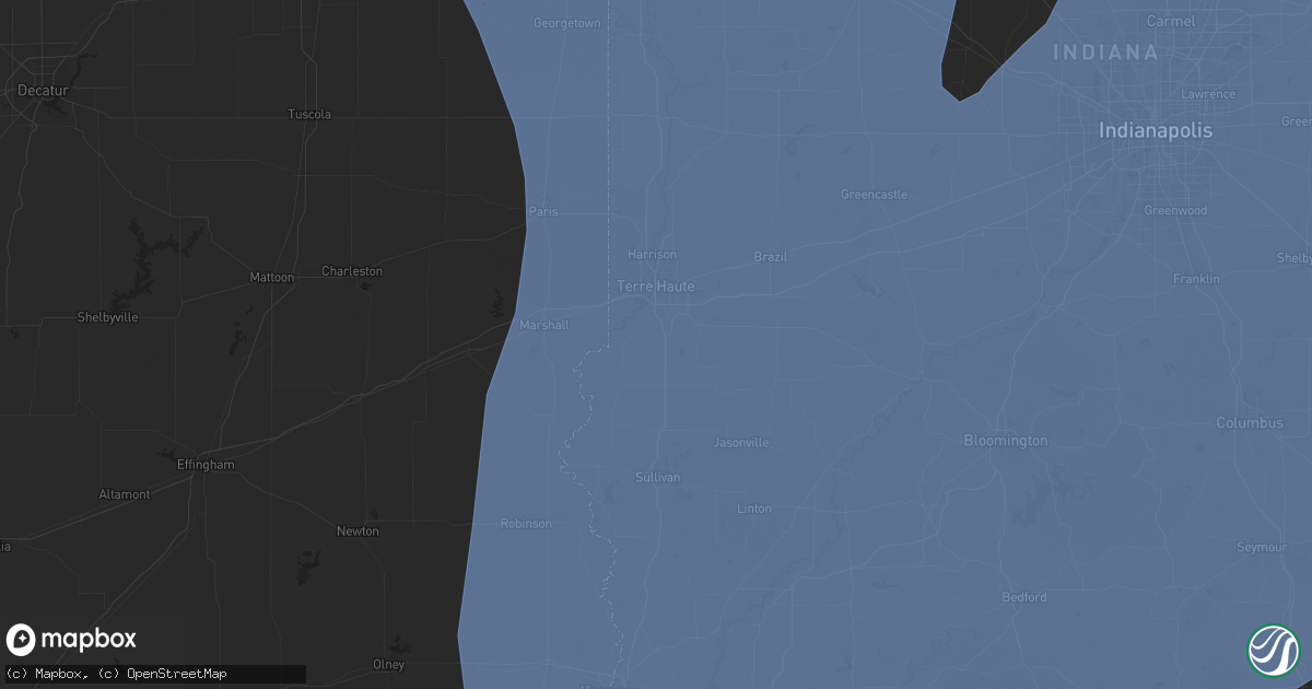
Hail Map in Terre Haute, IN on June 18, 2025
Get this storm
June 18 map
$229
one time, instant access
Download today. No call, no setup
Keep the $229
Bought the map and want the full workflow? Apply the entire $229 to a subscription within 7 days. None of it is wasted.
Every map, not just this one
This buys you this map. Subscription and you get every map we run, in the markets you choose from a few cities to whole states to nationwide. Plus real-time alerts the moment a storm fires.
Contact data
Name, contact info, occupancy, even credit band for addresses in the footprint. You go from where it hit to who to call.
Become the source they trust
Unlimited branding weather history reports on demand. You already have the documented answer ready for the property owner, and you are the one who showed up with it.
Property data and RoofTrace estimates
Pull up any address you have got, its value and the exact code rules for that jurisdiction, straight from One Click Code. Then RoofTrace estimates the squares, pitch, and roof value, priced the way you price.
Storm reports in Terre Haute, IN
Terre Haute, IN
| Date | Description |
|---|---|
| 06/18/20252:58 PM CDT | Thunderstorm winds blew down a 12-inch tree limb on 9th street between indiana and delaware streets in terre haute. |
| 06/18/20252:49 PM CDT | Numerous trees down northern vigo county...no specific locations mentioned. |
| 06/18/20252:24 PM CDT | Numerous power outages reported. |
| 06/18/20252:19 PM CDT | 12-14 inch diameter tree down. |
| 06/18/20252:18 PM CDT | A local report indicates 60 MPH wind near 3 N Indiana State Unive |
| 06/18/20252:17 PM CDT | 50mph wind gust with several tree limbs down. Sizes around 3 inches in diameter. |
All States Impacted by Hail Map on June 18, 2025
All Cities Impacted by Hail Map on June 18, 2025
- Seminole, OK
- Washington, OK
- Purcell, OK
- Noble, OK
- Lexington, OK
- Wewoka, OK
- Norman, OK
- Wanette, OK
- Meredosia, IL
- Chambersburg, IL
- Arenzville, IL
- Beardstown, IL
- Virginia, IL
- Kilbourne, IL
- Bath, IL
- Havana, IL
- Topeka, IL
- Easton, IL
- Oakford, IL
- Chandlerville, IL
- Petersburg, IL
- Nebo, IL
- Clarksville, MO
- Greenleaf, KS
- Jacksonville, IL
- Winchester, IL
- Chapin, IL
- Barnes, KS
- Palmyra, IL
- Girard, IL
- Modesto, IL
- Virden, IL
- Ashland, IL
- Frankfort, KS
- Sigel, IL
- Auburn, IL
- Neoga, IL
- Tallula, IL
- Montrose, IL
- Charleston, IL
- Westmoreland, KS
- Thomasville, AL
- Trilla, IL
- Mattoon, IL
- Newman, IL
- Jewett, IL
- Hindsboro, IL
- Oakland, IL
- Ashmore, IL
- Toledo, IL
- Fairfield, IL
- Burtonsville, MD
- Silver Spring, MD
- Laurel, MD
- Effingham, IL
- Royal, IL
- Saint Joseph, IL
- Ogden, IL
- Armstrong, IL
- Fithian, IL
- Penfield, IL
- Collison, IL
- Potomac, IL
- Danville, IL
- Cisne, IL
- Annapolis Junction, MD
- Fort George G Meade, MD
- Geff, IL
- Milford, IL
- Cissna Park, IL
- Brocton, IL
- Jessup, MD
- Hanover, MD
- Savage, MD
- Hidalgo, IL
- Greenup, IL
- Hume, IL
- Severn, MD
- Beltsville, MD
- Johnsonville, IL
- Keenes, IL
- Rossville, IL
- Alvin, IL
- Henning, IL
- Hoopeston, IL
- Casey, IL
- Sims, IL
- Tyler, AL
- Paris, IL
- Watseka, IL
- Mount Erie, IL
- Clay City, IL
- Ridge Farm, IL
- Indianola, IL
- Chrisman, IL
- Georgetown, IL
- Westfield, IL
- Sidell, IL
- Metcalf, IL
- Martinsville, IL
- Kansas, IL
- Odenton, MD
- Gambrills, MD
- Glen Burnie, MD
- Gifford, IL
- Rantoul, IL
- Ludlow, IL
- Paxton, IL
- Rankin, IL
- Buckley, IL
- Loda, IL
- Wellington, IL
- Onarga, IL
- Fowler, IN
- Ambia, IN
- Crescent City, IL
- Sheldon, IL
- Homer, IL
- Fairmount, IL
- Catlin, IL
- Muncie, IL
- Oakwood, IL
- Westville, IL
- Tilton, IL
- State Line, IN
- Covington, IN
- West Lebanon, IN
- Williamsport, IN
- Bismarck, IL
- Boswell, IN
- Perrysville, IN
- Cayuga, IN
- Dana, IN
- Hillsdale, IN
- Veedersburg, IN
- Bloomingdale, IN
- Kingman, IN
- Montezuma, IN
- Iroquois, IL
- Stockland, IL
- Kentland, IN
- Earl Park, IN
- Donovan, IL
- Morocco, IN
- Brook, IN
- Oxford, IN
- Pine Village, IN
- Hillsboro, IN
- Marshall, IN
- Attica, IN
- Fair Oaks, IN
- Rensselaer, IN
- Goodland, IN
- Severna Park, MD
- Millersville, MD
- Crownsville, MD
- Clanton, AL
- Graysville, AL
- Stanberry, MO
- Clyde, MO
- Marshall, IL
- Glenn Dale, MD
- Greenbelt, MD
- Lanham, MD
- Autaugaville, AL
- Selma, AL
- Noble, IL
- Sumner, IL
- Parkersburg, IL
- Calhoun, IL
- Claremont, IL
- Mount Ayr, IN
- Wolcott, IN
- Remington, IN
- Templeton, IN
- West Lafayette, IN
- Chalmers, IN
- Otterbein, IN
- Brookston, IN
- New Richmond, IN
- Waveland, IN
- Lafayette, IN
- Westpoint, IN
- Mellott, IN
- Wingate, IN
- Romney, IN
- Newtown, IN
- Rockville, IN
- Linden, IN
- Crawfordsville, IN
- Waynetown, IN
- Alamo, IN
- Russellville, IN
- New Market, IN
- Ladoga, IN
- Farmer City, IL
- Davidsonville, MD
- Gilbertown, AL
- Bridgeport, IL
- Browns, IL
- Mount Carmel, IL
- Clinton, IN
- Olney, IL
- Lawrenceville, IL
- Flat Rock, IL
- Robinson, IL
- West Salem, IL
- Oblong, IL
- Annapolis, MD
- Pasadena, MD
- Arnold, MD
- Le Roy, IL
- Clinton, LA
- Toxey, AL
- Butler, AL
- Fort Branch, IN
- Carlisle, IN
- Palestine, IL
- Mccomb, MS
- Oaktown, IN
- Dennison, IL
- West Union, IL
- West Terre Haute, IN
- Universal, IN
- West York, IL
- Annapolis, IL
- Vermilion, IL
- Fairbanks, IN
- Mecca, IN
- Stoy, IL
- Hutsonville, IL
- Merom, IN
- Terre Haute, IN
- New Goshen, IN
- Saint Francisville, IL
- Sullivan, IN
- Shelburn, IN
- Farmersburg, IN
- Rosedale, IN
- Bridgeton, IN
- Clay City, IN
- Monroe City, IN
- Hazleton, IN
- Pimento, IN
- Westphalia, IN
- Sandborn, IN
- Washington, IN
- Knightsville, IN
- Wheatland, IN
- Roachdale, IN
- Petersburg, IN
- Coalmont, IN
- Ragsdale, IN
- Cory, IN
- Harmony, IN
- Patoka, IN
- Edwardsport, IN
- Bowling Green, IN
- Vincennes, IN
- Dugger, IN
- Lewis, IN
- Brazil, IN
- Allendale, IL
- Jasonville, IN
- Riley, IN
- Hymera, IN
- Worthington, IN
- Freelandville, IN
- Greencastle, IN
- Linton, IN
- Decker, IN
- Bruceville, IN
- Bicknell, IN
- Staunton, IN
- Carbon, IN
- Coal City, IN
- Reelsville, IN
- Centerpoint, IN
- Plainville, IN
- Bainbridge, IN
- Lyons, IN
- Freedom, IN
- Poland, IN
- Elnora, IN
- Switz City, IN
- Wheatfield, IN
- Monon, IN
- Kouts, IN
- La Crosse, IN
- San Pierre, IN
- Francesville, IN
- Wanatah, IN
- Hanna, IN
- Medaryville, IN
- Reynolds, IN
- North Judson, IN
- Demotte, IN
- Valparaiso, IN
- Union Mills, IN
- Battle Ground, IN
- Winamac, IN
- Monticello, IN
- Darlington, IN
- Clarks Hill, IN
- Colfax, IN
- Newberry, IN
- Patricksburg, IN
- Spencer, IN
- Odon, IN
- Frankfort, IN
- Putnamville, IN
- New Ross, IN
- Thorntown, IN
- Montgomery, IN
- Cloverdale, IN
- Fillmore, IN
- Bloomfield, IN
- Delphi, IN
- Yeoman, IN
- Star City, IN
- Idaville, IN
- Royal Center, IN
- Burnettsville, IN
- Buffalo, IN
- Logansport, IN
- Knox, IN
- Monterey, IN
- Kewanna, IN
- Lucerne, IN
- Ora, IN
- La Porte, IN
- Westville, IN
- Hamlet, IN
- Kingsford Heights, IN
- Culver, IN
- Rochester, IN
- Grovertown, IN
- Plymouth, IN
- Argos, IN
- Jamestown, IN
- Francisco, IN
- Princeton, IN
- Oakland City, IN
- La Fayette, GA
- Rock Spring, GA
- North Liberty, IN
- Walkerton, IN
- New Carlisle, IN
- Rolling Prairie, IN
- Mill Creek, IN
- Rossville, IN
- Mulberry, IN
- Advance, IN
- Lizton, IN
- Coatesville, IN
- Lebanon, IN
- North Salem, IN
- Danville, IN
- Loogootee, IN
- Cannelburg, IN
- Quincy, IN
- Gosport, IN
- Scotland, IN
- Manhattan, KS
- Winslow, IN
- Cohutta, GA
- Solsberry, IN
- Kirklin, IN
- Crane, IN
- Martinsville, IN
- Amo, IN
- Pittsboro, IN
- Stilesville, IN
- Wakarusa, IN
- Elkhart, IN
- Notre Dame, IN
- Nappanee, IN
- Tippecanoe, IN
- Lakeville, IN
- South Bend, IN
- Osceola, IN
- Mishawaka, IN
- Bremen, IN
- Bourbon, IN
- Akron, IN
- Mentone, IN
- Claypool, IN
- Burket, IN
- Warsaw, IN
- Etna Green, IN
- Michigantown, IN
- Forest, IN
- Russiaville, IN
- Cutler, IN
- Burlington, IN
- Camden, IN
- Bringhurst, IN
- Kokomo, IN
- Flora, IN
- Walton, IN
- Sharpsville, IN
- Young America, IN
- Bunker Hill, IN
- Galveston, IN
- Evansville, IN
- Elberfeld, IN
- Alma, KS
- Otwell, IN
- Jackson, AL
- Springville, AL
- Odenville, AL
- Clarksville, MD
- Columbia, MD
- Ellicott City, MD
- Grove Hill, AL
- Trussville, AL
- Moody, AL
- Hyattsville, MD
- College Park, MD
- Gibson Island, MD
- Paragon, IN
- Clayton, IN
- Monrovia, IN
- Ellettsville, IN
- Stinesville, IN
- Williams, IN
- Bloomington, IN
- Springville, IN
- Owensburg, IN
- Shoals, IN
- Mitchell, IN
- Mooresville, IN
- Bargersville, IN
- Unionville, IN
- Brooklyn, IN
- Morgantown, IN
- Plainfield, IN
- Trafalgar, IN
- Avon, IN
- Indianapolis, IN
- Brownsburg, IN
- Camby, IN
- West Newton, IN
- Franklin, IN
- Greenwood, IN
- Bedford, IN
- Nashville, IN
- Avoca, IN
- Oolitic, IN
- Heltonville, IN
- Norman, IN
- Silver Lake, IN
- Atwood, IN
- Winona Lake, IN
- Pierceton, IN
- Leesburg, IN
- Ashville, AL
- Birdseye, IN
- Saint Anthony, IN
- Schnellville, IN
- Lynnville, IN
- Rising Fawn, GA
- Frankfort, SD
- Flat Rock, AL
- Trenton, GA
- Ider, AL
- North Little Rock, AR
- Sherwood, AR
- Carmel, IN
- Zionsville, IN
- Whitestown, IN
- Westfield, IN
- Arcadia, IN
- Sheridan, IN
- Beech Grove, IN
- Whiteland, IN
- Cicero, IN
- Fishers, IN
- Noblesville, IN
- Atlanta, IN
- Tipton, IN
- Kempton, IN
- Windfall, IN
- Milford, IN
- Syracuse, IN
- North Webster, IN
- New Paris, IN
- Greentown, IN
- Converse, IN
- Miami, IN
- Amboy, IN
- Peru, IN
- Grissom Arb, IN
- Onward, IN
- Denver, IN
- Wabash, IN
- Roann, IN
- Nineveh, IN
- Columbus, IN
- Orleans, IN
- West Baden Springs, IN
- Seymour, IN
- Brownstown, IN
- Freetown, IN
- Medora, IN
- Cromwell, IN
- Albion, IN
- Ligonier, IN
- Millersburg, IN
- Goshen, IN
- Larwill, IN
- Kimmell, IN
- La Fontaine, IN
- Paoli, IN
- Tunnelton, IN
- Eckerty, IN
- French Lick, IN
- Celestine, IN
- Elwood, IN
- North Manchester, IN
- Odessa, MO
- South Whitley, IN
- Stendal, IN
- Outlook, MT
- Taswell, IN
- English, IN
- Hardinsburg, IN
- Campbellsburg, IN
- Vallonia, IN
- Salem, IN
- Paris Crossing, IN
- Scottsburg, IN
- Austin, IN
- Crothersville, IN
- Commiskey, IN
- Shelbyville, IN
- Needham, IN
- Fairland, IN
- Edinburgh, IN
- Hope, IN
- North Vernon, IN
- Elizabethtown, IN
- Clifford, IN
- Taylorsville, IN
- Jonesville, IN
- Scipio, IN
- Boggstown, IN
- New Palestine, IN
- Greenfield, IN
- Lapel, IN
- Fortville, IN
- Anderson, IN
- Mccordsville, IN
- Flat Rock, IN
- Fountaintown, IN
- Pendleton, IN
- Middlebury, IN
- Howe, IN
- Wawaka, IN
- Topeka, IN
- Shipshewana, IN
- Lagrange, IN
- Summitville, IN
- Fairmount, IN
- Rome City, IN
- Wolcottville, IN
- Kendallville, IN
- Marion, IN
- Dwight, KS
- Junction City, KS
- Newberry, FL
- Urbana, IN
- Laketon, IN
- Liberty Mills, IN
- Servia, IN
- Lagro, IN
- High Springs, FL
- Alachua, FL
- Gordo, AL
- Elrod, AL
- Echola, AL
- Huntington, IN
- Andrews, IN
- Columbia City, IN
- Fort Payne, AL
- Collinsville, AL
- Deputy, IN
- Milroy, IN
- Grammer, IN
- Ingalls, IN
- Wilkinson, IN
- Vernon, IN
- Greensburg, IN
- Waldron, IN
- Maxwell, IN
- Hartsville, IN
- Arlington, IN
- Morristown, IN
- Westport, IN
- Manilla, IN
- Frankton, IN
- Gwynneville, IN
- Saint Paul, IN
- Charlottesville, IN
- Carthage, IN
- South Milford, IN
- Alexandria, IN
- Swayzee, IN
- Jonesboro, IN
- Daleville, IN
- Gaston, IN
- Muncie, IN
- Homer, IN
- Upland, IN
- New Castle, IN
- Yorktown, IN
- Fowlerton, IN
- Shirley, IN
- Matthews, IN
- Rushville, IN
- Middletown, IN
- Knightstown, IN
- Gas City, IN
- Markleville, IN
- Sturgis, MI
- Northport, AL
- Sweetser, IN
- Dubois, IN
- Alta Vista, KS
- Churubusco, IN
- Burr Oak, MI
- Bronson, MI
- Pleasant Lake, IN
- Hudson, IN
- Orland, IN
- Angola, IN
- Westby, MT
- Hartford City, IN
- Berry, AL
- Fayette, AL
- Ferdinand, IN
- Fremont, IN
- Coldwater, MI
- Sherwood, MI
- Union City, MI
- Montgomery, MI
- Lewisville, IN
- Kennard, IN
- Springport, IN
- Spiceland, IN
- Mays, IN
- Glenwood, IN
- Falmouth, IN
- Osgood, IN
- Dupont, IN
- Butlerville, IN
- Holton, IN
- Huntertown, IN
- Laotto, IN
- Decatur, MS
- Hickory, MS
- Russellville, AL
- Council Grove, KS
- Straughn, IN
- Hinckley, OH
- Richfield, OH
- Poneto, IN
- Liberty Center, IN
- Montpelier, IN
- Van Buren, IN
- Warren, IN
- Medina, OH
- Akron, OH
- Eaton, IN
- Athens, MI
- Marshall, MI
- Homer, MI
- Quincy, MI
- Ceresco, MI
- Tekonsha, MI
- Burlington, MI
- Reading, MI
- Mooreland, IN
- Dunkirk, IN
- Losantville, IN
- Albany, IN
- Portland, IN
- Modoc, IN
- Selma, IN
- Winchester, IN
- Hagerstown, IN
- Parker City, IN
- Farmland, IN
- Redkey, IN
- Williamsburg, IN
- Lynn, IN
- Ridgeville, IN
- Connersville, IN
- Sunman, IN
- Fountain City, IN
- Richmond, IN
- Liberty, IN
- Brownsville, IN
- Laurel, IN
- Centerville, IN
- Greens Fork, IN
- West College Corner, IN
- Brookville, IN
- Cambridge City, IN
- Cedar Grove, IN
- Boston, IN
- Economy, IN
- Batesville, IN
- Milton, IN
- Oldenburg, IN
- Metamora, IN
- Bath, IN
- Webster, IN
- Moores Hill, IN
- New Trenton, IN
- Madison, IN
- Aurora, IN
- Guilford, IN
- Dillsboro, IN
- Lexington, IN
- West Harrison, IN
- Versailles, IN
- Milan, IN
- Napoleon, IN
- Pekin, IN
- Garrett, IN
- Allen, KS
- Hitchcock, SD
- Hartselle, AL
- Peninsula, OH
- Grassy Butte, ND
- Bluffton, IN
- Markle, IN
- Bryant, IN
- Berne, IN
- Willshire, OH
- Salamonia, IN
- Monroe, IN
- Fort Recovery, OH
- Rockford, OH
- Van Wert, OH
- Celina, OH
- Geneva, IN
- Ohio City, OH
- Union City, IN
- Coldwater, OH
- Saratoga, IN
- Keystone, IN
- Decatur, IN
- Pennville, IN
- Palestine, OH
- Hollansburg, OH
- Burkettsville, OH
- Greenville, OH
- Maria Stein, OH
- Ansonia, OH
- Versailles, OH
- New Madison, OH
- Eaton, OH
- New Paris, OH
- Rossburg, OH
- Union City, OH
- New Weston, OH
- Saint Henry, OH
- Mendon, OH
- Bismarck, ND
- Menoken, ND
- Orient, SD
- Grenora, ND
- Underwood, IN
- Muscle Shoals, AL
- Town Creek, AL
- Leighton, AL
- Munroe Falls, OH
- Tallmadge, OH
- Stow, OH
- Cuyahoga Falls, OH
- Americus, KS
- Watford City, ND
- Harrison, OH
- Lawrenceburg, IN
- Decatur, AL
- Hazelton, ND
- Courtland, AL
- Killdeer, ND
- Harned, KY
- Irvington, KY
- Webster, KY
- Rogersville, AL
- Lawton, OK
- Elgin, OK
- Marlow, OK
- Montezuma, OH
- Continental, OH
- Fort Jennings, OH
- Grover Hill, OH
- Saint Marys, OH
- Oakwood, OH
- Delphos, OH
- Scott, OH
- Middle Point, OH
- Spencerville, OH
- Venedocia, OH
- Defiance, OH
- Cloverdale, OH
- New Knoxville, OH
- Ottoville, OH
- Chickasaw, OH
- Buckland, OH
- Covington, OH
- Osgood, OH
- Fort Loramie, OH
- Lima, OH
- New Bavaria, OH
- New Bremen, OH
- Piqua, OH
- Wapakoneta, OH
- Anna, OH
- Minster, OH
- Yorkshire, OH
- Houston, OH
- Arcanum, OH
- Botkins, OH
- Bradford, OH
- Gettysburg, OH
- Russia, OH
- Sidney, OH
- Clayton, OH
- Okeana, OH
- Dayton, OH
- Camden, OH
- Pleasant Hill, OH
- Eldorado, OH
- Englewood, OH
- Pitsburg, OH
- Somerville, OH
- Cross Plains, IN
- West Alexandria, OH
- New Lebanon, OH
- Lewisburg, OH
- Laura, OH
- West Milton, OH
- College Corner, OH
- Brookville, OH
- Hamilton, OH
- West Manchester, OH
- Oxford, OH
- Farmersville, OH
- Germantown, OH
- Troy, OH
- Ludlow Falls, OH
- Verona, OH
- Phillipsburg, OH
- Middletown, OH
- Cleves, OH
- Rising Sun, IN
- North Bend, OH
- Petersburg, KY
- Canaan, IN
- Bennington, IN
- Vevay, IN
- Anderson, AL
- Paulding, OH
- Jakin, GA
- Athens, AL
- Hanover, IN
- Guston, KY
- Ekron, KY
- Brandenburg, KY
- Dunn Center, ND
- Williston, ND
- Zahl, ND
- Cecil, OH
- Tanner, AL
- Emporia, KS
- Haleyville, AL
- Bedford, KY
- La Grange, KY
- Westport, KY
- Pendleton, KY
- Laconia, IN
- Carrollton, KY
- Hamler, OH
- Pandora, OH
- Malinta, OH
- Vaughnsville, OH
- Holgate, OH
- Napoleon, OH
- Deshler, OH
- Gomer, OH
- Miller City, OH
- Leipsic, OH
- Ottawa, OH
- McClure, OH
- Uniopolis, OH
- Kalida, OH
- Columbus Grove, OH
- Weston, OH
- Cairo, OH
- Custar, OH
- Forest, OH
- Lakeview, OH
- Lewistown, OH
- Beaverdam, OH
- Alger, OH
- Lafayette, OH
- Waynesfield, OH
- Ada, OH
- Bluffton, OH
- McComb, OH
- Findlay, OH
- New Hampshire, OH
- Arlington, OH
- Dunkirk, OH
- Rawson, OH
- Jenera, OH
- Hoytville, OH
- Benton Ridge, OH
- Jackson Center, OH
- Mount Cory, OH
- North Baltimore, OH
- Harrod, OH
- Maplewood, OH
- Pemberton, OH
- Enon, OH
- New Carlisle, OH
- Springfield, OH
- Fairborn, OH
- Conover, OH
- North Hampton, OH
- Seven Mile, OH
- Belle Center, OH
- West Liberty, OH
- Williamstown, OH
- Kenton, OH
- Rosewood, OH
- Cincinnati, OH
- Fletcher, OH
- Bellefontaine, OH
- Roundhead, OH
- McGuffey, OH
- Dola, OH
- Huntsville, OH
- Hooven, OH
- Fairfield, OH
- Tipp City, OH
- De Graff, OH
- Quincy, OH
- Trenton, OH
- Russells Point, OH
- Urbana, OH
- Vandalia, OH
- Donnelsville, OH
- Port Jefferson, OH
- Miamisburg, OH
- Miamitown, OH
- Saint Paris, OH
- Christiansburg, OH
- Franklin, OH
- Casstown, OH
- Rushsylvania, OH
- Medway, OH
- Burlington, KY
- Hebron, KY
- Monroe, OH
- Springboro, OH
- West Chester, OH
- Addyston, OH
- Neosho Rapids, KS
- Morgantown, KY
- Campbellsburg, KY
- Moffit, ND
- Linton, ND
- Redfield, SD
- Big Sandy, TN
- Huron, TN
- Bruceton, TN
- Hollow Rock, TN
- Huntingdon, TN
- West Point, KY
- Shepherdsville, KY
- Elizabeth, IN
- Muldraugh, KY
- Louisville, KY
- Cygnet, OH
- Bowling Green, OH
- Portage, OH
- Milton Center, OH
- Rudolph, OH
- Van Buren, OH
- Wayne, OH
- Wharton, OH
- Kirby, OH
- Fostoria, OH
- Upper Sandusky, OH
- Jerry City, OH
- Alvada, OH
- Vanlue, OH
- Arcadia, OH
- Carey, OH
- Mount Victory, OH
- Mount Blanchard, OH
- Bloomdale, OH
- Ridgeway, OH
- Harpster, OH
- Raymond, OH
- Marysville, OH
- Mingo, OH
- La Rue, OH
- Richwood, OH
- North Lewisburg, OH
- West Mansfield, OH
- East Liberty, OH
- Zanesfield, OH
- Cable, OH
- Tremont City, OH
- Morral, OH
- Loveland, OH
- Woodstock, OH
- Dayton, KY
- Alpha, OH
- Fort Thomas, KY
- Kings Mills, OH
- Mason, OH
- Morrow, OH
- Yellow Springs, OH
- Maineville, OH
- Erlanger, KY
- Xenia, OH
- Lebanon, OH
- Mechanicsburg, OH
- Covington, KY
- Ft Mitchell, KY
- Florence, KY
- Newport, KY
- Bellevue, KY
- Cedarville, OH
- South Lebanon, OH
- Wilberforce, OH
- Oregonia, OH
- Bellbrook, OH
- Waynesville, OH
- Spring Valley, OH
- Brecksville, OH
- Camden, TN
- Eva, TN
- Epping, ND
- Stewart, TN
- Waverly, TN
- Duncan, OK
- Buena Vista, TN
- Mayfield, KY
- Fisherville, KY
- Westport, TN
- Eldorado, OK
- Frederick, OK
- Jetson, KY
- West Millgrove, OH
- Genoa, OH
- Millbury, OH
- Perrysburg, OH
- Clay Center, OH
- Martin, OH
- Pemberville, OH
- Curtice, OH
- New Riegel, OH
- Bradner, OH
- Woodville, OH
- Risingsun, OH
- Helena, OH
- McCutchenville, OH
- Luckey, OH
- Elmore, OH
- Kansas, OH
- Gibsonburg, OH
- Williston, OH
- Walbridge, OH
- Rossford, OH
- Temperance, MI
- Northwood, OH
- Stony Ridge, OH
- Toledo, OH
- Erie, MI
- Oregon, OH
- Maumee, OH
- Holland, OH
- Monclova, OH
- Waterville, OH
- Haskins, OH
- Grand Rapids, OH
- Dunbridge, OH
- Whitehouse, OH
- Tontogany, OH
- Grelton, OH
- Liberty Center, OH
- La Salle, MI
- Luna Pier, MI
- Harbor View, OH
- Fremont, OH
- Bascom, OH
- Graytown, OH
- Burgoon, OH
- Oak Harbor, OH
- Tiffin, OH
- Lindsey, OH
- Sycamore, OH
- Rocky Ridge, OH
- Bettsville, OH
- Bluffton, GA
- Coleman, GA
- Faxon, OK
- Berthold, ND
- Morris, GA
- Caneyville, KY
- Brownsville, KY
- Leitchfield, KY
- Roundhill, KY
- Hudson, OH
- Elkton, KY
- Trenton, KY
- Shelbyville, KY
- Finchville, KY
- Simpsonville, KY
- Flaxton, ND
- Clarksville, TN
- Guthrie, KY
- Brooks, KY
- Fairdale, KY
- Lewisburg, KY
- Wingo, KY
- Bucyrus, OH
- Old Fort, OH
- New Bloomington, OH
- Bloomville, OH
- Green Springs, OH
- Marion, OH
- Nevada, OH
- South Solon, OH
- Jeffersonville, OH
- Clarksville, OH
- Blanchester, OH
- Martinsville, OH
- South Vienna, OH
- New Vienna, OH
- Goshen, OH
- Camp Dennison, OH
- Port William, OH
- Harveysburg, OH
- Milford Center, OH
- Catawba, OH
- Pleasant Plain, OH
- Midland, OH
- Terrace Park, OH
- Washington Court House, OH
- Milford, OH
- Wilmington, OH
- Sabina, OH
- Miamiville, OH
- South Charleston, OH
- Jamestown, OH
- London, OH
- Galloway, OH
- Delaware, OH
- Radnor, OH
- Hilliard, OH
- Broadway, OH
- Magnetic Springs, OH
- Mount Sterling, OH
- Green Camp, OH
- Irwin, OH
- Ostrander, OH
- Caledonia, OH
- Bloomingburg, OH
- Prospect, OH
- Dublin, OH
- Plain City, OH
- West Jefferson, OH
- Strasburg, ND
- New Town, ND
- Bowbells, ND
- Saint Lawrence, SD
- Tipton, OK
- Geronimo, OK
- Miller, SD
- Cuthbert, GA
- Coxs Creek, KY
- Bee Spring, KY
- Taylorsville, KY
- Waddy, KY
- Bowling Green, KY
- Allensville, KY
- Russellville, KY
- Mount Washington, KY
- Stanley, ND
- Clermont, KY
- Lebanon Junction, KY
- Lacarne, OH
- Port Clinton, OH
- Bellevue, OH
- Vickery, OH
- Republic, OH
- Clyde, OH
- Attica, OH
- Mount Gilead, OH
- Chatfield, OH
- Edison, OH
- Willard, OH
- Shelby, OH
- Galion, OH
- Monroeville, OH
- Castalia, OH
- Powell, OH
- Ashley, OH
- Amlin, OH
- Plymouth, OH
- New Washington, OH
- Cardington, OH
- Sandusky, OH
- Crestline, OH
- Lakeside Marblehead, OH
- Waldo, OH
- Tiro, OH
- Albion, MI
- Litchfield, MI
- Allen, MI
- Camden, MI
- Hanover, MI
- Jonesville, MI
- Hillsdale, MI
- Union, KY
- Melbourne, KY
- Silver Grove, KY
- Latonia, KY
- Batavia, OH
- Independence, KY
- Hickory, KY
- Parsons, TN
- Cumberland Furnace, TN
- Cunningham, TN
- Clarkson, KY
- Dawson, GA
- Donnybrook, ND
- Sweeden, KY
- Lexington, TN
- Elmer, OK
- Olmstead, KY
- Leesburg, GA
- Smithville, GA
- Fredonia, KY
- Altus, OK
- Cumberland City, TN
- Linden, TN
- Quanah, TX
- Auburn, KY
- De Mossville, KY
- Butler, KY
- Williamstown, KY
- Dickson, TN
- McEwen, TN
- Southside, TN
- Princeton, KY
- Leslie, GA
- Eufaula, AL
- Erin, TN
- Hodgen, OK
- Gilmer, TX
- Big Sandy, TX
- De Soto, GA
- Norwich, ND
- Surrey, ND
- Oakfield, GA
- Rockfield, KY
- Mammoth Cave, KY
- Kenmare, ND
- Warwick, GA
- Sylvester, GA
- Frankfort, KY
- Adairville, KY
- Glen Ullin, ND
- Almont, ND
- Midway, KY
- Stamping Ground, KY
- Bagdad, KY
- Heavener, OK
- Granville, ND
- Tolley, ND
- Snyder, OK
- Williamsburg, OH
- Mount Orab, OH
- Sugar Tree, TN
- Cerulean, KY
- Versailles, KY
- Mount Eden, KY
- Cobb, GA
- Norwalk, OH
- Wellington, OH
- North Fairfield, OH
- Wakeman, OH
- Sullivan, OH
- Milan, OH
- Vermilion, OH
- Greenwich, OH
- New London, OH
- Berlin Heights, OH
- Oberlin, OH
- Shiloh, OH
- Kipton, OH
- Nova, OH
- Collins, OH
- Amherst, OH
- Huron, OH
- Mansfield, OH
- Ashland, OH
- Westlake, OH
- North Ridgeville, OH
- Avon, OH
- Elyria, OH
- Lorain, OH
- Sheffield Lake, OH
- Avon Lake, OH
- Lagrange, OH
- Grafton, OH
- Bay Village, OH
- Olmsted Falls, OH
- Brookpark, OH
- Columbia Station, OH
- Rocky River, OH
- Cleveland, OH
- Lakewood, OH
- North Olmsted, OH
- Valley City, OH
- Litchfield, OH
- Berea, OH
- North Royalton, OH
- Broadview Heights, OH
- Brunswick, OH
- Independence, OH
- Strongsville, OH
- Hopkinsville, KY
- Crofton, KY
- Dagmar, MT
- Mountain Park, OK
- Lansford, ND
- Lexington, KY
- Headrick, OK
- Marianna, AR
- Mohall, ND
- Bethel, OH
- Duke, OK
- Goodlettsville, TN
- Greenbrier, TN
- Joelton, TN
- Mena, AR
- Bardstown, KY
- Foster, KY
- Carson, ND
- Bedford, OH
- Northfield, OH
- Twinsburg, OH
- Euclid, OH
- Macedonia, OH
- Beachwood, OH
- Solon, OH
- Maple Heights, OH
- Chagrin Falls, OH
- Eastlake, OH
- Wickliffe, OH
- Newburg, ND
- Bloomfield, KY
- Felicity, OH
- Falmouth, KY
- Hartsville, TN
- Roosevelt, OK
- Forrest City, AR
- Hughes, AR
- Hartford, KY
- Beaver Dam, KY
- Upham, ND
- Flasher, ND
- Gates Mills, OH
- Willoughby, OH
- Chesterland, OH
- Novelty, OH
- Mentor, OH
- Aurora, OH
- Grand River, OH
- Painesville, OH
- Streetsboro, OH
- Newbury, OH
- Ravenna, OH
- Chardon, OH
- Mantua, OH
- Burton, OH
- Kent, OH
- Childress, TX
- Gotebo, OK
- Centerville, TN
- Vine Grove, KY
- Fairdale, ND
- Adams, ND
- Lawton, ND
- Fountain Run, KY
- Mountain View, OK
- Dickinson, ND
- Duck River, TN
- Mott, ND
- McKenzie, TN
- Maxbass, ND
- Perry, OH
- Bristolville, OH
- Windsor, OH
- West Farmington, OH
- Middlefield, OH
- Huntsburg, OH
- Newton Falls, OH
- Windham, OH
- Montville, OH
- Fowler, OH
- Cortland, OH
- Kinsman, OH
- Warren, OH
- North Bloomfield, OH
- Orwell, OH
- Hiram, OH
- Garrettsville, OH
- Rome, OH
- Thompson, OH
- Southington, OH
- Farmdale, OH
- Leavittsburg, OH
- Burghill, OH
- Geneva, OH
- Ashtabula, OH
- Madison, OH
- Austinburg, OH
- Andover, OH
- Rock Creek, OH
- Dorset, OH
- Jefferson, OH
- Williamsfield, OH
- Lankin, ND
- Cordell, OK
- Milton, KY
- Solen, ND
- Dunmor, KY
- Belton, KY
- Pembroke, KY
- Towner, ND
- Petersburg, ND
- Salem, OH
- New Leipzig, ND
- Dahlen, ND
- Heth, AR
- Elgin, ND
- Charlotte, TN
- Proctor, AR
- Rochester, KY
- Shields, ND
- McCrory, AR
- Drayton, ND
- Pembina, ND
- Brickeys, AR
- Warrensburg, MO
- Belcourt, ND
- Lyles, TN
- Primm Springs, TN
- Centerview, MO
- Moro, AR
- Aubrey, AR
- Marvell, AR
- Holly Grove, AR
- Caraway, AR
- Schell City, MO
- Lexa, AR
- Kennedy, MN
- Newport, AR
- Osceola, AR
- Etowah, AR
- Lake City, AR
- Keiser, AR
- Jonesboro, AR
- Black Oak, AR
- Lebanon, TN
- Palermo, ND
- Monette, AR
- Manila, AR
- Bantry, ND
- Chandler, IN
- Hebron, ND
- Fulton, KY
- Scottsville, KY
- Clinton, KY
- Cash, AR
- Weiner, AR
- Water Valley, KY
- Covington, TN
- Henning, TN
- Harrisburg, AR
- Ripley, TN
- Lakota, ND
- Trumann, AR
- Bay, AR
- Boaz, KY
- Brownsville, TN
- Bells, TN
- Smithville, AR
- Dyess, AR
- Strawberry, AR
- Lepanto, AR
- Jackson, TN
- Denmark, TN
- Beech Bluff, TN
- Oakfield, TN
- Luray, TN
- Wilson, AR
- Wildersville, TN
- Darden, TN
- Bono, AR
- Paragould, AR
- Pinson, TN
- Brookland, AR
- Beech Grove, AR
- Brighton, TN
- Walnut Ridge, AR
- Mason, TN
- Stanton, TN
- Burlison, TN
- Humboldt, TN
- Reading, KS
- Joiner, AR
- Tyronza, AR
- Marked Tree, AR
- State University, AR
- Fisher, AR
- Drummonds, TN
- Munford, TN
- Turrell, AR
- Gilmore, AR
- Earle, AR
- Atoka, TN
- Millington, TN
- Marion, AR
- Crawfordsville, AR
- Bassett, AR
- Frenchmans Bayou, AR
- Memphis, TN
- Arlington, TN
- Collierville, TN
- Eads, TN
- West Memphis, AR
- Griffithville, AR
- Des Arc, AR
- Cordova, TN
- Cotton Plant, AR
- Tunica, MS
- Robinsonville, MS
- Walls, MS
- Nesbit, MS
- Hernando, MS
- Southaven, MS
- Olive Branch, MS
- Fraser, MI
- Clinton Township, MI
- Alexander, IL
- Pleasant Plains, IL
- Lafayette, TN
- Hebron, IN
- Pesotum, IL
- Broadlands, IL
- Atwood, IL
- Philo, IL
- Tuscola, IL
- Allerton, IL
- Camargo, IL
- Murdock, IL
- Villa Grove, IL
- Tolono, IL
- Sidney, IL
- Longview, IL
- Ivesdale, IL
- Sadorus, IL
- Bondville, IL
- Savoy, IL
- Urbana, IL
- Champaign, IL
- Thomasboro, IL
- Dewey, IL
- Gilman, IL
- Altamont, IL
- Arcola, IL
- Stewardson, IL
- Humboldt, IL
- Teutopolis, IL
- Shumway, IL
- Arthur, IL
- Redmon, IL
- Watson, IL
- Lerna, IL
- Gays, IL
- Sullivan, IL
- Windsor, IL
- Bethany, IL
- Findlay, IL
- Bement, IL
- Seymour, IL
- Lovington, IL
- Hammond, IL
- Tower Hill, IL
- Strasburg, IL
- Mode, IL
- Beecher City, IL
- Cowden, IL
- Lakewood, IL
- Shelbyville, IL
- Wheeler, IL
- Newton, IL
- Yale, IL
- Dieterich, IL
- Willow Hill, IL
- Fredericktown, OH
- West Salem, OH
- Jeromesville, OH
- Homerville, OH
- Spencer, OH
- Wooster, OH
- Burbank, OH
- Polk, OH
- Loudonville, OH
- Bellville, OH
- Lucas, OH
- Hayesville, OH
- Perrysville, OH
- Butler, OH
- Lakeville, OH
- Shreve, OH
- Orrville, OH
- Chippewa Lake, OH
- Rittman, OH
- Smithville, OH
- Westfield Center, OH
- Creston, OH
- Barberton, OH
- Seville, OH
- Wadsworth, OH
- Lodi, OH
- Marshallville, OH
- Sterling, OH
- Doylestown, OH
- Uniontown, OH
- North Lawrence, OH
- Apple Creek, OH
- Lakemore, OH
- Mogadore, OH
- Rootstown, OH
- Clinton, OH
- Canal Fulton, OH
- Lambertville, MI
- Swanton, OH
- Sylvania, OH
- Ottawa Lake, MI
- Neapolis, OH
- Berkey, OH
- Stockbridge, MI
- Dansville, MI
- Leslie, MI
- Blissfield, MI
- Hudson, MI
- Osseo, MI
- Jasper, MI
- Pittsford, MI
- Clayton, MI
- Adrian, MI
- Sand Creek, MI
- Concord, MI
- Webberville, MI
- Howell, MI
- Fowlerville, MI
- Gregory, MI
- White Pigeon, MI
- Goldsmith, IN
- Convoy, OH
- Wren, OH
- Craigville, IN
- Ossian, IN
- Haviland, OH
- Petroleum, IN
- Monroeville, IN
- Melrose, OH
- Twelve Mile, IN
- Macy, IN
- Divernon, IL
- Glenarm, IL
- Pawnee, IL
- Madisonville, KY
- Centertown, KY
- Central City, KY
- Sacramento, KY
- Bremen, KY
- Island, KY
- Denton, MD
- Ridgely, MD
- Queen Anne, MD
- Centreville, MD


